South Africa: Western Cape Province
Südafrika: West-Kap Provinz
ENGLISH: Back on the road! Over the next few months, we’ll be traveling through South Africa, Namibia, and Angola. Since winter is about to begin in the Southern Hemisphere, we’ve decided to drive from Cape Town first to Namibia and Angola (where it’s warmer) and return to South Africa in September (“Southern Spring”). This blog is about our trip through the Western Cape Province (April / May 2026).
DEUTSCH: Wieder unterwegs! Die nächsten Monat werde wir durch Südafrika, Namibia und Angola reisen. Da jetzt auf der südlichen Halbkugel bald der Winter beginnt haben wir uns entschlossen von Kapstadt aus zuerst nach Namibia und Angola zu fahren (wo es wärmer ist) und im September („südlicher Frühling“) nach Südafrika zurückzukehren. Dieser Blog handelt von unserer Fahrt durch die West-Kap Provinz (April / Mai 2026).

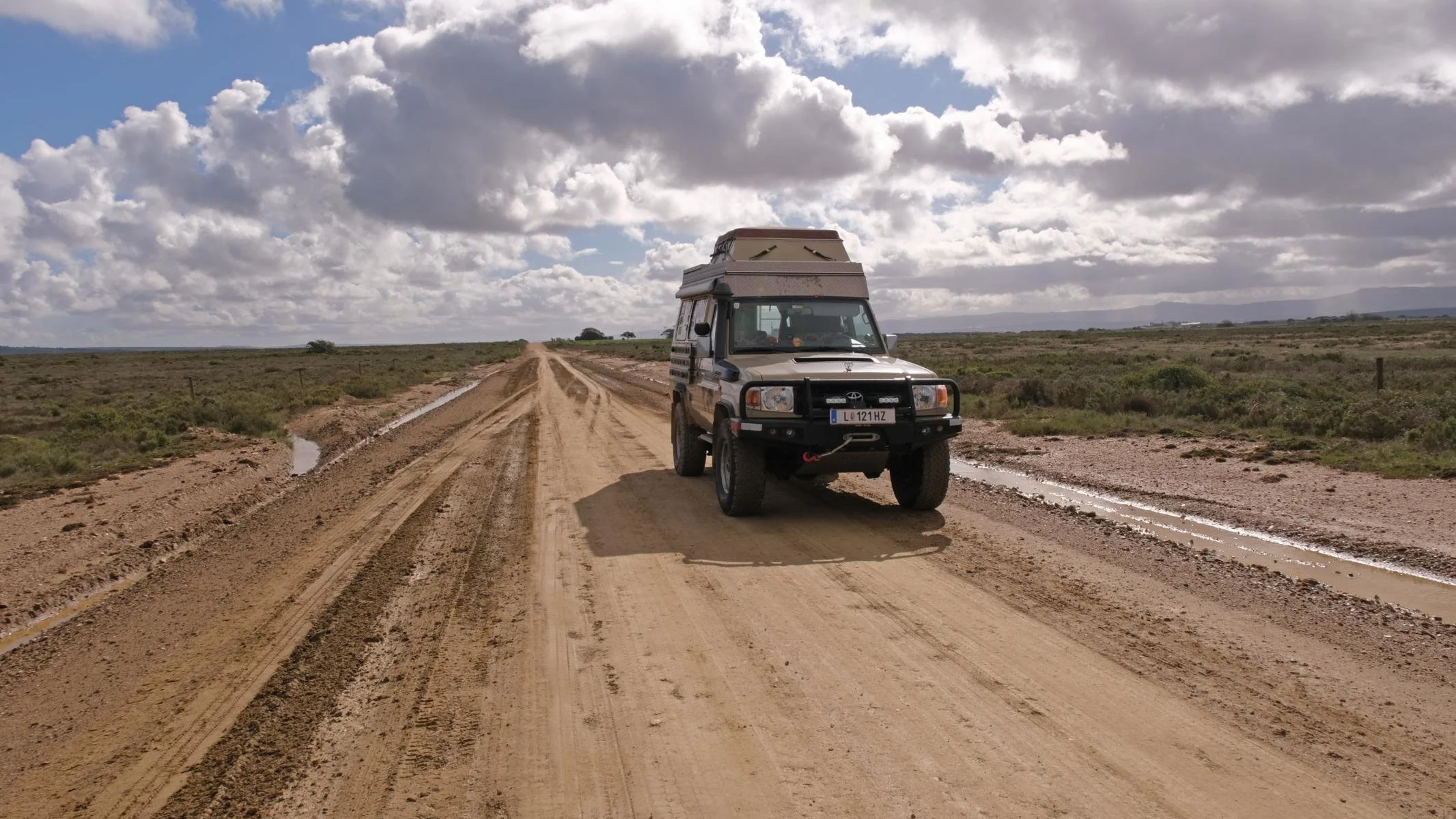
In mid-April 2026, I arrived in Cape Town, South Africa. Unfortunately, Ursula was unable to fly due to an ear infection and therefore joined me in Kimberley a month later.
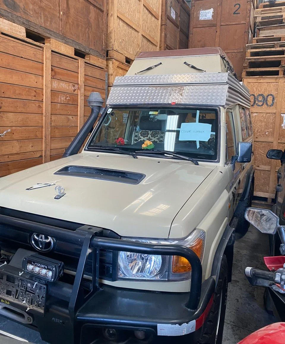
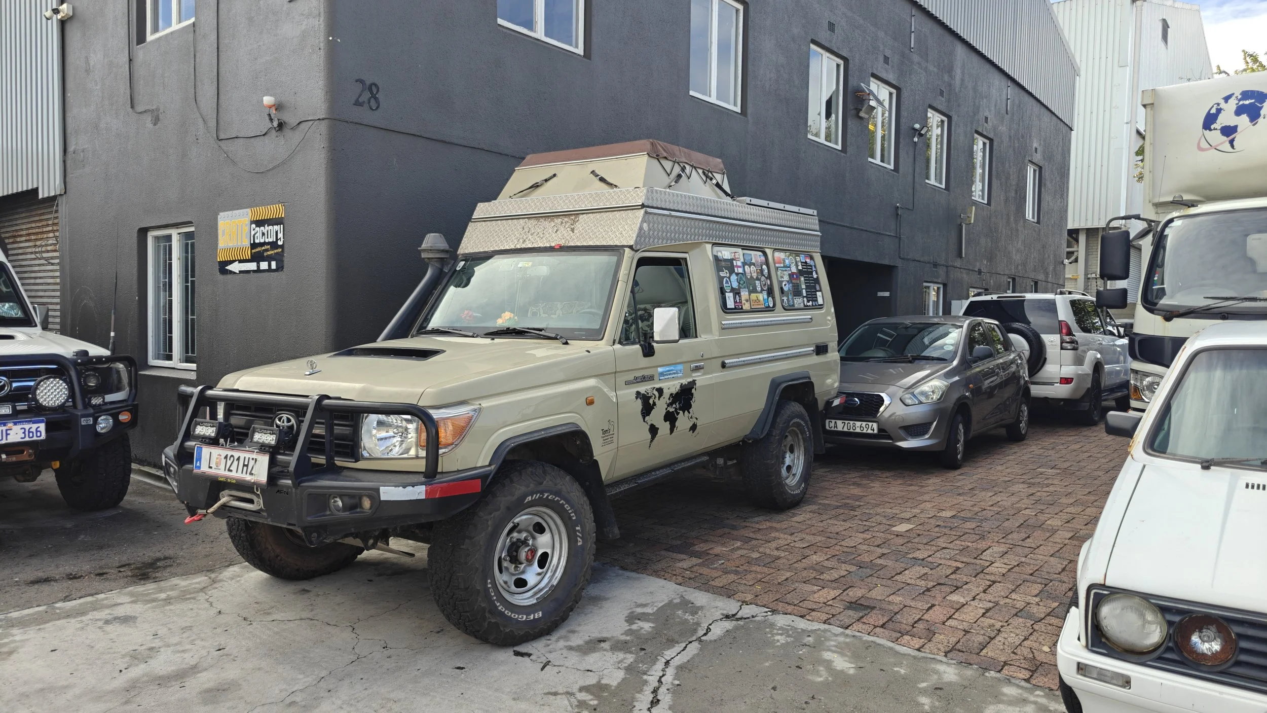
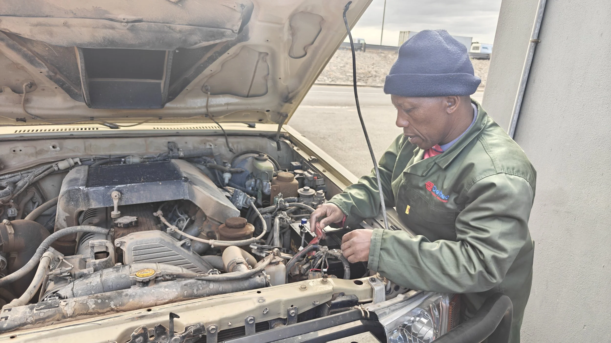
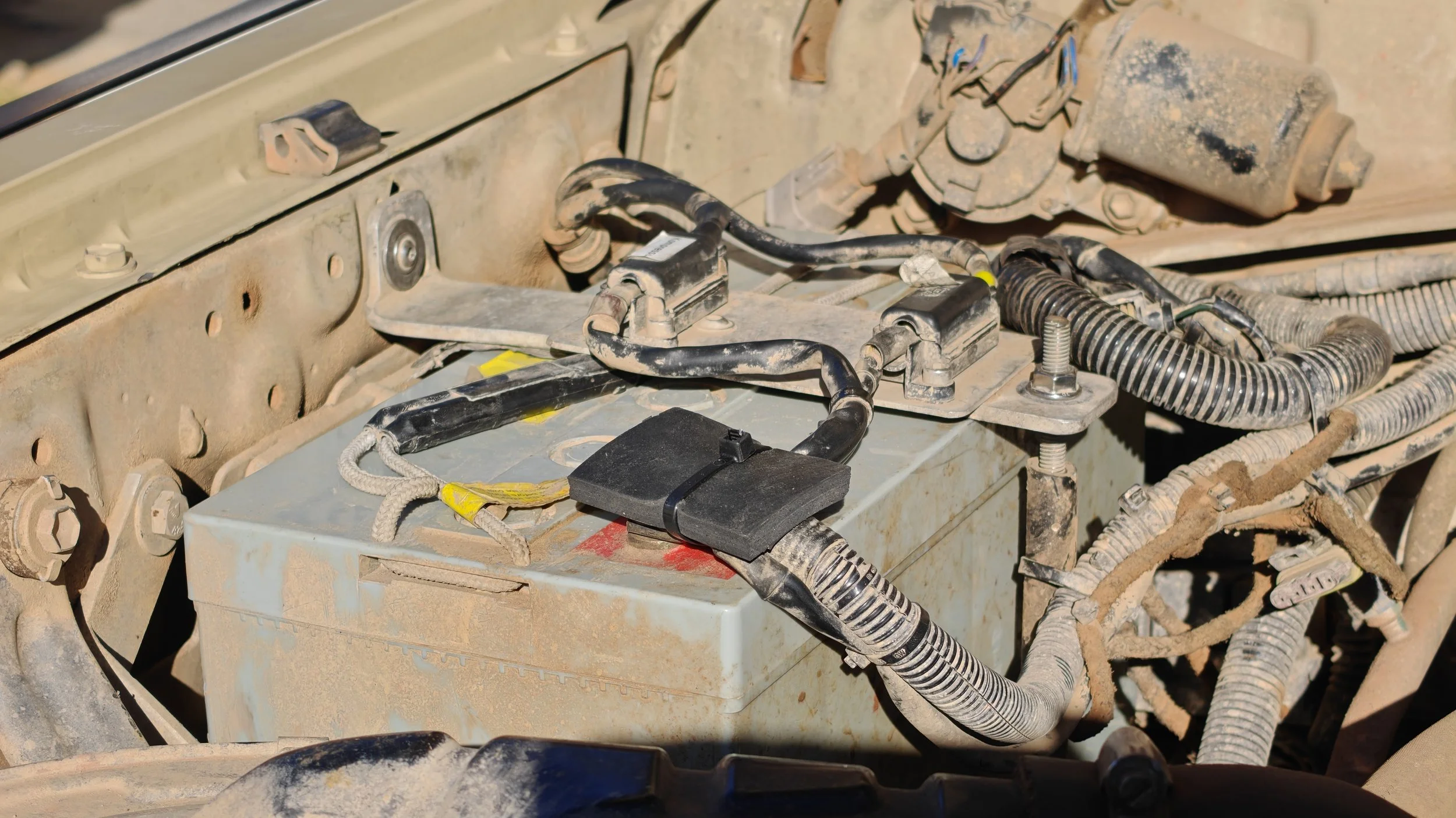
In February 2025, we had shipped our Land Cruiser in a container from Thailand to Cape Town. There, it was unloaded by a freight forwarder (EconoTrans https://exportandimport.co.za/ ) and safely stored in their warehouse. As expected, I had to replace both batteries. After a service and a few minor repairs, the car was ready to drive again. I spent the first few days at a campground (African Overlanders https://africanoverlanders.com/ ) to chat with other overlanders and learn from their travel experiences. You always get the best information from those who have just driven the route.
Mitte April 2026 bin ich in Kapstadt / Südafrika eingetroffen. Ursula konnte wegen einer Mittelohr-Entzündung leider nicht fliegen und ist daher erst ein Monat später nach Kimberly nachgekommen.
Im Februar 2025 haben wir unseren Landcruiser in einem Container von Thailand aus nach Kapstadt verschifft. Dort wurde er von einer Spedition (EconoTrans https://exportandimport.co.za/ ) ausgeladen und in ihrem Lagerhaus sicher verwahrt. Wie zu erwarten musste ich beide Batterien wechseln. Nach einem Service und einigen kleineren Reparaturen war das Auto wieder fahrbereit. Die ersten Tage verbrachte ich auf einem Campingplatz (African Overlanders https://africanoverlanders.com/ ), um mich mit anderen Overlandern auszutauschen bzw. von ihren Reise-Erfahrungen zu profitieren. Die besten Infos bekommt man immer von denen, die eine Strecke gerade gefahren sind.
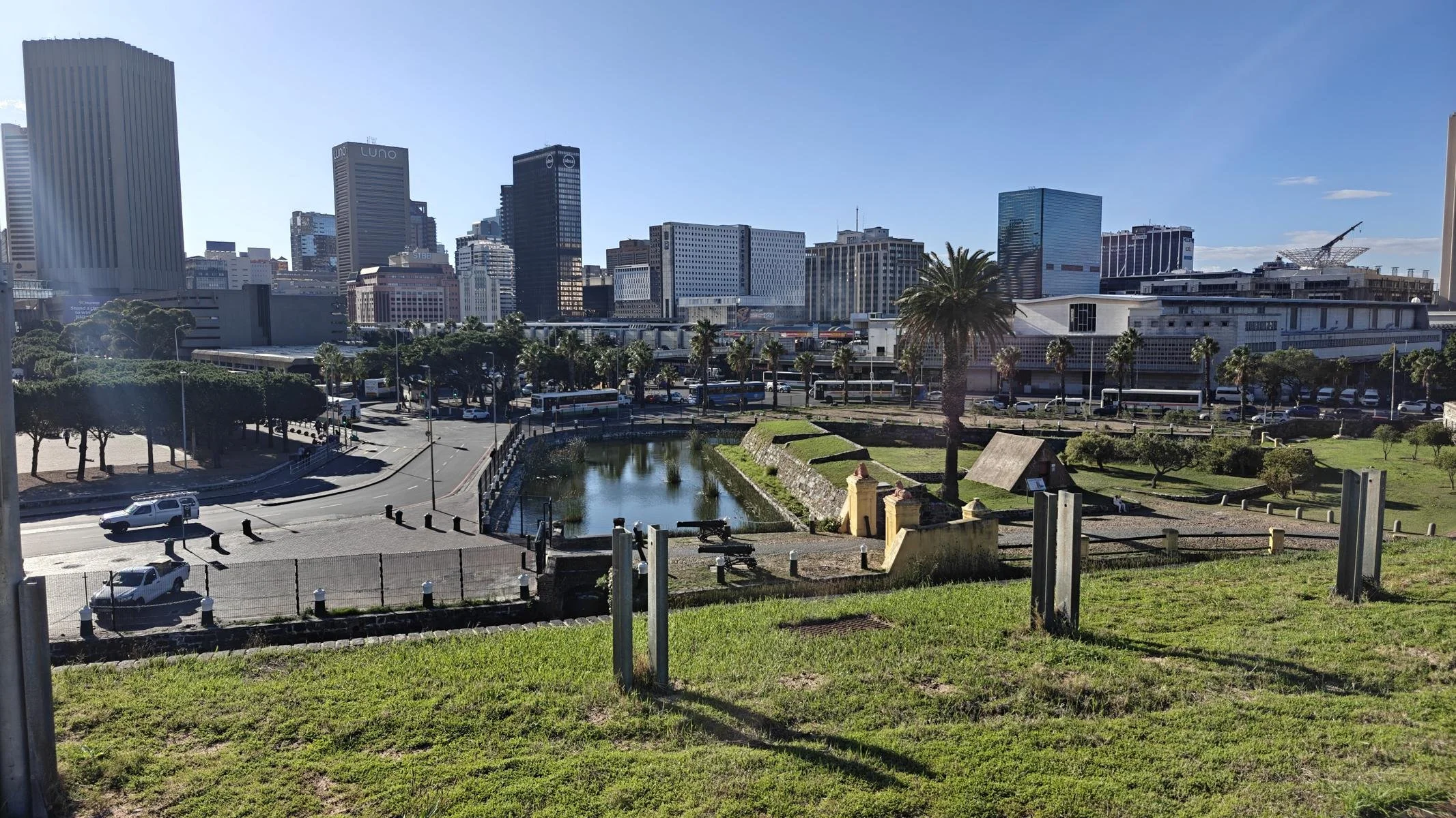
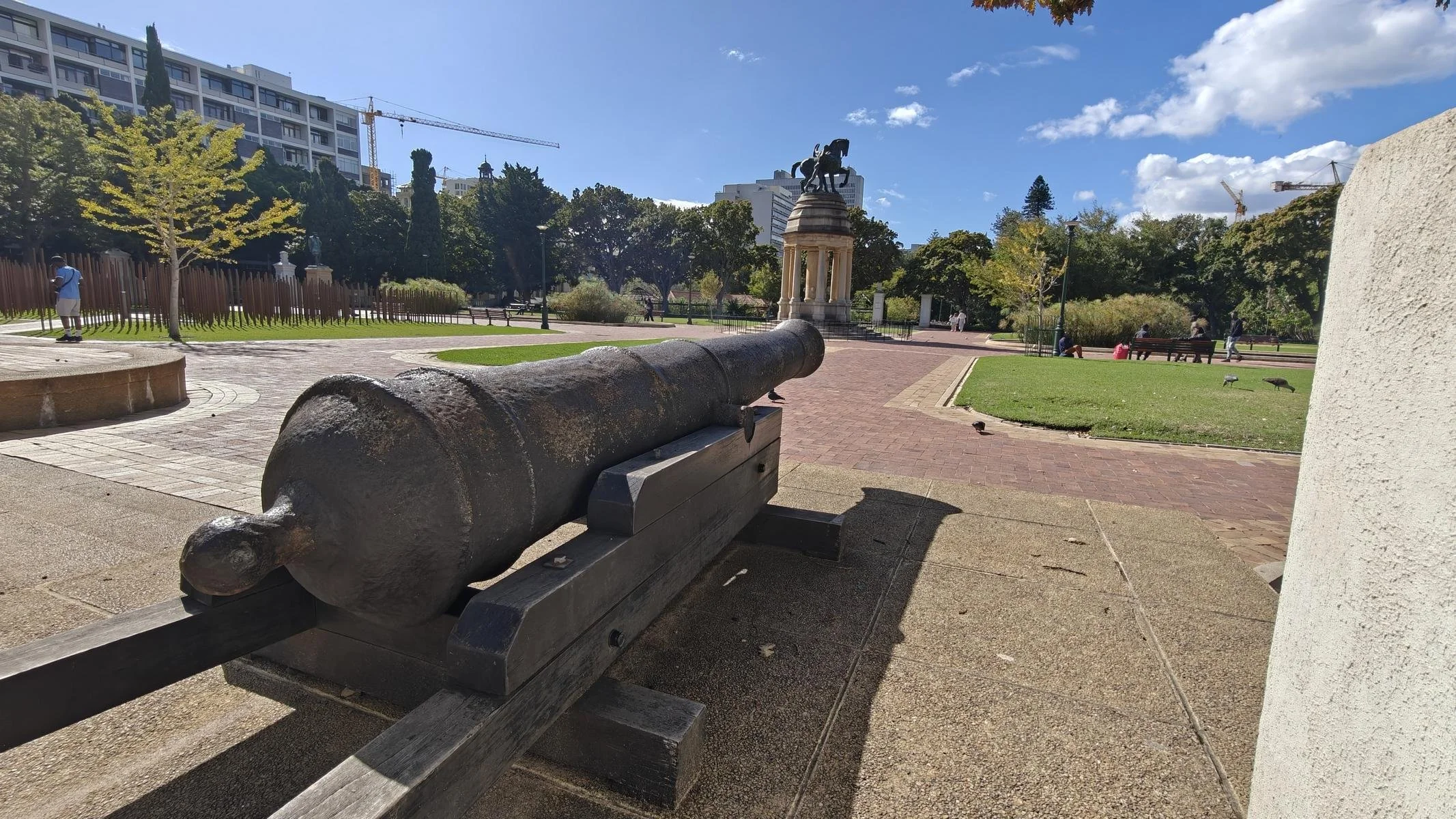
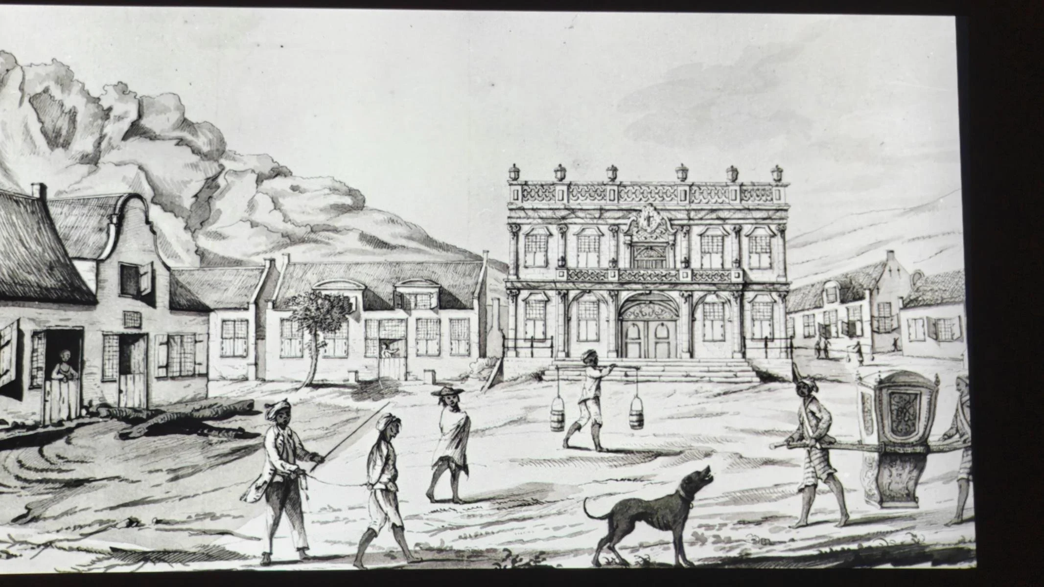
An initial attempt by Portuguese sailors to establish a settlement in Cape Town Bay failed in 1510 due to resistance from the local Khoi people. In 1652, the Dutch East India Company (Vereenigde Oostindische Compagnie; abbreviated VOC) established a trading post intended to supply ships and sailors en route to the Dutch colonies (present-day Indonesia). Over the next 150 years, more and more predominantly Dutch settlers (who called themselves Boers) arrived, pushing further inland and subjugating or displacing the African population (Khoi, San, etc.). In 1806, Great Britain permanently took over the colony and opened it to British emigrants. The pentagonal Castle of Good Hope, built starting in 1666, is the oldest building in South Africa. The fortress was once located by the sea and is now a museum.
Ein erster Versuch portugiesischer Seefahrer, in der Bucht von Kapstadt eine Siedung zu gründen, scheiterte 1510 am Widerstand der lokalen Khoi-bevölkerung. 1652 gründete die Niederländischen Ostindien-Kompanie (Vereenigde Oostindische Compagnie; abgekürzt VOC) eine Handelsniederlassung, die der Versorgung der Schiffe und Seeleute auf dem Weg zu den holländischen Kolonien (heutiges Indonesien) dienen sollte. In den folgenden 150 Jahre kamen immer mehr vorwiegend holländische Siedler (die sich Buren nannten), die weiter ins Landesinnere vordrangen und die afrikanische Bevölkerung (Khoi, San....) unterwarfen bzw. verdrängten. 1806 übernahm Großbritannien dauerhaft die Kolonie und öffnete sie für britische Auswanderer. Das ab 1666 errichtete fünfeckige Castle of Good Hope ist das älteste Gebäude Südafrikas. Die Festung lag früher am Meer und ist heute ein Museum.
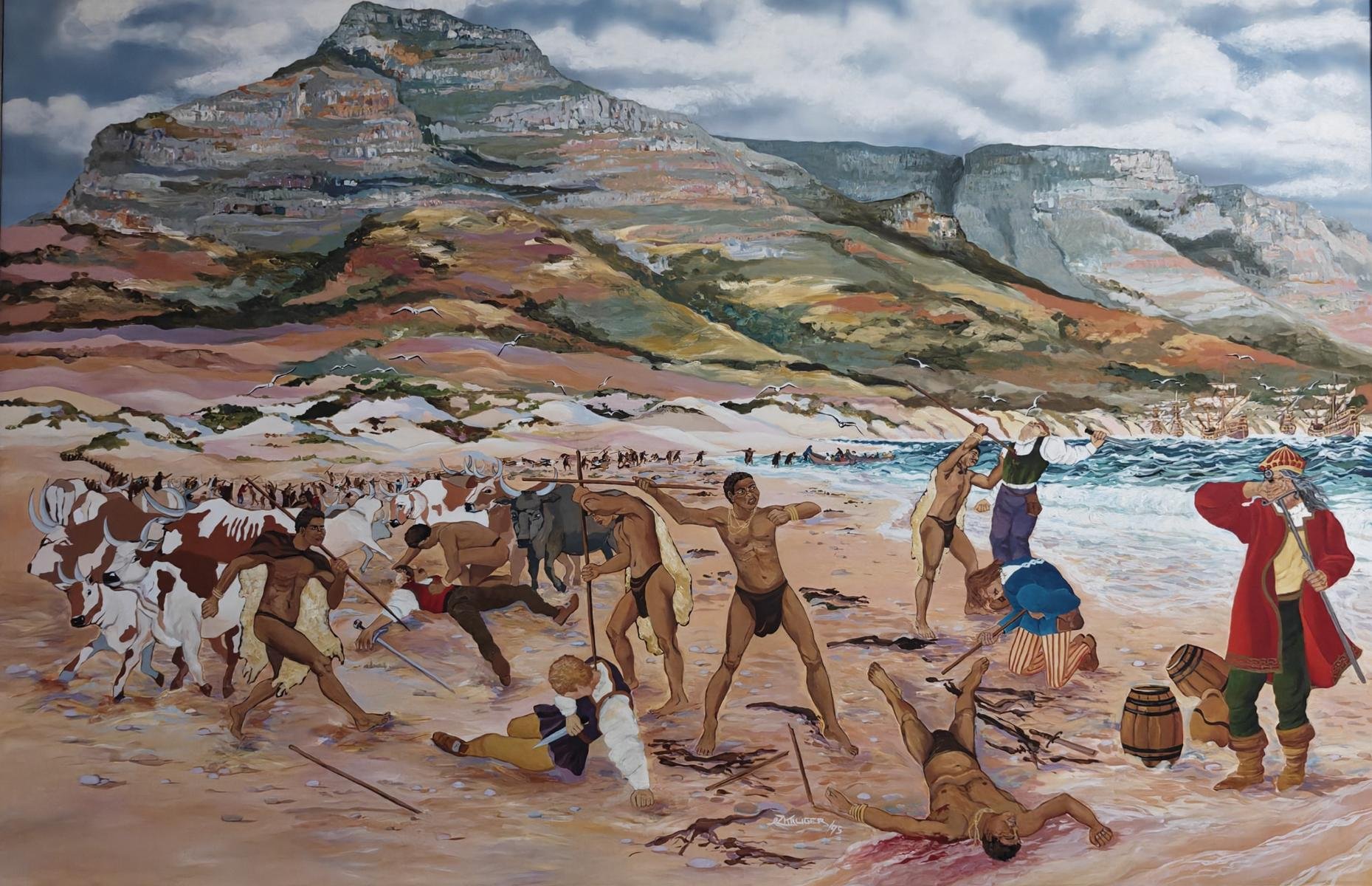
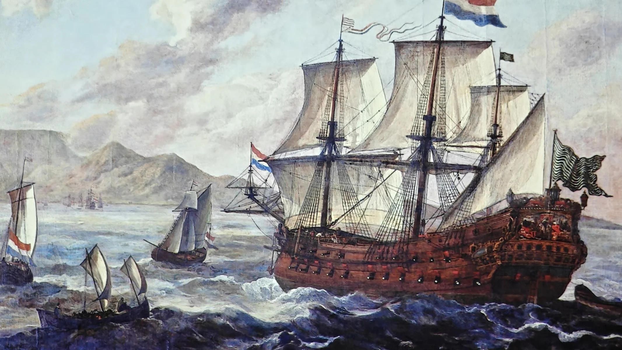
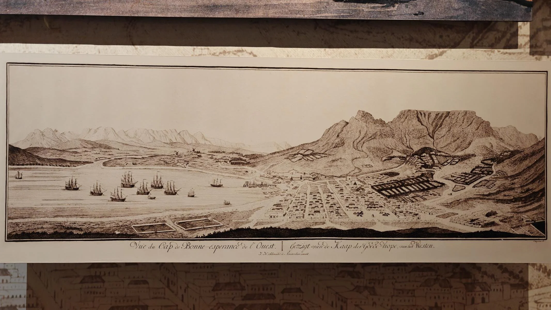
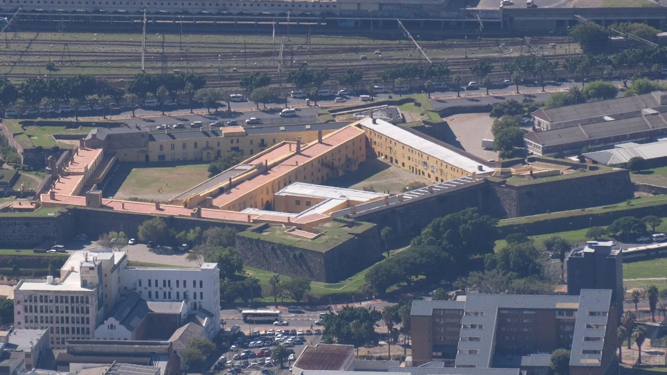
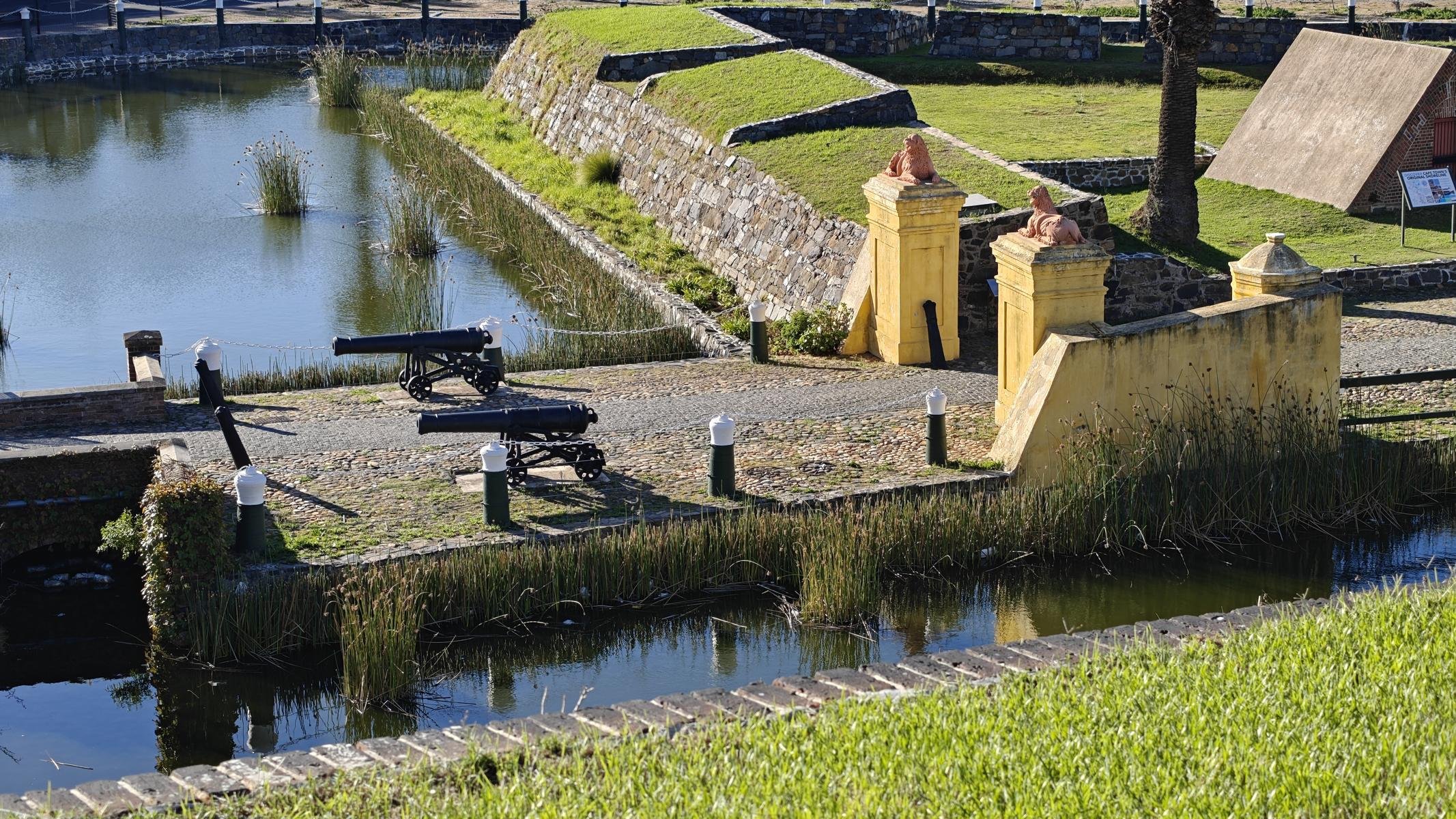
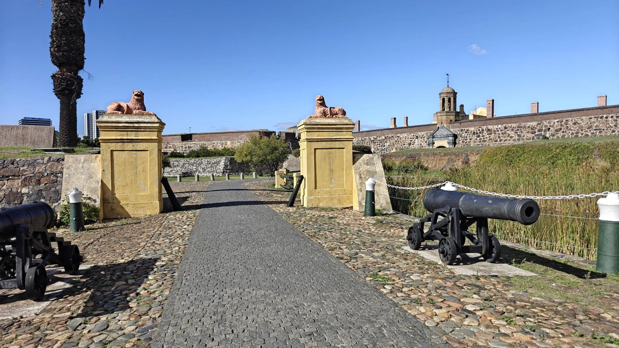
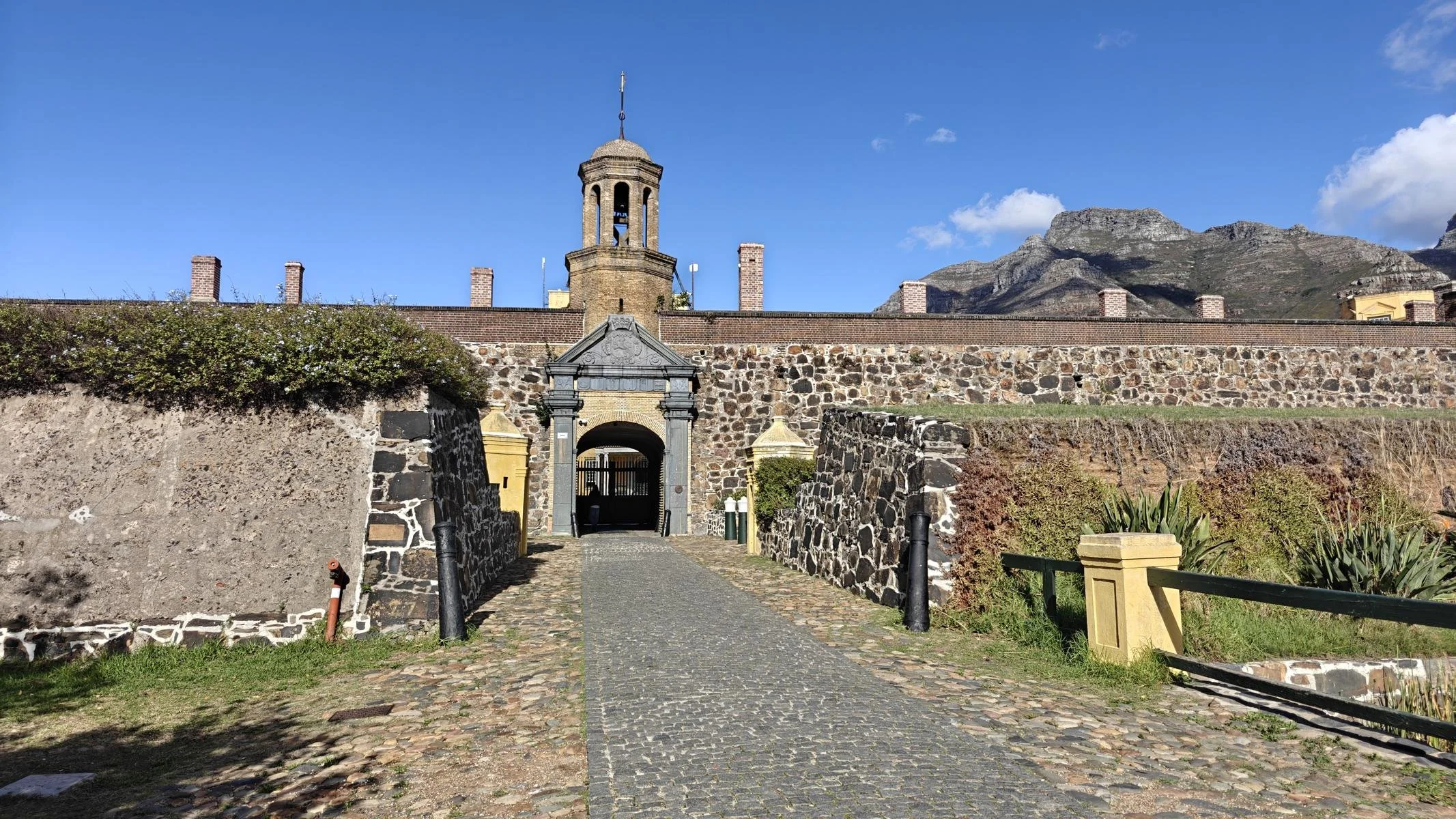
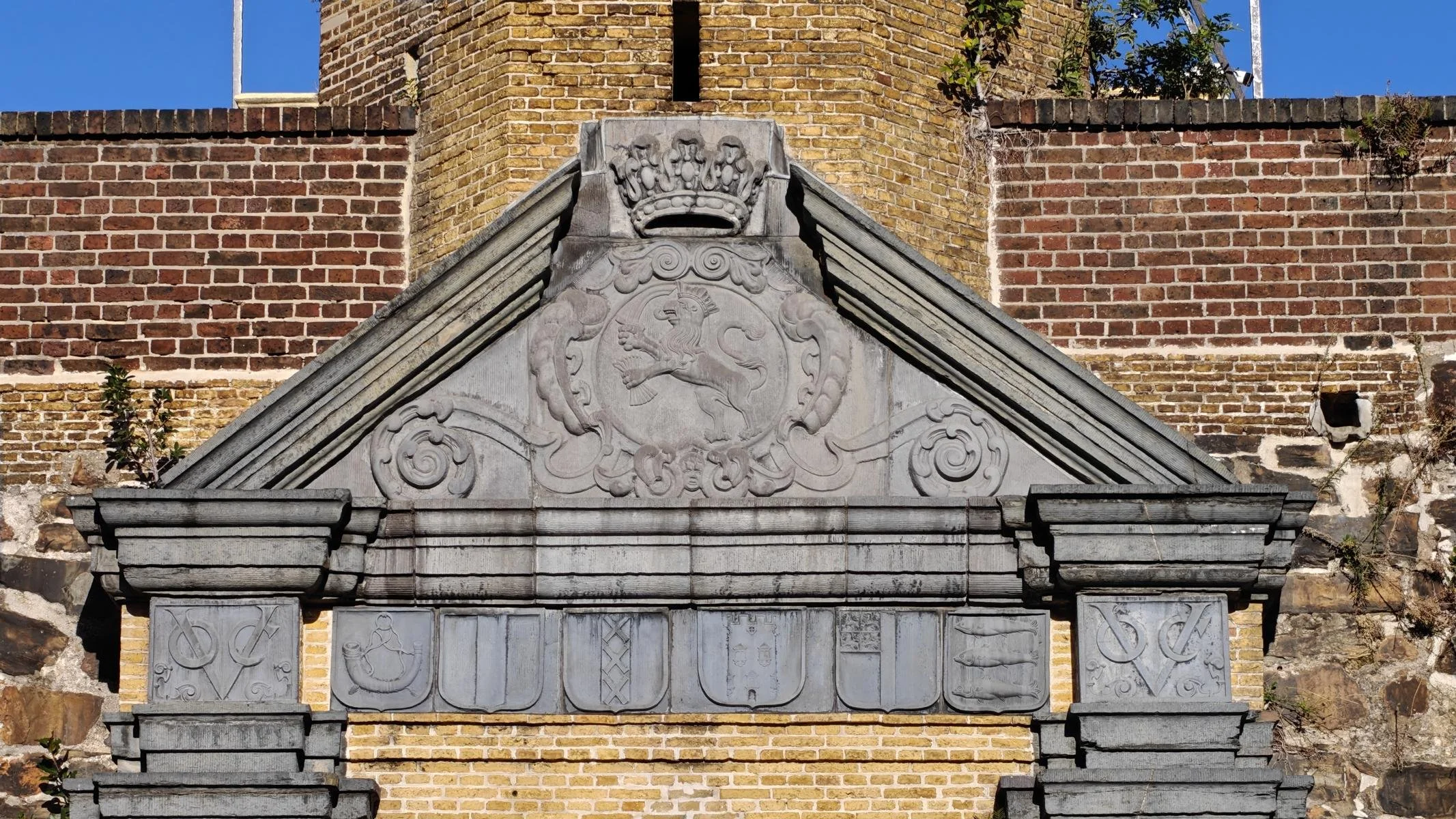
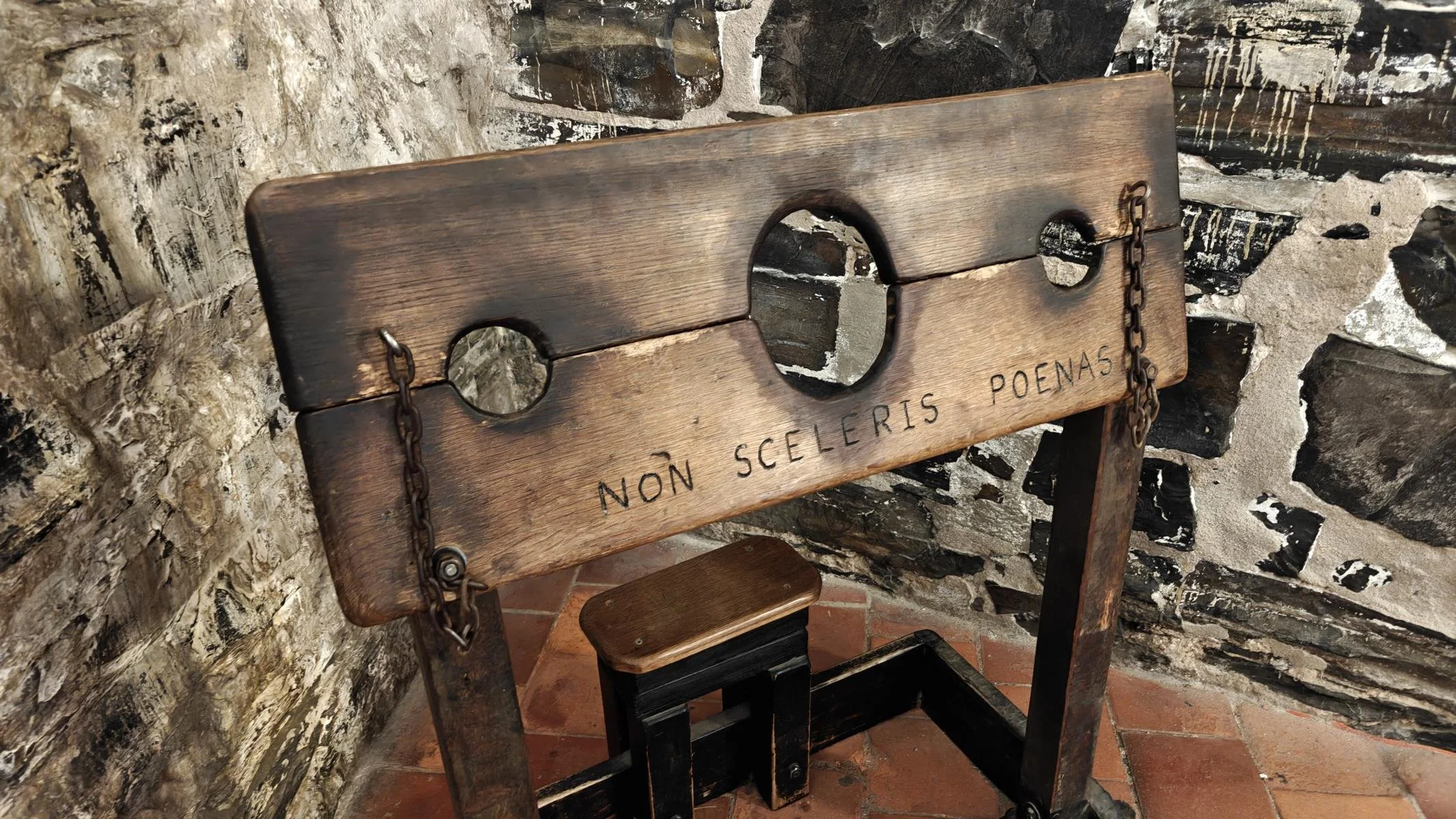
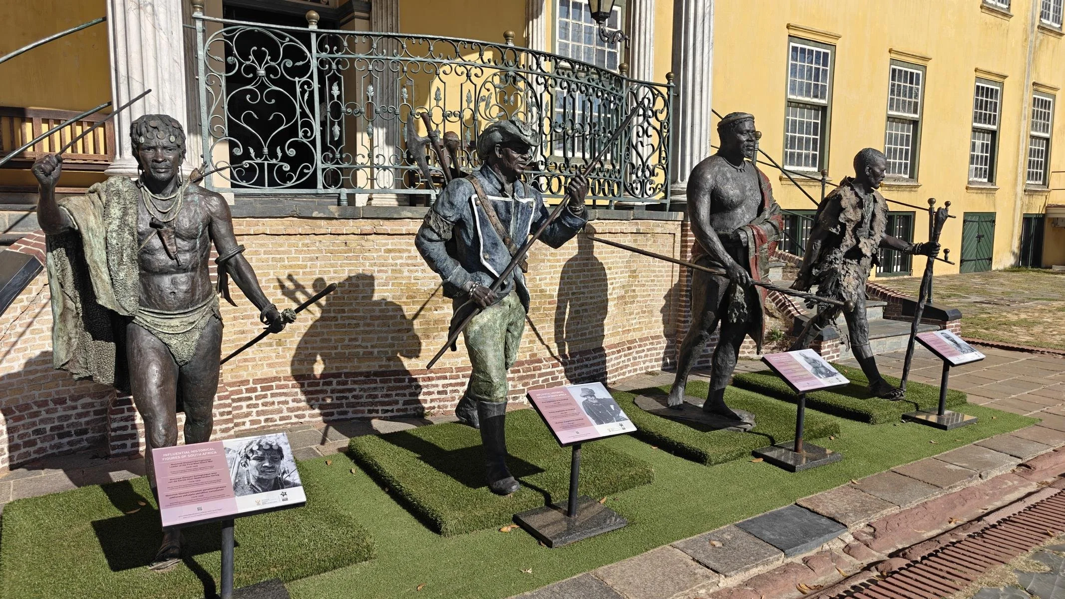
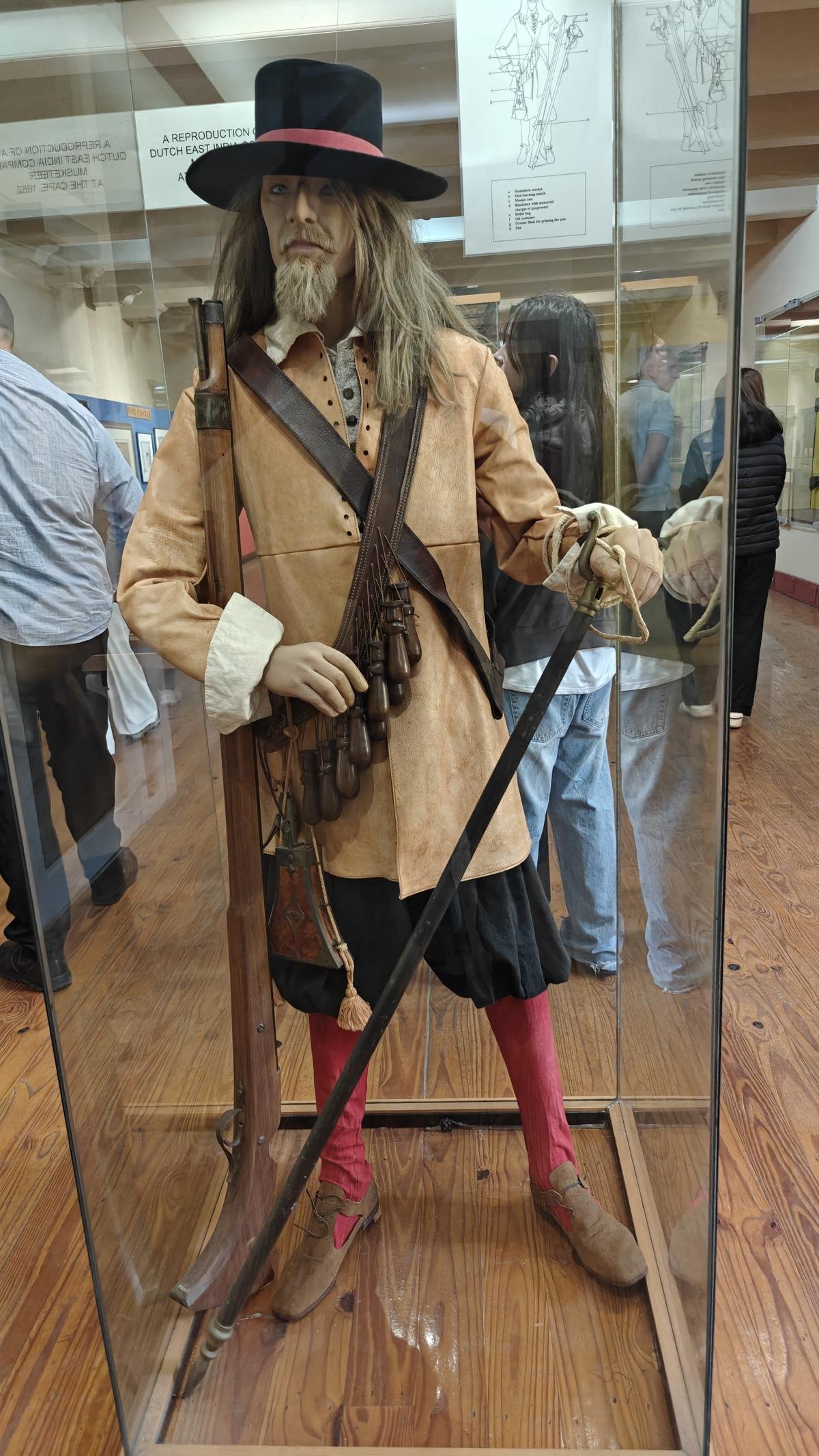
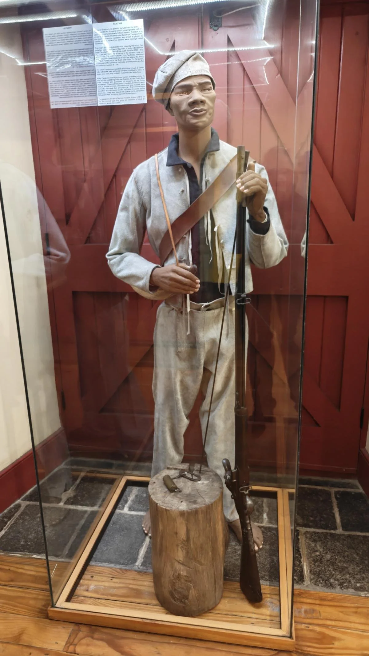
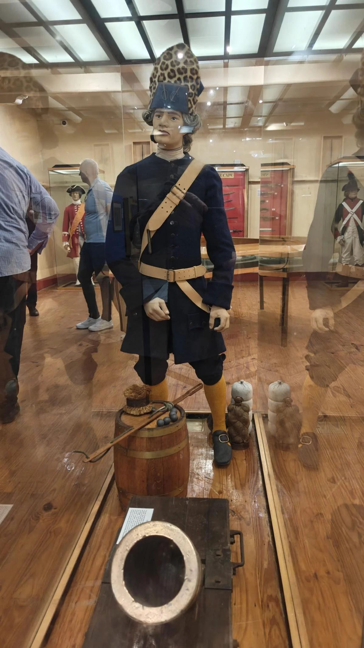
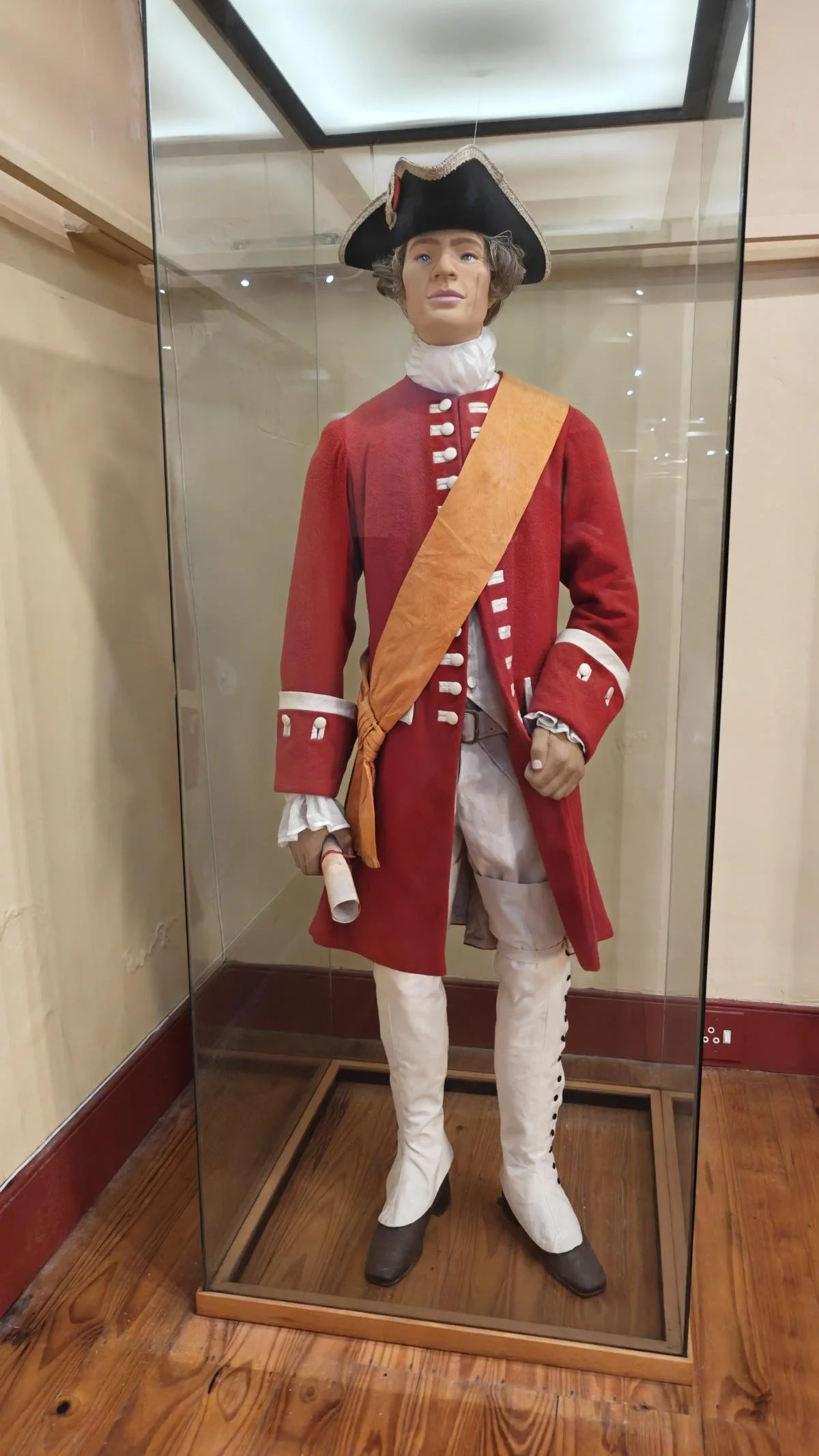
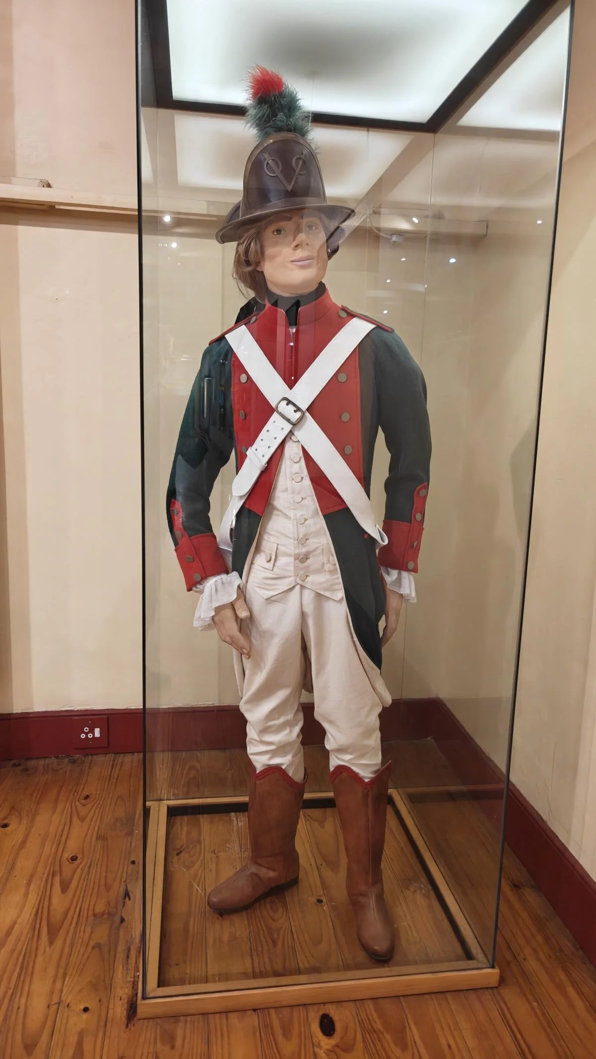
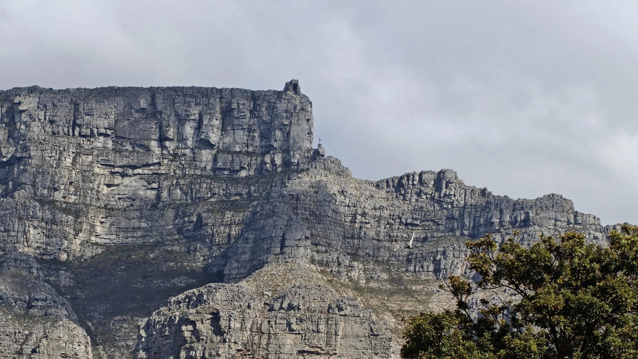
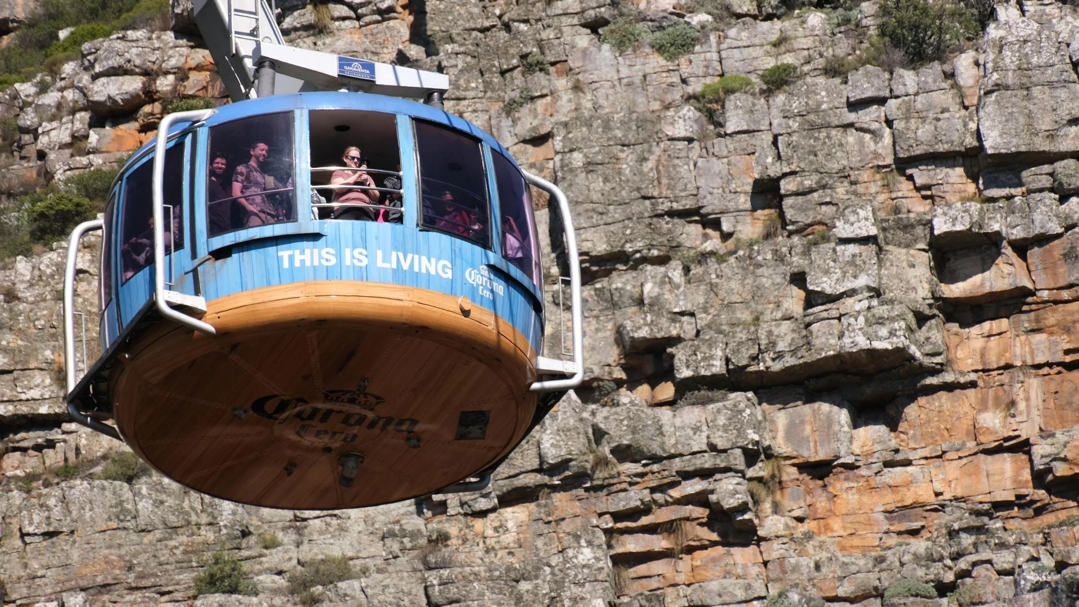
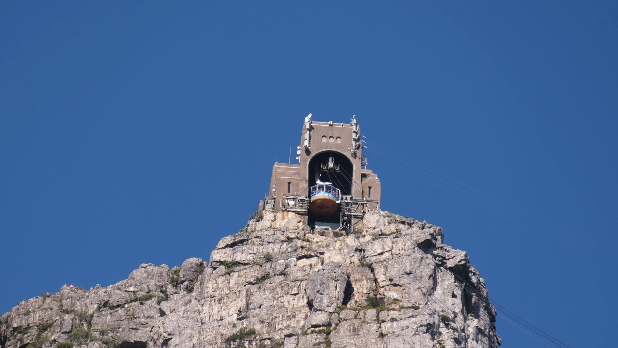
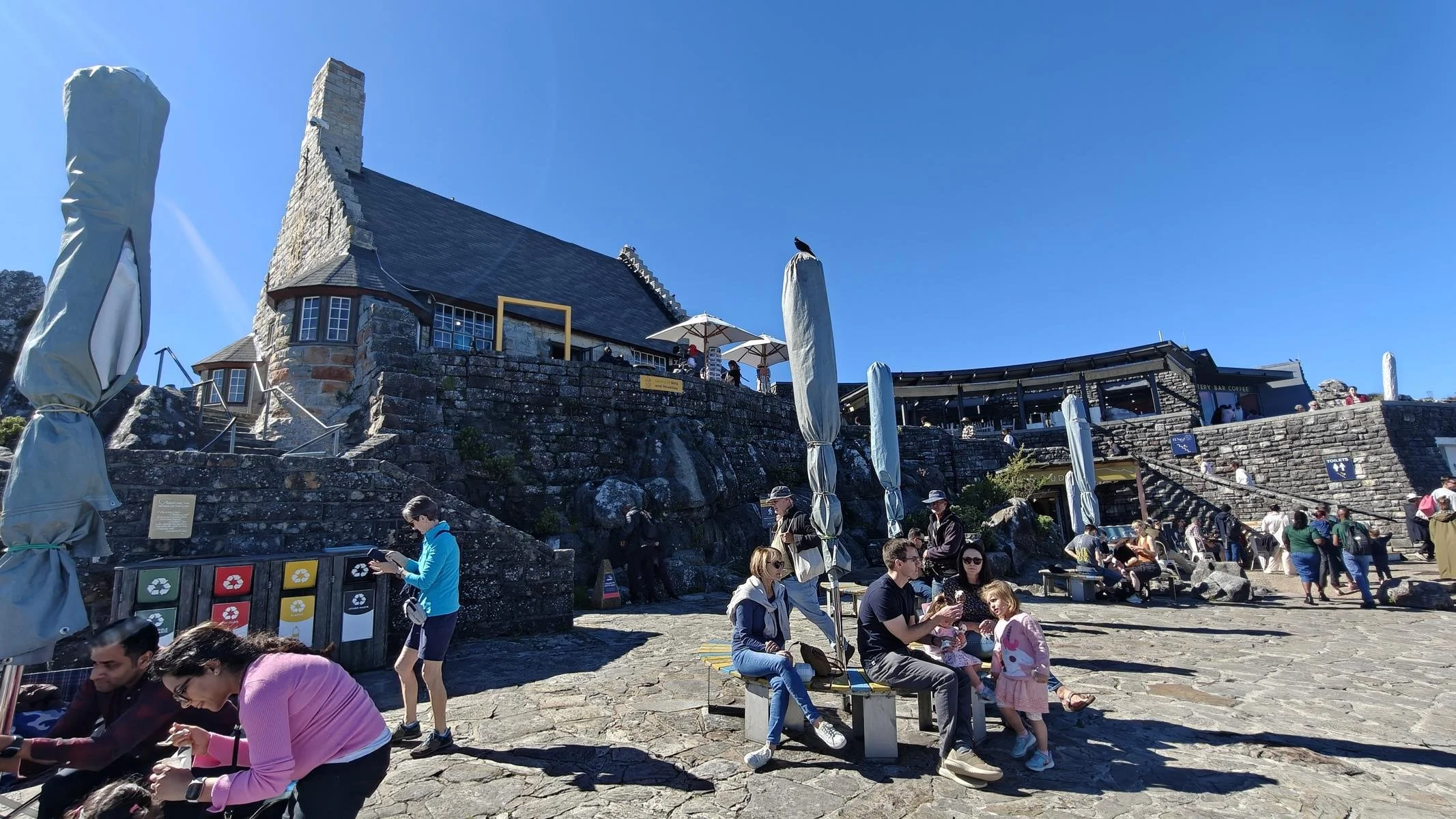
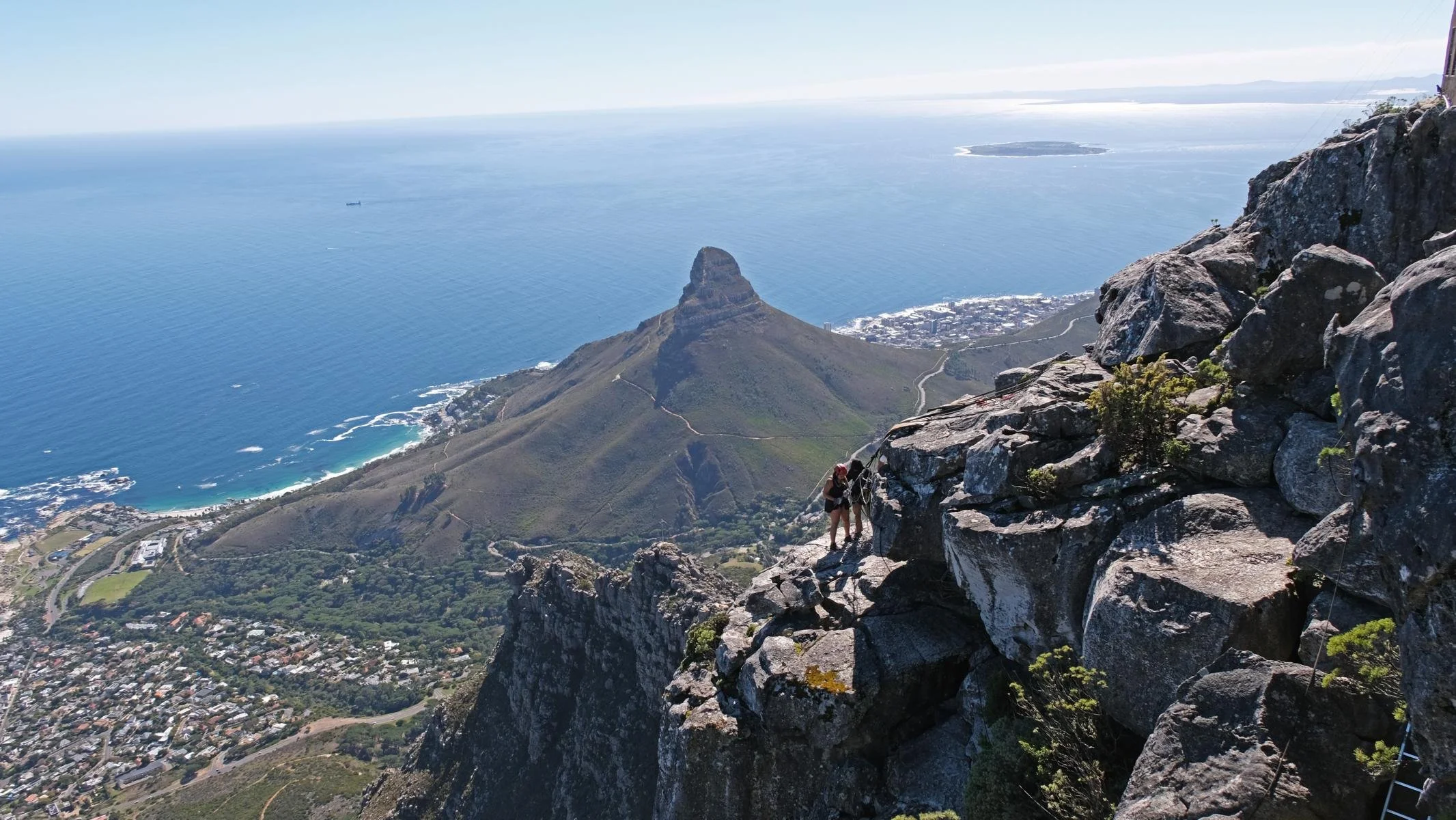
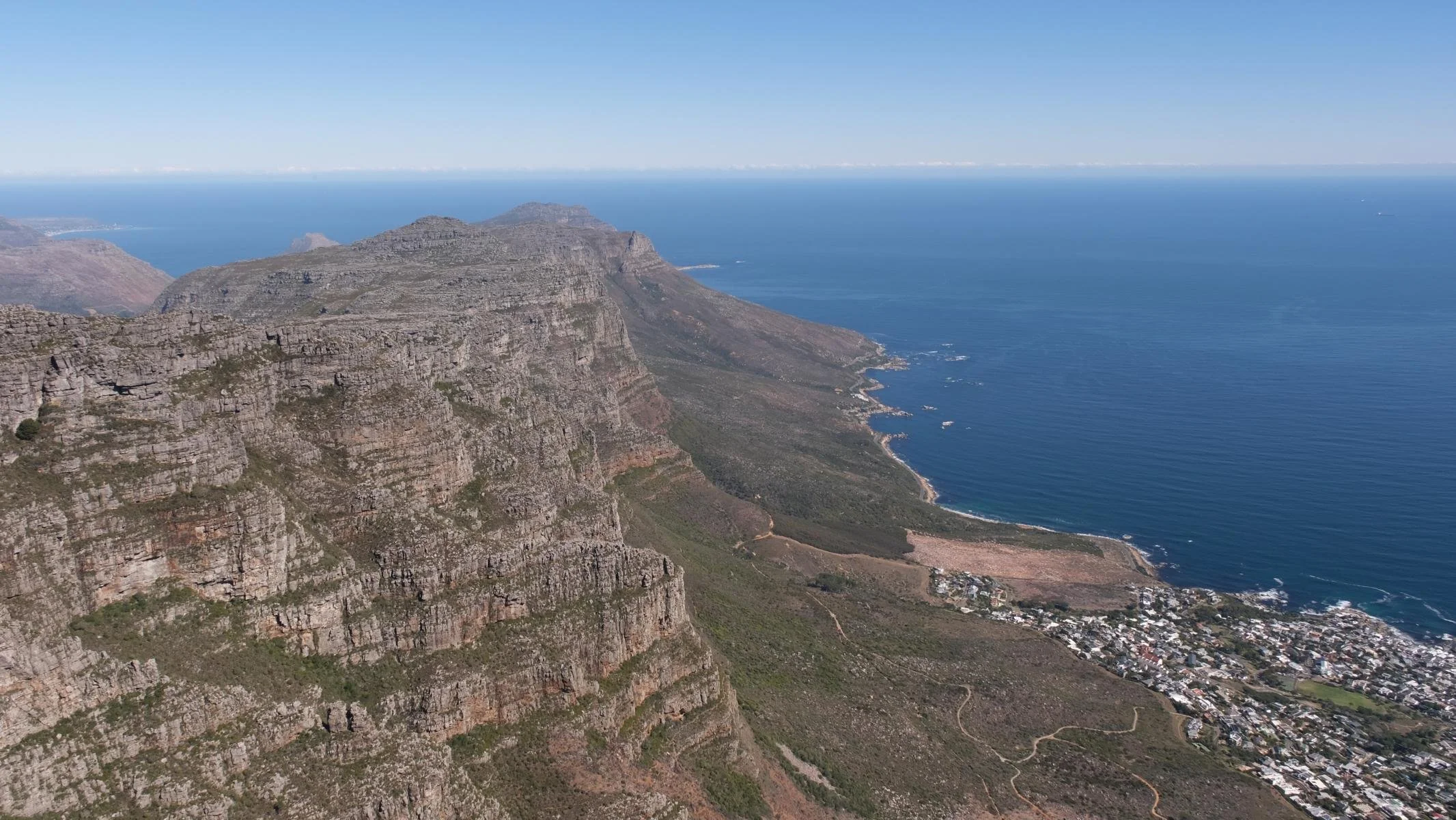
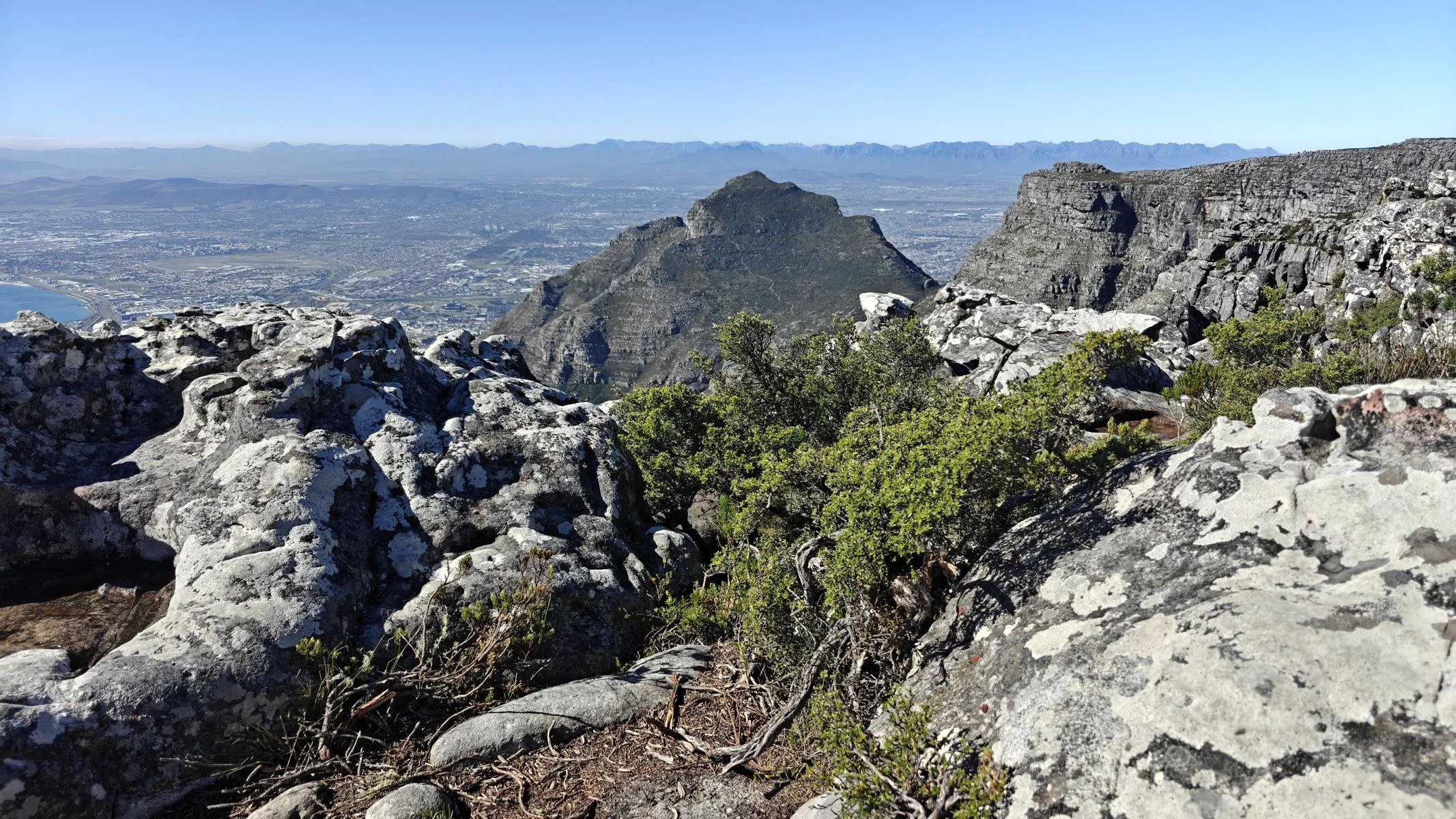
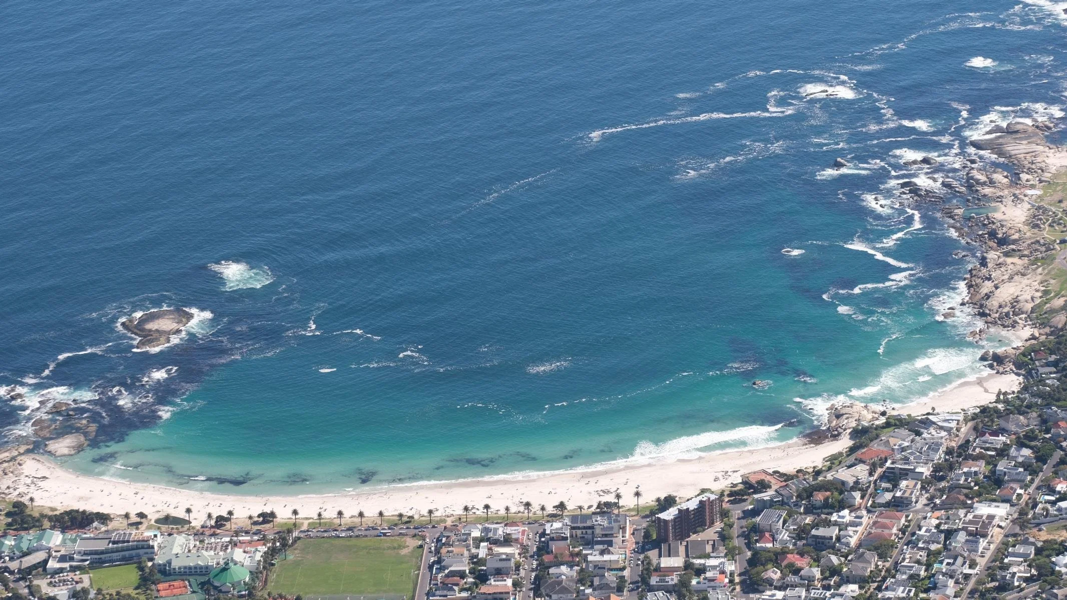
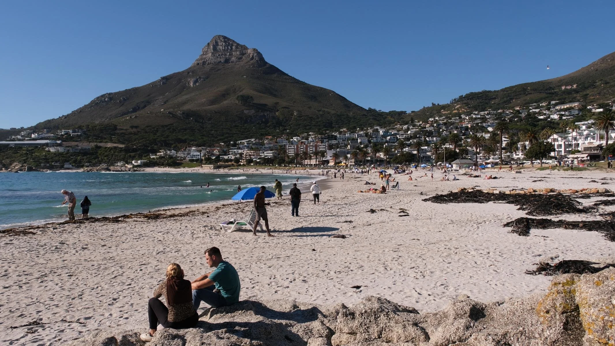
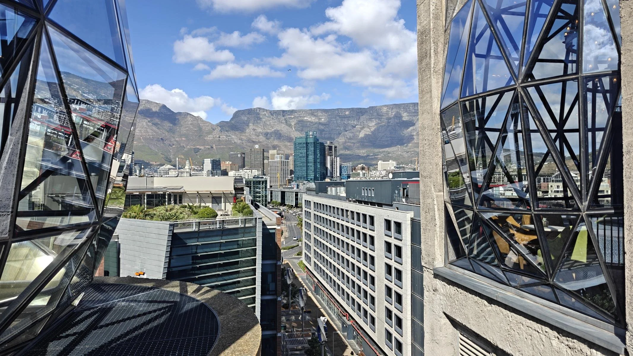
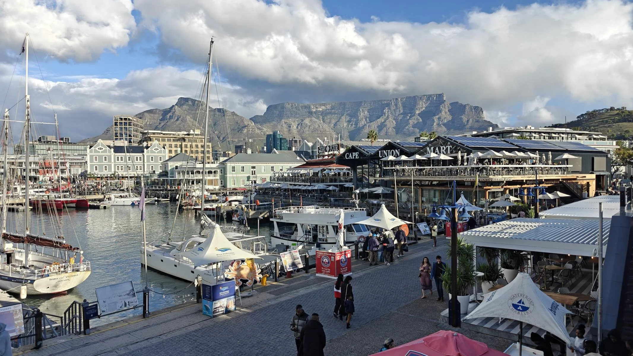
Table Mountain (1.086 m / 3,562 ft) is the city’s landmark. There are several trails leading to the summit on foot. However, due to the precarious security situation, it is advised not to go alone. The cable car is a more comfortable option. The gondola rotates once on its axis during the ascent. From the top, you have a magnificent view of the bay, the city, and Clifton Beach to the southeast.
Der 1086 m hohe Tafelberg ist das Wahrzeichen der Stadt. Es gibt mehrere Wege, um zu Fuß zum Gipfel zu gelangen. Allerdings wird geraten, wegen der prekären Sicherheitslage nicht alleine zu gehen. Bequemer ist es mit der Seilbahn. Die Gondel dreht sich während der Auffahrt einmal um die Achse. Von oben hat man einen herrlichen Ausblick auf die Bucht, die Stadt und den südöstlich gelegen Clifton Beach.
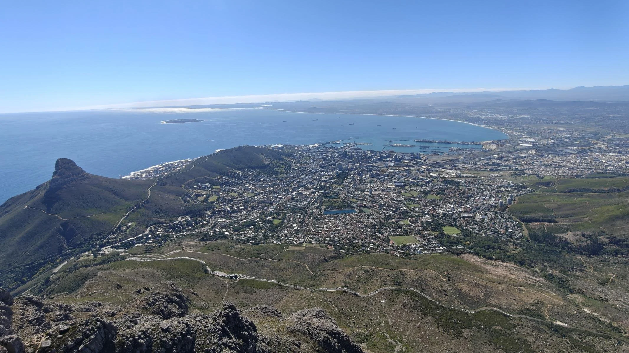
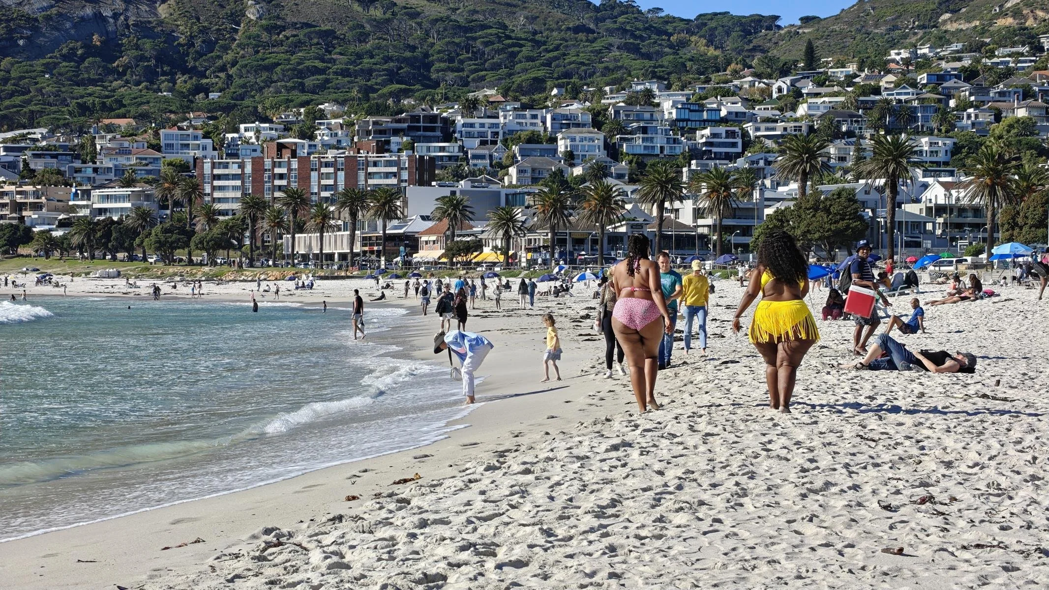
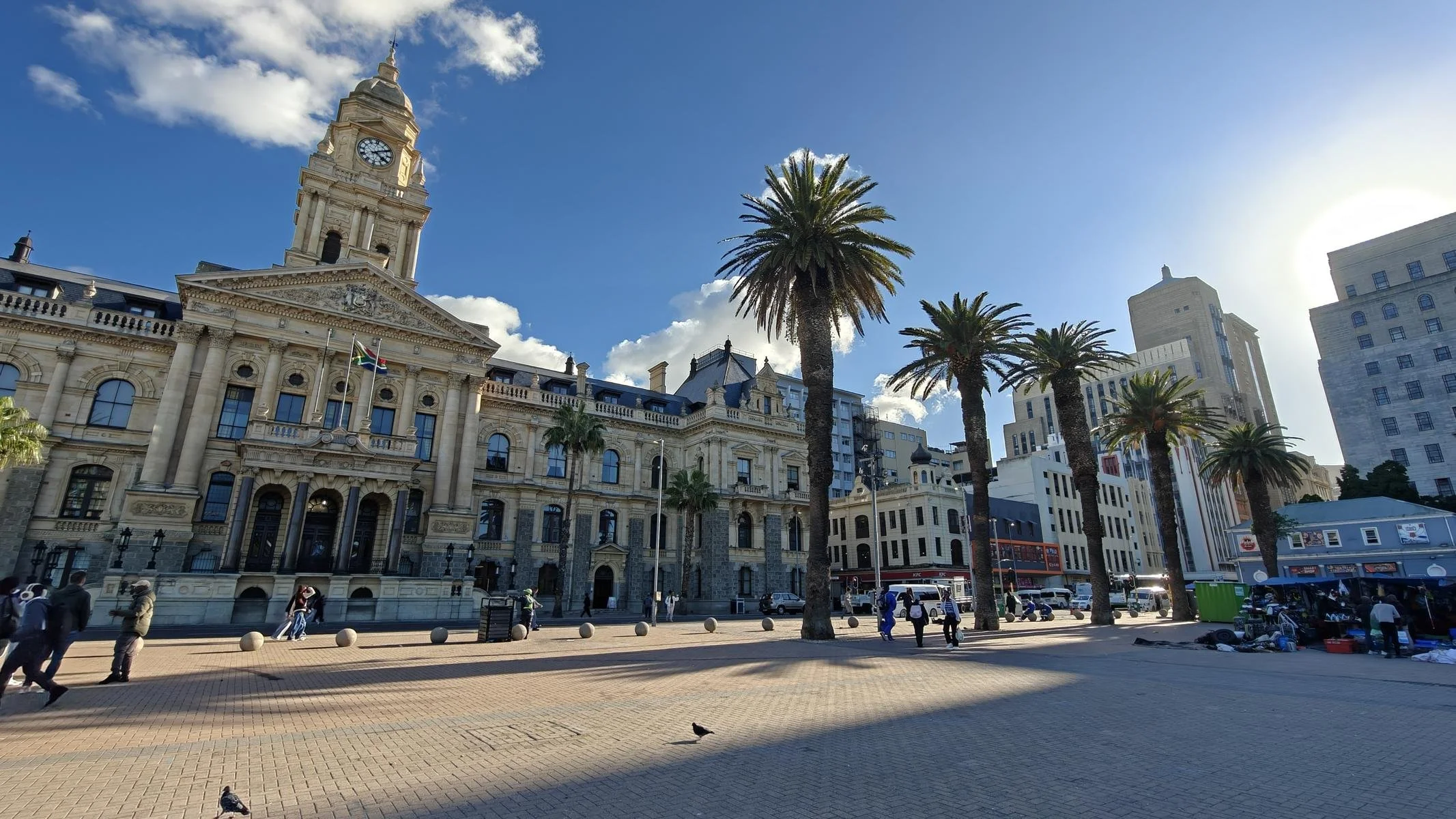
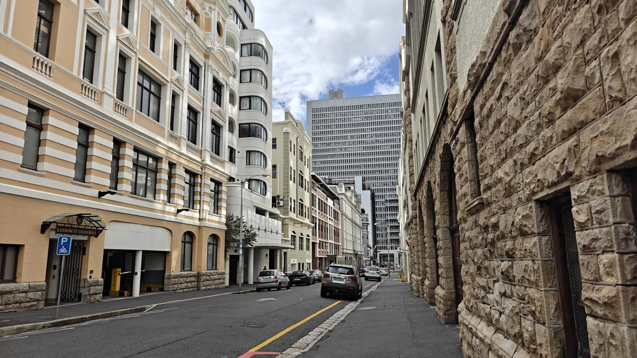
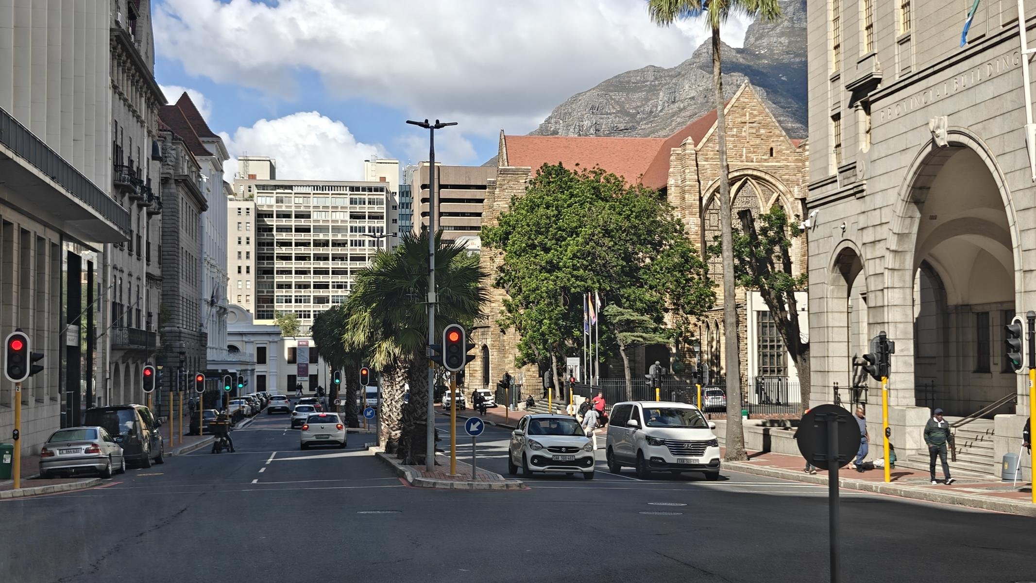
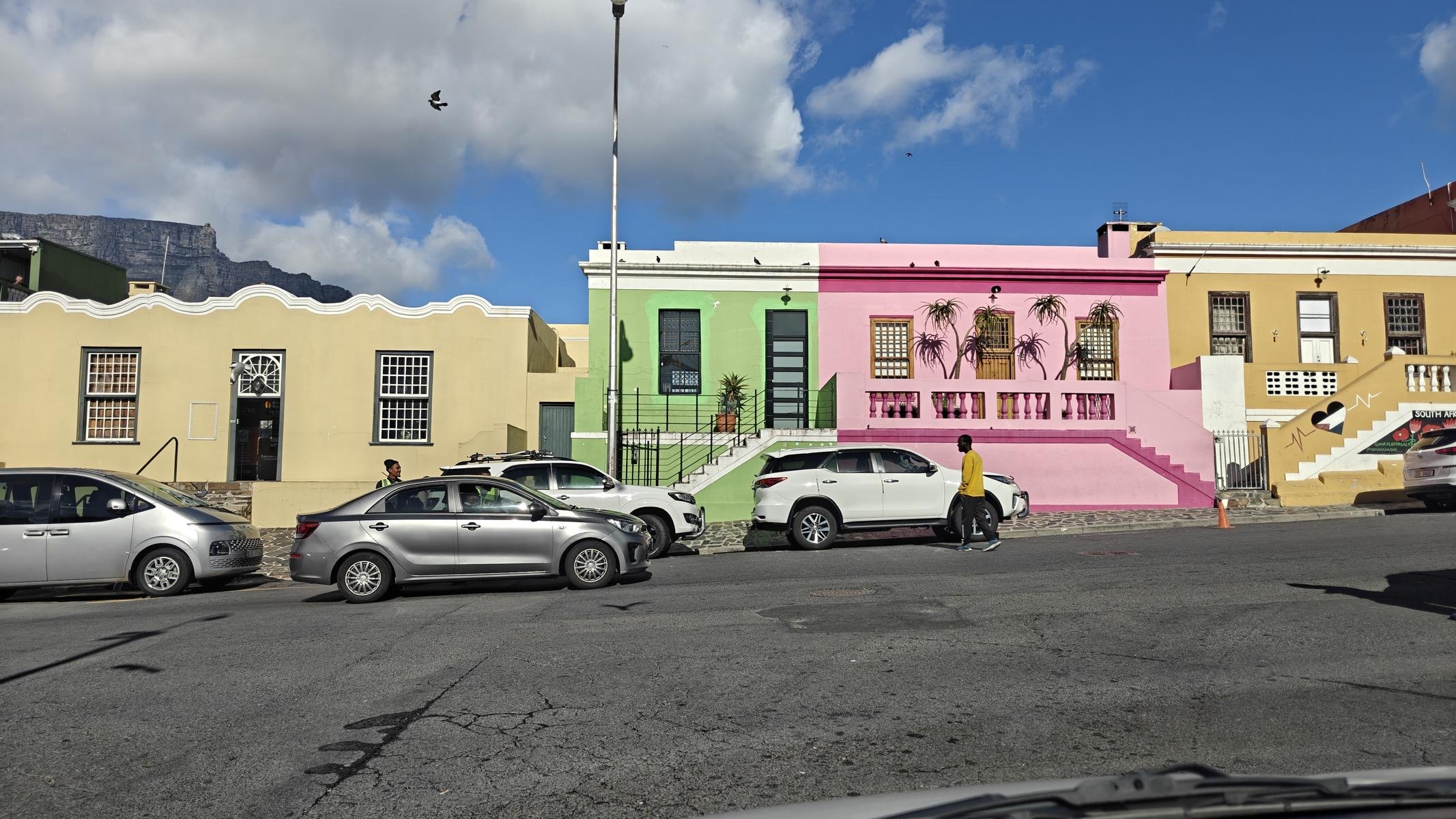
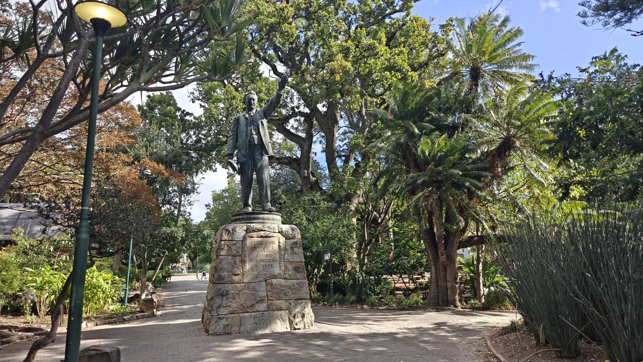
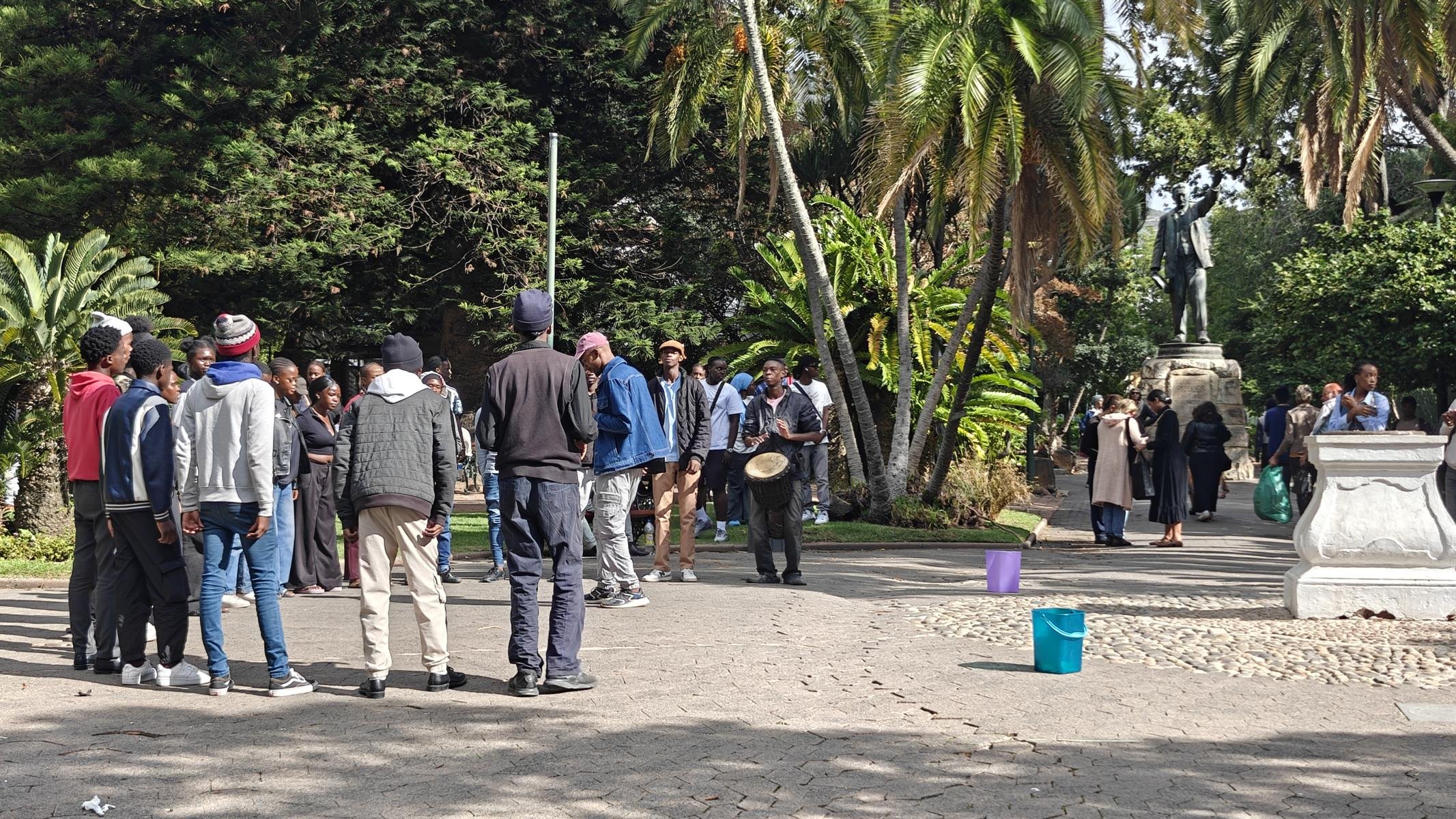
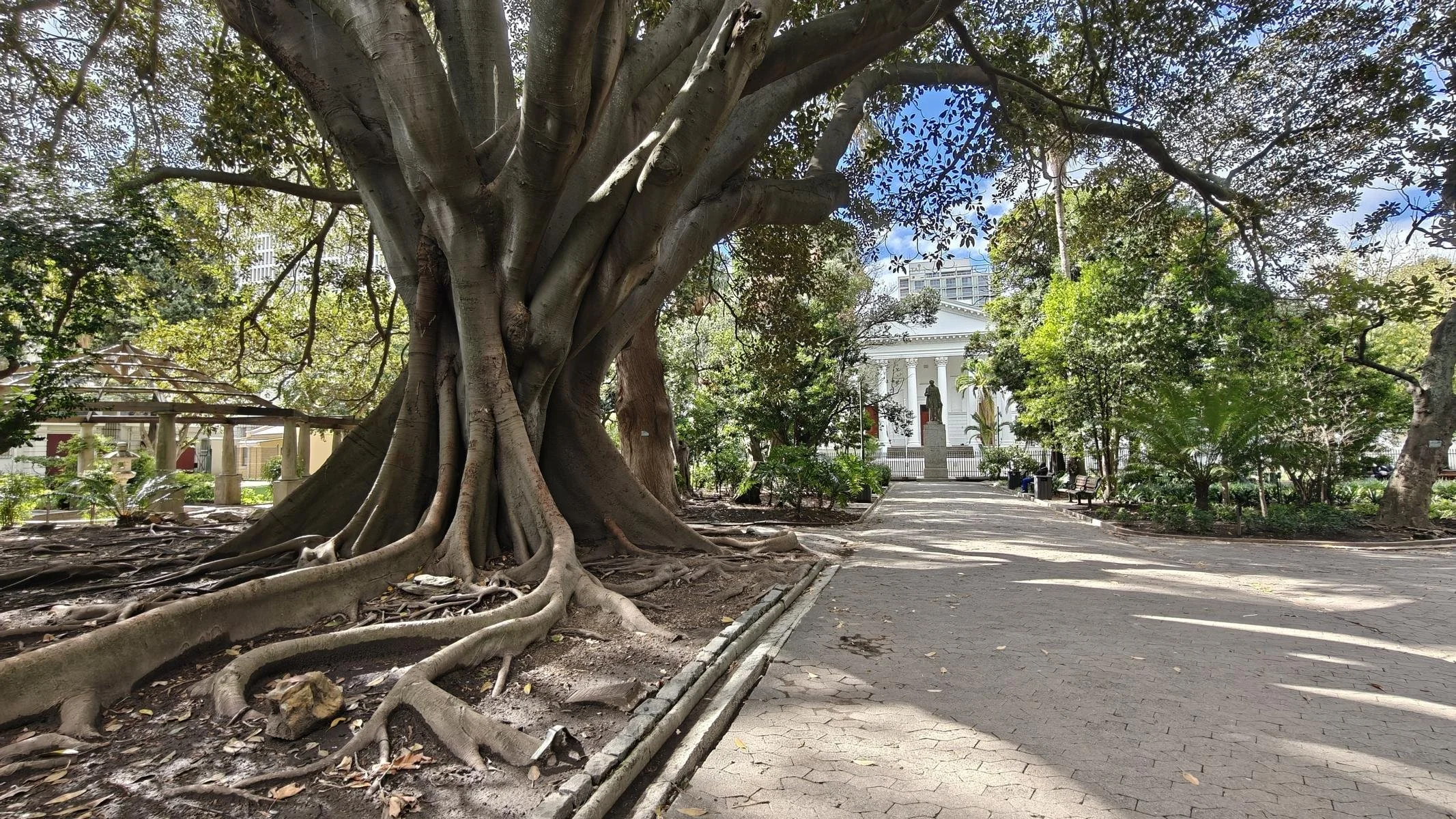
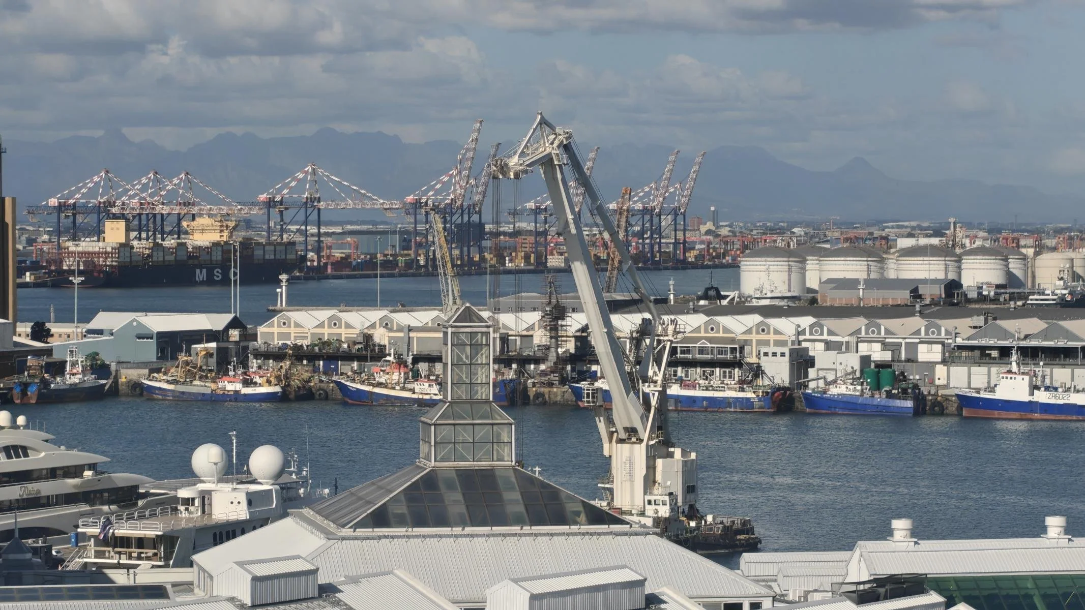
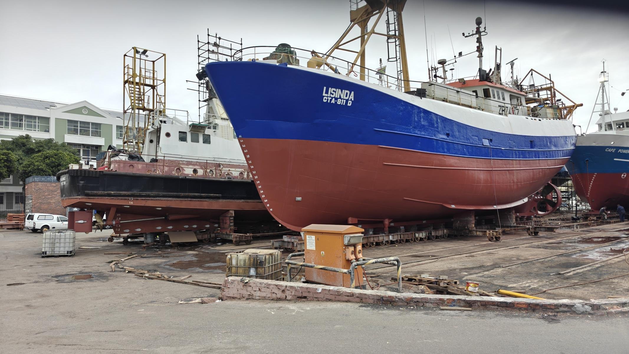
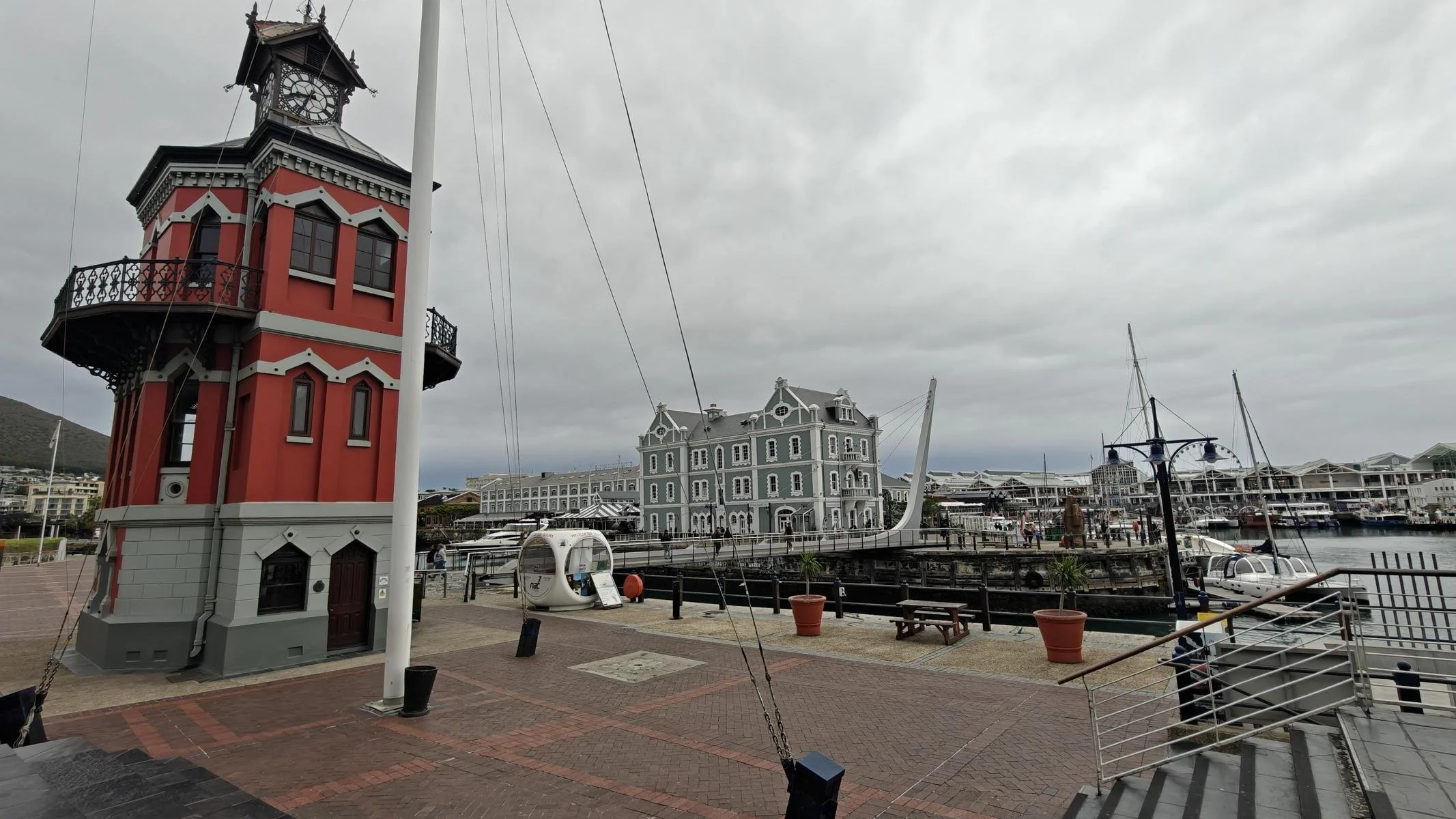
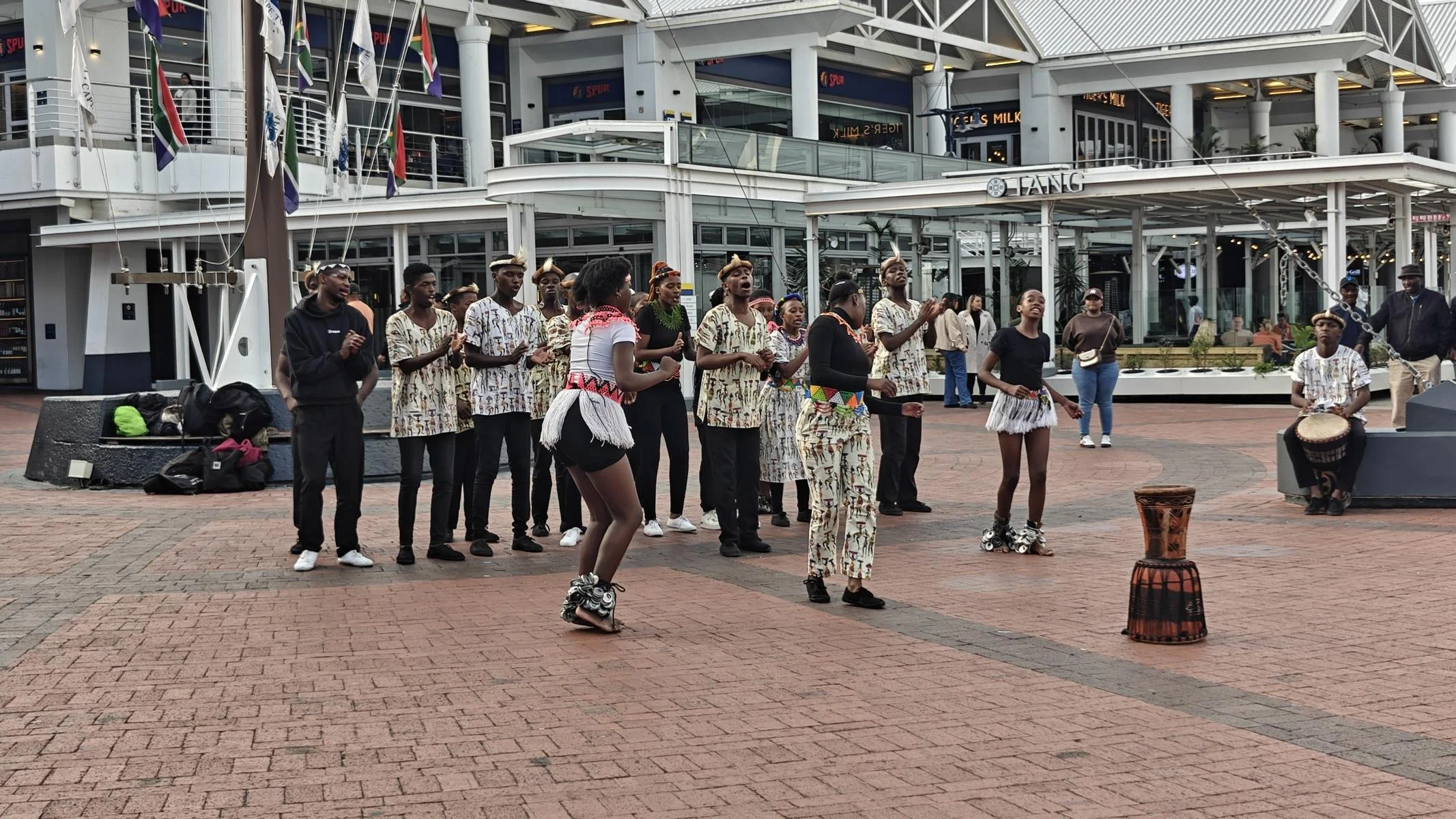
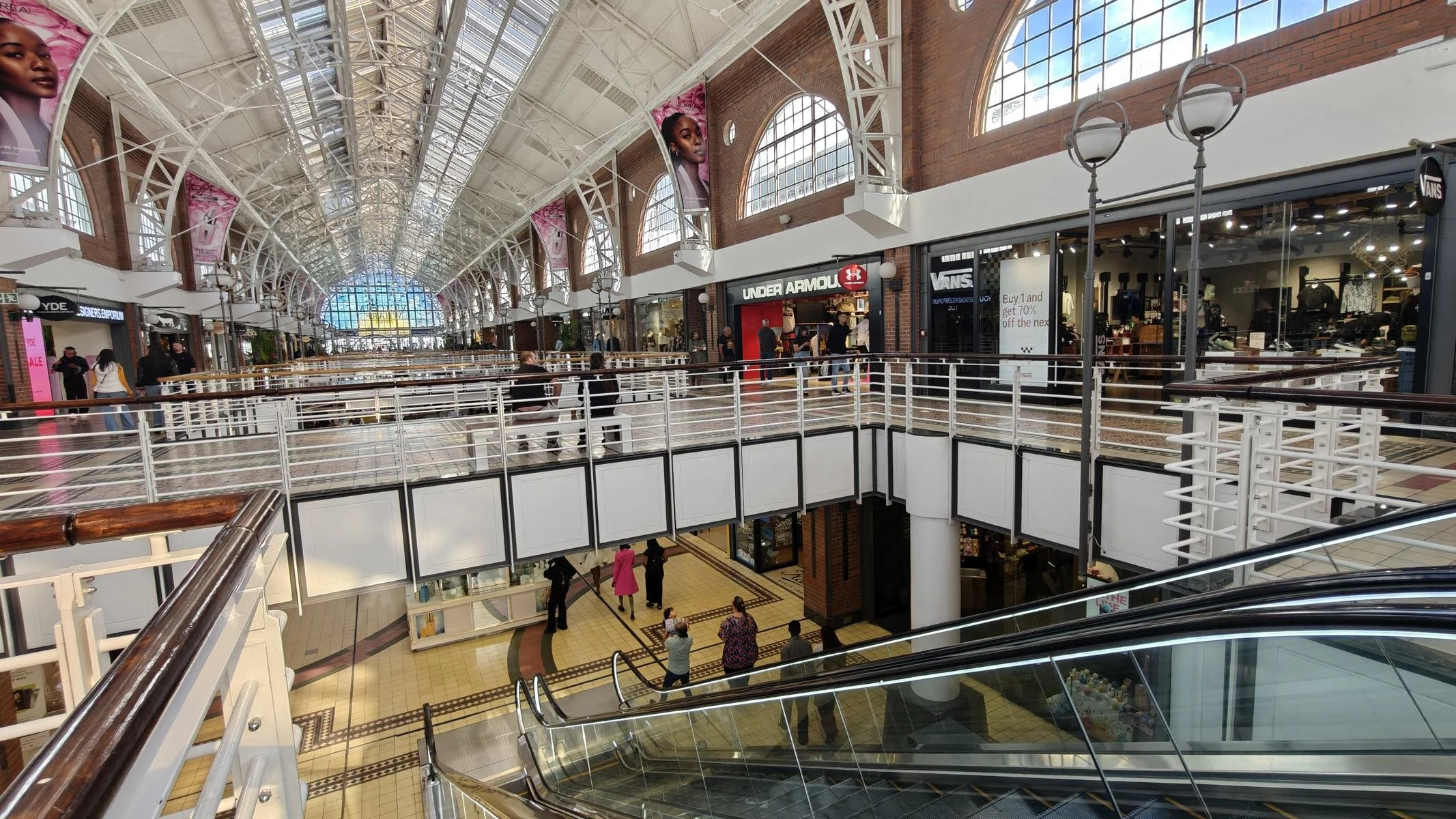
The city of Cape Town has a population of 433,000. However, if you include the suburbs and townships, the total population is nearly 5 million. Here are some photos of the city center.
Die Stadt Kapstadt hat 433.00 Einwohner*innen. Nimmt man die Vororte und Townships dazu, dann sind es jedoch fast 5 Millionen. Einige Fotos vom Zentrum der Stadt.
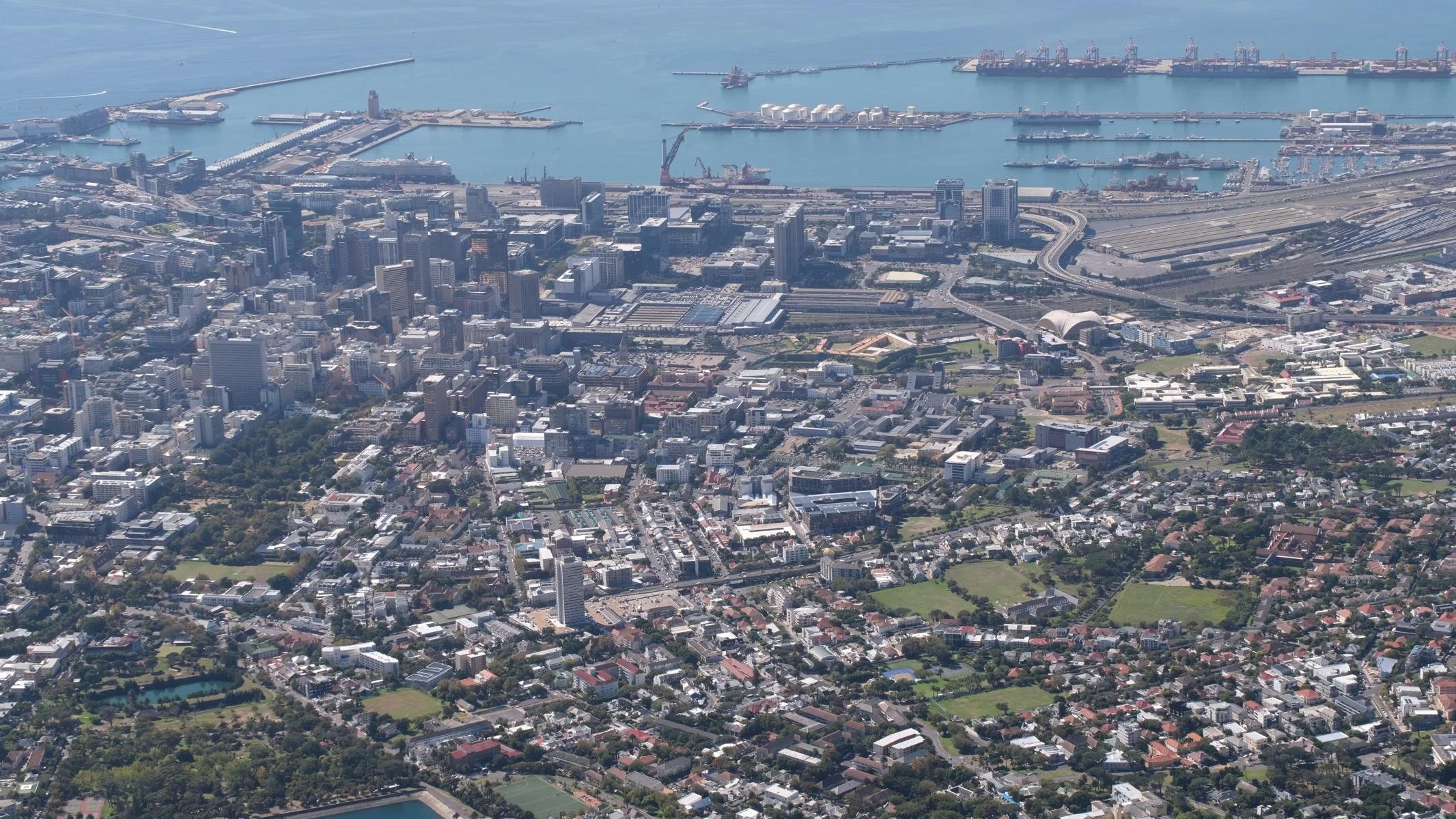
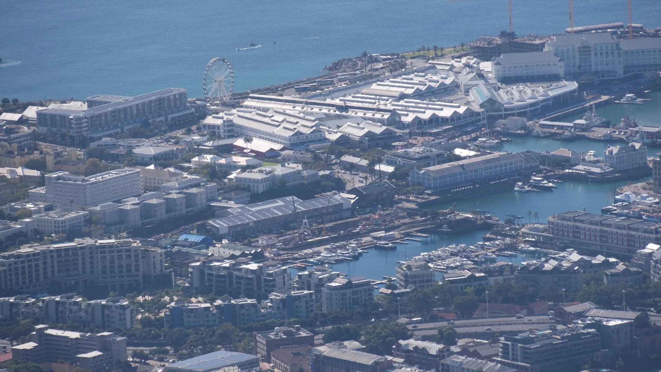
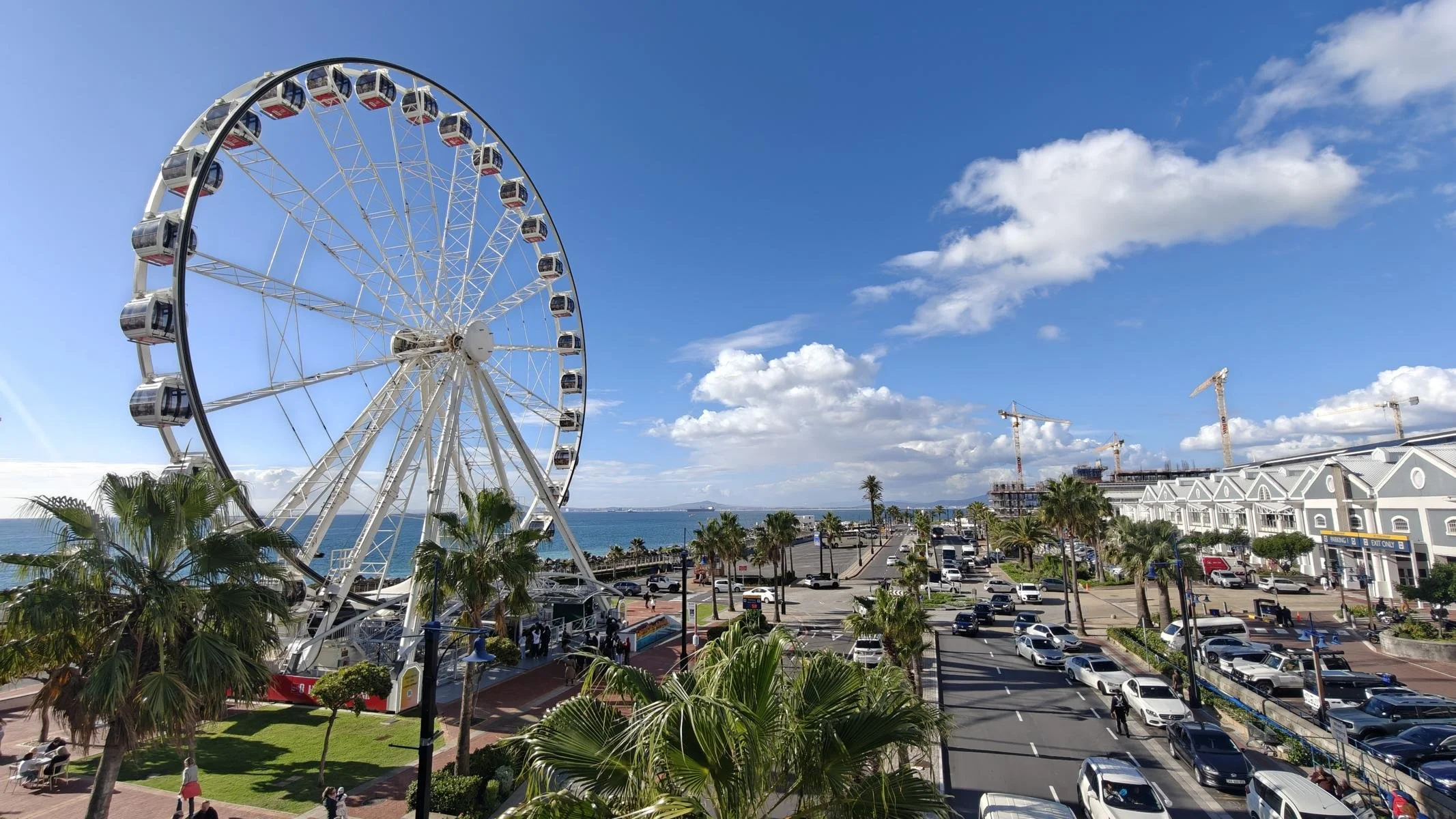
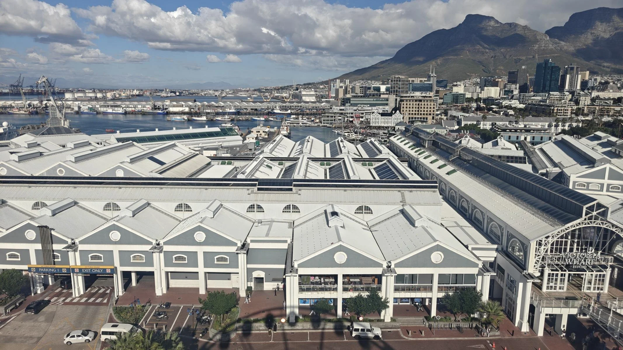
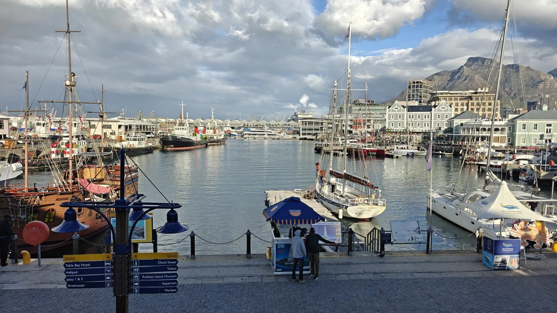
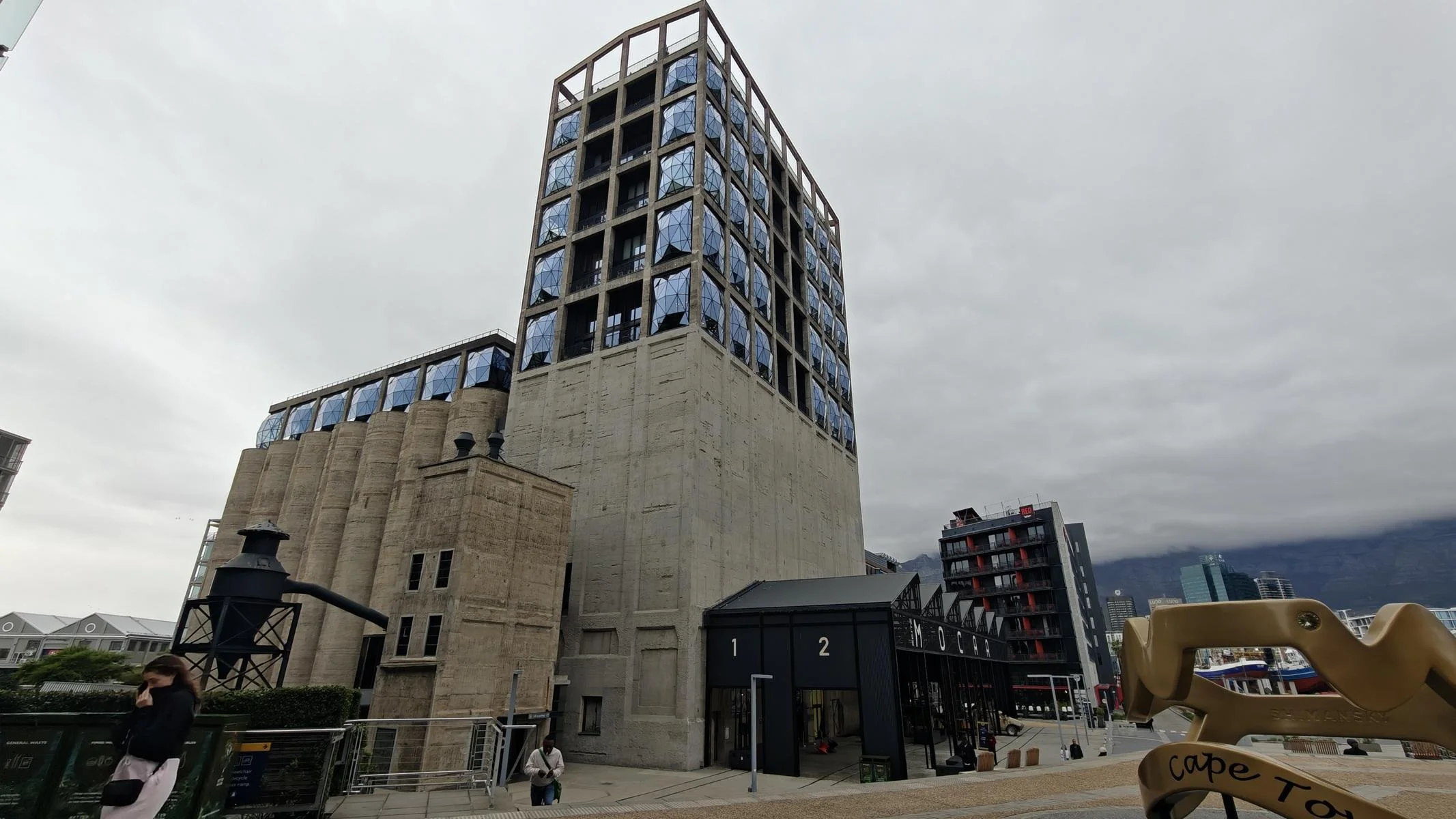
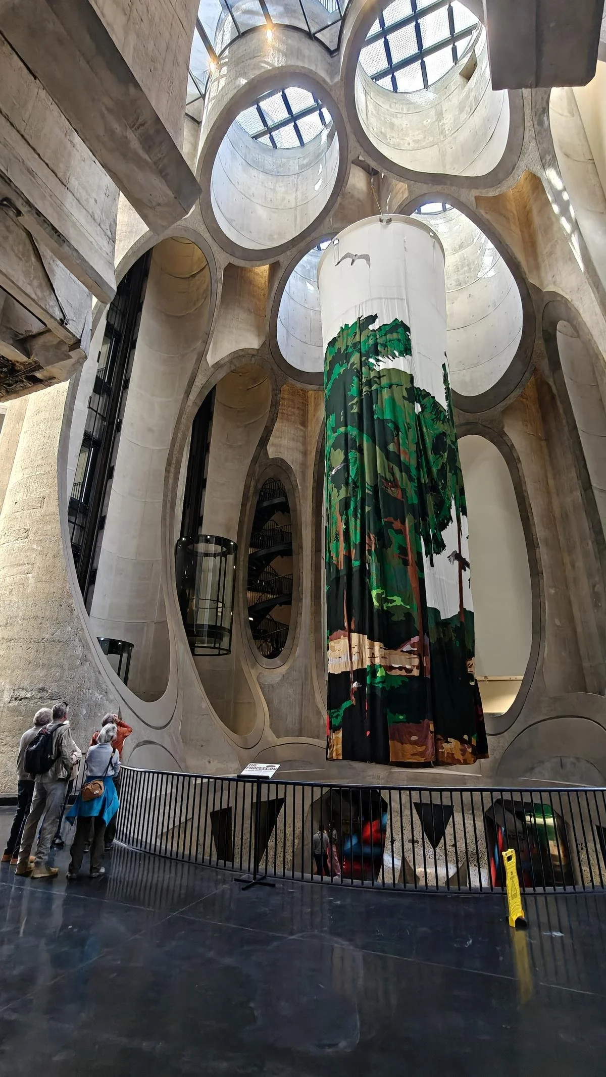
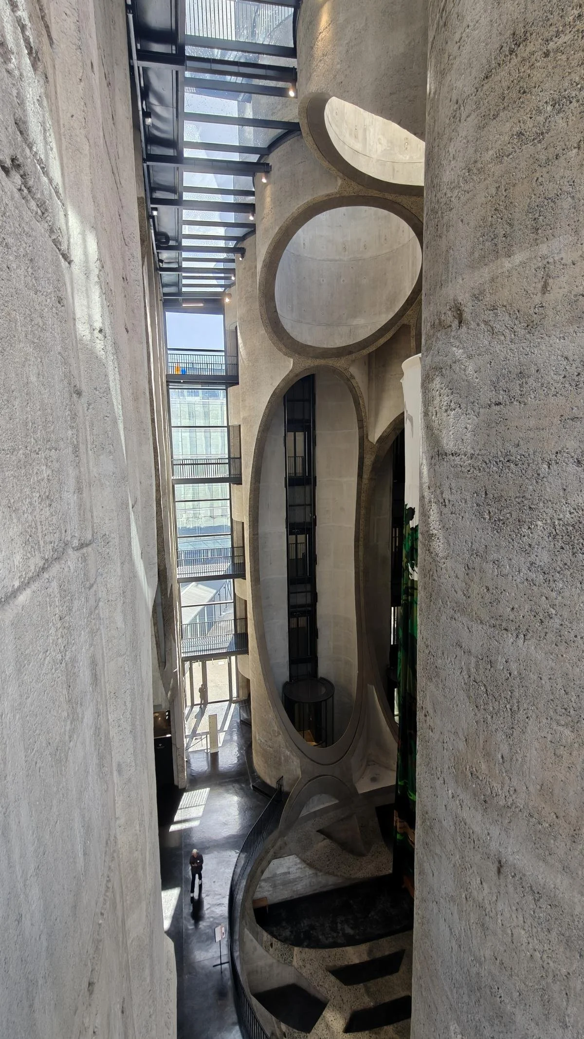
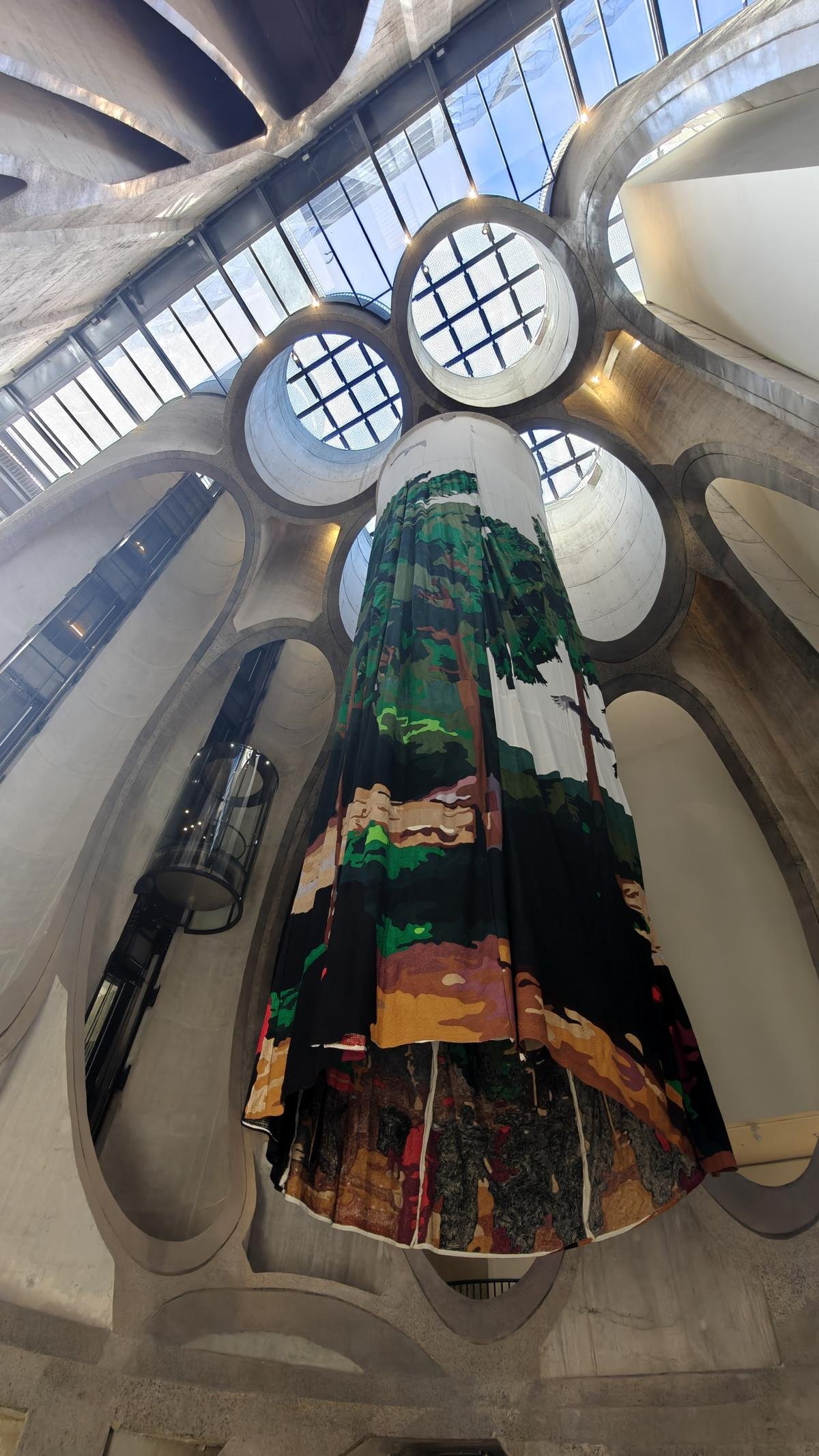
A major tourist attraction is the Waterfront, the neighborhood surrounding the harbor. The Zeitz Museum of Contemporary Art (MOCAA) is particularly worth a visit. An old silo was cut open on the inside and converted into an art gallery.
Ein touristisches Highlight ist die Waterfront, das Viertel rund um den Hafen. Besonders empfehlenswert das Zeitz Museum of Contemporary Art (MOCAA). Ein alter Silo wurde innen aufgeschnitten und in eine Kunstgalerie umgewandelt.
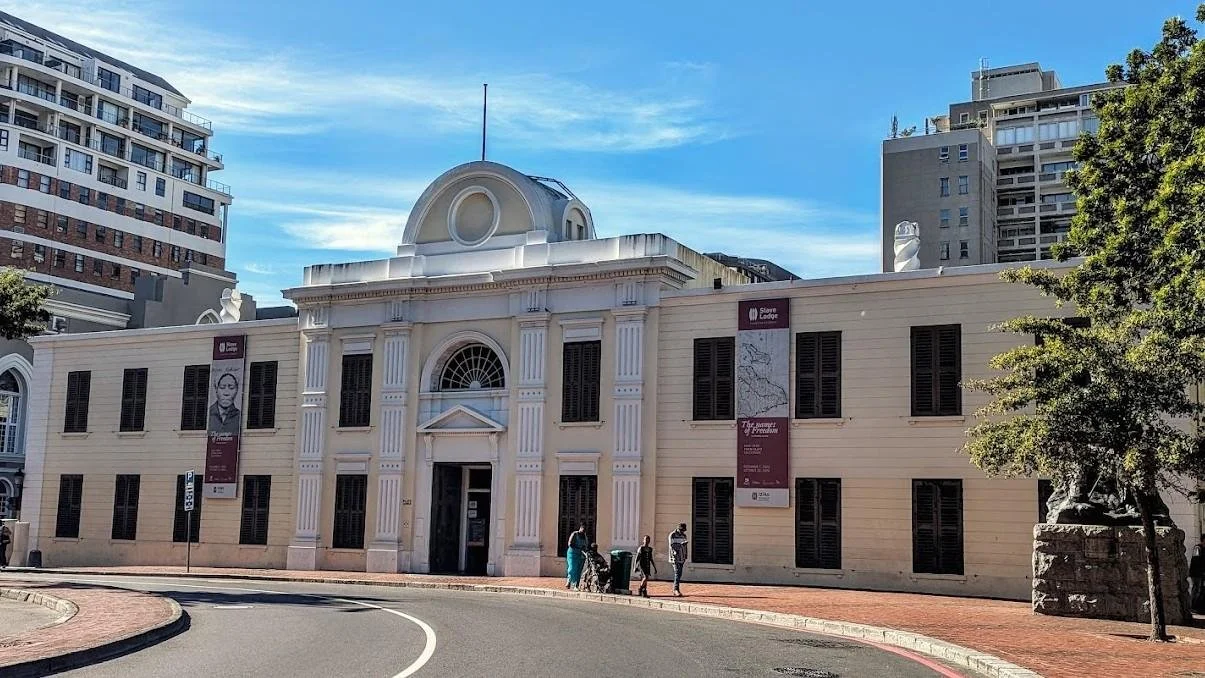
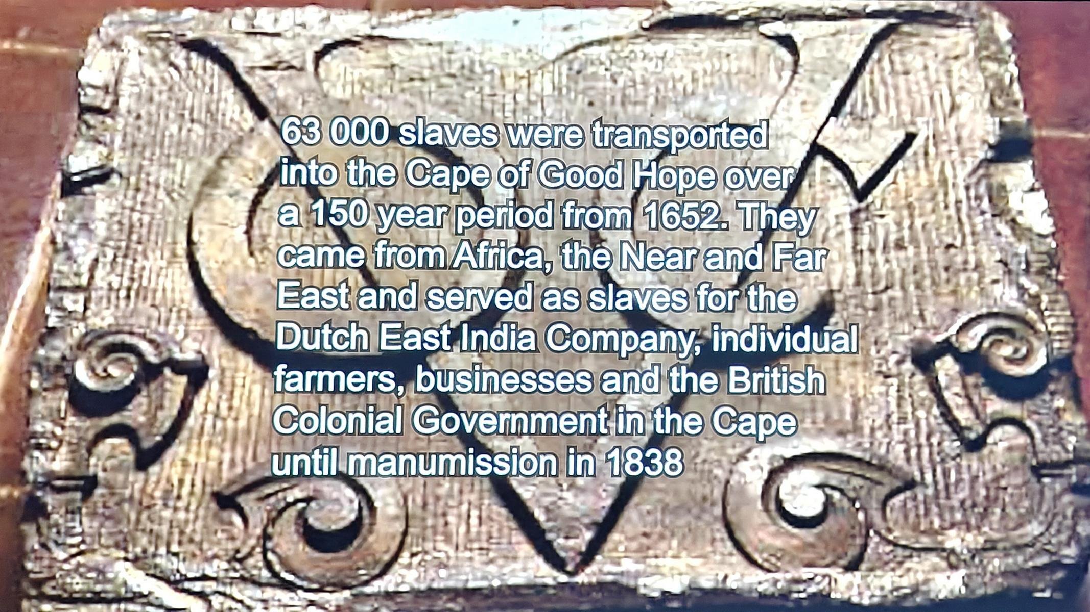
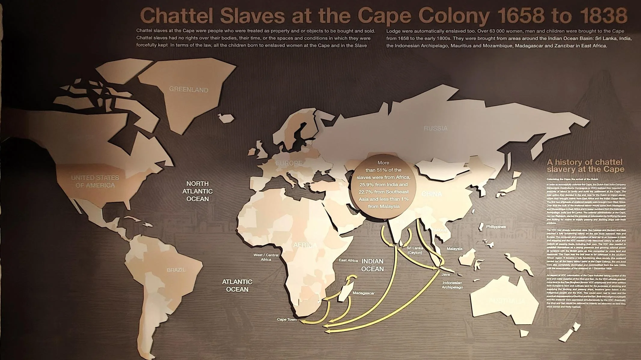
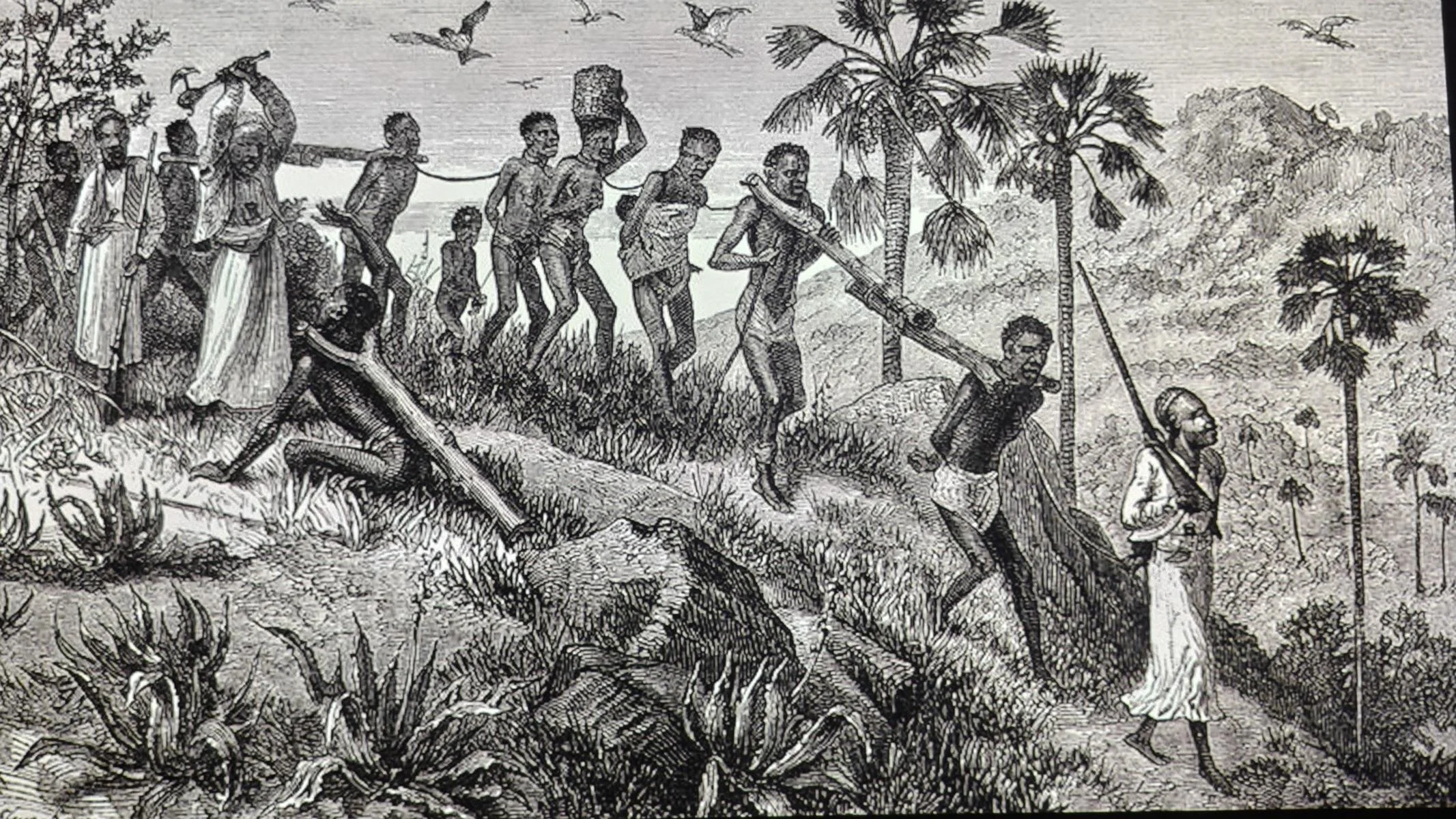
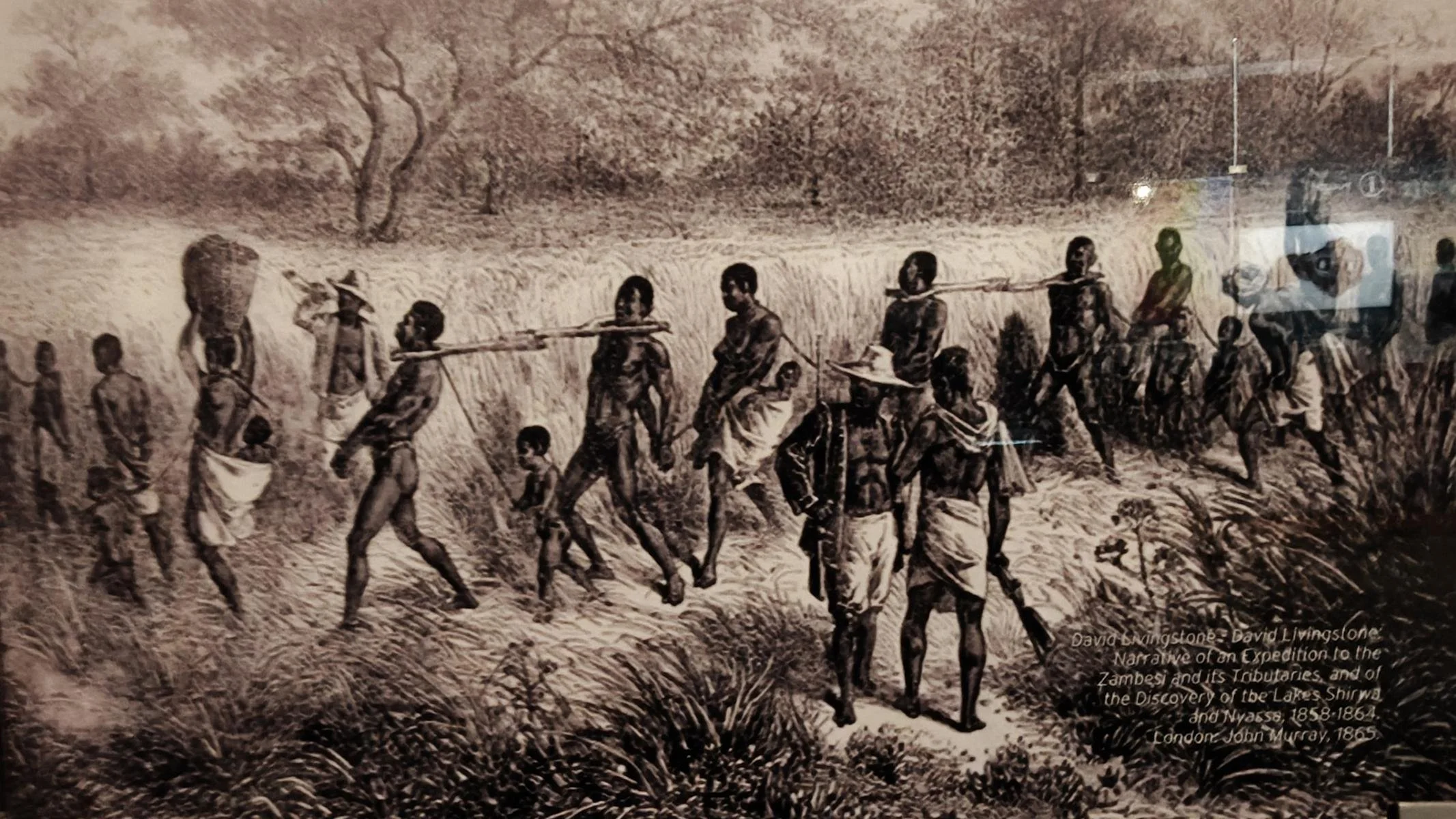
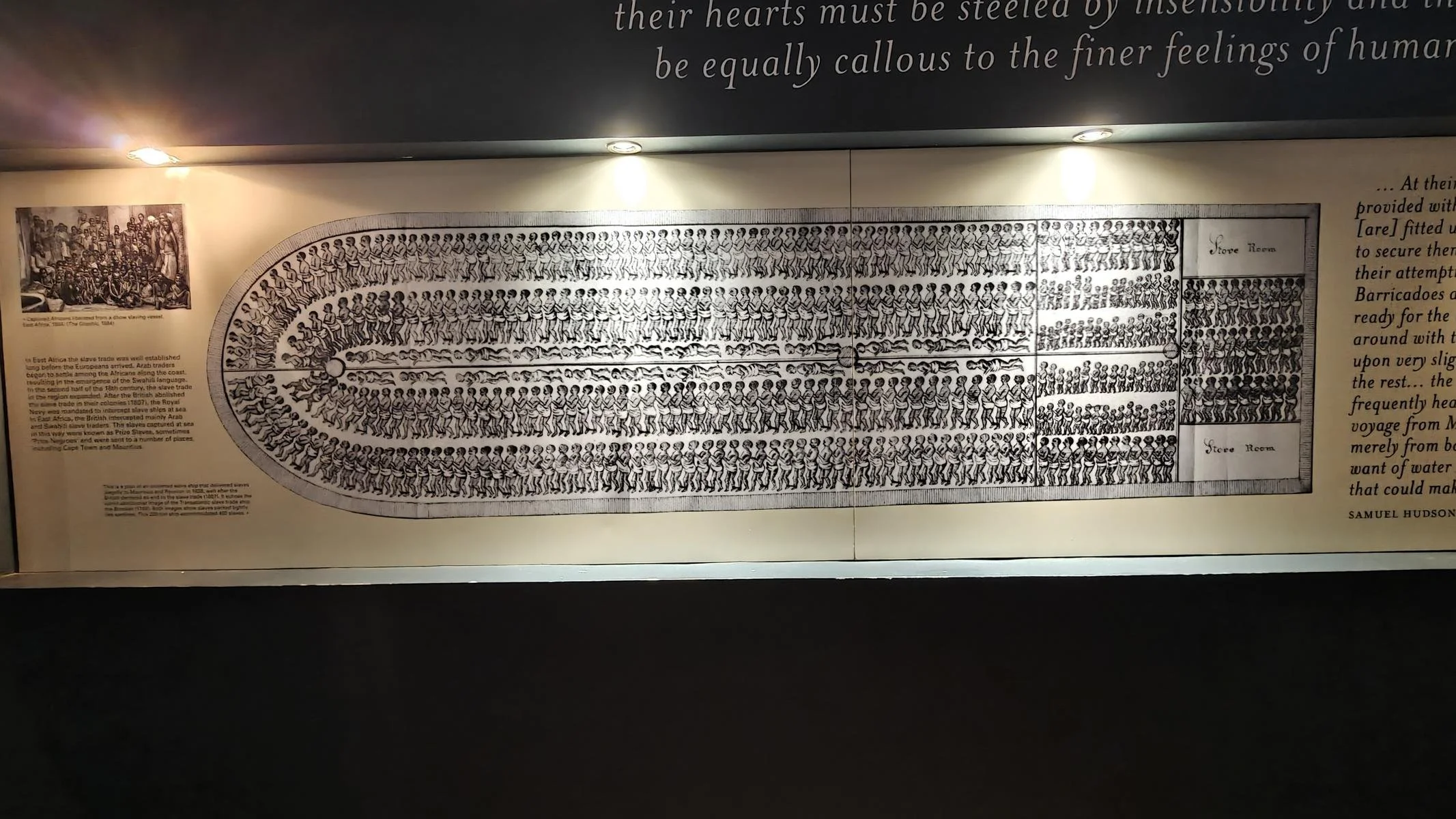
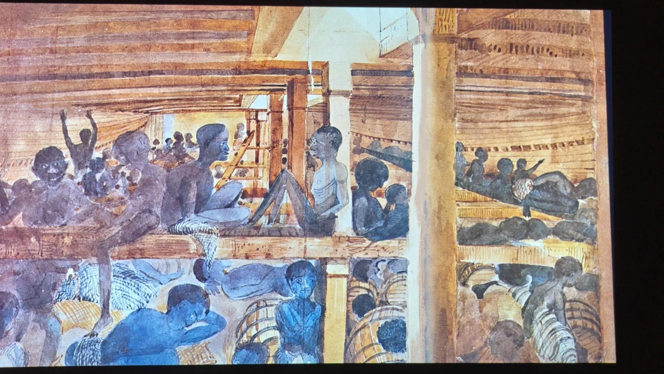
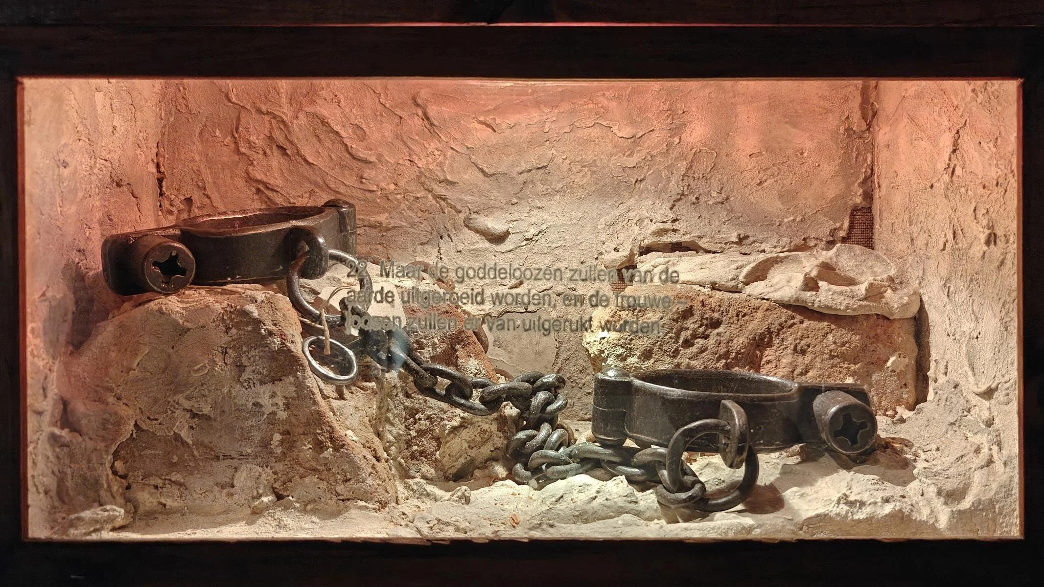
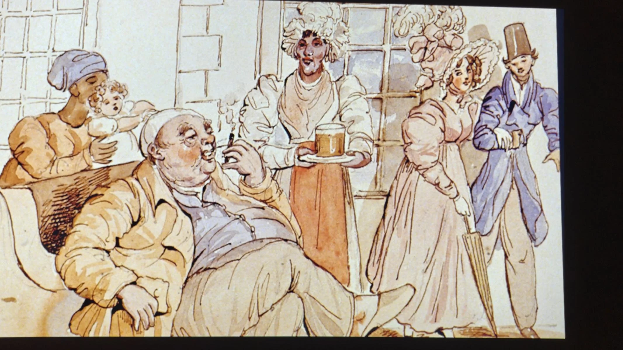
The Iziko Slave Lodge is a must-see; between 1652 and 1838, the Dutch East India Company traded more than 60,000 slaves there. Between 1711 and 1795, there were more slaves than free people living in Cape Town. About half of the slaves came from Dutch colonies in Southeast Asia. Slavery was not abolished in the Cape Colony until 1838.
Unbedingt sehenswert ist die Iziko Slave Lodge, in der die Holländische Ost-Indien Company zwischen 1652 bis 1838 mehr als 60.000 Sklaven handelte. Zwischen 1711 und 1795 lebten in Kapstadt mehr Sklaven als freie Menschen. Rund die Hälfte der Sklaven kam aus holländischen Kolonien in Südostasien. In der Kap Kolonie wurde die Sklaverei erst 1838 abgeschafft.
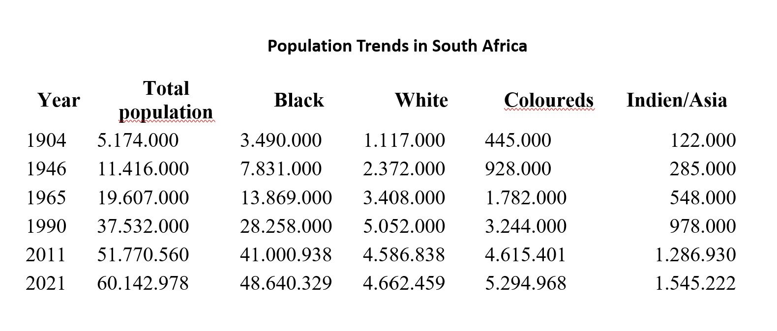
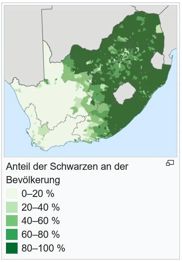
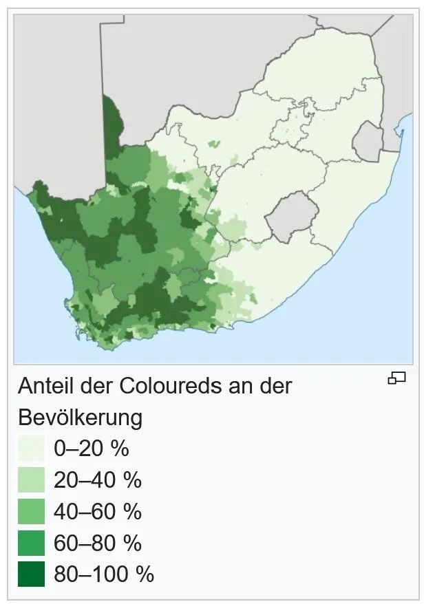
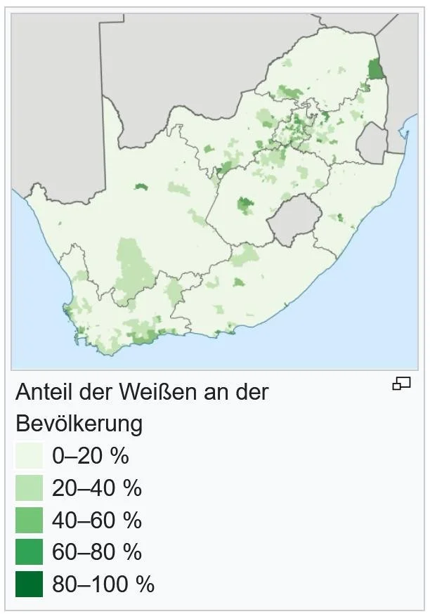
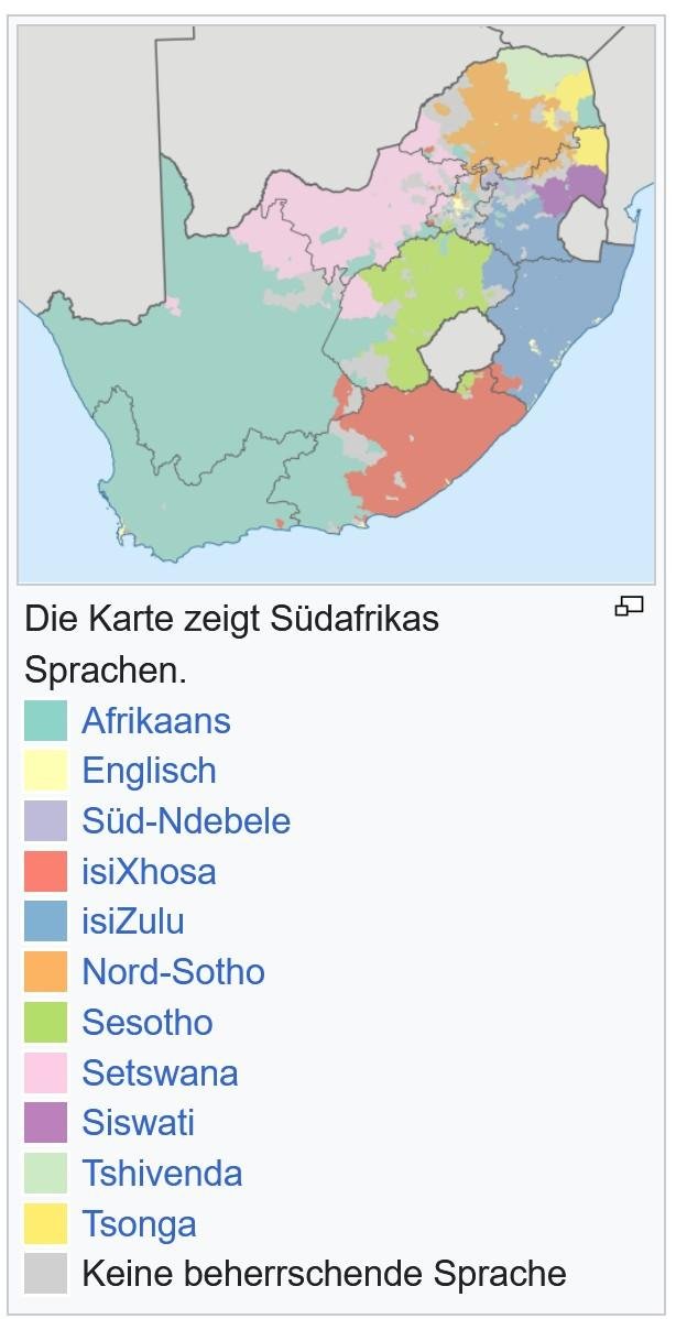
South Africa, a country of 60 million people, is one of the most multi-ethnic regions in Africa. In addition to the indigenous African populations—the Khoi, San, Bantu (Zulu, Xhosa), Sotho-Tswana, Venda-Karanga, and Tsonga—were joined, starting in the 16th century, by immigrants from Europe (Dutch, British, French, German) and slaves from Southeast Asia and Madagascar, as well as Indians and Chinese. As the statistics below show, the African (black) population has always constituted the vast majority.
Südafrika, ein Land mit 60 Millionen Einwohner*innen, ist eine der am meisten multi-ethnischen Regionen Afrikas. Zu der autochthonen afrikanischen Bevölkerung - Khoi, San, Bantu (Zulu, Xhosa), Sotho-Tswana, Venda-Karanga und Tsonga – kamen ab dem 16. Jh. Einwanderer aus Europa (Holländer, Briten, Franzosen, Deutsche) und Sklaven aus Südostasien und Madagaskar, sowie Inder und Chinesen. Wie nachstehende Statistik zeigt bildete die afrikanische (schwarze) Bevölkerung immer die große Mehrheit.
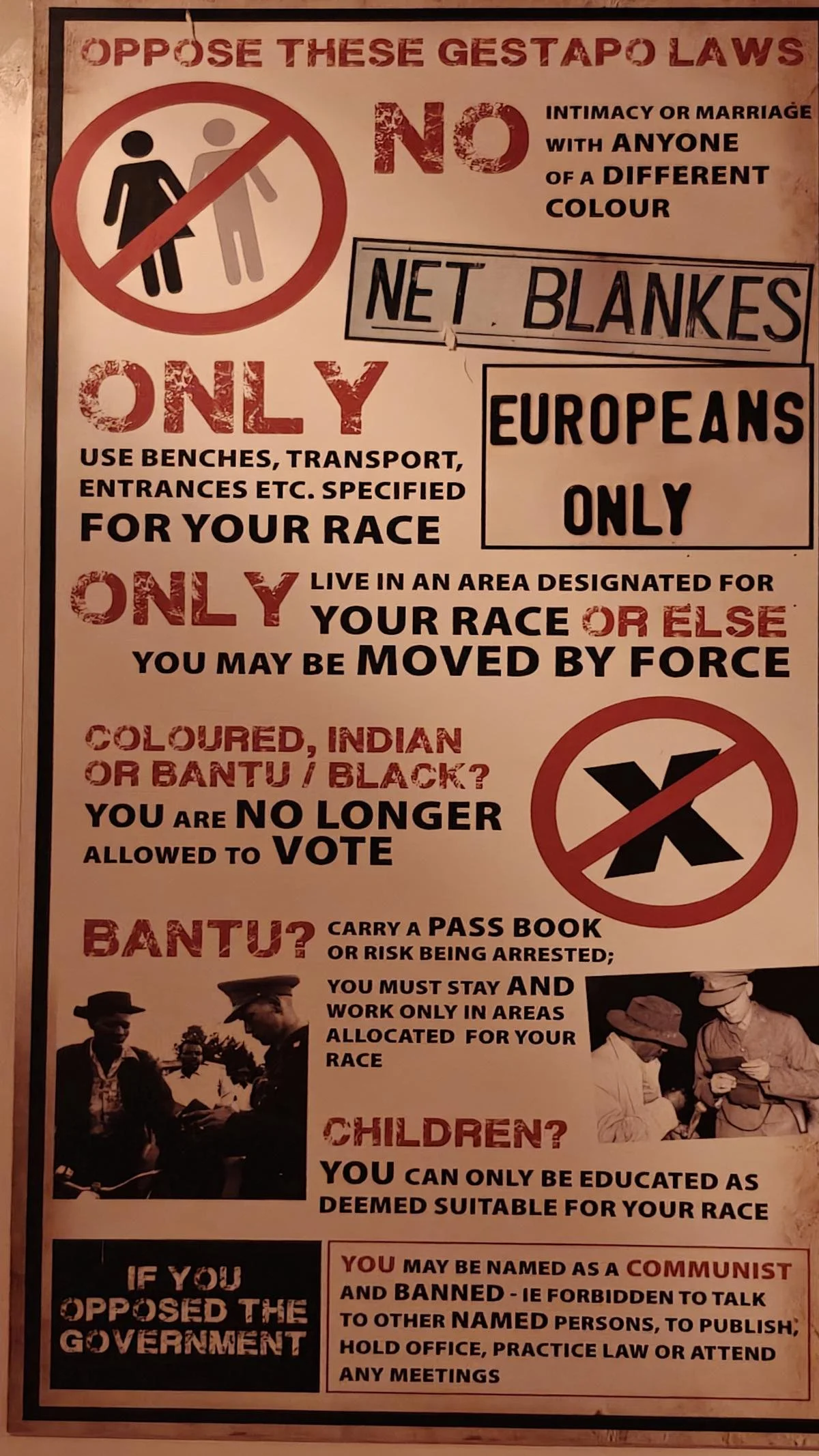
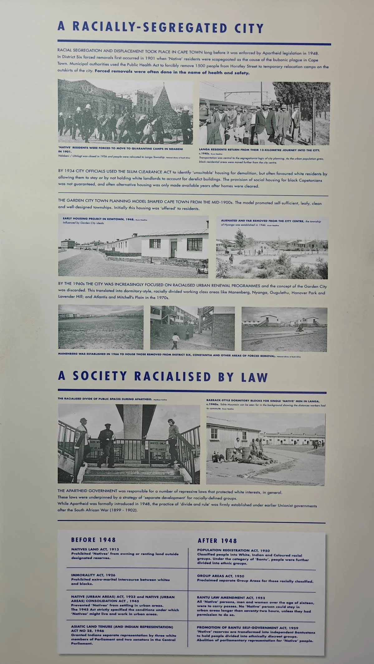
In South Africa, the 20th century was politically marked by the racist policy of apartheid. This was intended to secure the political and economic dominance of the white minority (in 1904, 22% of the population was white). Through more than 1,000 laws, ethnic groups were systematically segregated, and the black and colored populations were largely deprived of their rights. Key milestones included:
Political disenfranchisement: Throughout the 20th century, Black and Coloured people were gradually stripped of their political rights, including the right to vote.
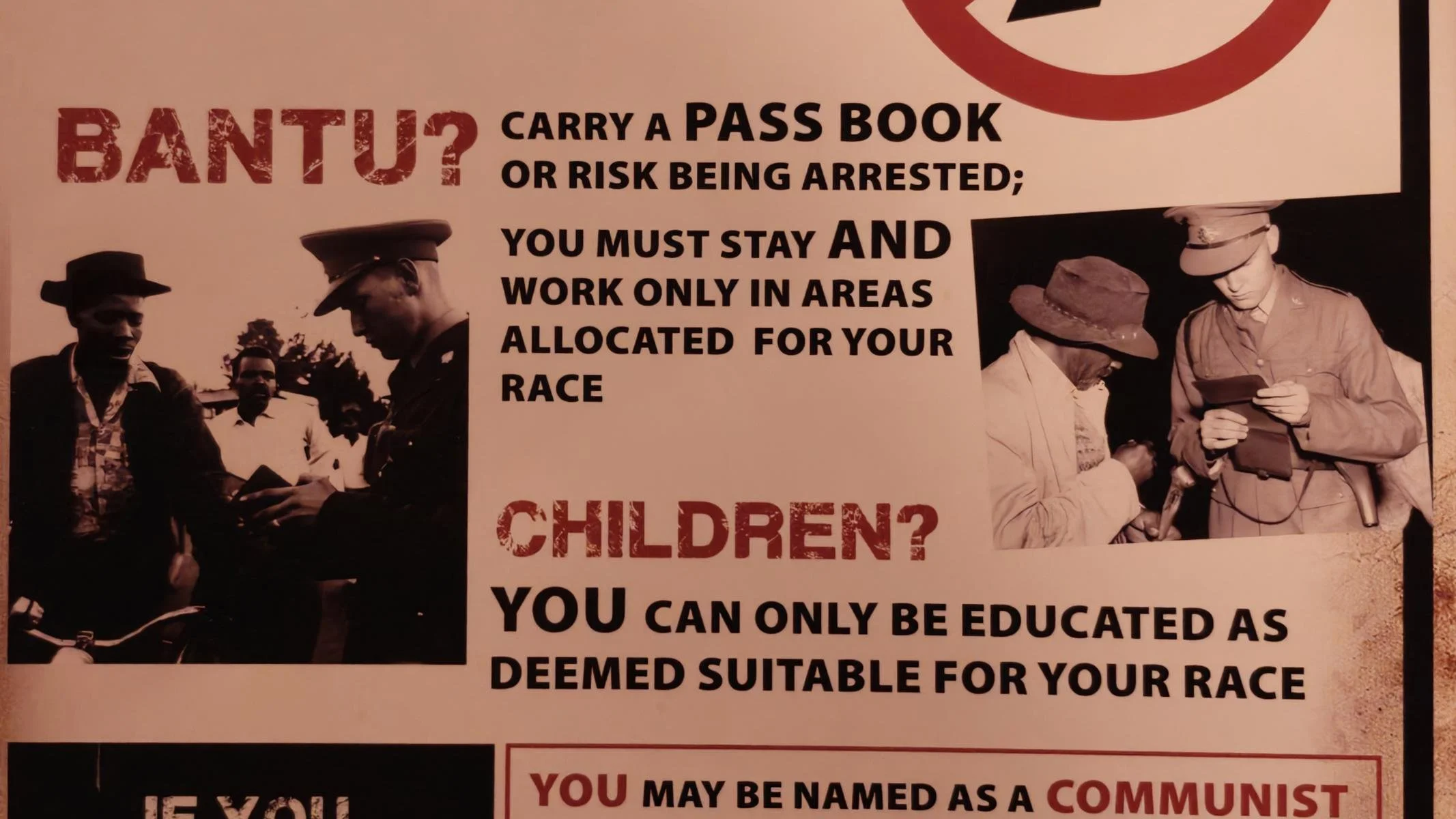
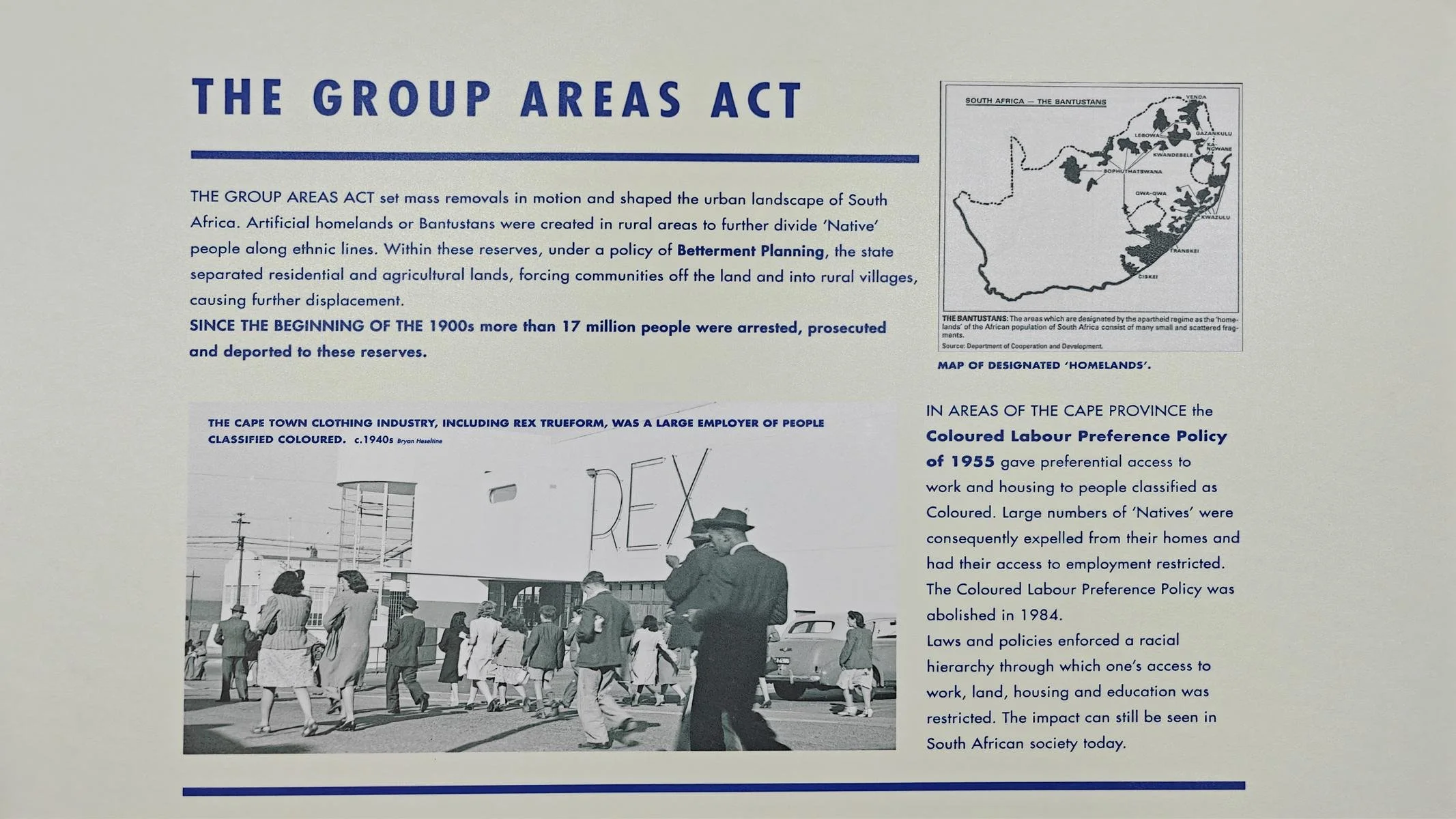
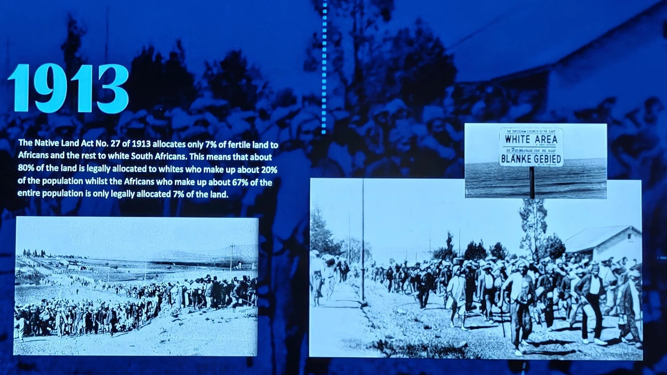
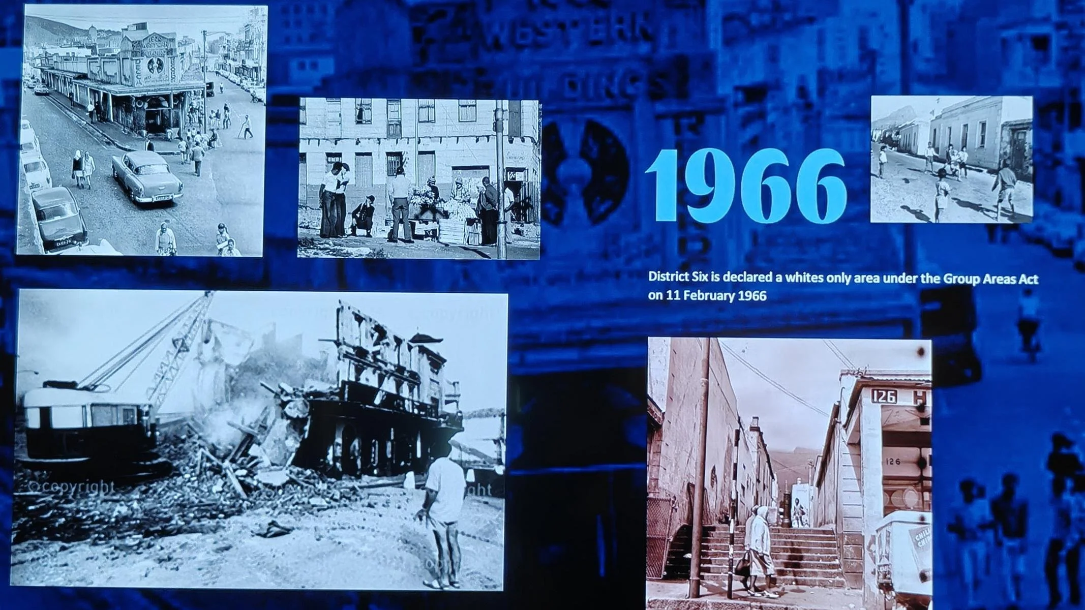
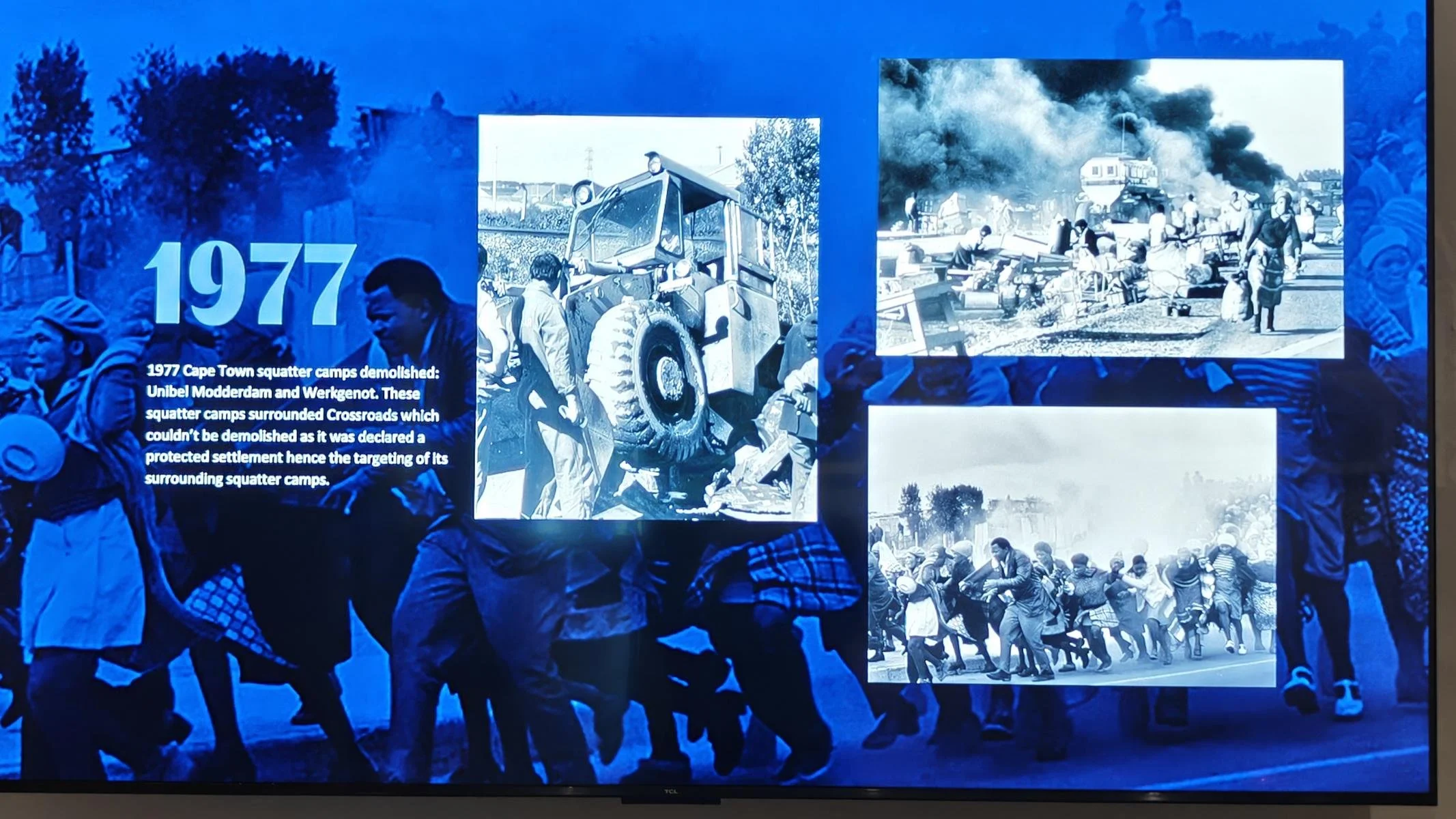
Spatial segregation: The Native Land Act, passed in 1913, restricted the black population (which made up 70% of the population) to acquiring land only within the reserves (7% of the country’s total land area). The Native Urban Act of 1927 prohibited the black population from living in cities. Forced resettlements without compensation to townships or reserves (so-called homelands with only rudimentary infrastructure) resulted in a complete spatial separation of the population groups. Later, even access to cities was restricted for Black people (max. 72 hours; proof of employment required).
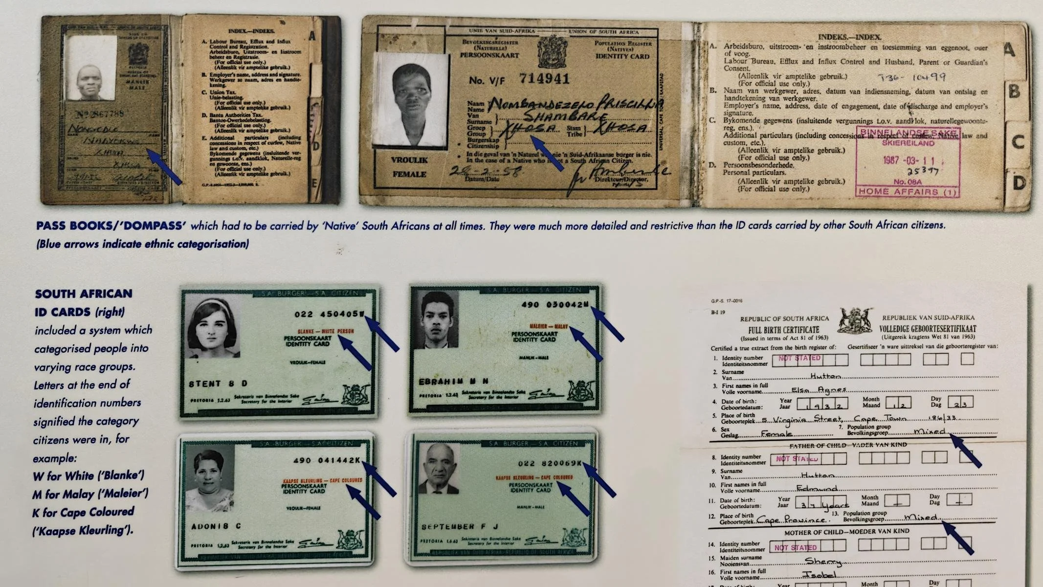
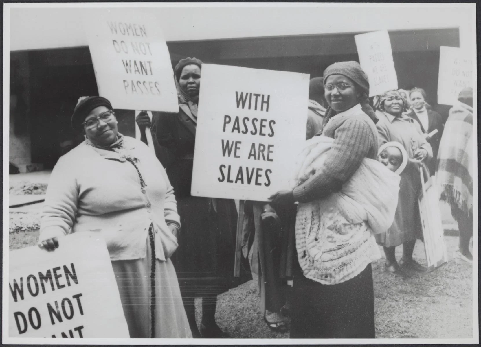
Pass Laws: To enforce racial segregation, Black people were required to carry a pass at all times, which specified how long they were permitted to remain in an area reserved for whites. As a result, more than 17 million people were arrested over the years for violating this law.
Prohibition of “interracial mixing”: The Immorality Act of 1927 and subsequent laws prohibited sexual intercourse between people of different skin colors.
The Population Registration Act of 1950 mandated that the entire population be categorized into three groups (White, Black, Colored) and that this classification be recorded on identity cards.
Exclusion from education: The Bantu Education Act of 1953 severely restricted the Black population’s access to education. Future Prime Minister Hendrik Verwoerd explained the motives: “There is no place for [the Bantu] in the European population group above the level of certain forms of labor ... What is the use of a mathematics education for a Bantu child if it cannot be put to practical use?” In the years that followed, educational spending per white child was four times higher than per black child.
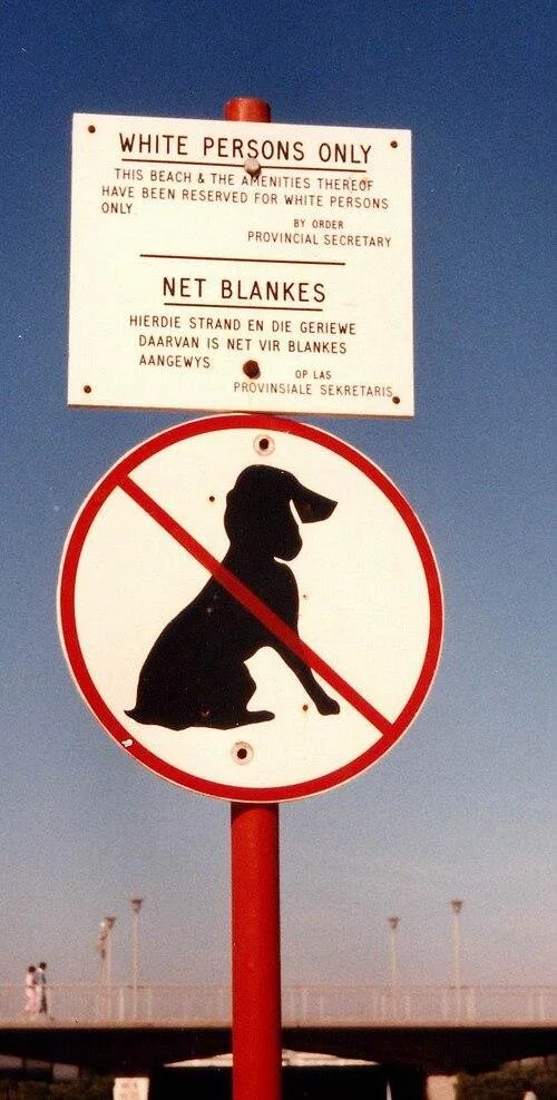
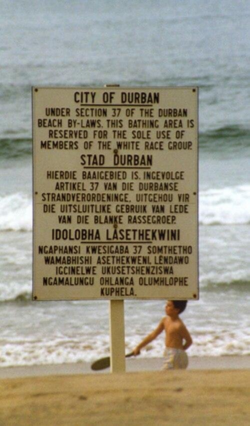
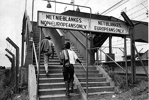
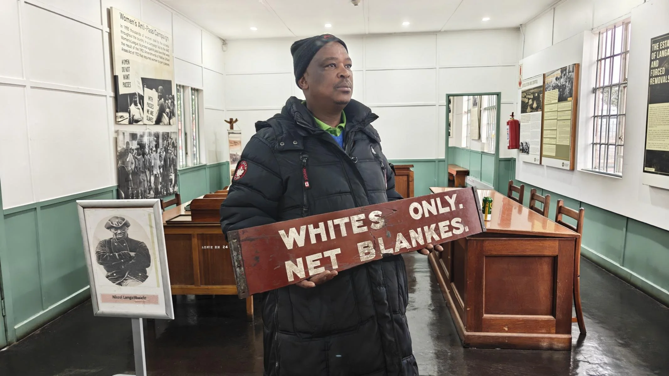
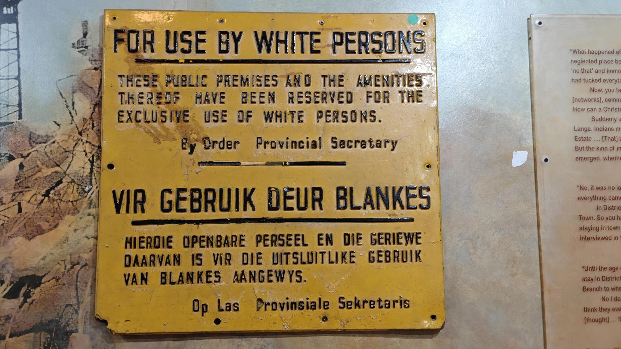
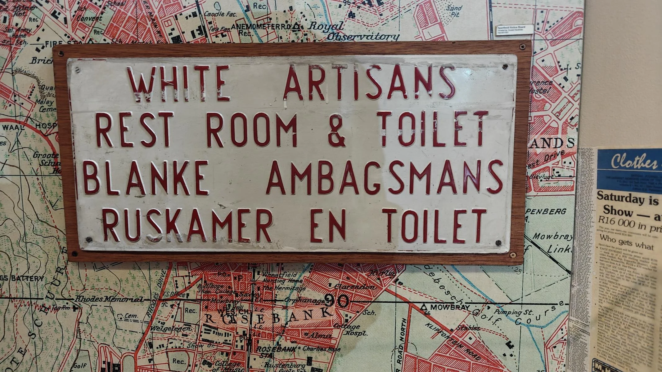
Racial segregation in public spaces: Public spaces were divided along racial lines, and access to stairways, beaches, parks, schools, stores, hospitals, and other facilities was restricted based on skin color.
The goal of apartheid legislation was to maintain a privileged white upper class and create an army of disenfranchised Black migrant workers who would work for white employers at rock-bottom wages. When they were no longer needed, they could be deported to their homelands or reserves at any time.
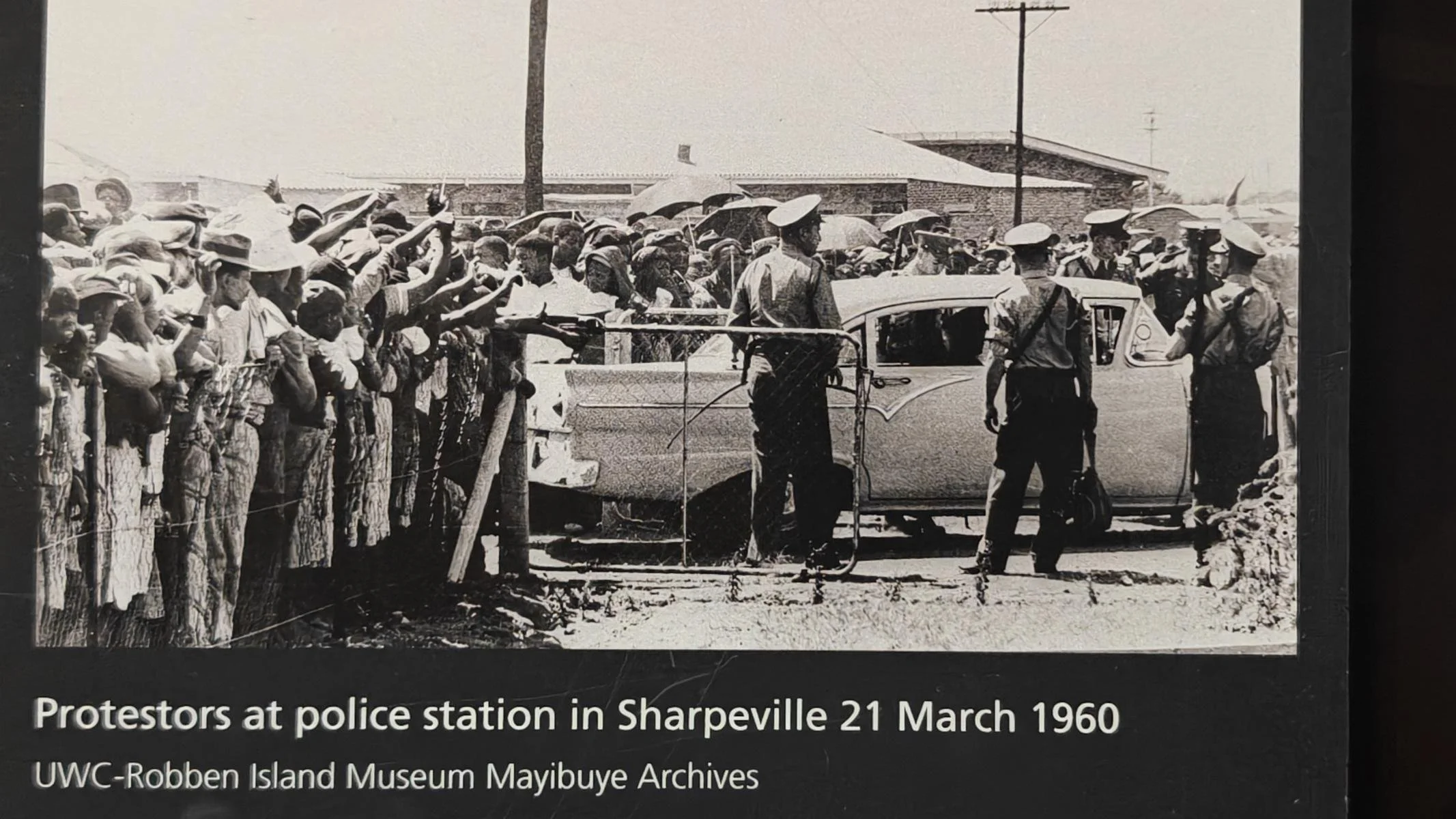
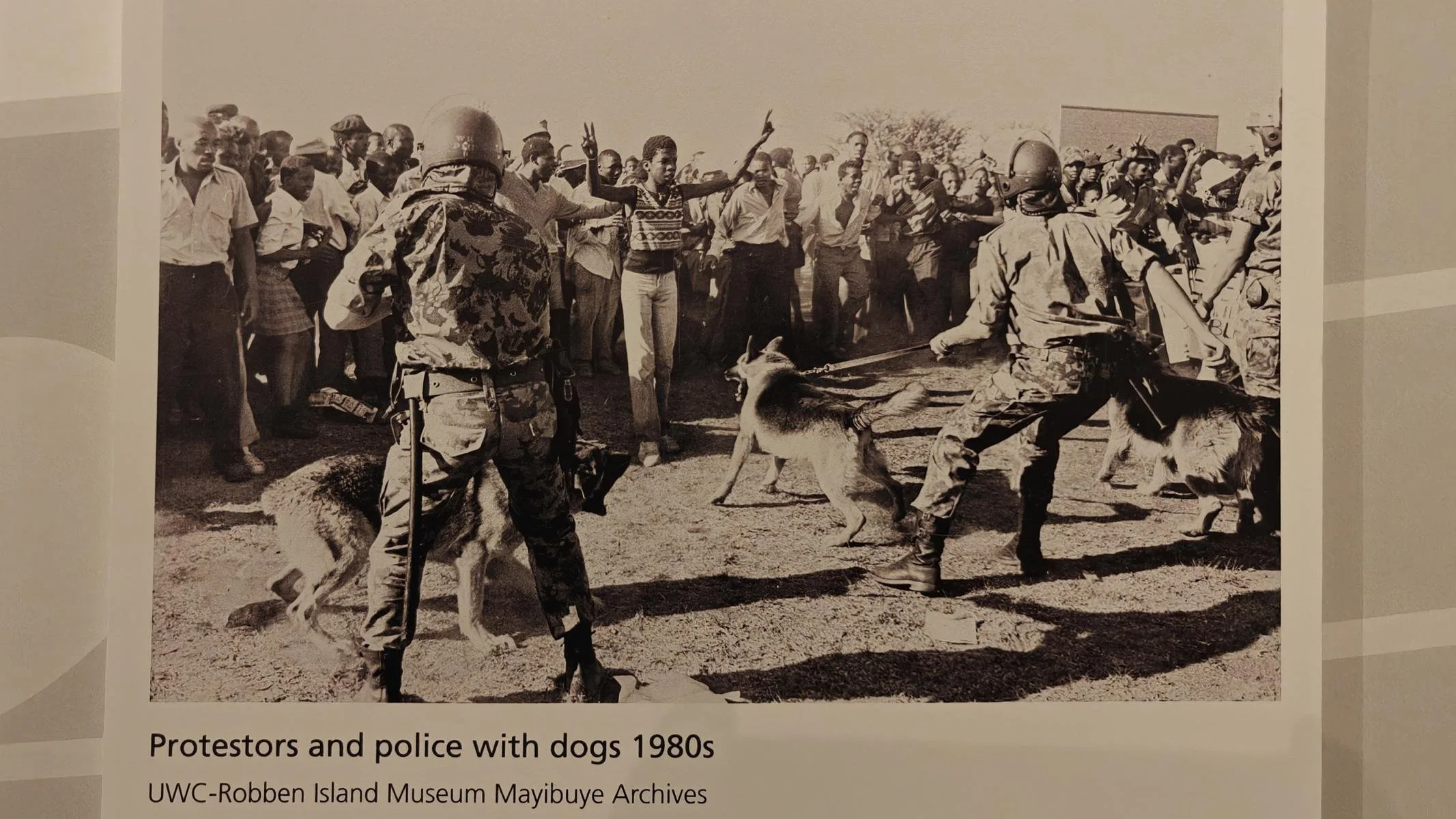
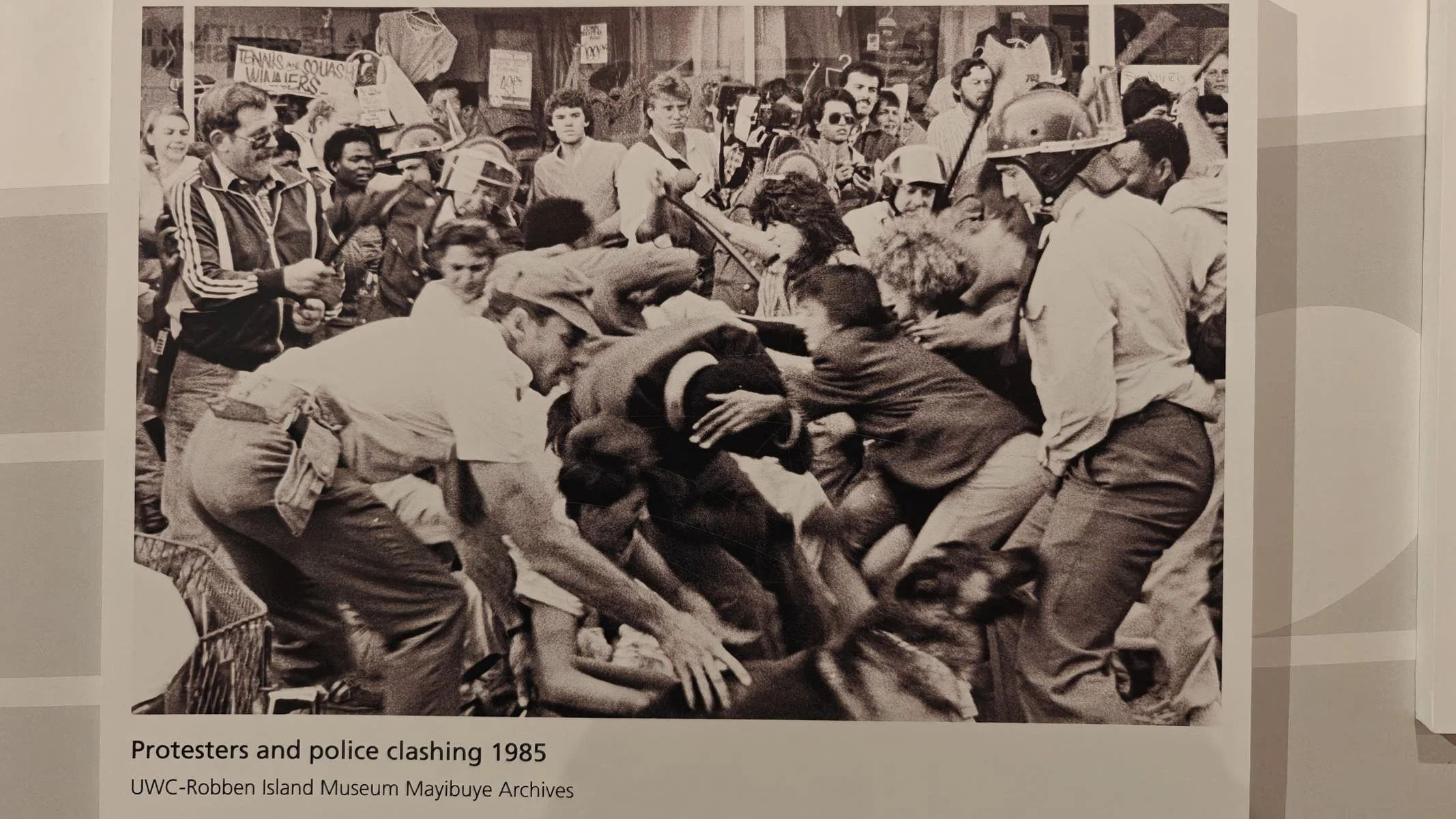
The apartheid system was enforced by an omnipresent state apparatus of repression (police, military, judiciary), which cracked down with great brutality on any form of opposition until 1990. On international level, the apartheid regime attempted to justify the oppression of the black population as a fight against communism.
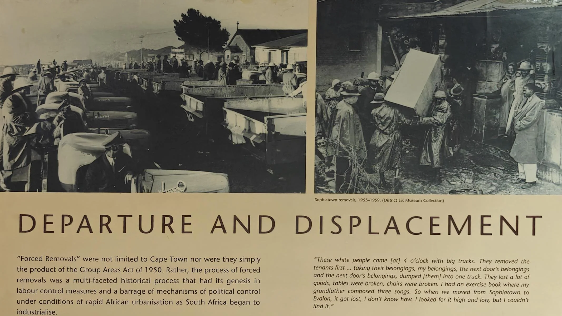
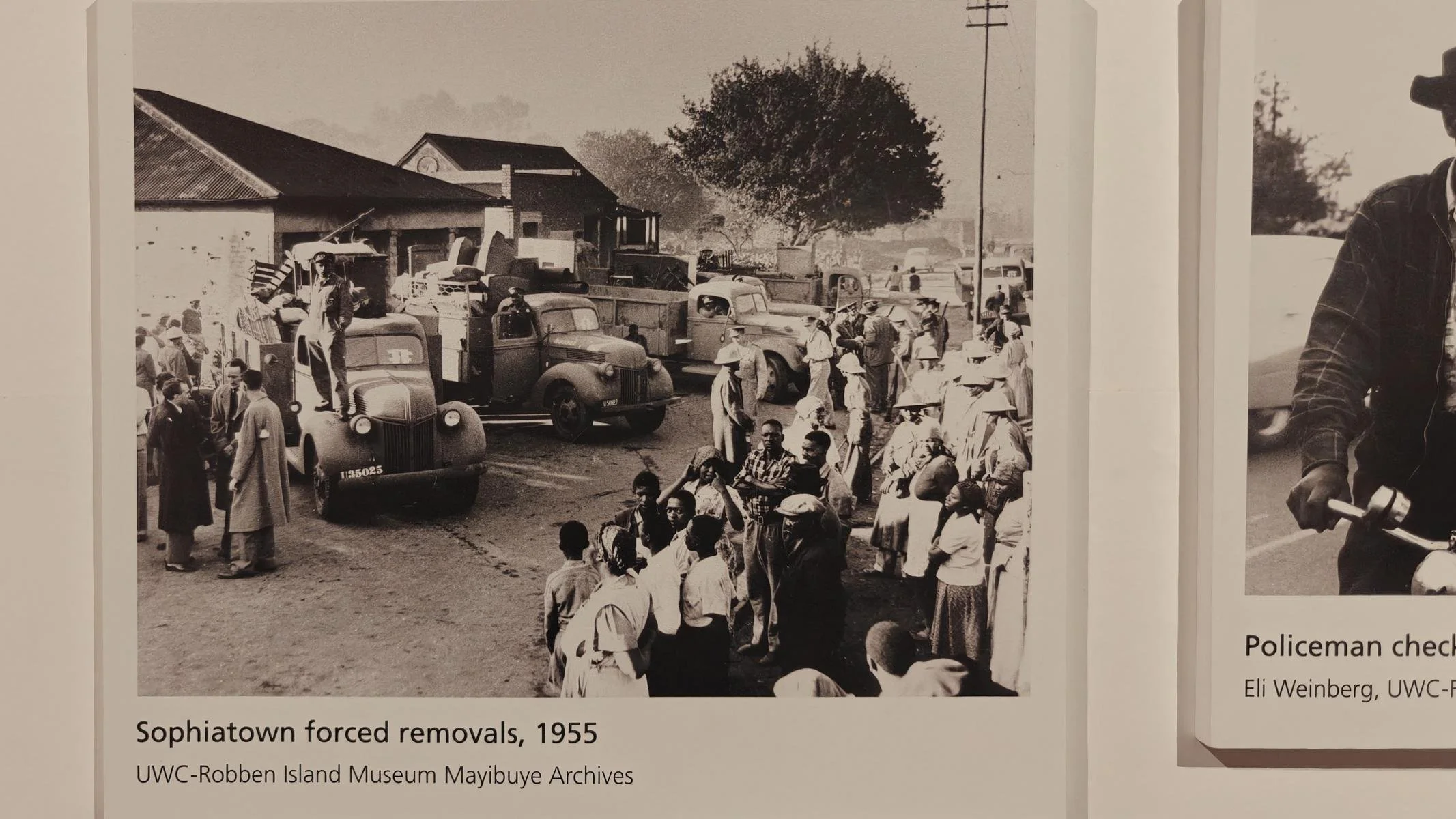
Most of the photos below are from exhibitions on the topic of apartheid at the Iziko Slave Lodge and the District Six Museum (both in Cape Town).
Das 20. Jh. war in Südafrika politisch geprägt durch das rassistische Politik der Apartheit. Dadurch sollte die politische und wirtschaftliche Vorherrschaft der weißen Minderheit (im Jahre 1904 waren 22% der Bevölkerung Weiße) gesicherte werden. Durch über 1000 Gesetze wurden ethnische Gruppen systematisch getrennt und die schwarze und die farbige Bevölkerung weitgehend entrechtet. Wichtige Stationen waren:
· Politische Entrechtung: Sukzessive wurden Schwarze (Black) und Farbige (Coloured) im 20. Jh. von politischen Rechten einschließlich dem Wahlrecht ausgeschossen.
· Räumliche Segregation: Der 1913 beschlossene Native Land Act erlaubte der schwarzen Bevölkerung (die 70% ausmachte) Boden nur mehr in den Reservaten (7 % des Landes) zu erwerben. Durch den Native Urban Act 1927 wurde es der schwarzen Bevölkerung verboten, in den Städten zu wohnen. Entschädigungslose Zwangsumsiedlungen in Vororte (Townships) oder Reservate (sog. Homelands mit nur rudimentärer Infrastruktur) bewirkten eine völlig räumliche Trennung der Bevölkerungsgruppen. Später wurde sogar der Zutritt zu Städten für Schwarze eingeschränkt (max. 72 Stunden; Nachweis einer Arbeitsstelle).
· Passgesetze: Zur Durchsetzung der räumlichen Segregation mussten schwarze Personen ständig eine Pass bei sich tragen, in dem festgelegt war, wie lange sie sich in einem den Weißen vorbehalten Gebiet aufhalten durften. In der Folge wurden im Laufe der Jahre mehr als 17 Millionen Menschen wegen Übertretung dieses Gesetzes festgenommen.
· Verbot der „Rassen-Mischung“: Der Immorality Act 1927 und nachfolgende Gesetze verbot den Geschlechtsverkehr zwischen Menschen unterschiedlicher Hautfarbe.
· Der Population Registration Act 1950 schrieb vor, dass die gesamte Bevölkerung in drei Gruppen (Weiß, Schwarz, Farbig) kategorisierte werden soll und die Zugehörigkeit im Personalausweis eingetragen wird.
· Ausschluss von Bildung: Durch den Bantu Education Act 1953 wurde der Zugang der Schwarzen Bevölkerung zu Bildung massive beschränkt. Der spätere Premierminister Hendrik Verwoerd erklärte zu den Motiven: „Es gibt keinen Platz für [die Bantu] in der europäischen Bevölkerungsgruppe oberhalb des Niveaus bestimmter Formen der Arbeit ... Worin besteht der Nutzen einer Mathematikausbildung für ein Bantukind, wenn es diese in der Praxis nicht nutzen kann?“ Bildungsausgaben für weißes Kind waren in den Folgejahren vier Mal so hoch wie für ein schwarzes Kind.
· Rassen-Segregation im öffentlichen Raum: Der öffentliche Raum wurde nach rassistischen Kriterien aufgeteilt und der Zugang zu Stiegenaufgänge, Badestrände, Parks, Schulen, Geschäften, Spitälern... nach der Hautfarbe getrennt.
Ziel der Apartheit Gesetzgebung war die Aufrechterhaltung einer privilegierten weißen Oberschicht und die Schaffung eines Heers von rechtlosen schwarzen Wanderarbeitern, die zu Billigstlöhnen für weiße Unternehmer arbeiten sollten. Wenn sie nicht mehr benötigt wurden konnten sie jederzeit in ihre Homelands / Reservate abgeschoben werden.
Umgesetzt wurde das Apartheit-System durch einen omnipräsenten staatlichen Unterdrückungsapparat (Polizei, Militär, Justiz), der bis 1990 mit großer Brutalität gegen jede Form von Opposition vorging. Außenpolitisch wurde versucht, die Unterdrückung der schwarzen Bevölkerung als Kampf gegen den Kommunismus zu rechtfertigen.
Nachstehende Fotos stammen zu Großteil von Ausstellungen zum Thema Apartheit in der Iziko Slave Lodge sowie dem District Six Museum (beide in Kapstadt).
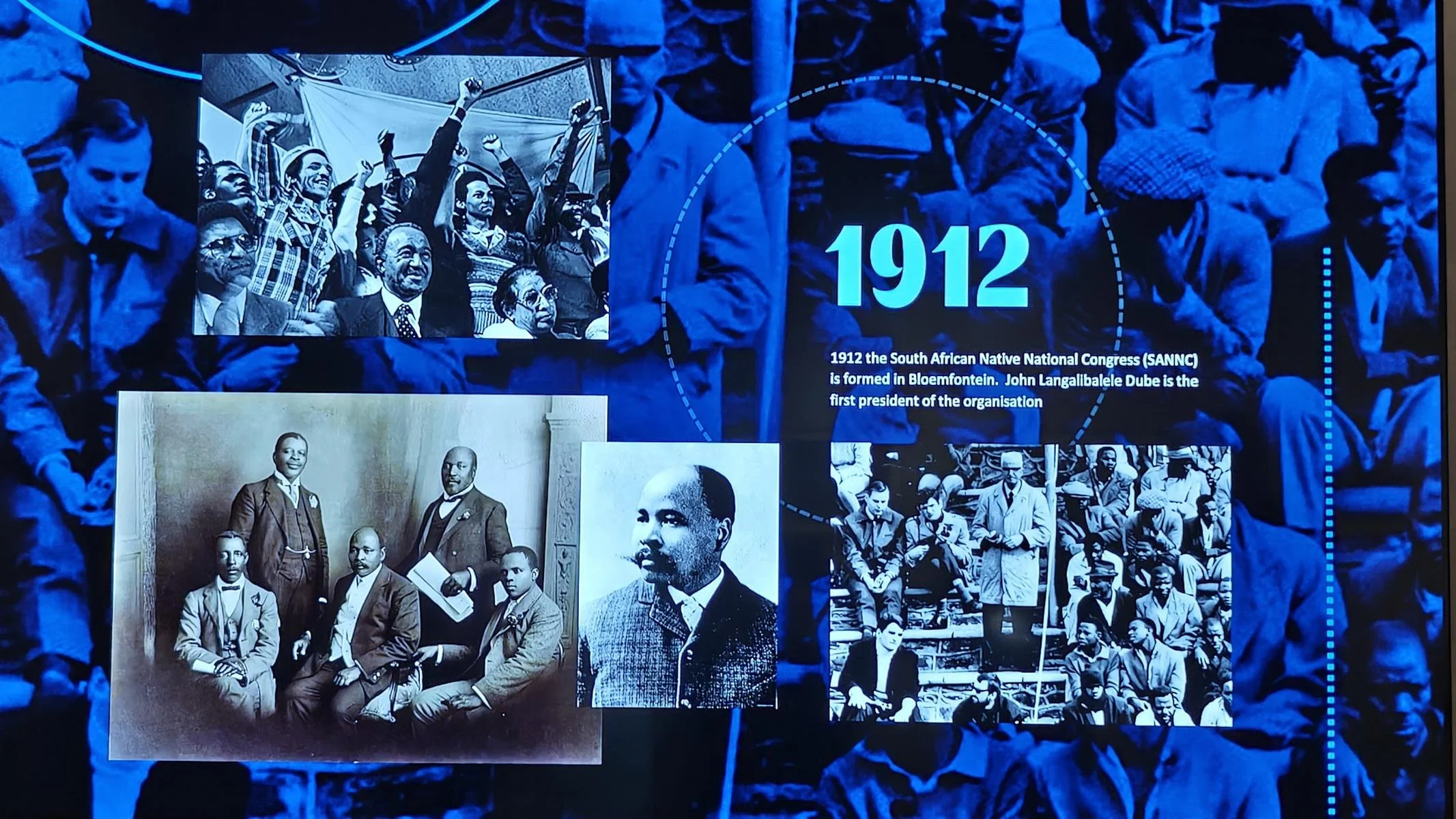
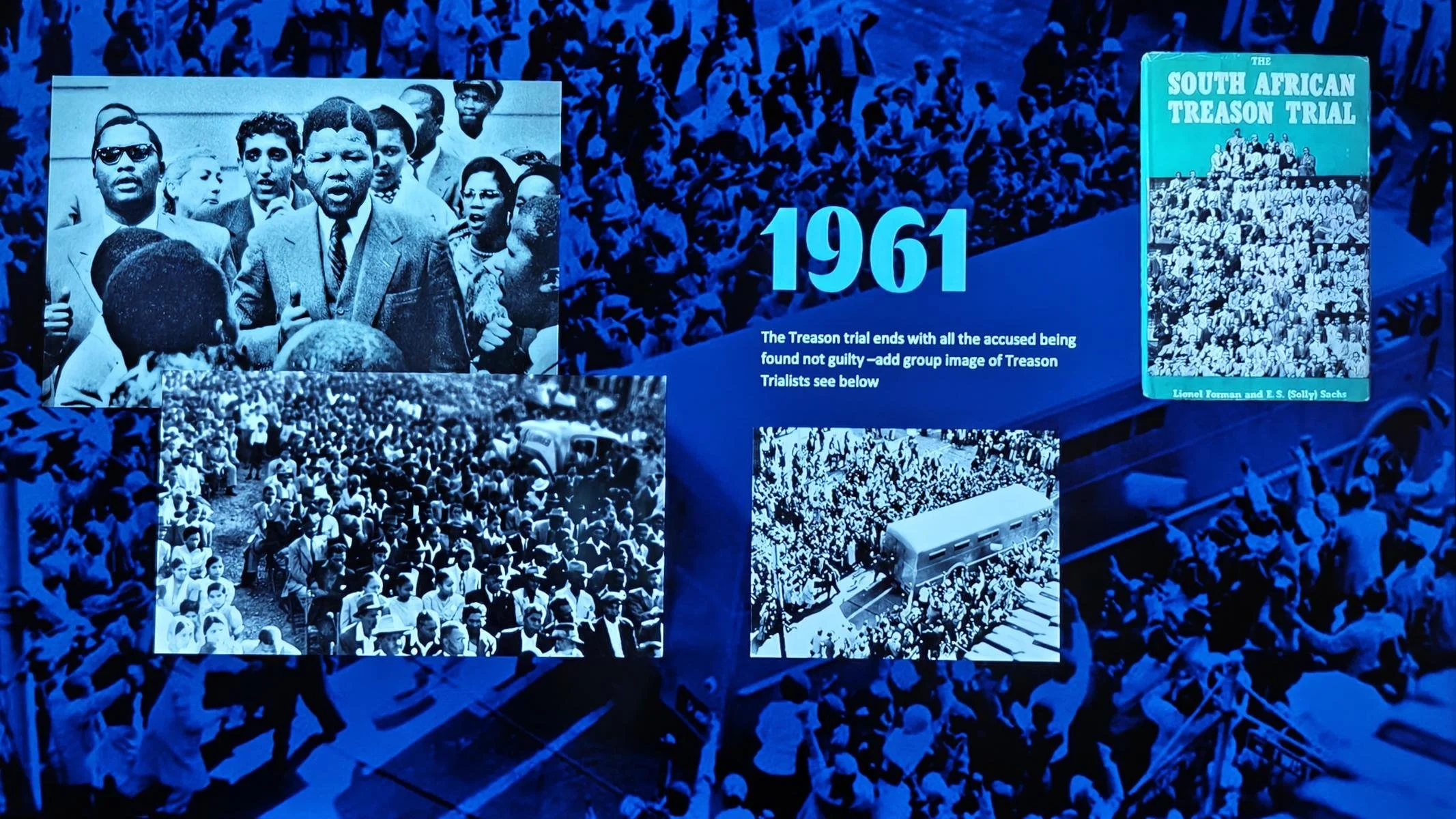
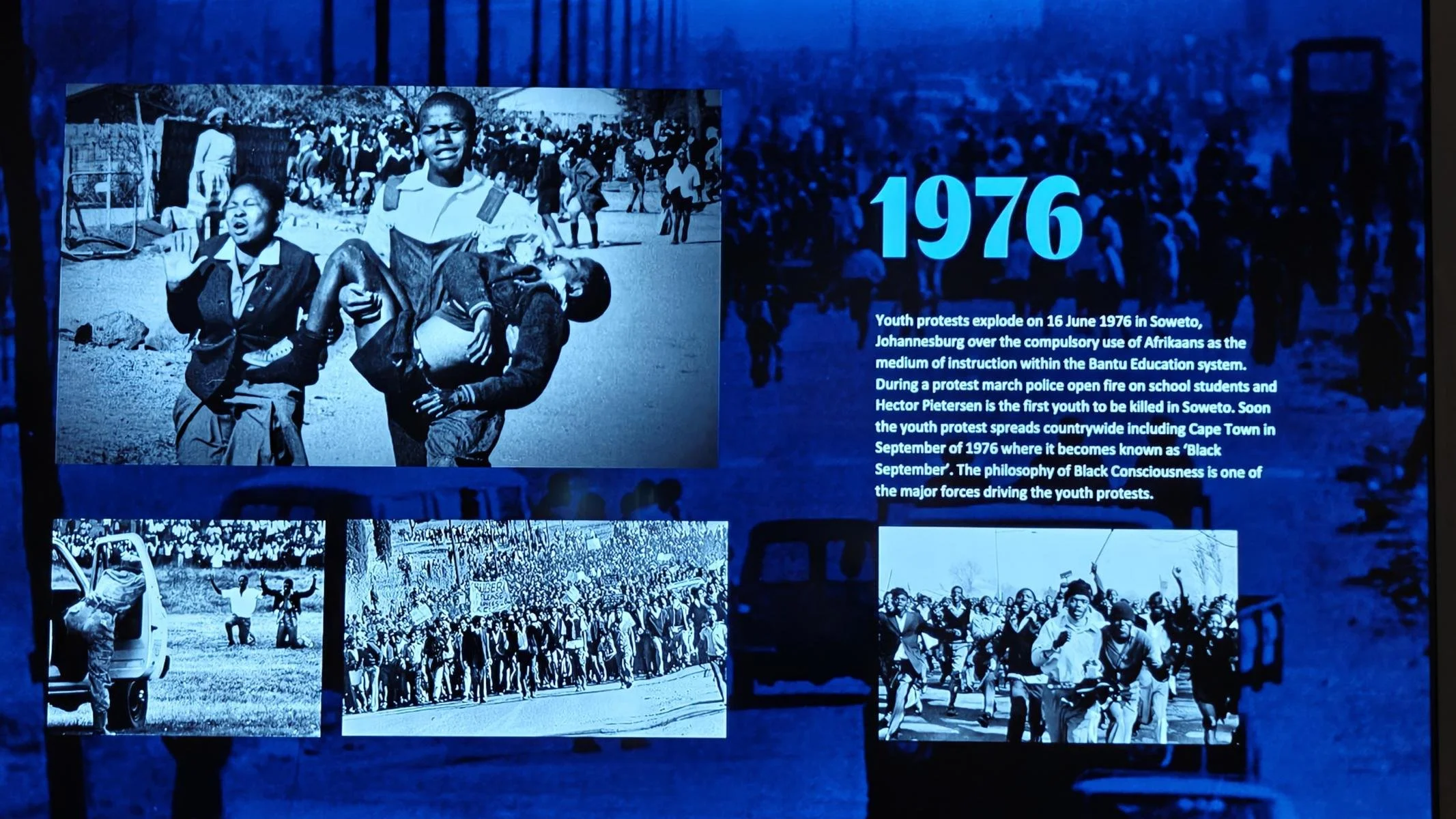
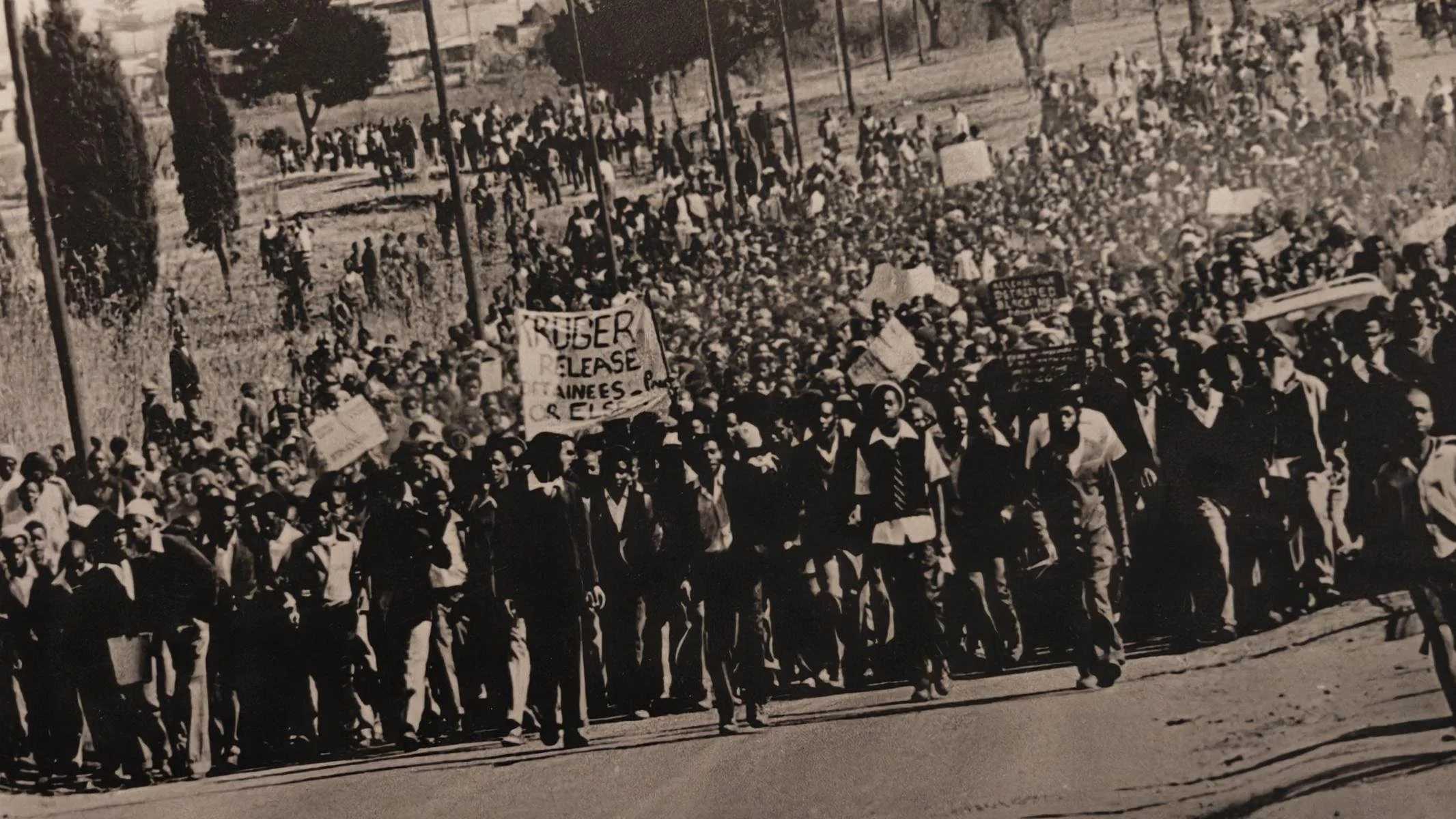
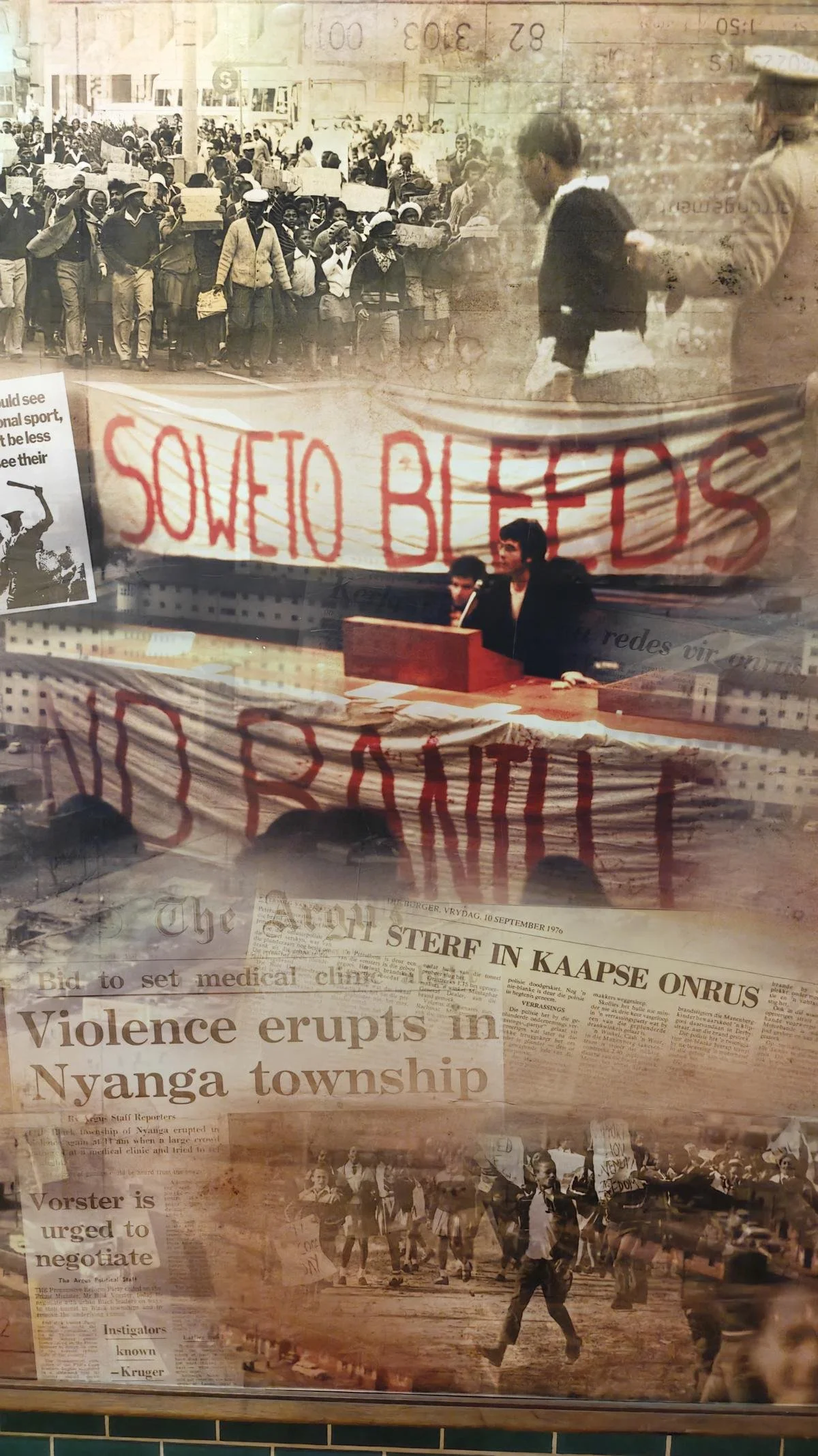
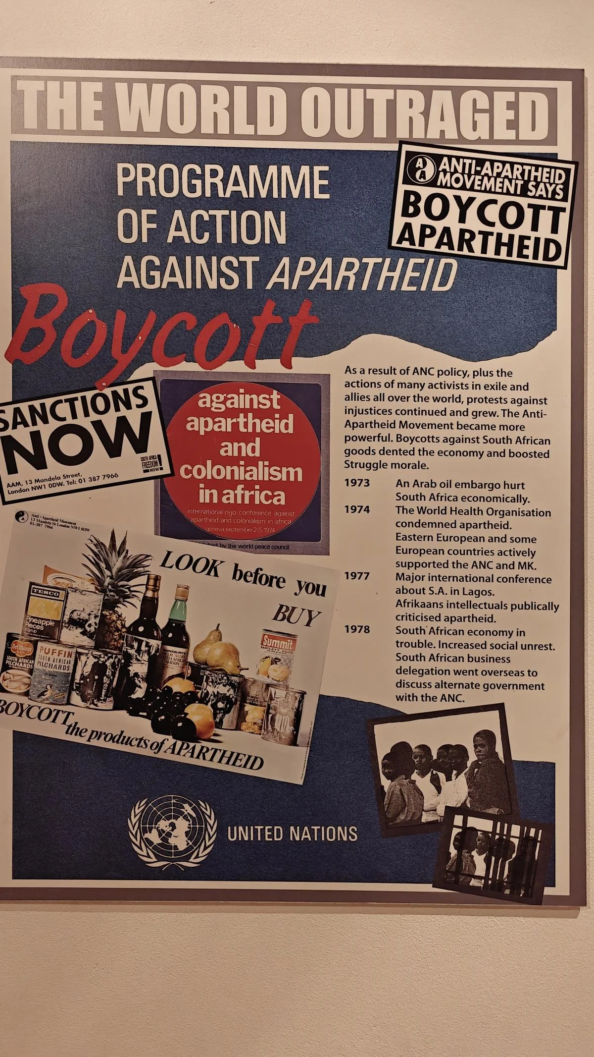
Resistance soon emerged, and numerous political and labor organizations, women’s groups, and youth and student organizations took up the fight against the oppressive regime. One of these was the African National Congress (ANC), founded in 1912, which in later years promoted socialist ideas and rose to become the most important political force against apartheid. For several decades, the black population fought back with various forms of civil resistance and later—in response to escalating police violence—also through violent resistance.
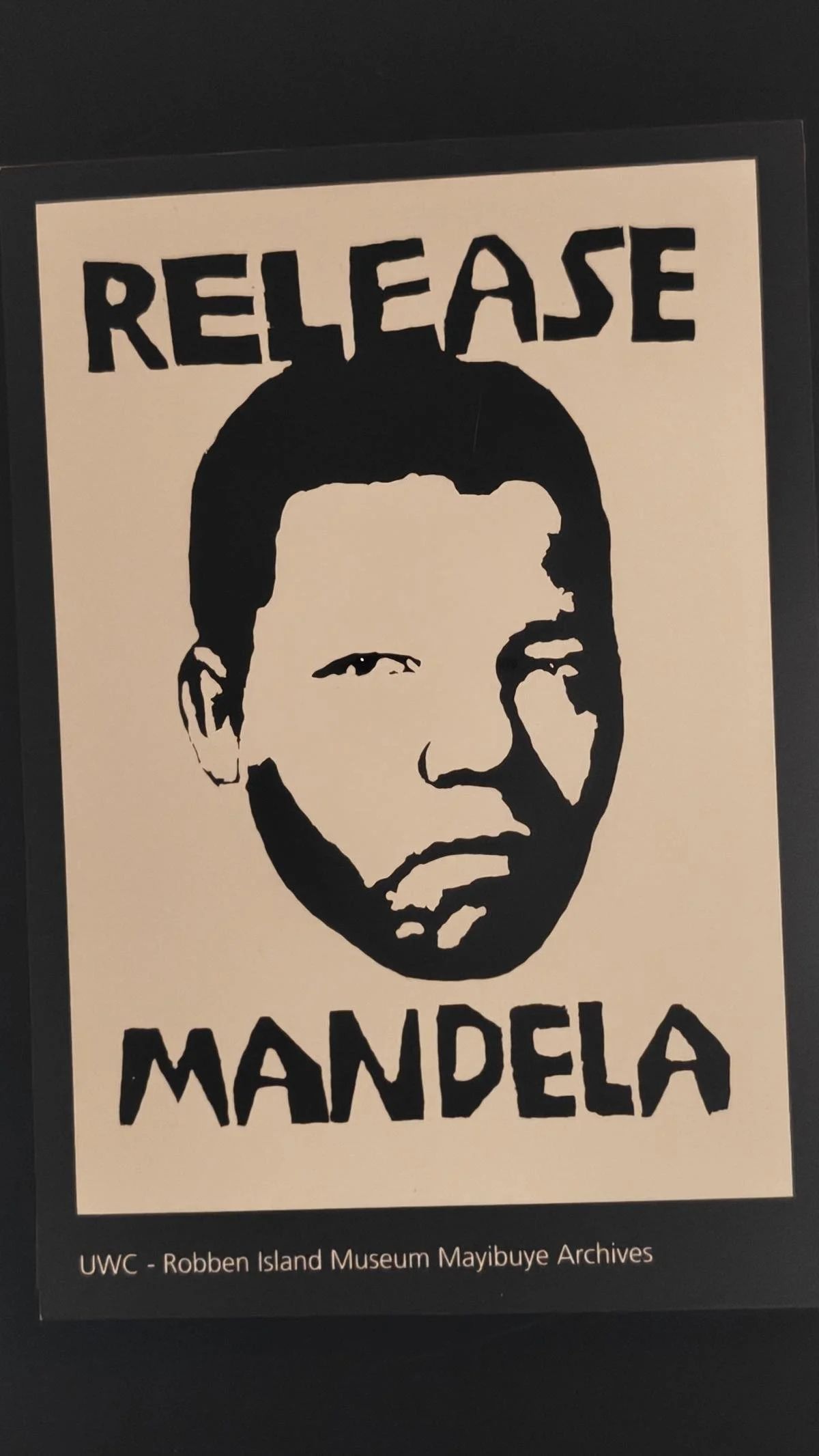
Over the course of the 1980s, it became increasingly clear that the apartheid system was no longer viable. Against the backdrop of the collapse of the Soviet Union, economic difficulties, and the growing resistance of the black majority population, the apartheid regime under President Frederik Willem de Klerk began to yield in the late 1980s. The ban on the ANC and other resistance organizations was lifted, and 3,000 political prisoners, including Nelson Mandela, were released. Between 1990 and 1994, all racist laws were repealed, and all citizens were granted equal rights regardless of skin color.
In the elections held in April 1994—the first to be based on universal and equal suffrage—the African National Congress (ANC) won with 62.6% of the vote, ahead of the formerly ruling National Party, which received 20.4%. Nelson Mandela, who had been imprisoned as a political prisoner for 27 years, was elected by the National Assembly as South Africa’s first black president and was inaugurated on May 10, 1994.
Sehr bald entwickelte sich Widerstand und zahlreiche politische und gewerkschaftliche Organisationen, Frauenverbände, Jugend- und Studentenorganisationen nahmen den Kampf gegen das Unterdrückungsregime auf. Eine davon war der 1912 gegründete African National Congress / ANC, der in späteren Jahren sozialistische Ideen propagierte und zur wichtigsten politischen Kraft gegen die Apartheit aufstieg. Mehrere Jahrzehnten wehrte sich die schwarze Bevölkerung mit unterschiedlichen Formen des zivilen und später - als Reaktion auf die eskalierende Polizeigewalt - auch gewaltsamen Widerstands.
Im Laufe der 1980er Jahre zeigte sich immer deutlicher, dass das Apartheit-System nicht mehr überlebensfähig war. Vor dem Hintergrund des Zusammenbruchs der Sowjetunion und dem Ende des Kalten Kriegs, wirtschaftlichen Schwierigkeiten und dem erstarkenden Widerstand der schwarzen Mehrheitsbevölkerung begann das Apartheit Regime unter Präsident Frederik Willem de Klerk Ende der 1980er Jahre einzulenken. Das Verbot des ANC und andere Widerstandsorganisation wurden aufgehoben und 3.000 politische Gefangen einschließlich Nelson Mandela freigelassen. Zwischen 1990 und 1994 wurden alle rassistischen Gesetze aufgehoben und alle Bürger erhielten ohne Ansehung der Hautfarbe die gleichen Rechte.
Bei den im April 1994 erstmals auf Basis eines allgemeinen und gleichen Wahlrechts abgehaltene Wahlen siegte der African National Congress (ANC) mit 62,6 % vor der ehemals regierenden Nationalen Partei mit 20,4 %. Nelson Mandela, der 27 Jahre als politischer Gefangener eingesperrt war, wurde von der National Versammlung zum erster schwarzen Präsident Südafrikas gewählt und am 10 May 1994 inauguriert.
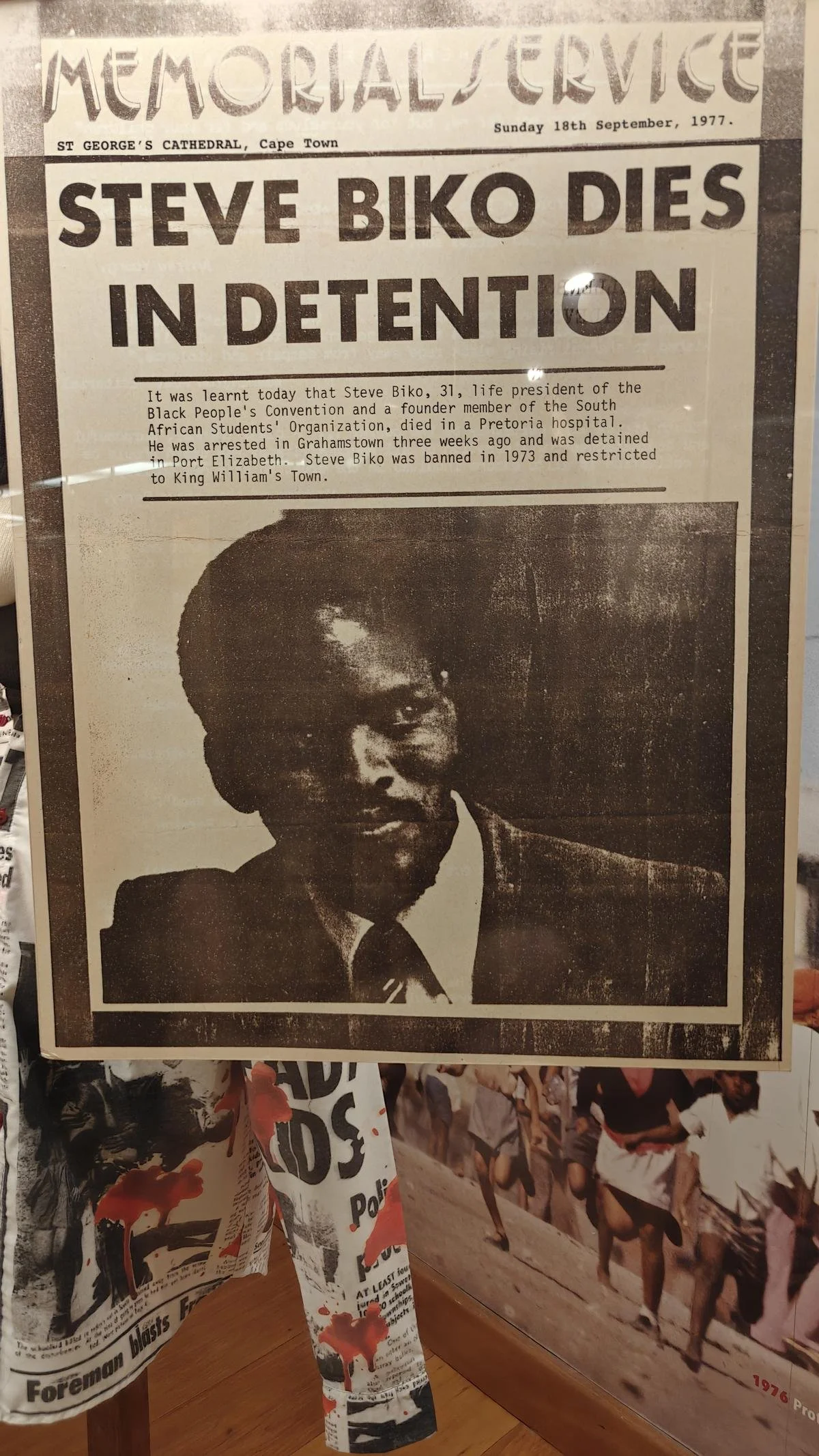
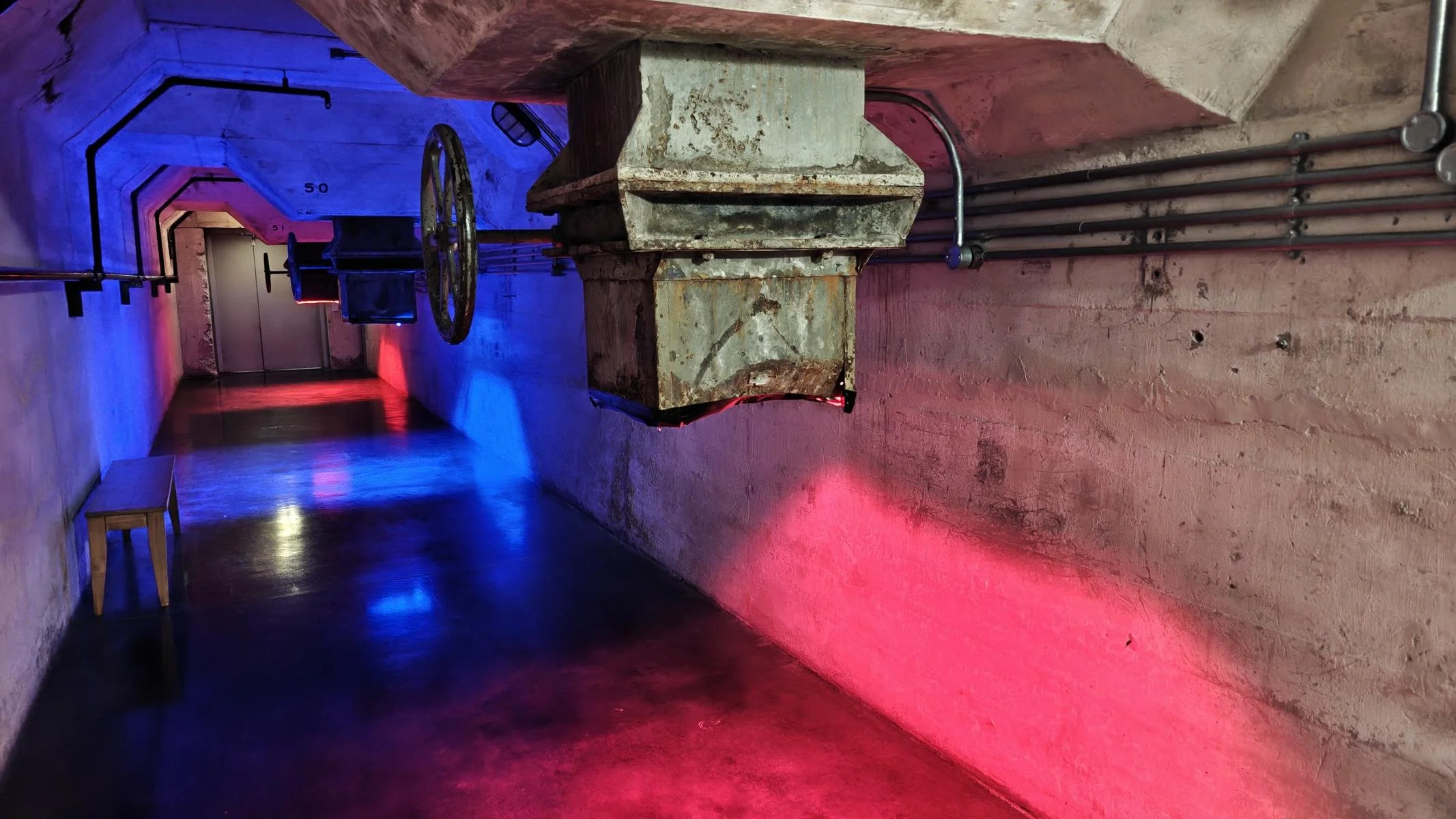
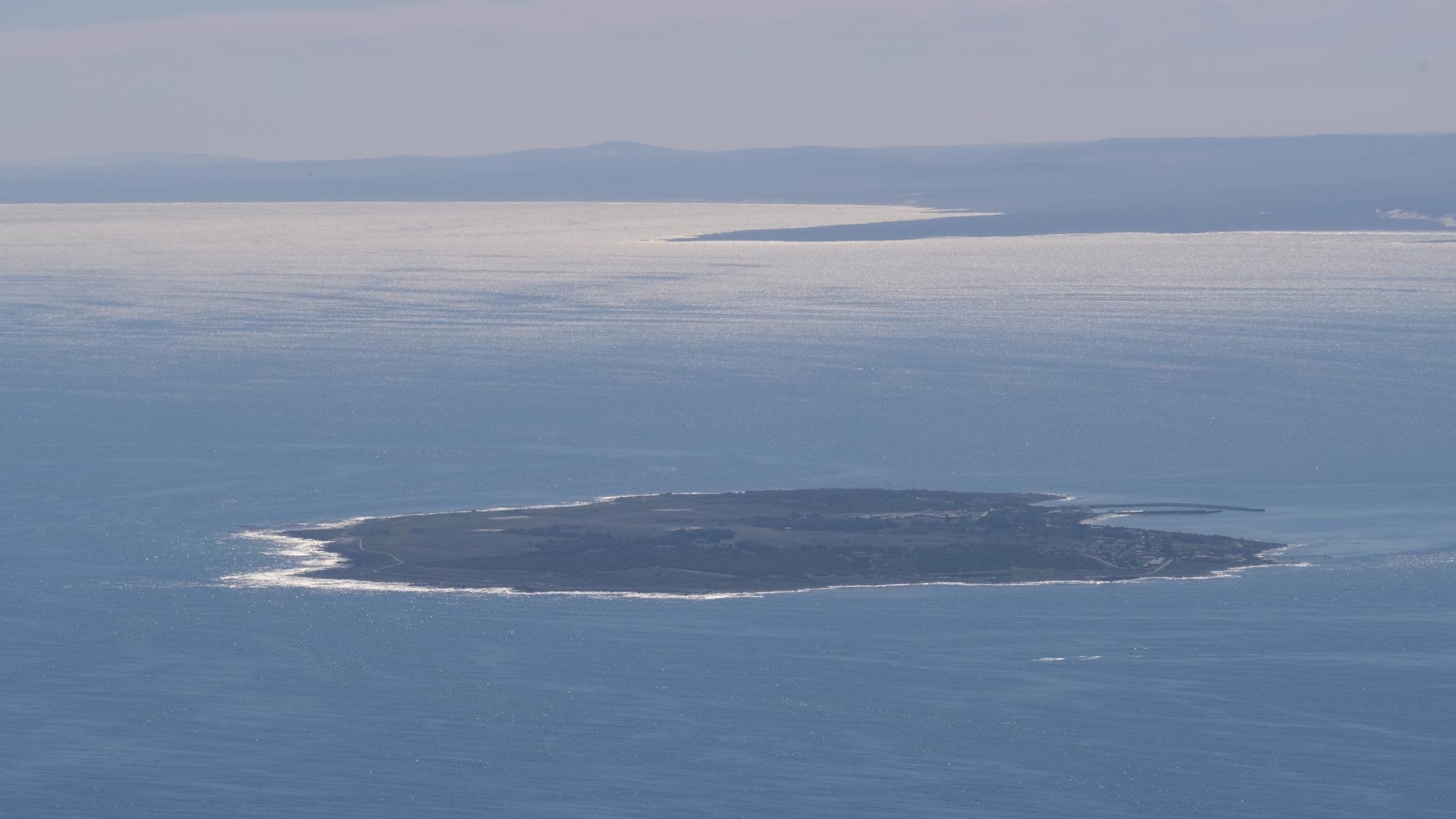
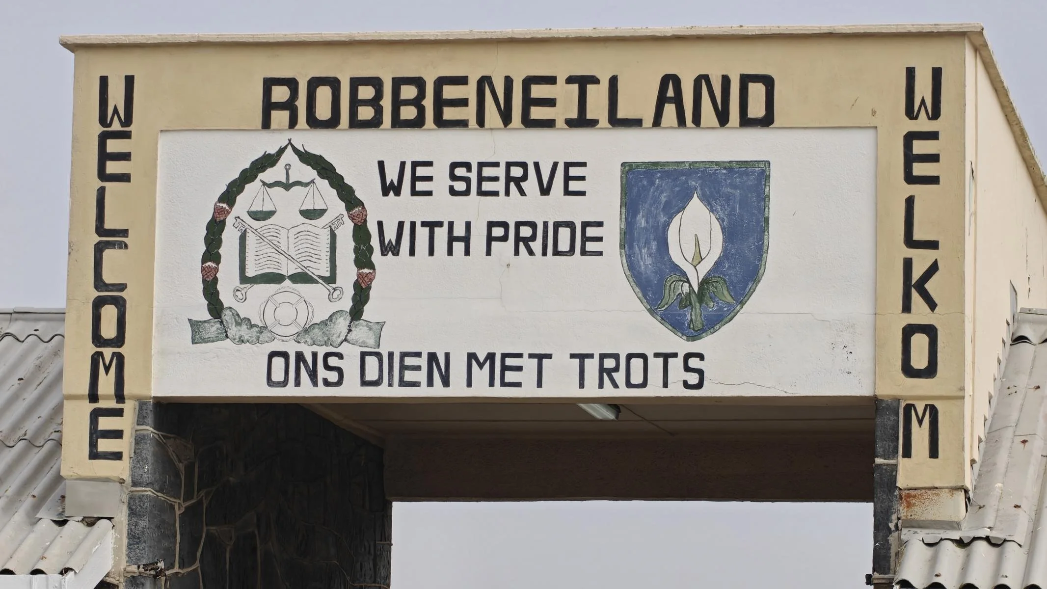
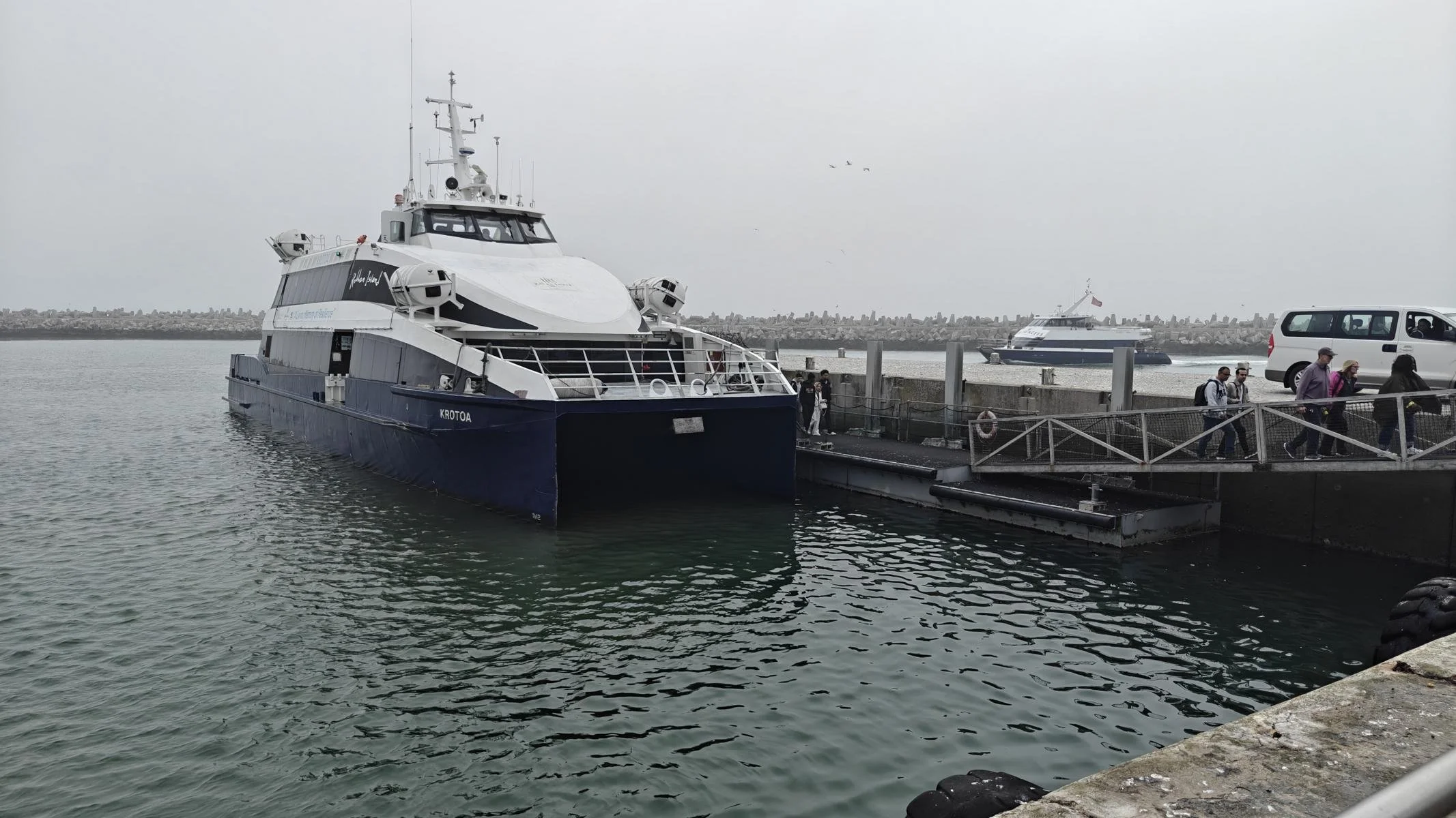
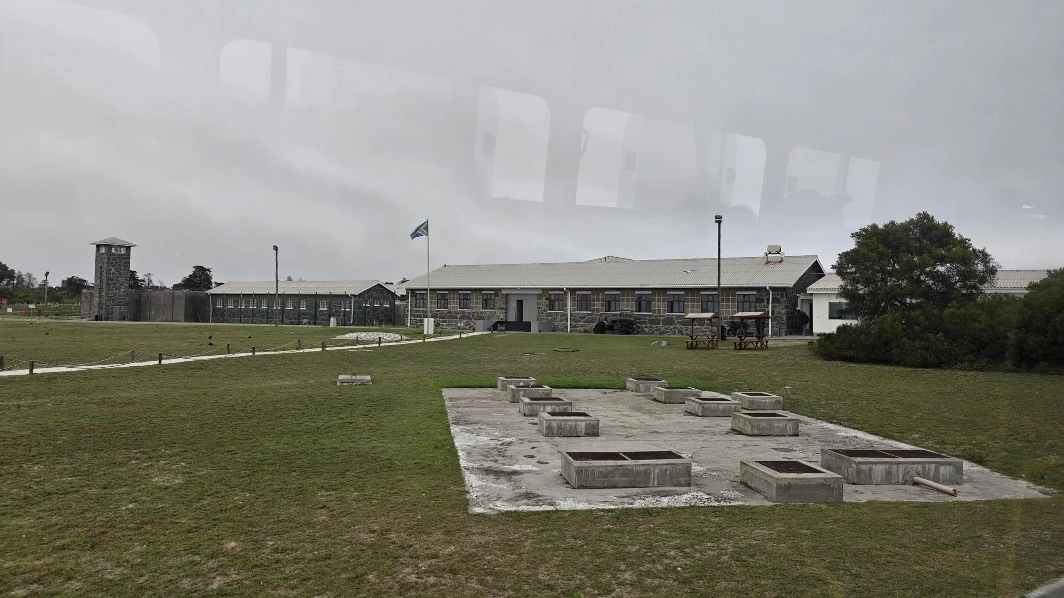
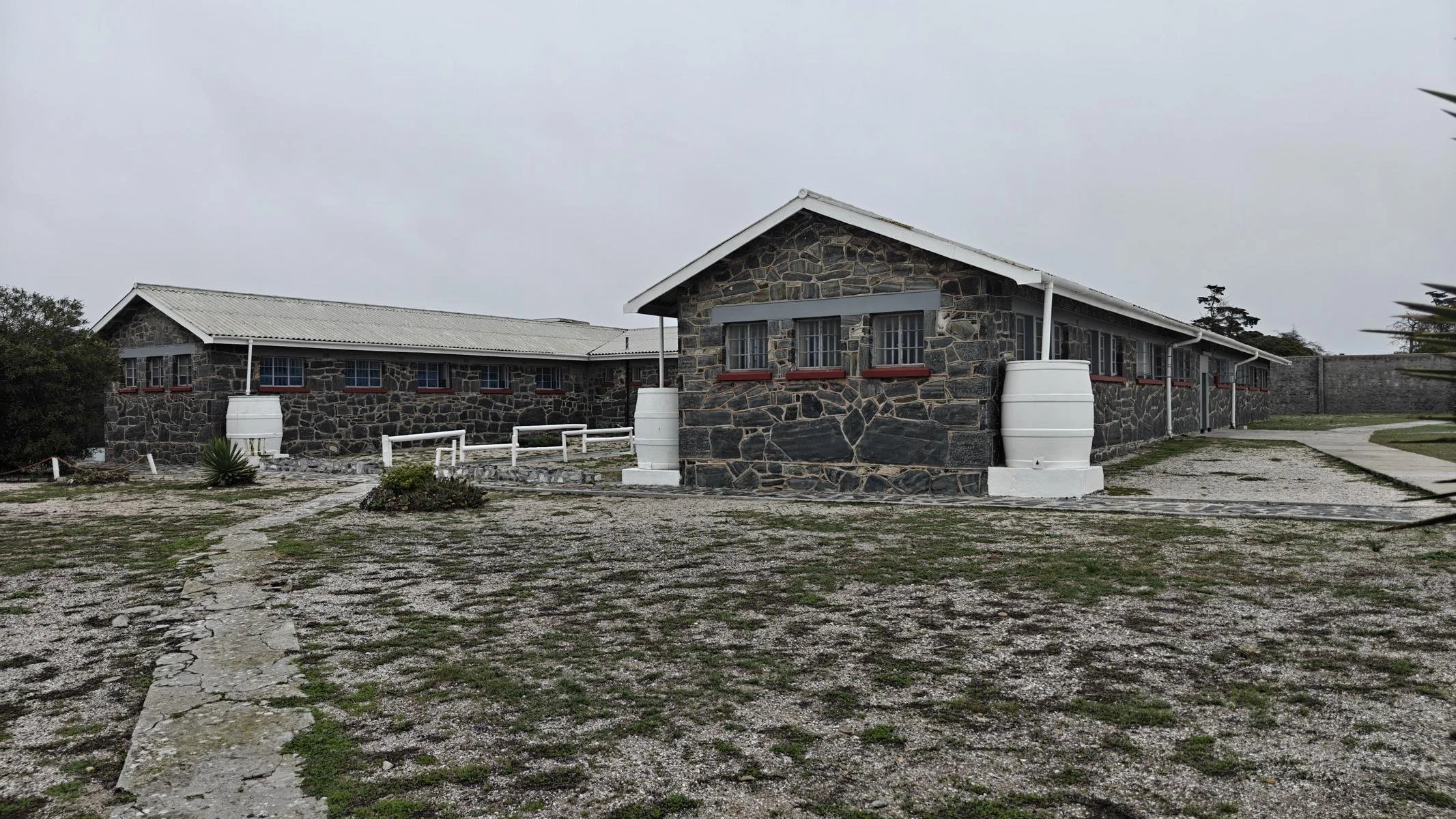
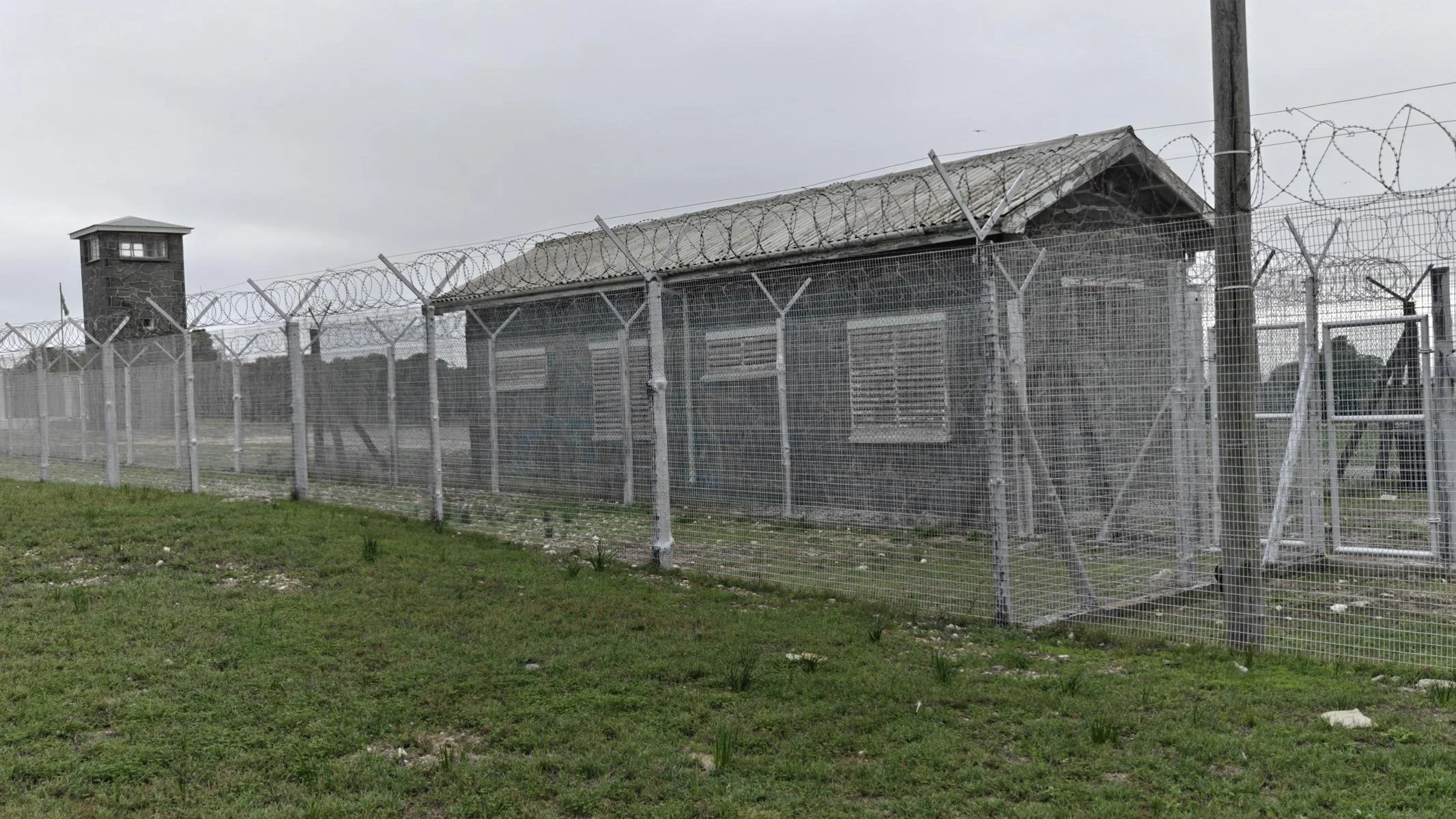
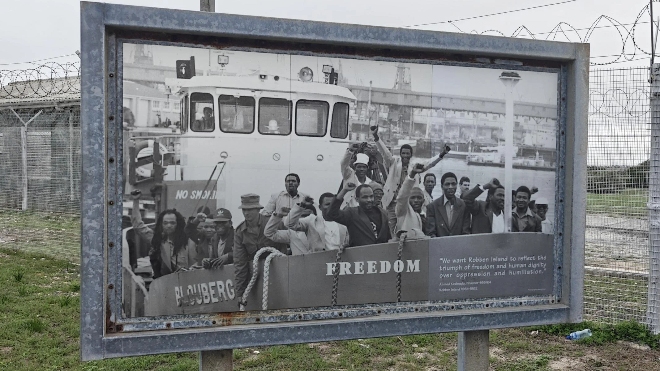
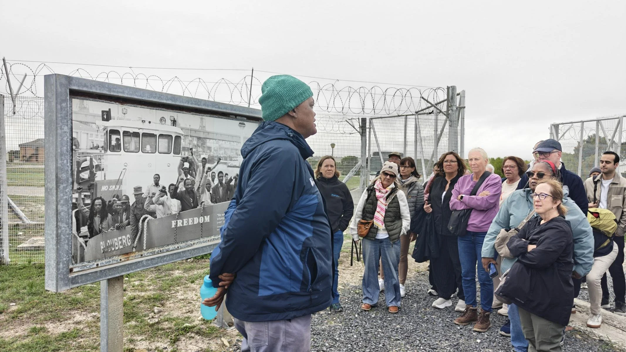
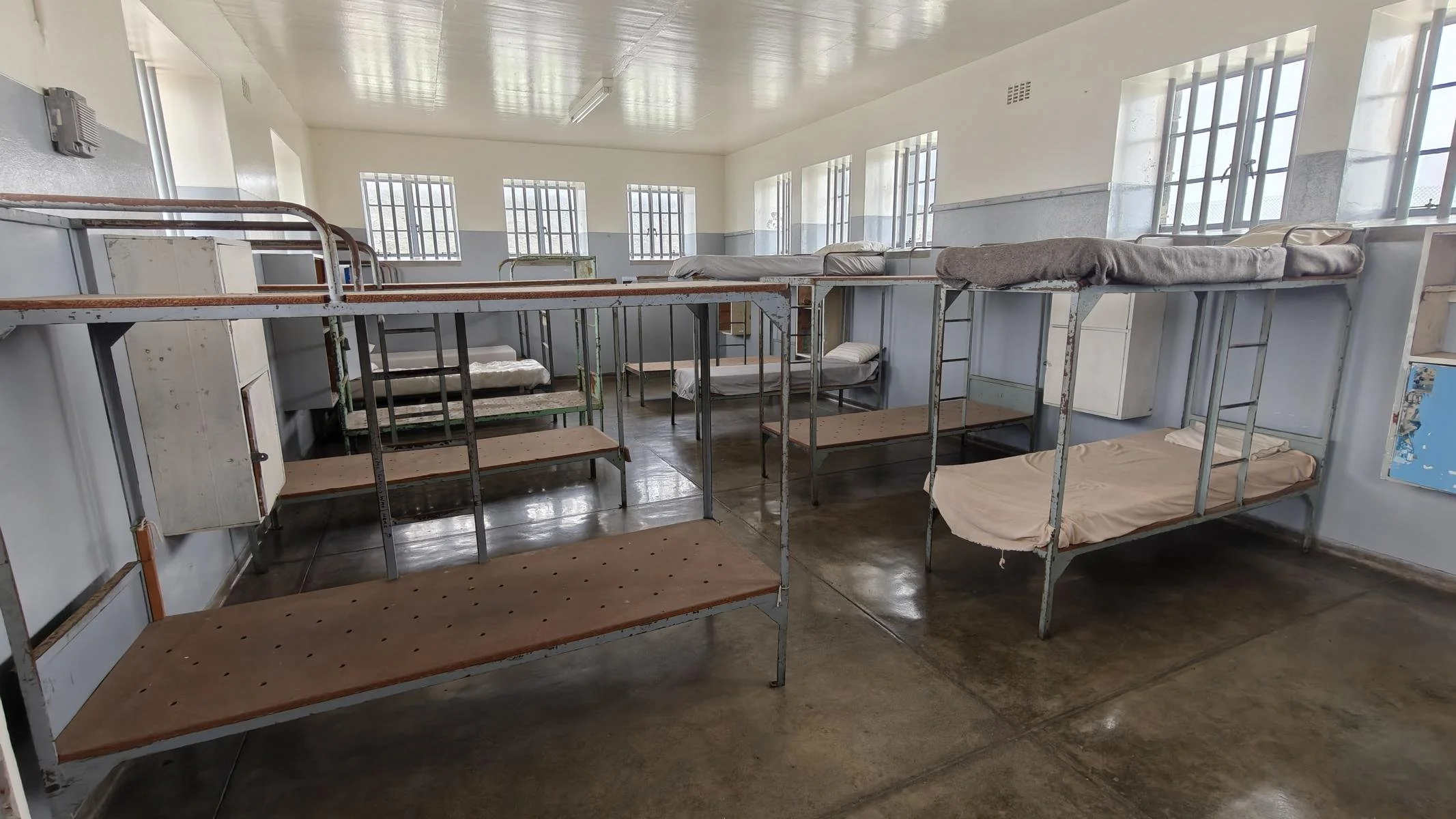
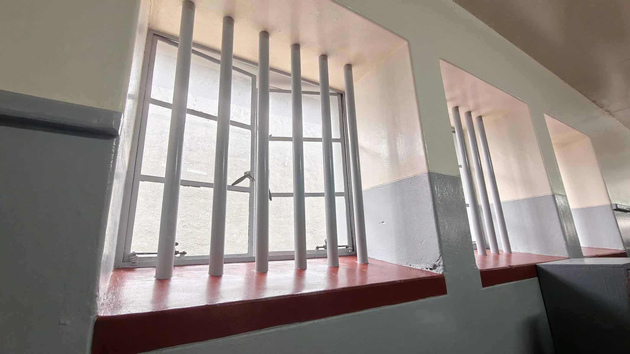
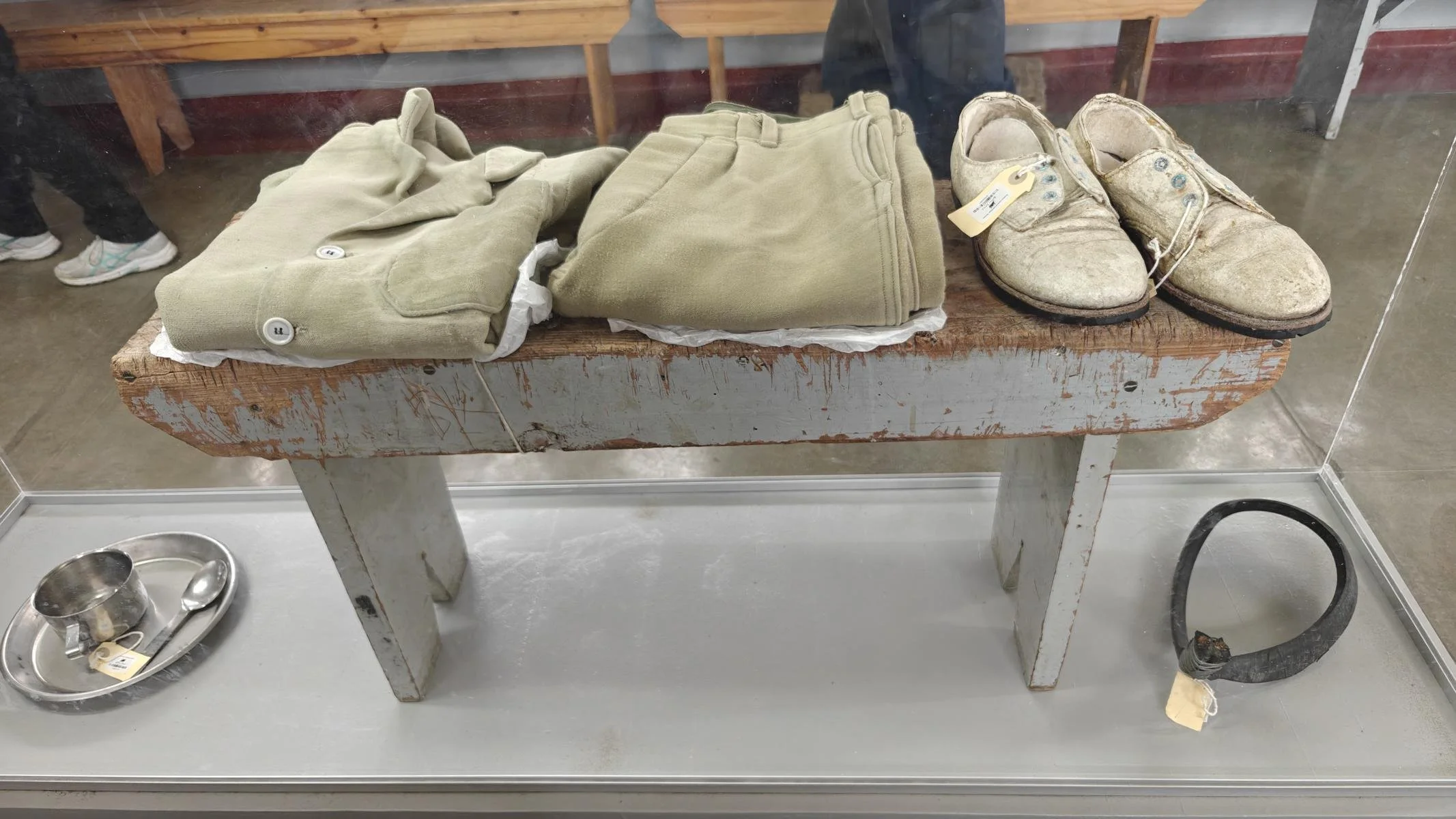
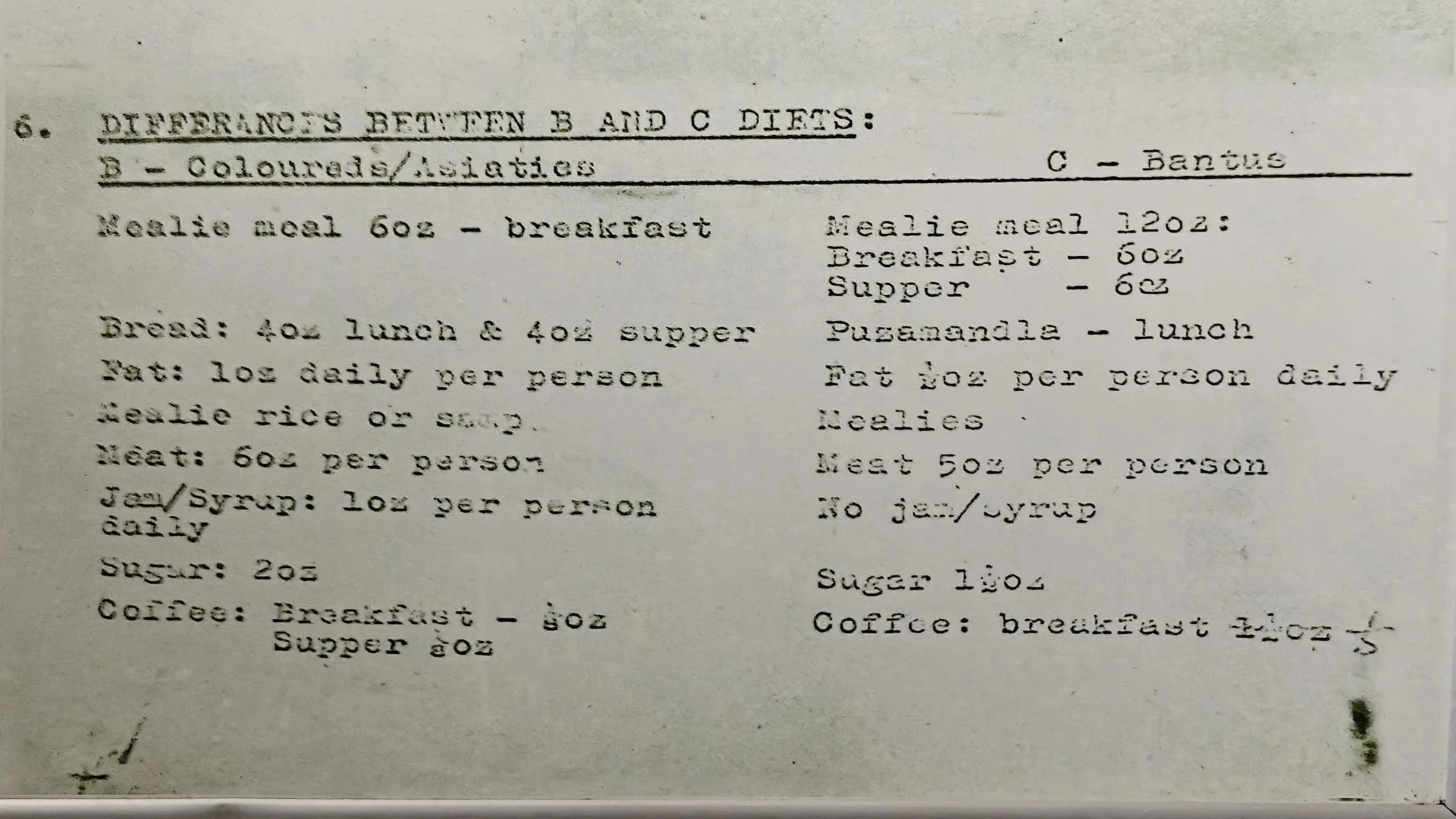
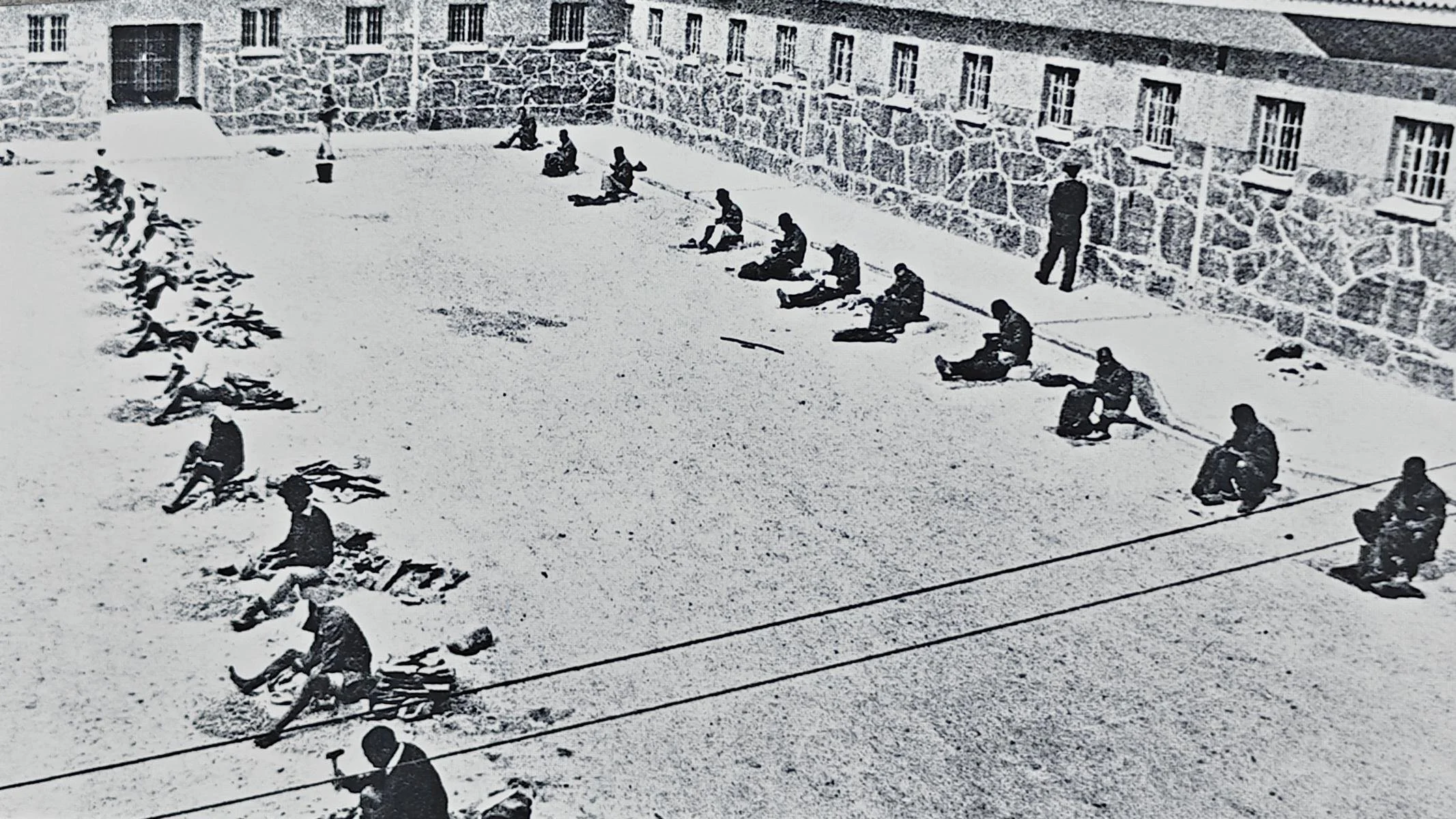
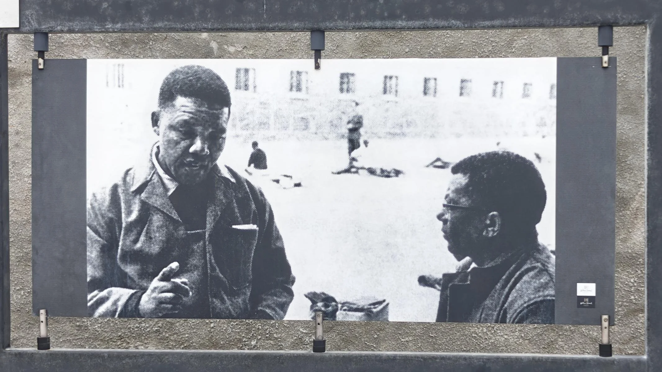
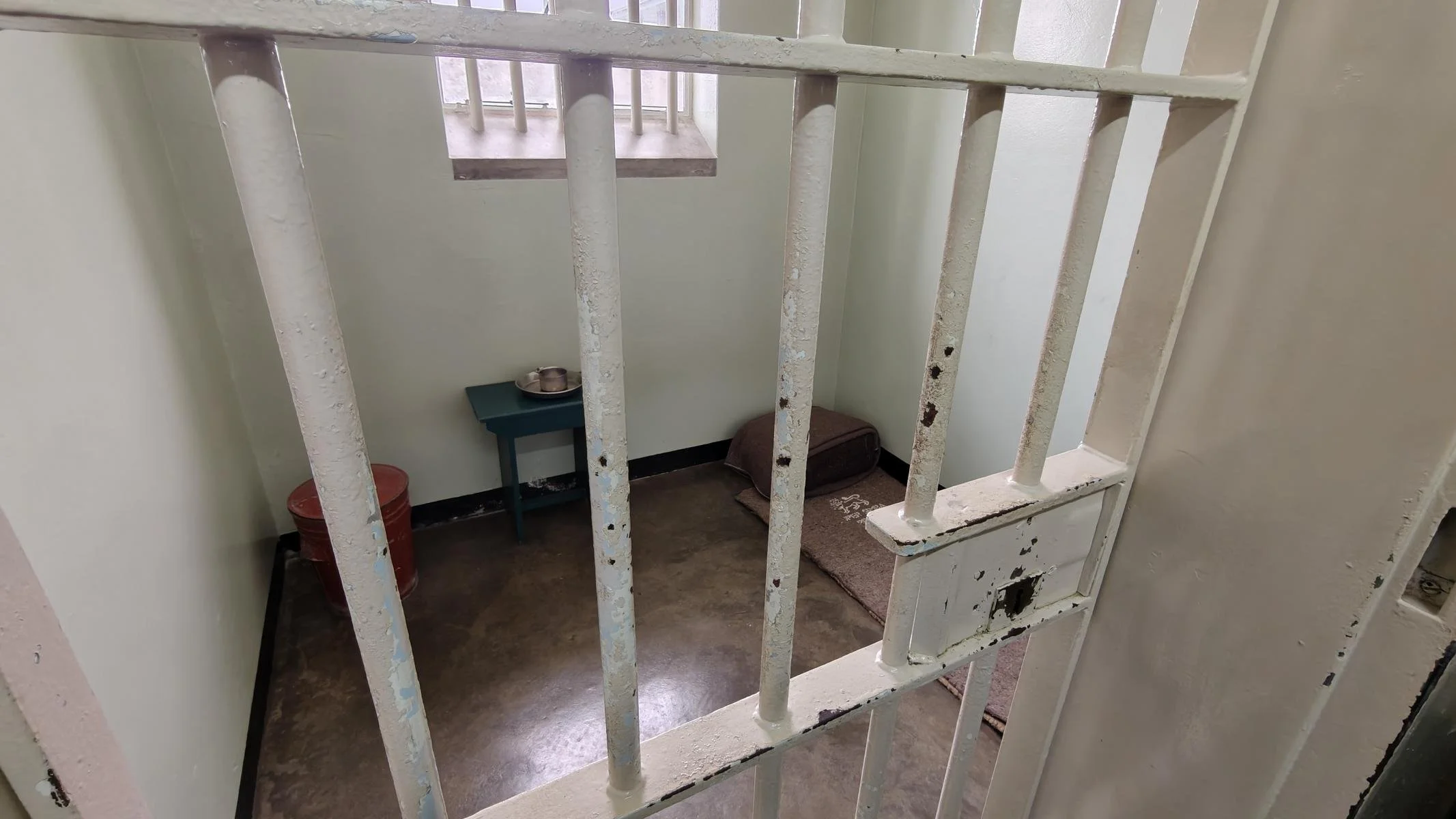
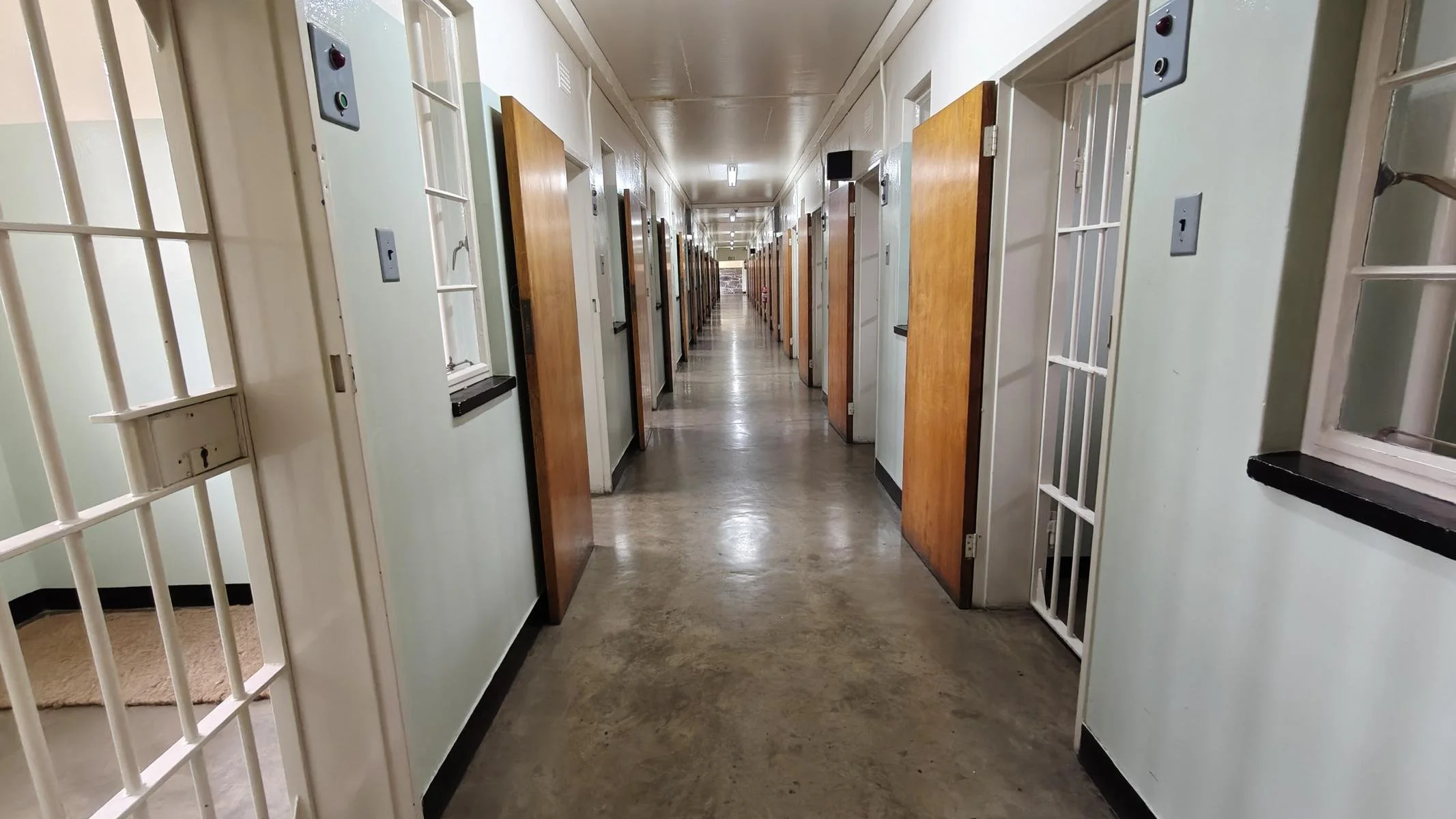
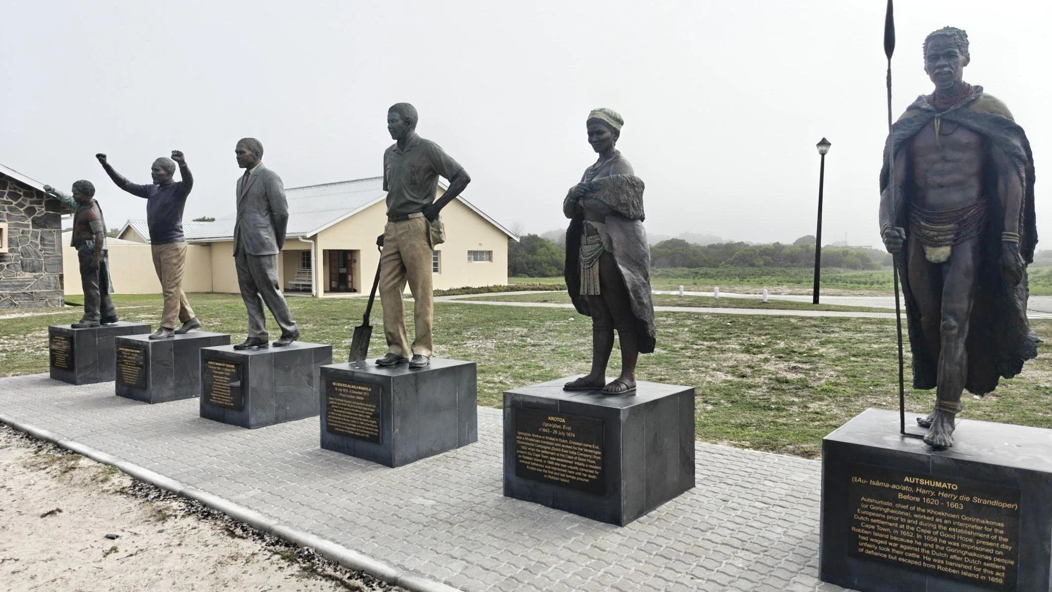
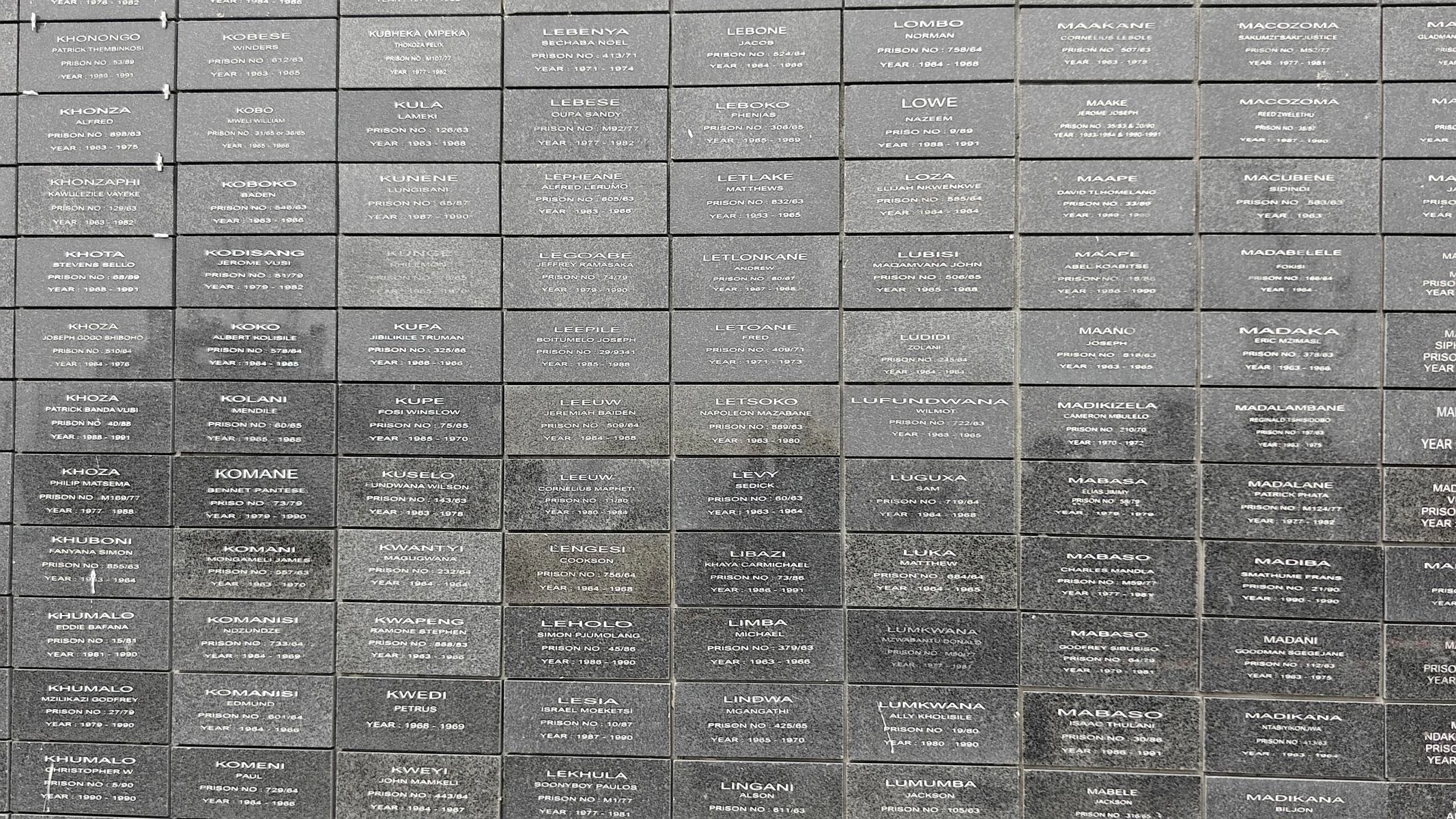
Robben Island, which covers an area of 5 km², is located 11 km off the coast of Cape Town. It has served as a prison island since the 17th century. Under the apartheid regime, more than 3,000 political prisoners were held there between 1961 and 1991. Today, the former prison is a museum that can be visited as part of an organized tour. Former inmates guide visitors through the prison facilities and describe the harsh realities of prison life. In keeping with apartheid ideology, prisoners were even segregated by ethnic group during meals. The most prominent political prisoner was the future president, Nelson Mandela, who was held here for 18 years in a solitary confinement cell.
11 km vor Kapstadt liegt die 5 km2 große Insel Robben Island. Seit dem 17. Jh. diente sie als Gefängnis-Insel. Unter dem Apartheit Regime wurden dort zw. 1961 und 1991, mehr als 3.000 politische Gefangen festgehalten. Heute ist das ehem. Gefängnis ein Museum, das im Rahmen einer organisierten Tour besucht werden kann. Ehemalige Insassen führen durch die Gefängnisanlagen und beschreiben die Grausamkeiten des Gefängnislebens. Entsprechend der Apartheit-Ideologie wurde sogar beim Essen nach ethnischen Gruppen unterschieden. Prominentester politischer Gefangener war der spätere Präsident Nelson Mandela, der hier 18 Jahre in einer Einzelzelle untergebracht war.
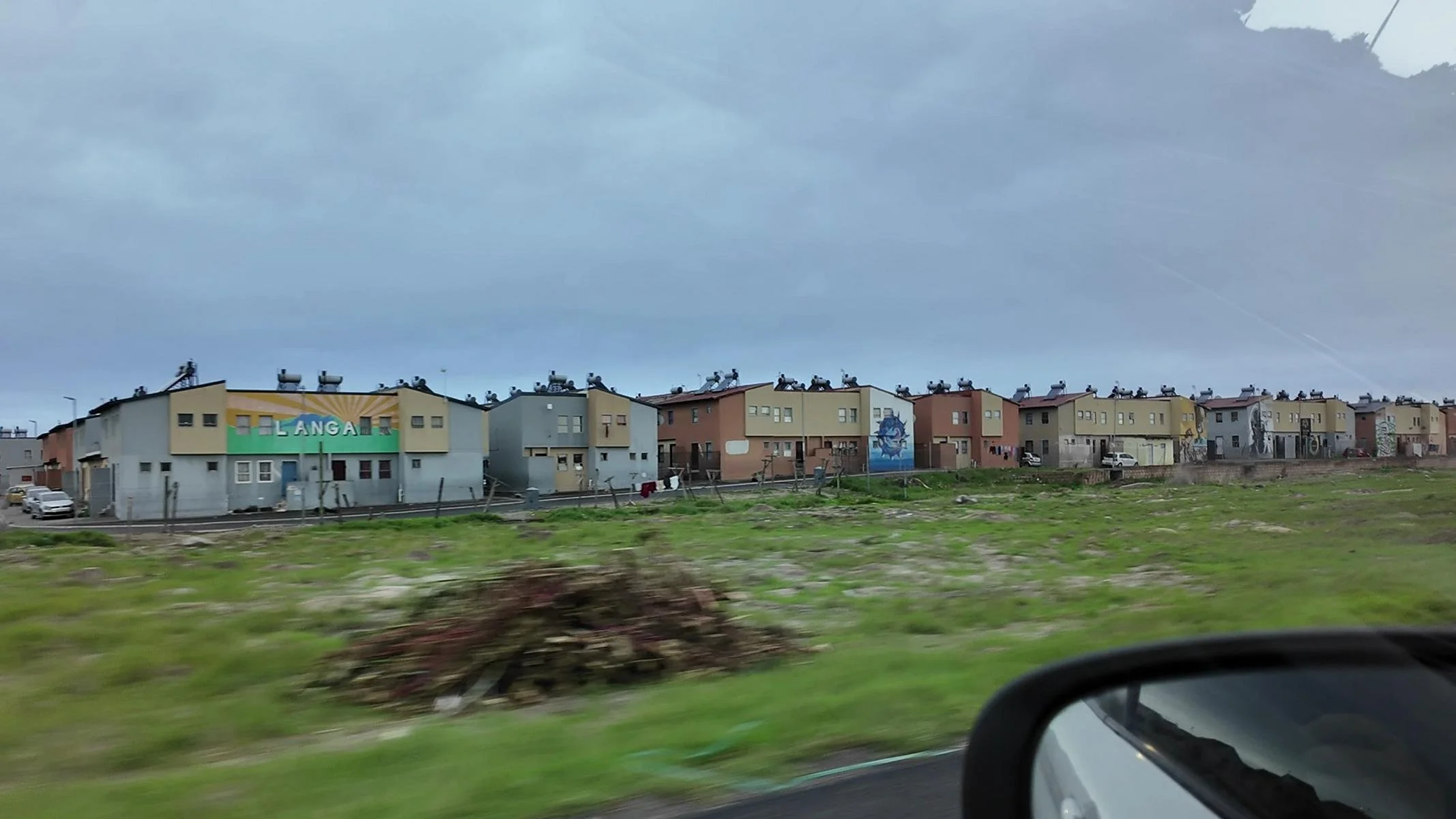
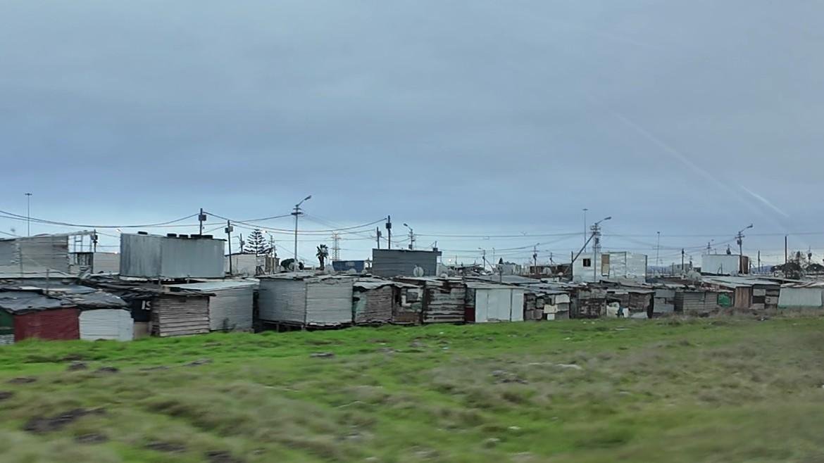
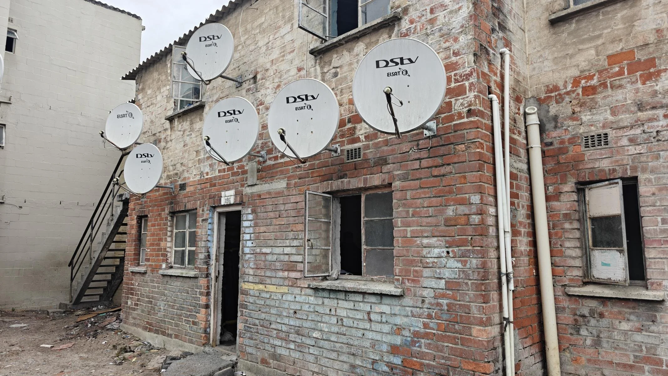
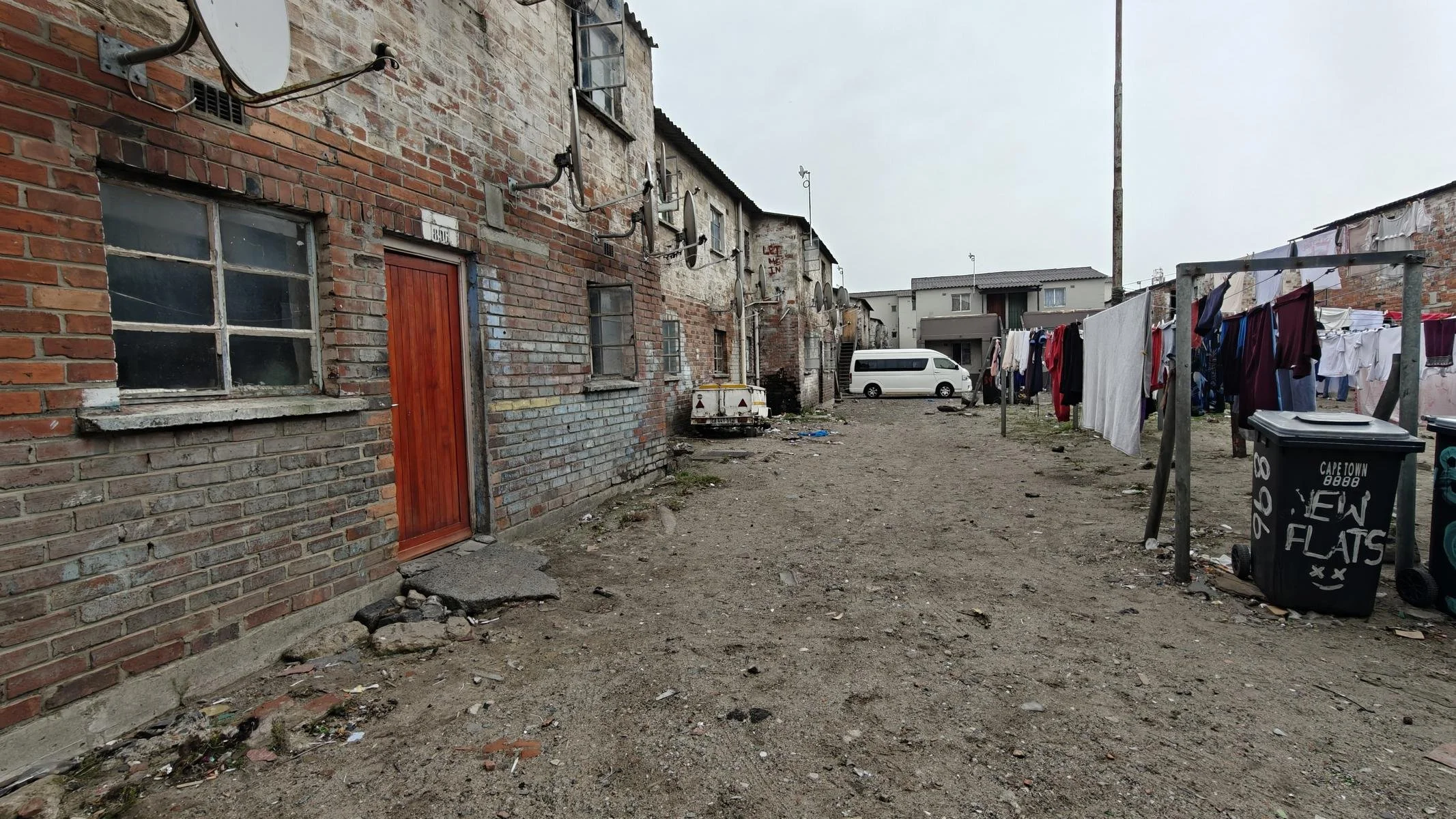
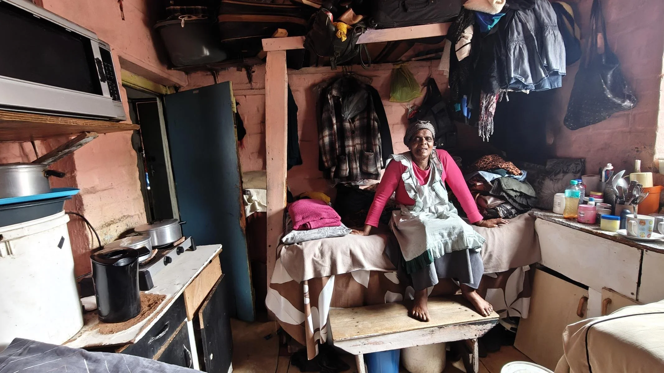
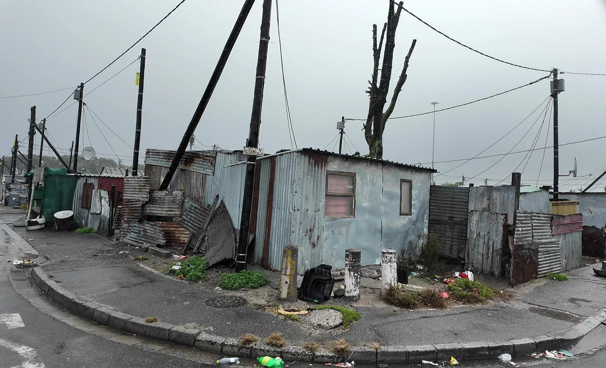
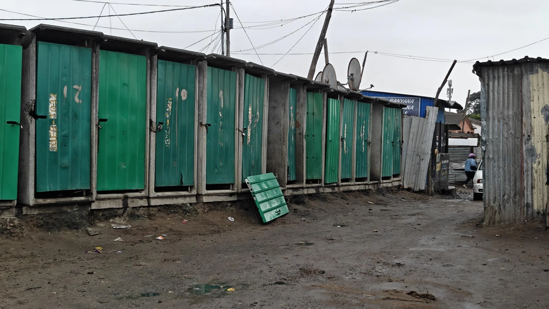
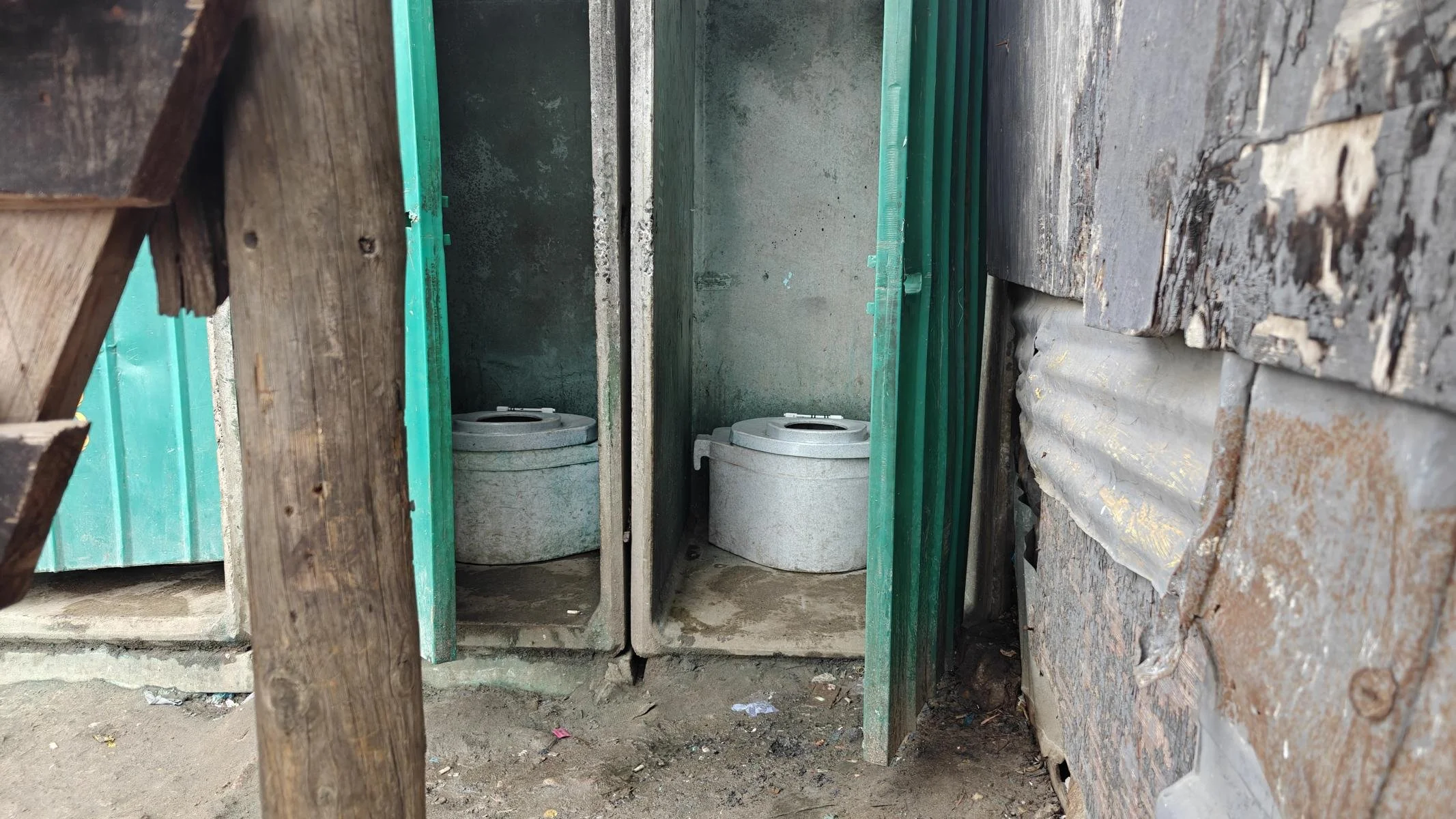
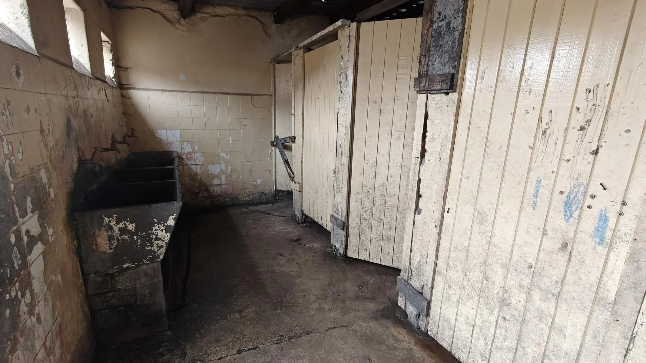
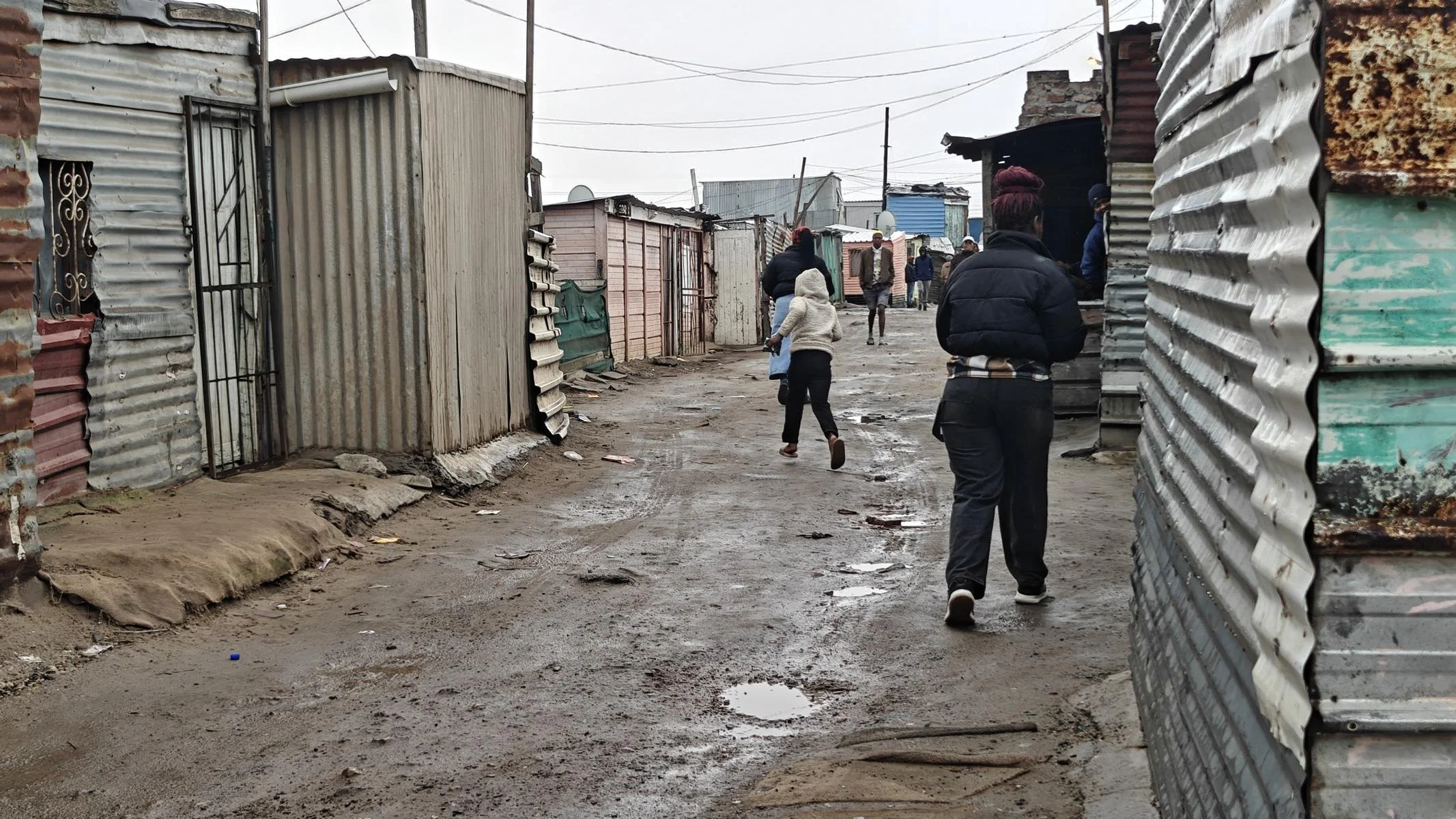
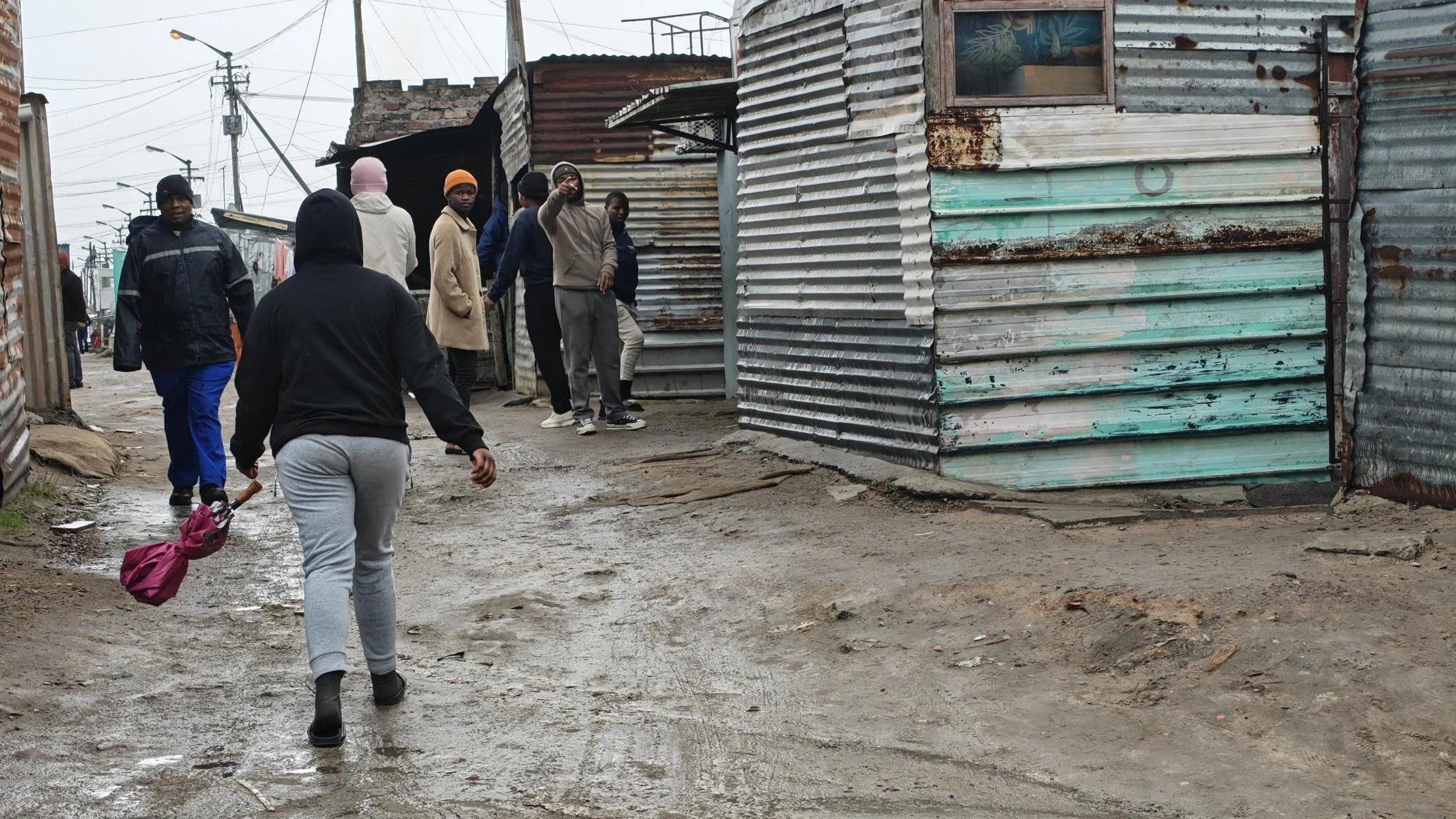
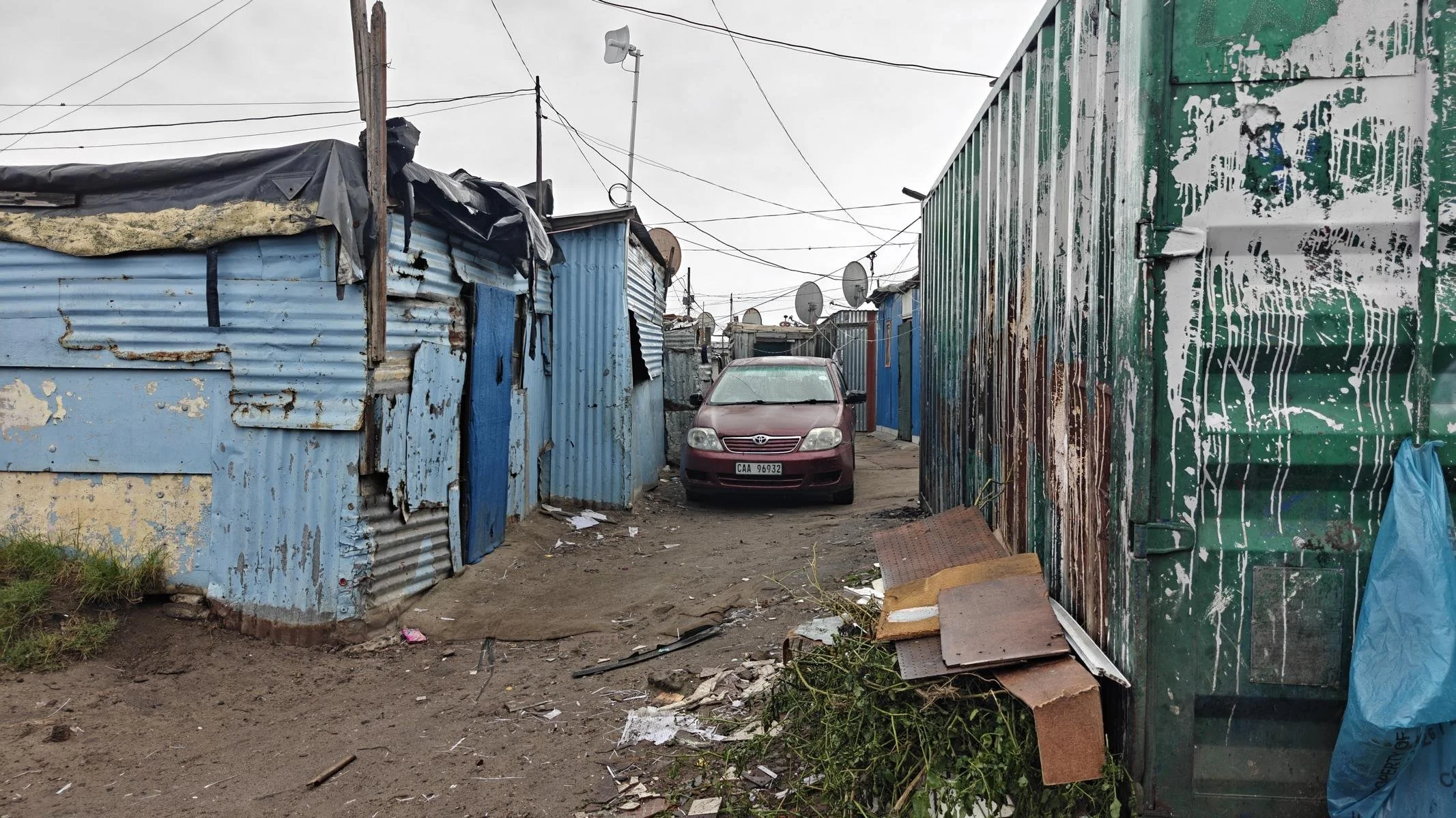
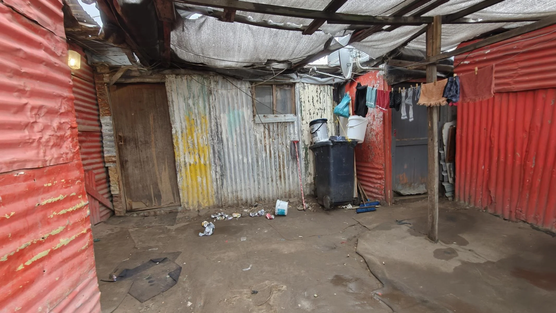
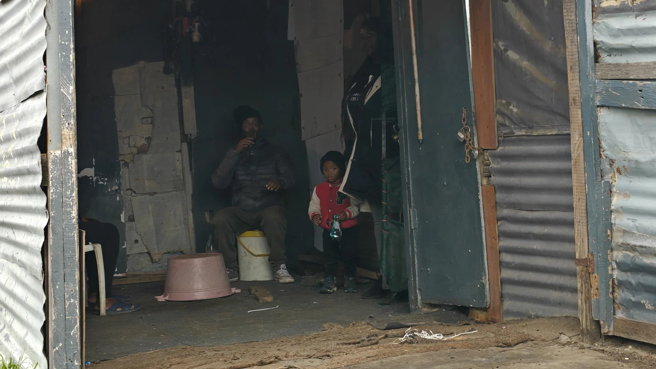
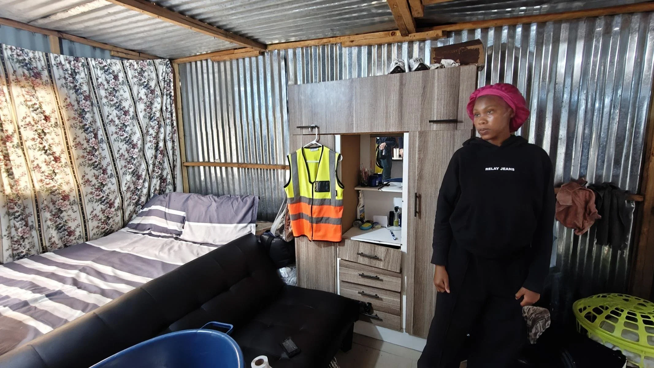
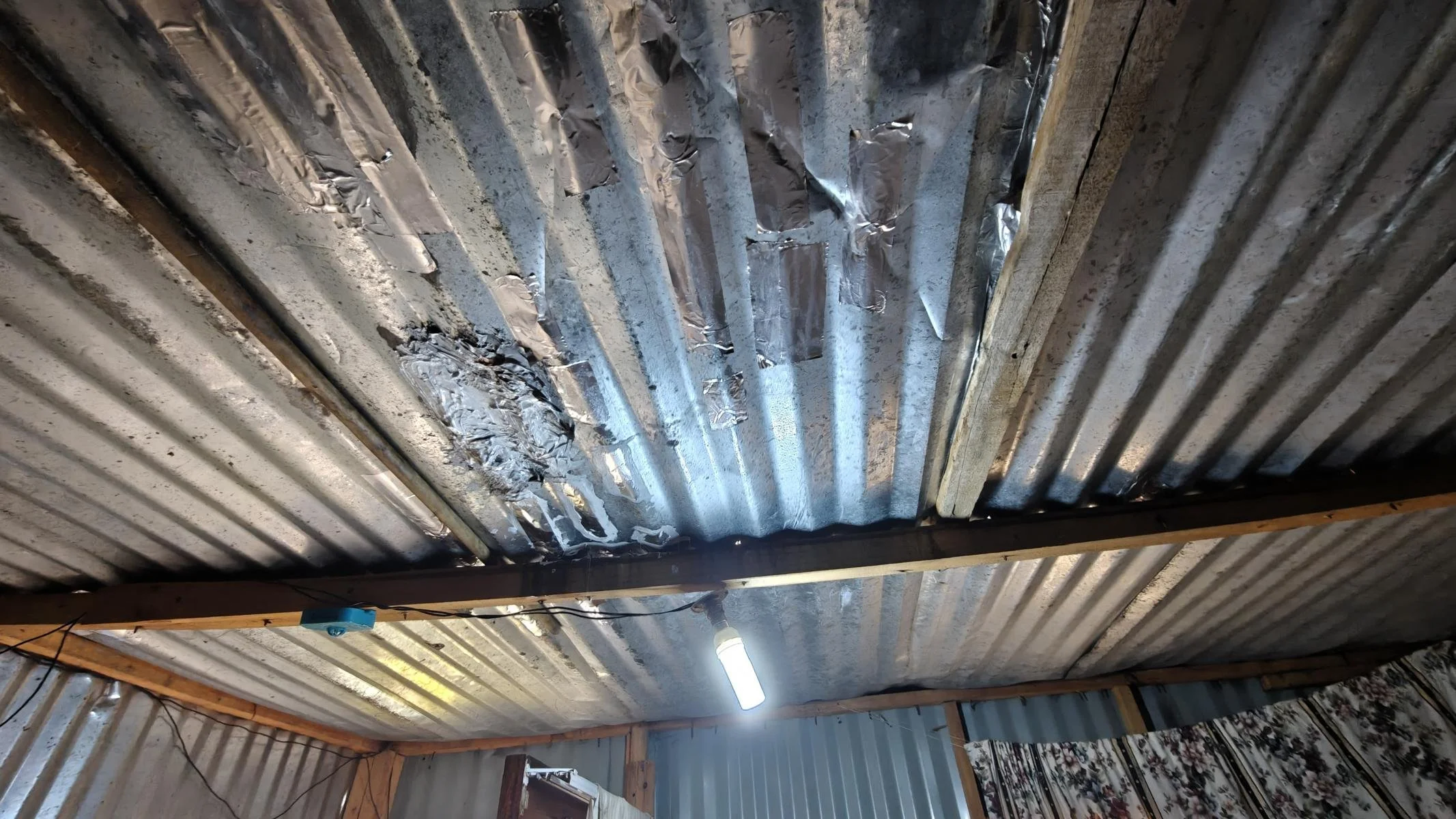
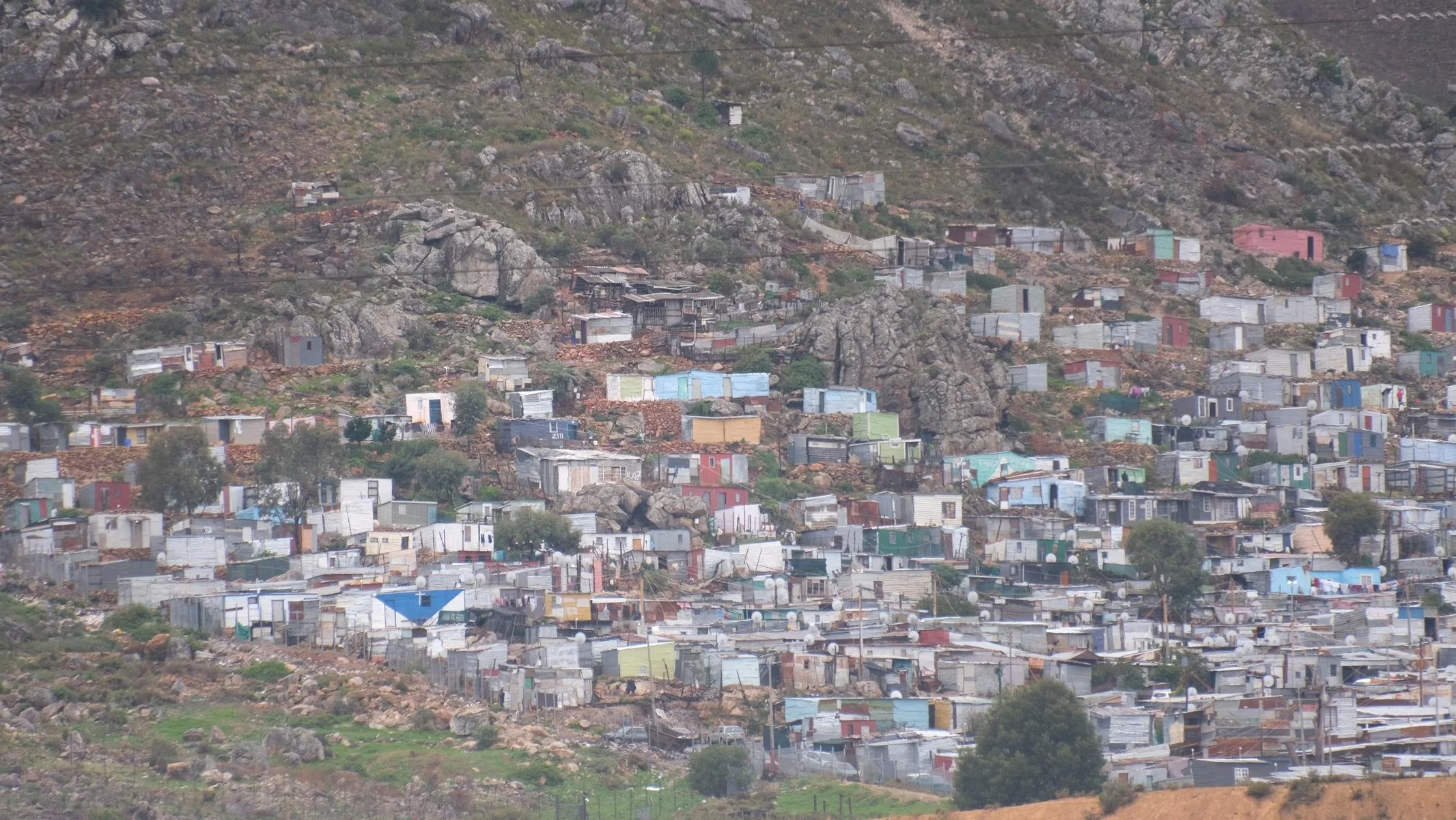
South Africa’s social problems are most clearly evident in the housing crisis. According to reports, 13% of the population lives in slums. The major cities of Johannesburg and Cape Town are particularly affected. While the government has built approximately 5 million housing units since 1994, at least 2.5 million households still live in corrugated iron shacks.
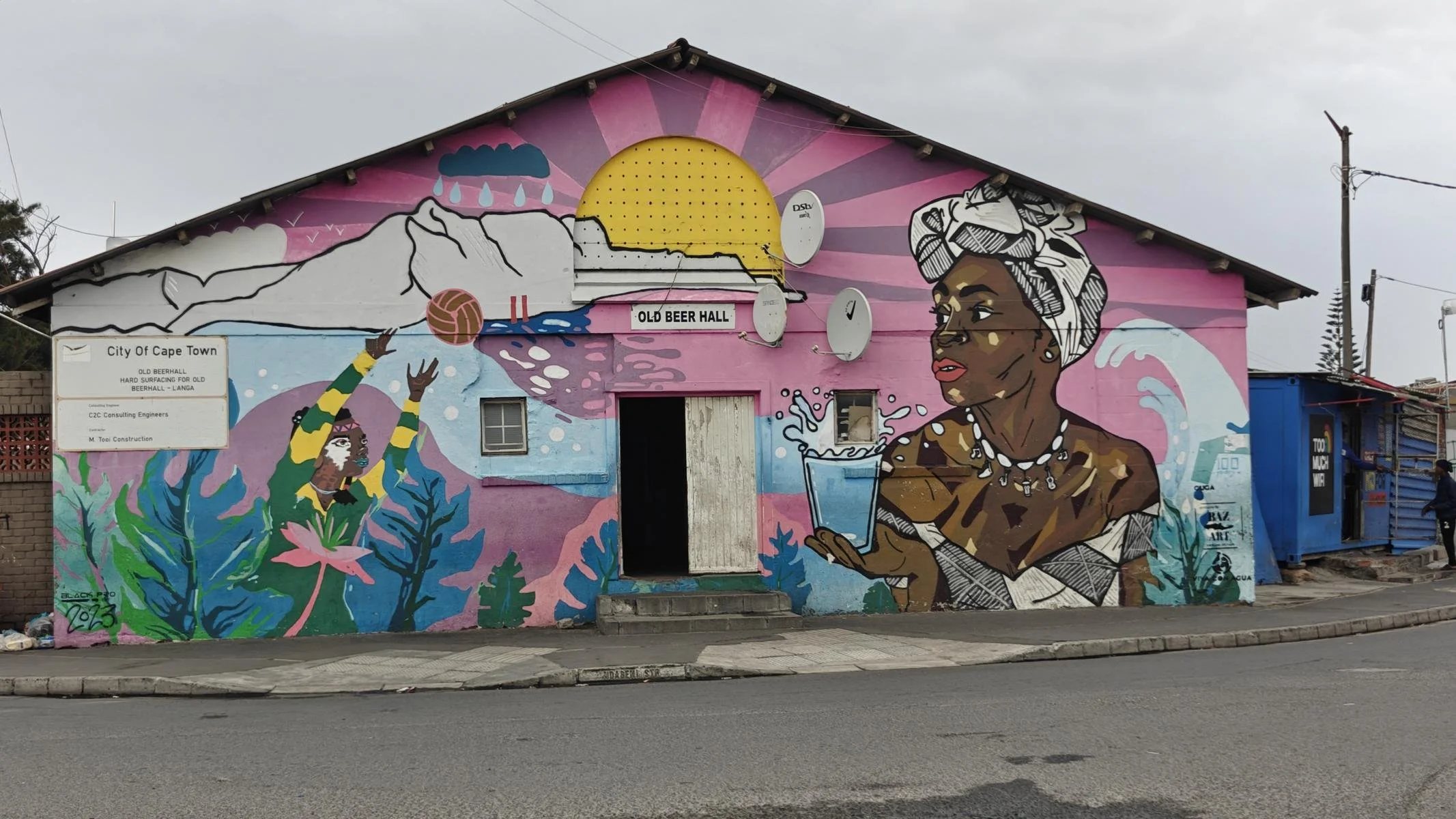
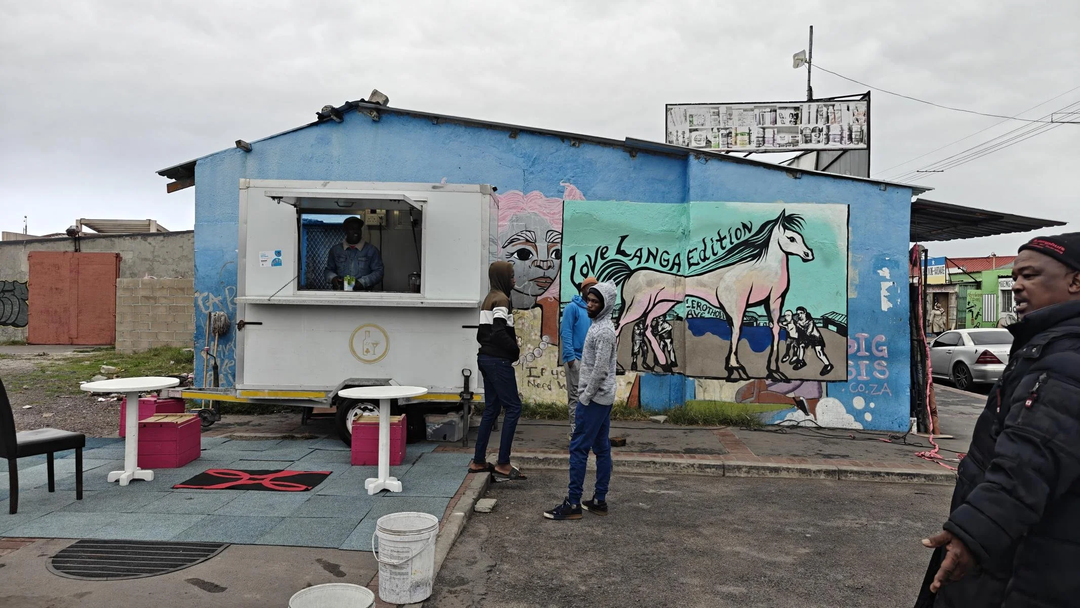
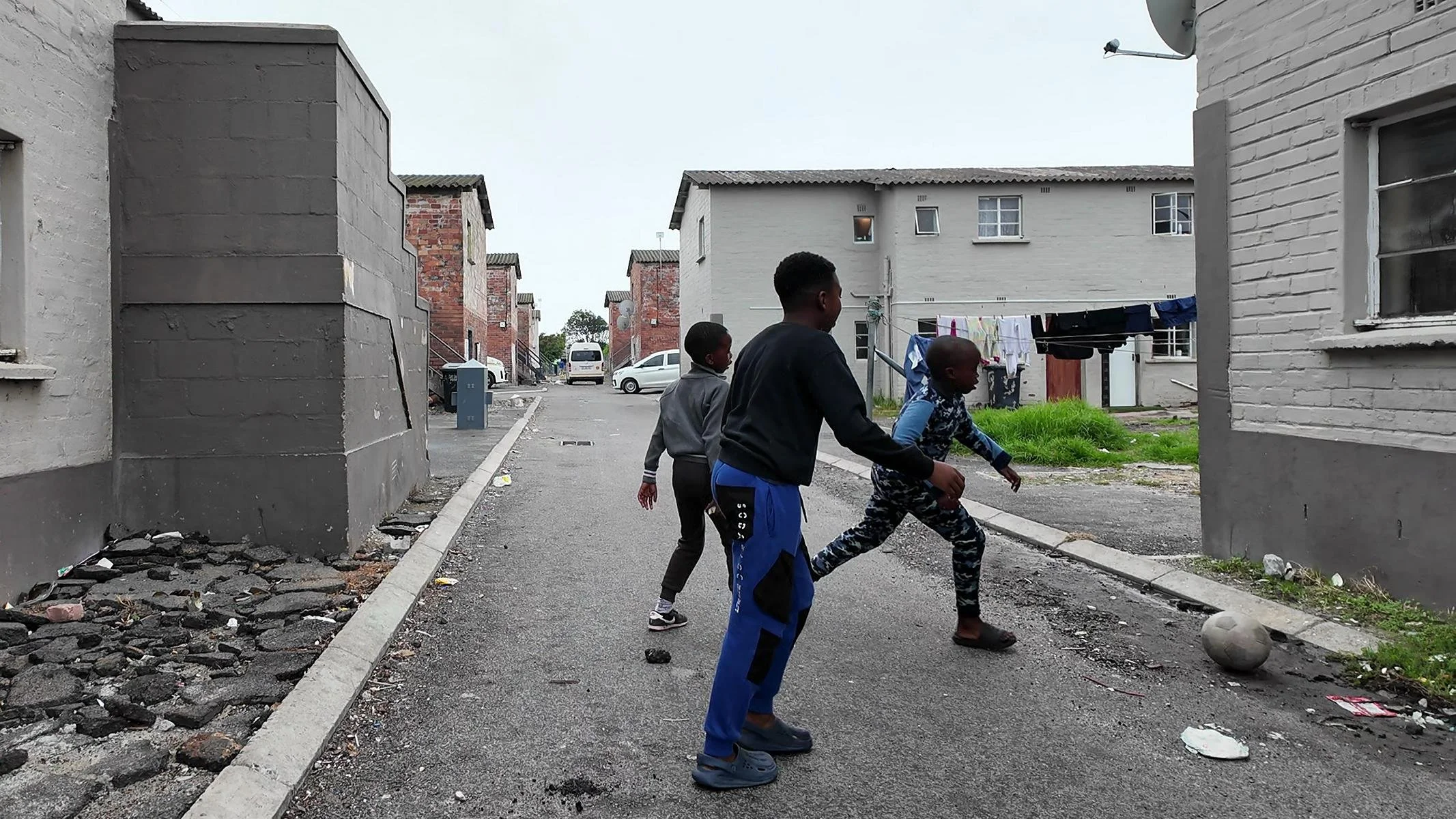
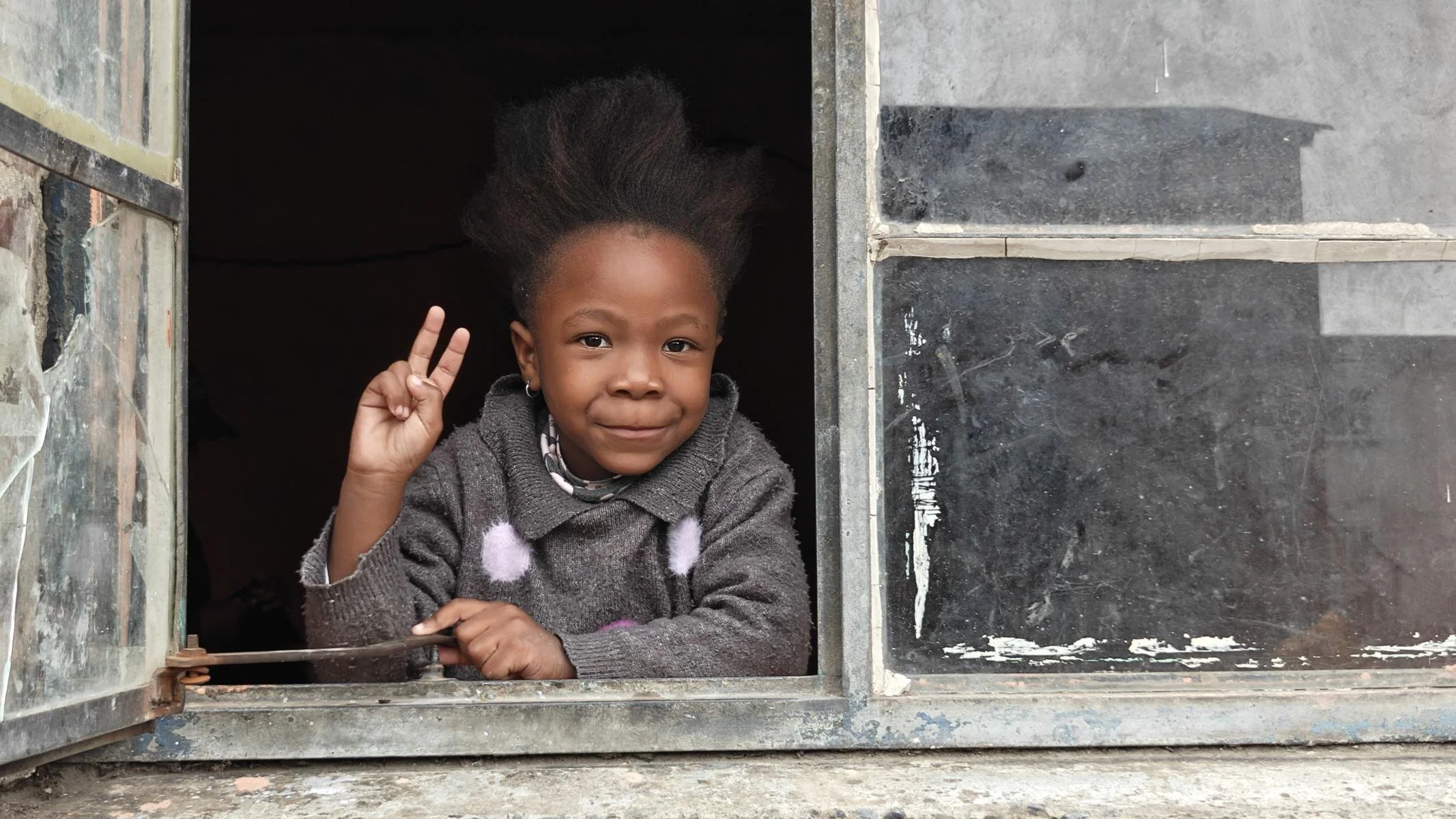
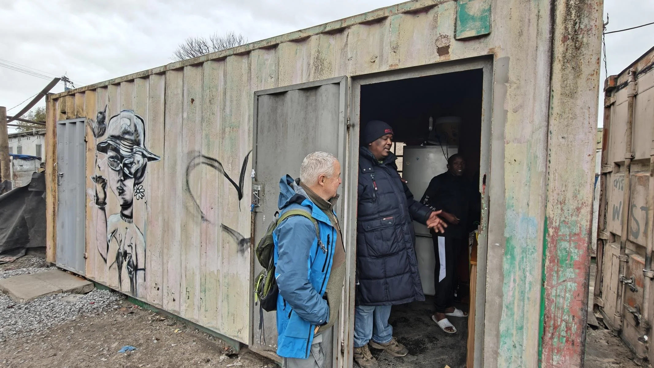
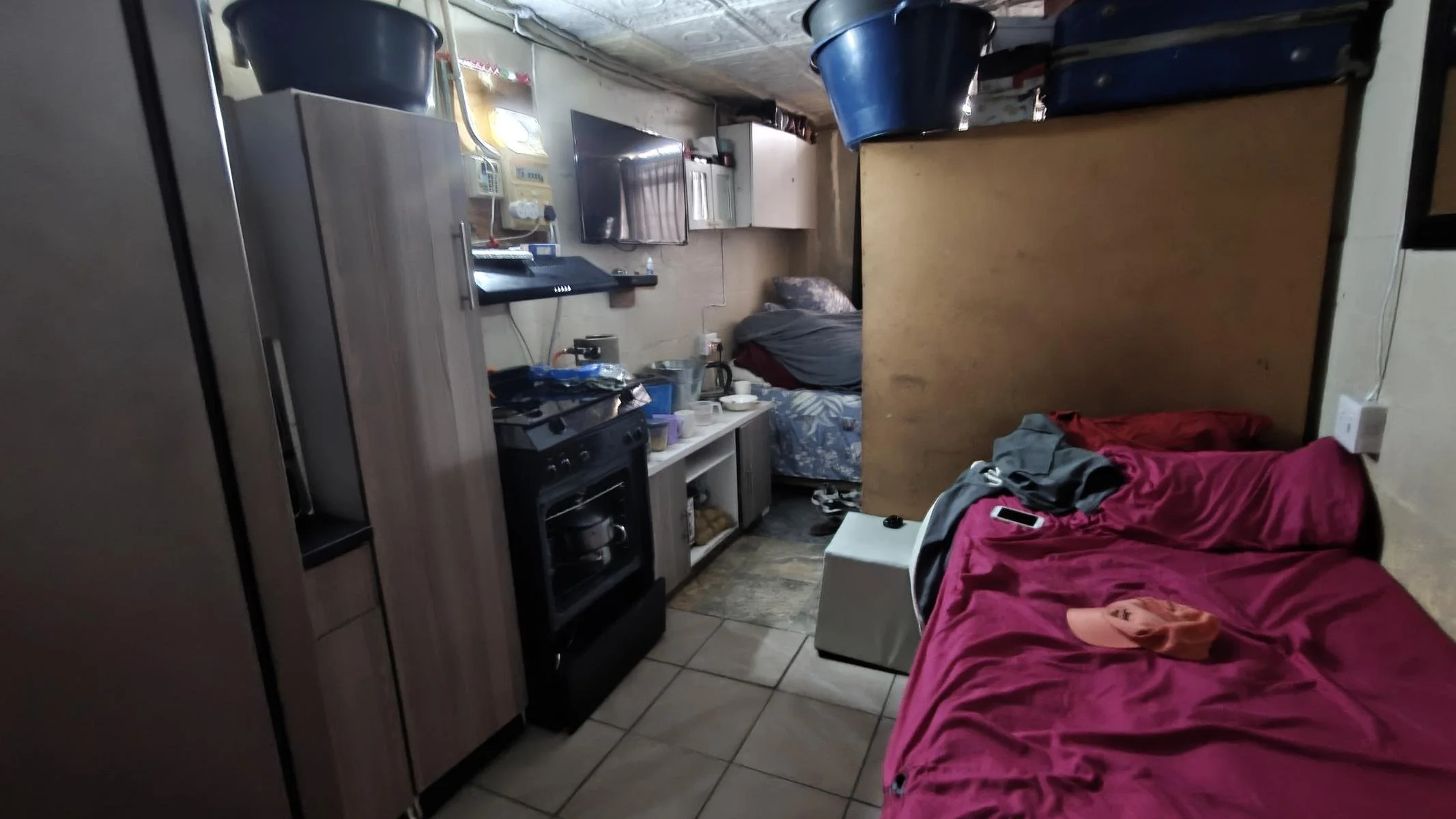
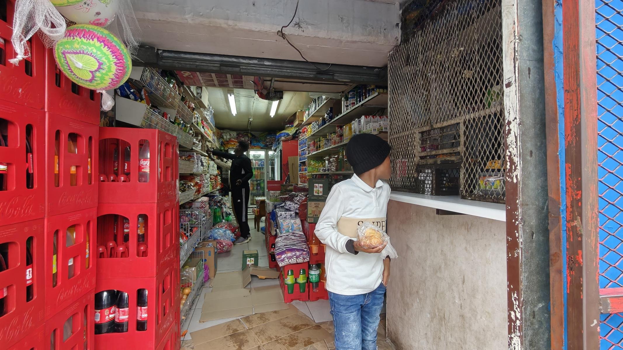
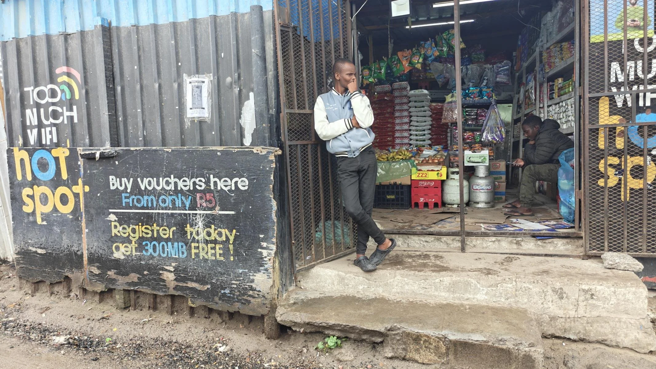
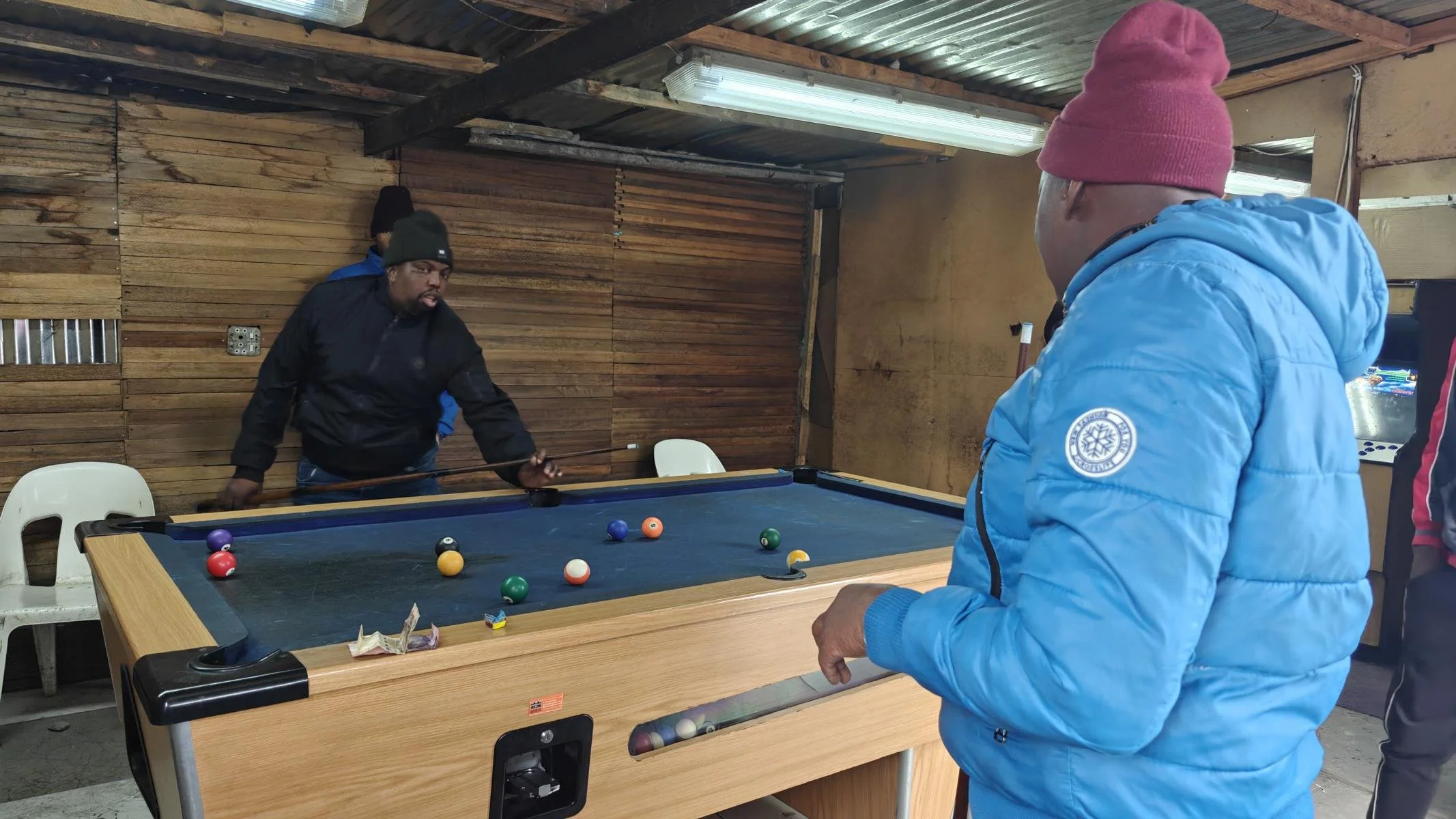
In Cape Town, I visited the Langa township (approx. 100,000 residents). My guide (it’s best not to go into such a settlement without a guide) explained to me that Langa has existed for several decades and that up to 12 people live together in a single dwelling—whether in houses, shipping containers, or corrugated iron shacks. Often, three people sleep in one bed. Shared toilets and bathrooms are the norm
Südafrikas soziale Problem werden am deutlichsten sichtbar anhand der Wohnungsnot. Berichten zufolge leben 13 % der Bevölkerung in Slums. Besonders betroffen sind die großen Städte Johannesburg und Kapstadt. Während die Regierung seit 1994 ca. 5 Millionen Wohneinheiten geschaffen hat, leben immer noch 2,5 Millionen Haushalte in Wellblechhütten.
Ich besuchte in Kapstadt das Township Langa (ca 100.000 Einwohnern). Mein Guide (ohne Guide sollte man besser nicht in so eine Siedlung gehen) erklärte mir, dass Langa schon seit mehreren Jahrzehnten besteht und in den Häusern, Containern bzw. Wellblech-Hütten bis zu 12 Personen emeinsam in einer Wohneinheit leben. Oft schlafen drei Menschen in einem Bett. Gemeinschafts-Toiletten / -Bäder sind die Regel.
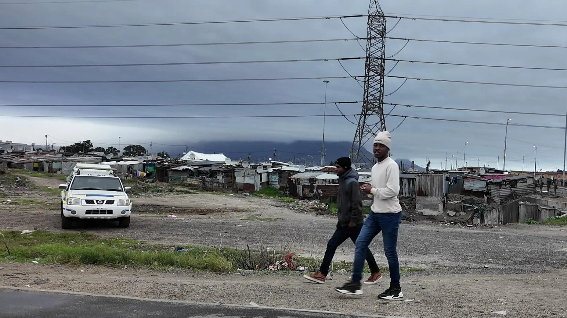
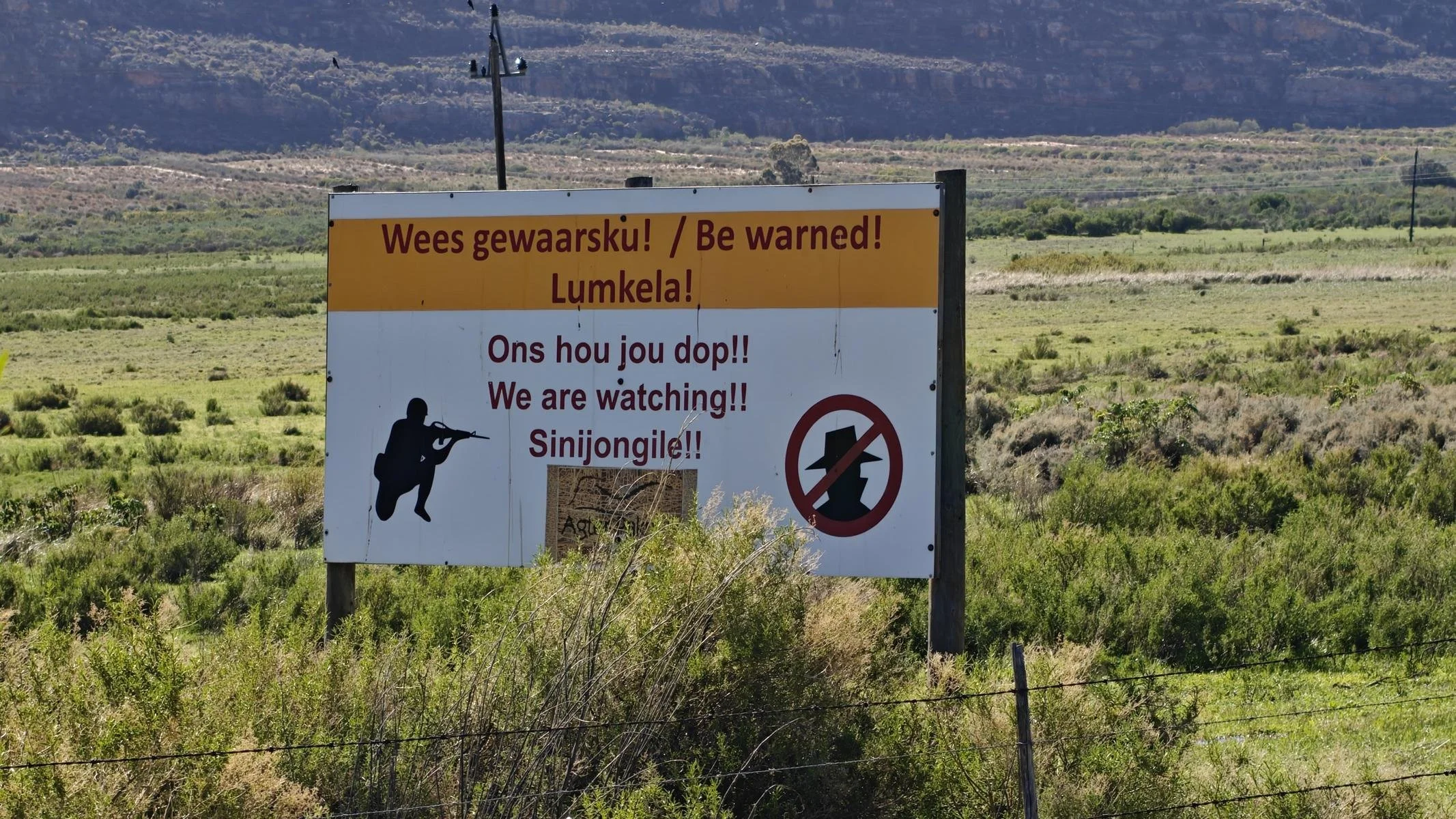
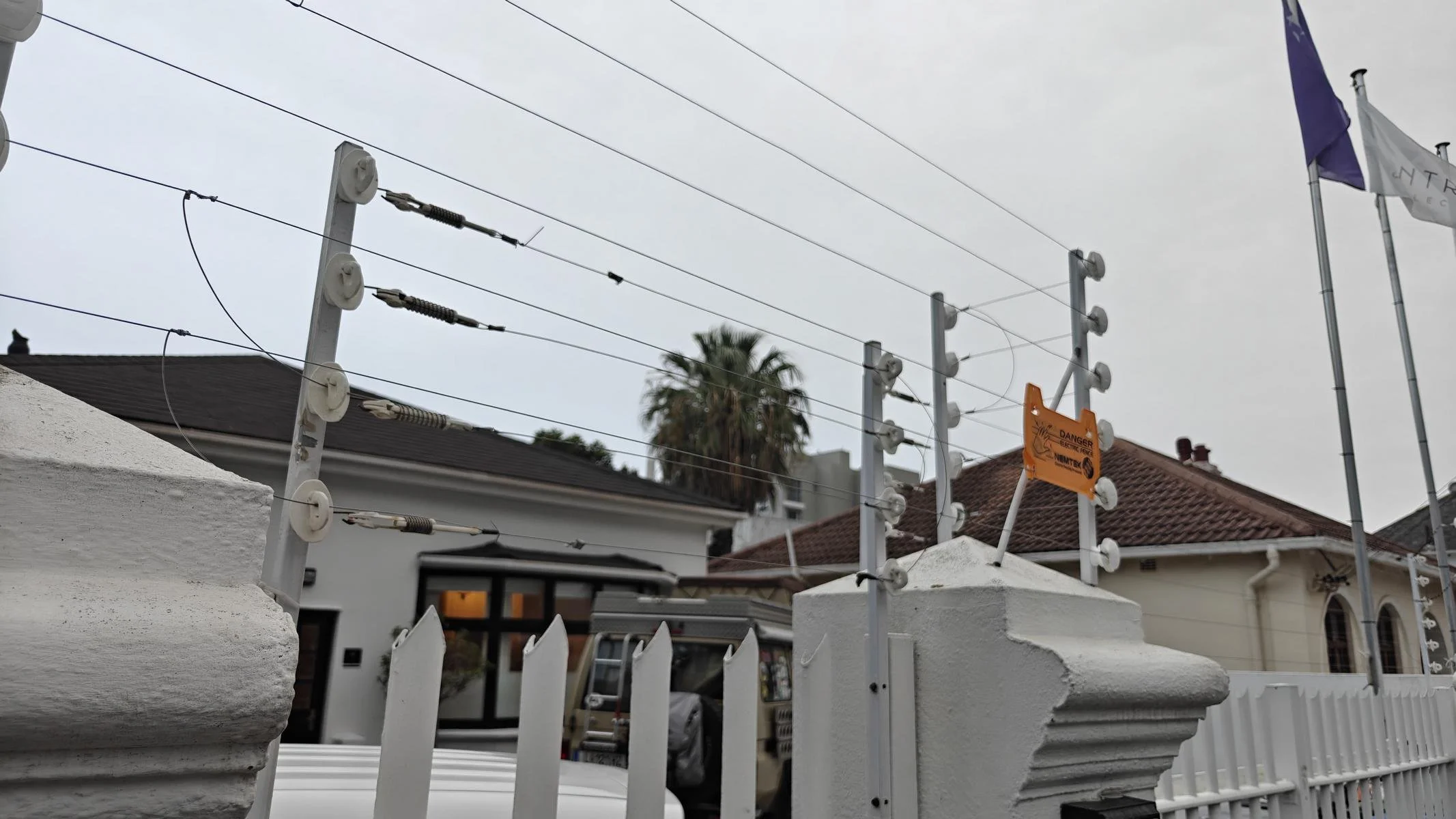
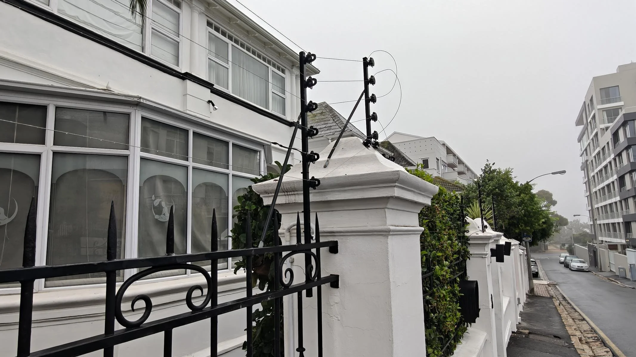
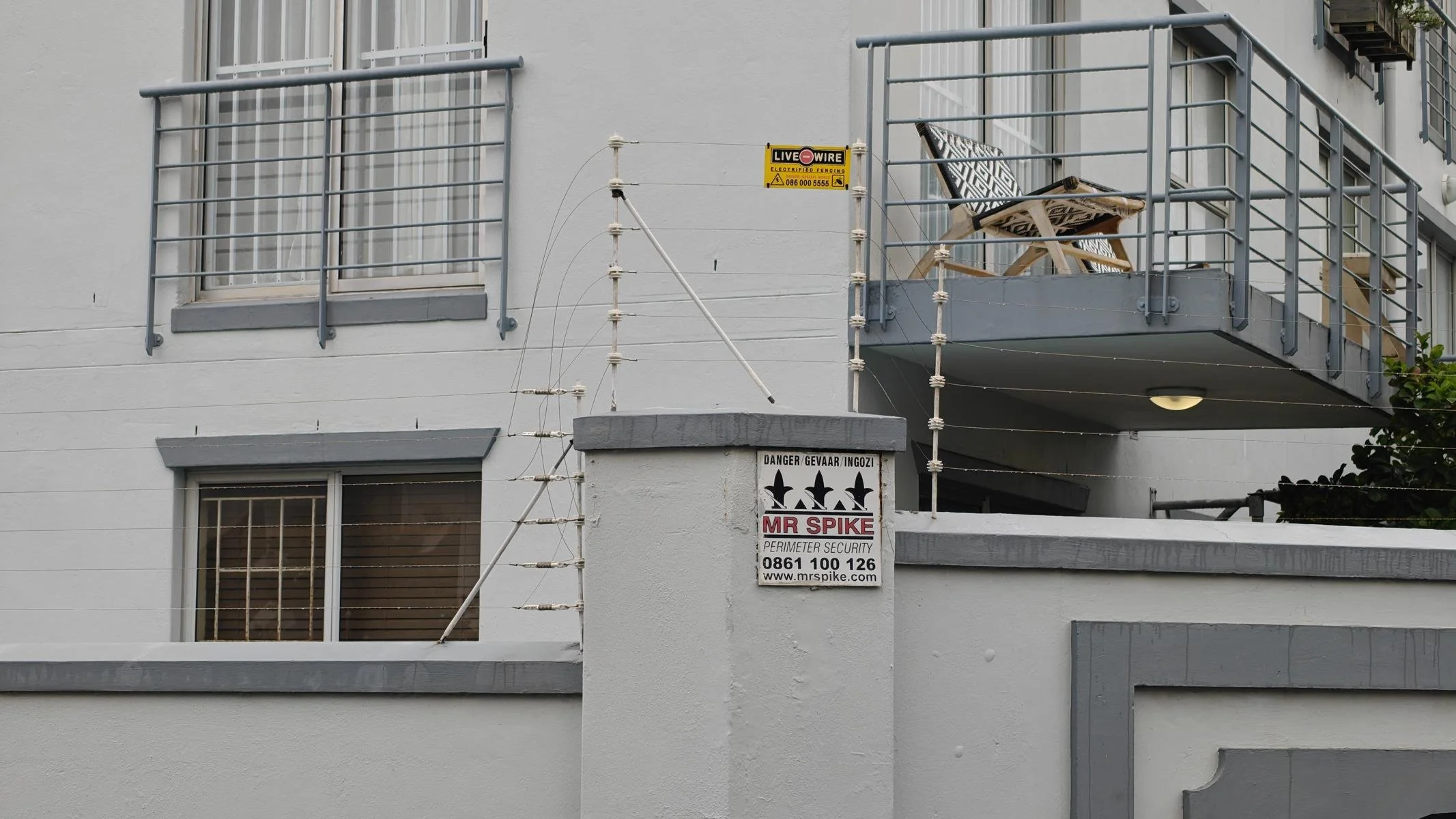
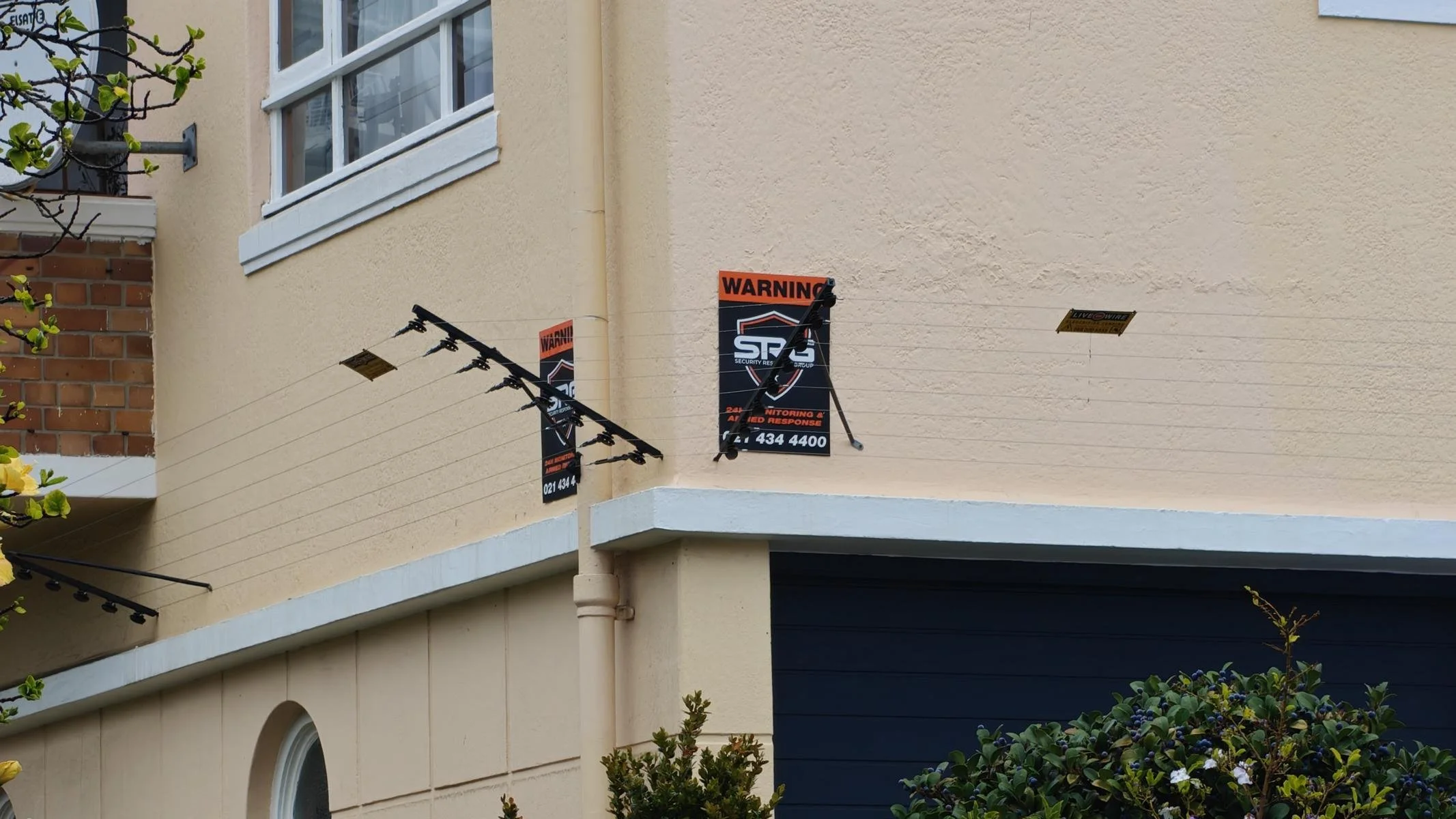
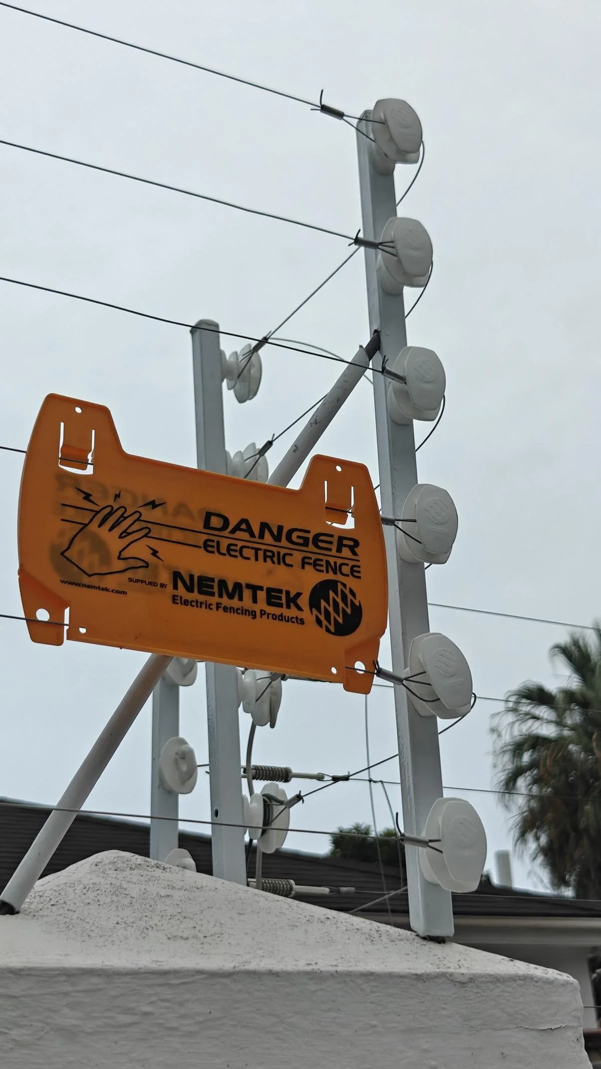
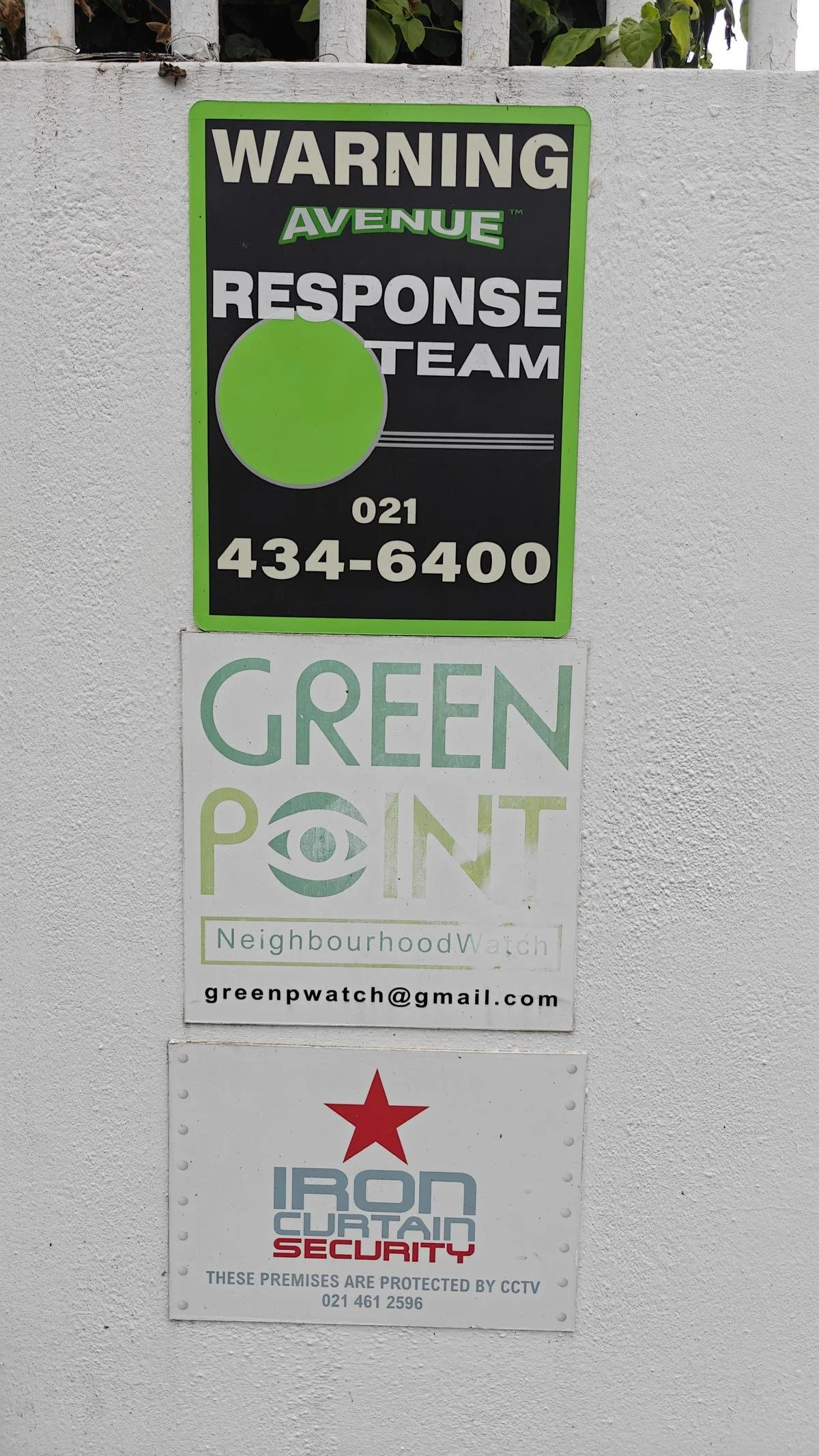
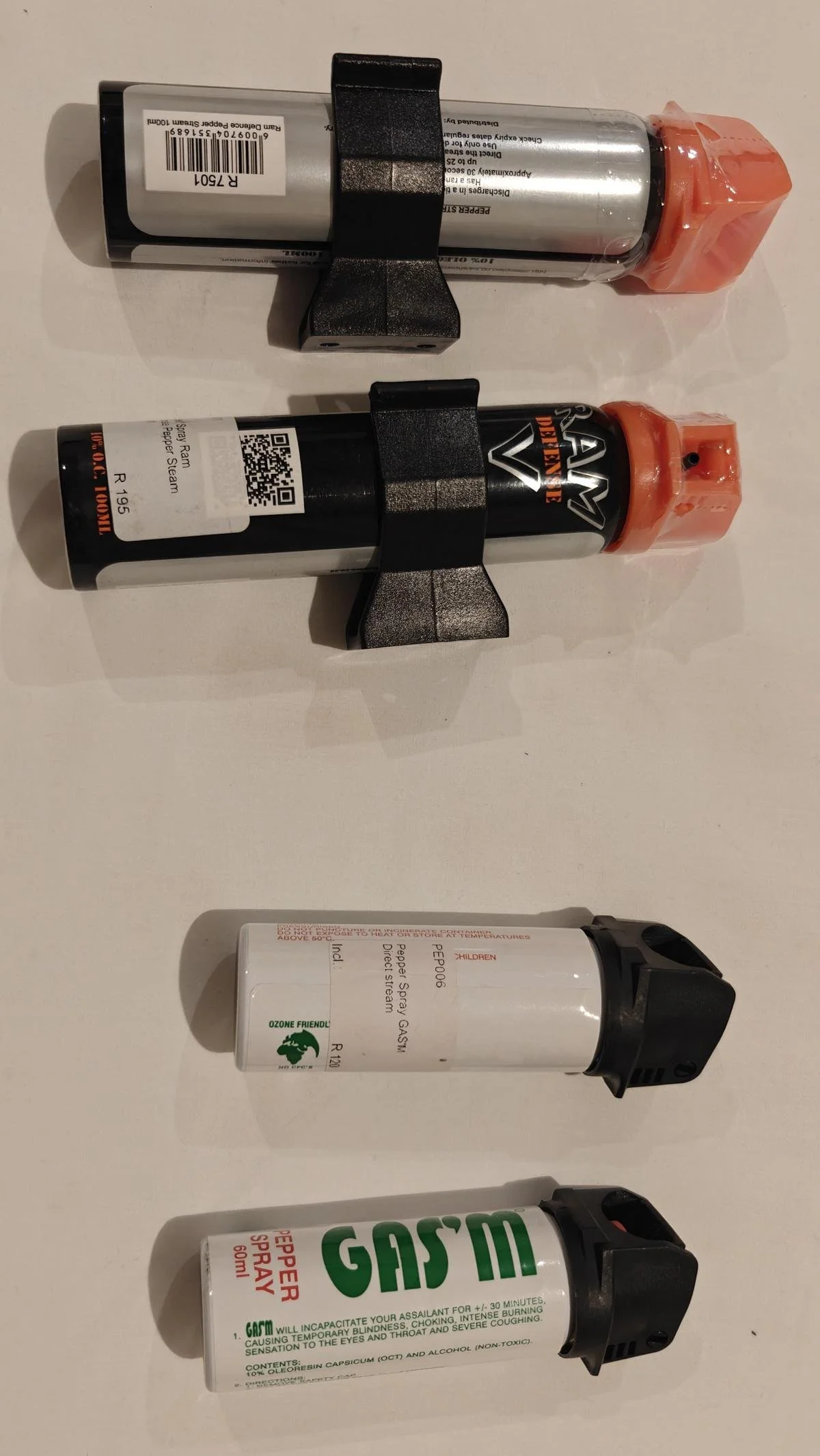
Unemployment in South Africa is alarmingly high. In the first quarter of 2026, the official unemployment rate stood at 32.6%, and among young people it is as high as 60%. Given the resulting social problems, it is not surprising that the crime rate is very high. Most middle-class homes are secured with electric fences and are regularly patrolled by private security guards. Ursula and I have also stocked up on pepper spray.
Die Arbeitslosigkeit in Südafrika ist dramatisch. Sie betrug im ersten Quartal 2026 offiziell 32,6 %, unter Jugendlichen liegt sie sogar bei 60 %. Angesichts der daraus resultierenden sozialen Probleme ist es nicht verwunderlich, dass die Kriminalitätsrate sehr hoch ist. Die meisten Mittelschichtshäuser sind mit elektrischen Zäunen gesichert und werden regelmäßig von privaten Wachdiensten patrouilliert. Wir haben uns ebenfalls mit Pfeffersprays eingedeckt.
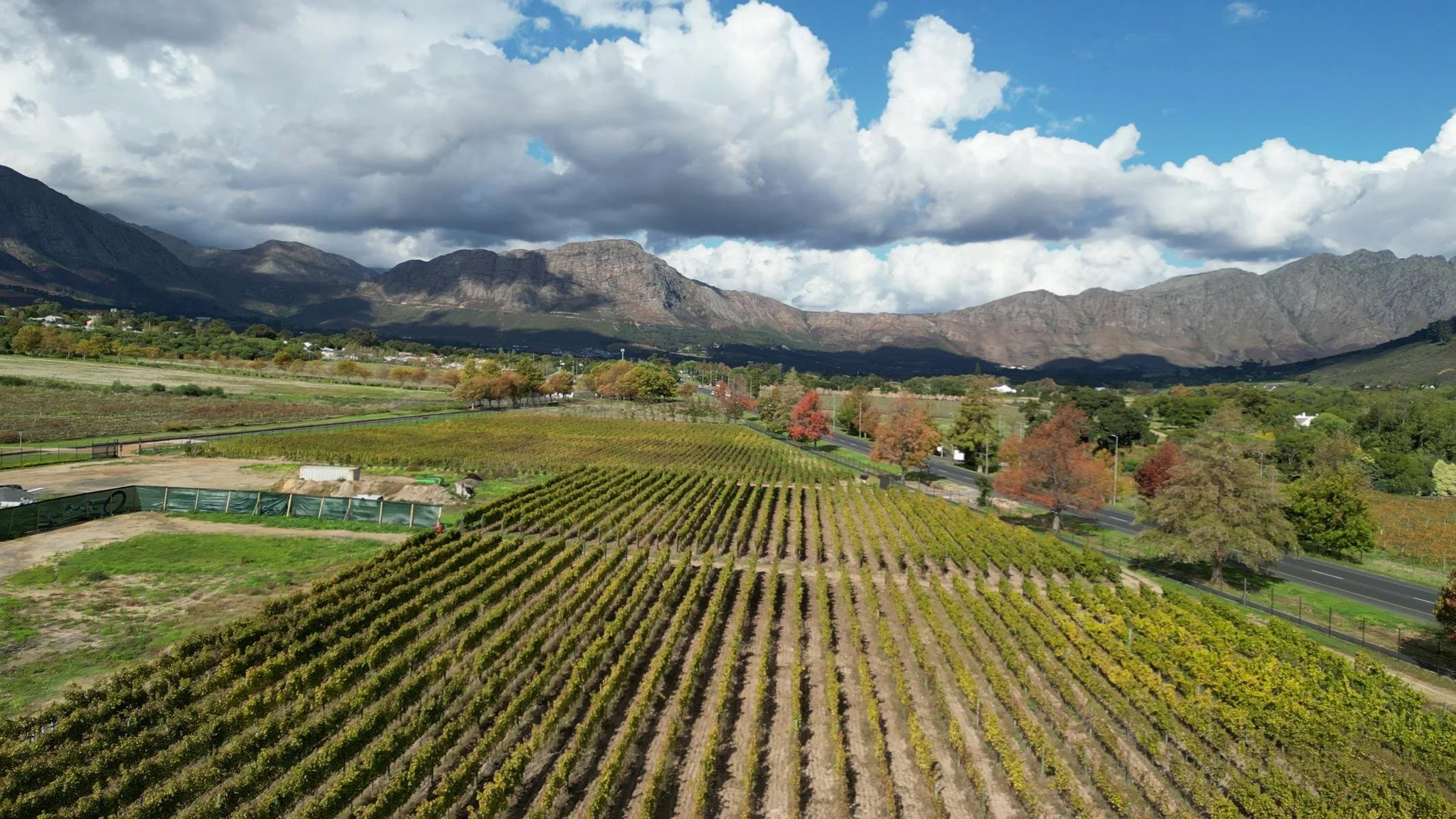
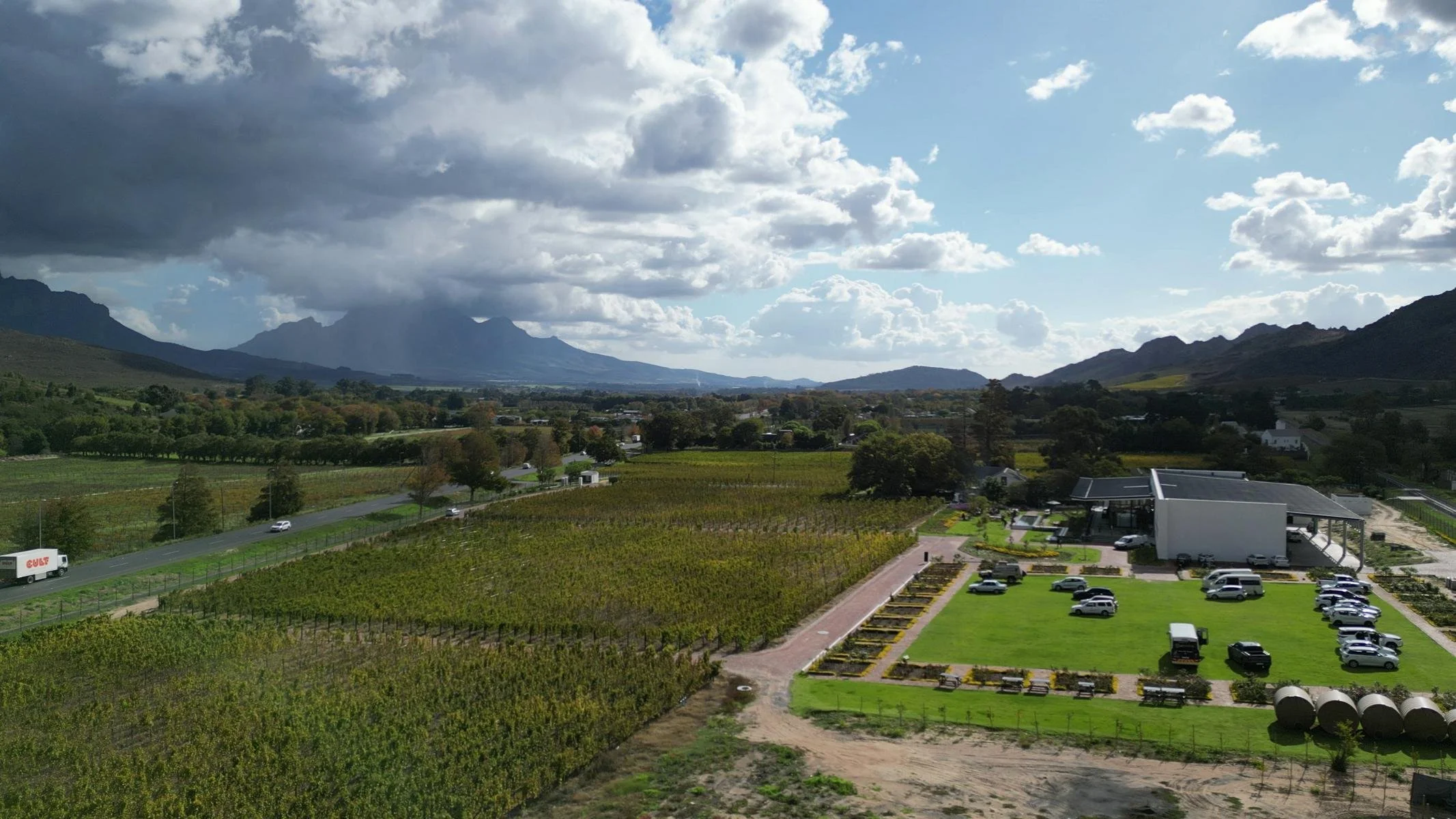
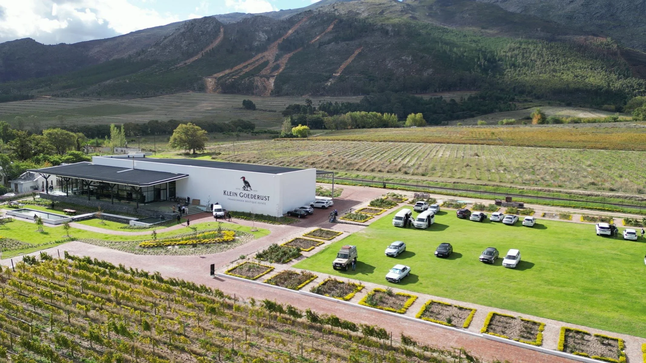
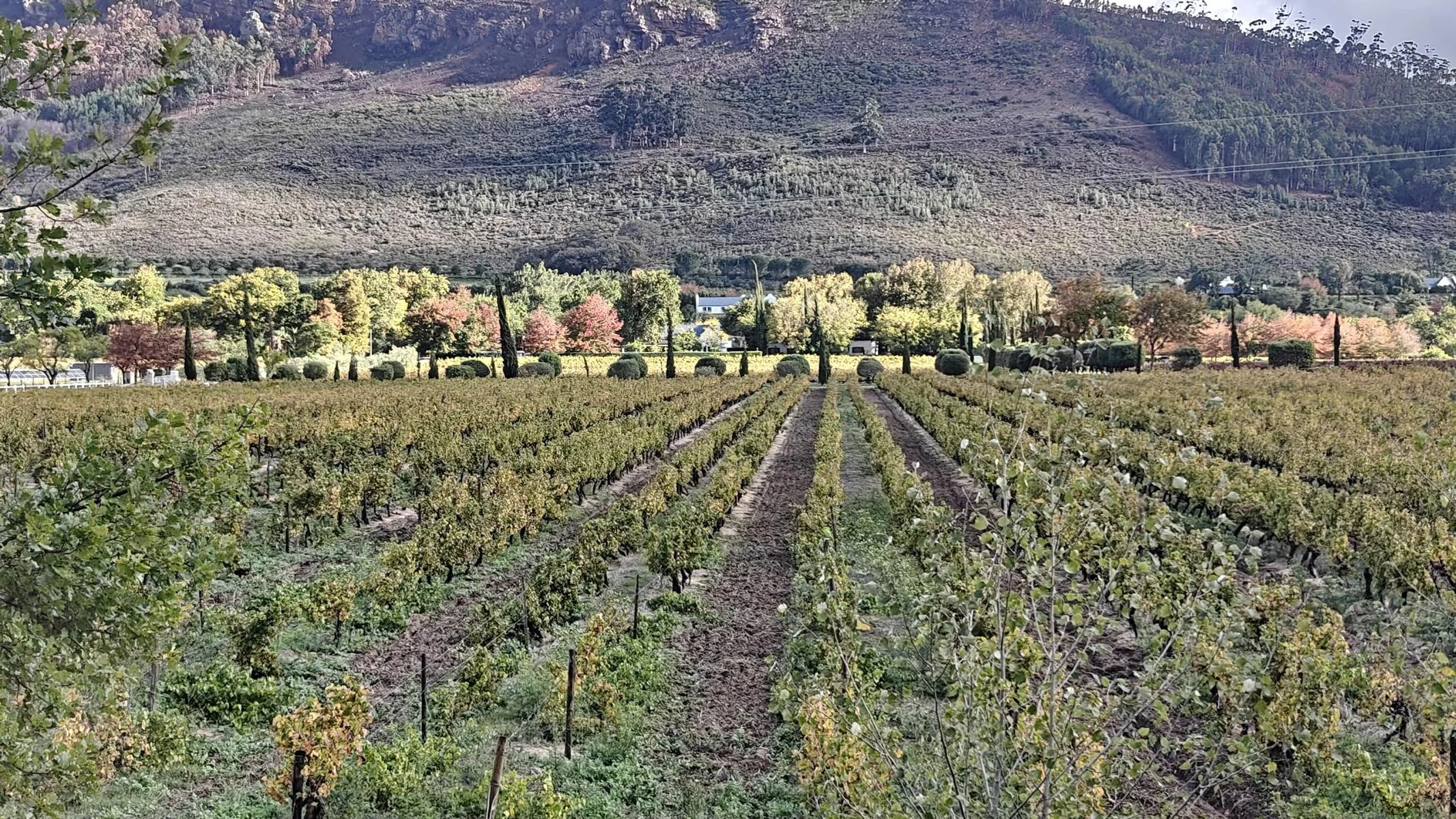
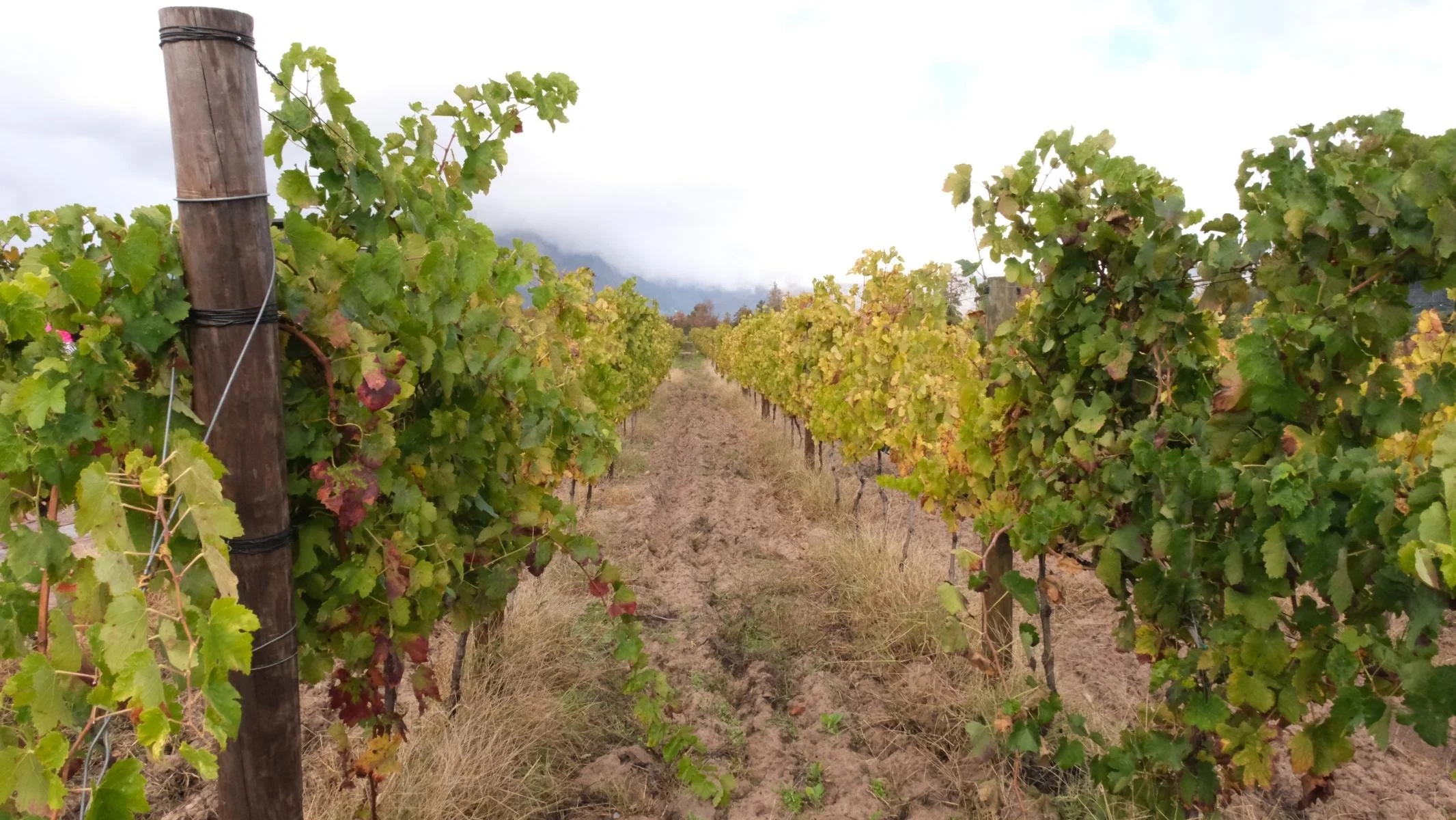
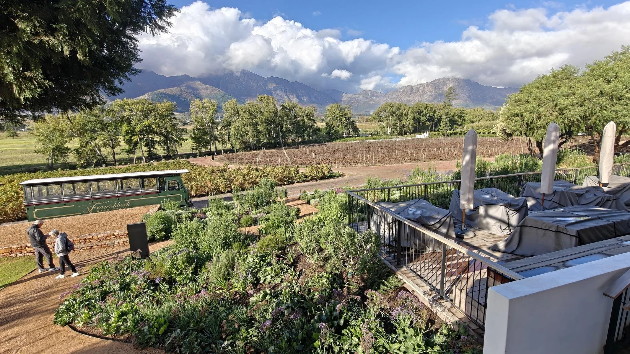
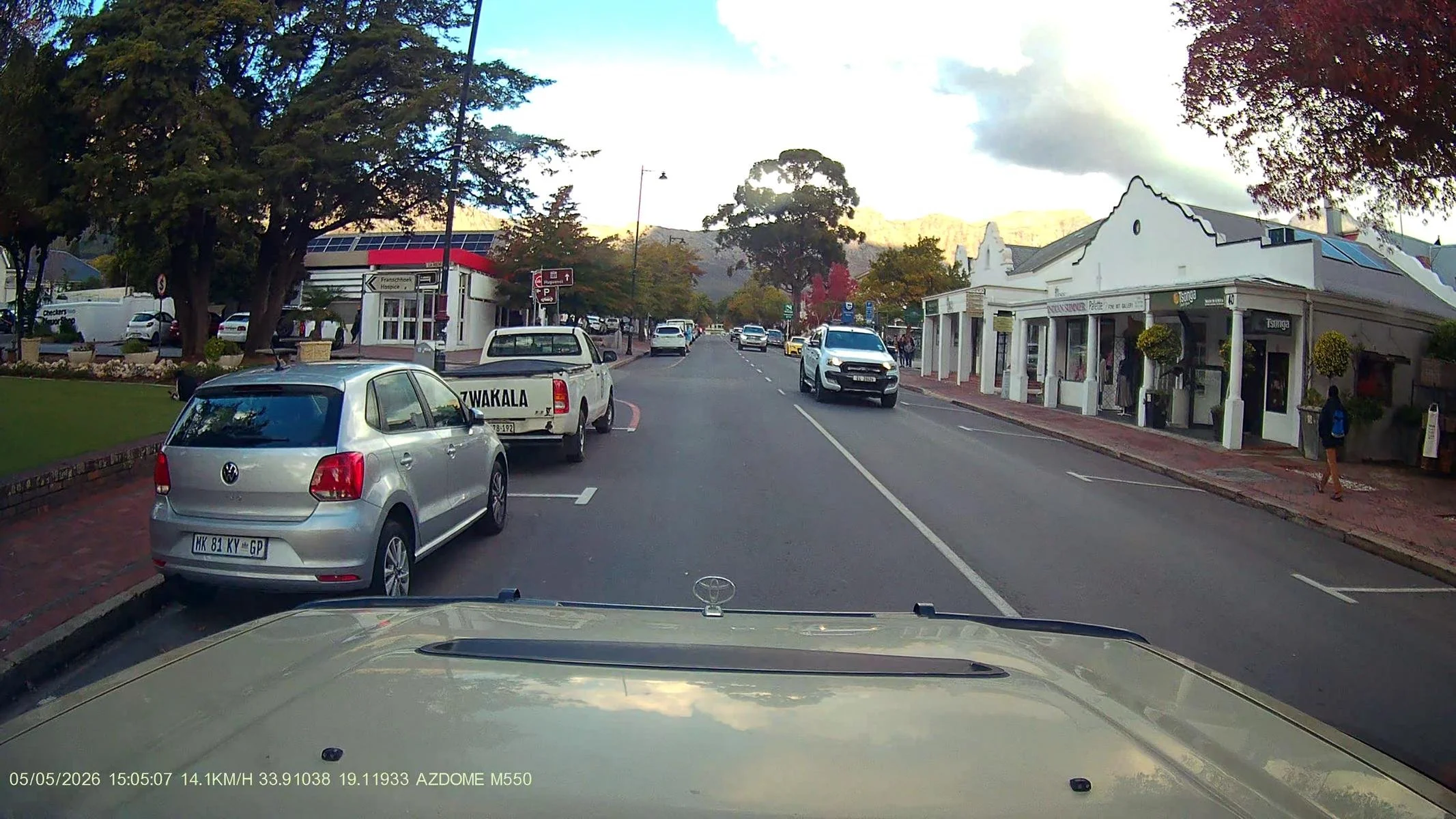
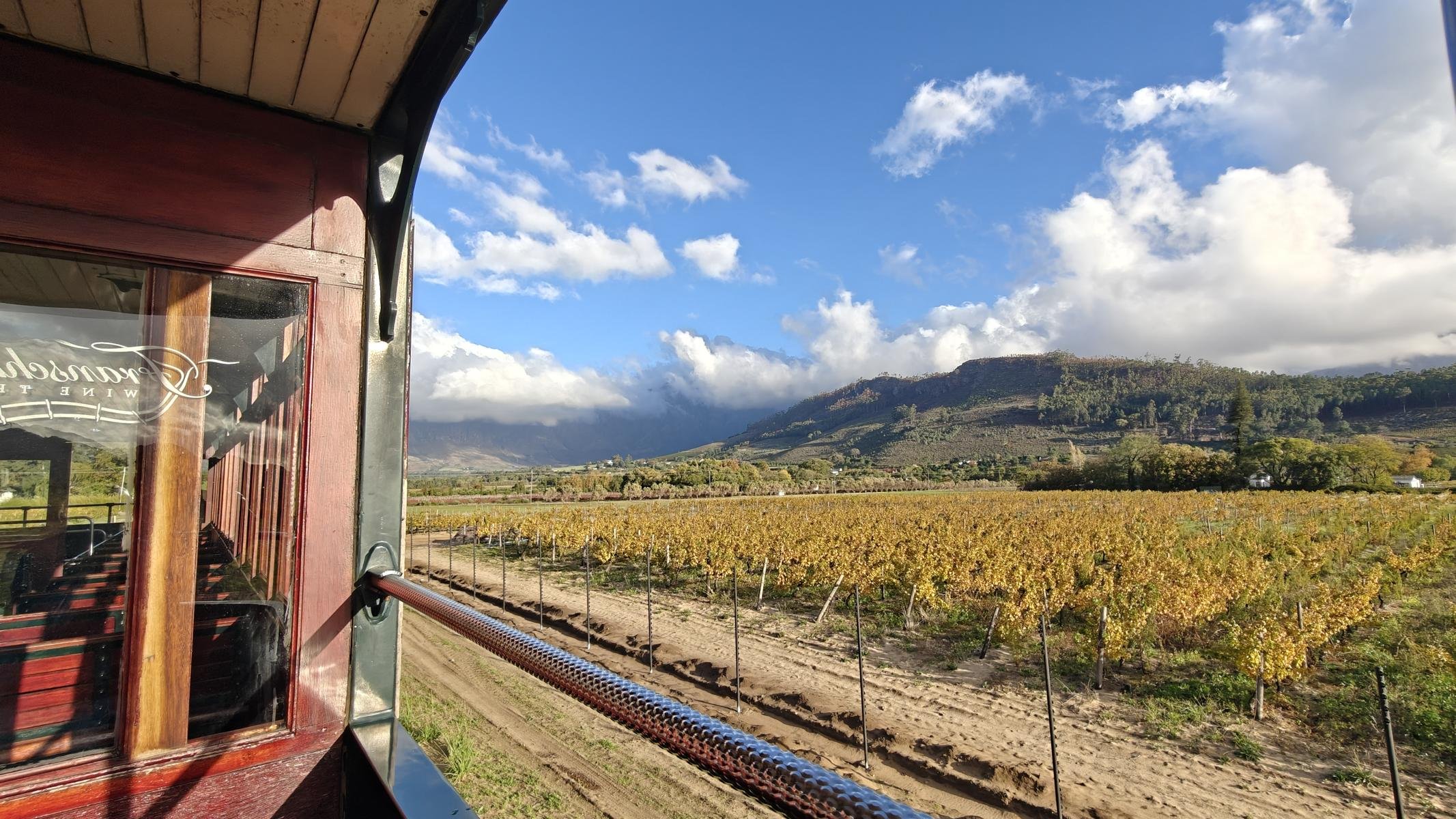
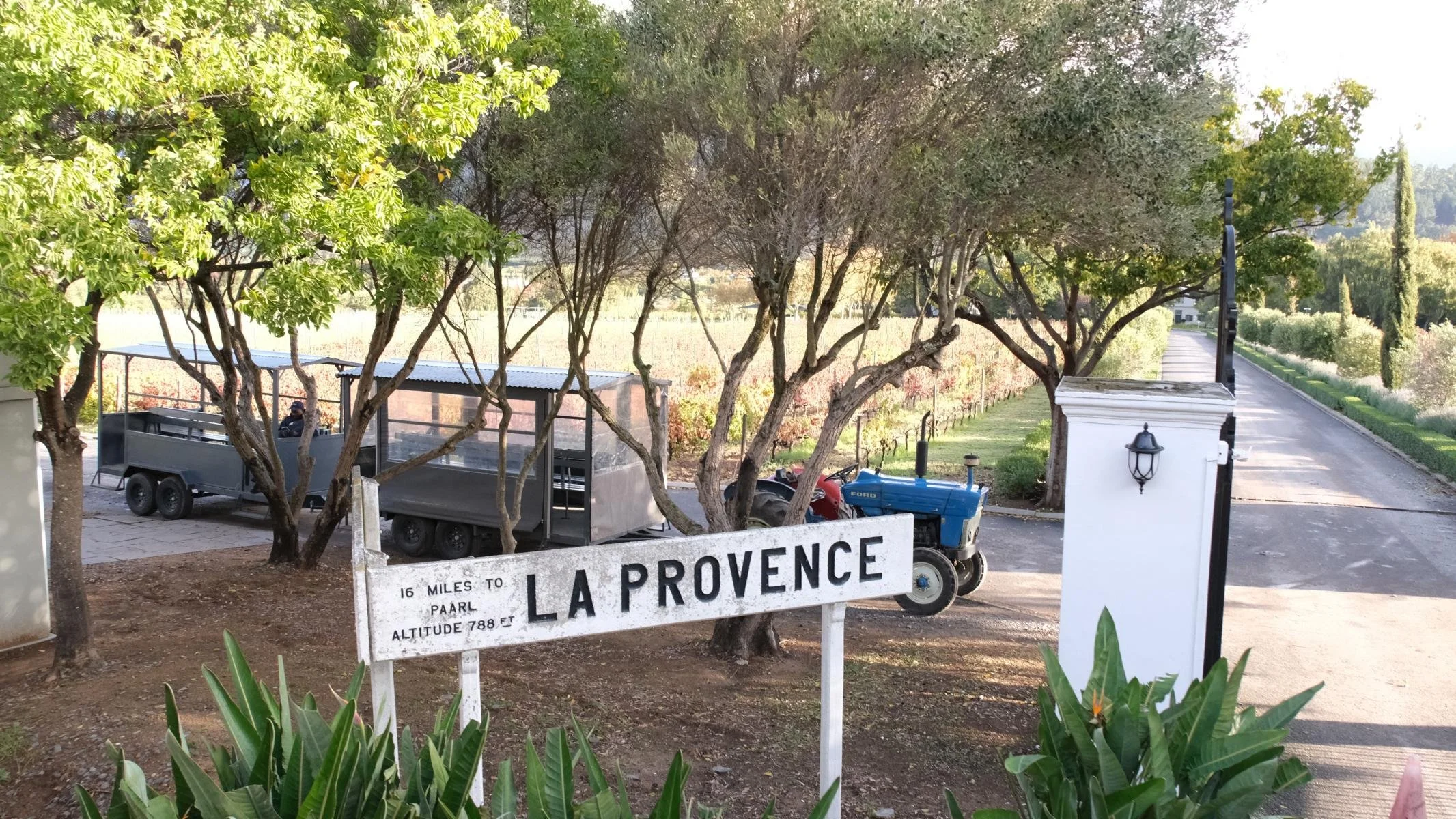
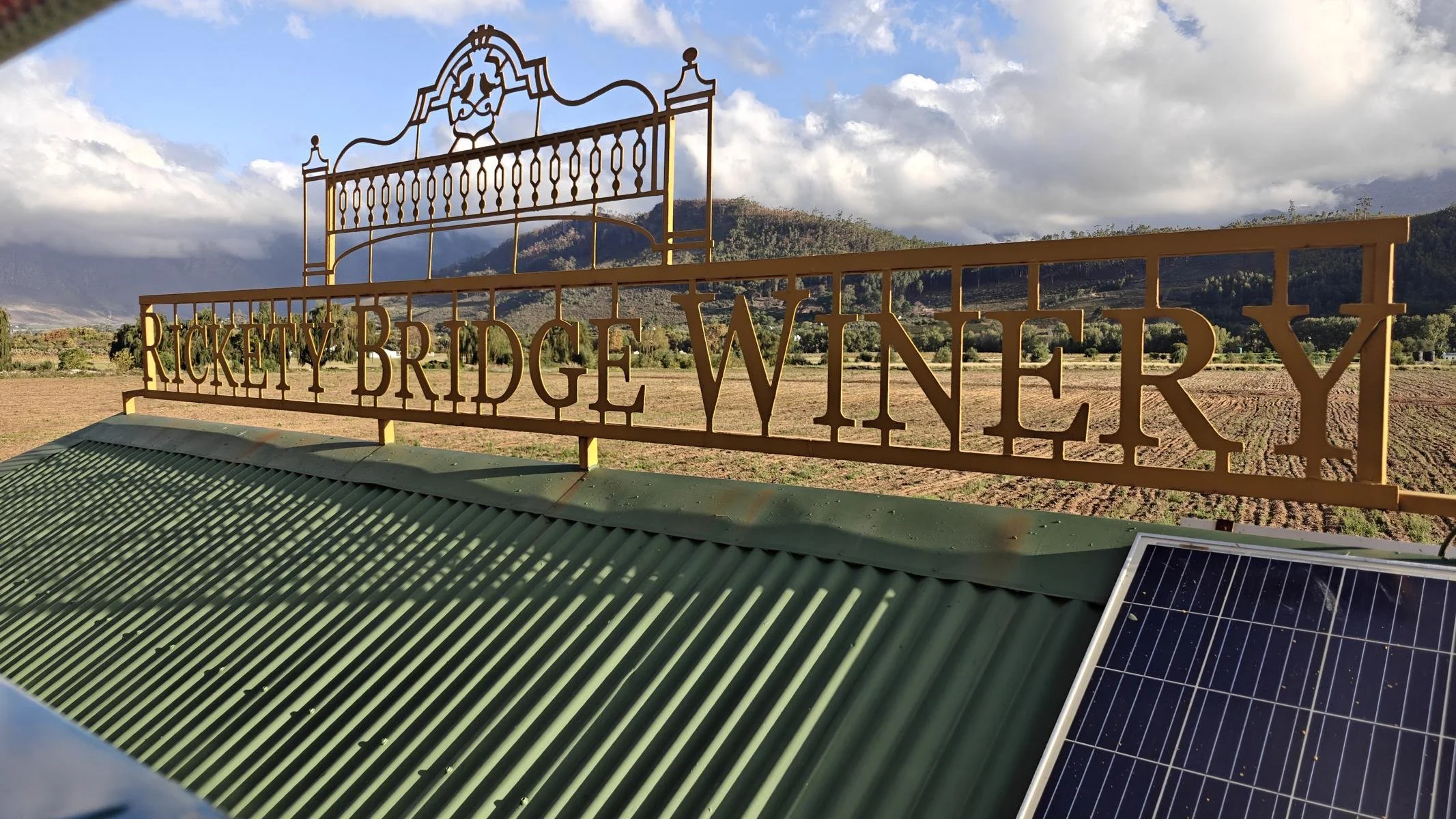
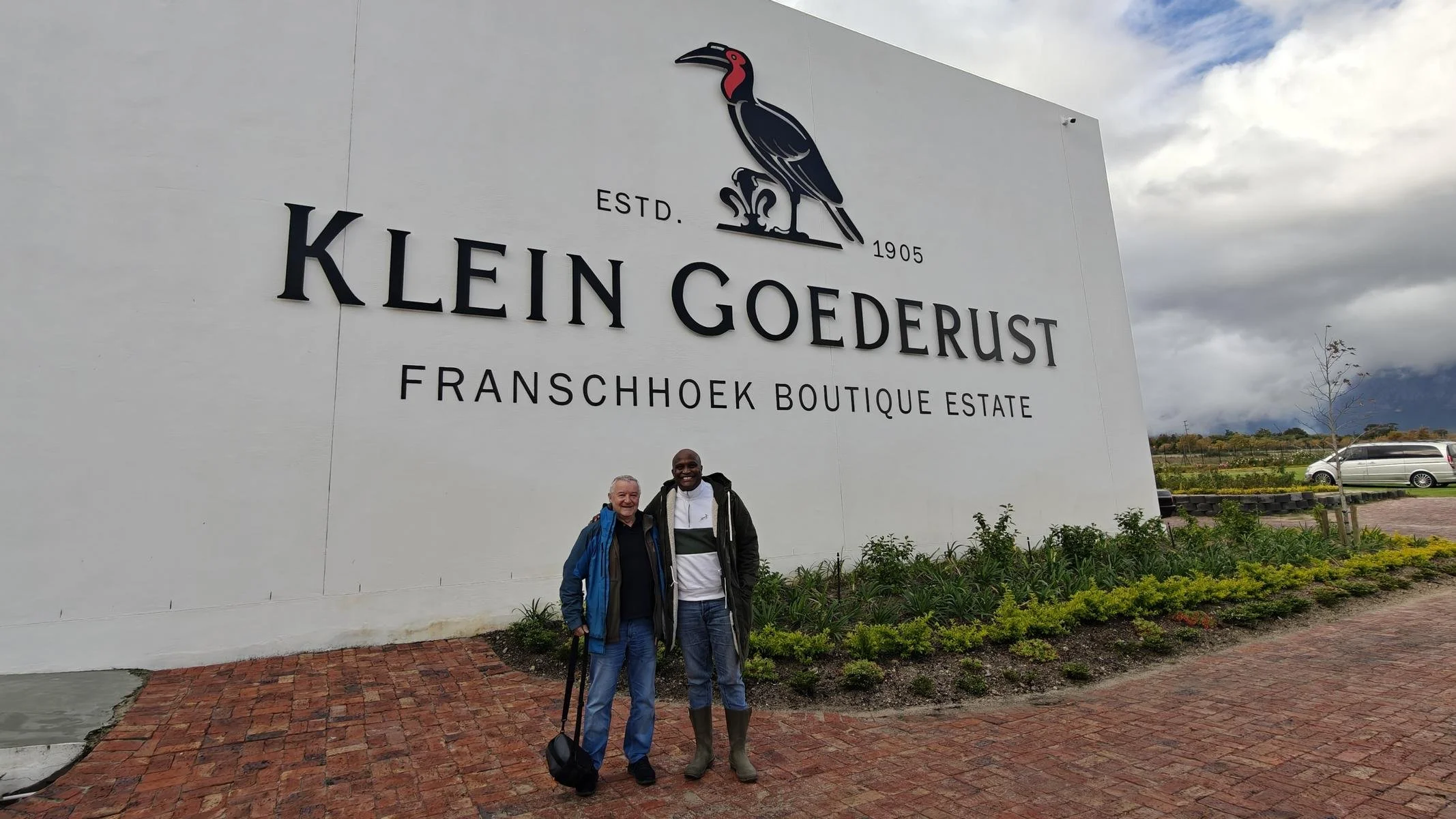
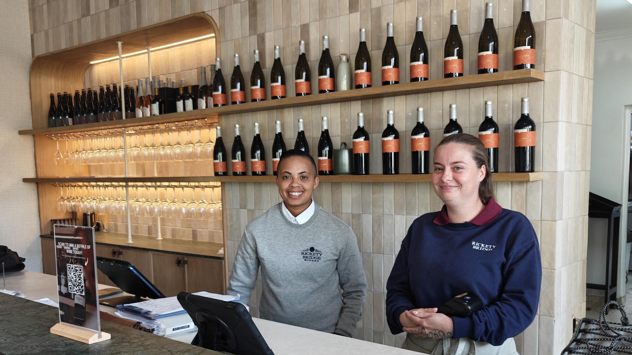
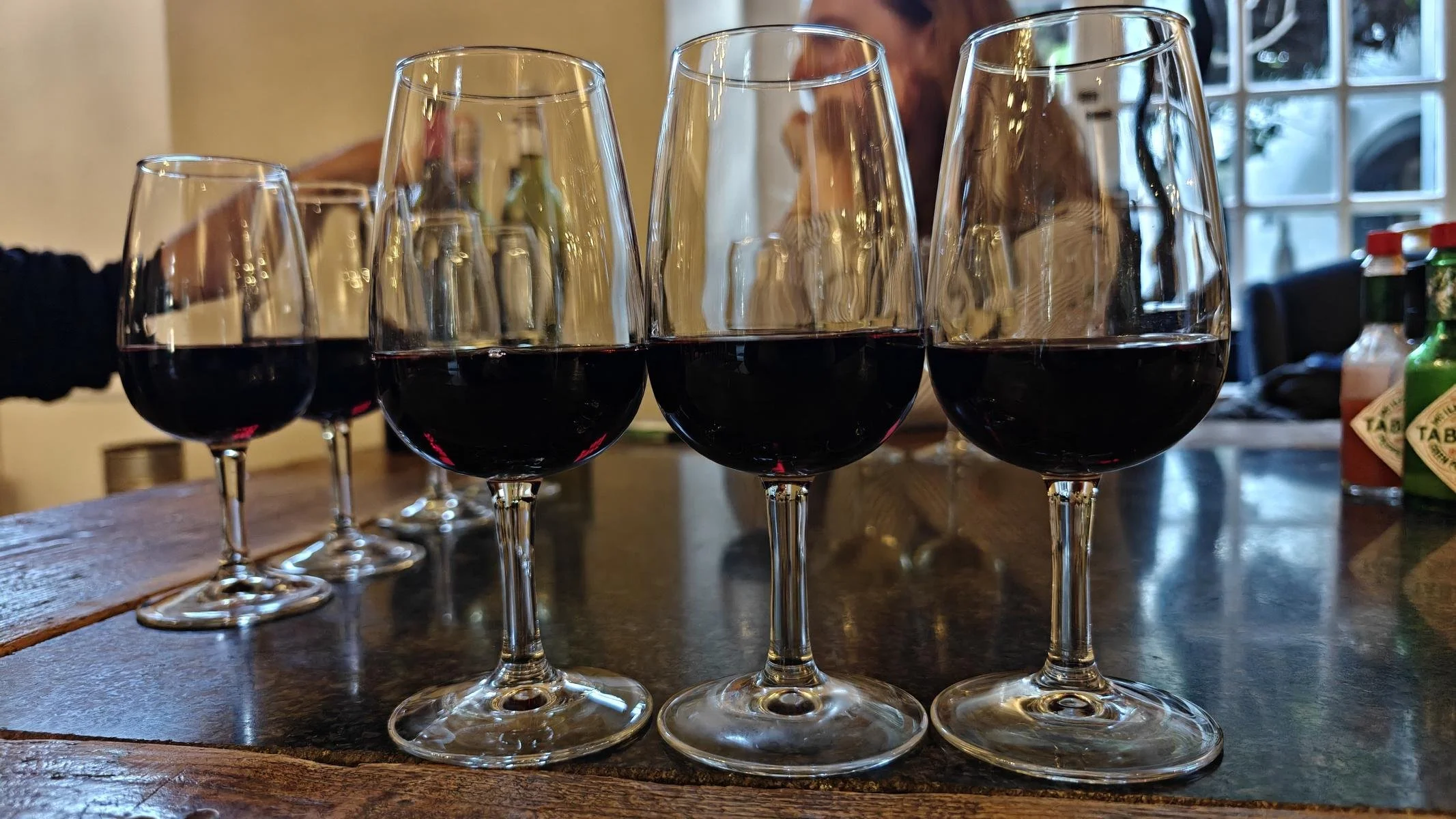
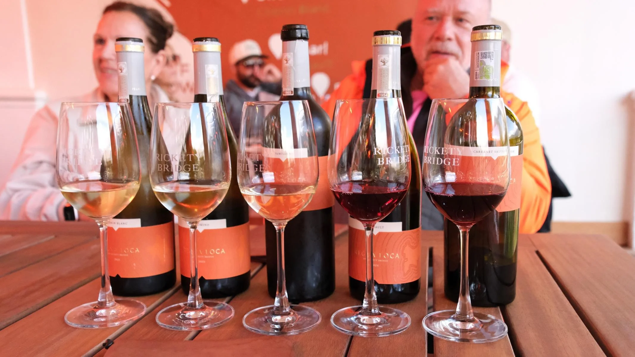
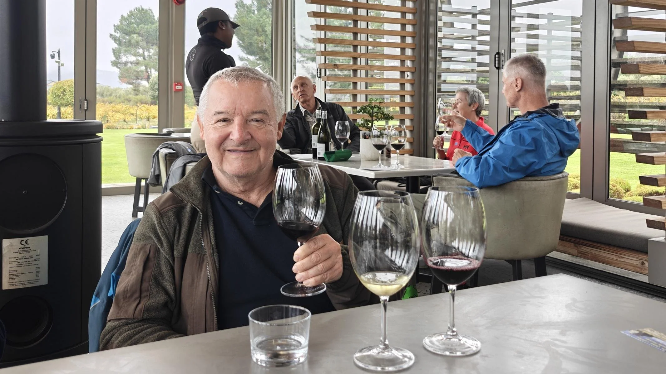
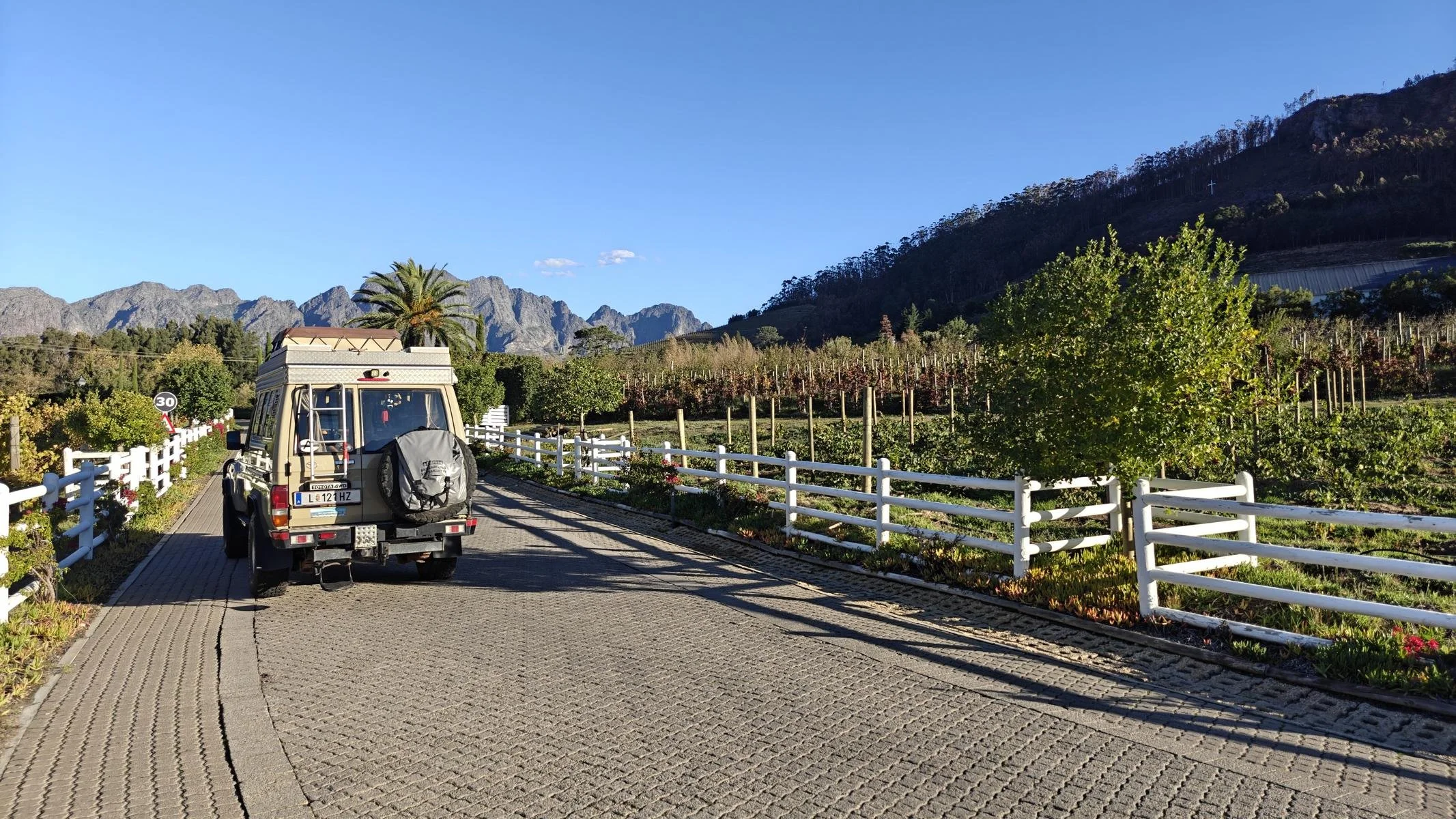
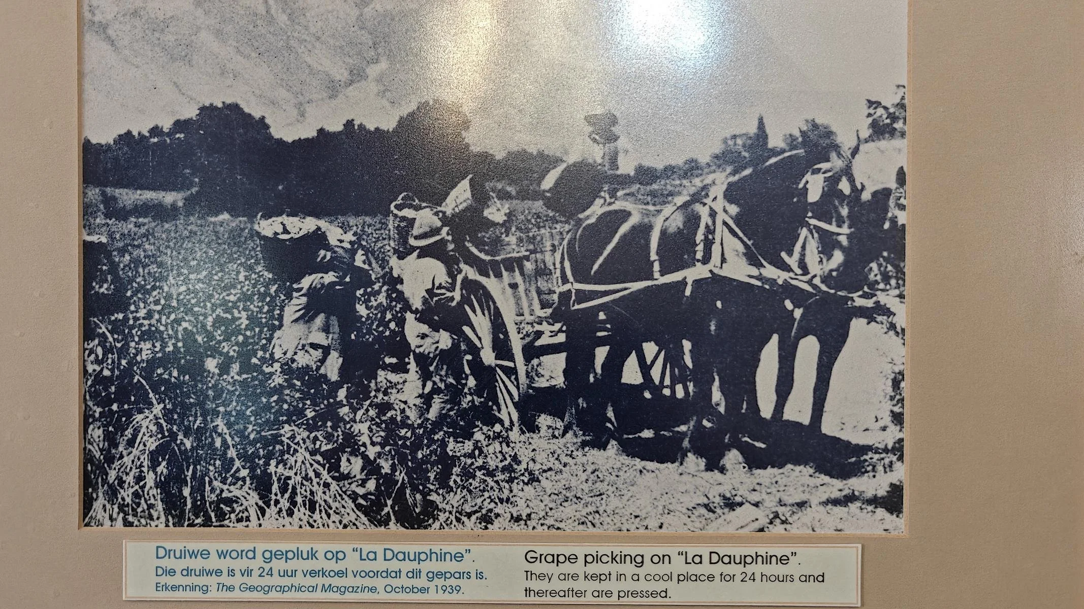
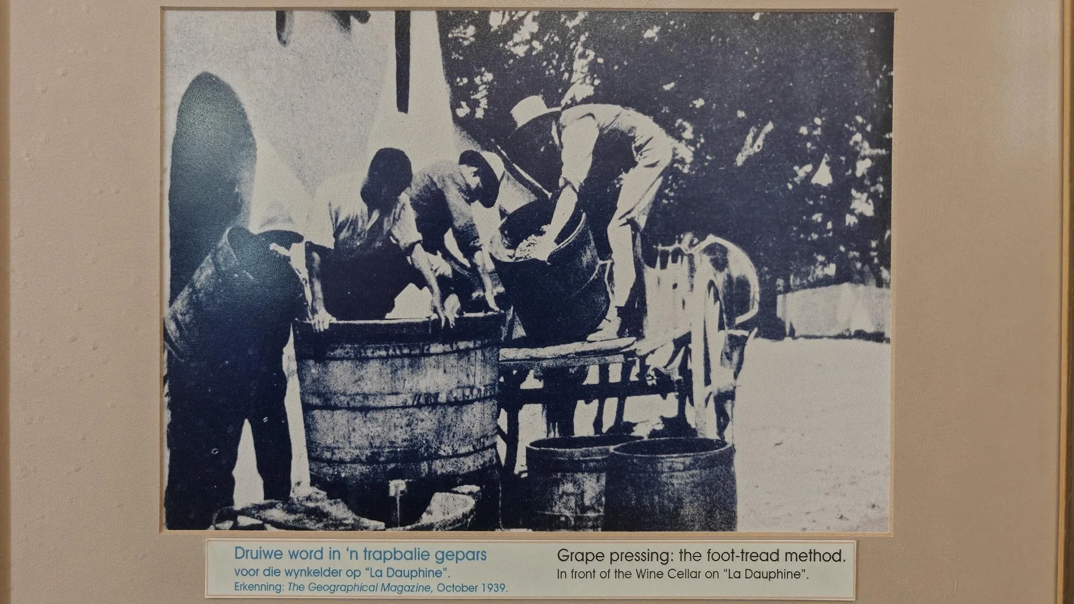
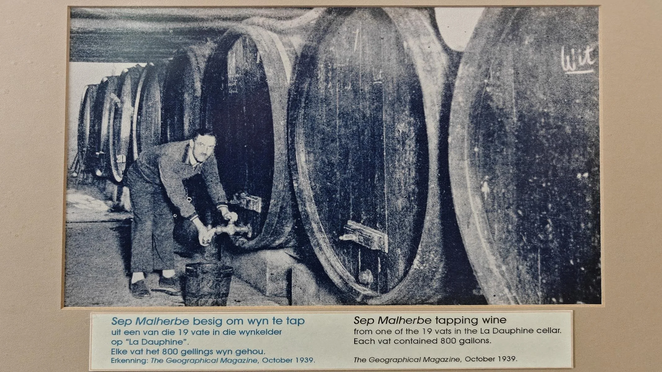
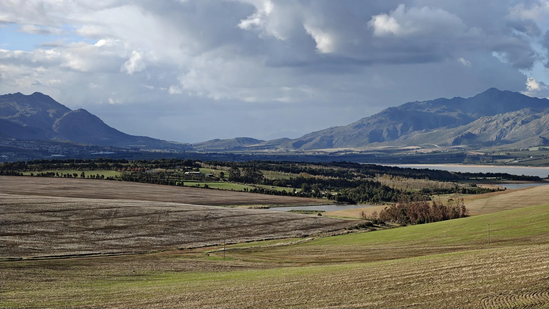
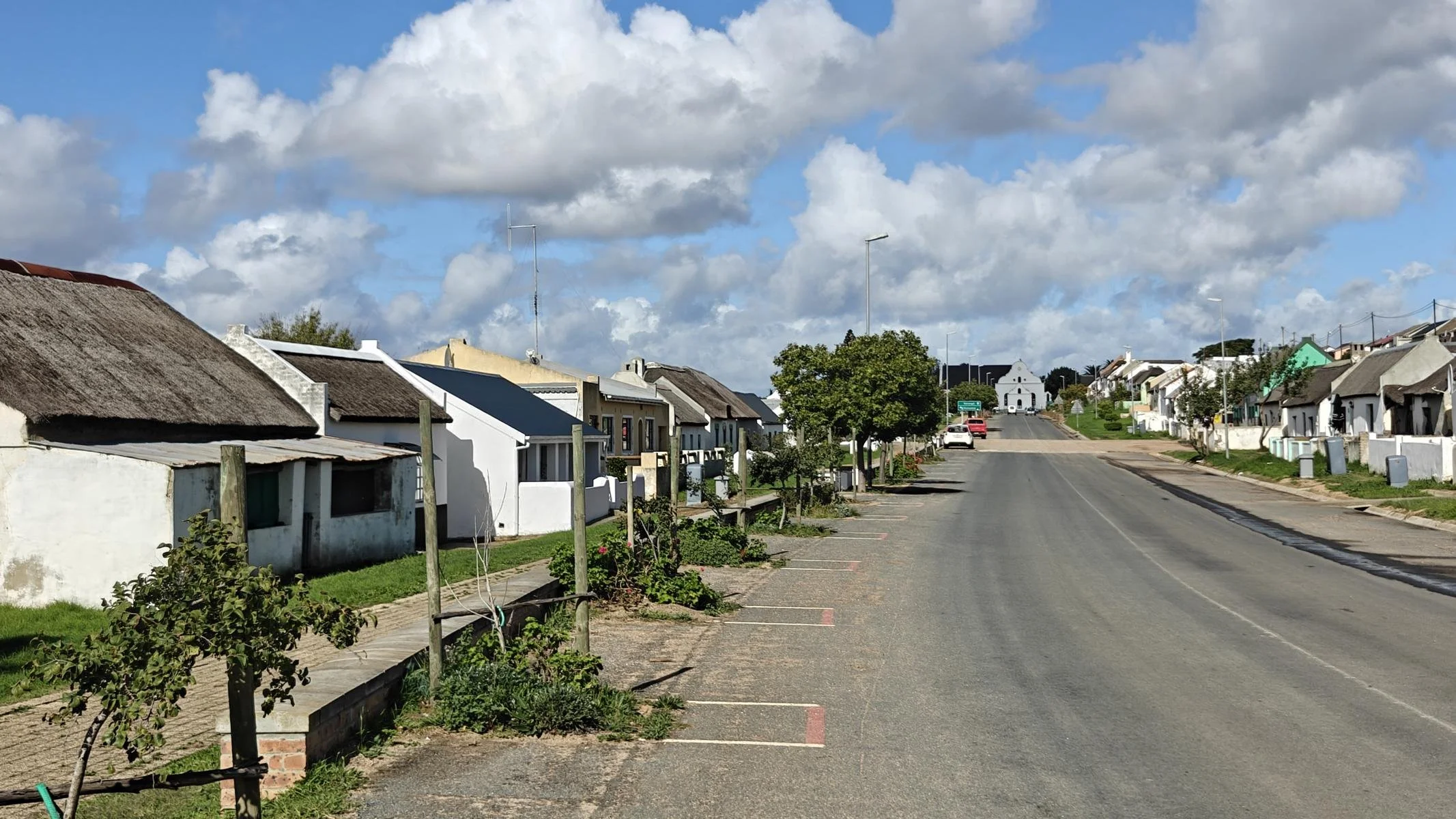
After a week in Cape Town, I wanted to see more of the country and headed first to the wine region. I chose not Stellenbosch but Franschhoek (population 1,066), located 80 km east of Cape Town. The name means “French Corner,” as the town was settled by French Huguenots in 1688 (see below). Nestled between mountains reaching up to 1,400 meters in height lies a valley with extensive vineyards. It’s hard to imagine that elephants once grazed here only 300 years ago.
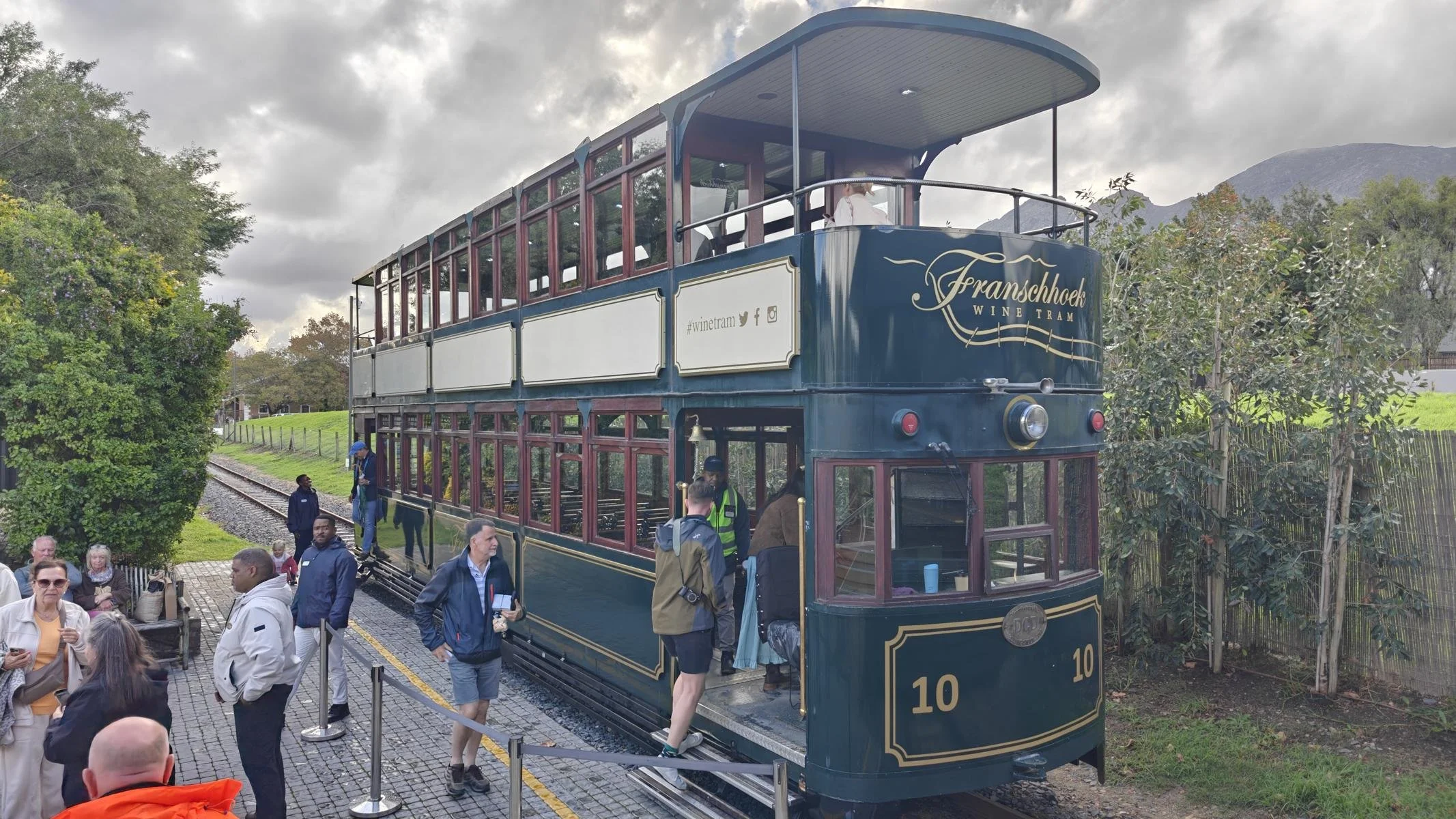
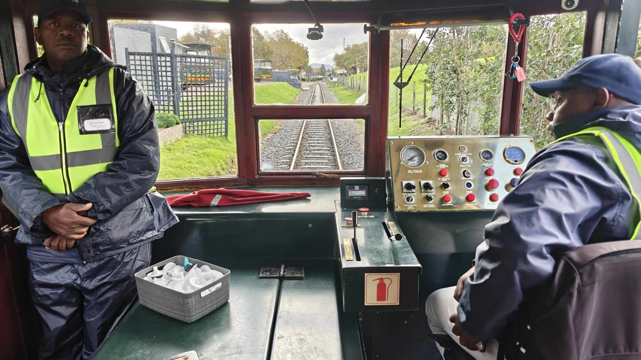
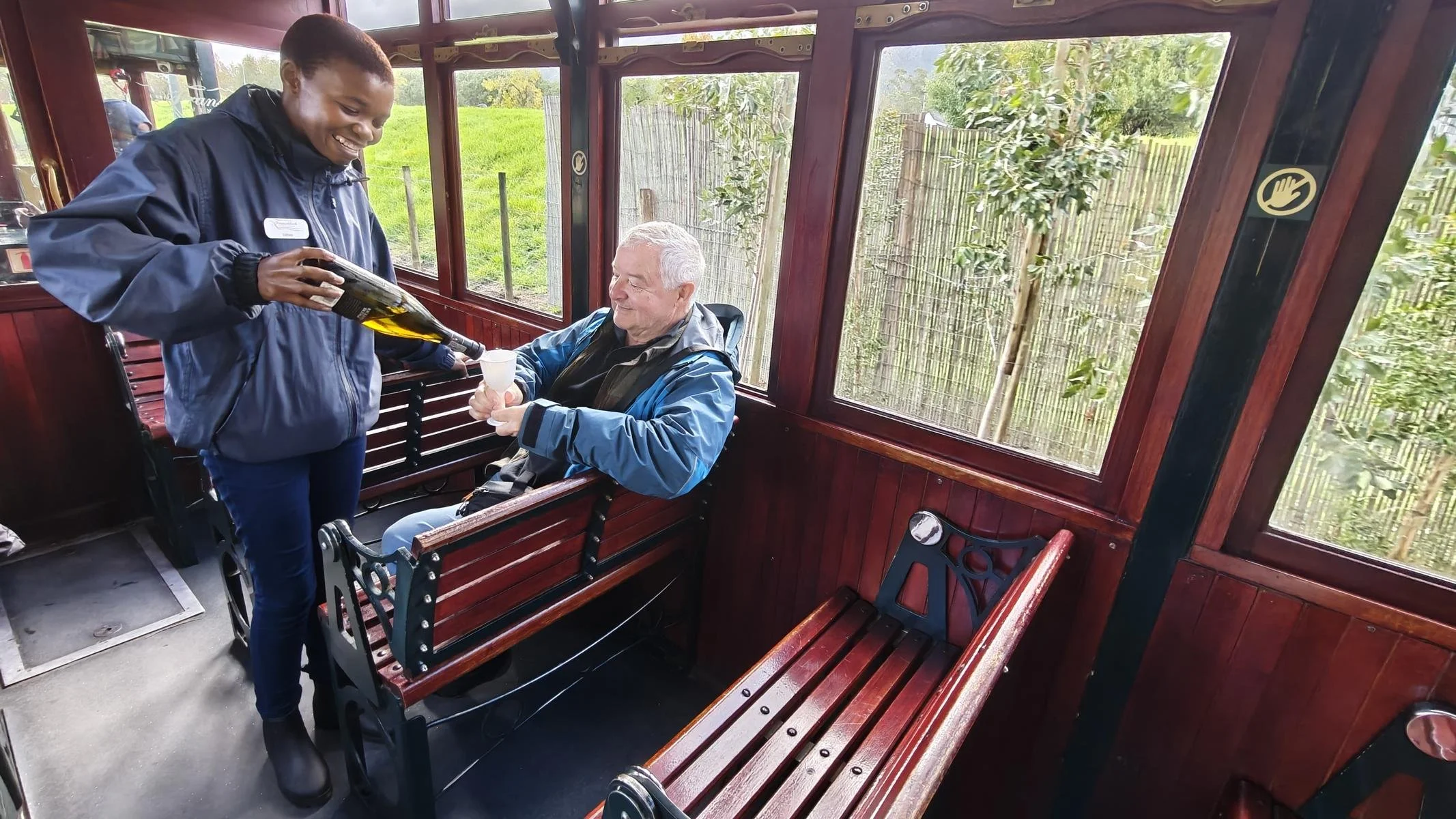
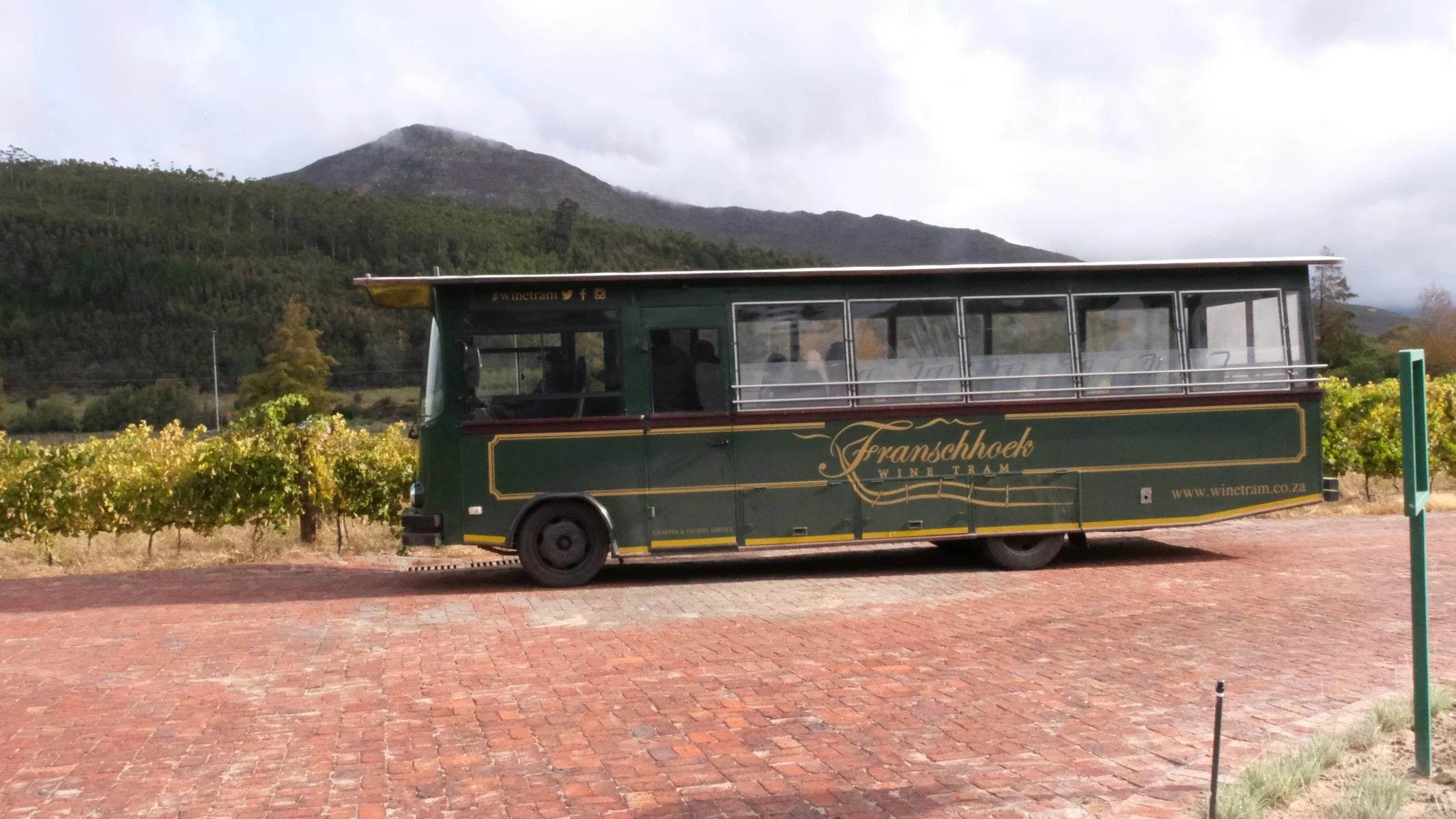
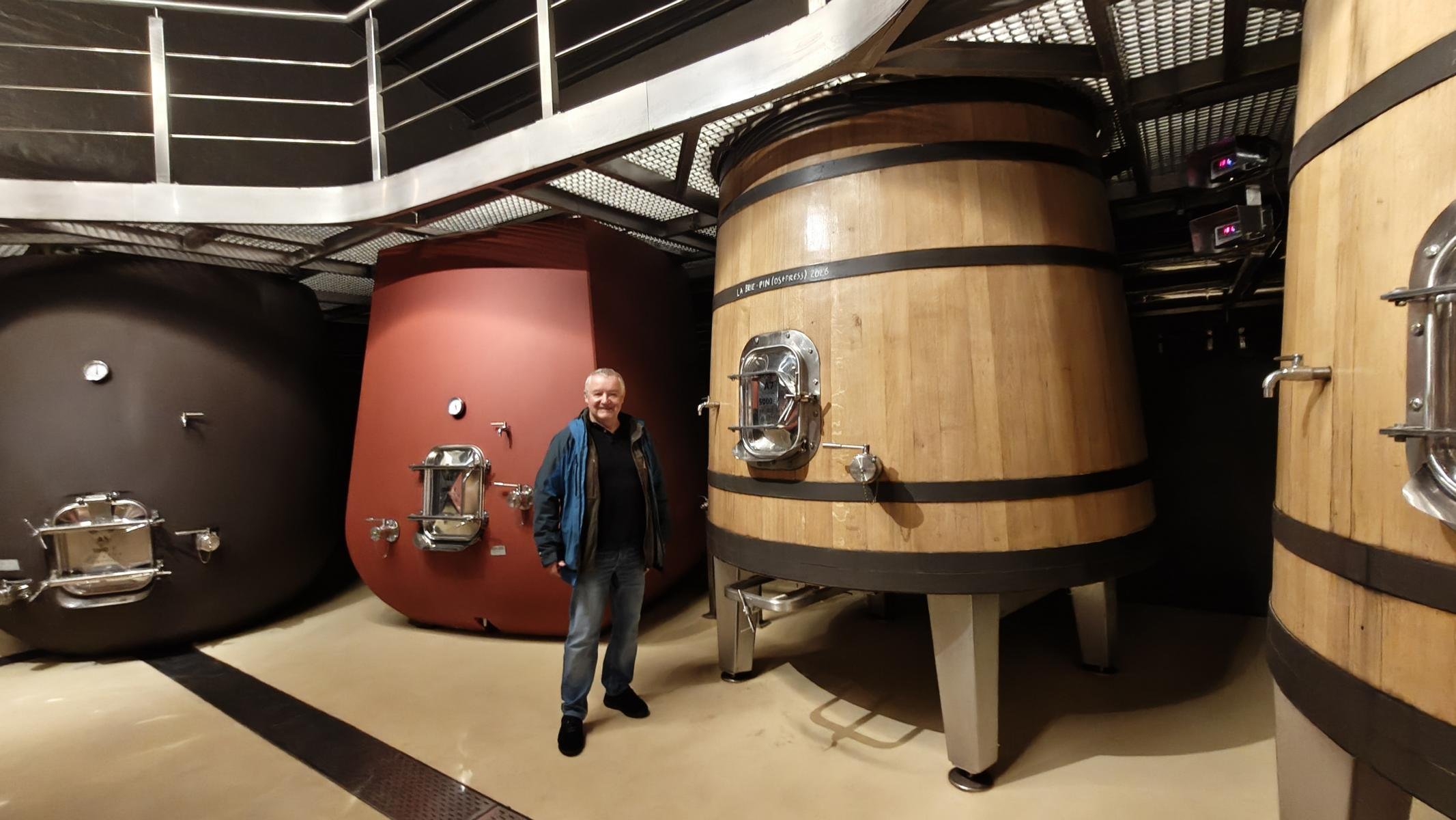
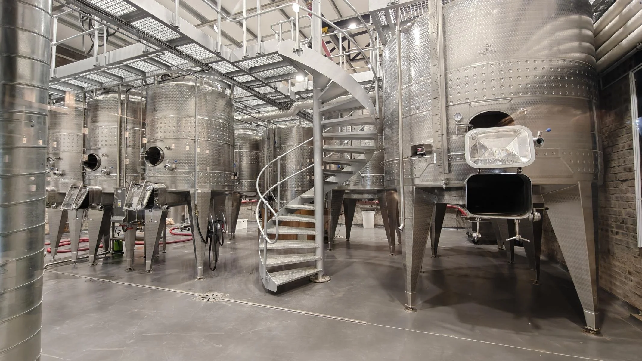
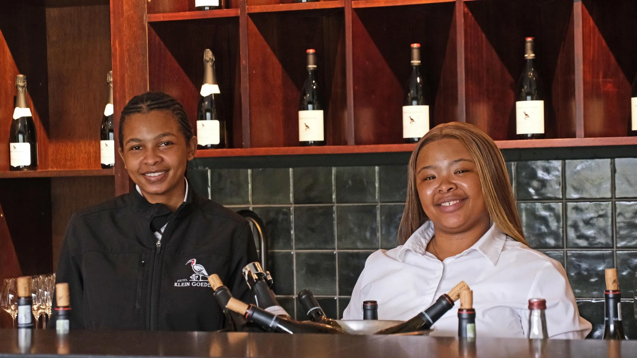
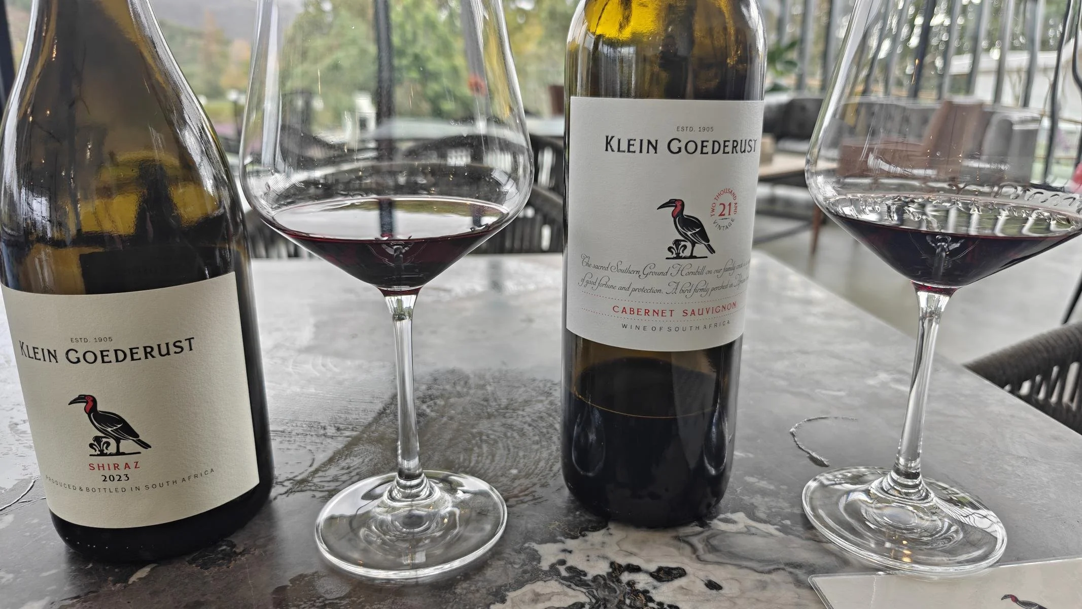
Franschhoek specializes entirely in wine tasting tourism: a wine tram (where wine is already served) and several bus routes transport tourists from winery to winery without the risk to lose the drivers license. All the wines—white, red, and champagne—tasted excellent. A telling sign of wealth distribution in South Africa: Only the Goederust winery has a black owner.
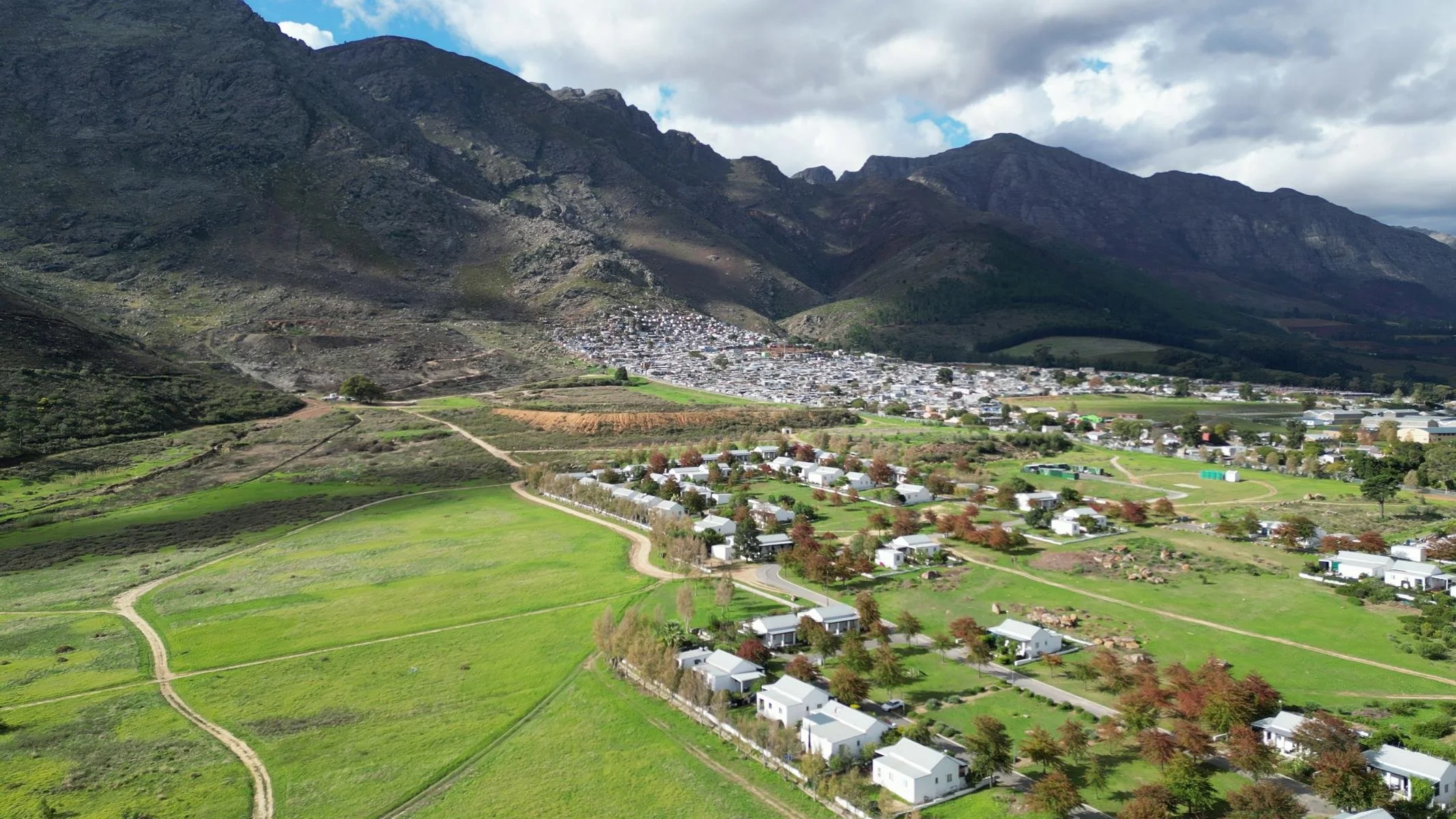
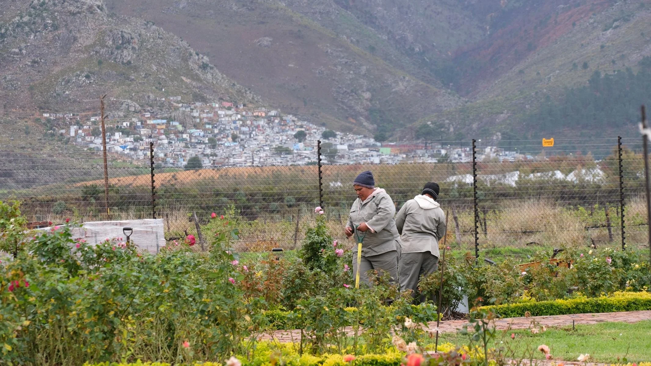
In stark contrast to the prosperity in the town center, a large portion of the workers employed at the wineries live in a shantytown on a mountainside. As some of the female workers told me, they have electricity there, but no running water and no sewage system.
Nach einer Woche in Kapstadt wollte ich mehr vom Land sehen und fuhr als erstes in die Weinregion. Ich wählte nicht Stellenbosch sondern das 80 km östlich von Kapstadt gelegene Franschhoek (1066 Einw.). Der Name bedeutet französisches Eck, da die Stadt 1688 von französischen Hugenotten besiedelt wurde (siehe dazu unten). Zwischen bis zu 1400 m hohen Bergen liegt ein Tal mit ausgedehnten Weinkulturen. Schwer vorstellbar, dass hier vor 300 Jahren noch Elefanten weideten.
Franschhoek ist ganz auf Weinverkostungs-Tourismus spezialisiert: Eine Wein-Straßenbahn (in der bereits Wein kredenzt wird) und mehrere Buslinien bringen die Touristen „Führerschein-schonend“ von Weingut zu Weingut. Alle Weine – weiß, rot und Champagner – schmeckten hervorragend. Bezeichnend für die Vermögensverteilung in Südafrika: Einzig das Weingut Goederust hat einen schwarzen Eigentümer.
In krassem Gegensatz zum Wohlstand im Ortszentrum lebt ein Großteil der Arbeiter*innen, die auf den Weingütern beschäftigt sind, in einer Slum-Siedlung an einem Berghang. Wie mir einige Arbeiterinnen erzählten haben sie dort zwar Strom, aber kein Fließwasser und keine Kanalisation.
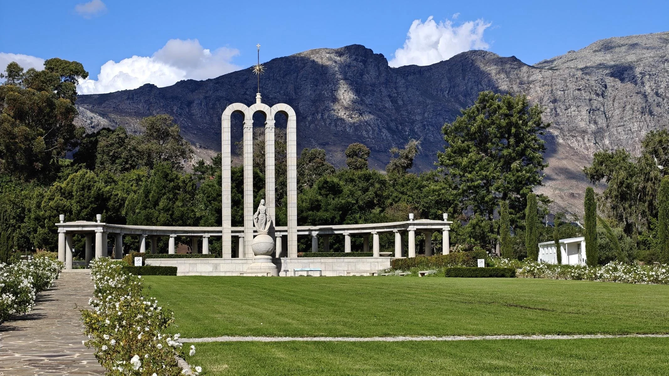
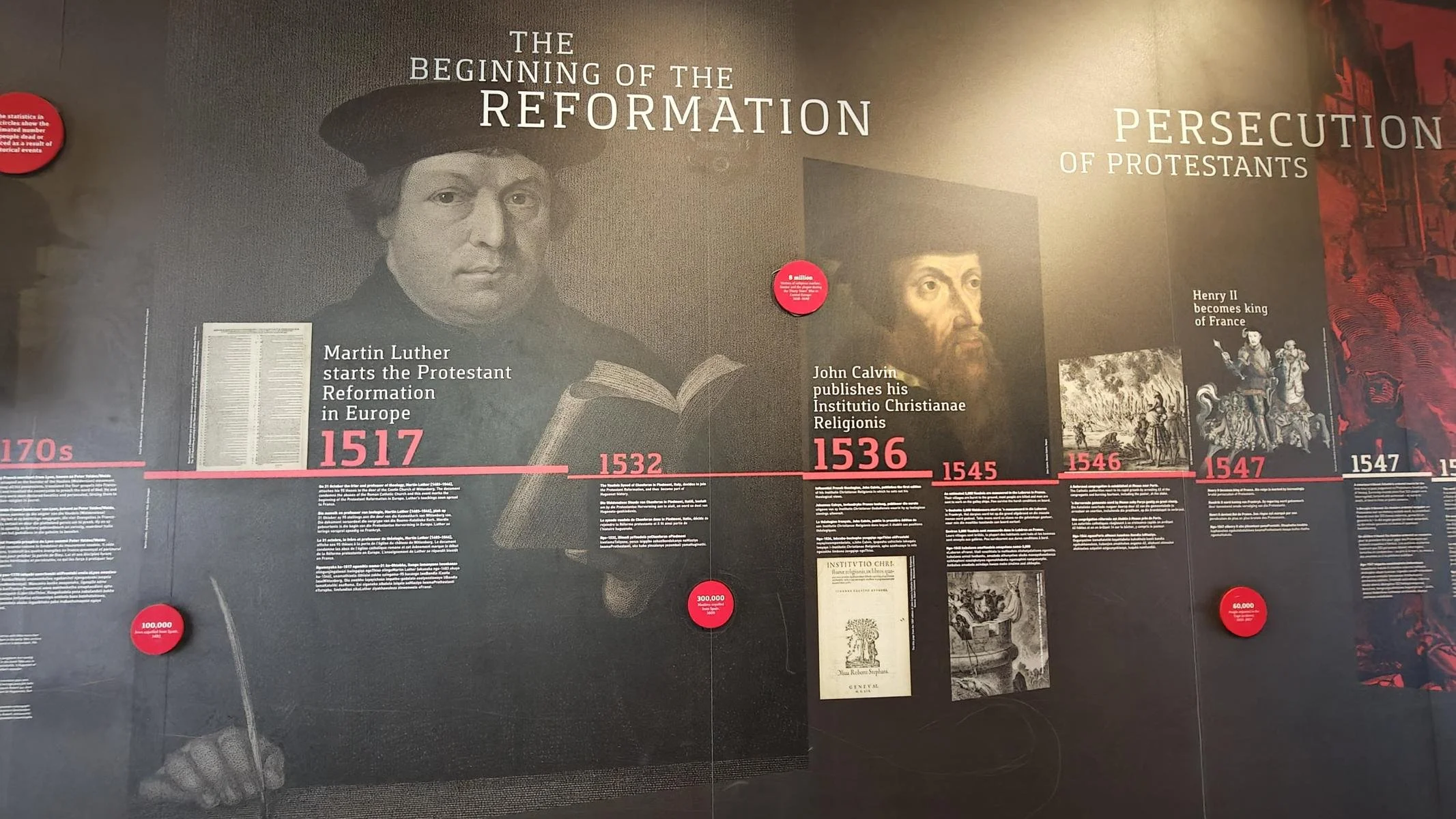
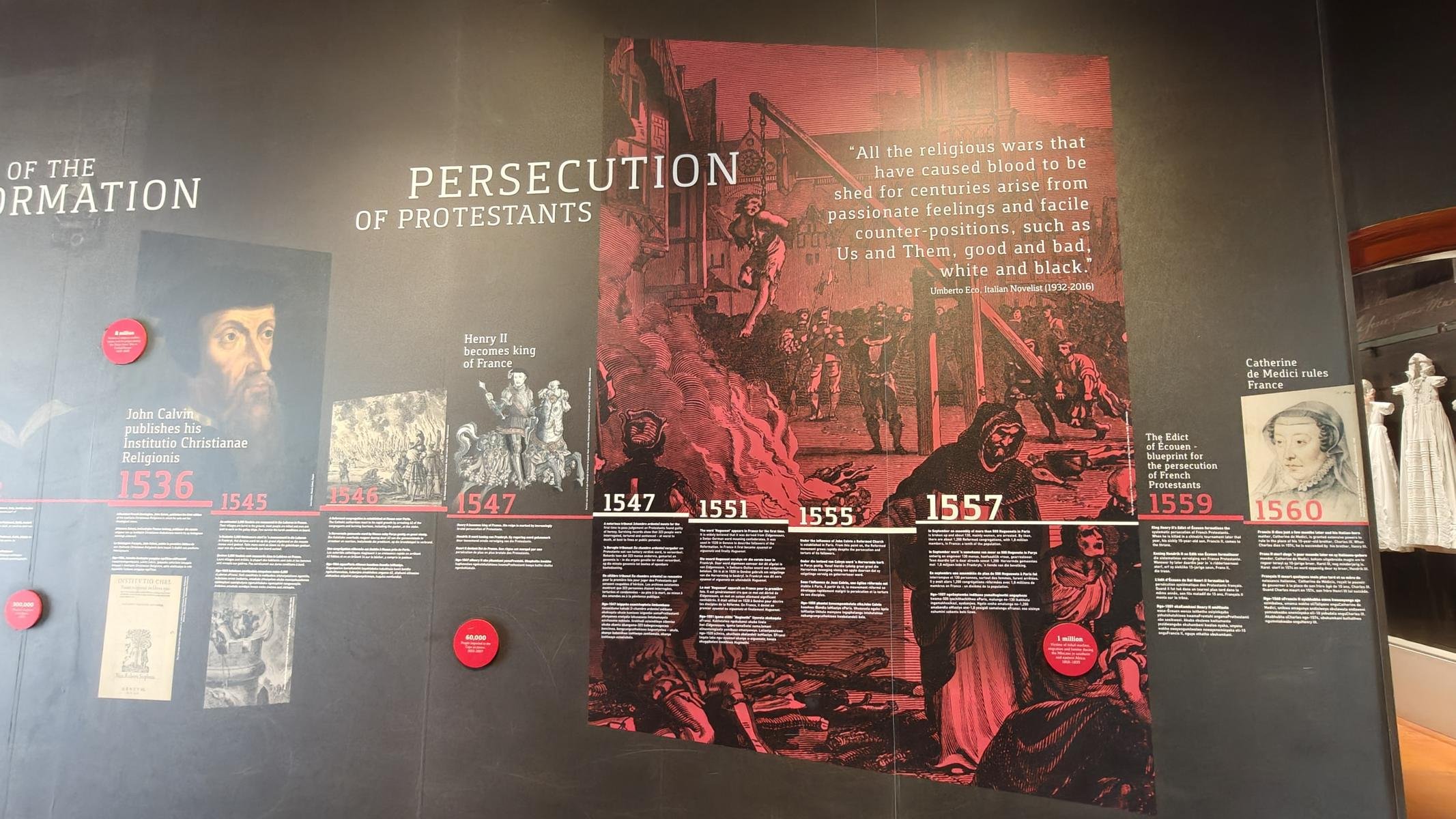
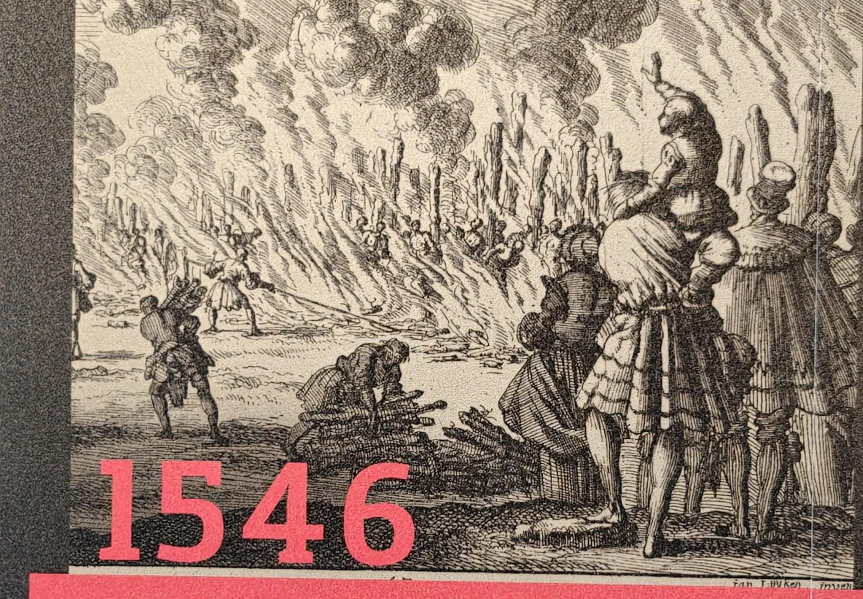
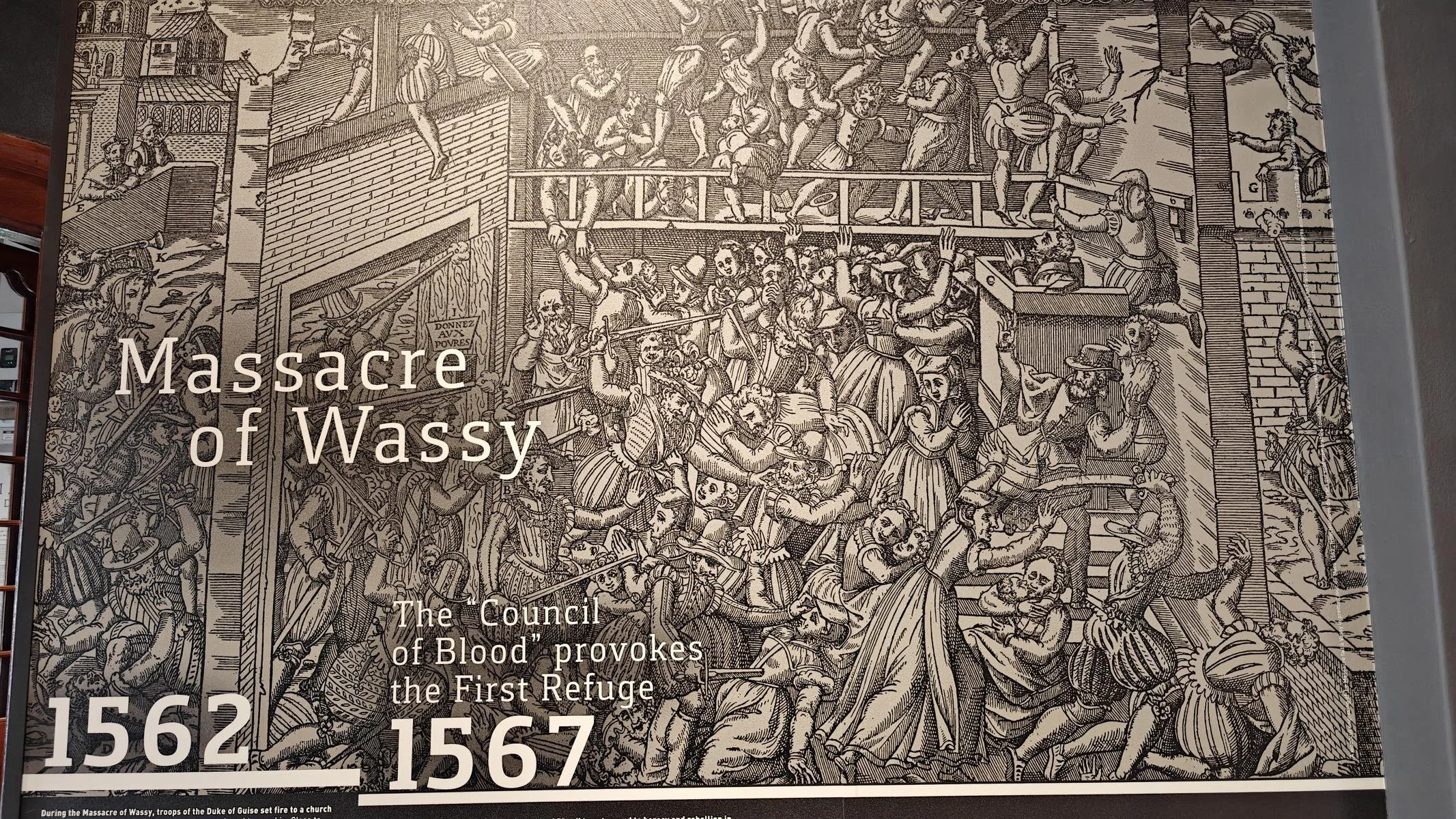
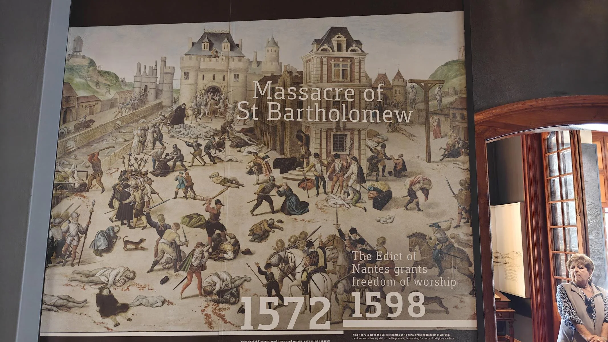
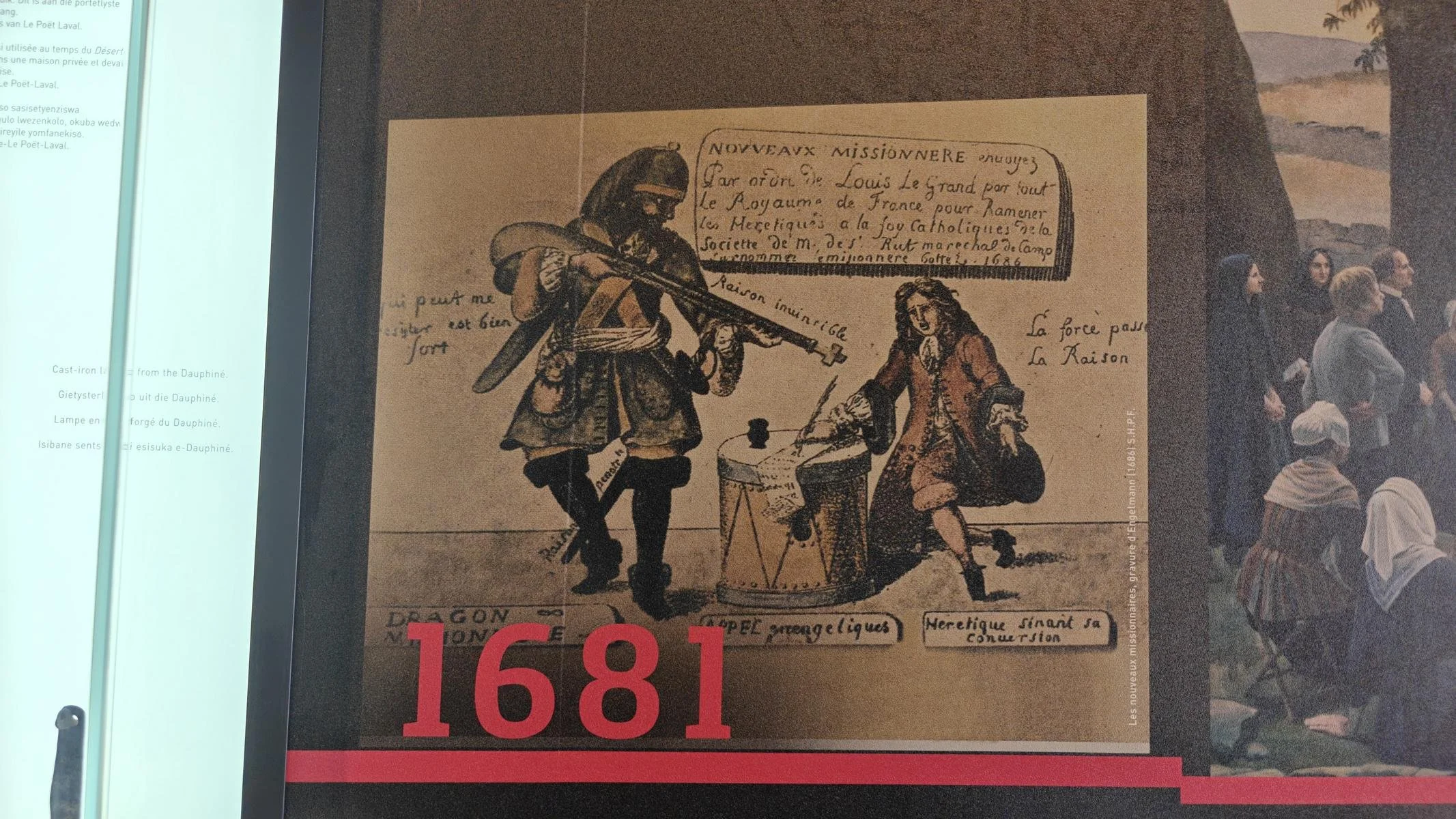
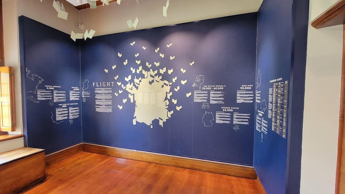
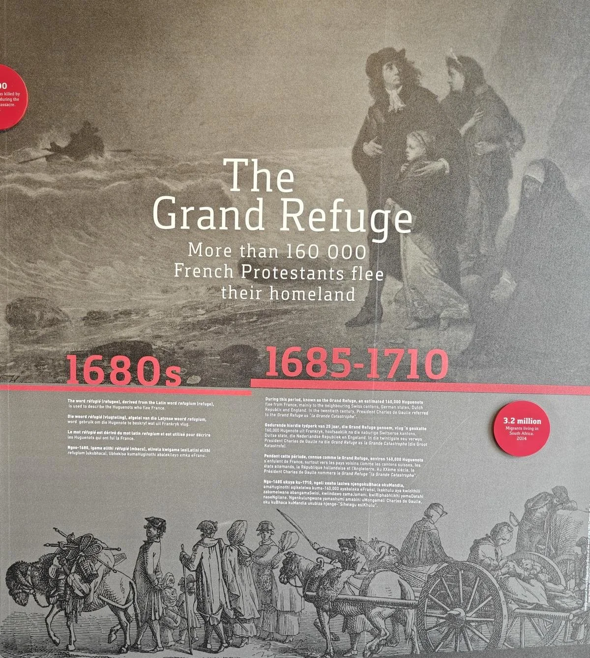
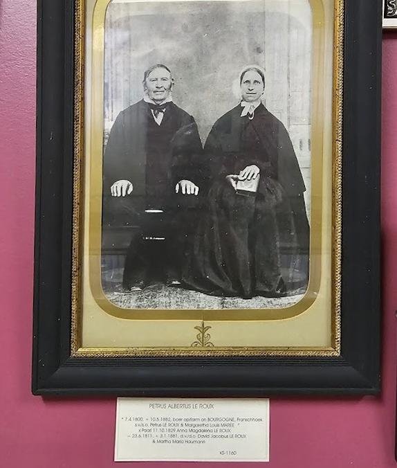
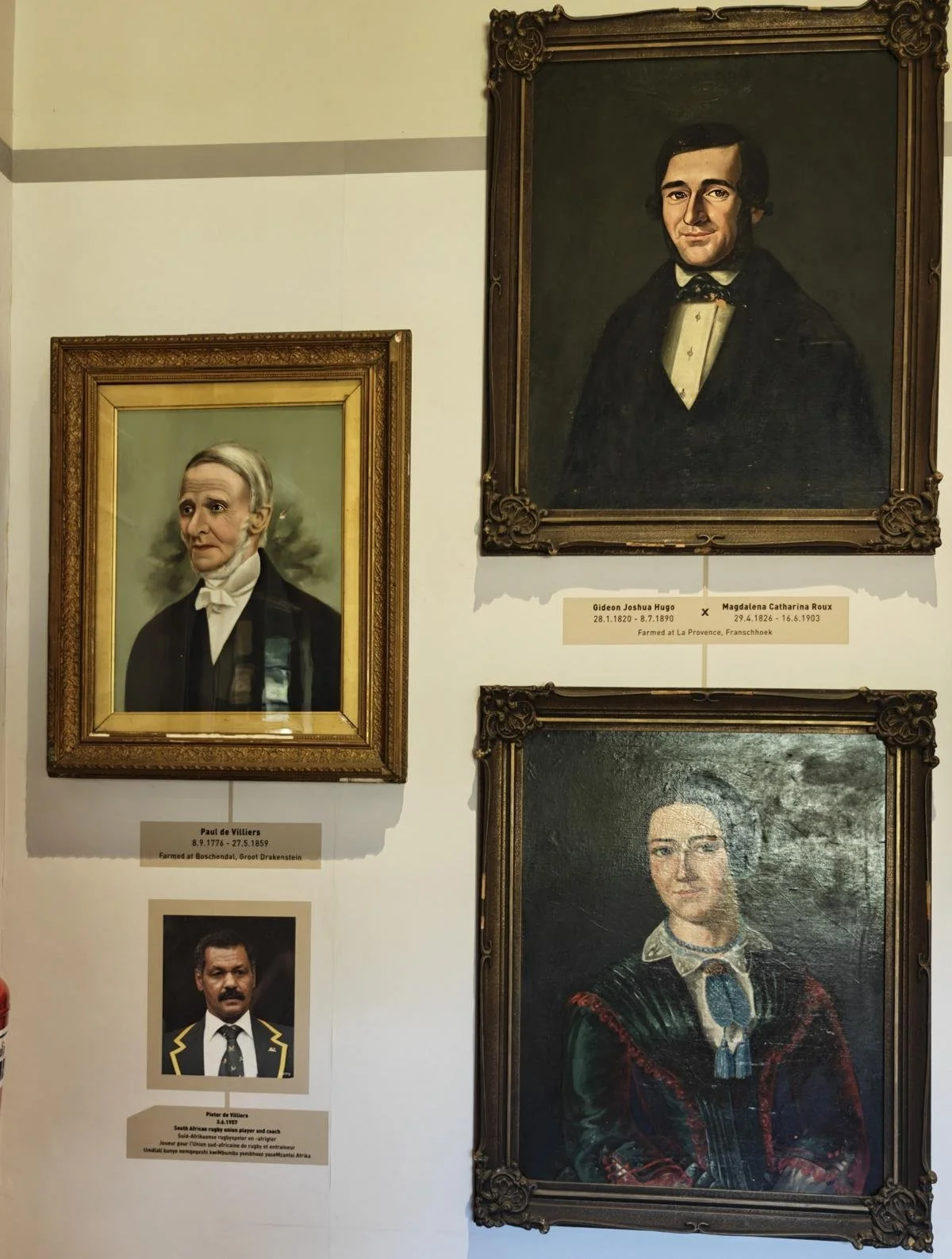
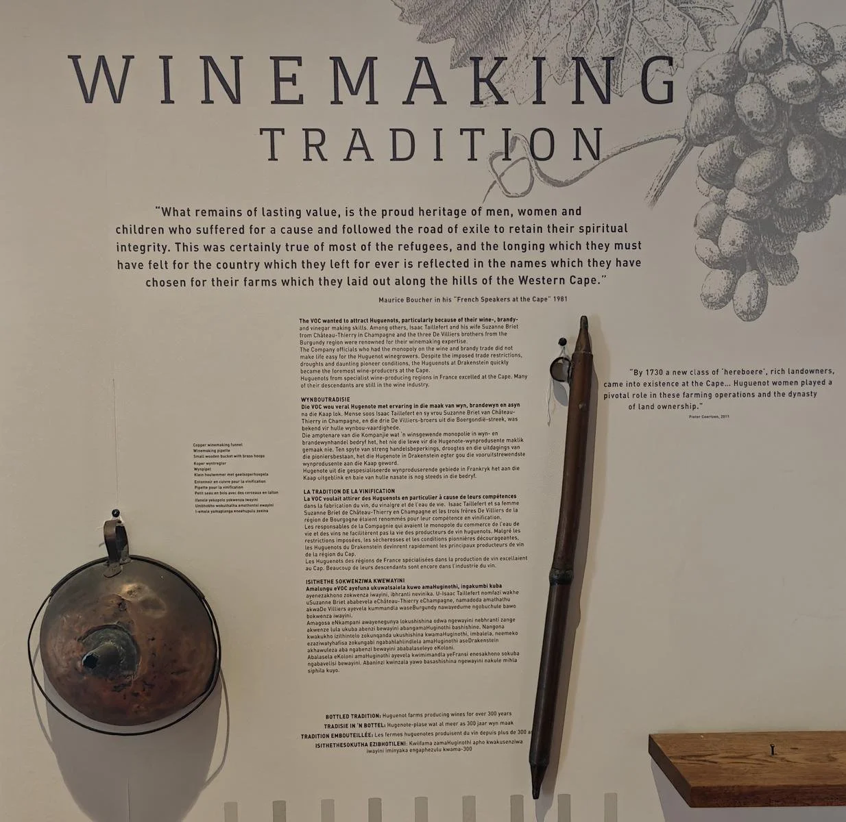
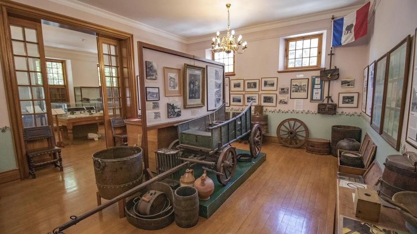
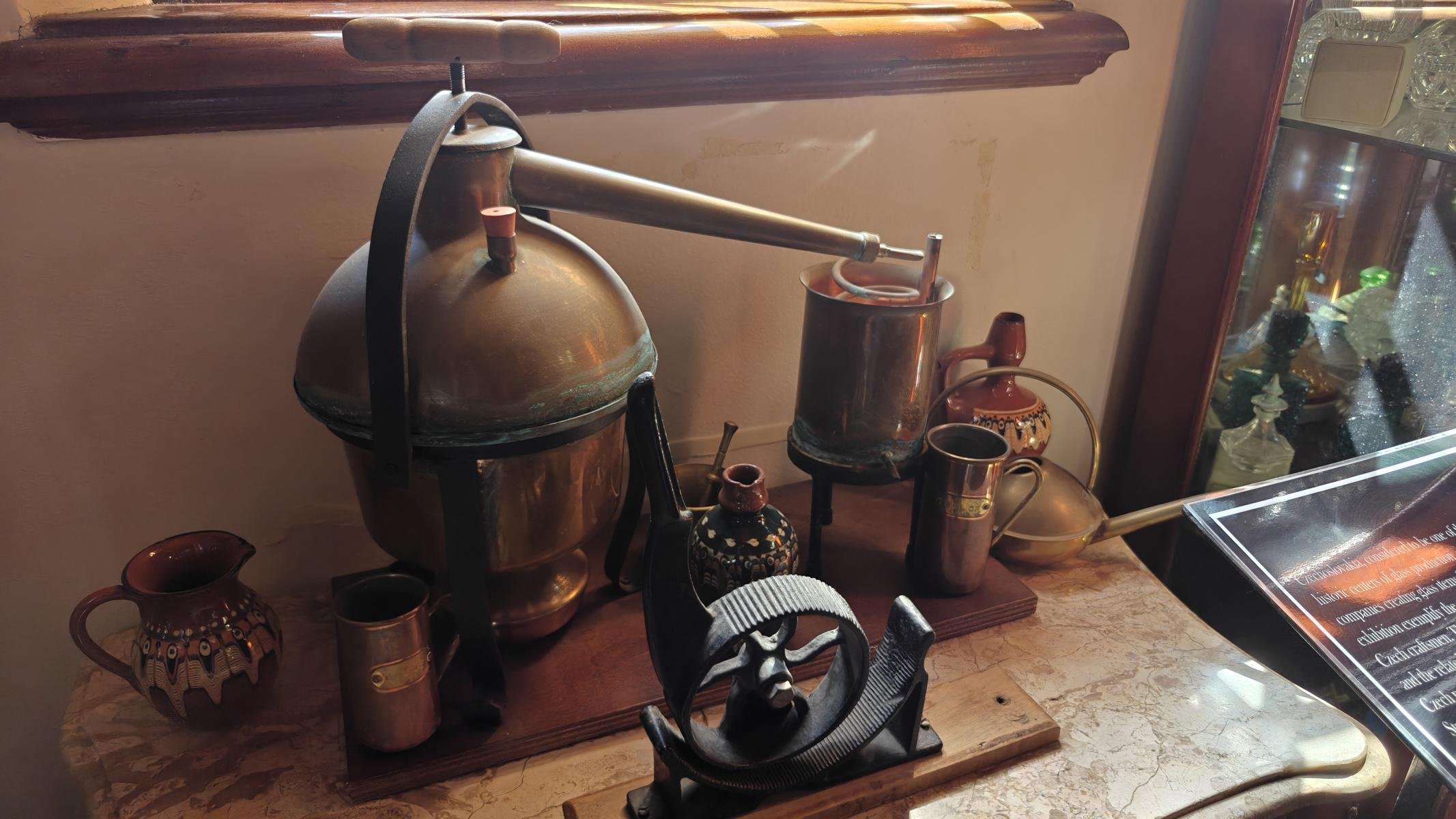
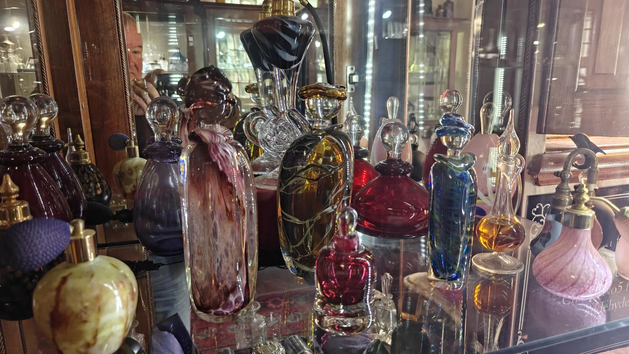
The village was settled by French Huguenots in 1688. Huguenots were French Protestants who followed Calvin’s interpretation of the faith. Faced with increasingly severe persecution under the French King Louis XIV and the threat of forced conversion to Catholicism, more than 200,000 Huguenots—particularly from southern and eastern France—fled to neighboring countries or the newly emerging colonies. Via a detour through the Protestant Netherlands, around 300 Huguenots emigrated to the then-Dutch Cape Colony in 1688 and were assigned the area that is now the Franschhoek Valley (from which they drove out the indigenous Khoi herders).
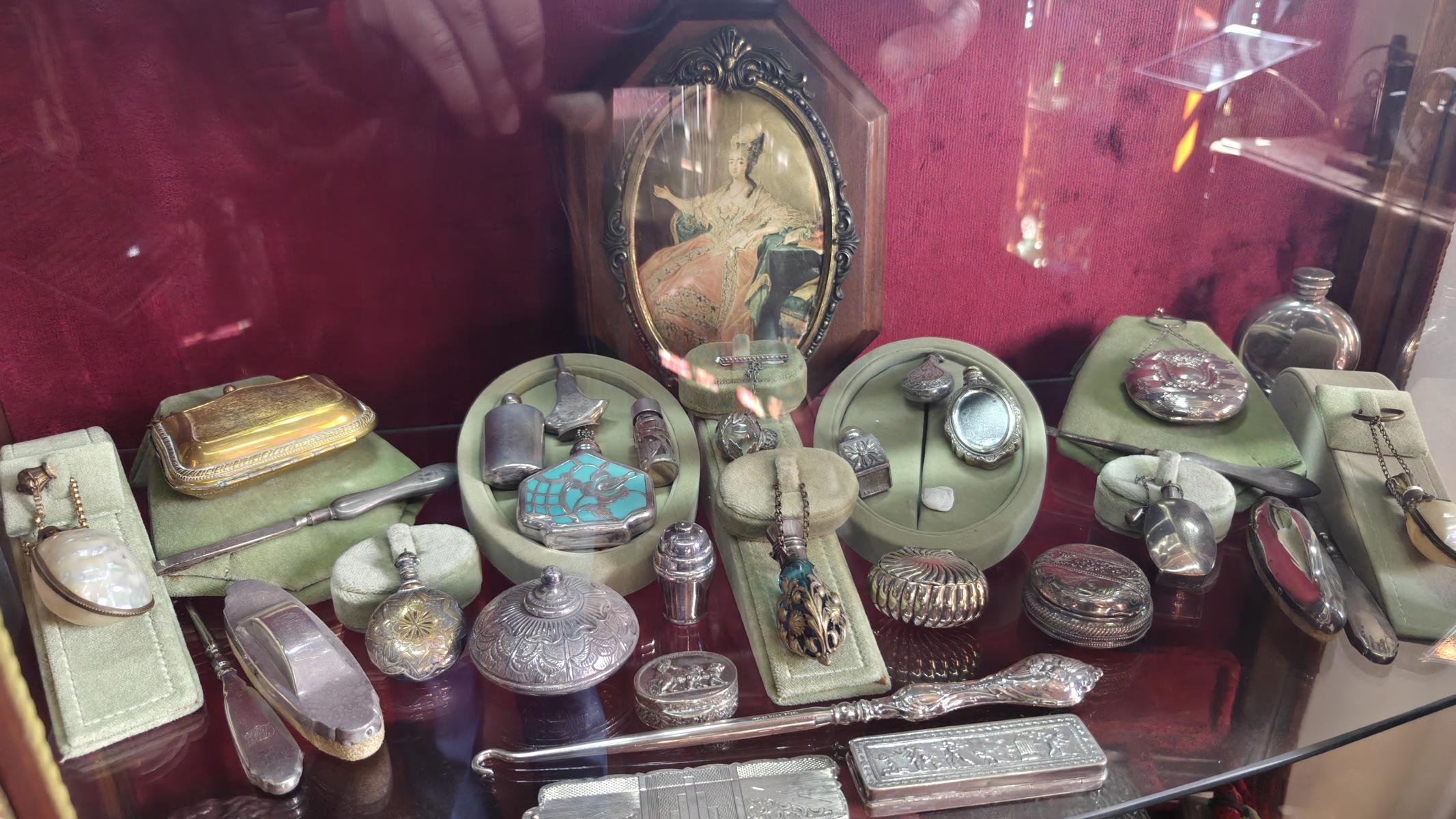
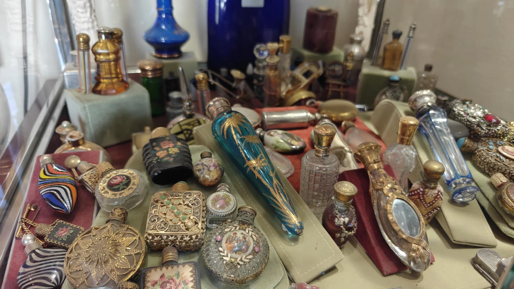
From the perspective of the Cape administration, there was particular interest in the Huguenots’ technical skills: agriculture and viticulture. Added to this was their expertise in perfume production. In addition to an imposing monument commemorating religious persecution in France, Franschhoek is home to an interesting Huguenot Museum.
Die Ortschaft wurde 1688 von französischen Hugenotten besiedelt. Hugenotten waren französische Protestanten, die der Glaubensauslegung Calvins folgten. Nach immer stärker werdender Verfolgung unter dem französischen König Ludwig XIV. und der drohenden Zwangs-Katholisierung flohen mehr als 200.000 Hugenotten insbesondere aus dem Süden und Osten Frankreichs in die Nachbarländer bzw. die neu entstehenden Kolonien. Auf dem Umweg über die protestantischen Niederlande wanderten 1688 rund 300 Hugenotten in die damals niederländische Kapkolonie aus und erhielten das heutige Franschhoek Tal zugewiesen (aus dem sie die autochthonen Khoi Hirten vertrieben).
Aus der Sicht der Kap-Verwaltung war man besonders an den technischen Fertigkeiten der Hugenotten interessiert: Landwirtschaft und Weinbau. Dazu kamen Kenntnisse zur Parfum Herstellung. Neben einem imposanten Denkmal, das an die religiöse Verfolgung in Frankreich erinnert, gibt es in Franschhoek ein interessantes Hugenotten Museum.
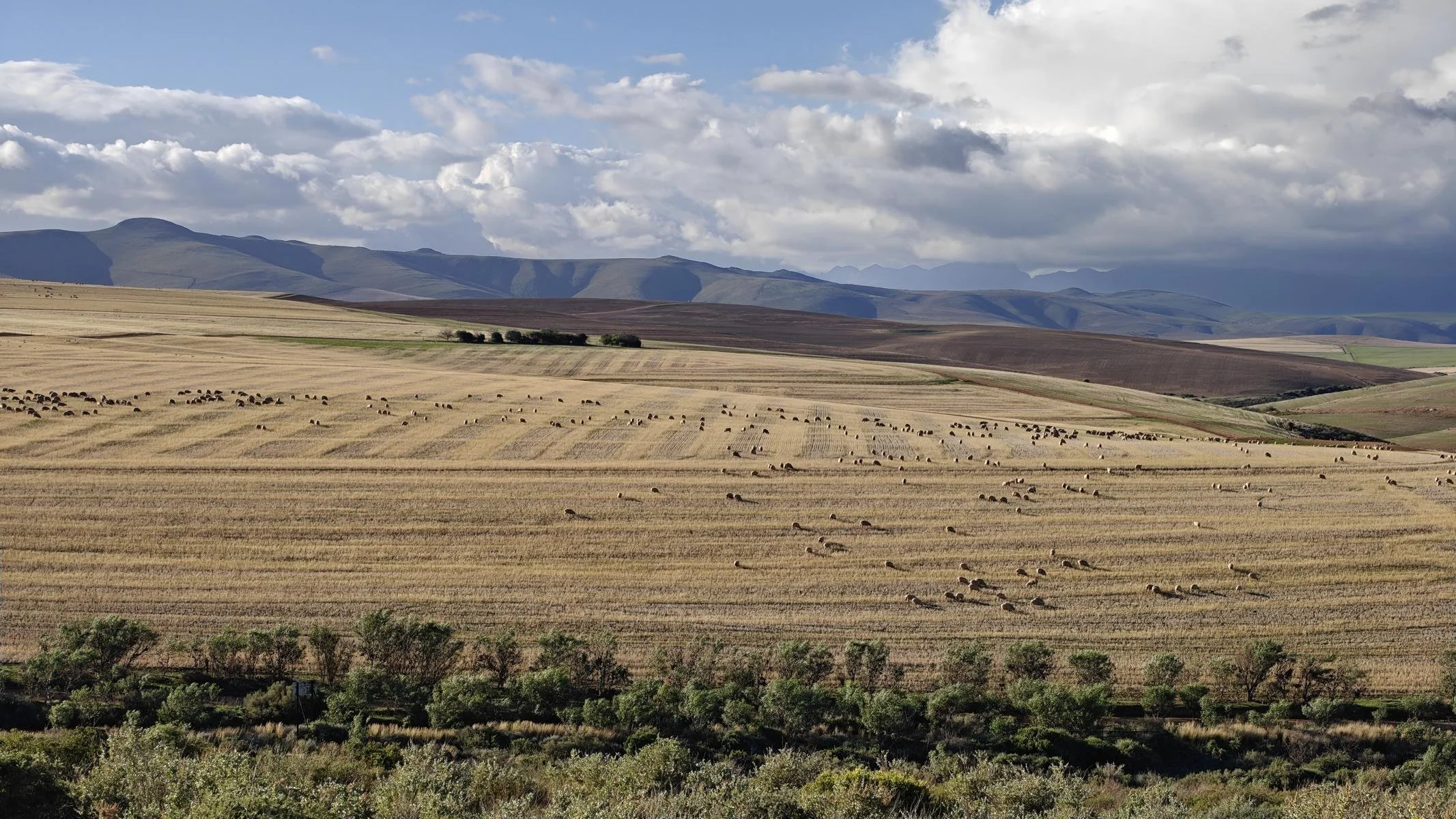
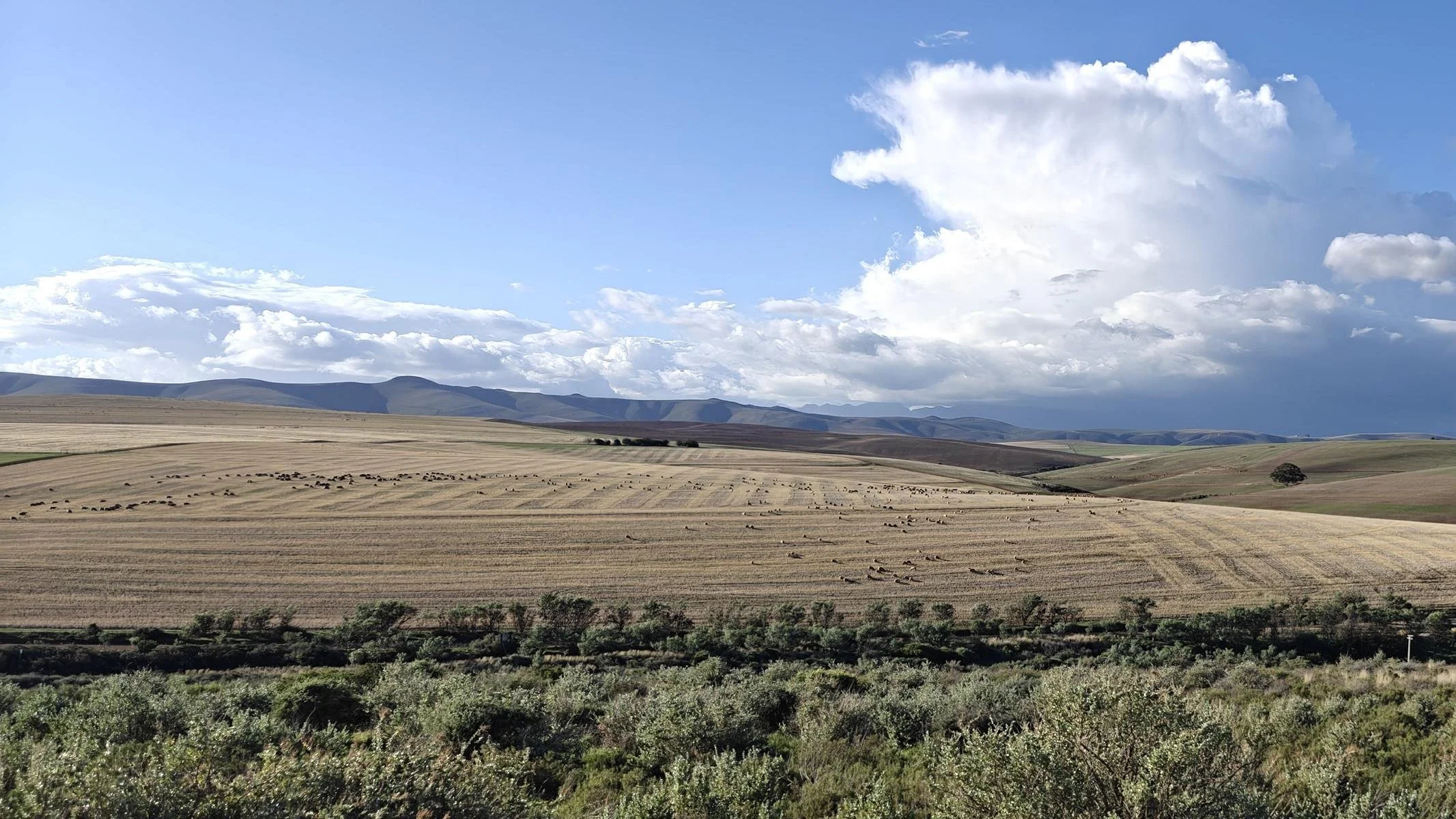
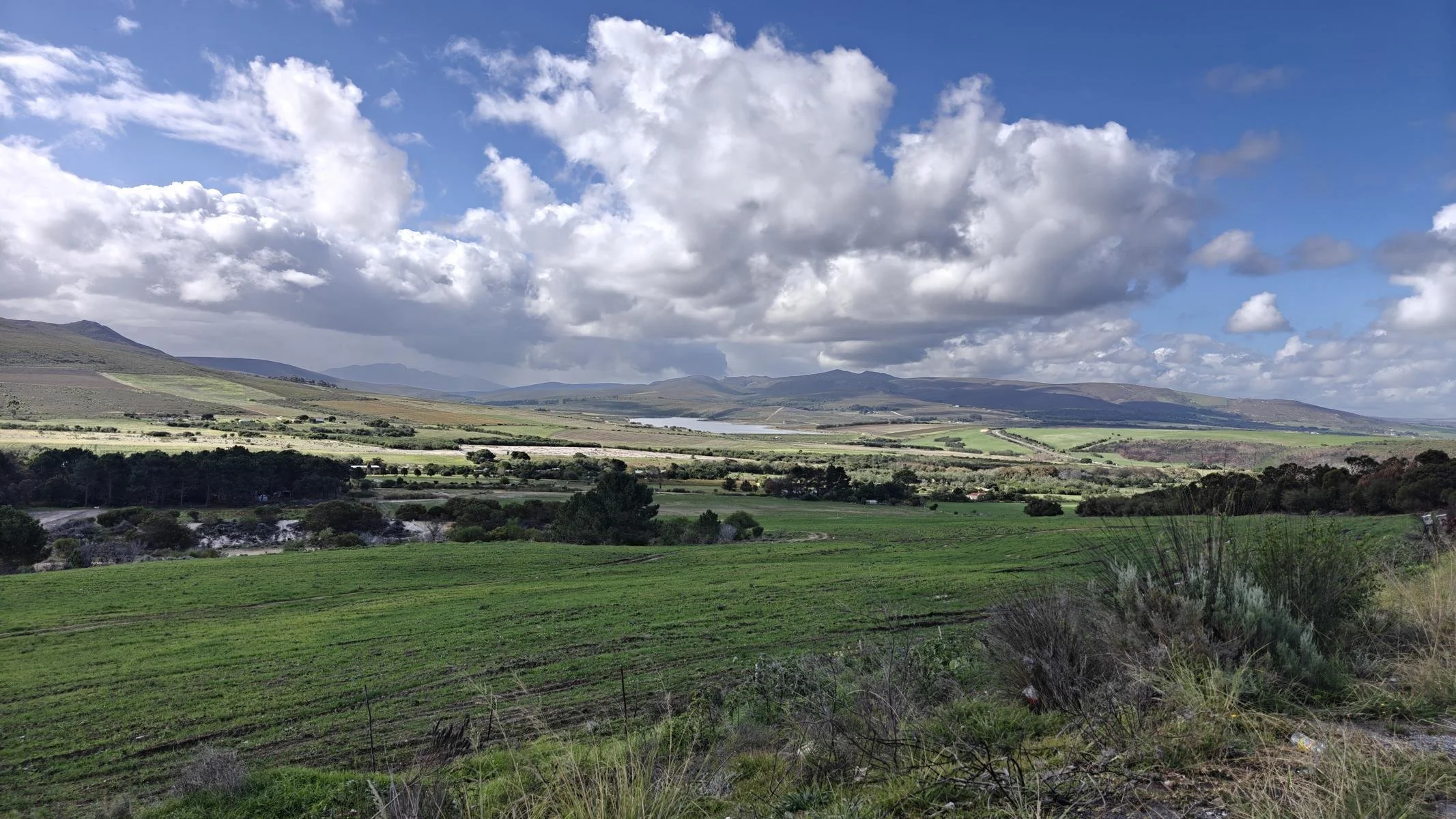
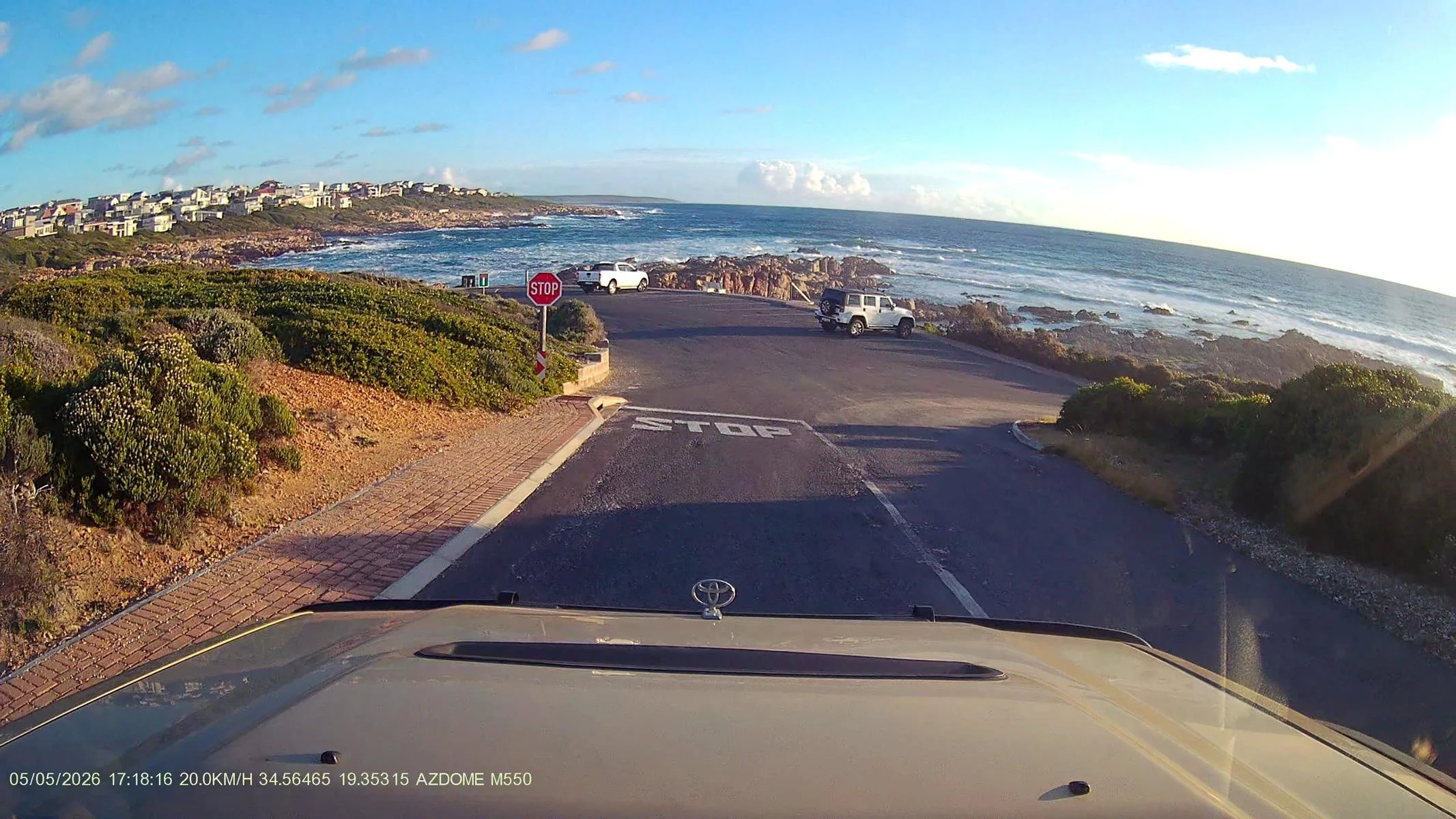
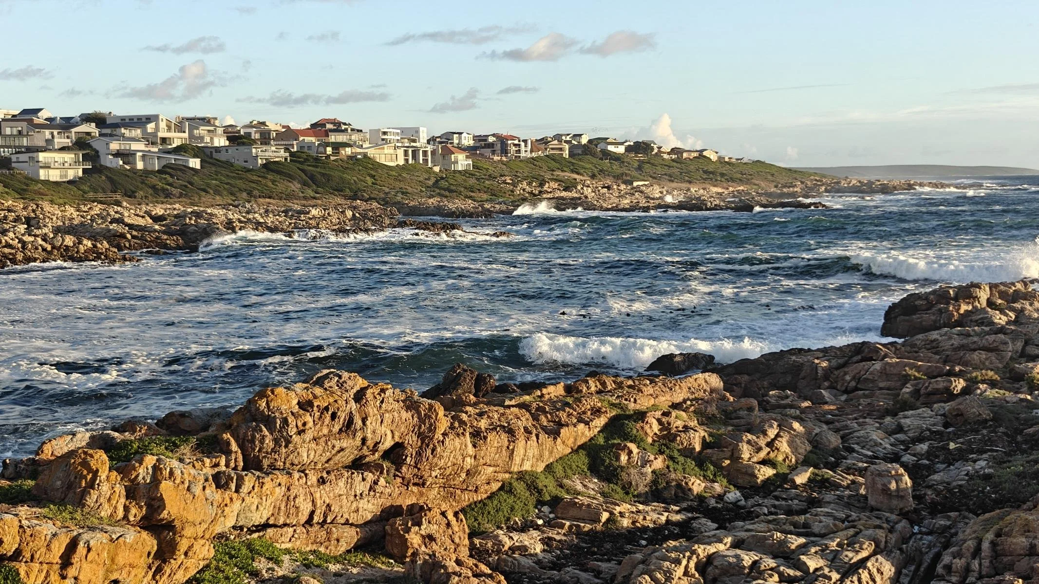
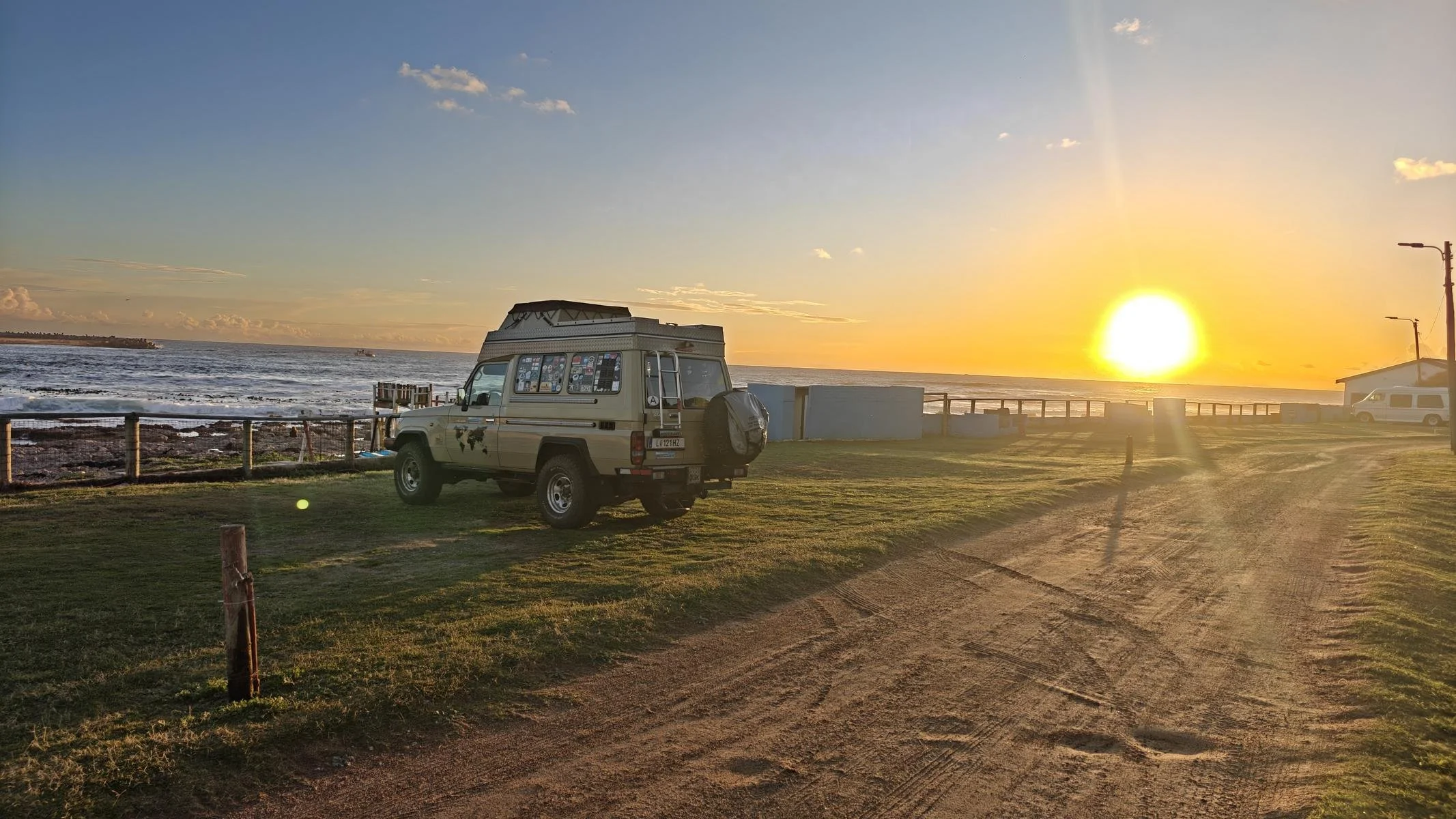
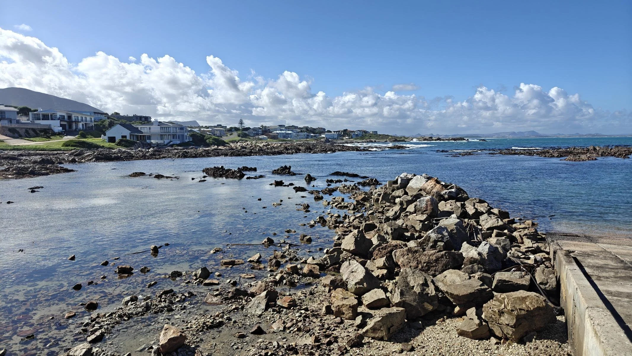
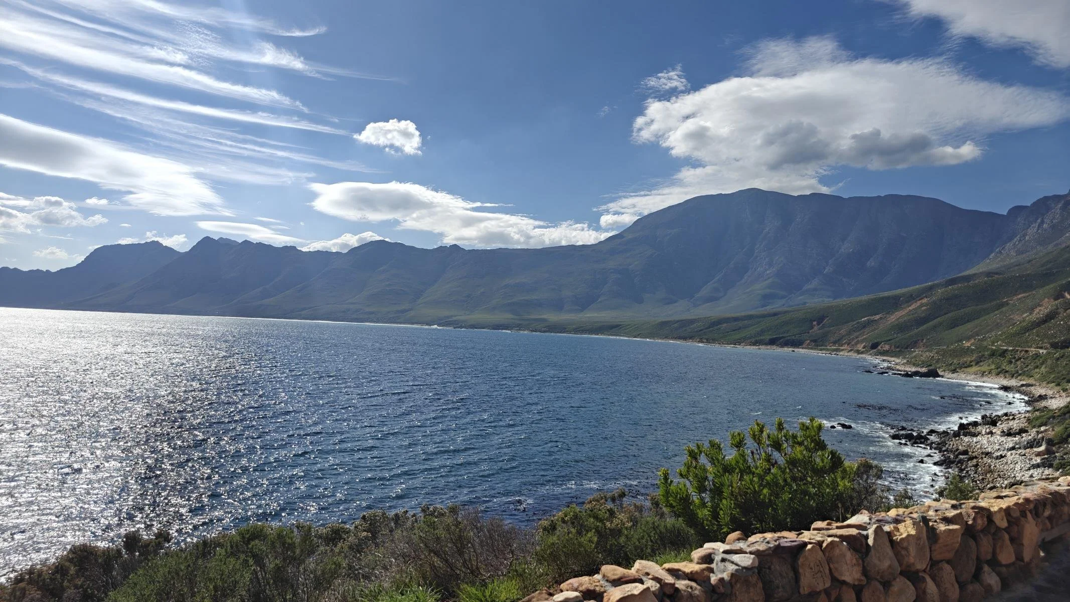
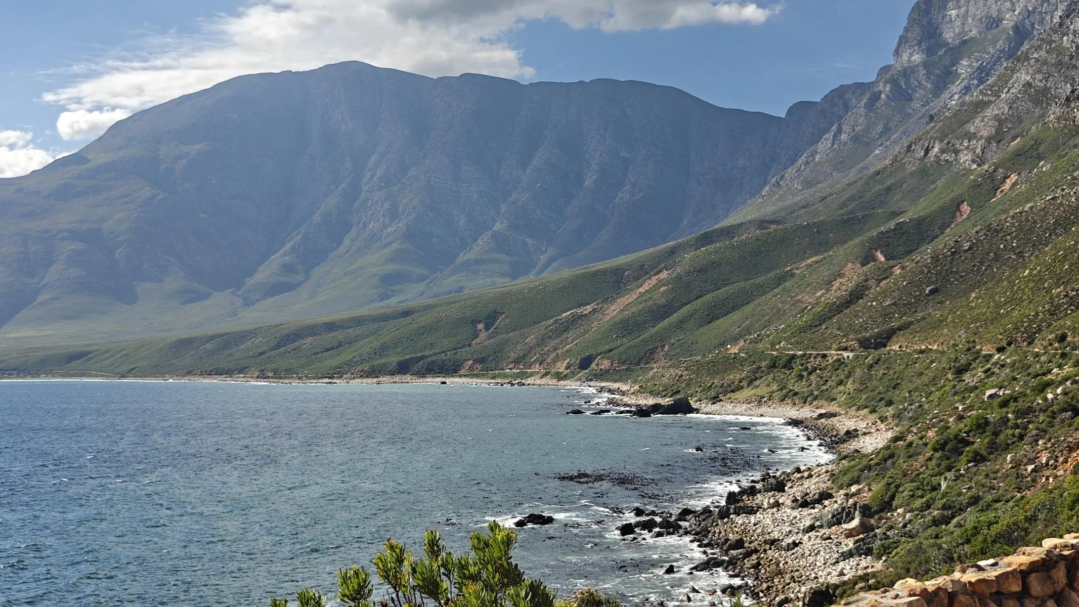
From Franschhoek, I drove about 180 km southeast to the southernmost tip of Africa. The road winds through a gently rolling landscape, passing by vast fields. Many of the farms cover well over 1,000 hectares. However, the soil is less productive due to low rainfall (in this region only about one-third of what it is in Austria). At the end I finally made it to a campground at the beach.
Von Franschhoek aus fuhr ich etwa 180 km in südöstlicher Richtung zur südlichsten Spitze Afrikas. Die Straße führt durch eine sanfte Hügellandschaft vorbei an langgezogenen Feldern. Viele der Farmen haben weit über 1.000 Hektar Land. Die Böden sind aber wegen der geringen Niederschläge (in dieser Region nur etwa 1/3 verglichen mit Österreich) weniger ertragreich. Schließlich erreichte ich einen Campingplatz am Strand.
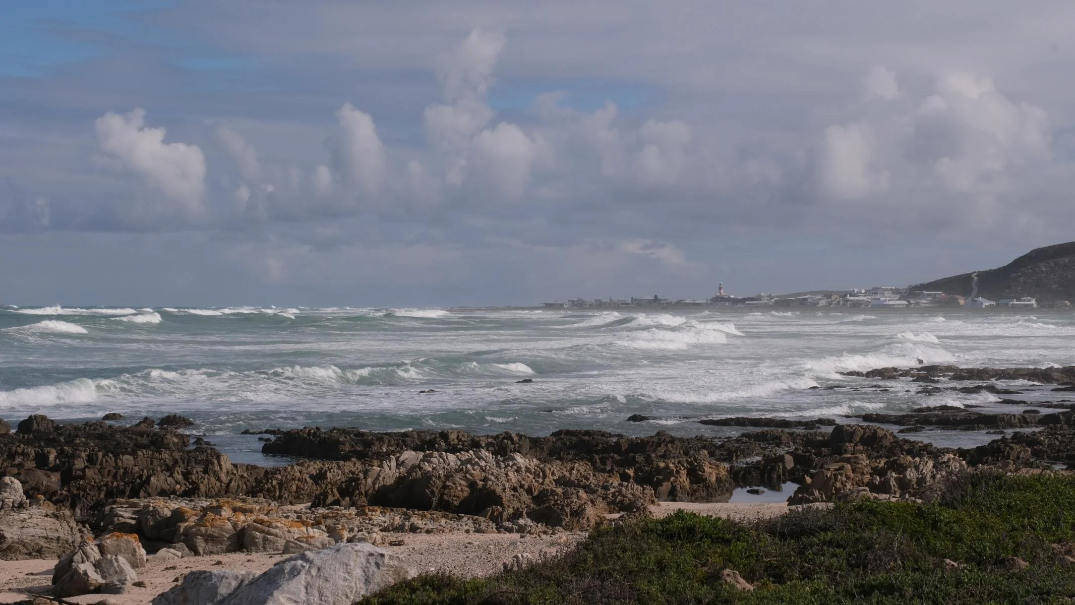
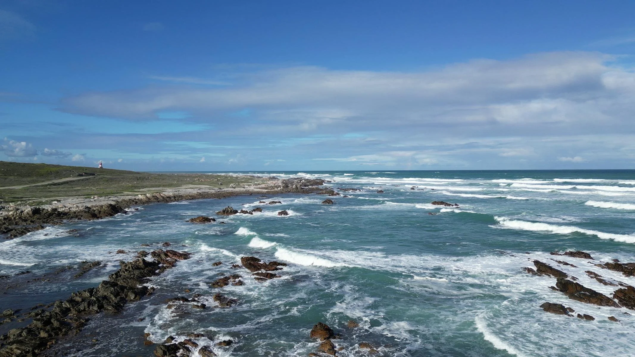
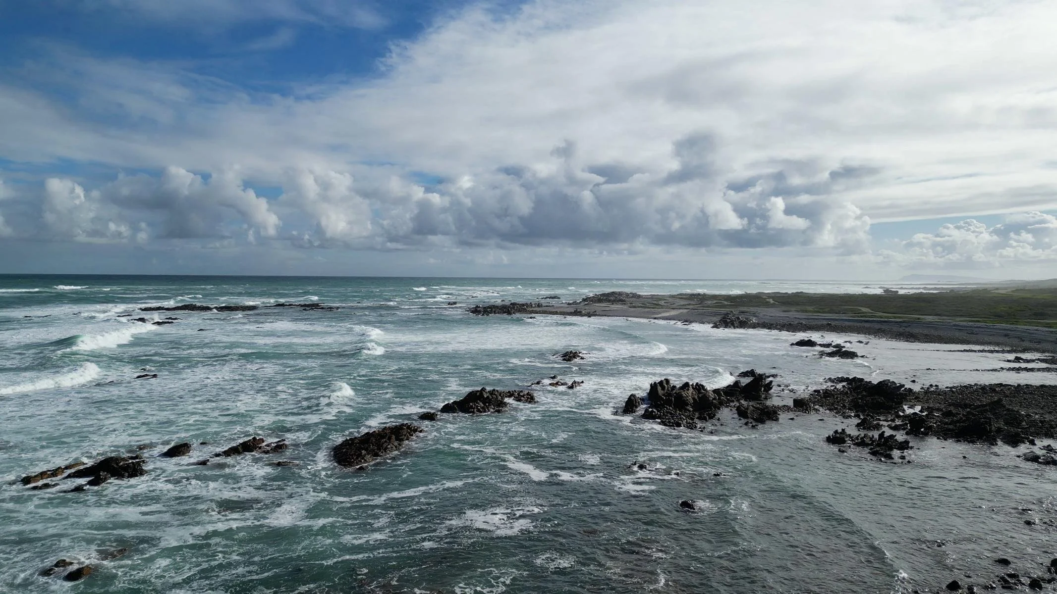
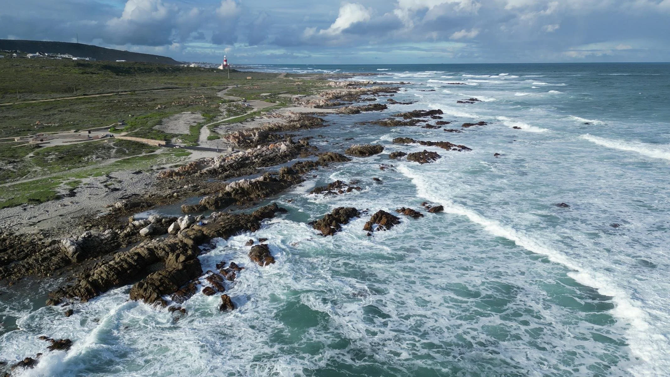
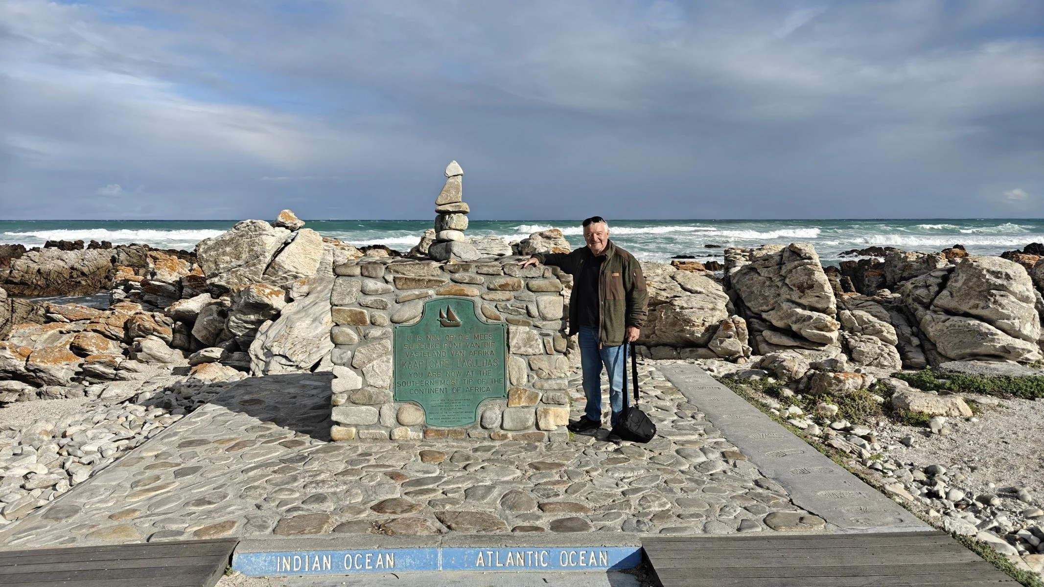
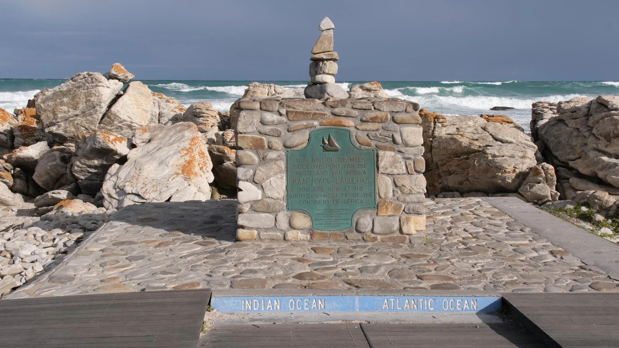
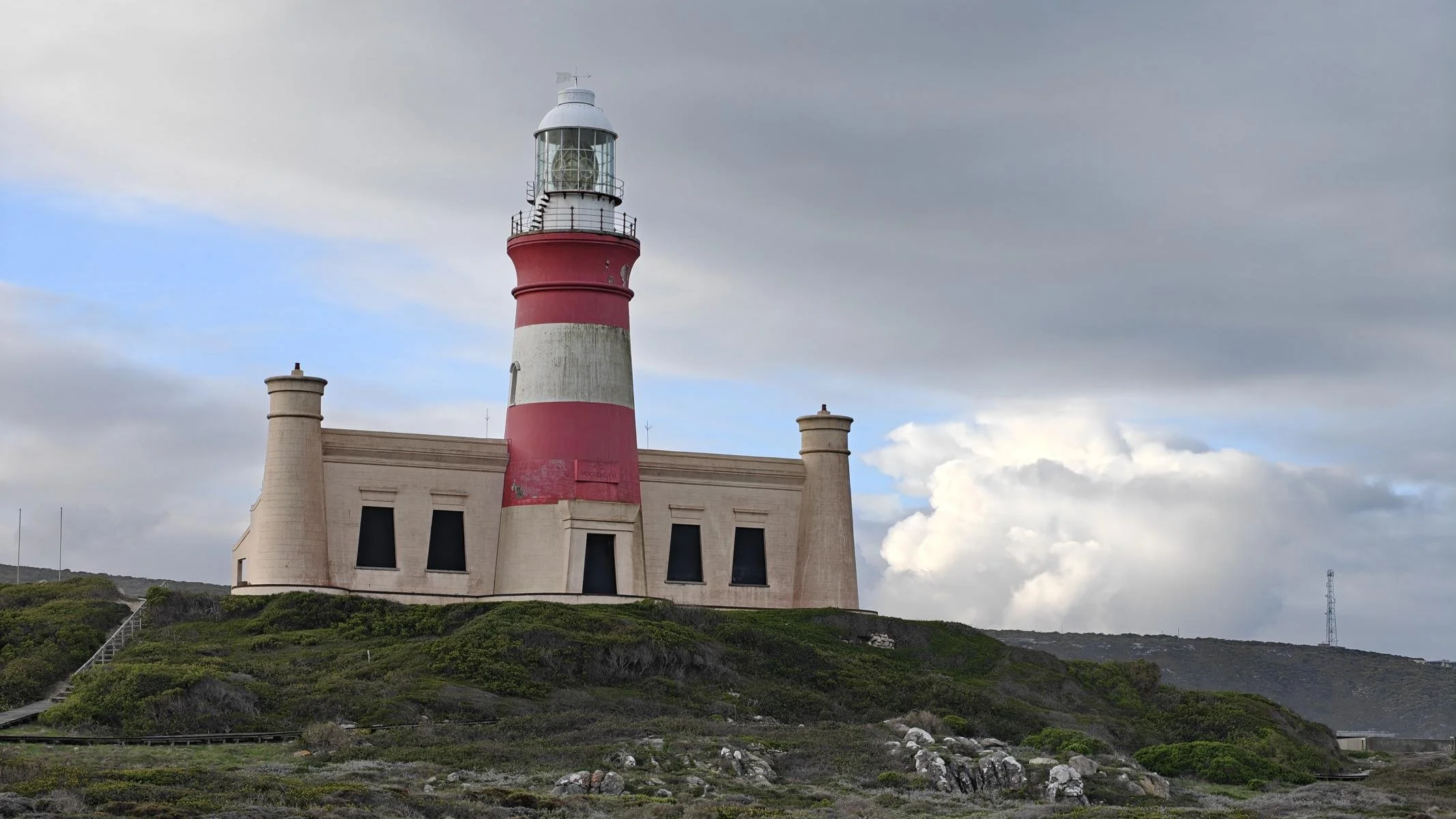
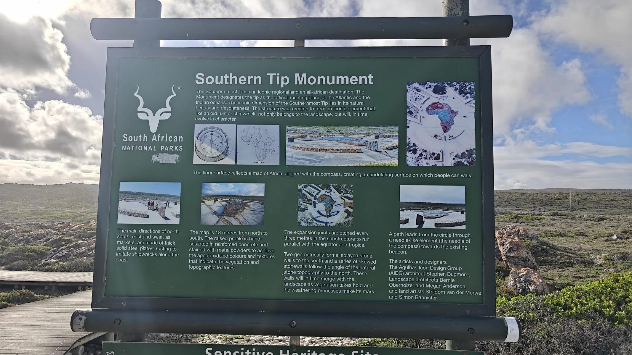
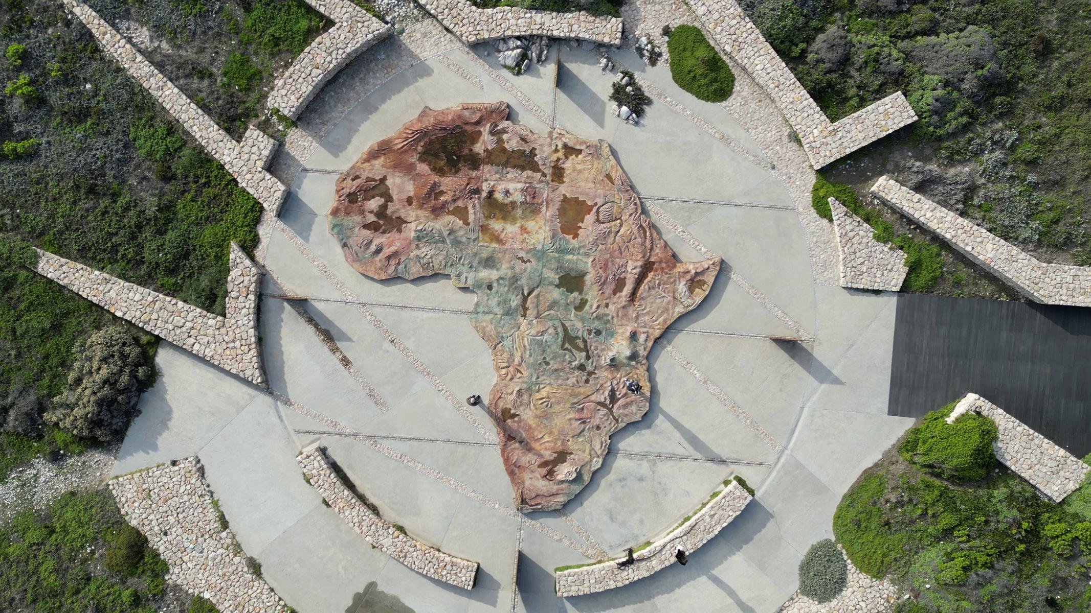
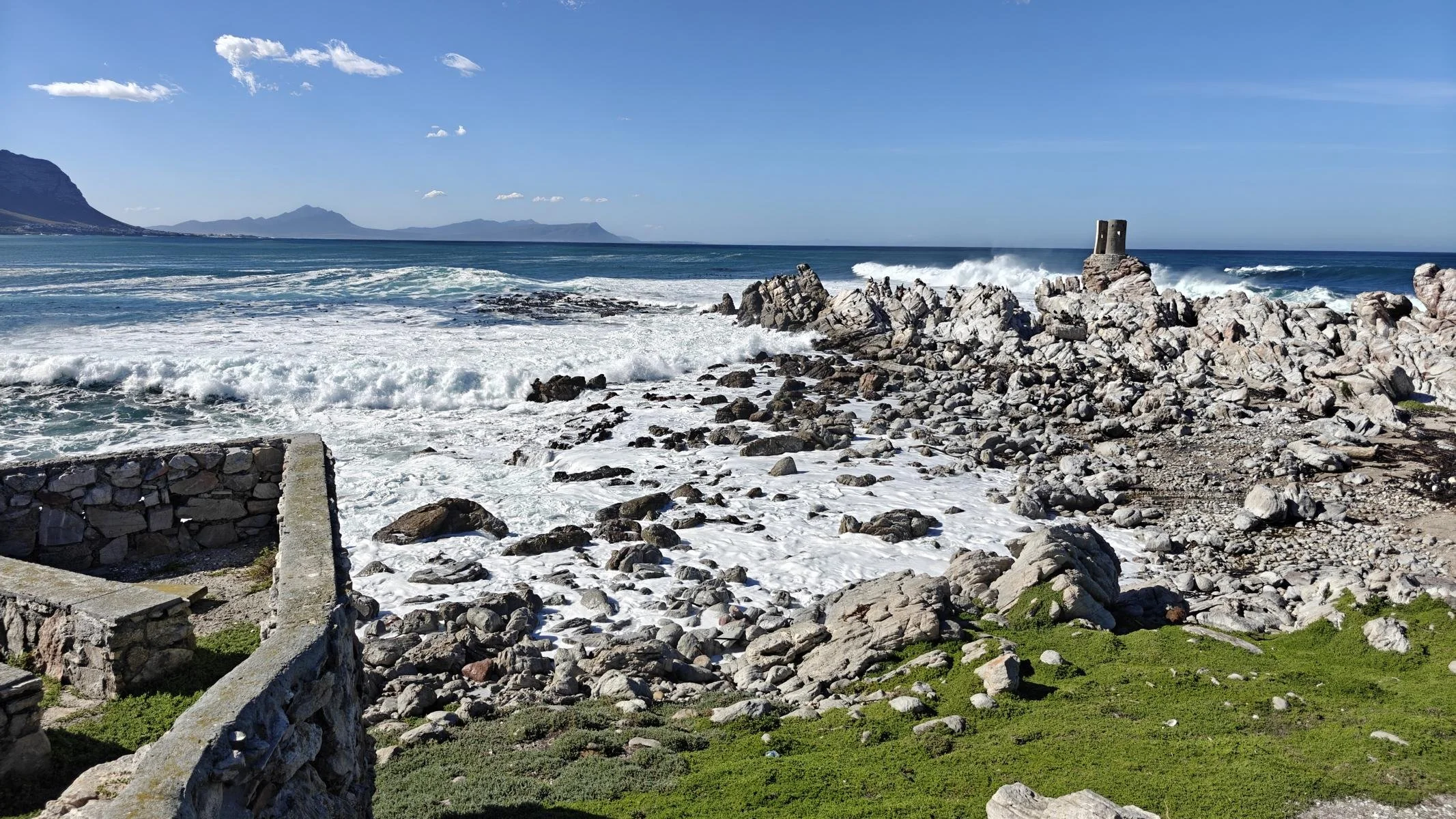
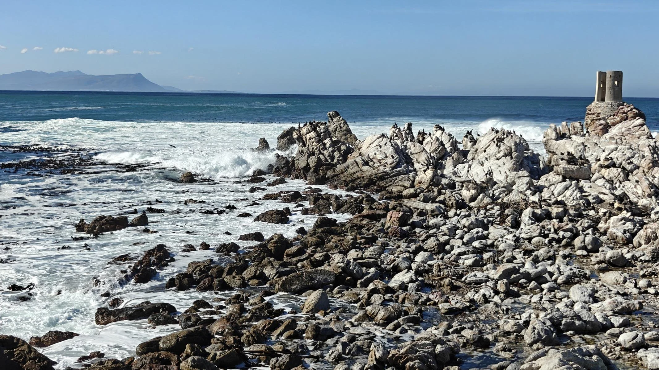
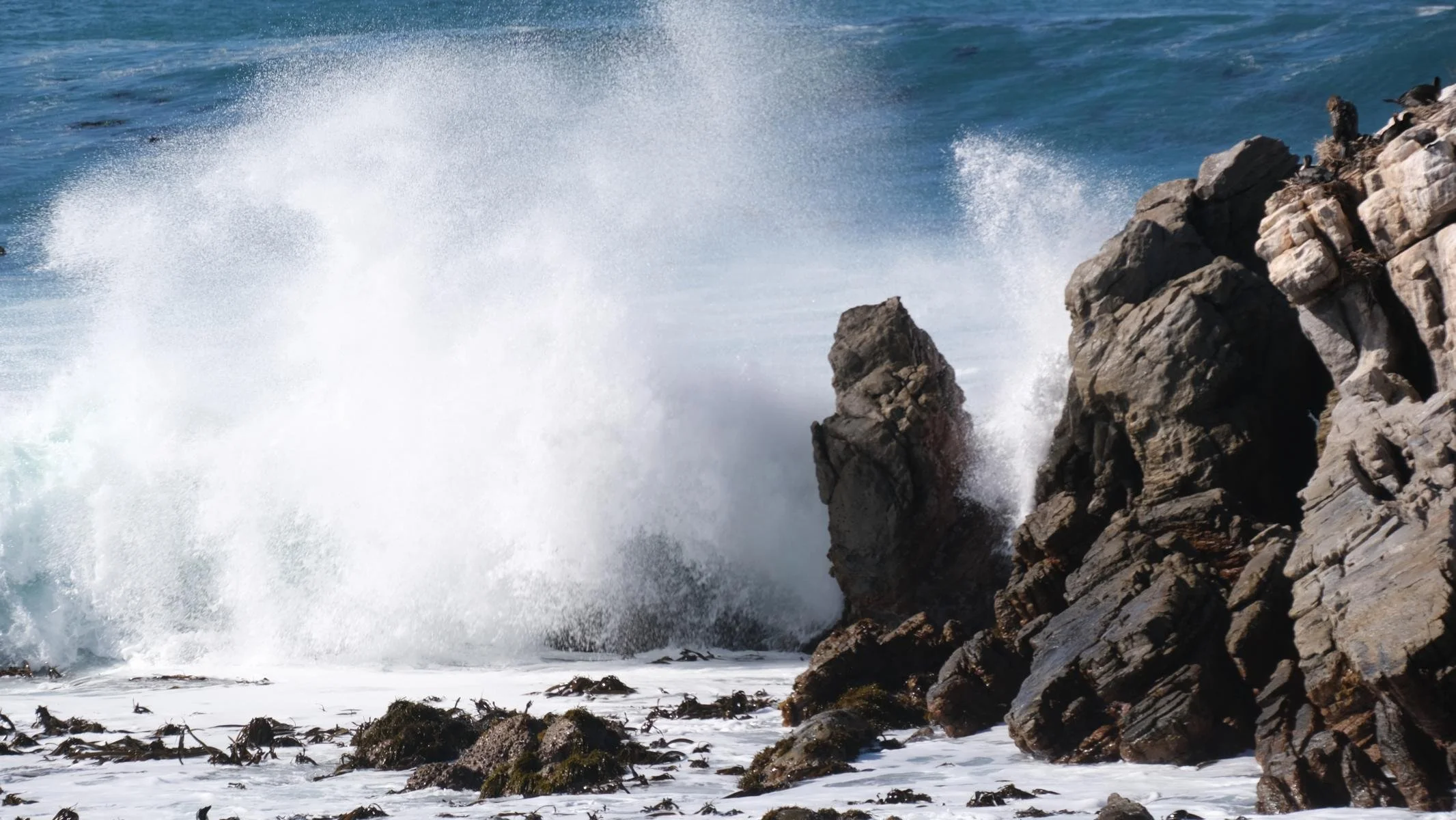
Contrary to popular belief, the southernmost point of Africa is not the Cape of Good Hope (near Cape Town) but Cape Agulhas (coordinates: 34°49′59.6″S and 20°00′0″E), located about 200 km southeast of Cape Town. In terms of the Northern Hemisphere, Cape Agulhas (Portuguese: Cape of the Needles) lies roughly at the same latitude as the southern tip of Greece or northern Morocco.
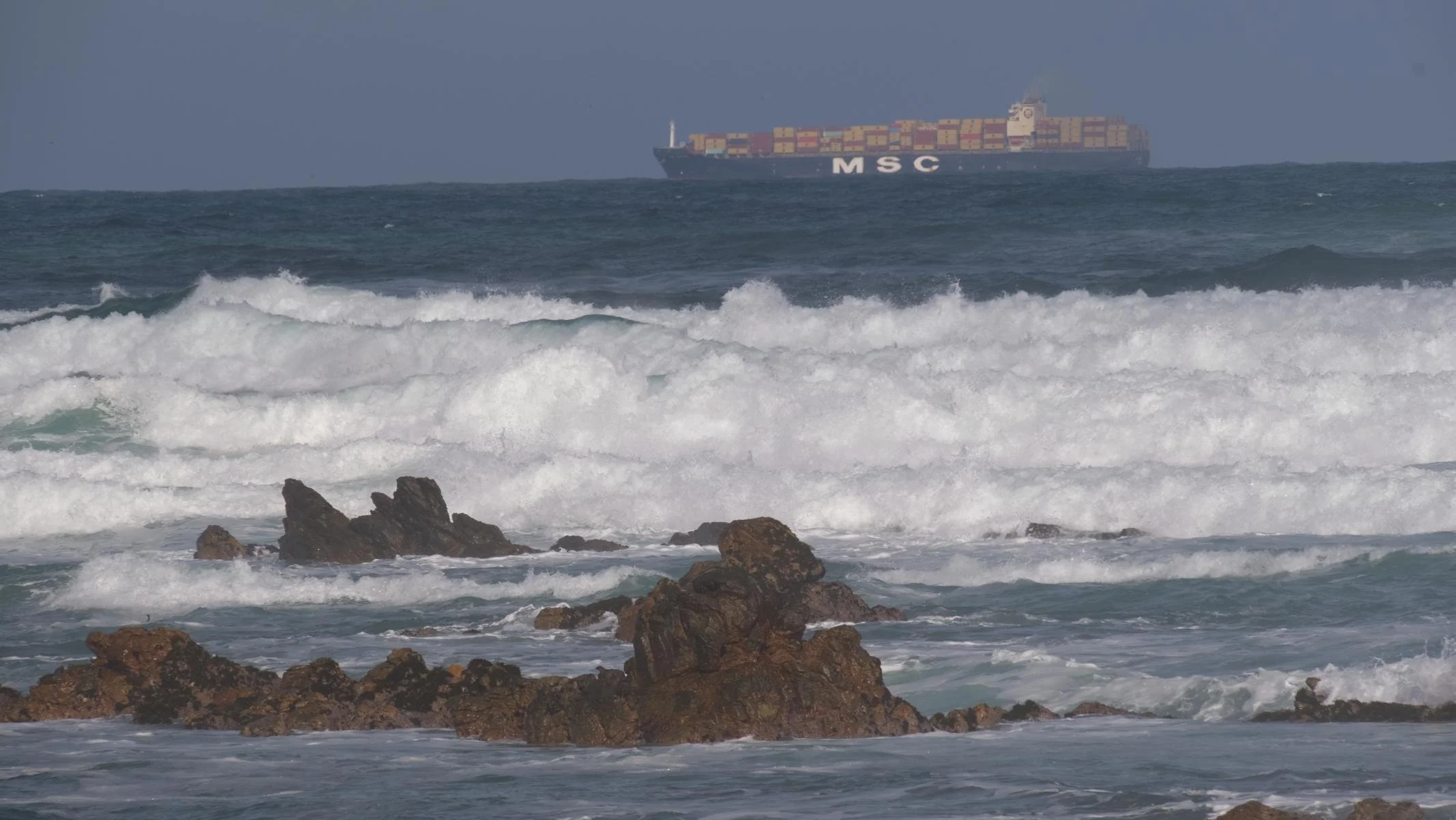
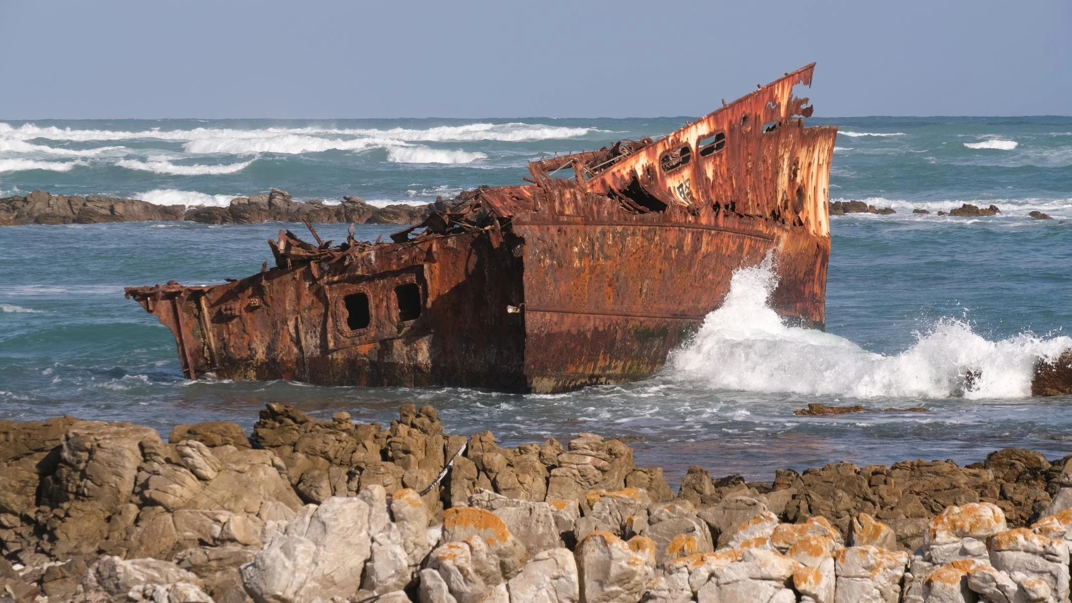
Geographically, Cape Agulhas marks the dividing line between the Indian and Atlantic Oceans. In fact, this is where the warm Agulhas Current and the cold Antarctic Circumpolar Current meet. Winter storms, giant waves, and a shallow continental shelf make Cape Agulhas particularly dangerous for shipping. According to records, approximately 150 ships have sunk in these waters to date.
Anders als allgemein angenommen ist nicht das Kap der Guten Hoffnung (nahe Kapstadt) sondern das Kap Agulhas (Koordinaten: 34°49′59.6″S und 20°00′0″E) rund 200 km süd-östlich von Kapstadt der südlichste Punkt Afrikas. Umgelegt auf die nördliche Halbkugel liegt das Kap Agulhas (portugiesisch: Kap der Nadeln) etwa auf der geografischen Breite der Südspitze Griechenlands / bzw. Nord-Marokkos.
Geografisch ist Kap Agulhas der Trennpunkt zwischen dem Indischen und dem Atlantischen Ozean. Tatsächlich treffen sich hier der warme Agulhas Strom und der kalte Antarktische Zirkumpolarstrom. Winterstürme, Riesenwellen und ein seichter Kontinentalsockel machen das Kap Agulhas für die Schifffahrt besonders gefährlich. Aufzeichnungen zufolge sind in diesen Gewässern bisher ca. 150 Schiffe gesunken.

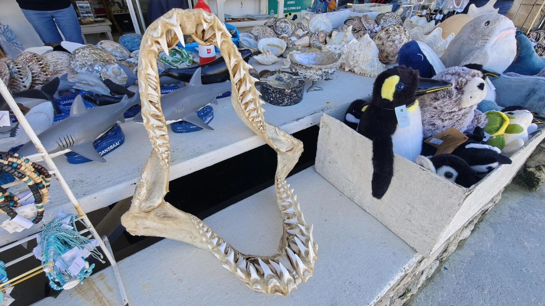
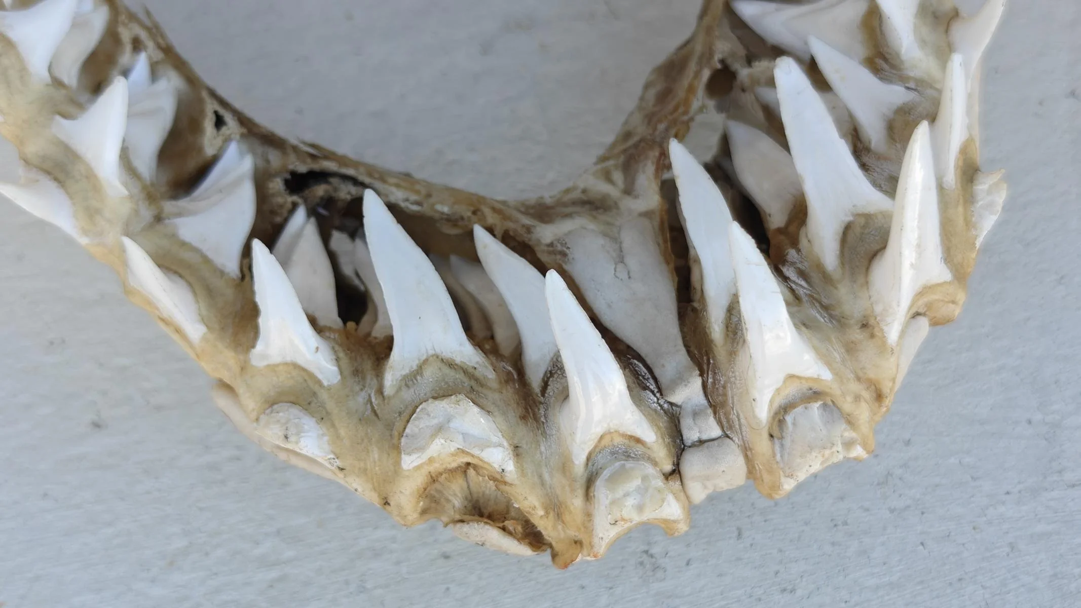
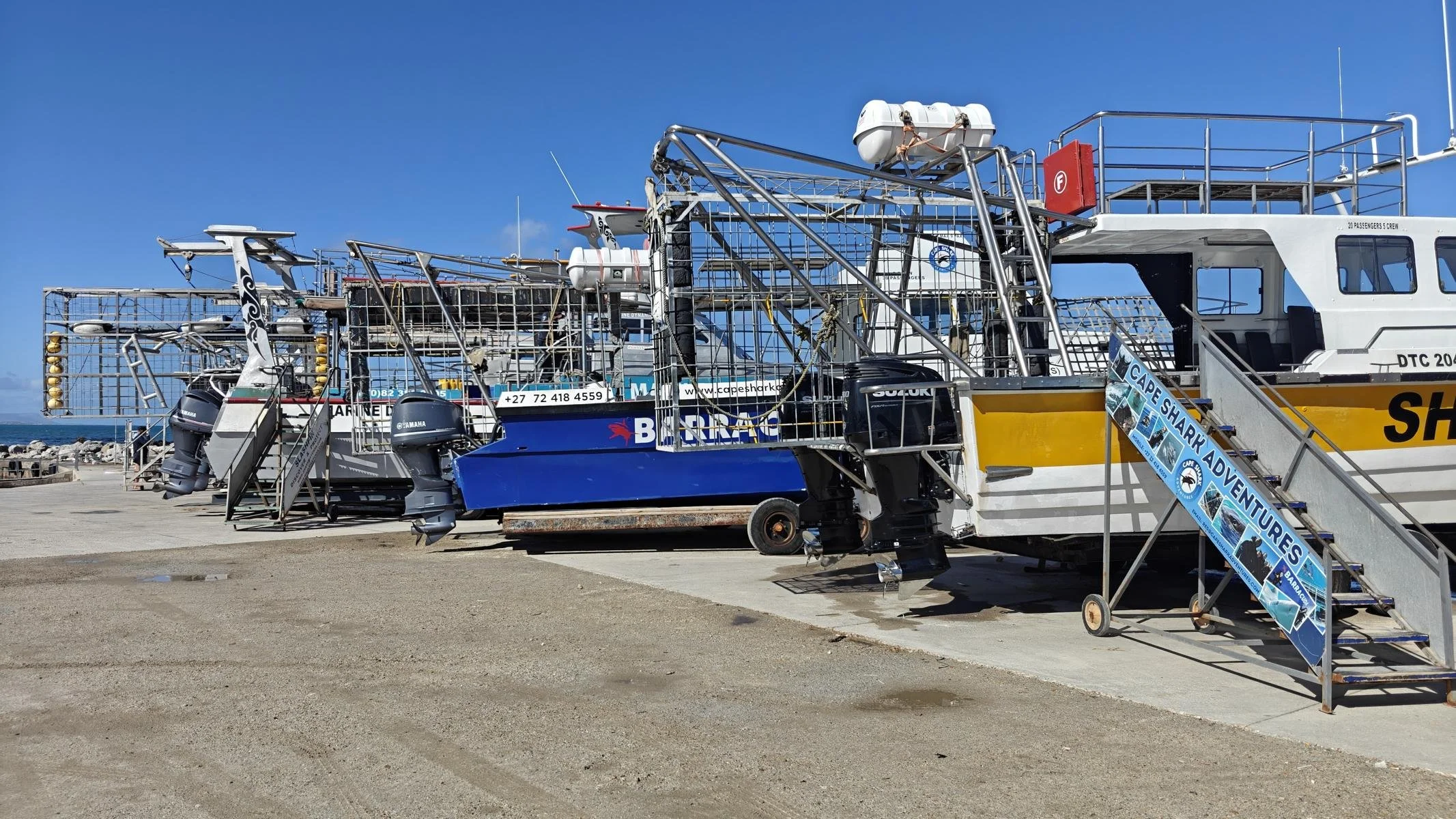
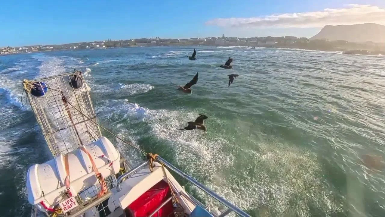
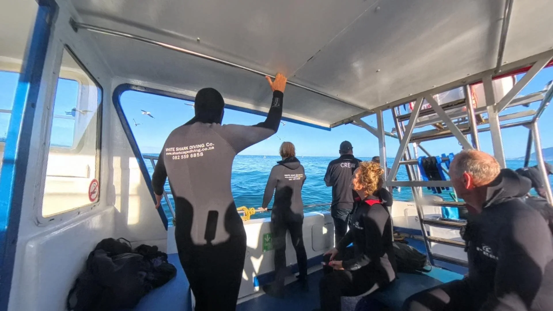
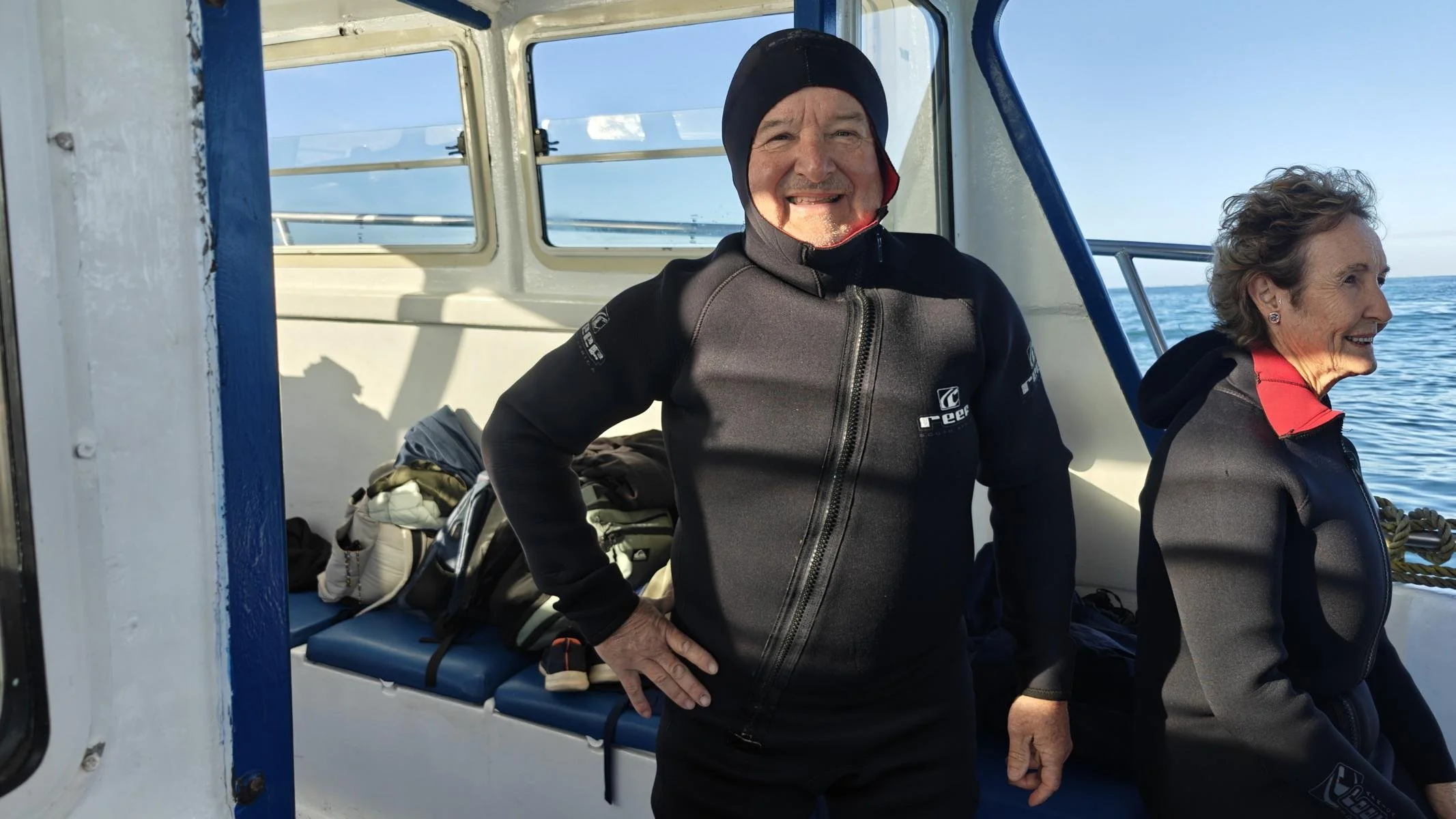
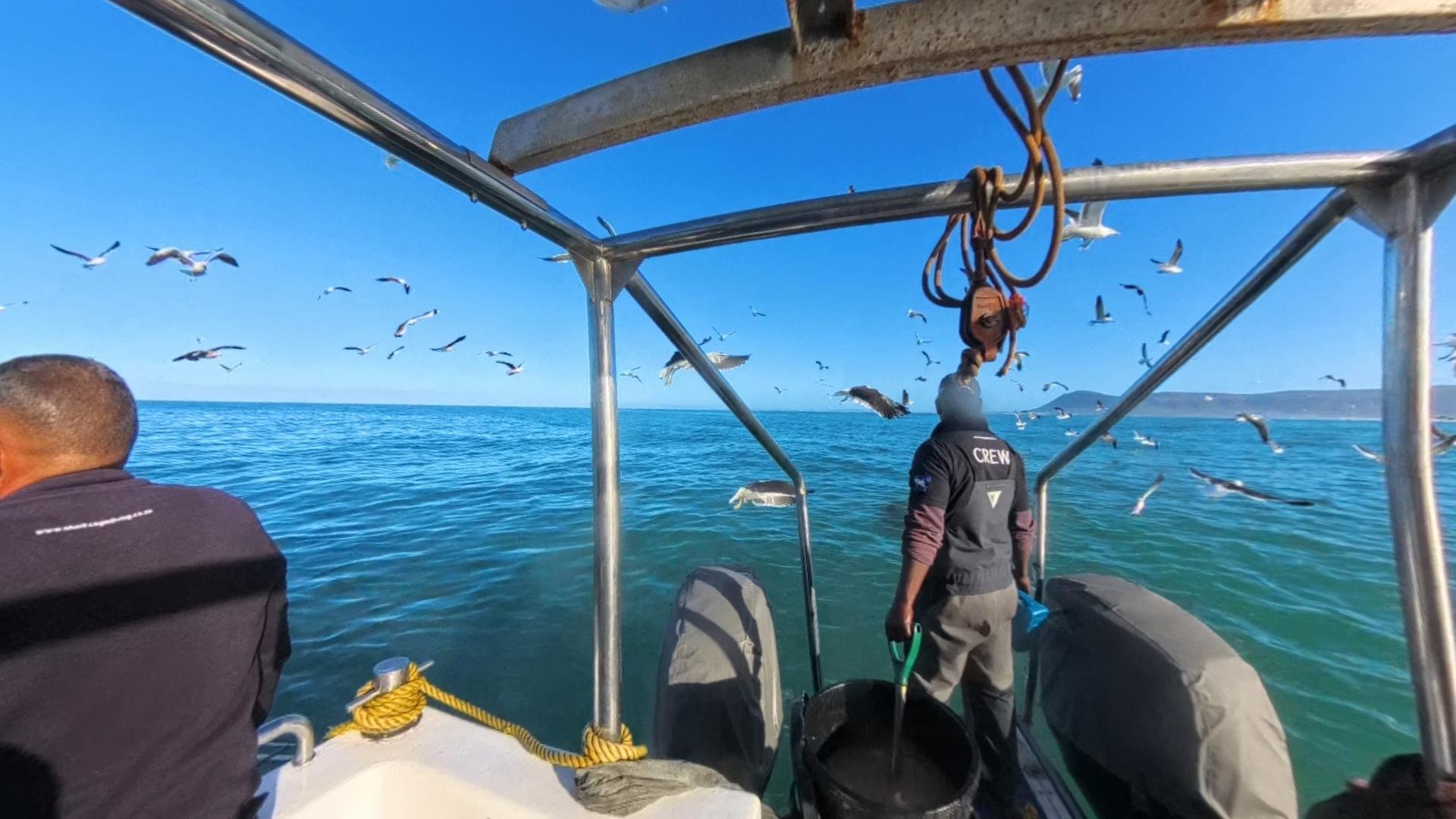
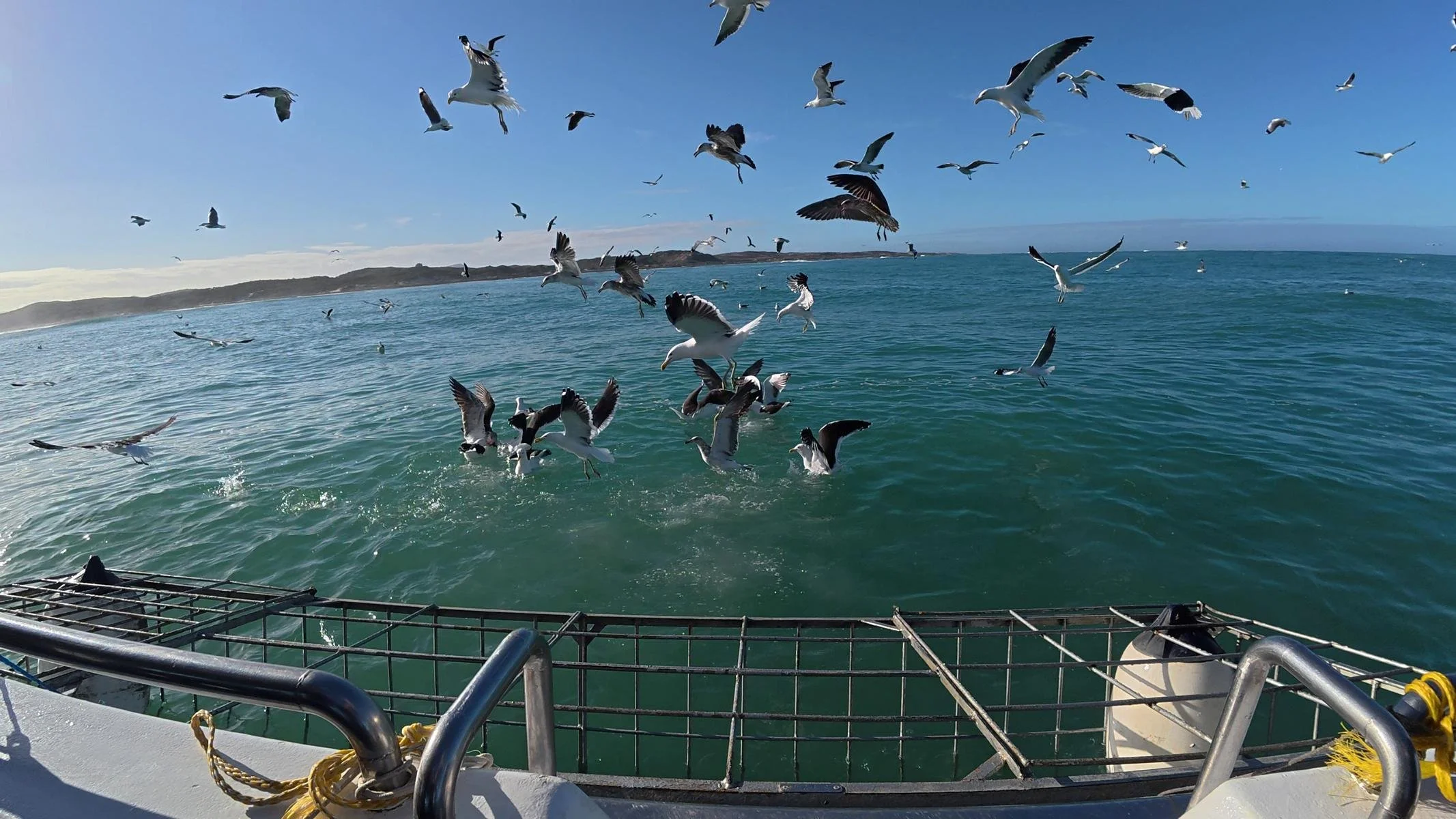
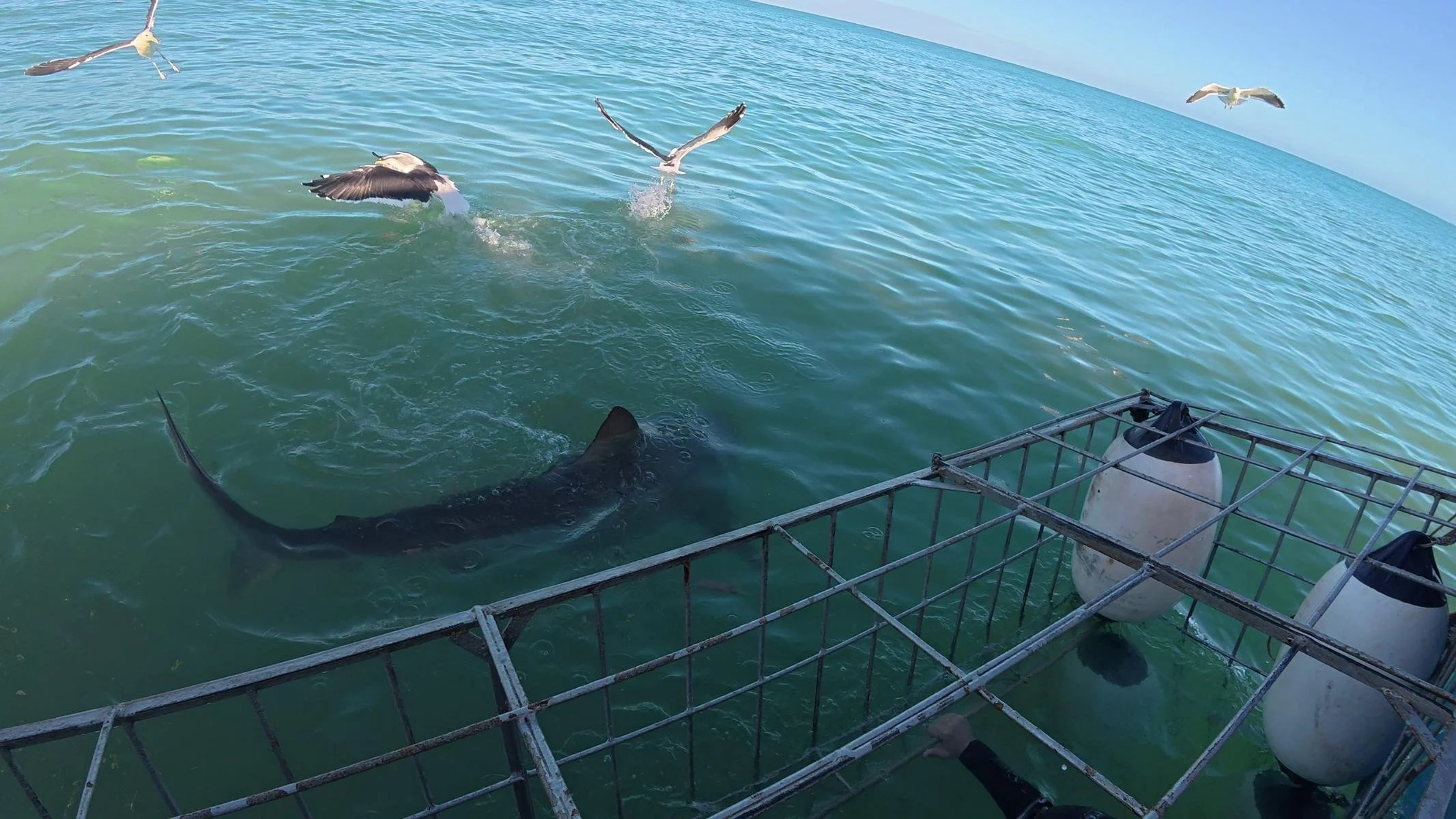
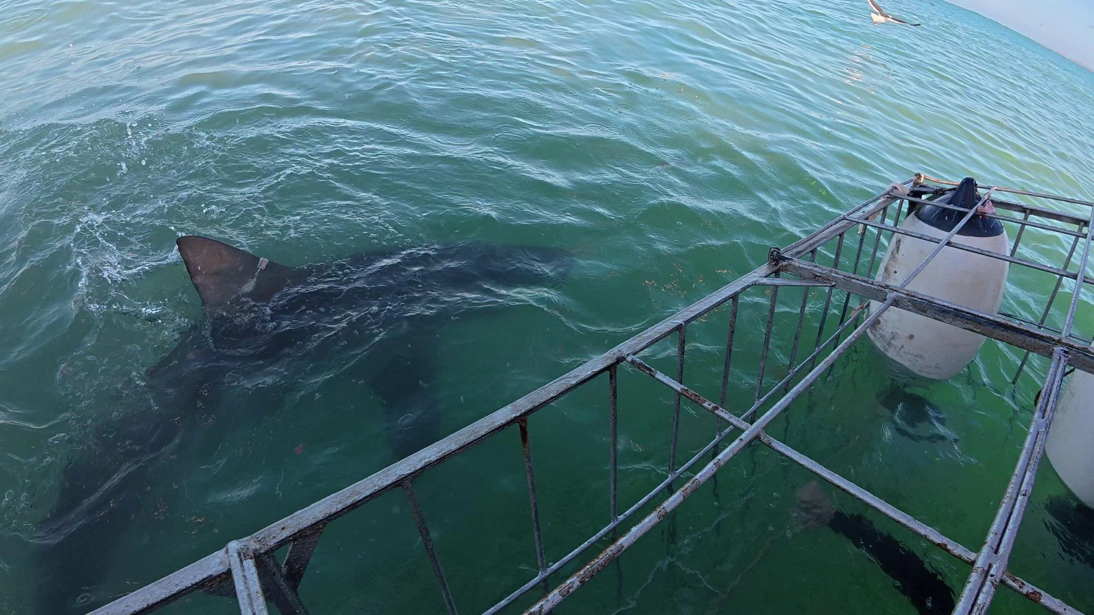
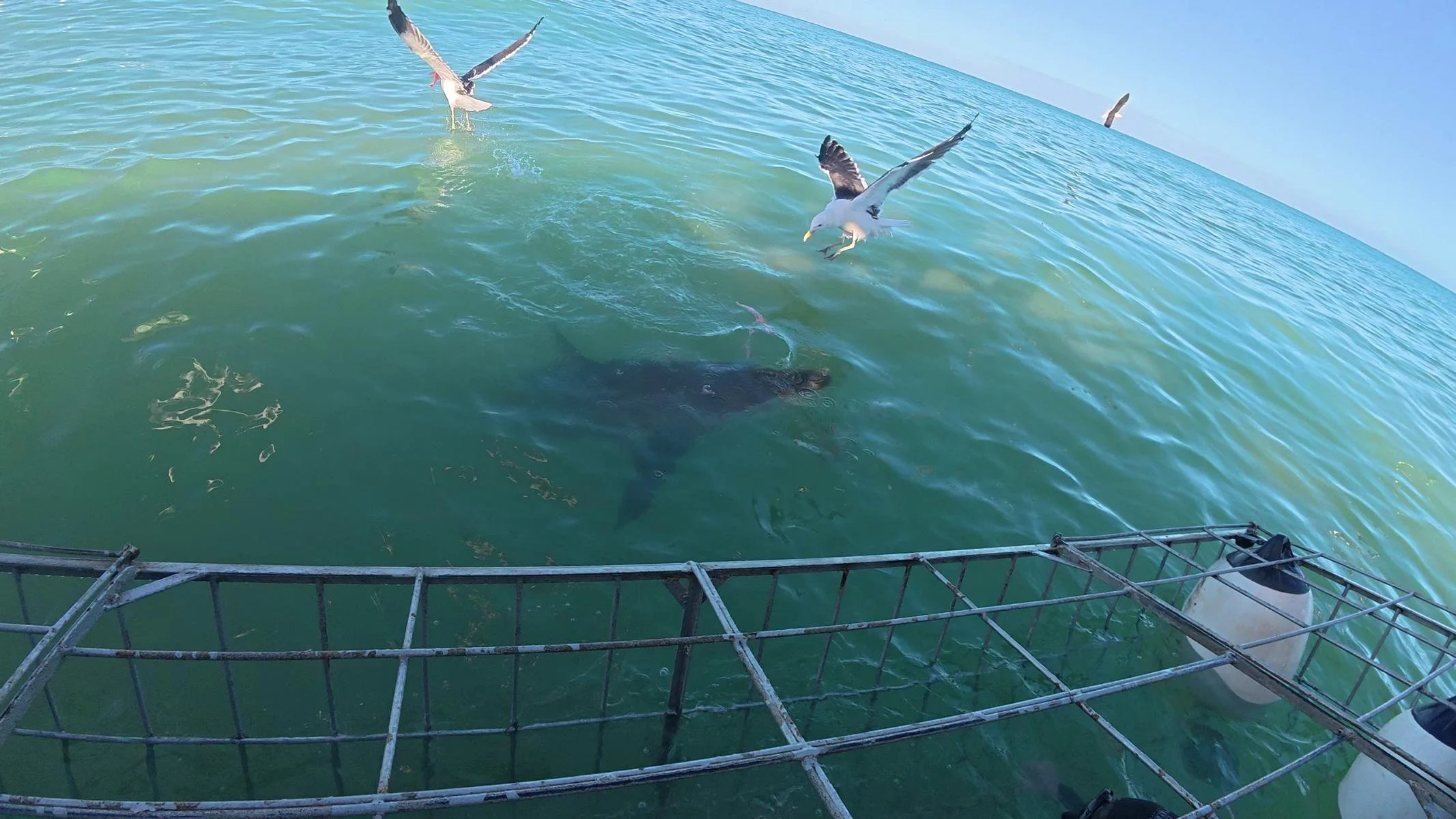
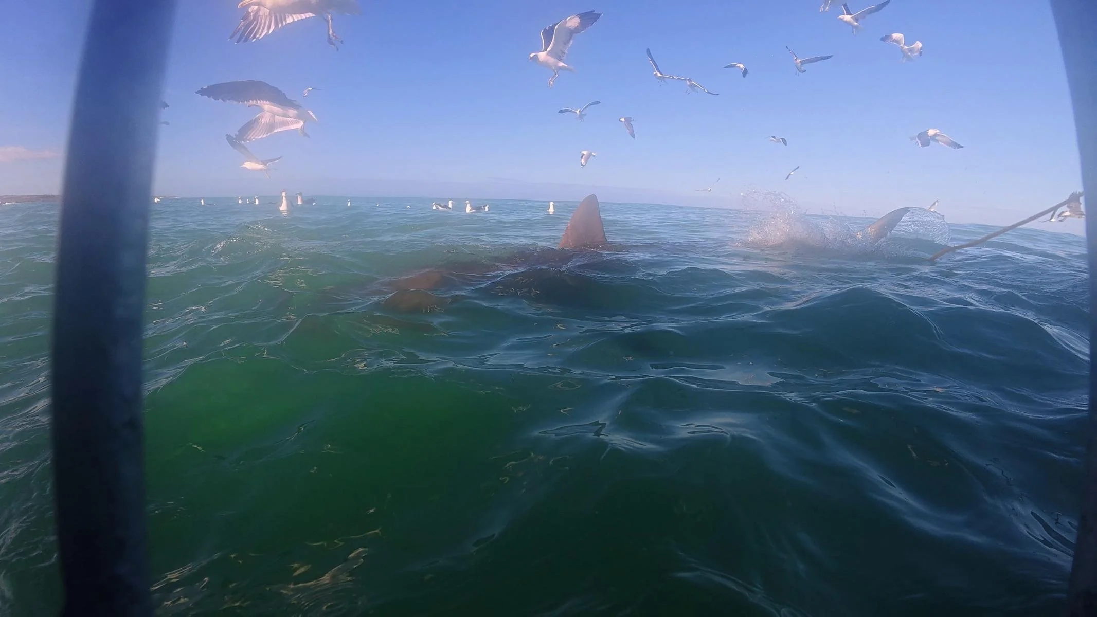
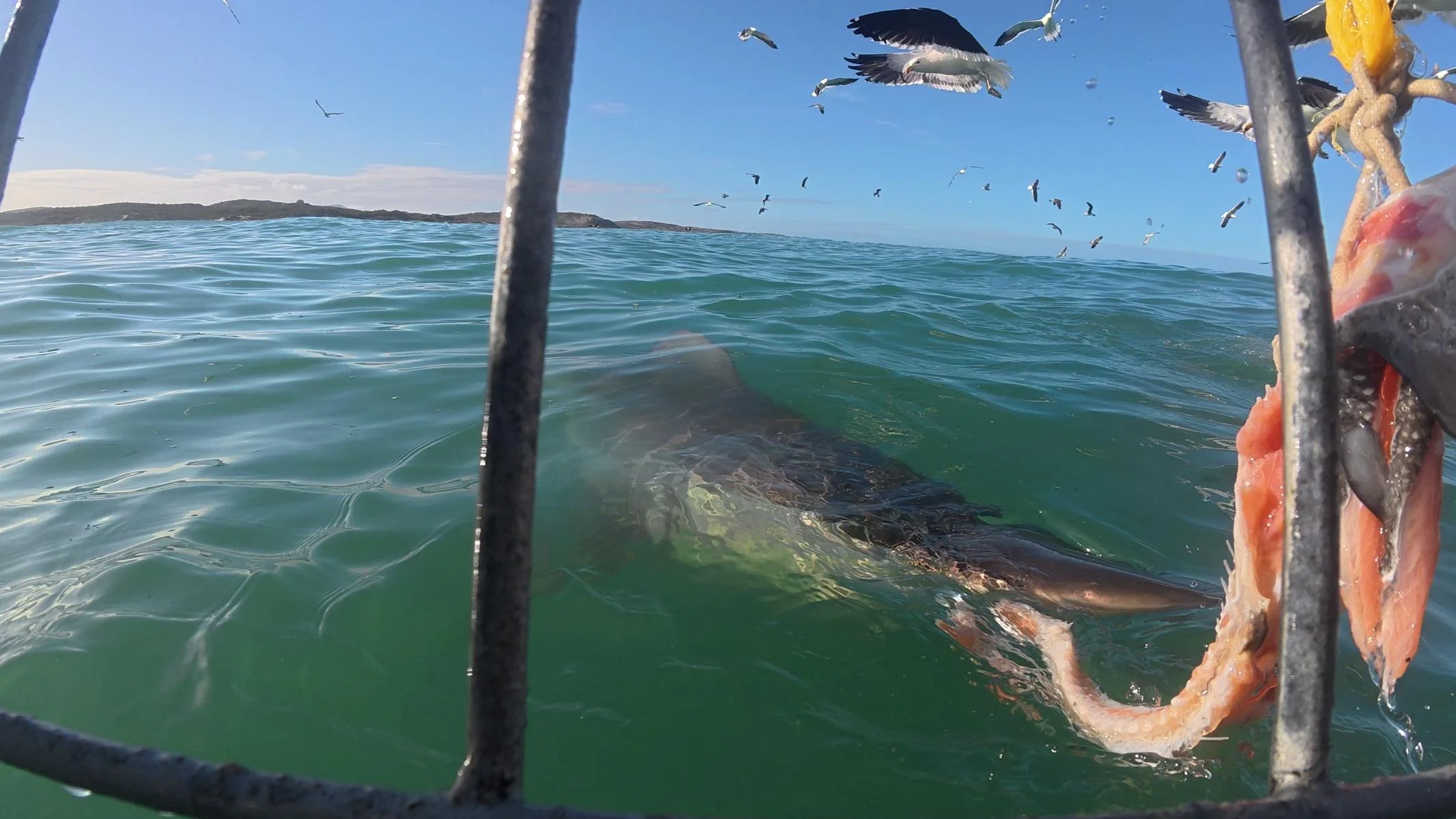
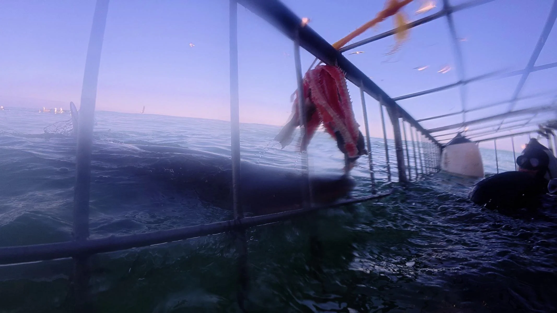
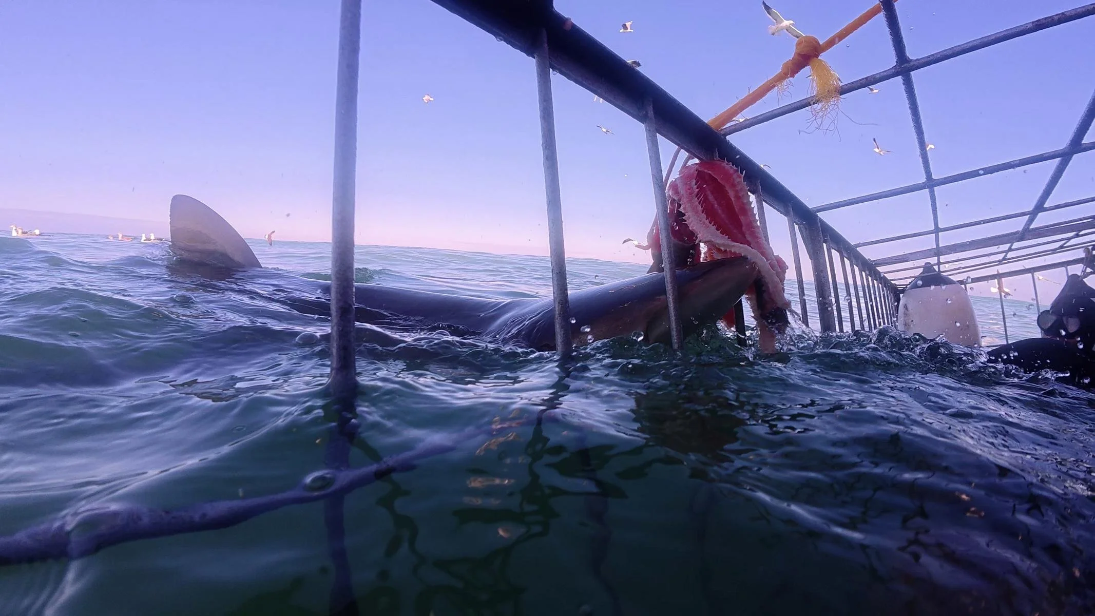
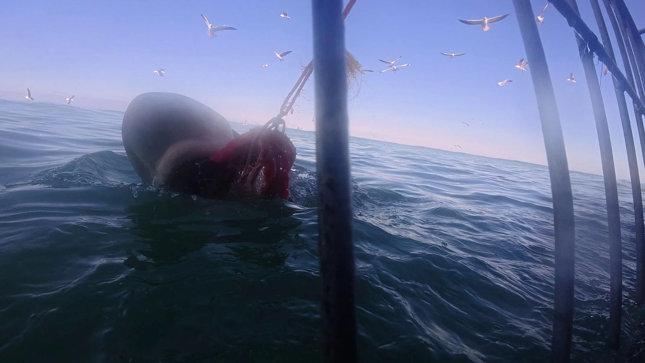
Gansbaai / Kleinbaai used to be known as the place with the highest concentration of great white sharks. Unfortunately, there haven’t been any great white sharks here since 2017. Shark nets and hunting, as well as the presence of some orcas, have drastically decimated the population along the entire coast.
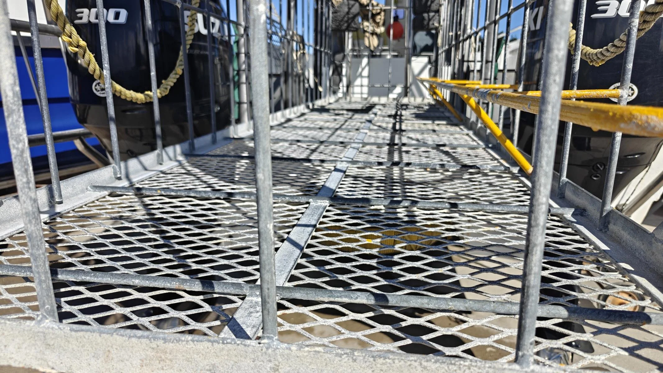
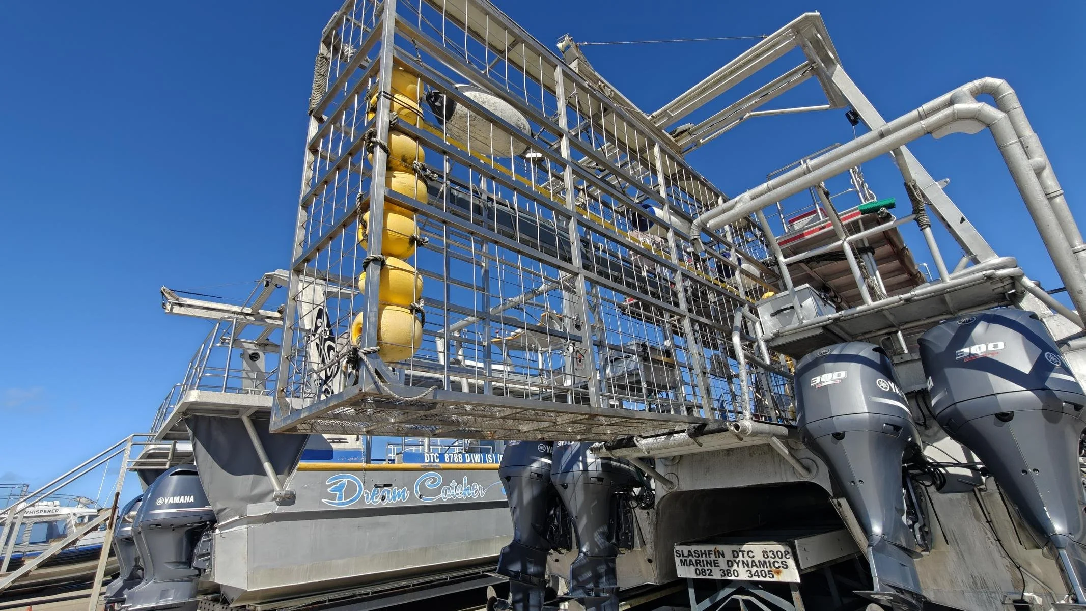
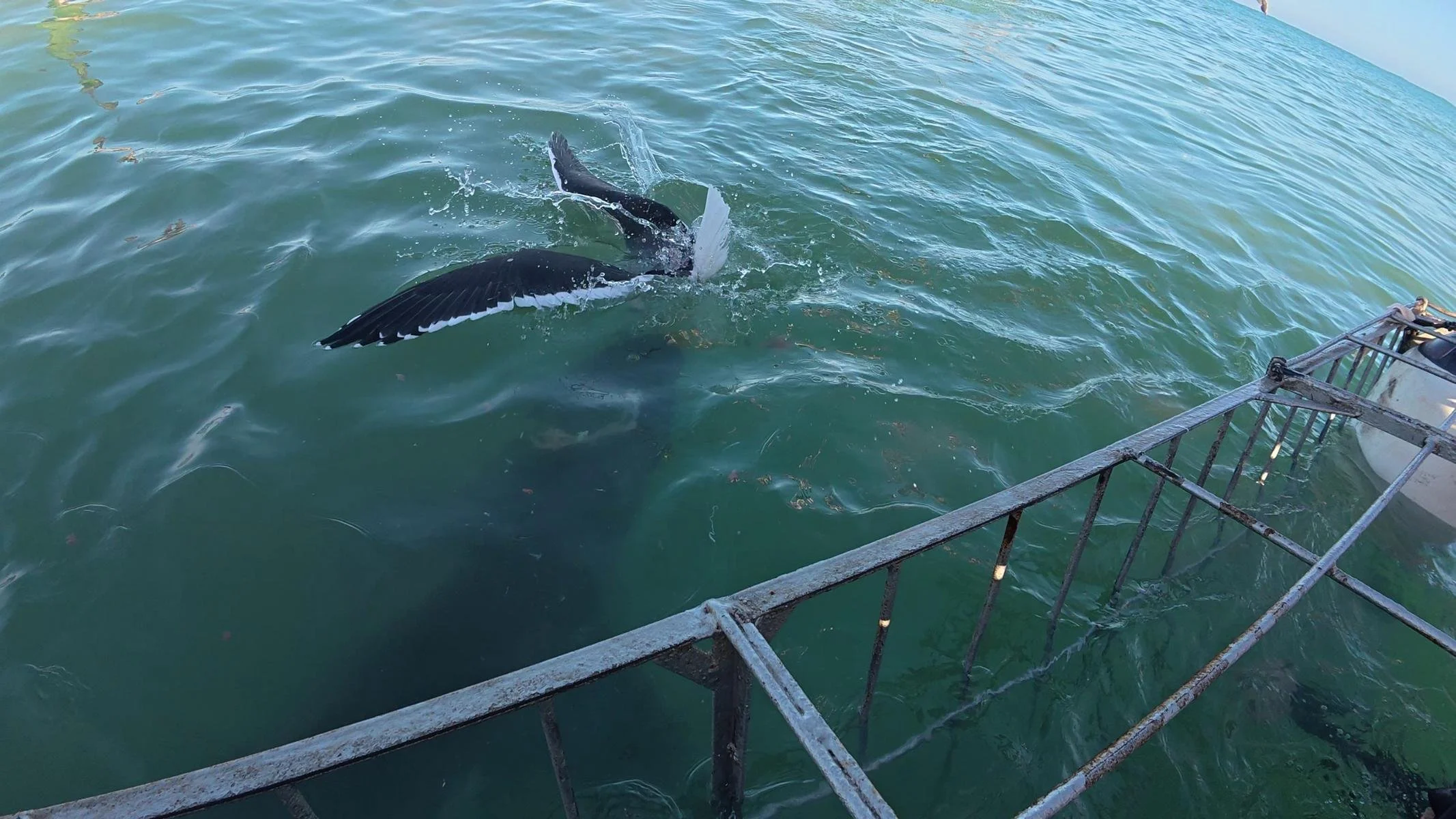
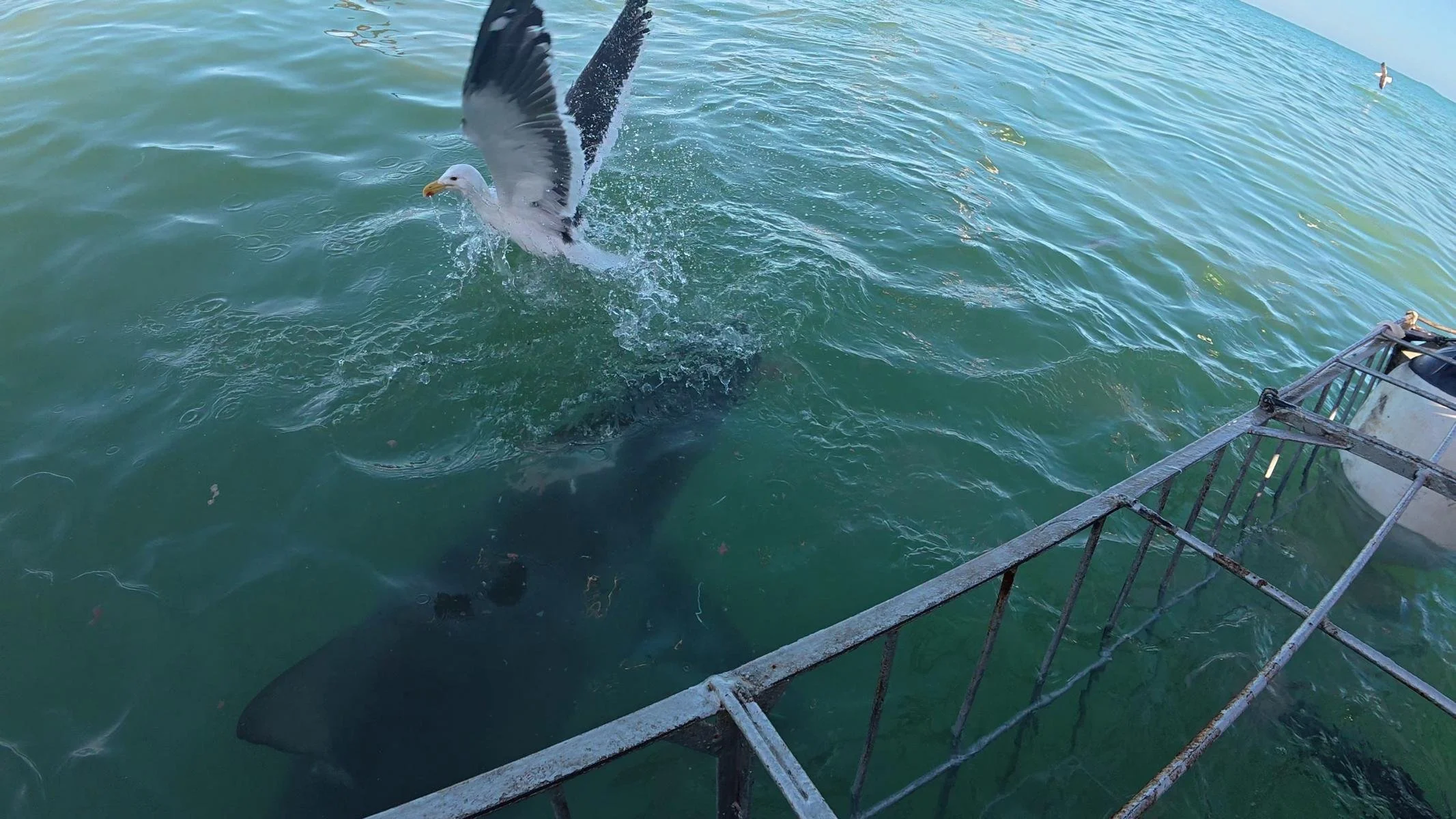
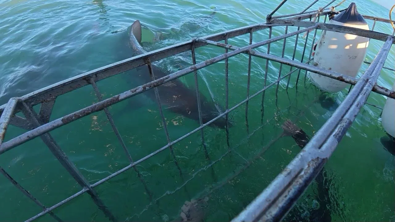
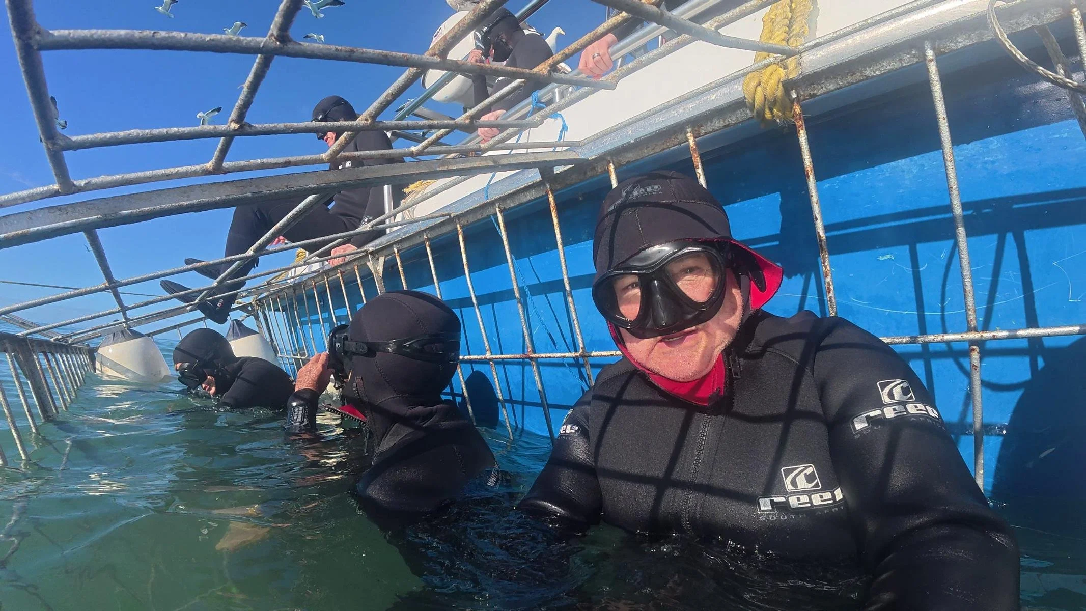
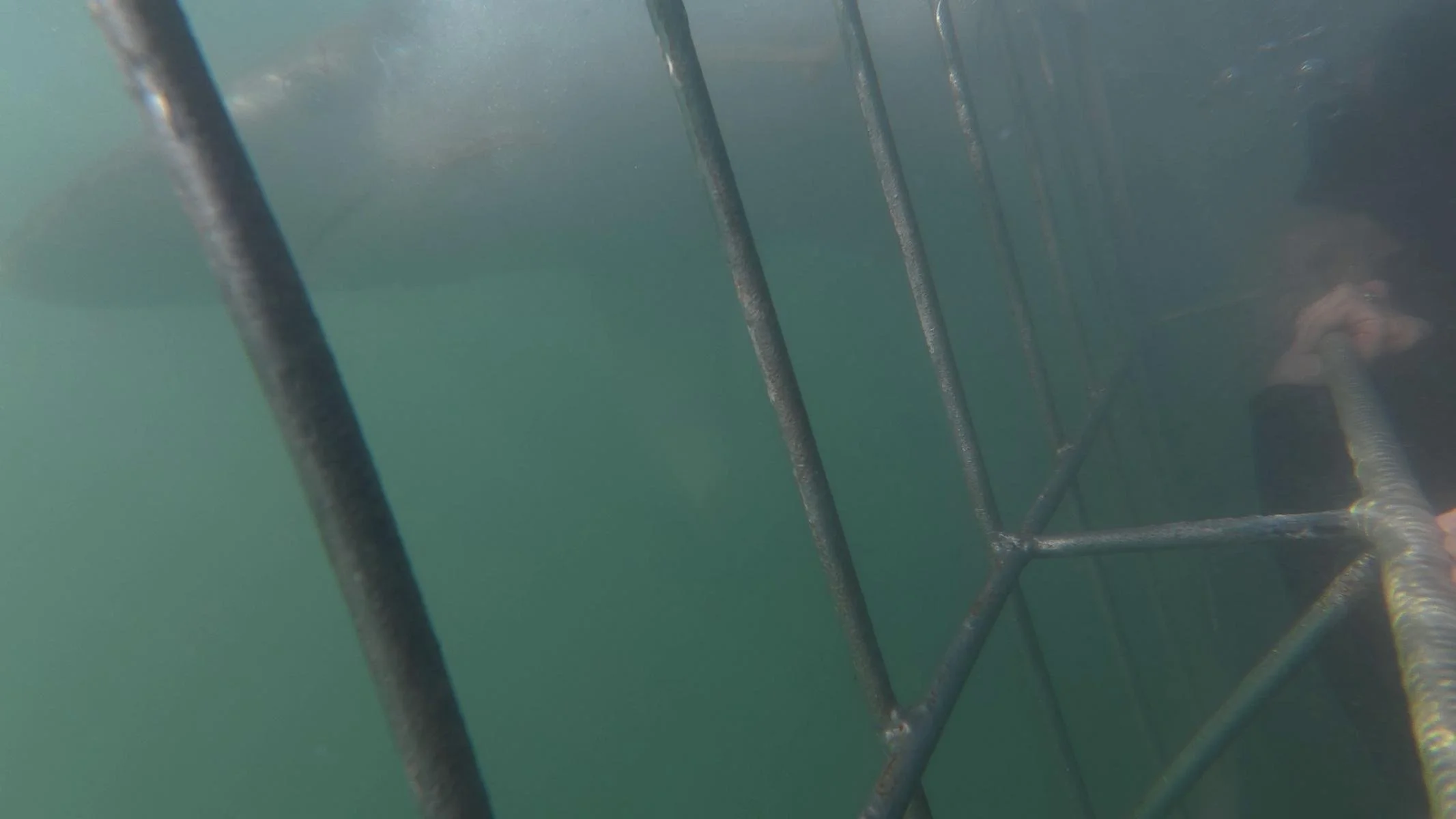
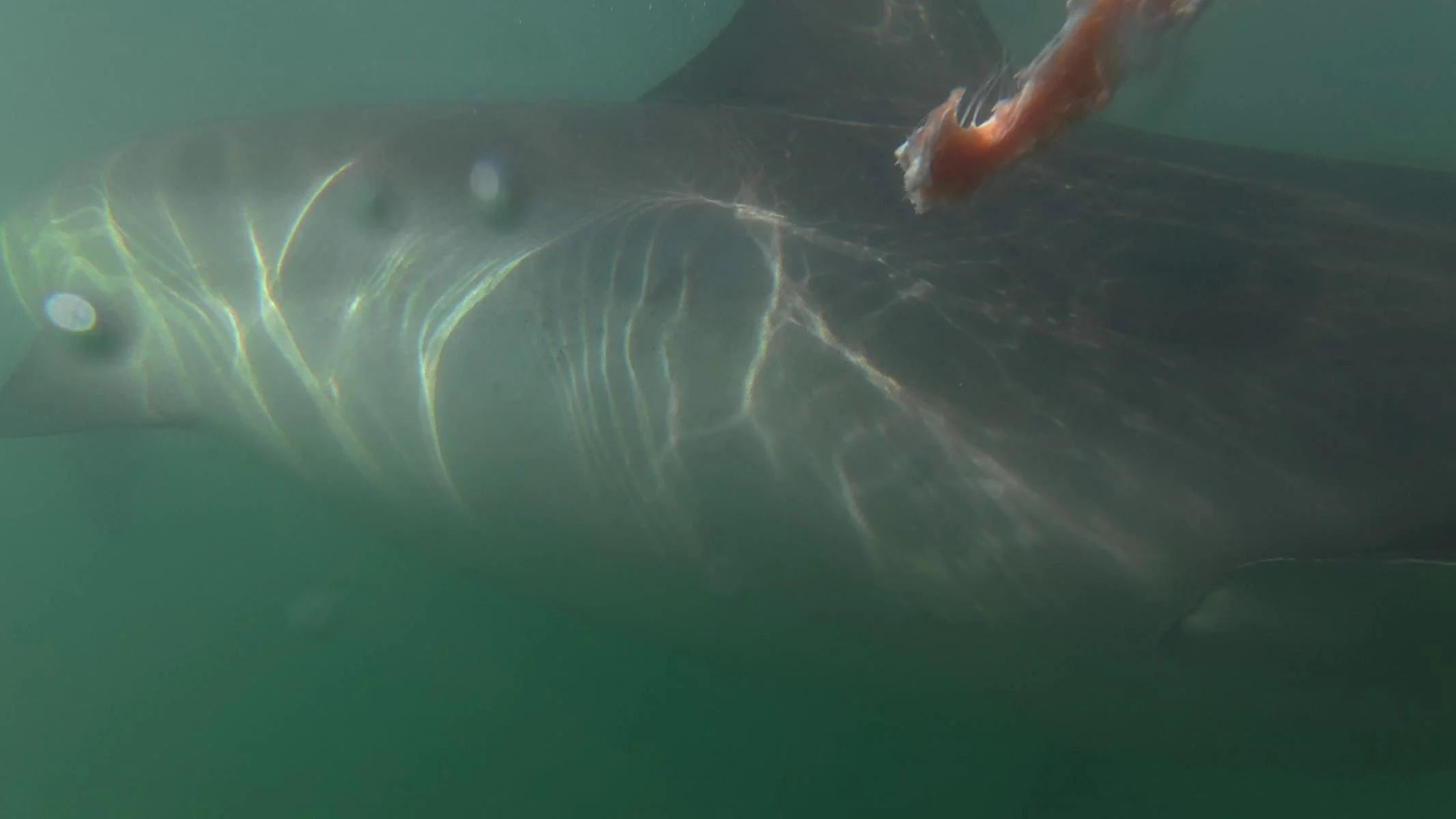
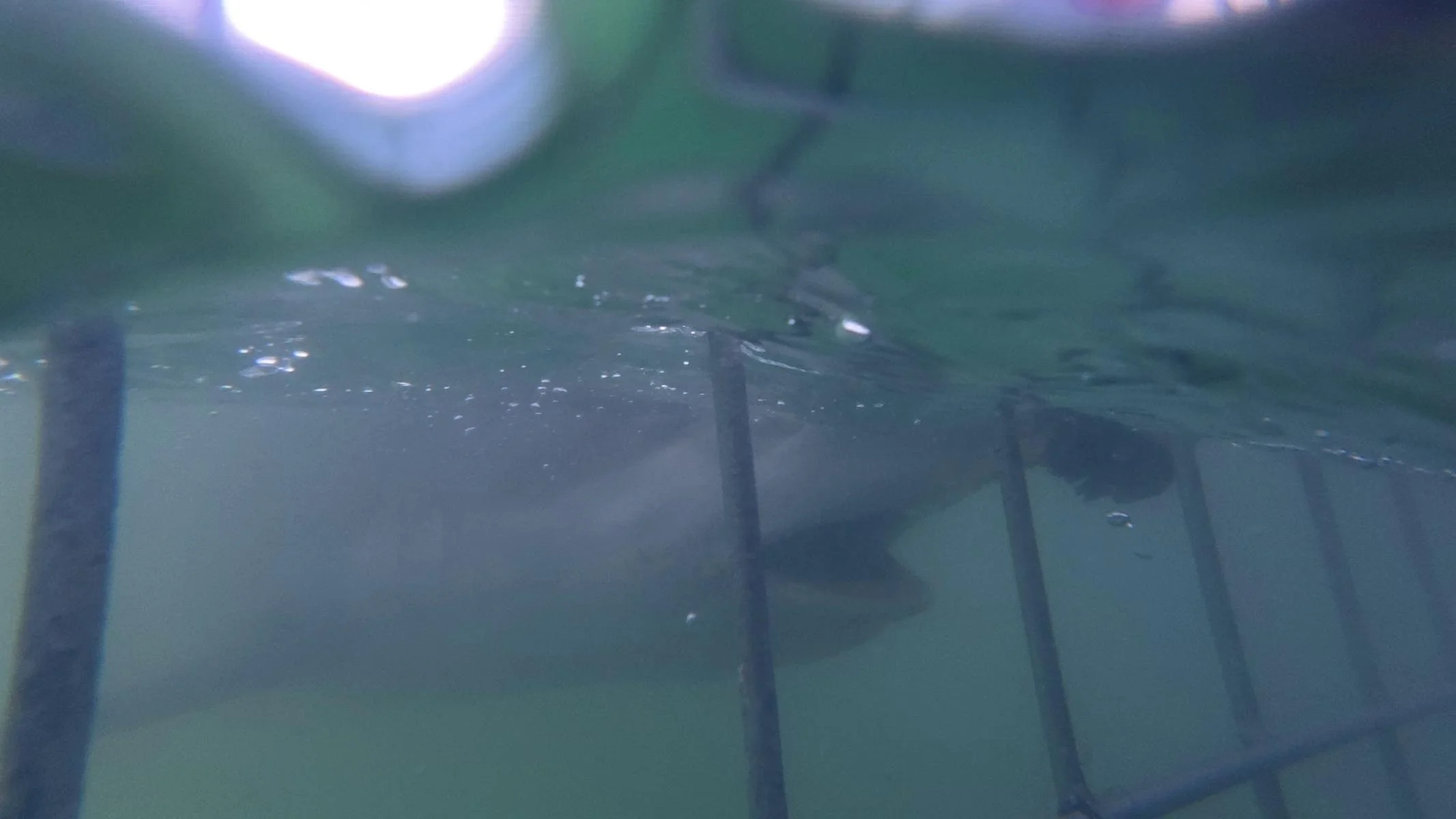
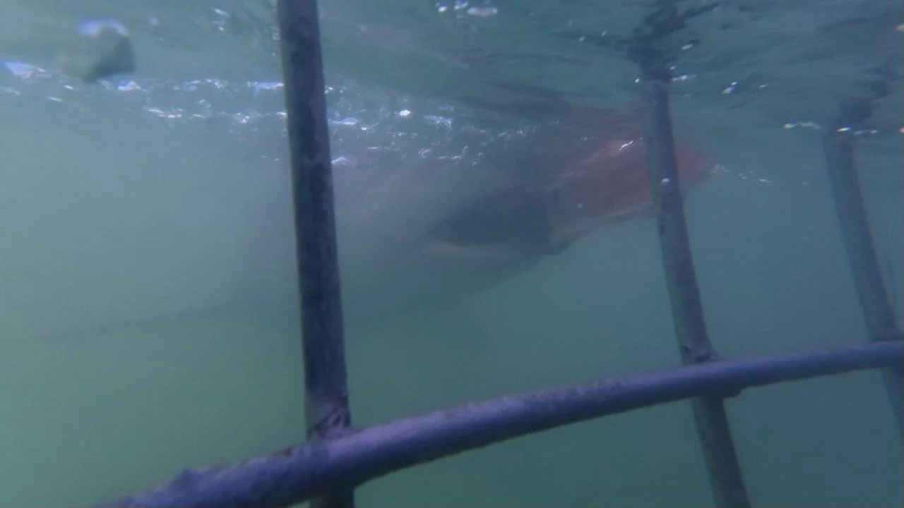
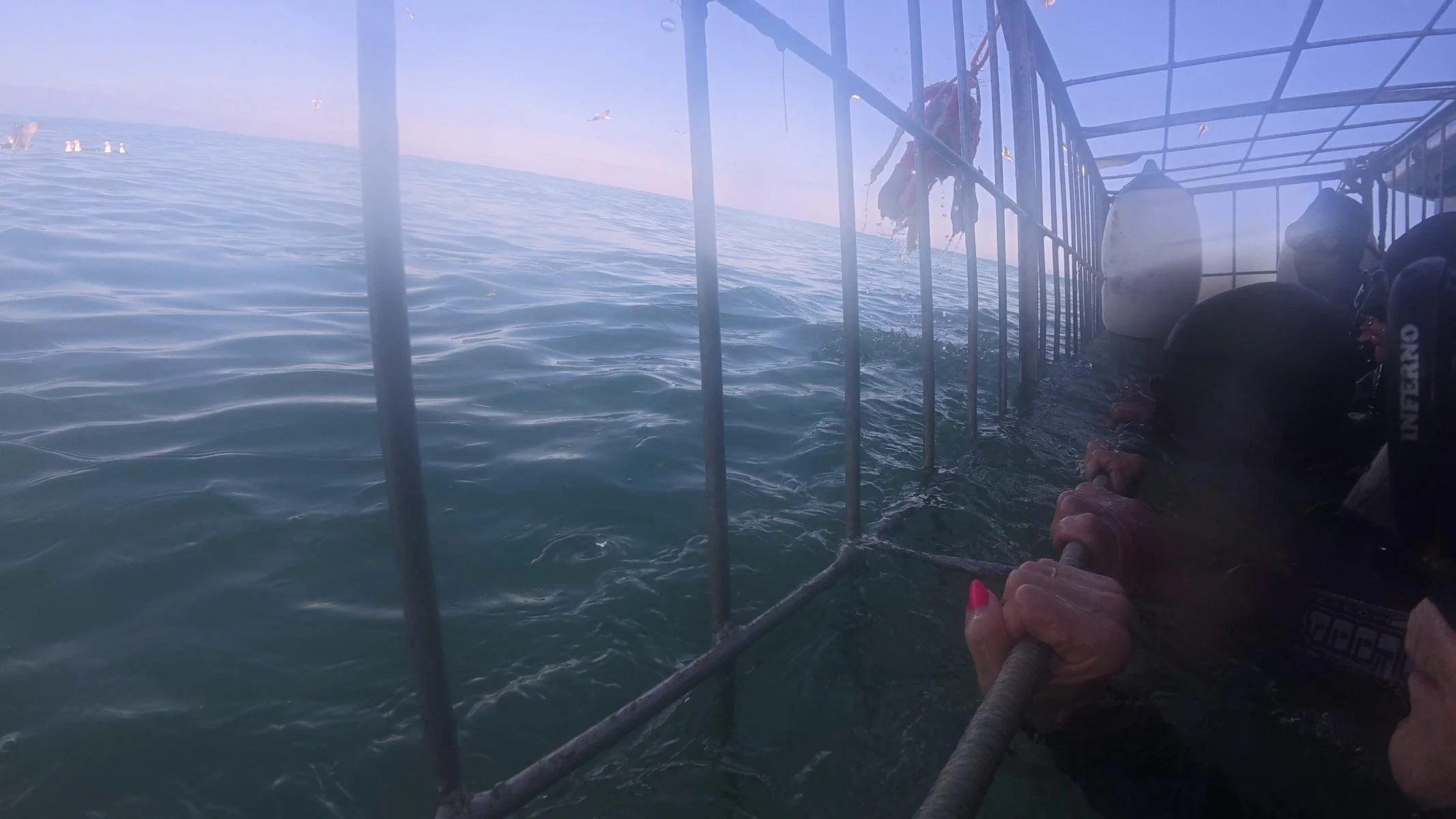
What still exists, however, is shark cage diving. But now it’s only with the somewhat smaller (up to 3 m) and less dangerous bronze whaler sharks. Shark cage diving is an absolute must for “adrenaline junkies.” Here’s how it works: You head out to sea in a group of up to 20 people. There, the sharks are lured with fish scraps. As soon as the first shark is spotted, eight people climb into the cage floating in the water for about 45 minutes. With a bit of luck, you can look directly into a shark’s mouth, either above or below the water. You shouldn’t cling to the bars with your fingers, though, because the shark could tear your skin as it brushes past. It was a very intense and “close-to-nature” experience. You just have to trust that the bars will hold the shark and that the cage won’t plunge to the ocean floor 😊.
Gansbaai / Kleinbaai war früher als der Ort mit der höchsten Dichte an Weißen Haien bekannt. Leider gibt es hier seit 2017 keine Weißen Haie mehr. Hai-Netze und Bejagung aber auch die Präsenz einiger Orcas haben die Bestände entlang der gesamten Küste massiv dezimiert.
Was es aber immer noch gibt ist das Haikäfigtauchen. Allerdings nur mehr mit den etwas kleineren (bis 3 m) und weniger gefährlichen Bronzehaien. Haikäfigtauchen ist ein absolutes Muss für „Adrenalin-Junkies“. Das ganze läuft etwa so ab: Man fährt in einer Gruppe von bis zu 20 Personen aufs Meer. Dort werden mit Fischresten die Hai angelockt. Sobald der erste Hai gesichtet wird klettert man zu acht für etwa 45 Minuten in den im Wasser schwimmenden Käfig. Mit etwas Glück kann man einem Hai über oder unter Wasser direkt in den Rachen schauen. Die Finger sollte man allerdings nicht an die Gitterstäbe klammern, da einem der Hai beim Vorbeischrammen die Haut aufreißen kann. Es war ein sehr intensives und „naturnahes“ Erlebnis. Man muss nur einfach darauf vertrauen, dass das Gitter den Hai aushält und der Käfig nicht auf den Meeresgrund hinunterstürzt 😊.

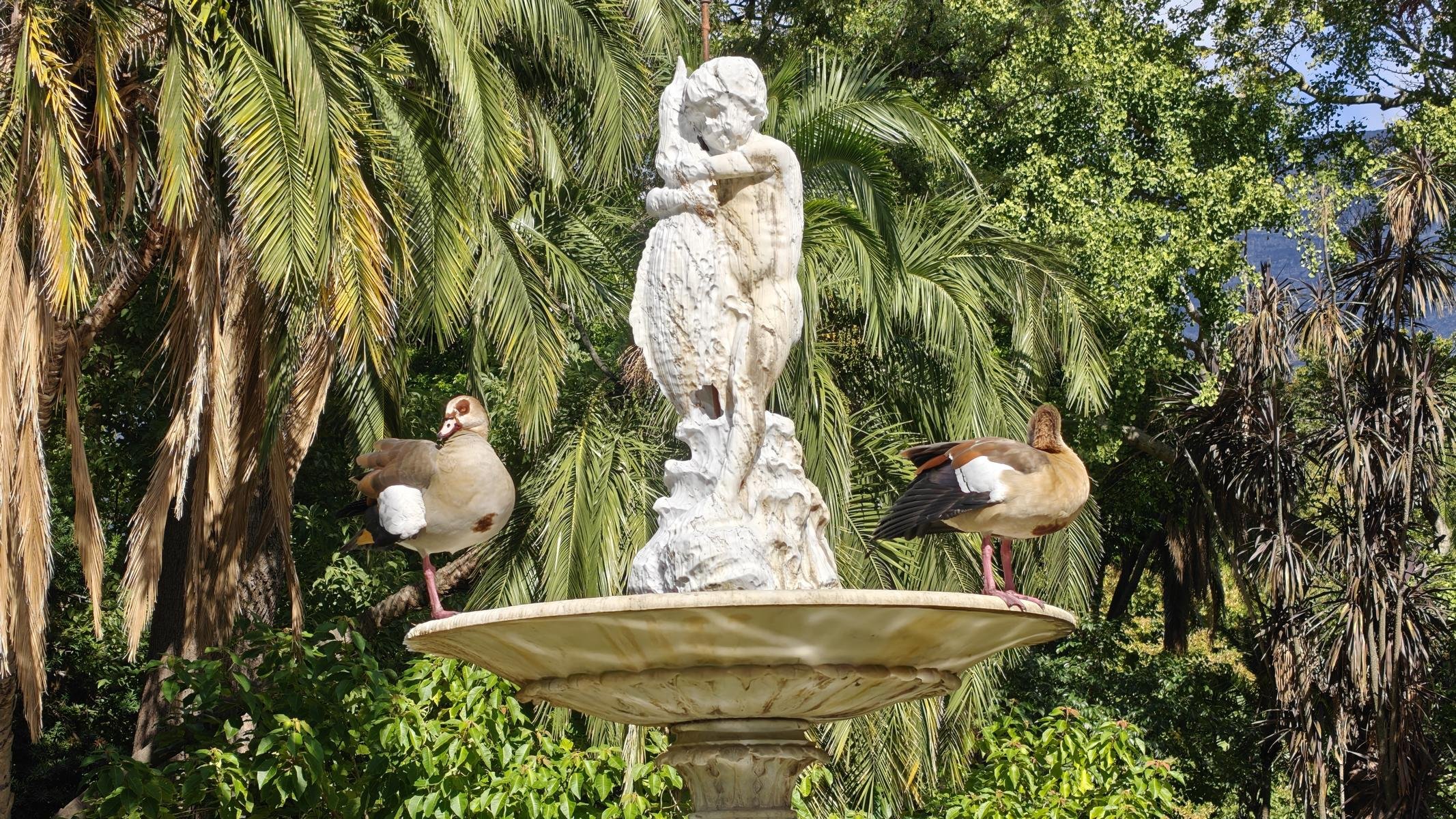
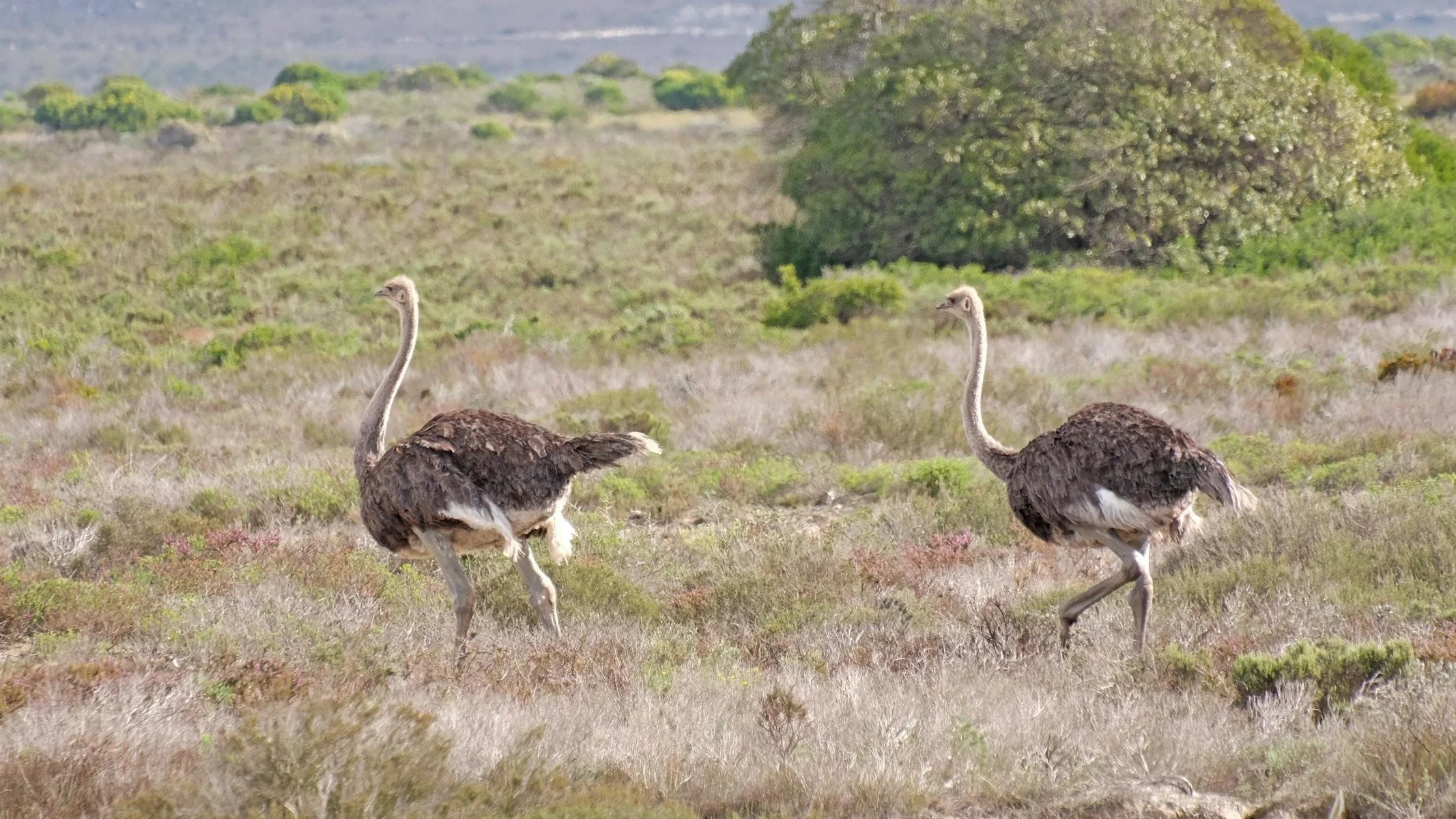
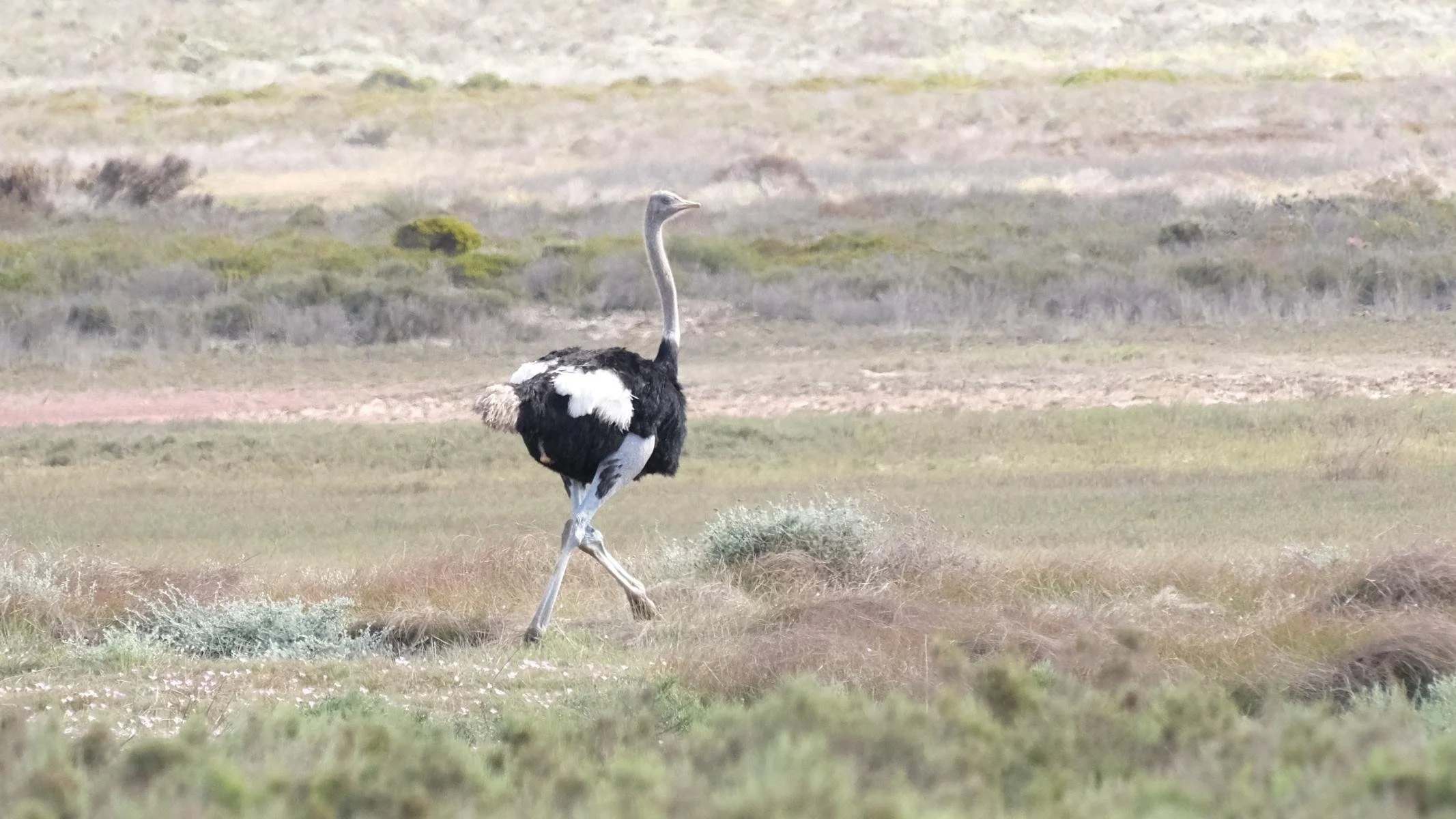
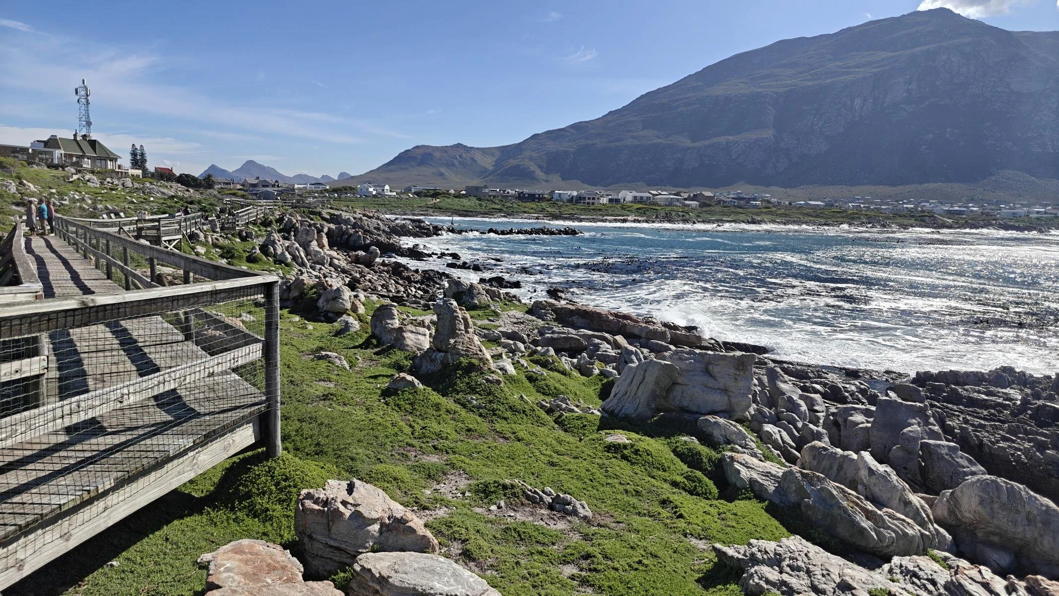
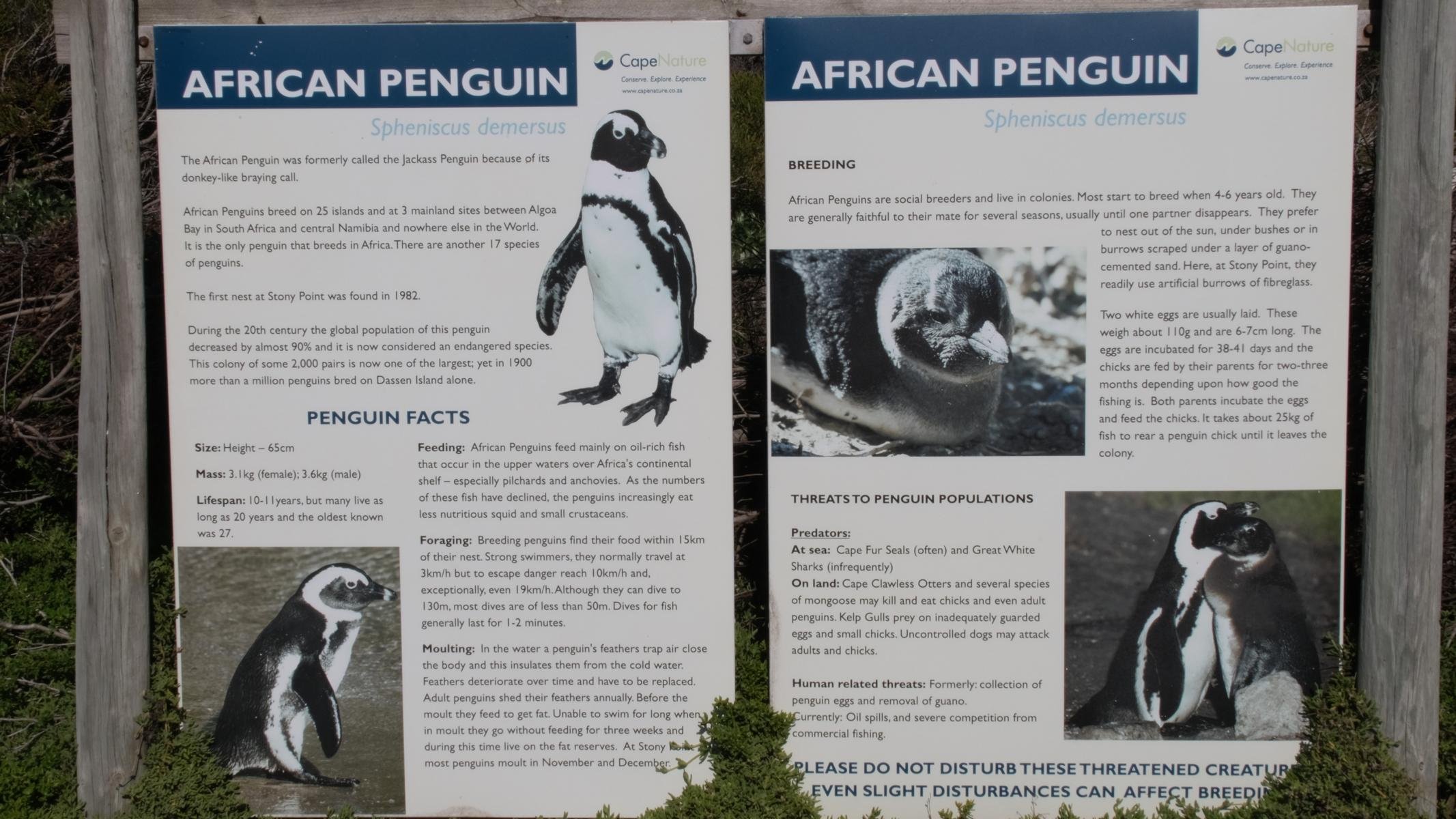
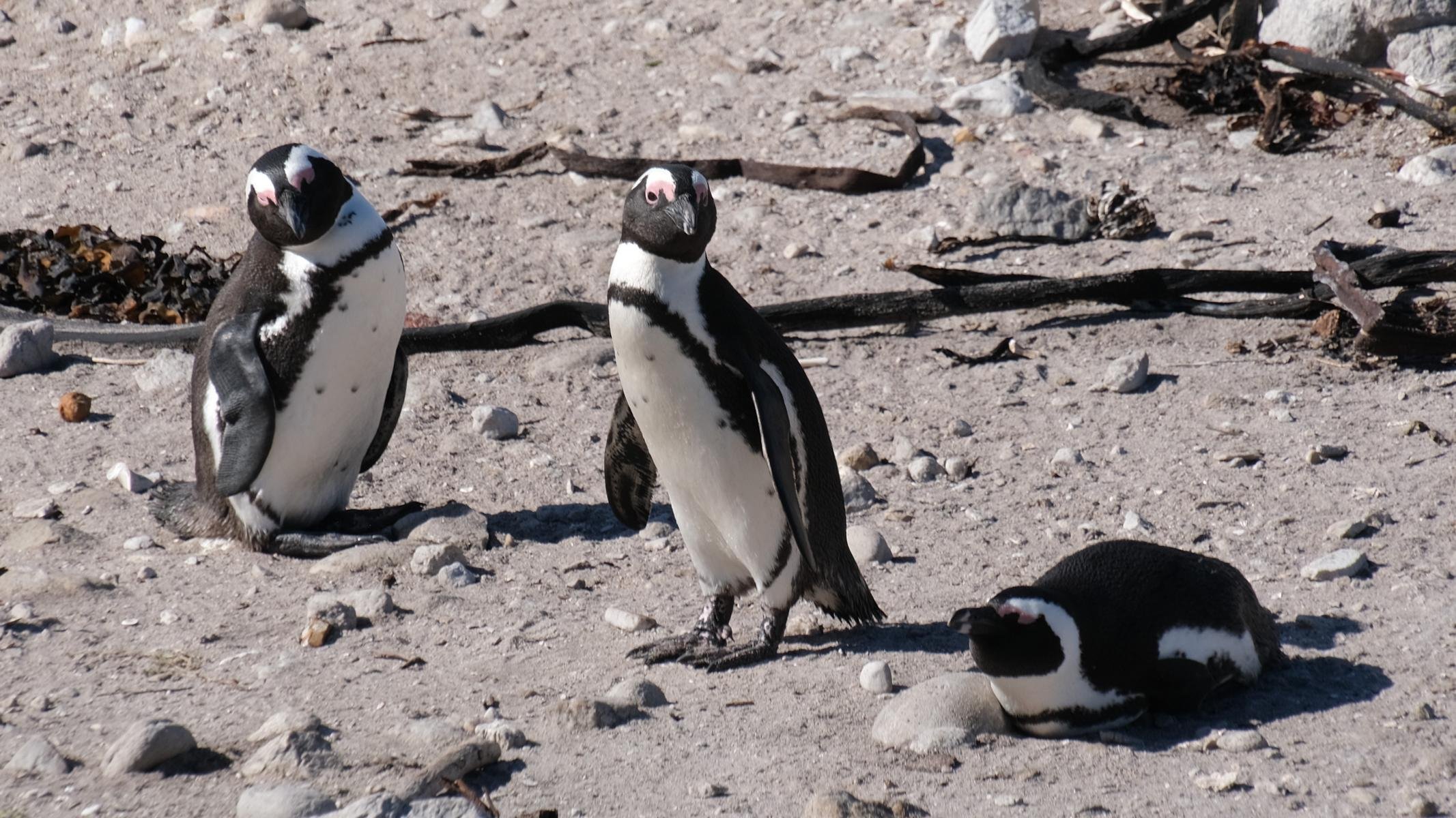
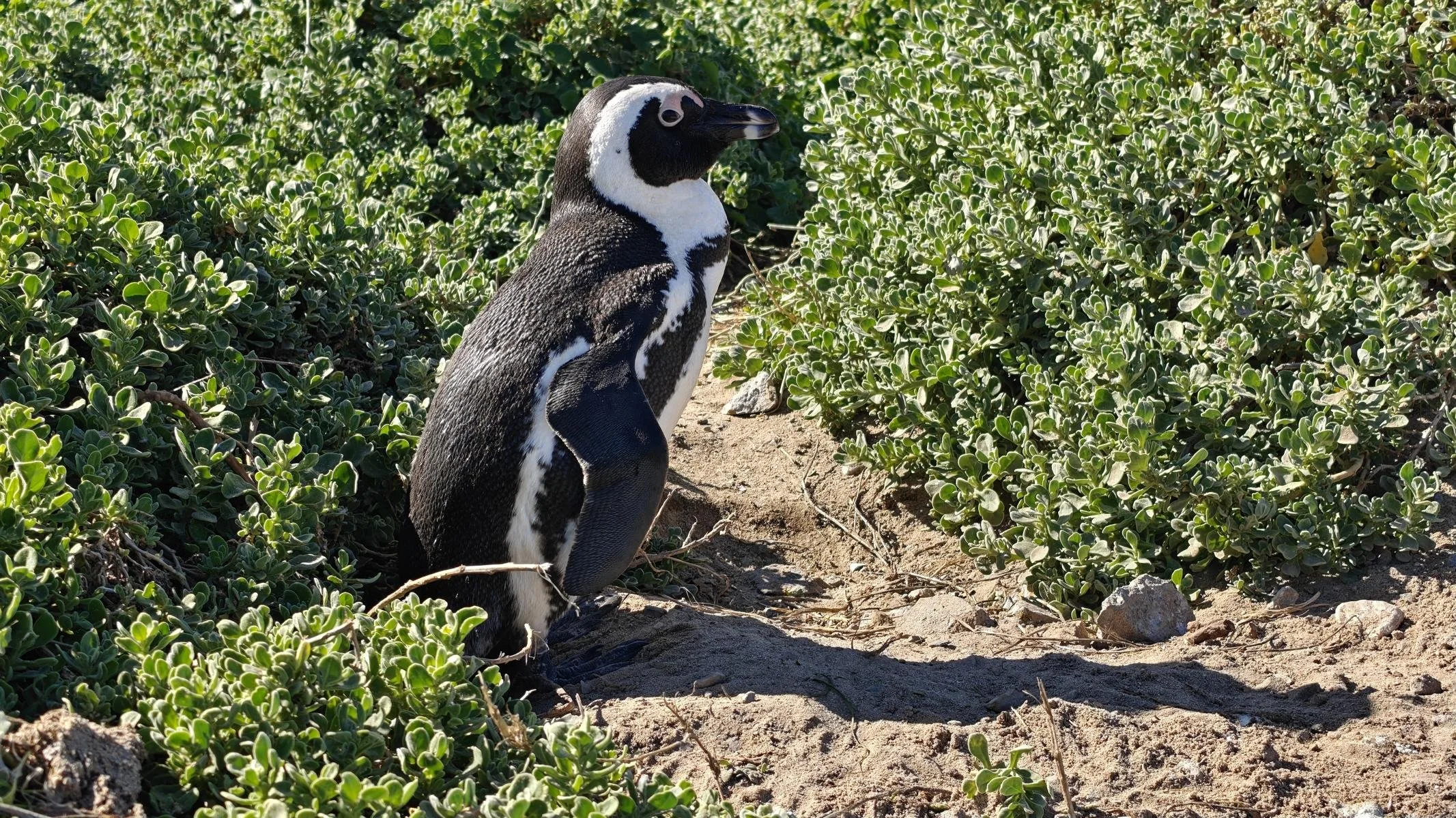
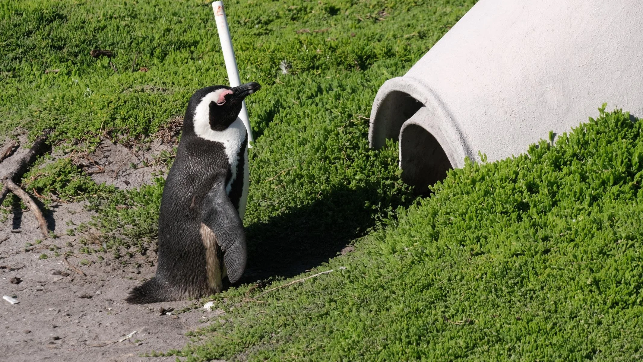
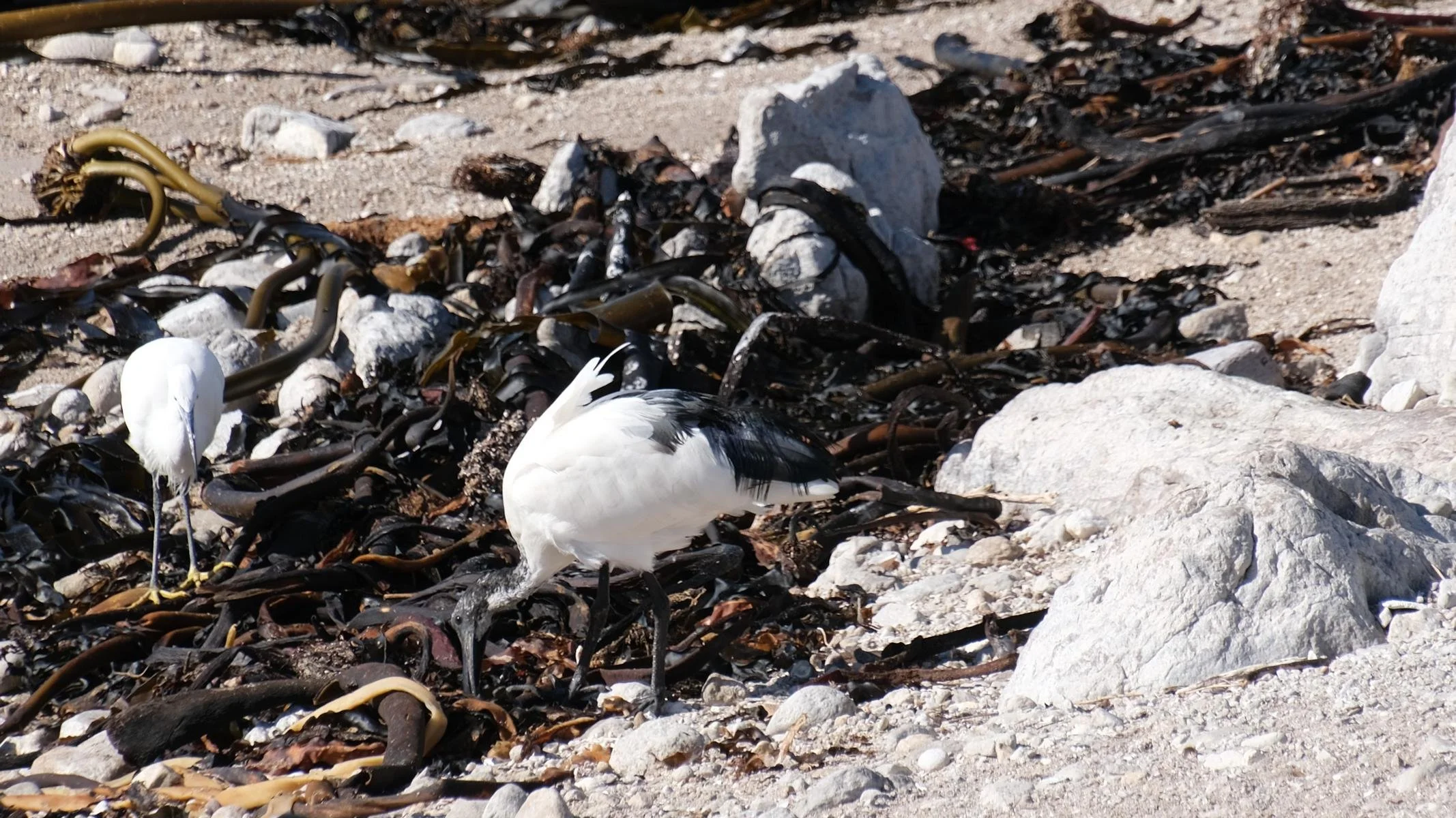
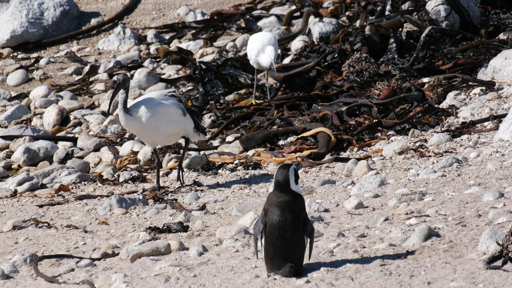
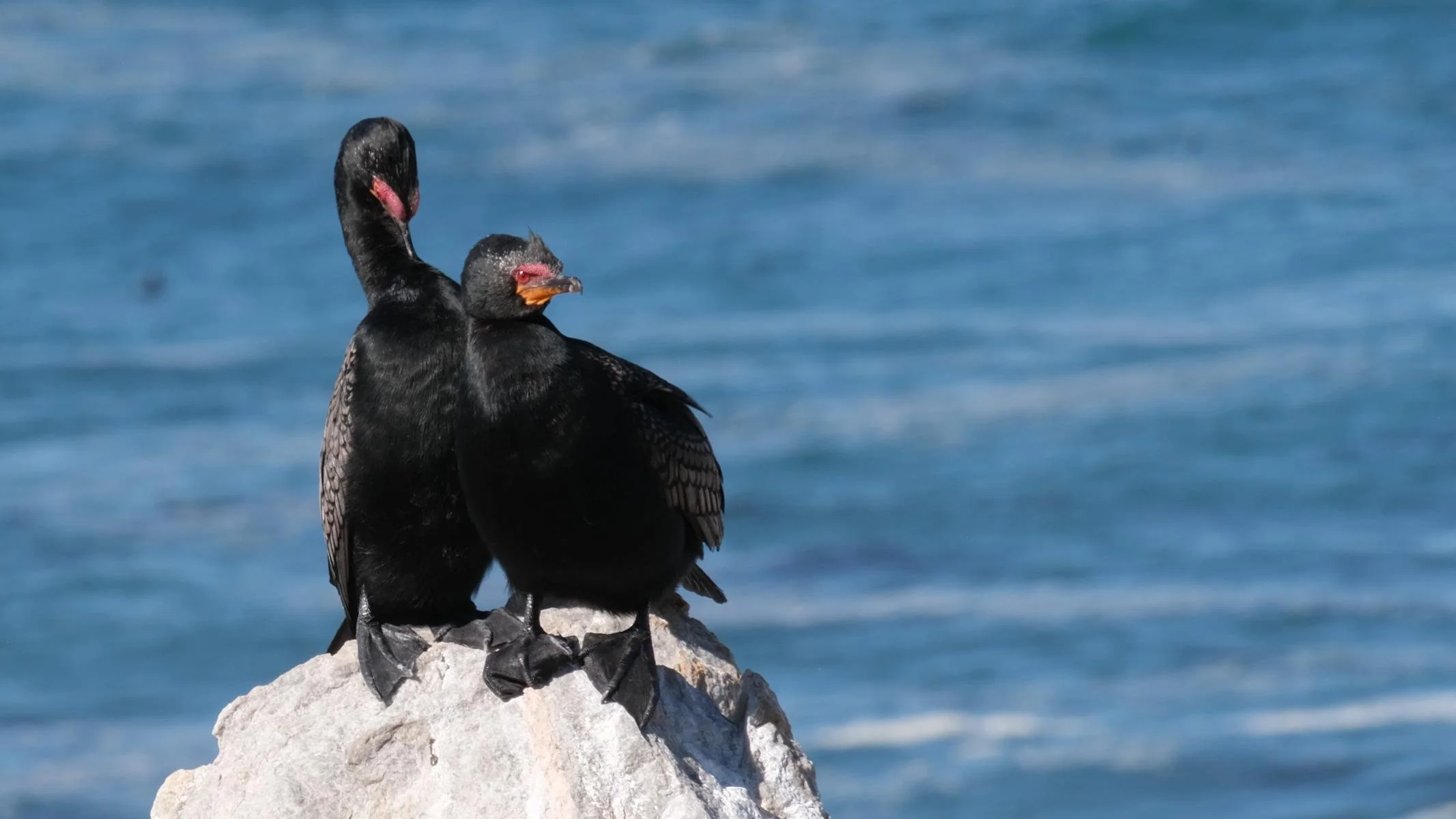
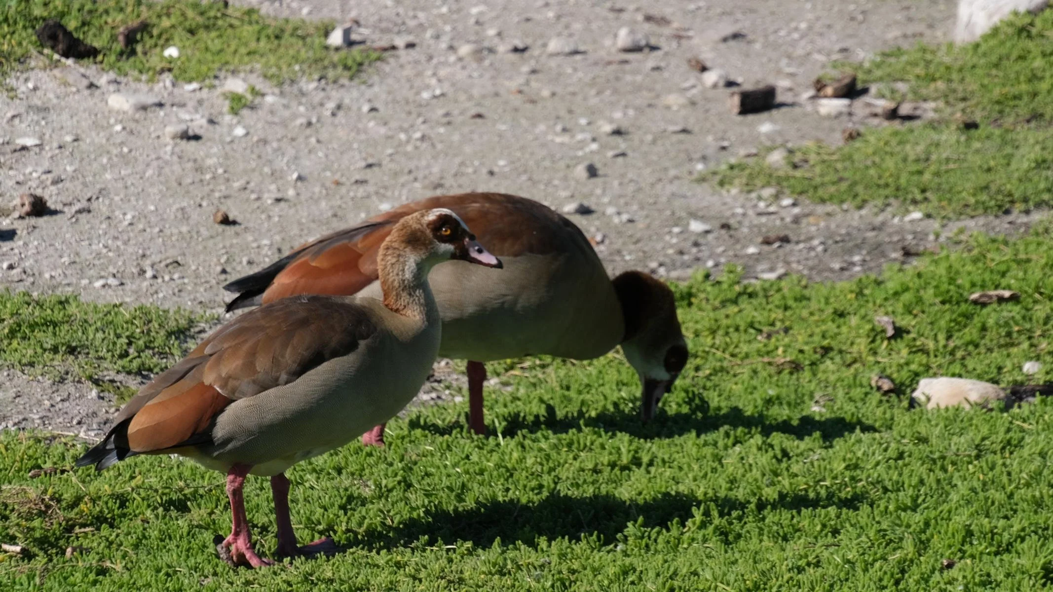
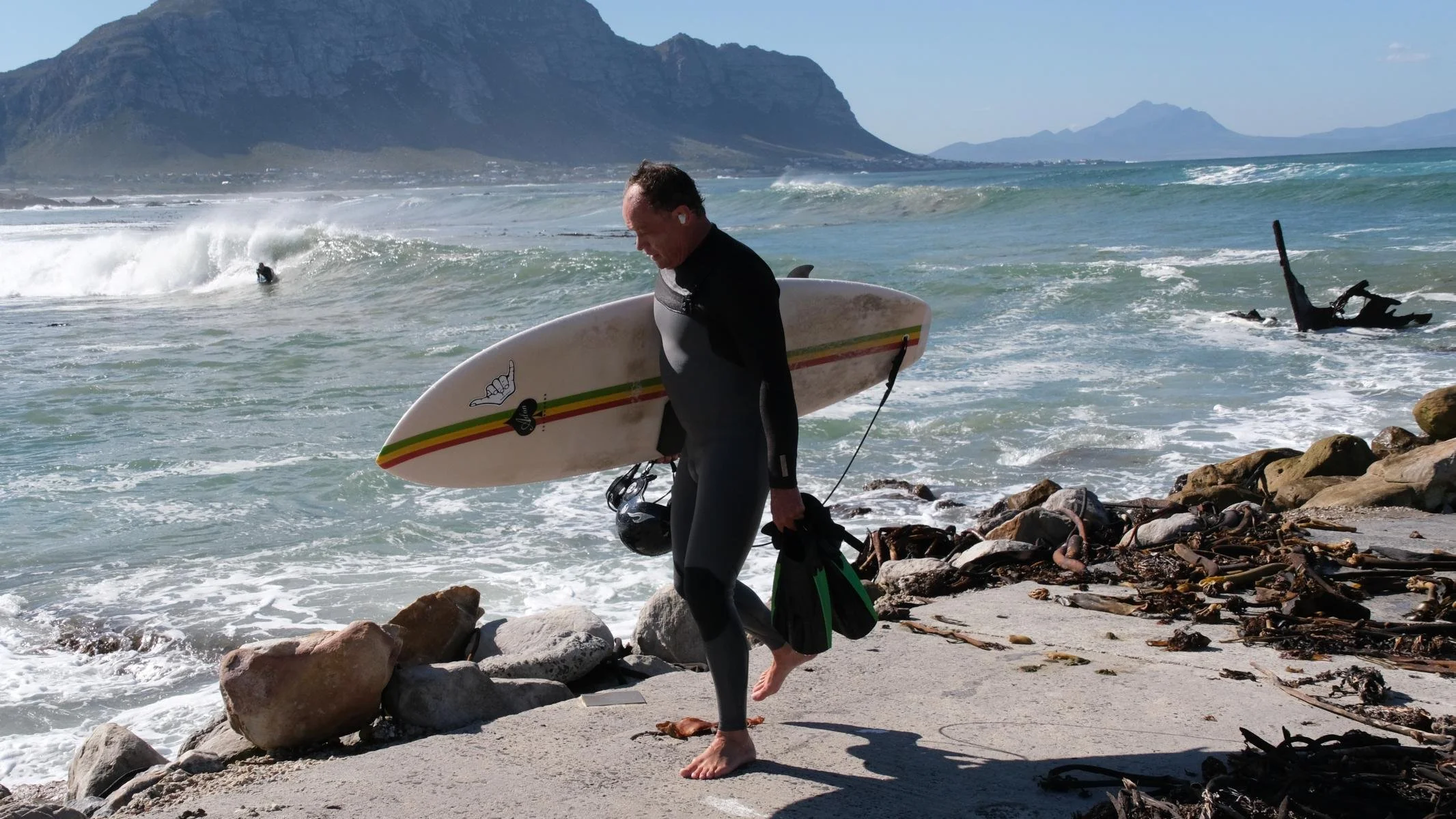
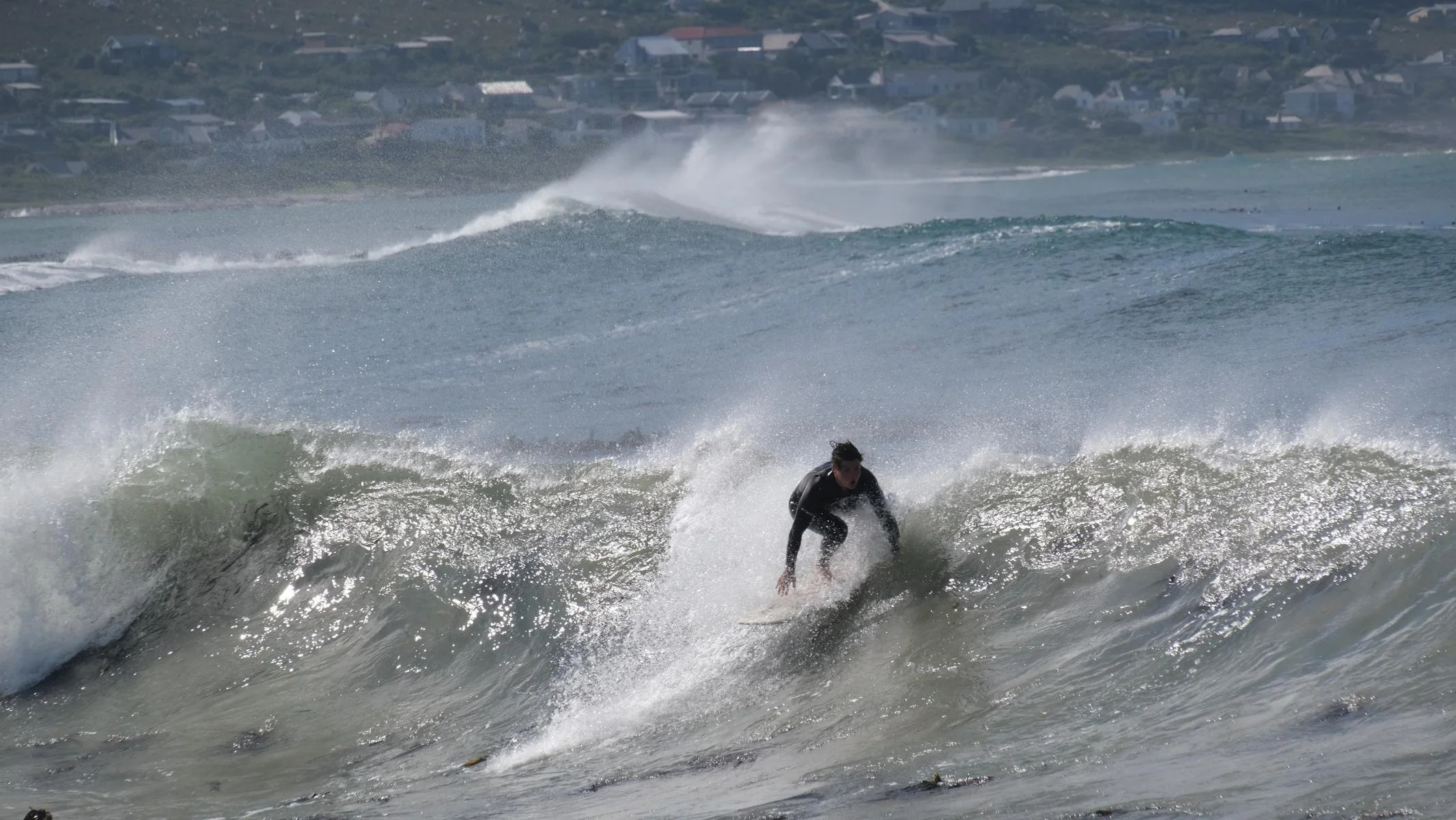
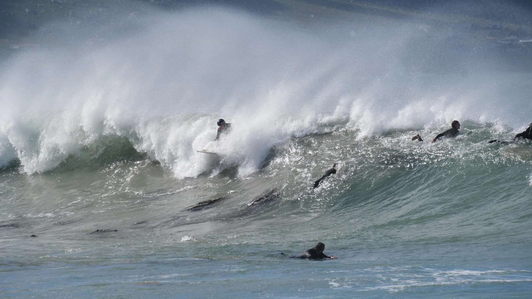
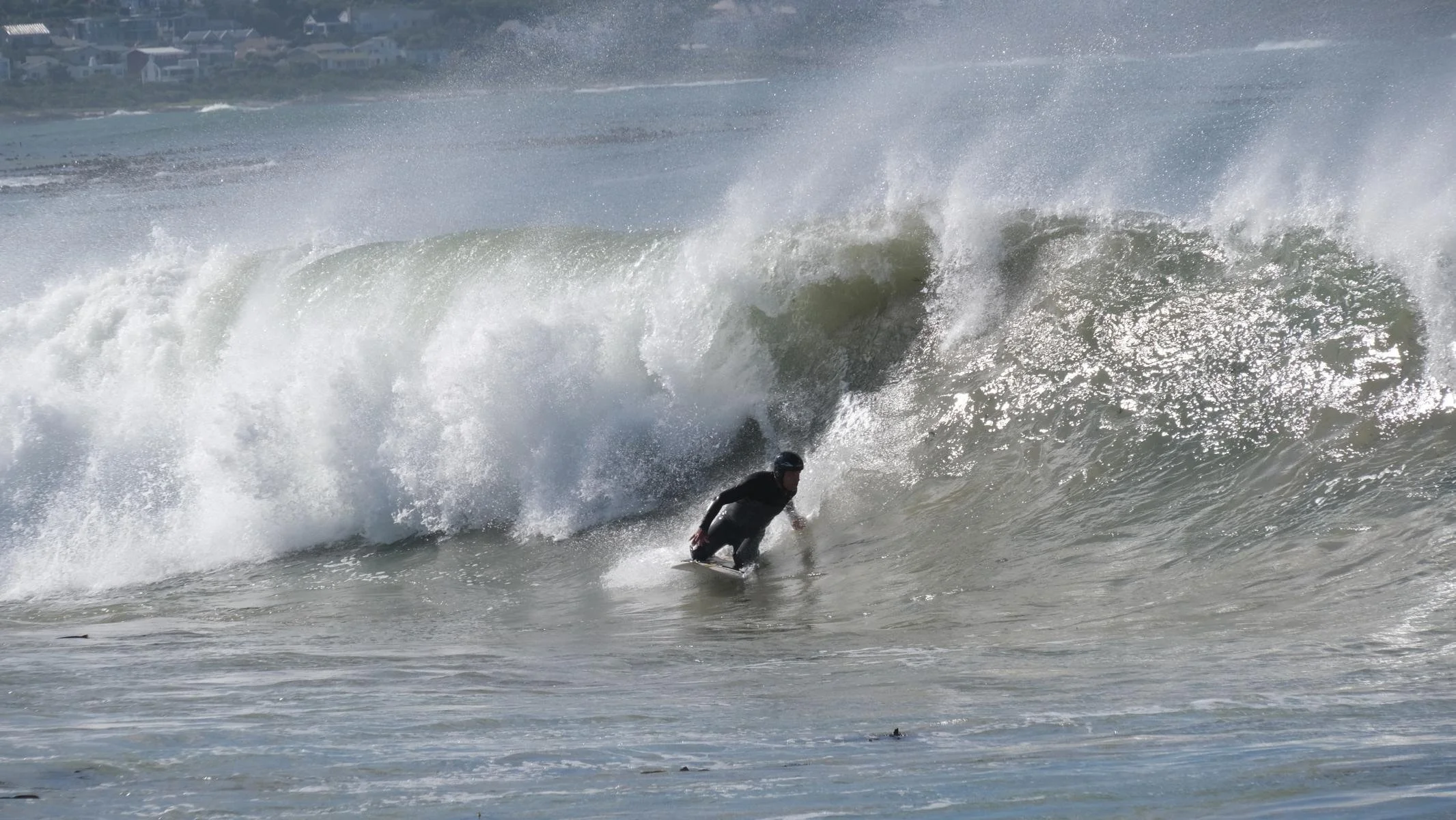
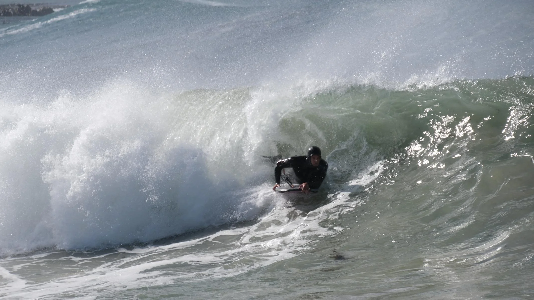
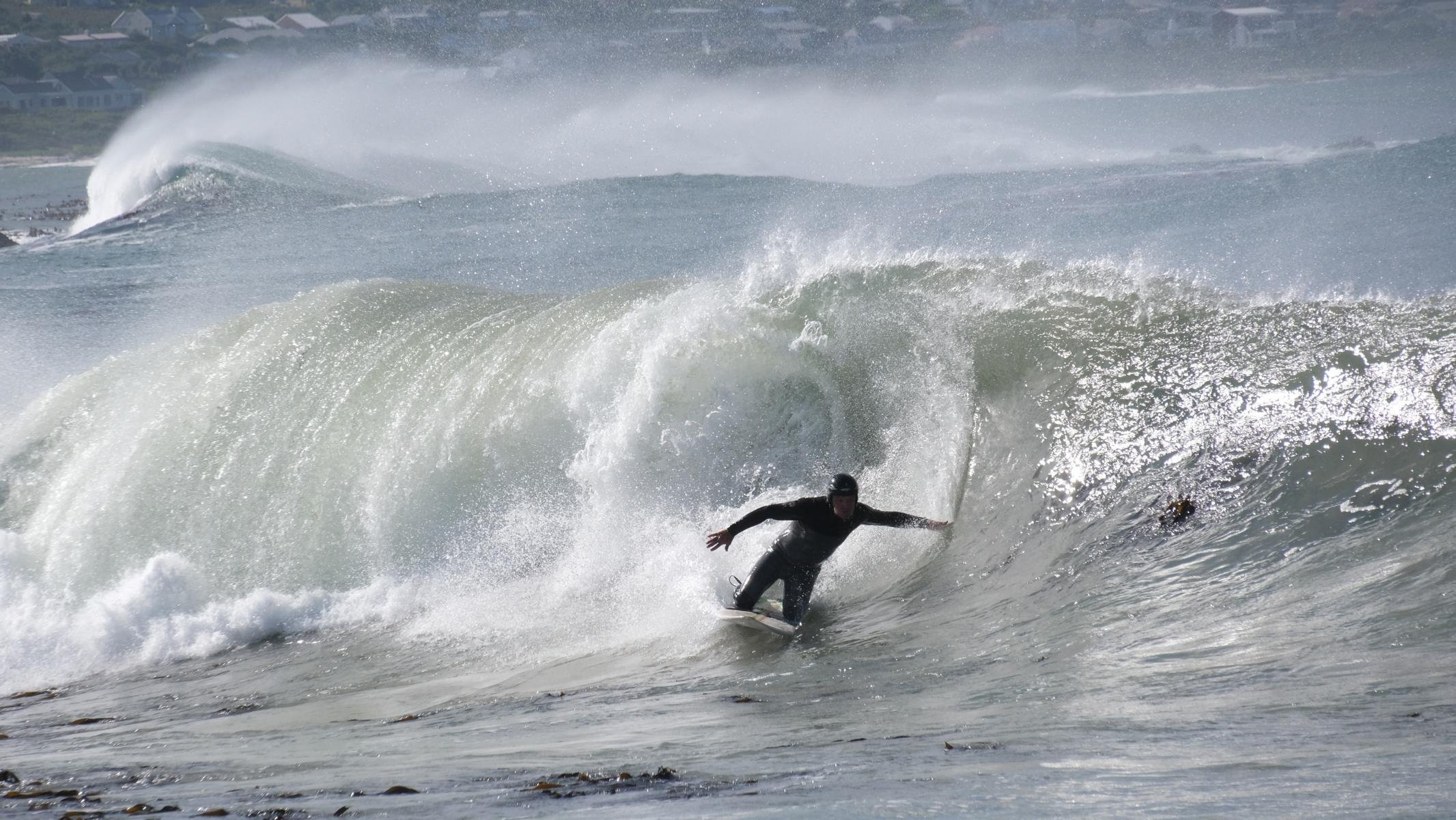
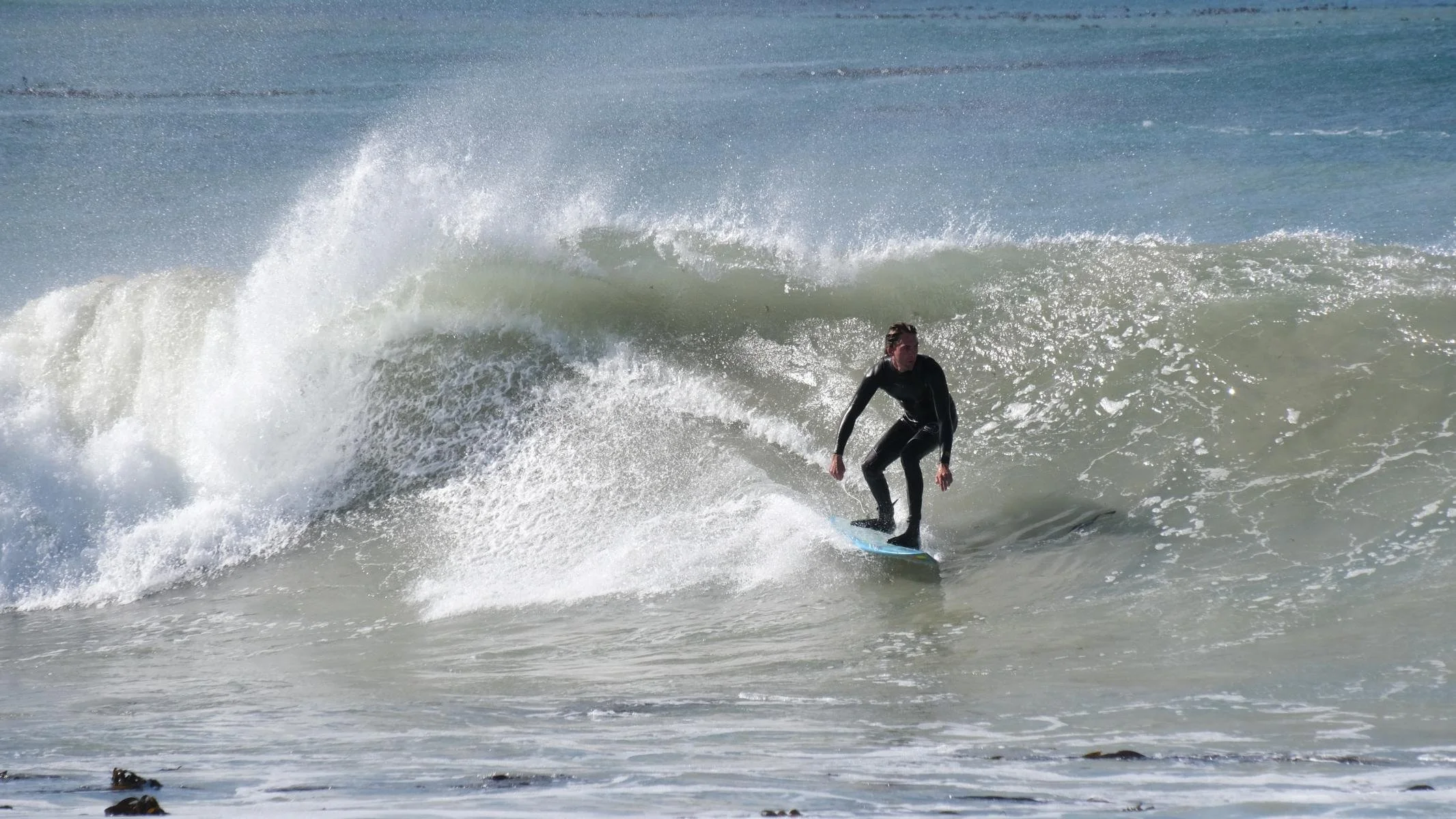
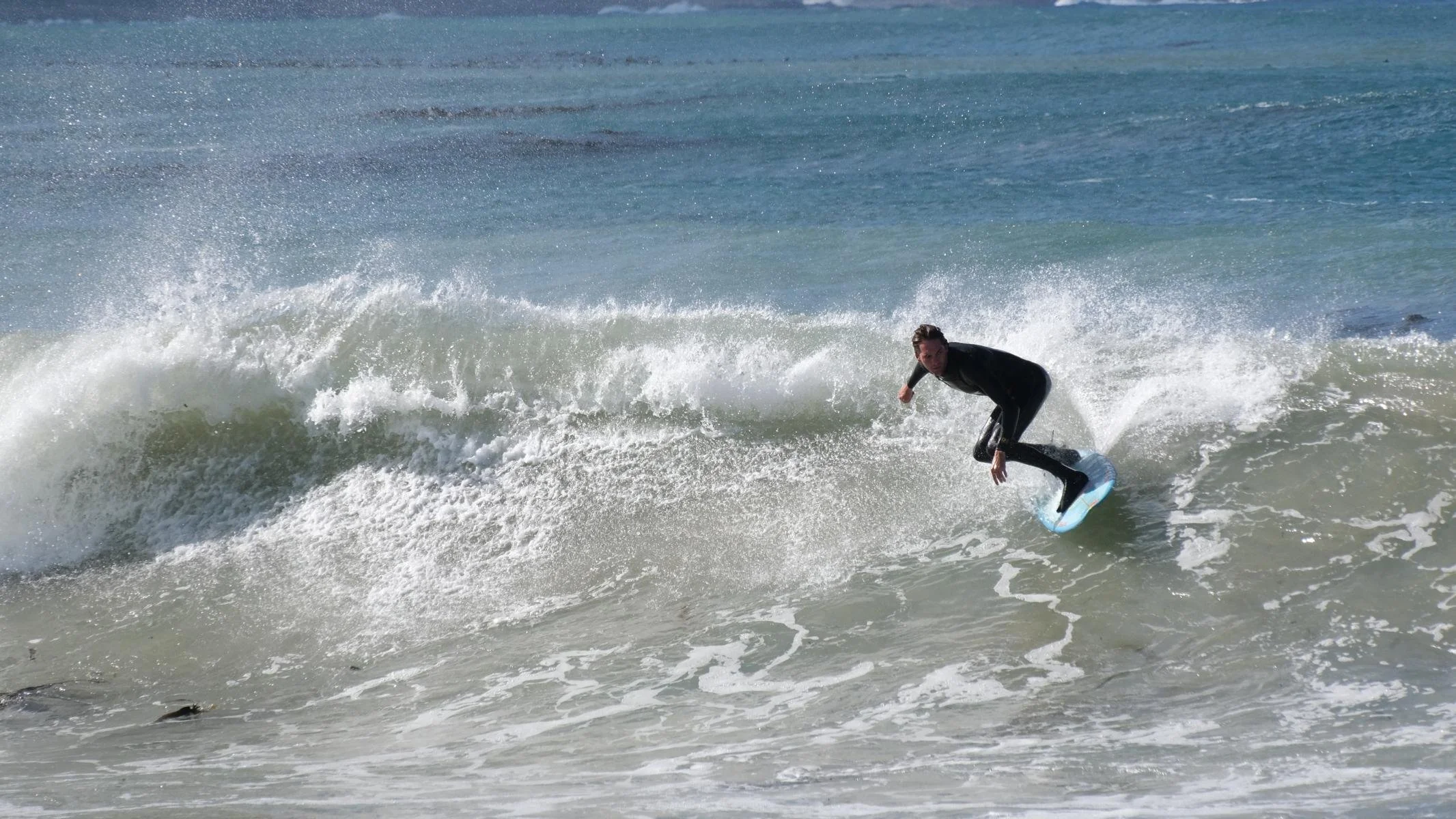
Betty's Bay, located 100 km southeast of Cape Town, is the breeding ground for a penguin colony and a great spot for birdwatching (nile geese, cormorants, ibises). The bay is also an ideal spot for surfing (a sport I don't practice, though).
Betty`s Bay, 100 km südöstlich von Kapstadt gelegen, ist der Brutplatz einer Pinguin Kolonie und ein guter Platz um Vögel zu beobachten (Nilgänse, Kormoran, Ibis). Außerdem ist die Bucht ein idealer Platz zum Wellensurfen (eine Sportart, die ich allerdings nicht ausübe).


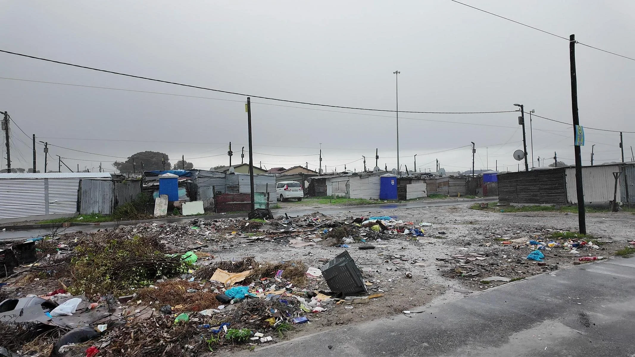
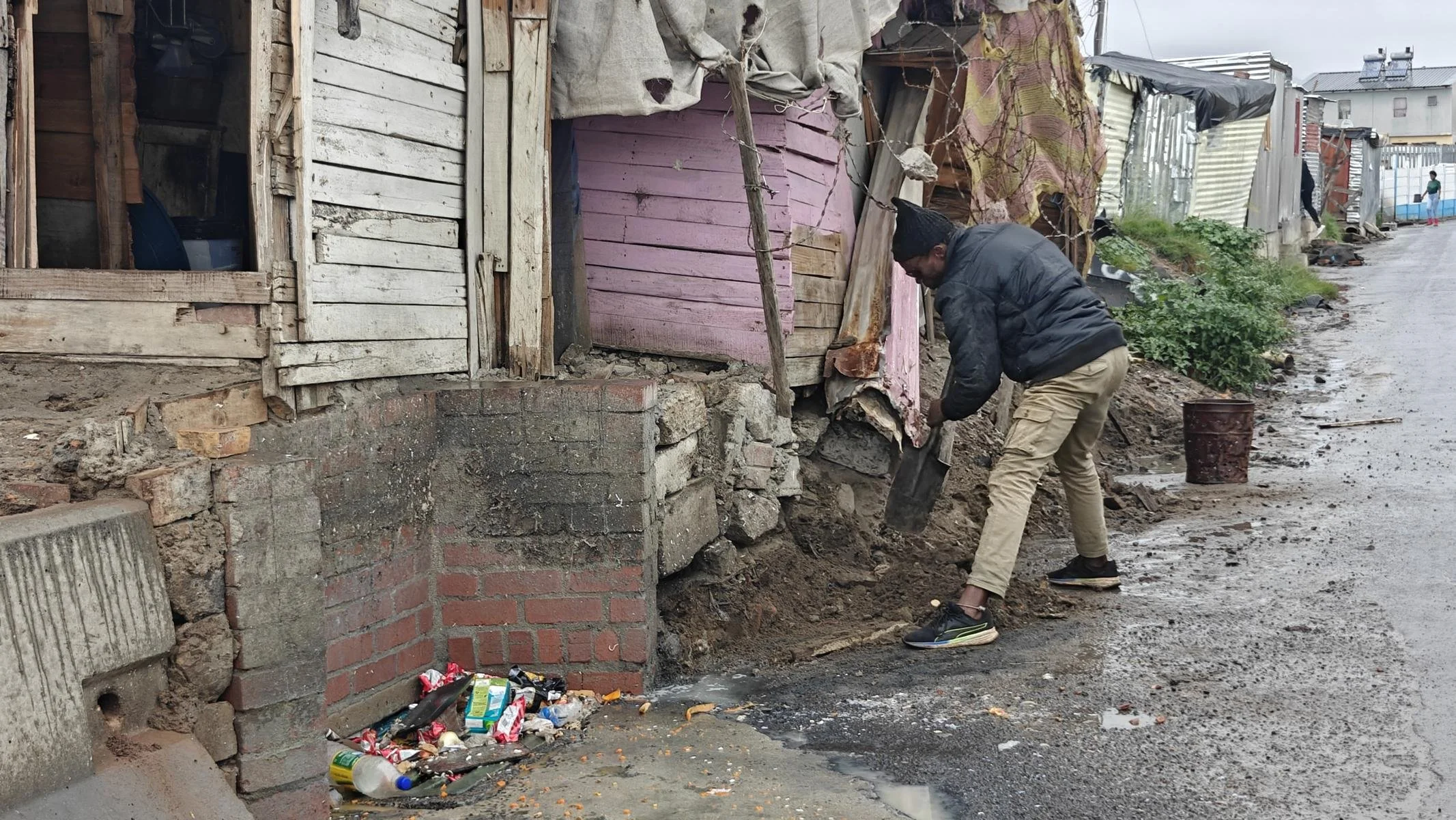
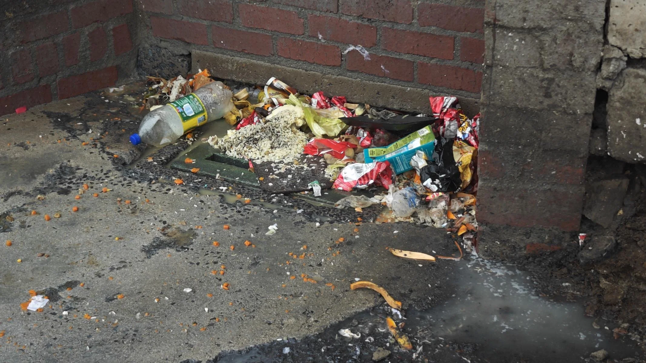
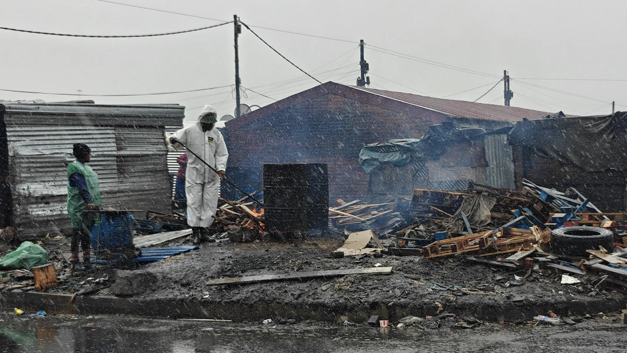
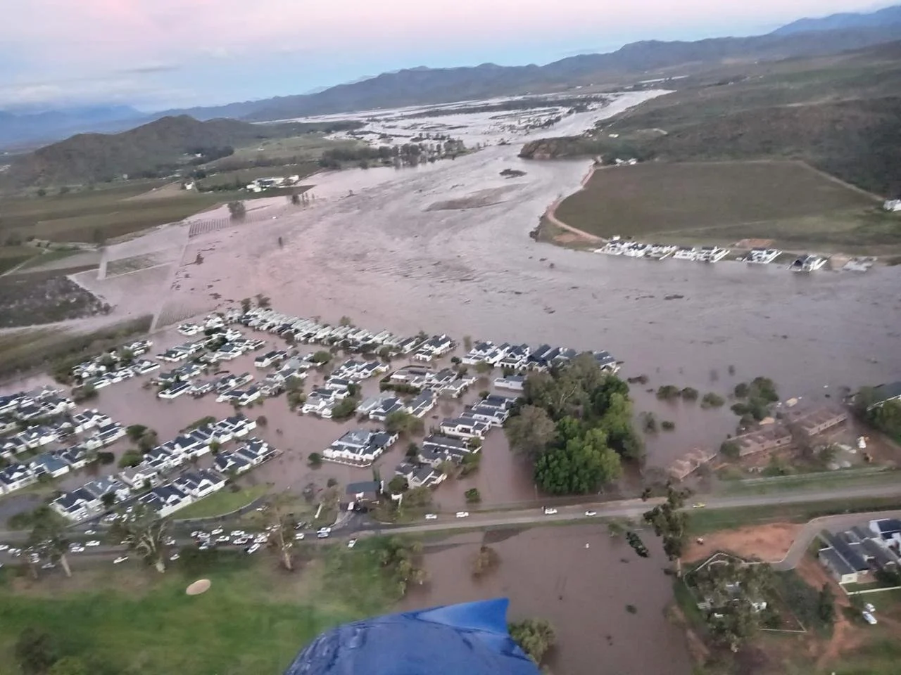
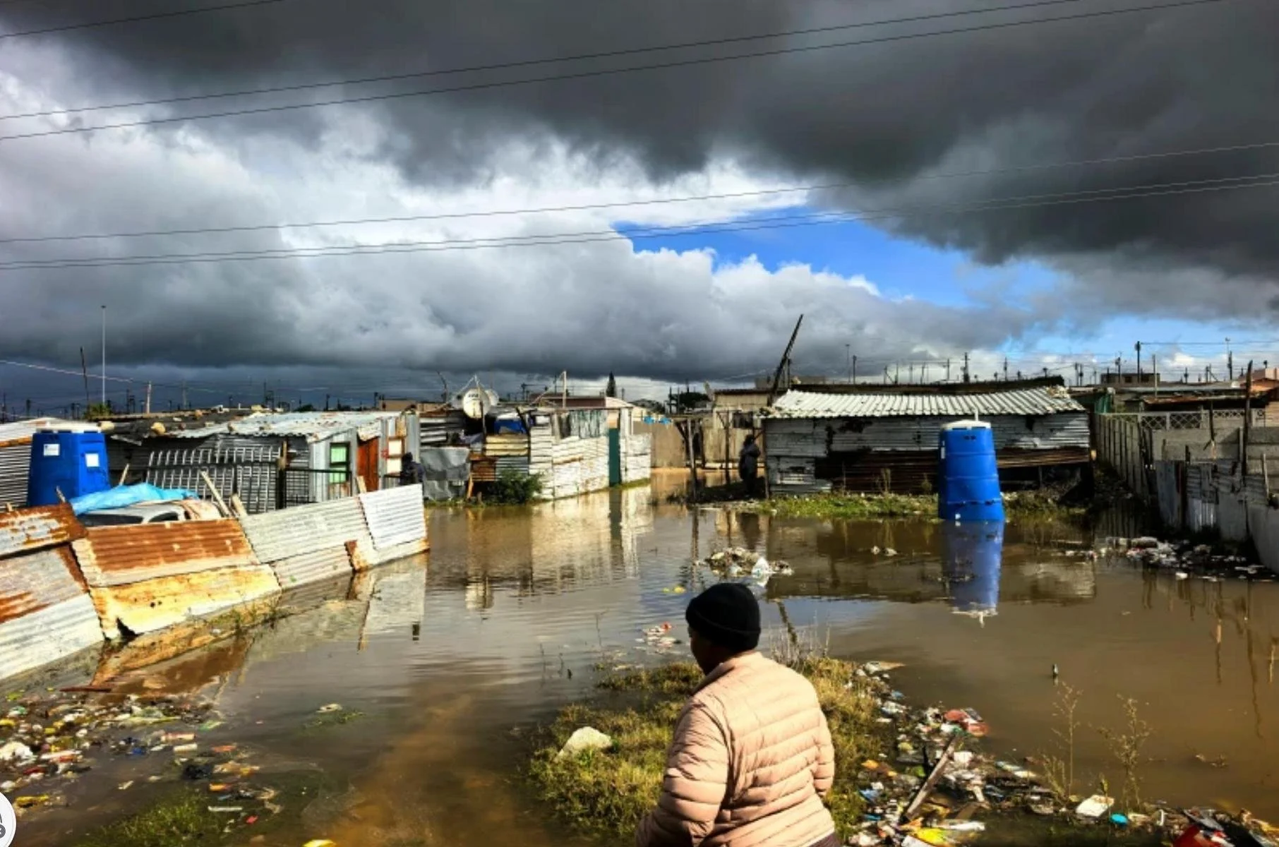
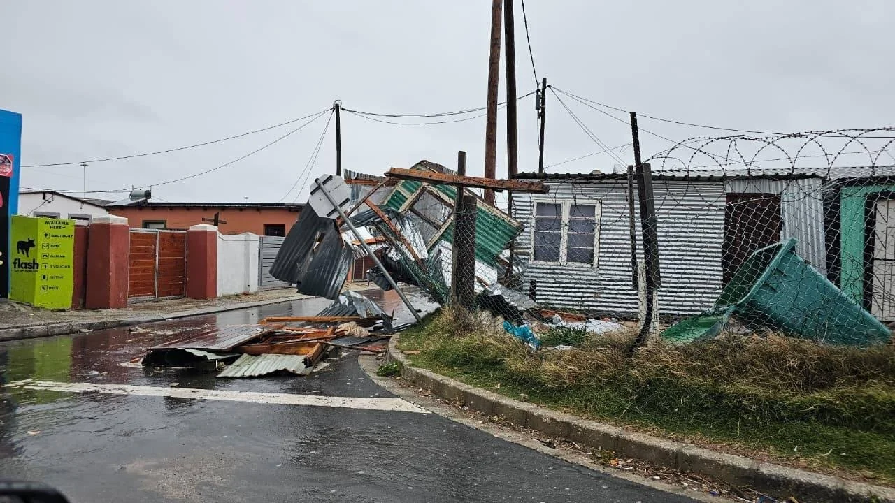
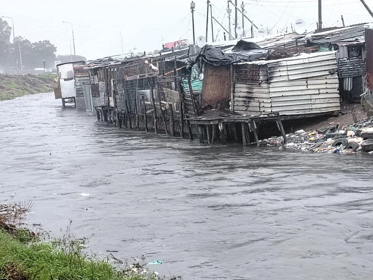
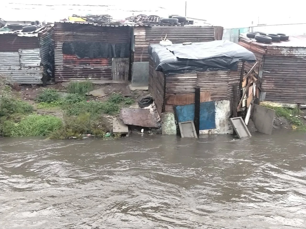
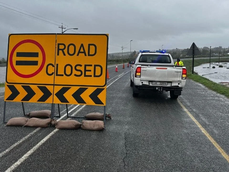
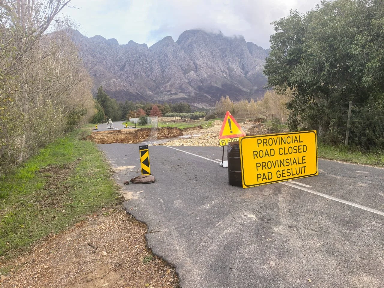
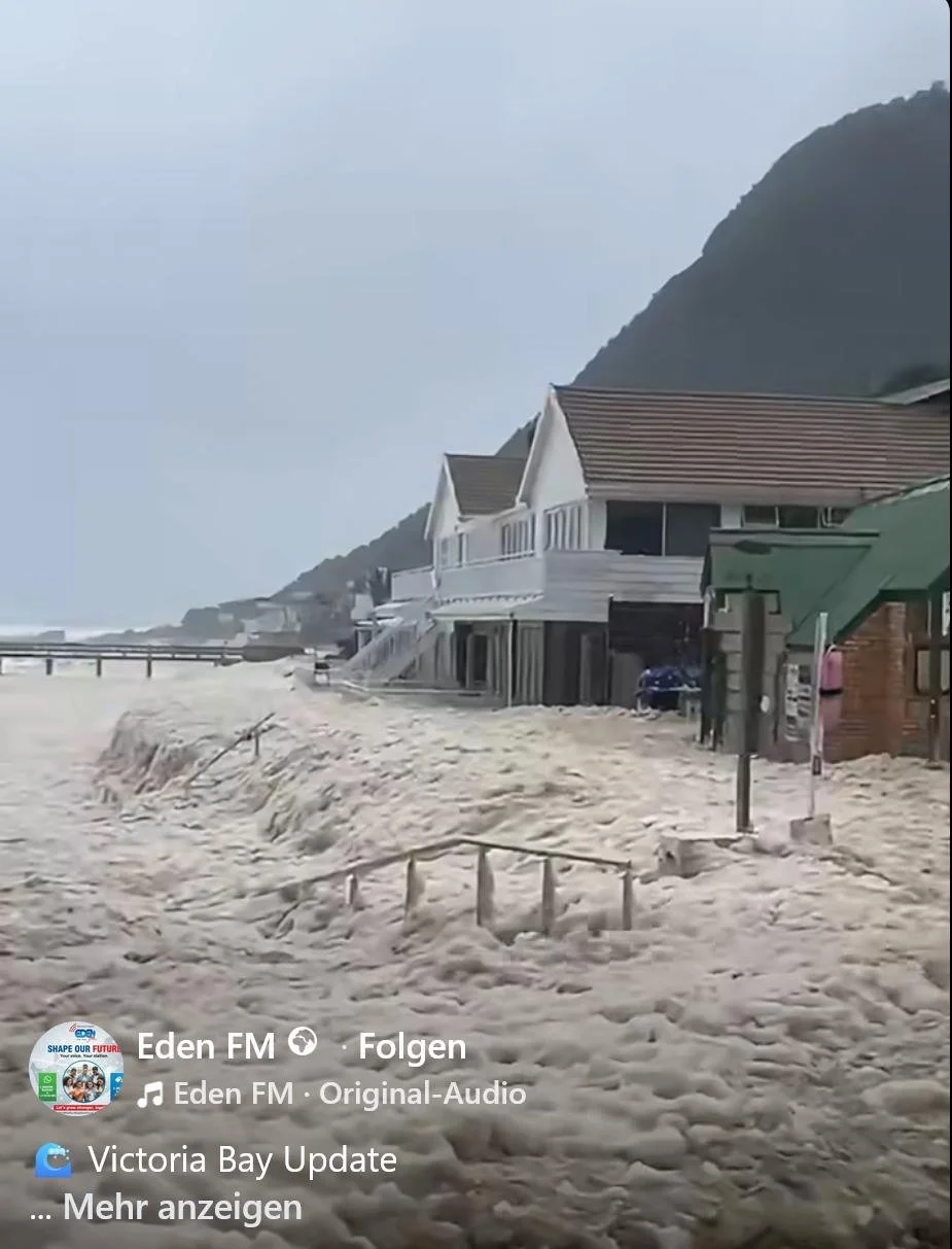
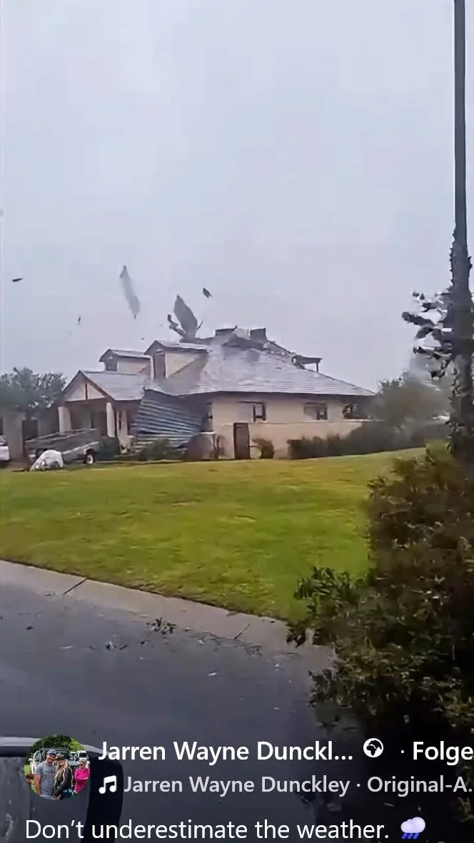
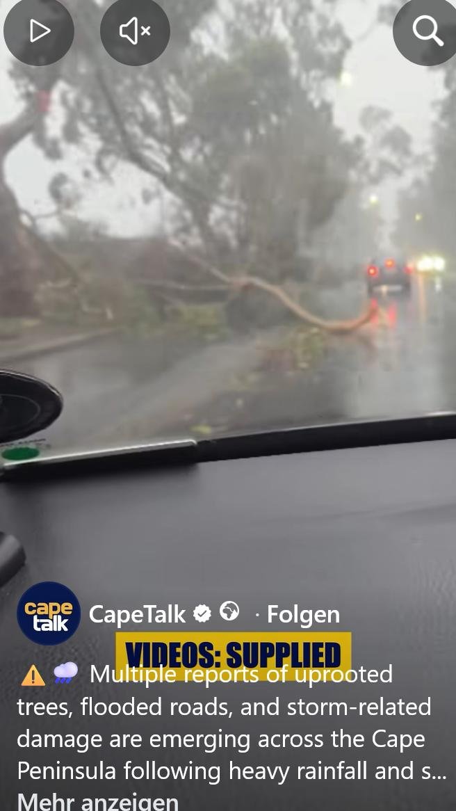
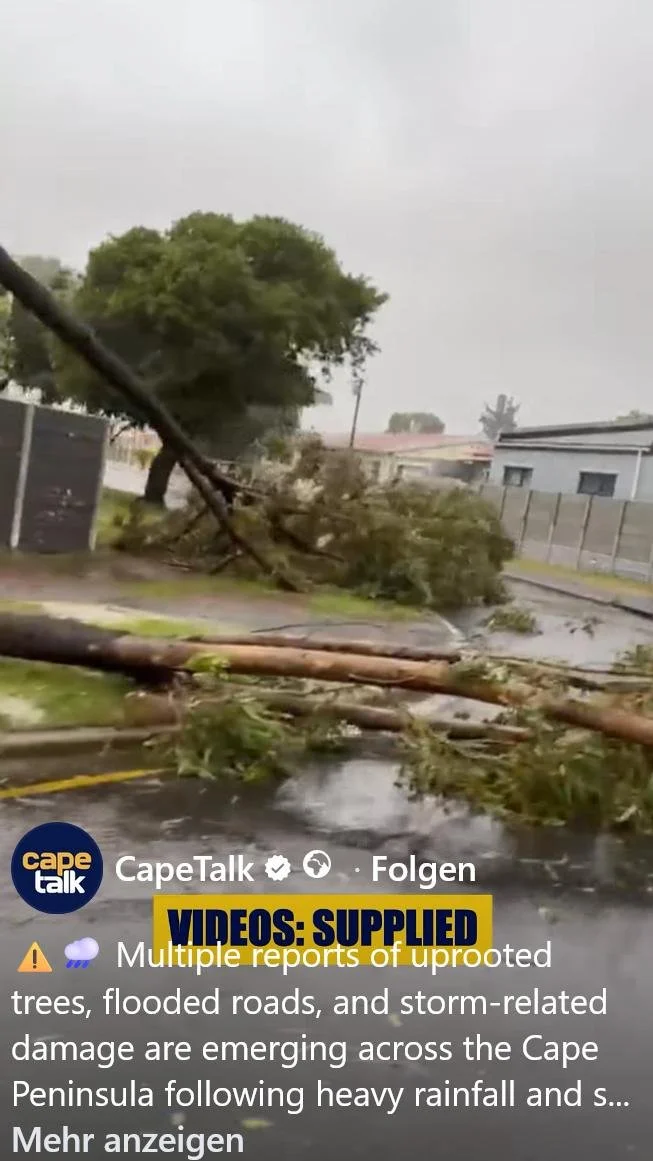
In the second week of May, one of the worst weather disasters in recent decades struck South Africa. A storm front brought three days of heavy rain and gusts of up to 130 km/h, resulting in at least ten deaths and severe damage to buildings and road infrastructure. Unfortunately, the residents of the corrugated-iron shacks in the townships were once again particularly hard hit. Below images are taken from the internet.
In der zweiten Maiwoche brach über Südafrika eine der schwersten Unwetterkatastrophen der letzten Jahrzehnte herein. Eine Sturmfront mit drei Tage Starkregen und Sturmböen bis zu 130 km/h. verursachte mindestens zehn Tote und schwere Schäden an Gebäuden und Straßen. Besonders betroffen waren leider wieder die Bewohner*innen der Wellblechhütten in den Townships. Nachstehende Fotos stammen aus dem Internet.
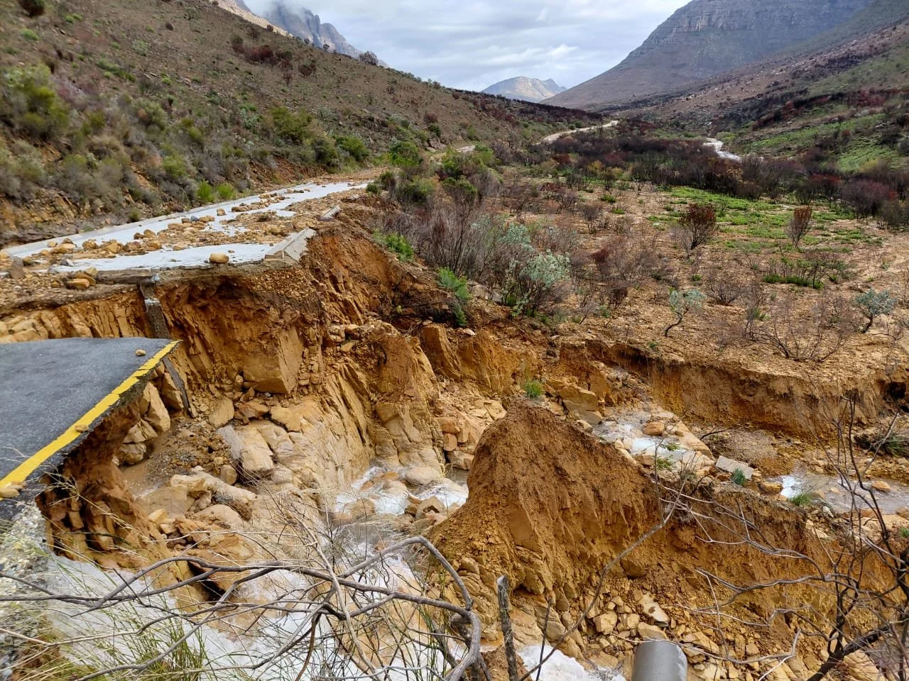
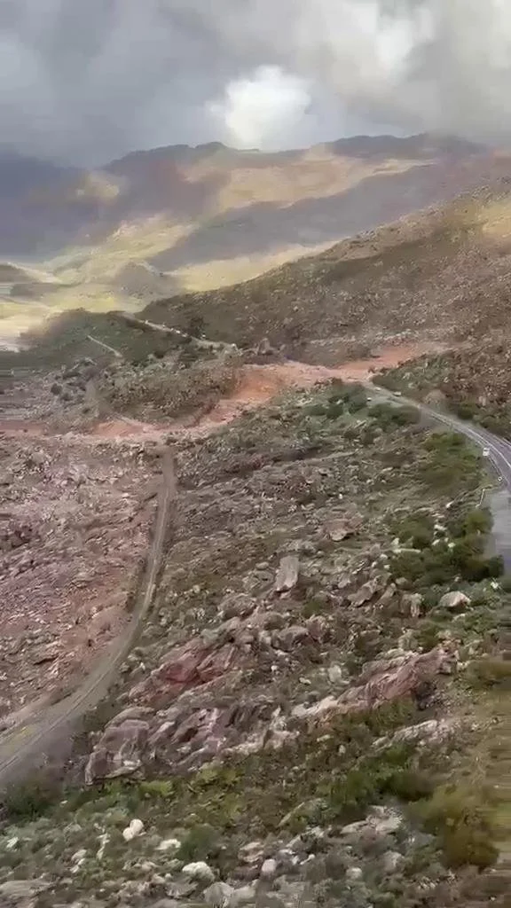
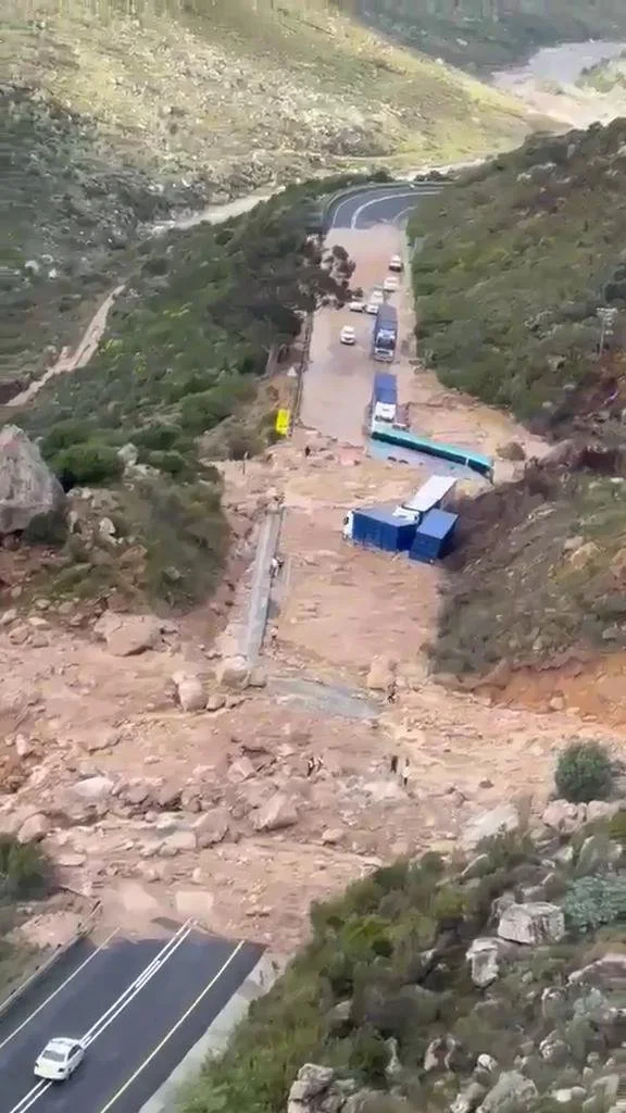
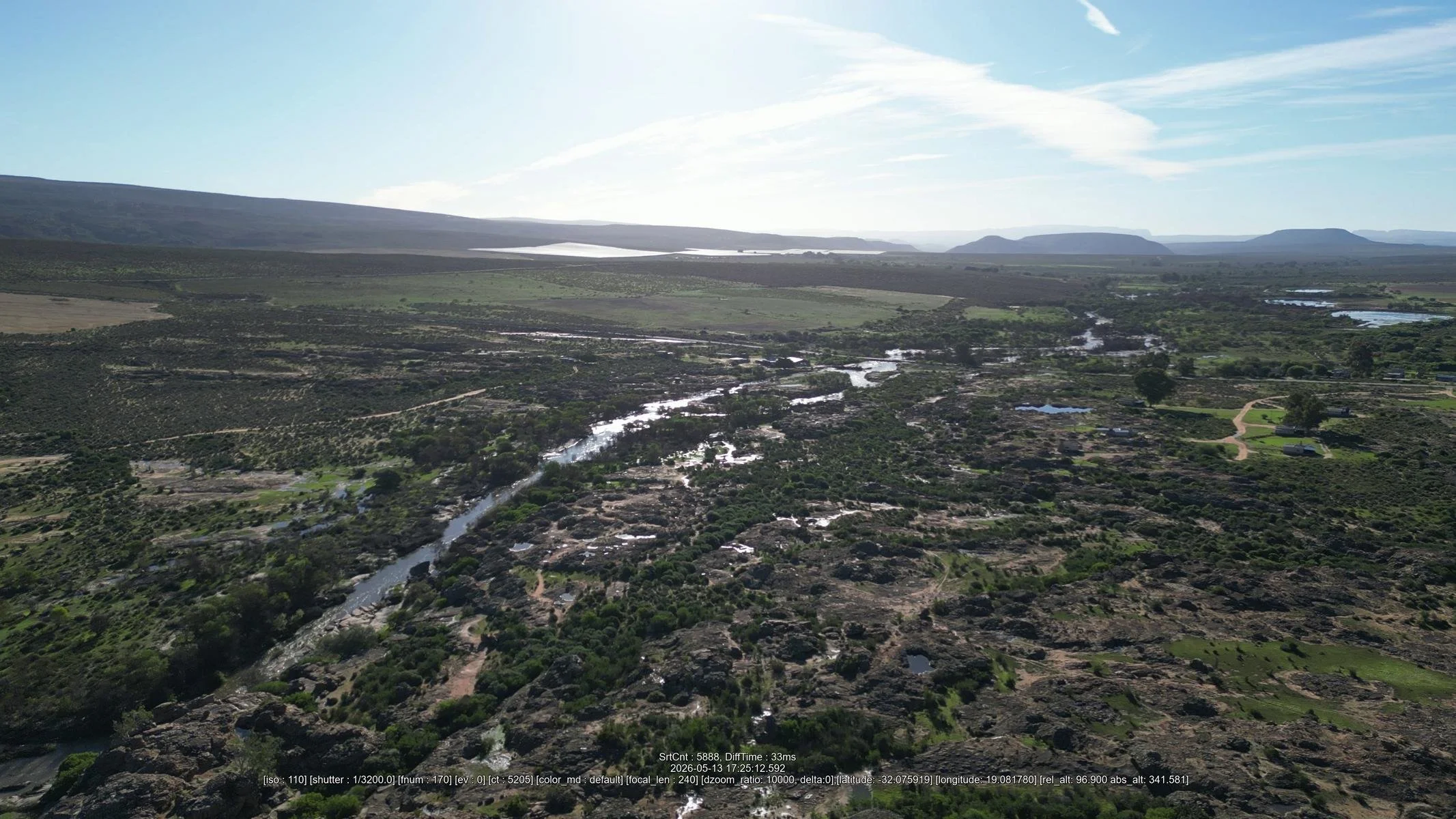
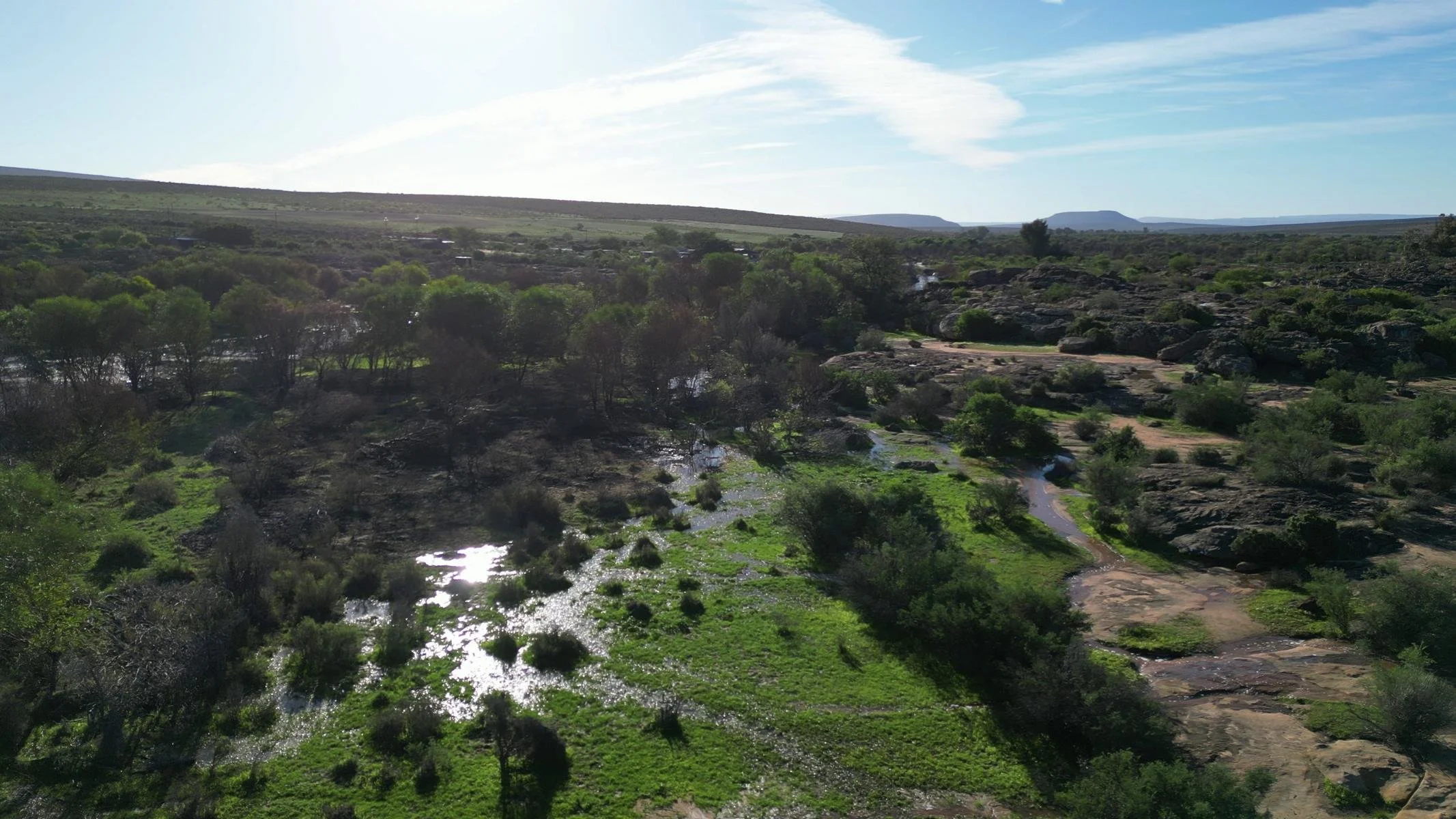
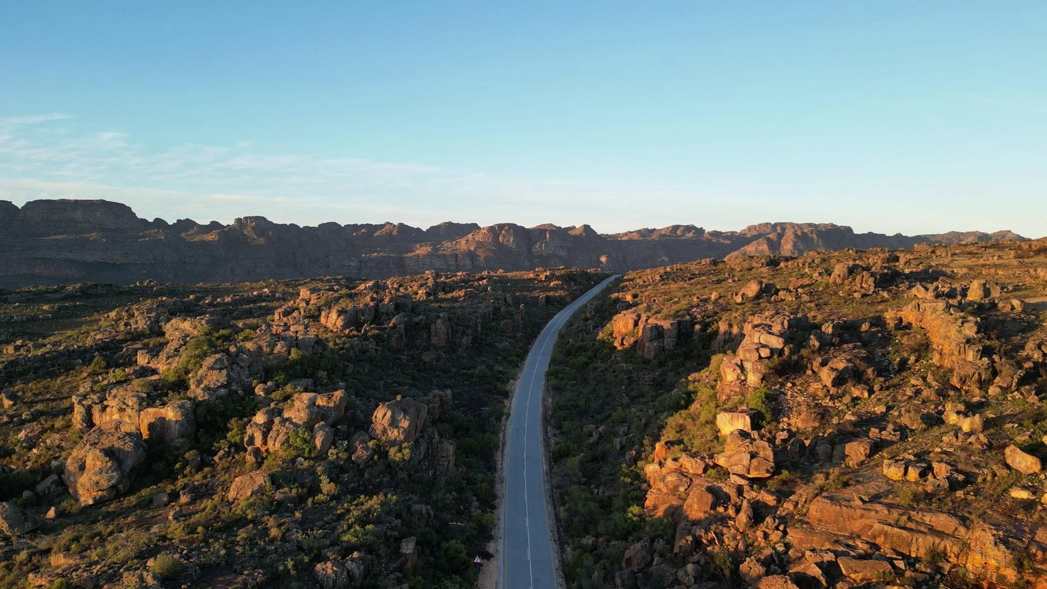
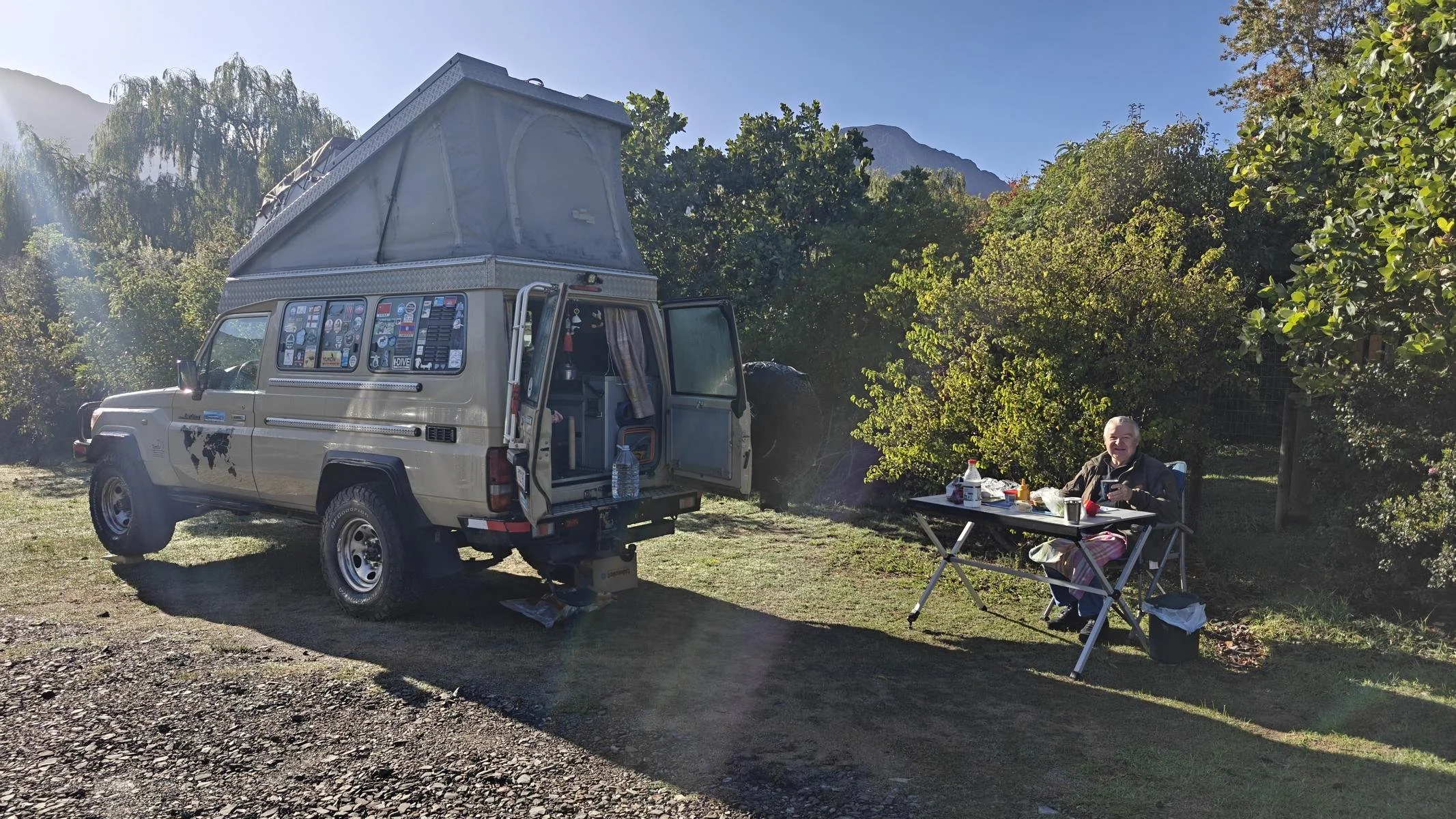
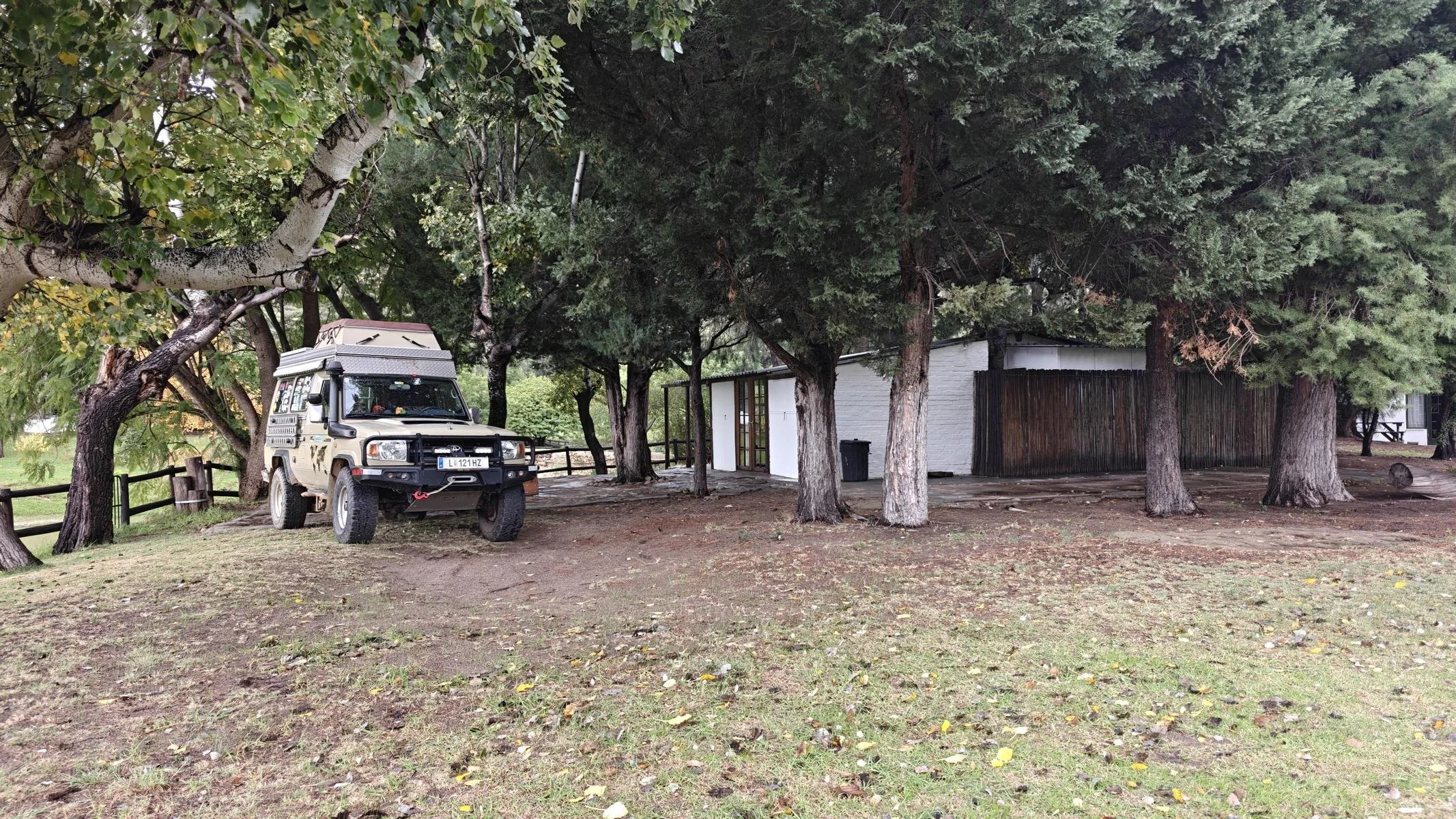
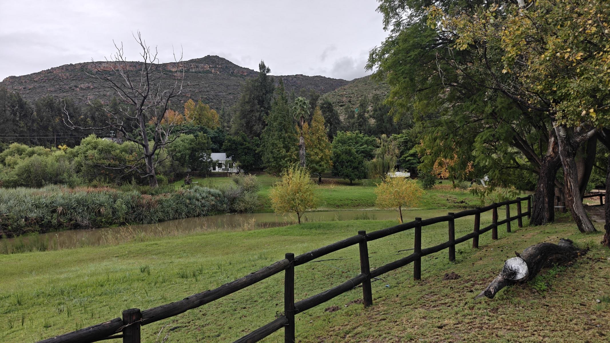
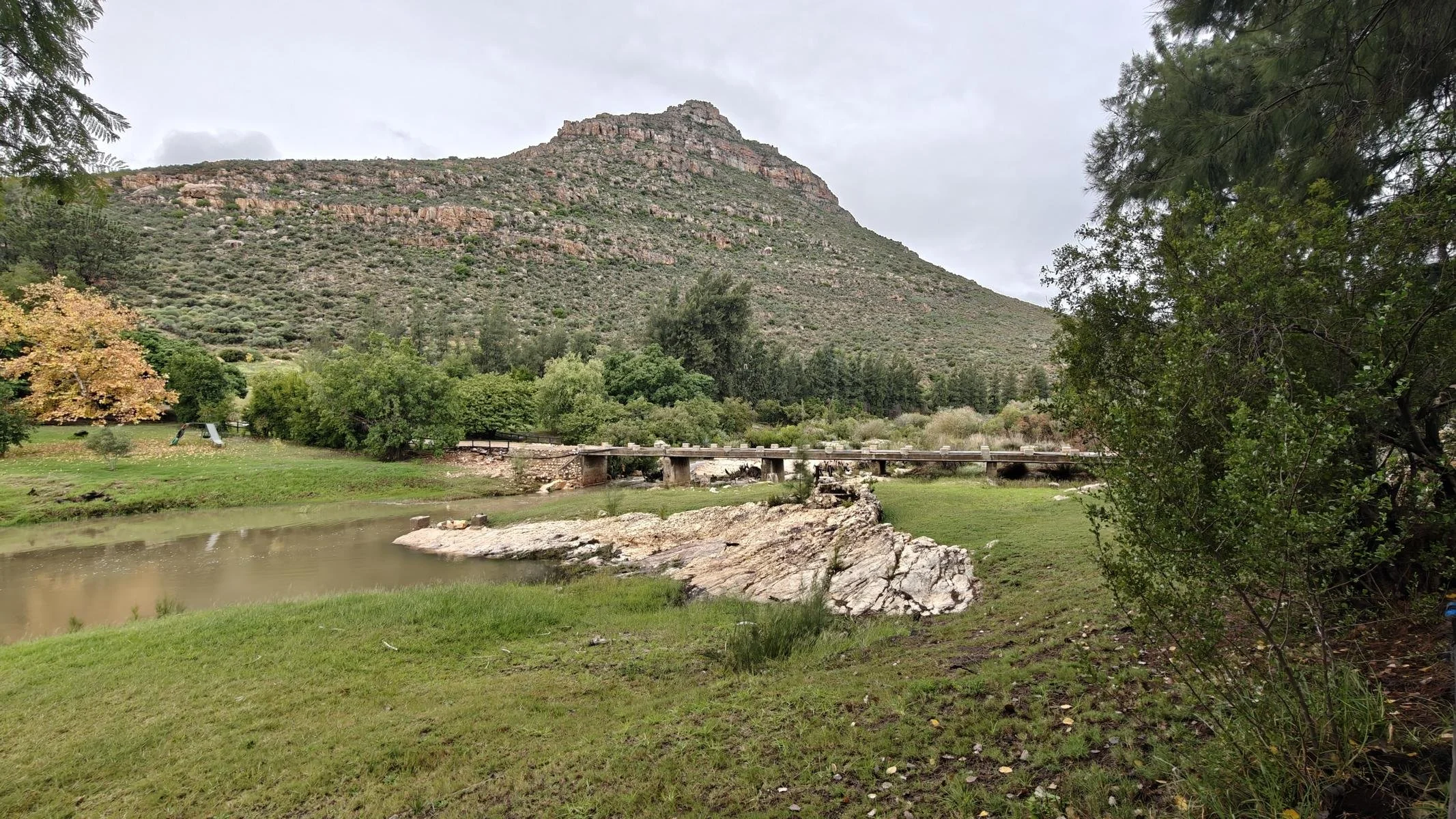
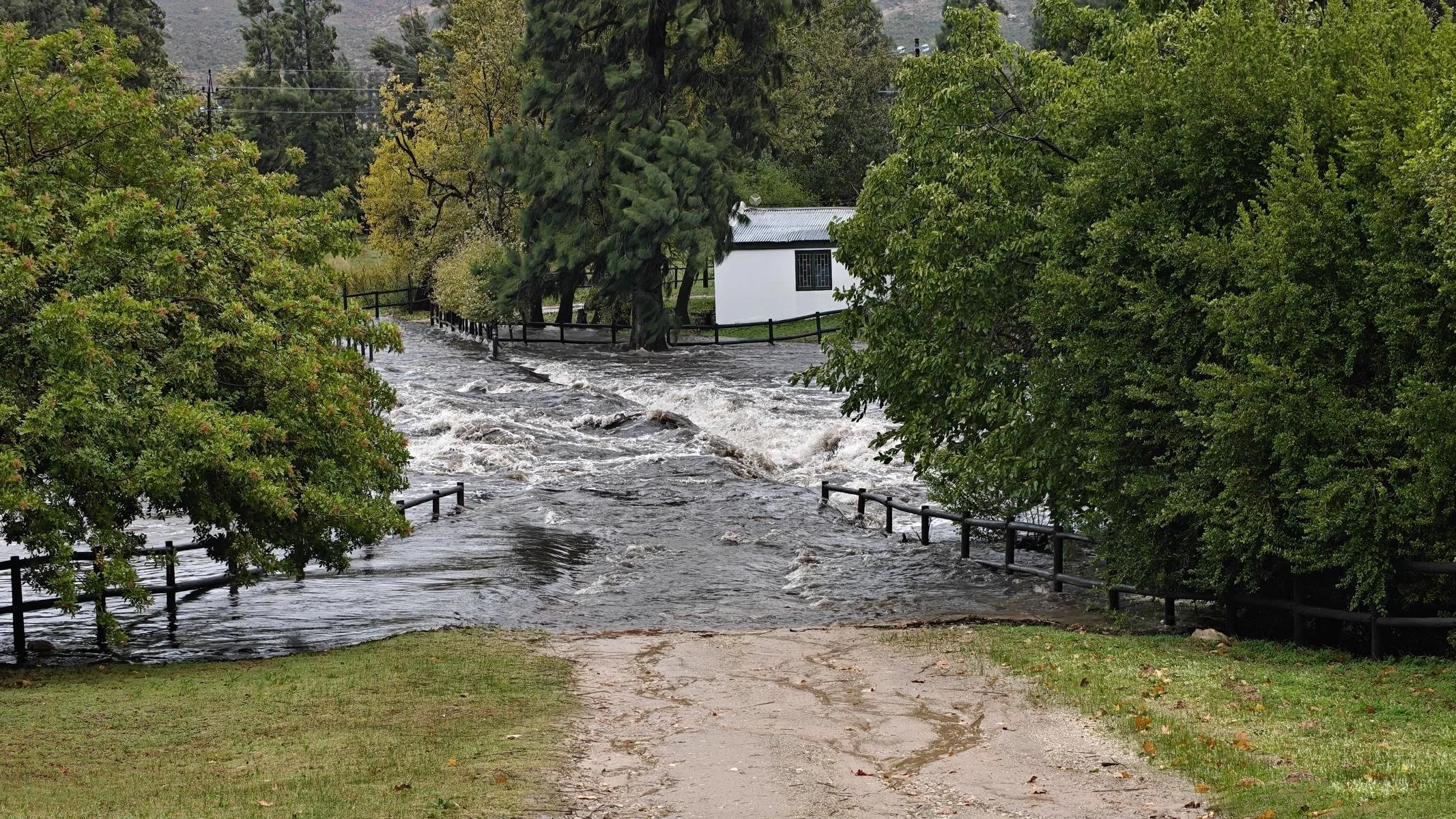
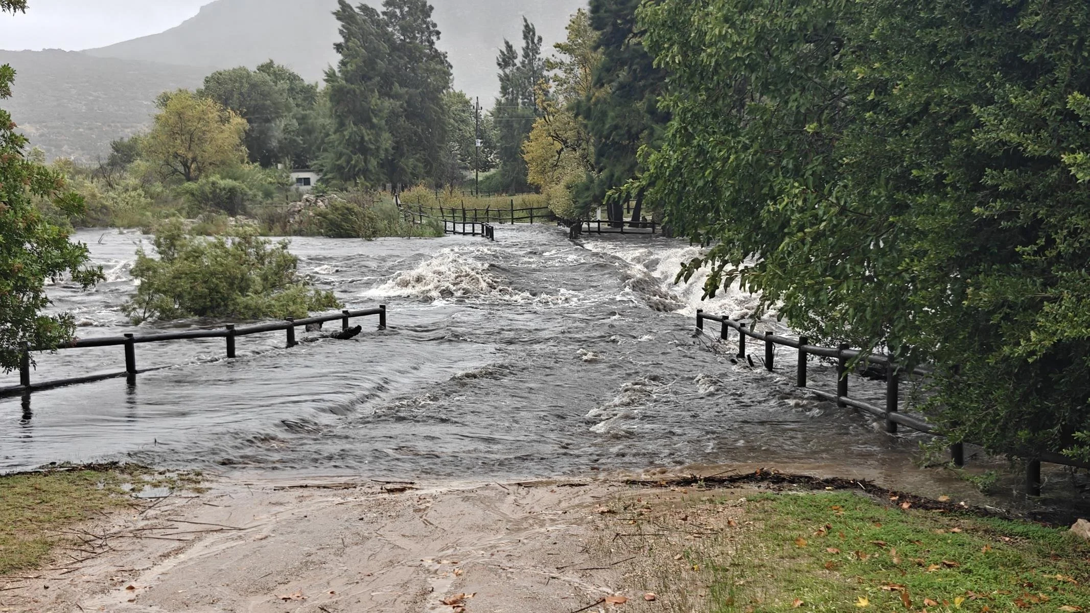
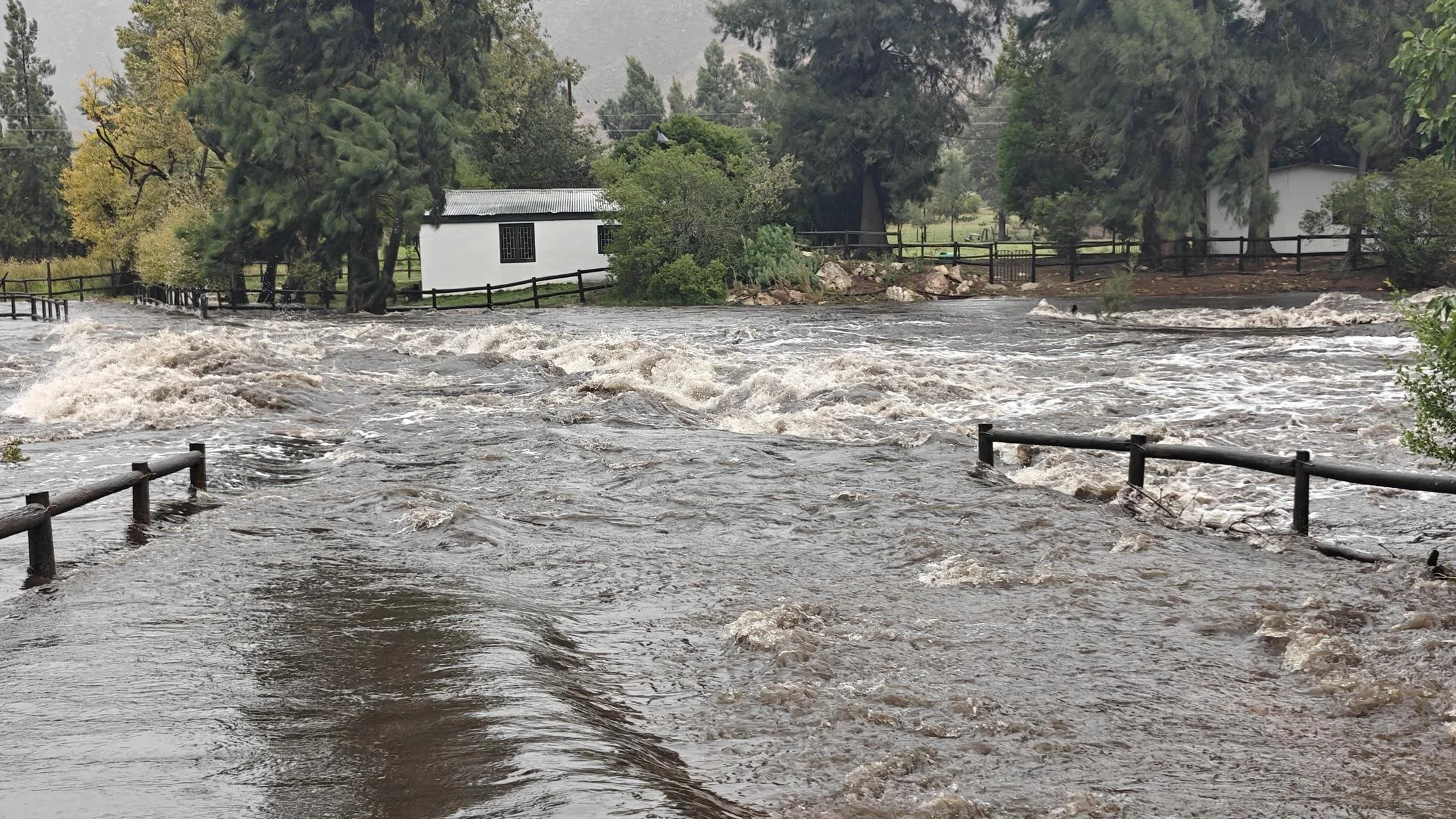
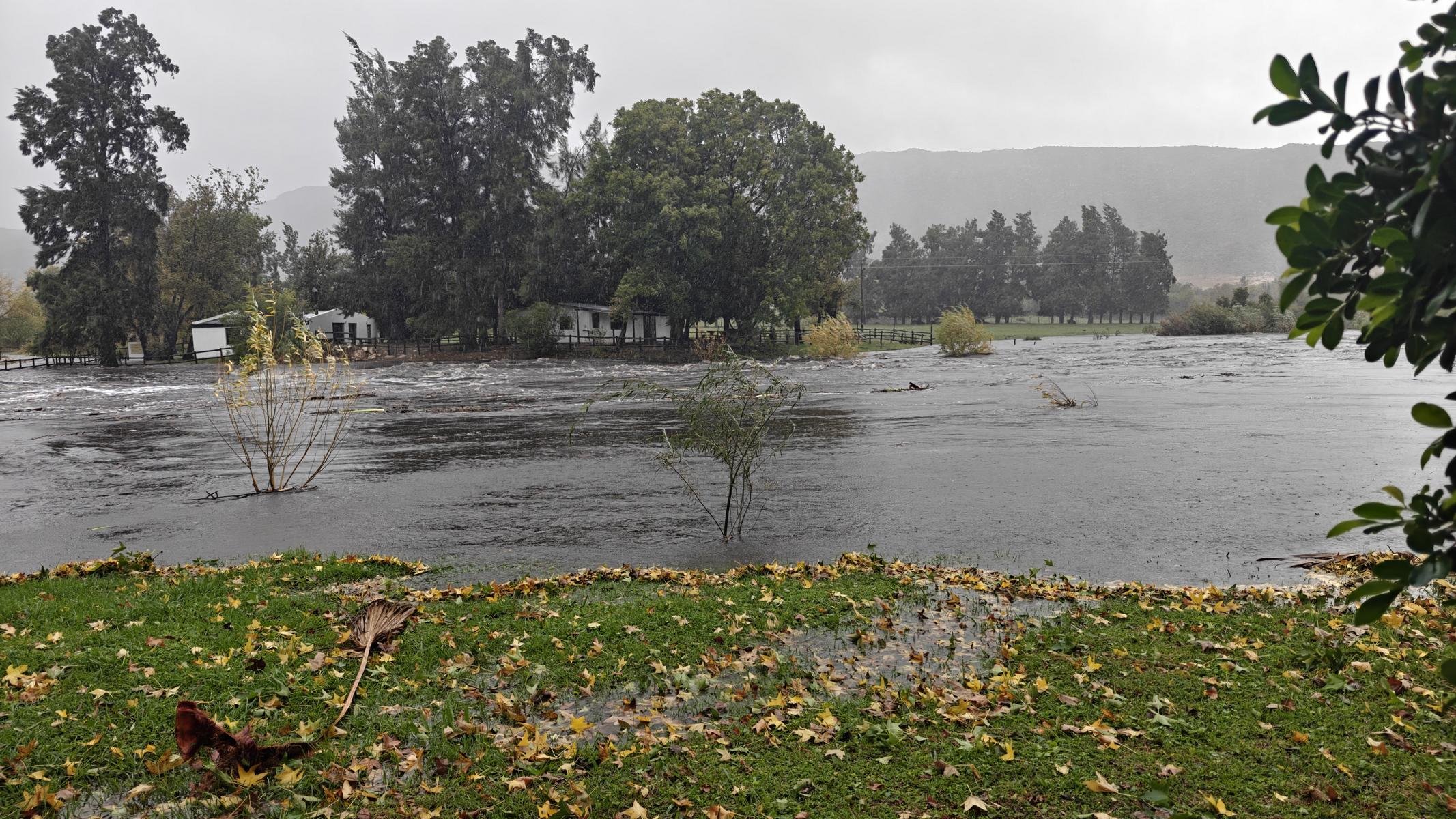
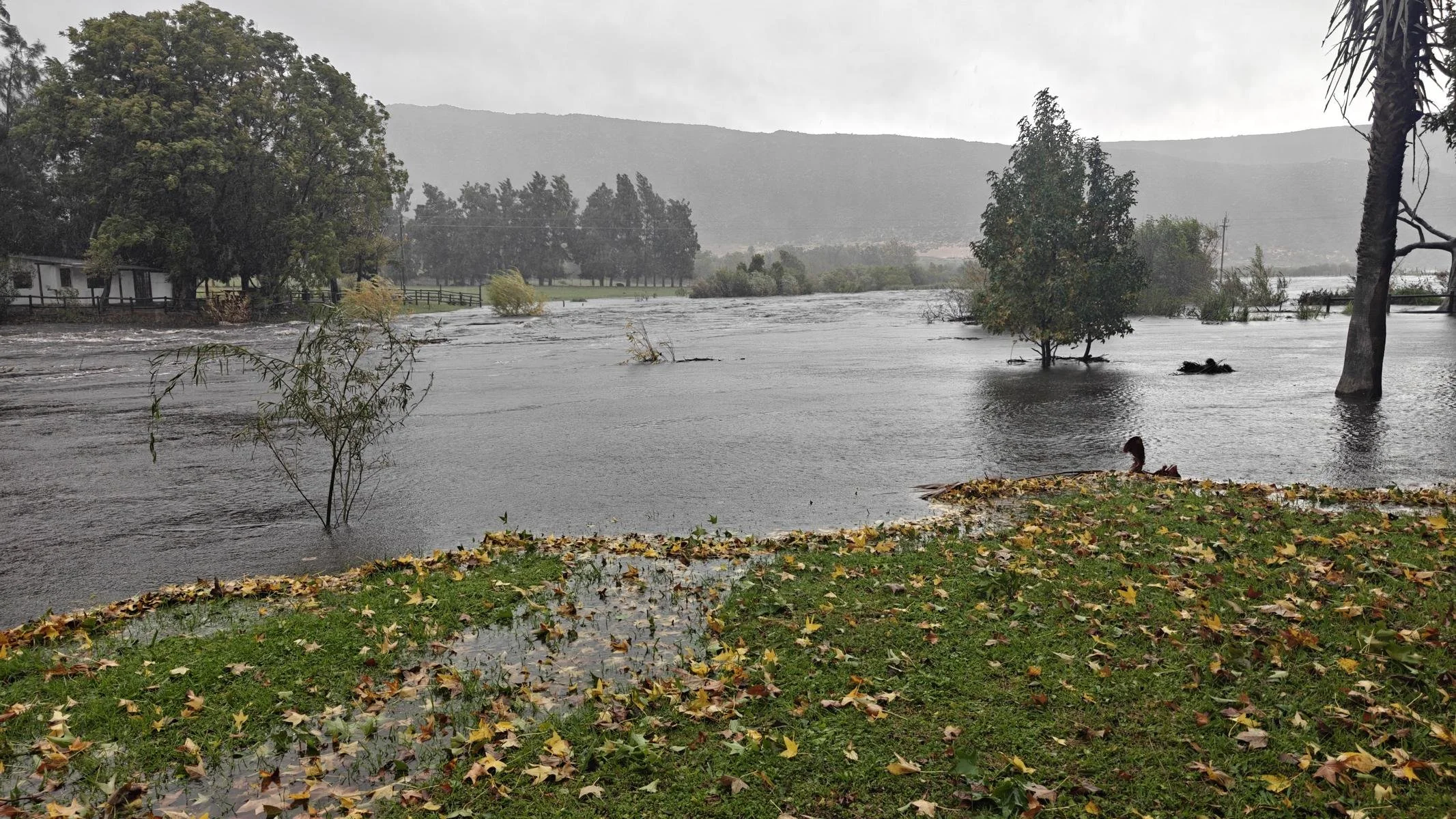
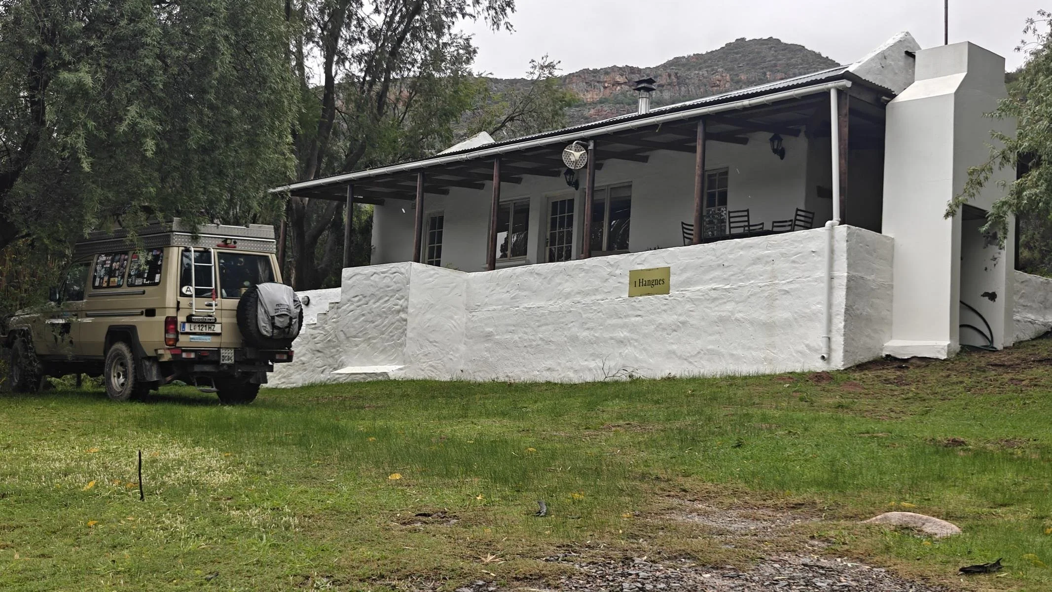
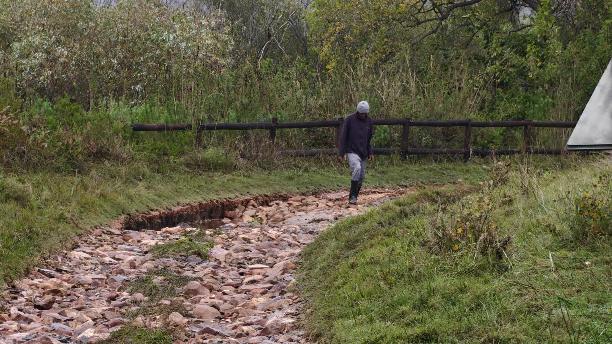
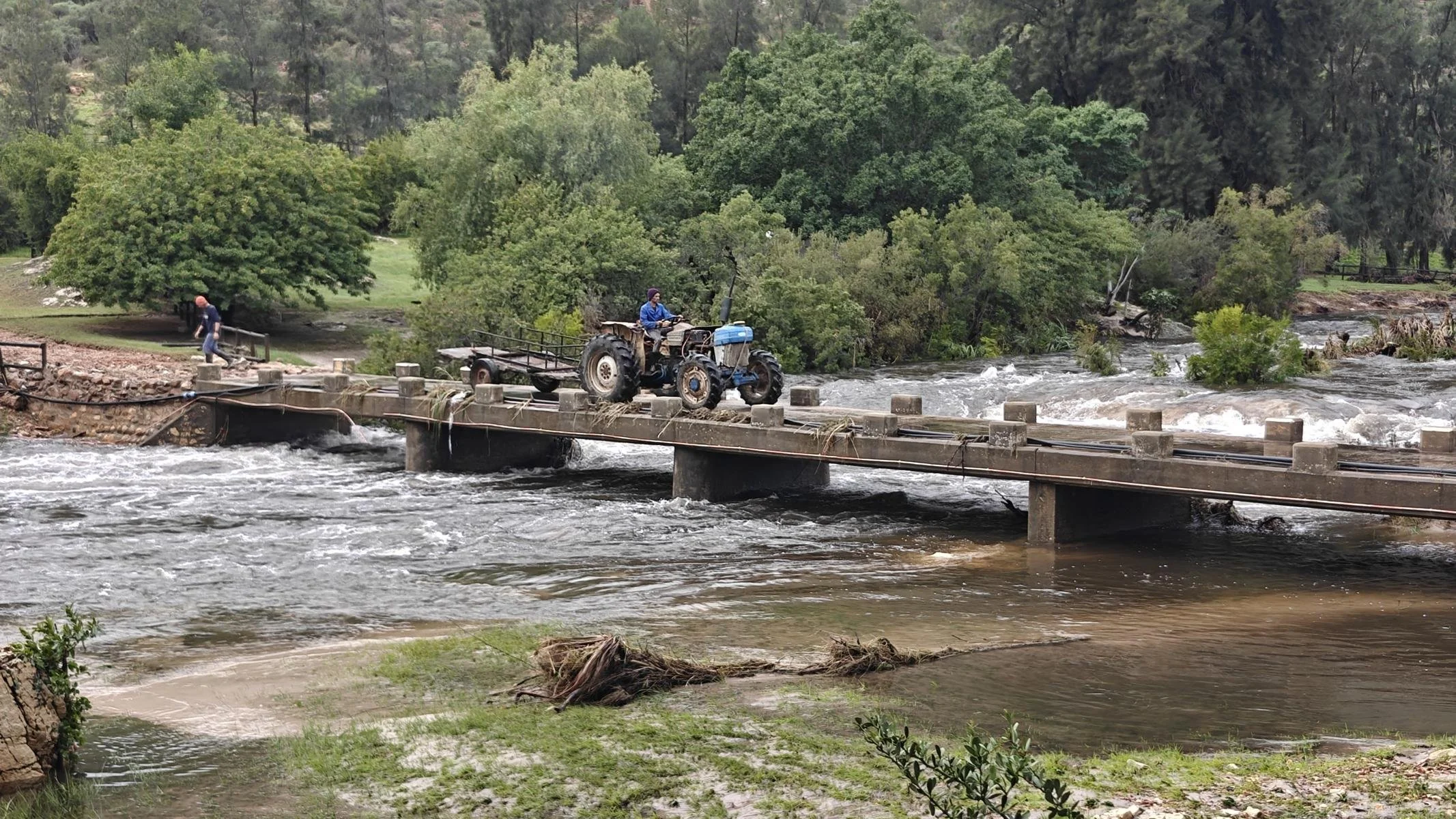
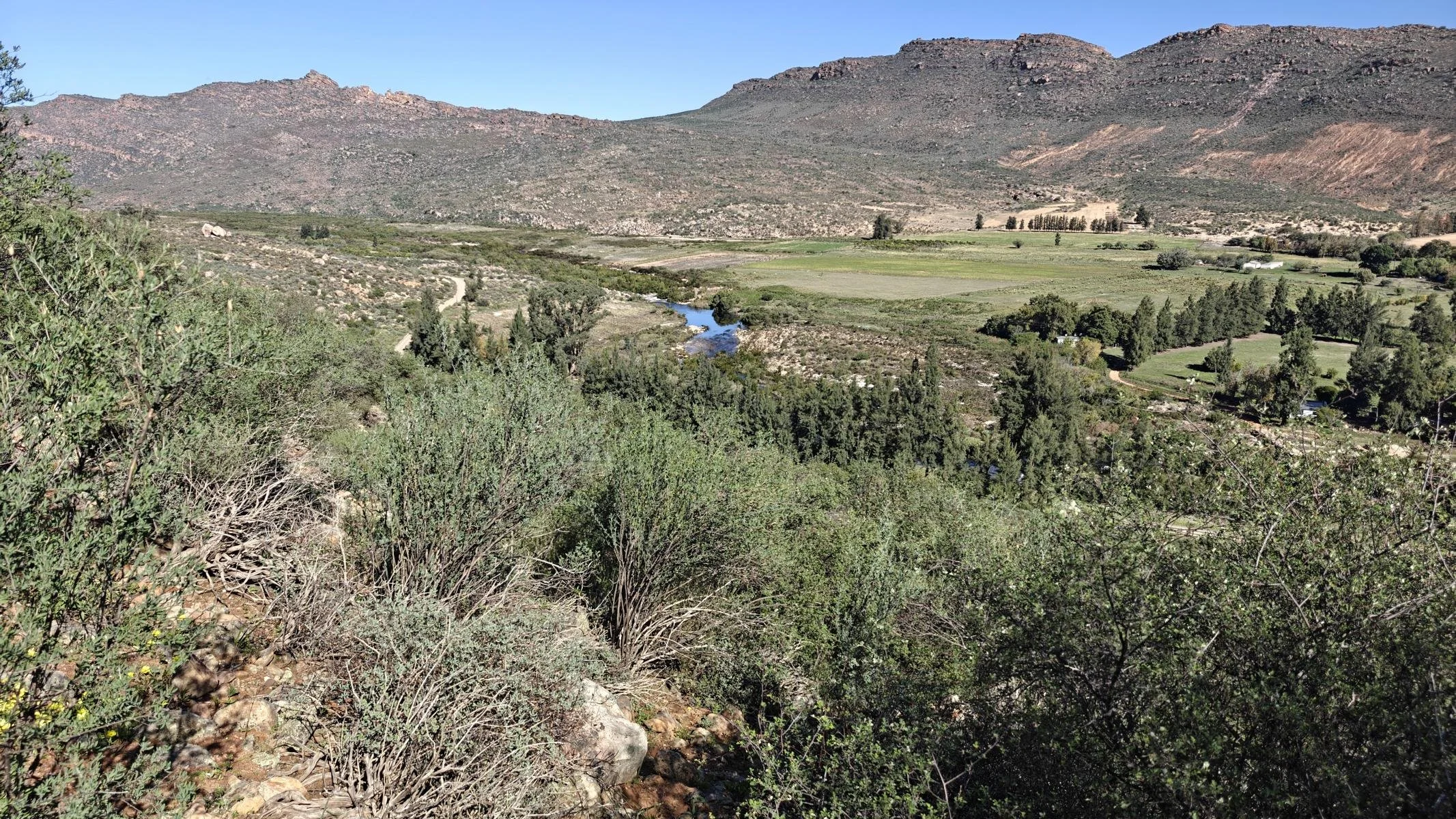
Due to the weather warning, I decided to ride out the storm front in a small side valley of the Cederberg Mountains (250 km north of Cape Town), which run perpendicular to the predicted wind direction. As it is not particular comfortable to stay in our camping car during the storm I settled into a bungalow on a small farm. However, on the very second night, I was evacuated from my building to a higher location. The harmless little creek had swollen enormously, flooded the bridge, and threatened to inundate all the houses along the bank. After four days, the rain finally stopped, and the water receded quickly. Apart from some power and water outages, I got off relatively lightly.
Aufgrund der Wetterwarnung beschloss ich, die Sturmfront in einem kleinen Seitental des Cederberg Massivs (250 km nördlich von Kapstadt), das quer zur angekündigten Windrichtung verlief, auszusitzen. Da es bei Schlechtwetter und Sturm in unserem Auto nicht sehr bequem ist quartierte mich in einem Bungalow auf einer kleinen Farm ein. Allerdings wurde ich in schon in der zweiten Nacht aus meinem Gebäude in ein höhergelegenes evakuiert. Der harmlose kleine Bach war binnen kurzem gewaltig angeschwollen, überflutete die Brücke und drohte alle Häuser am Ufer zu überschwemmen. Nach vier Tagen hörte der Regen schließlich auf und auch das Wasser ging schnell zurück. Vom Ausfall von Strom und Wasser abgesehen kam ich damit relativ glimpflich davon.
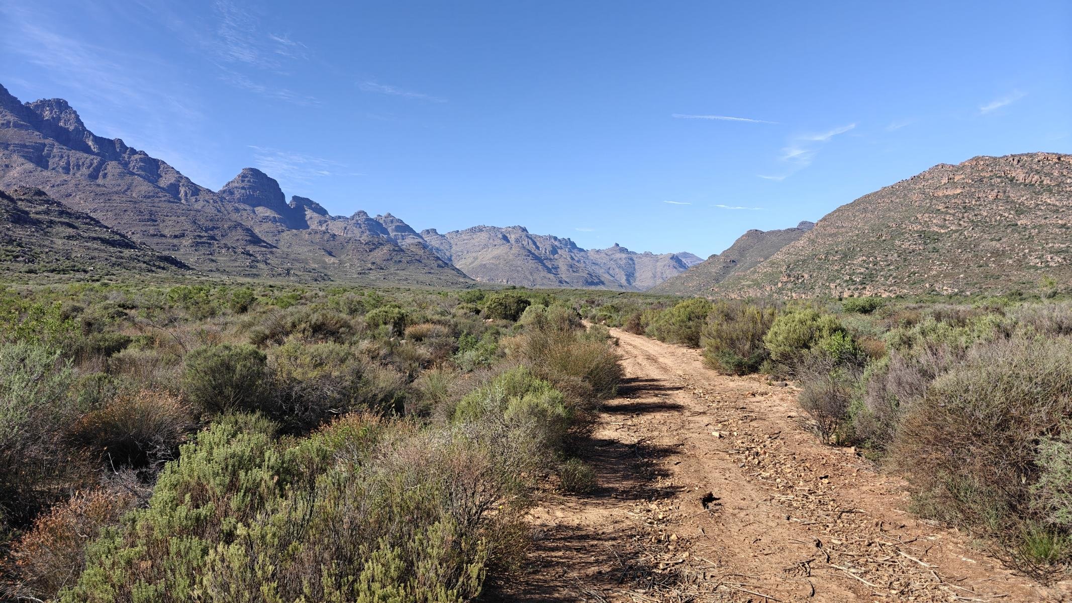
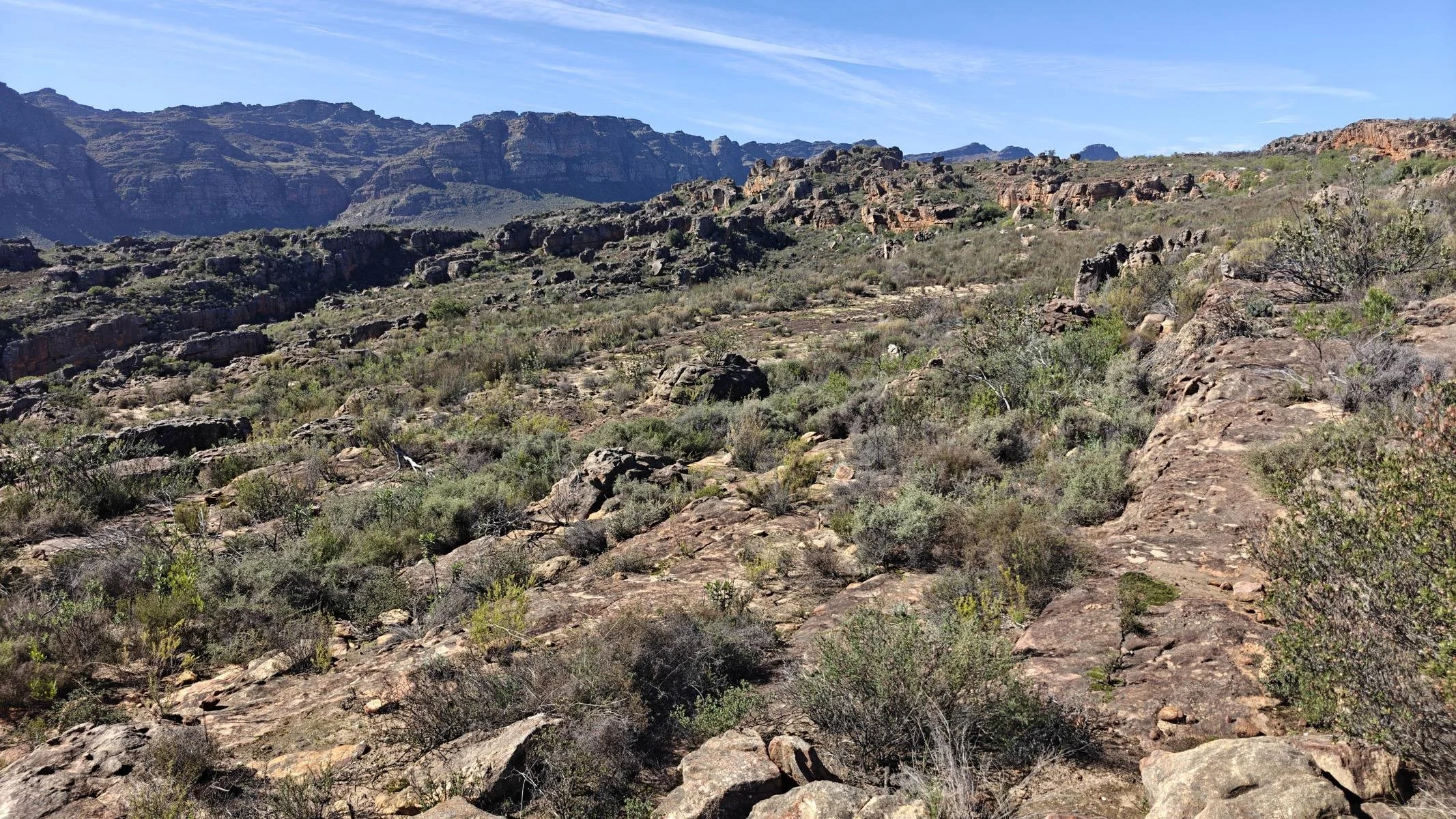
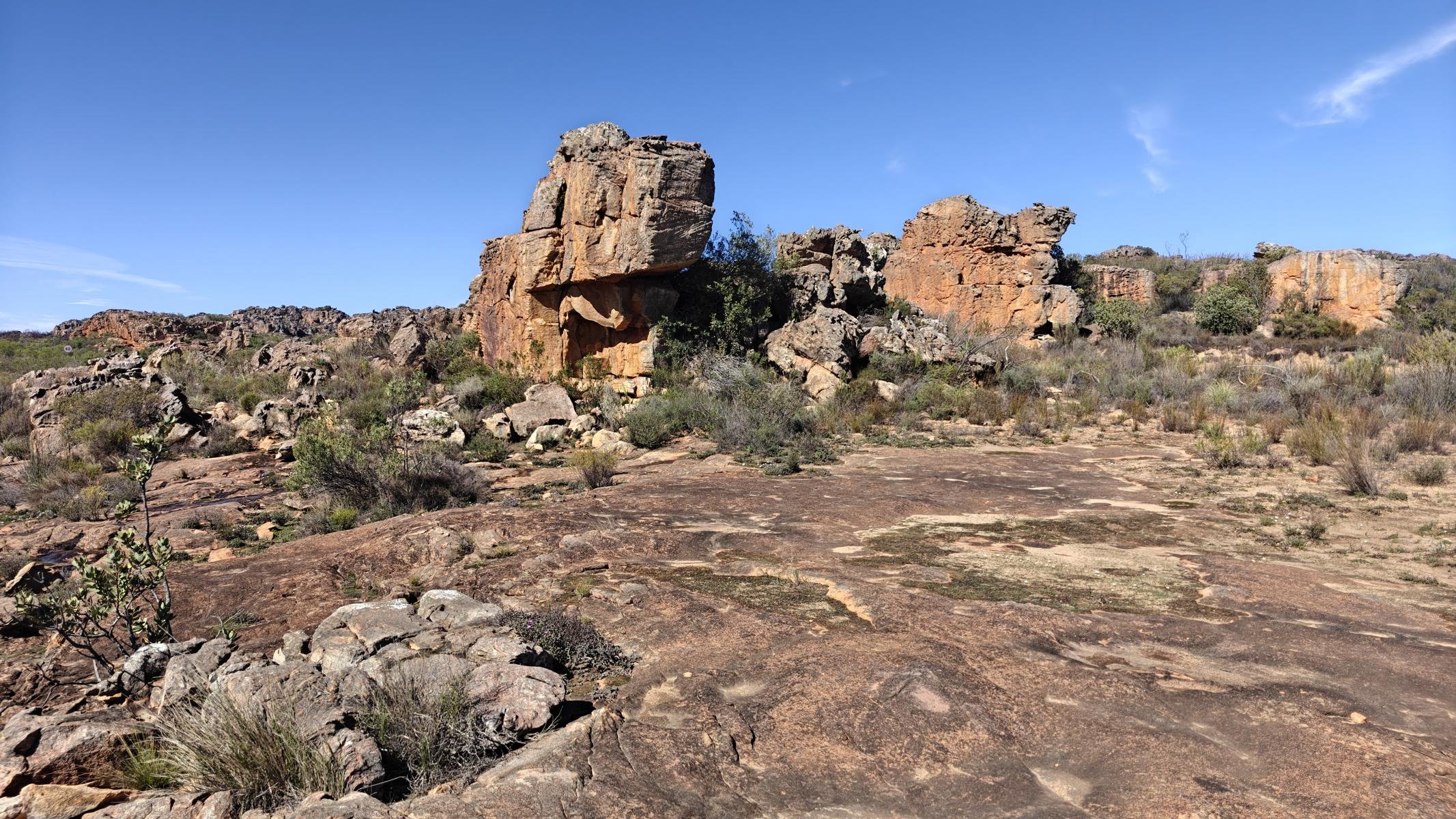
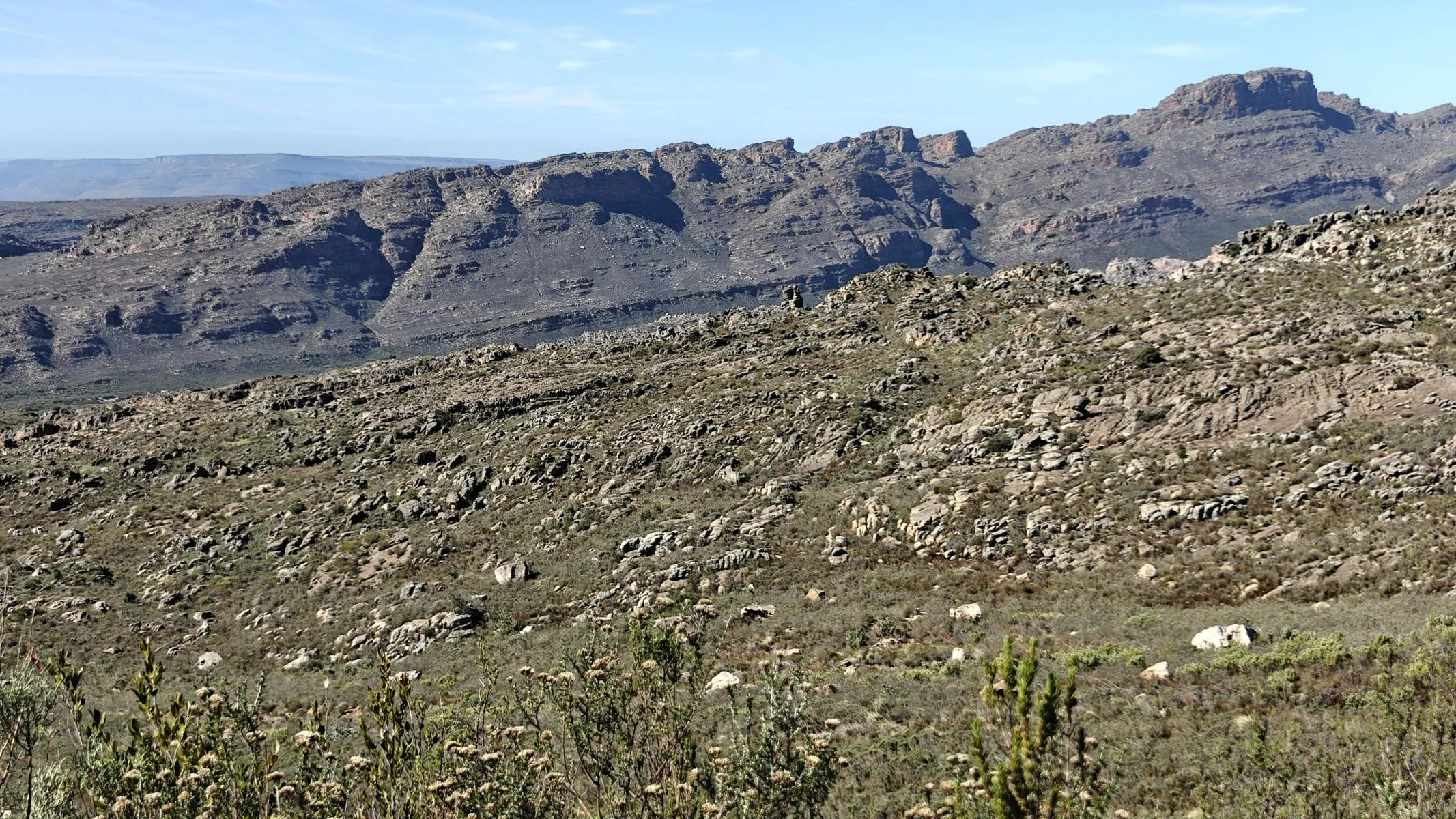
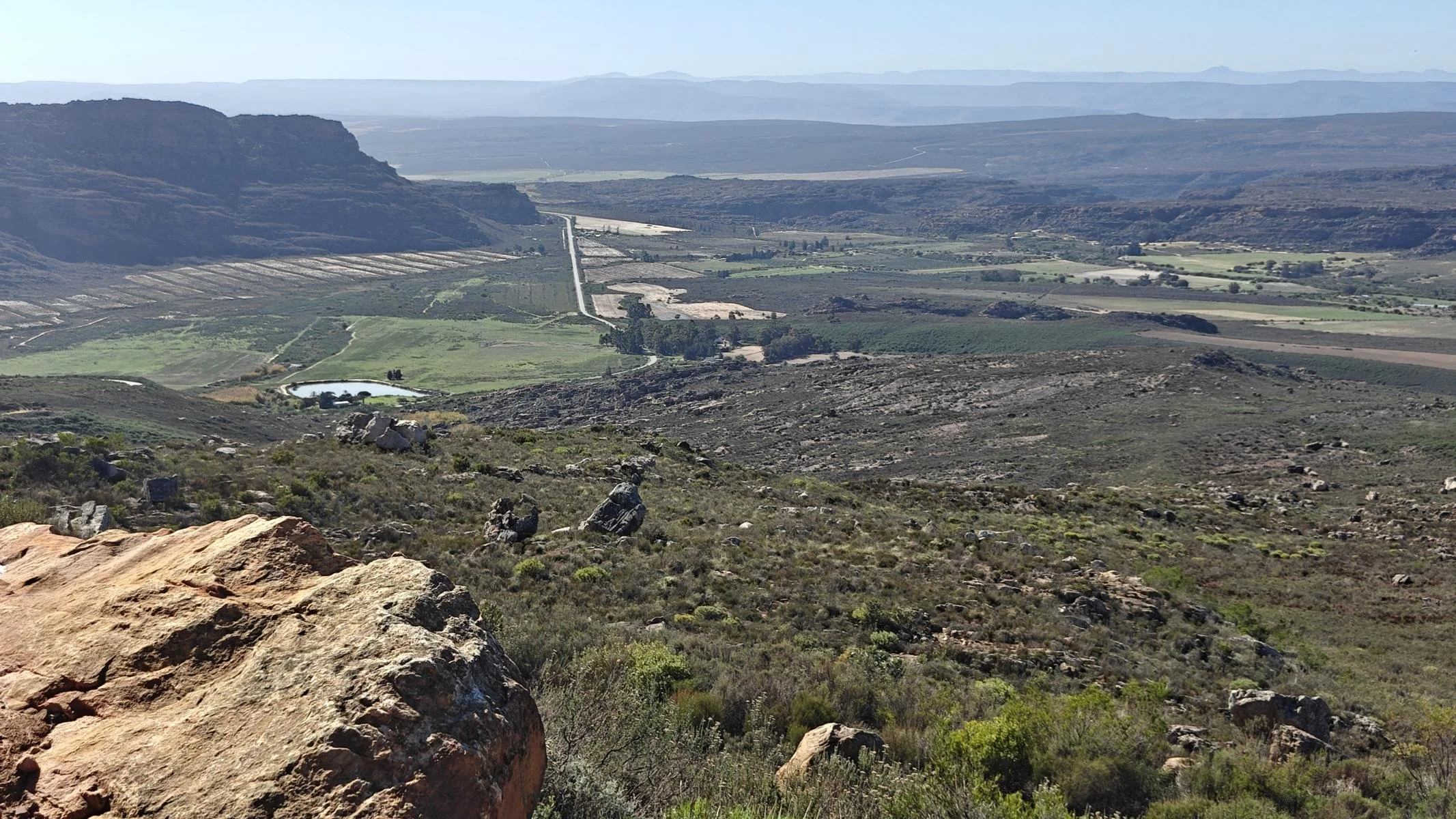
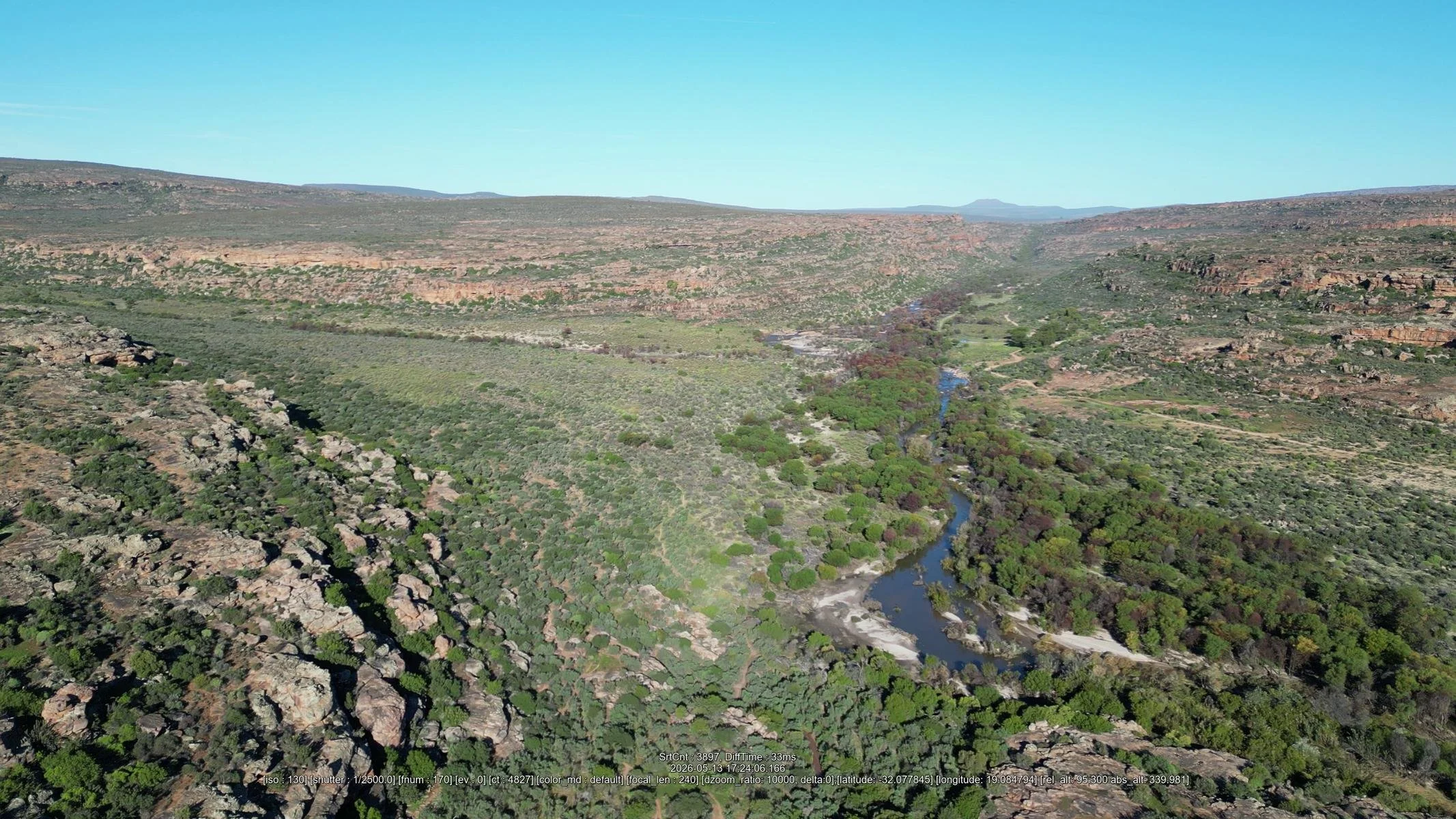
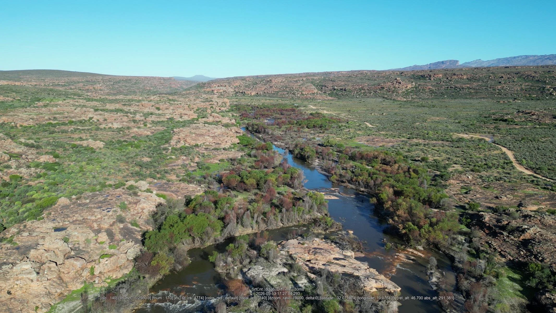
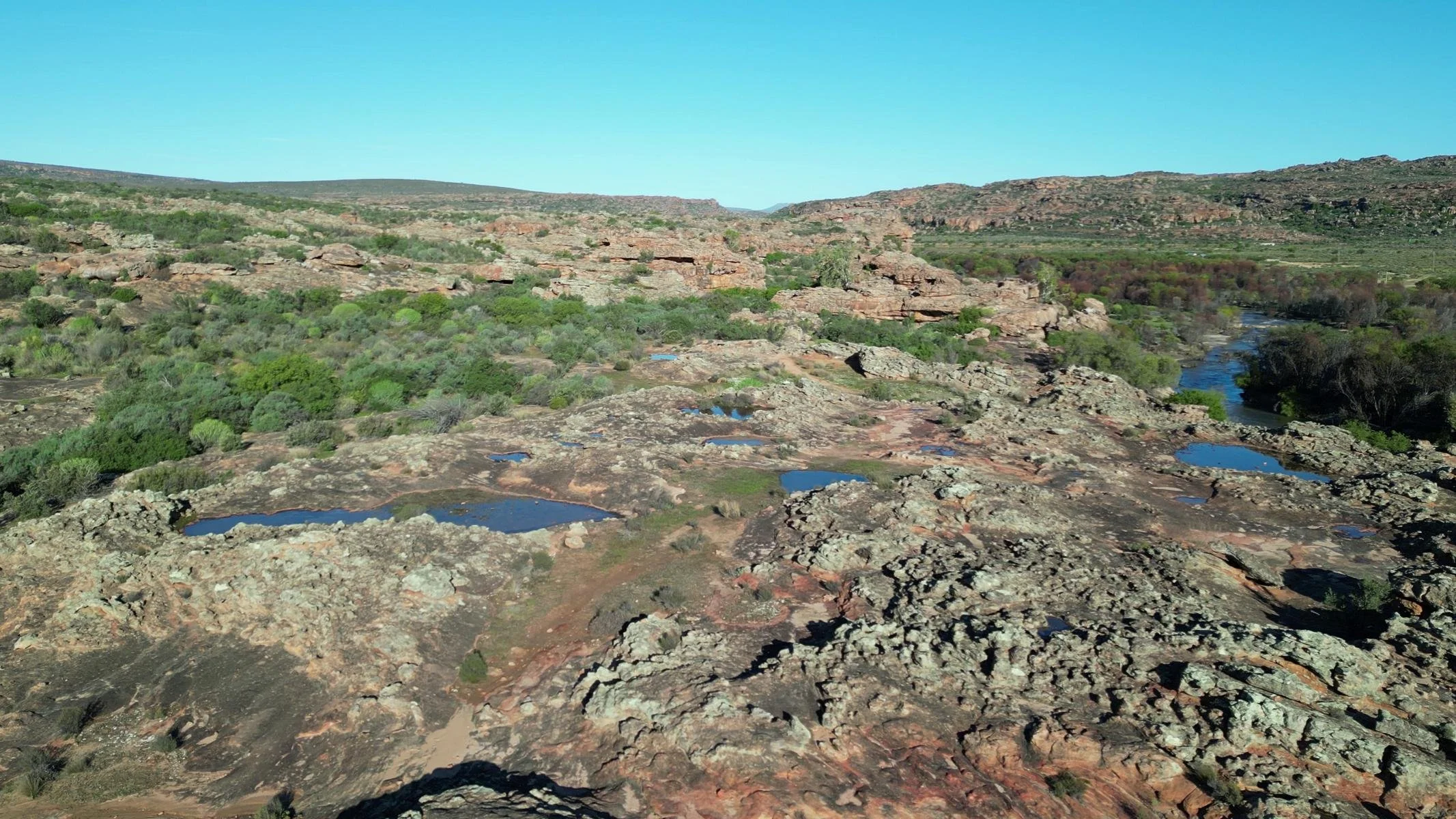
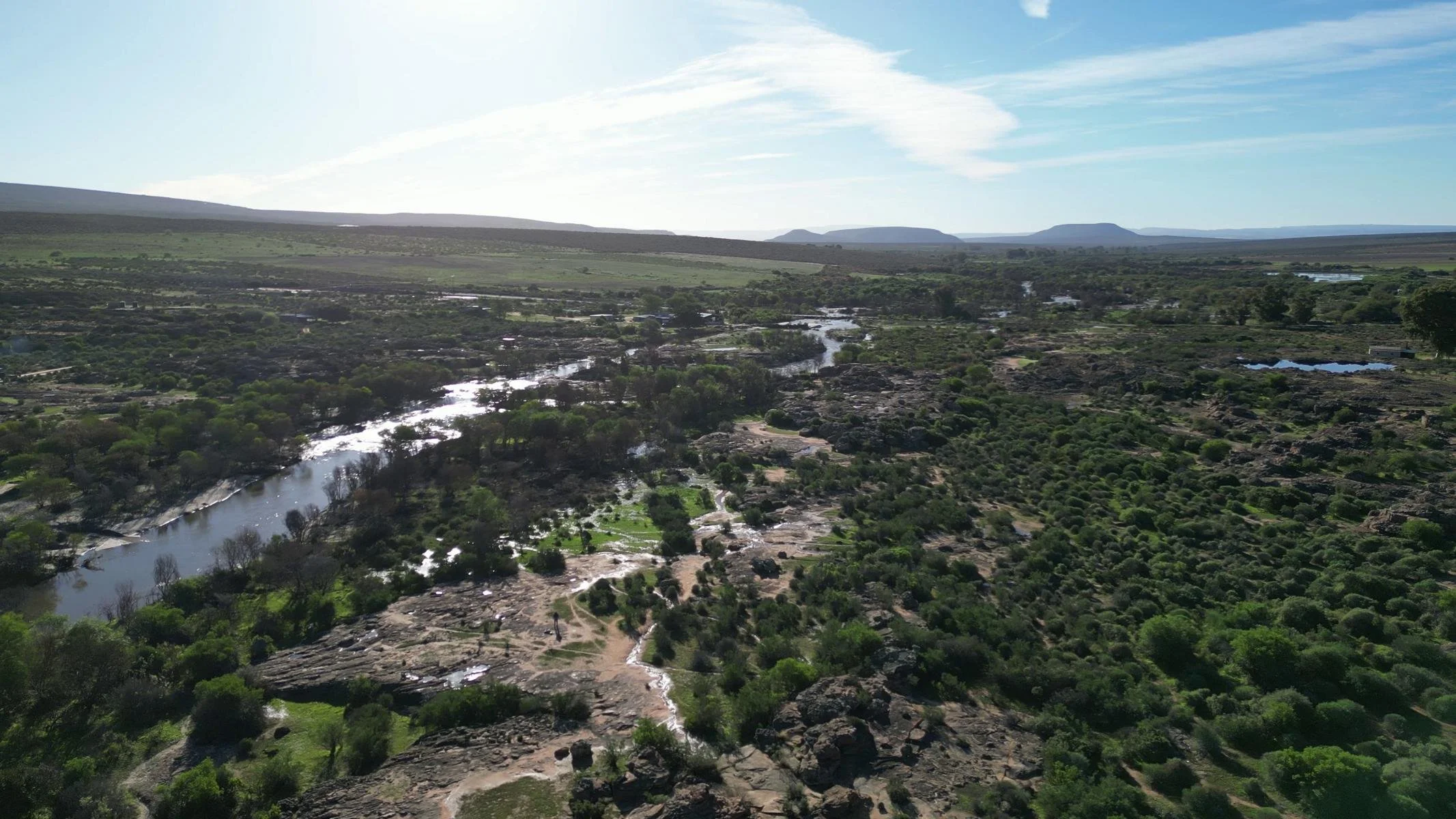
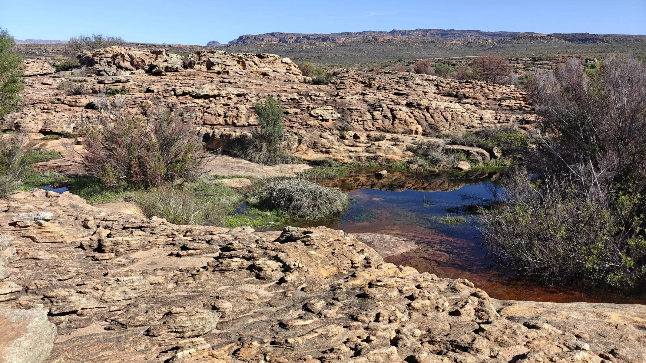
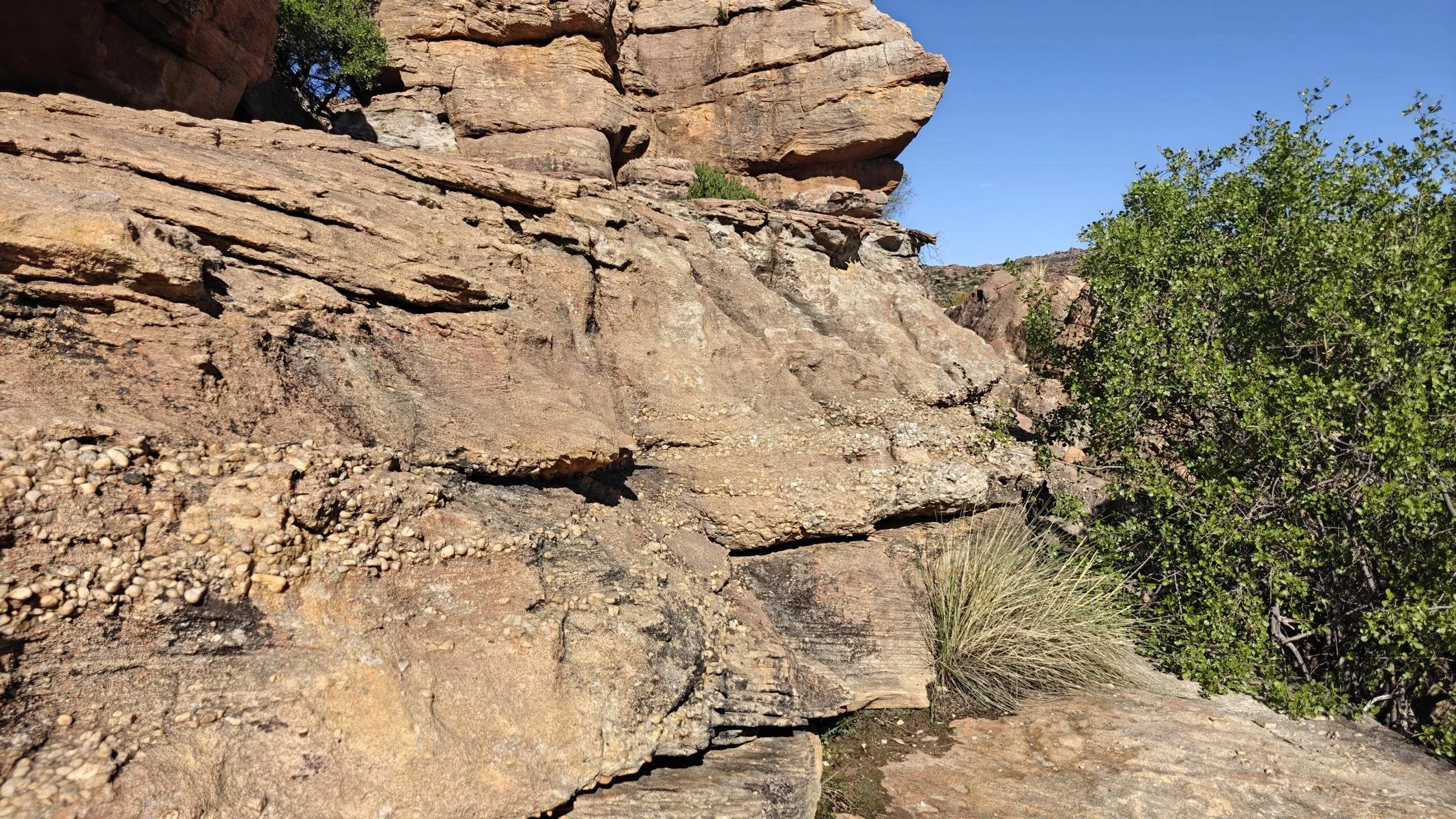
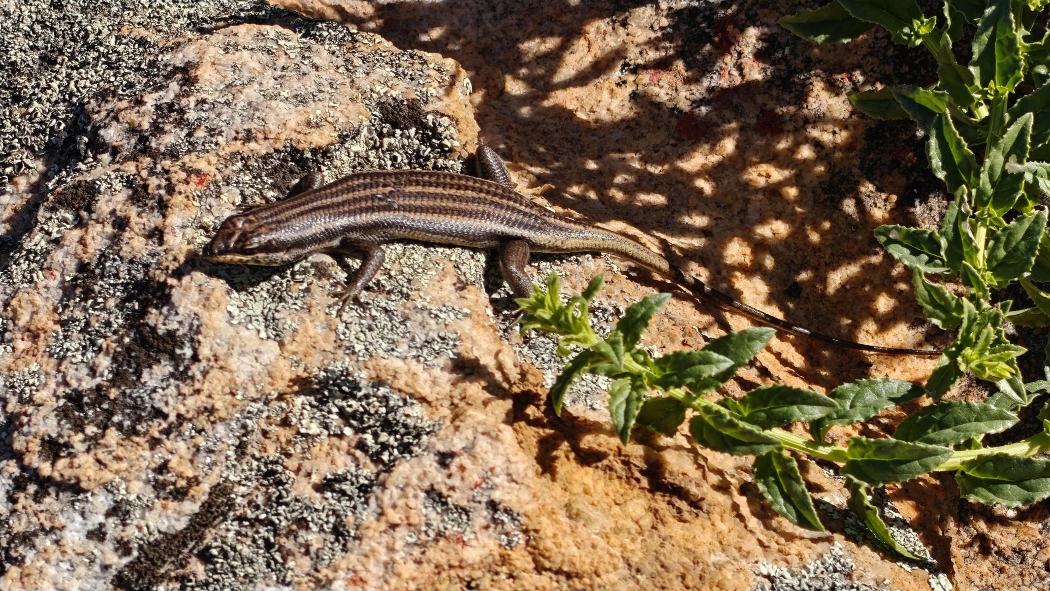
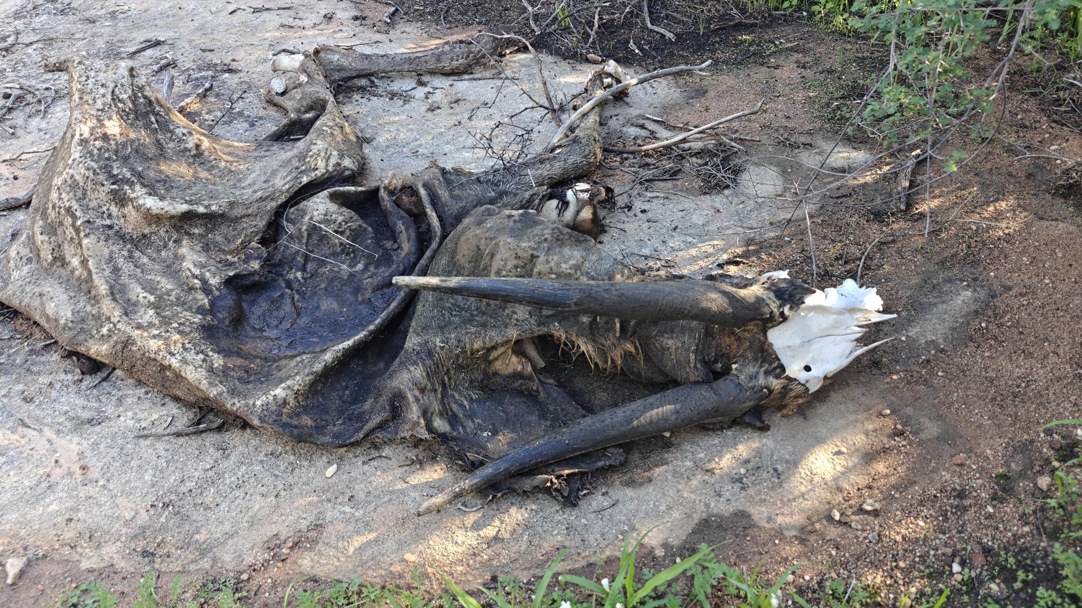
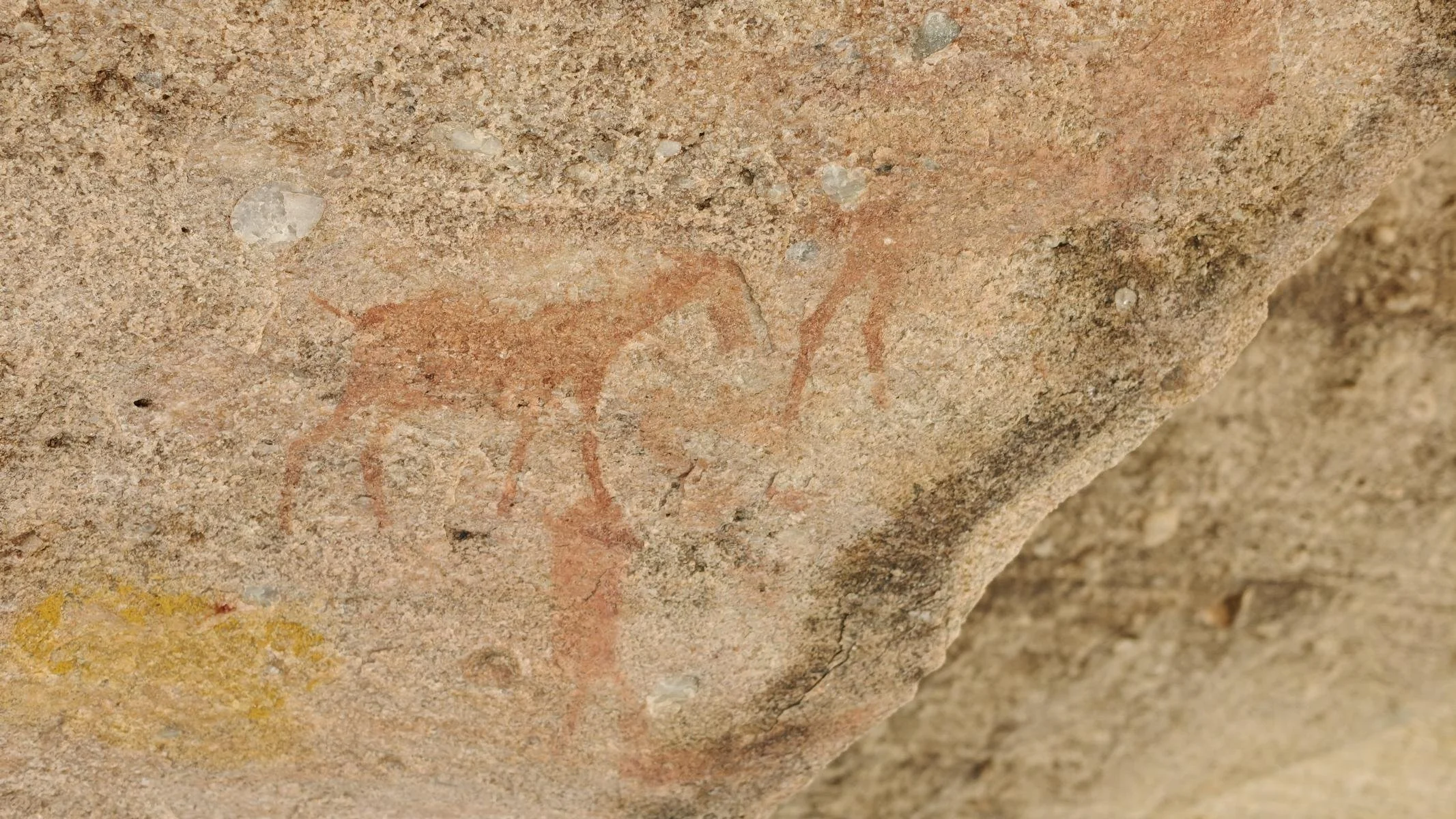
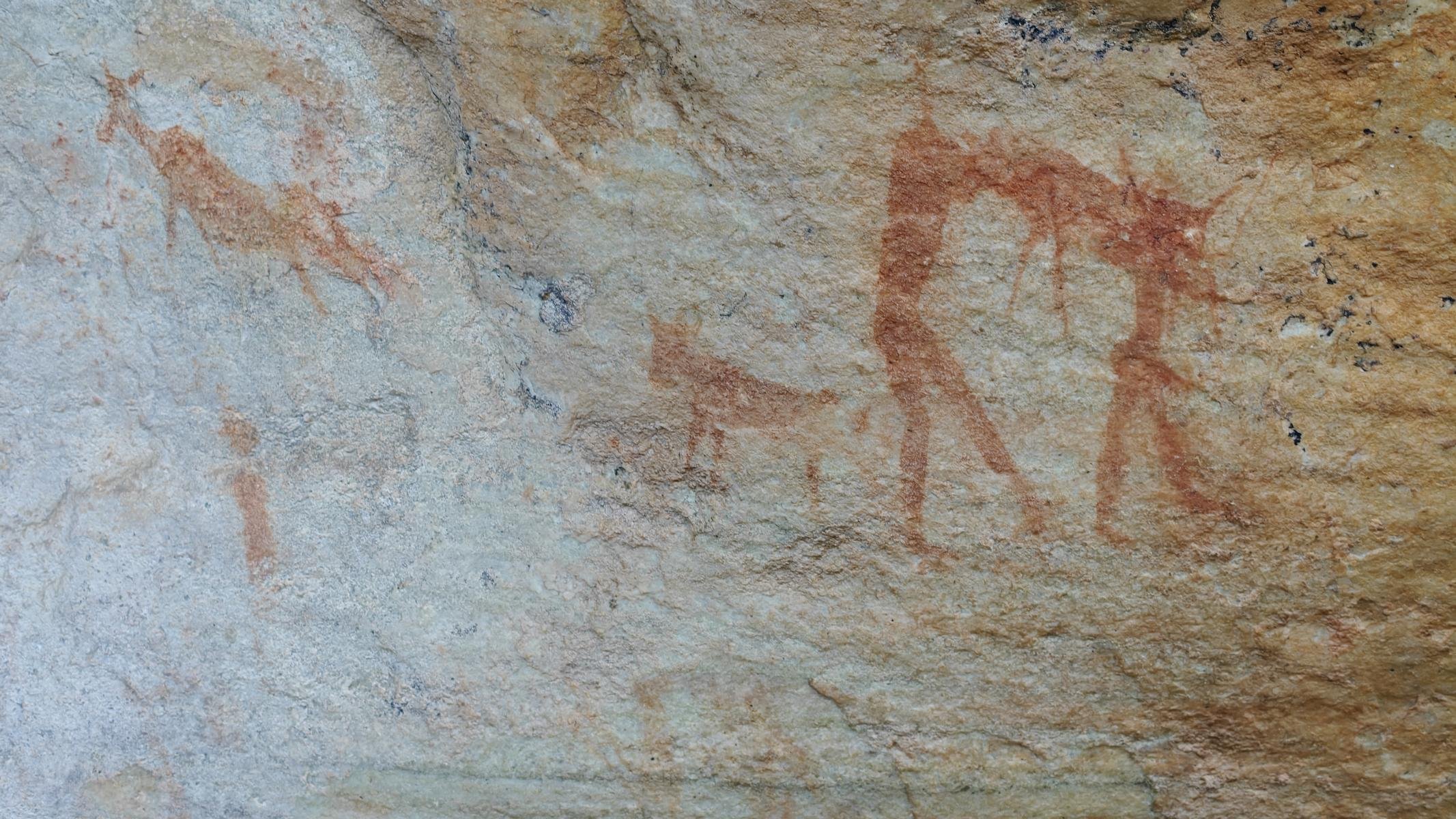
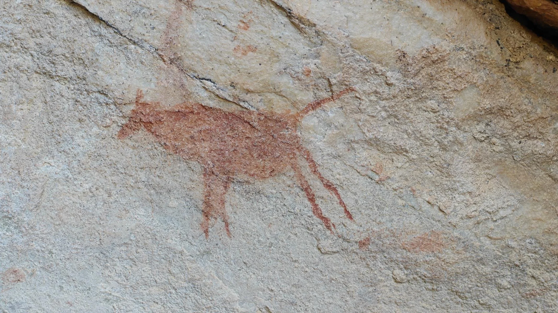
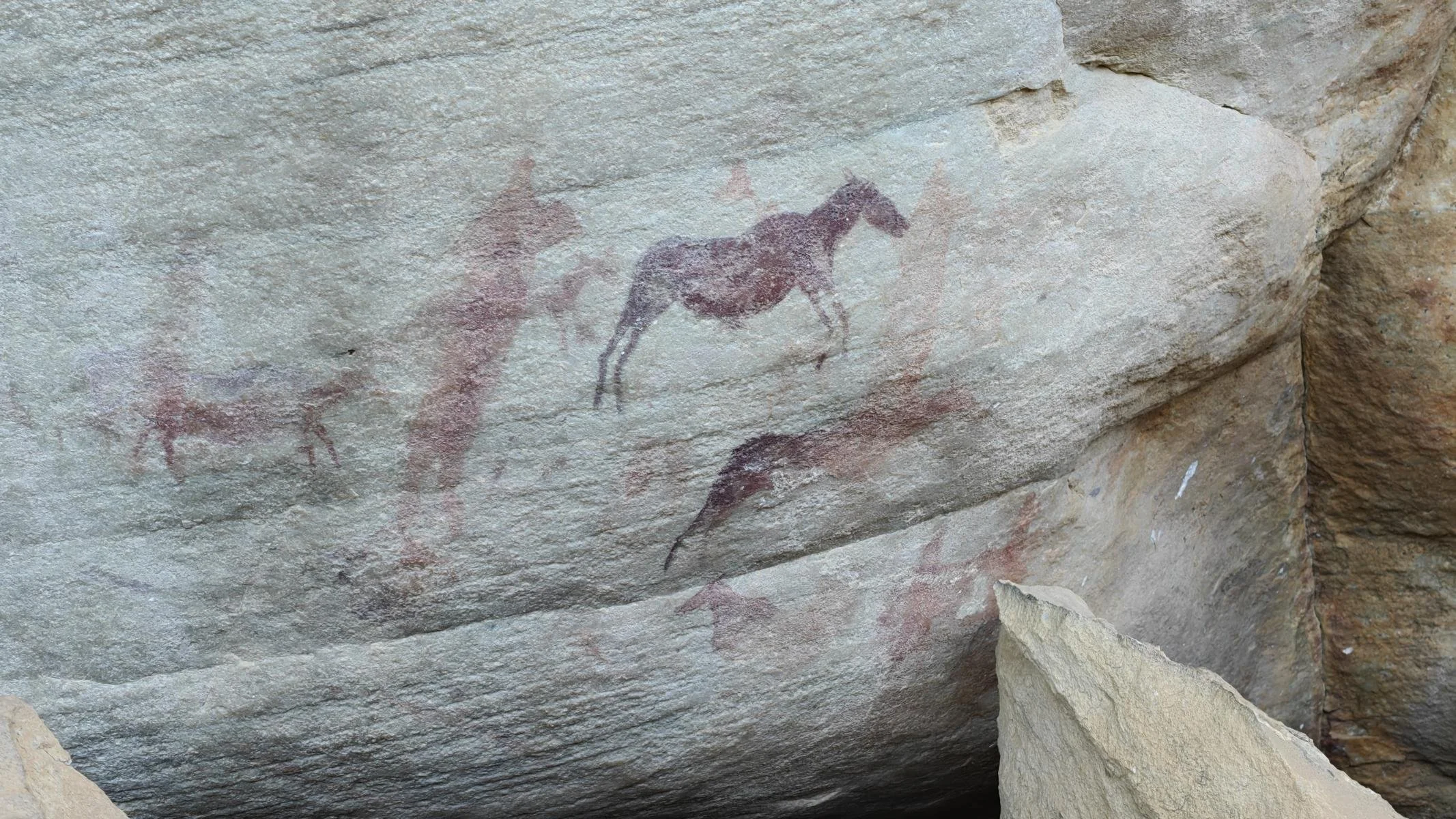
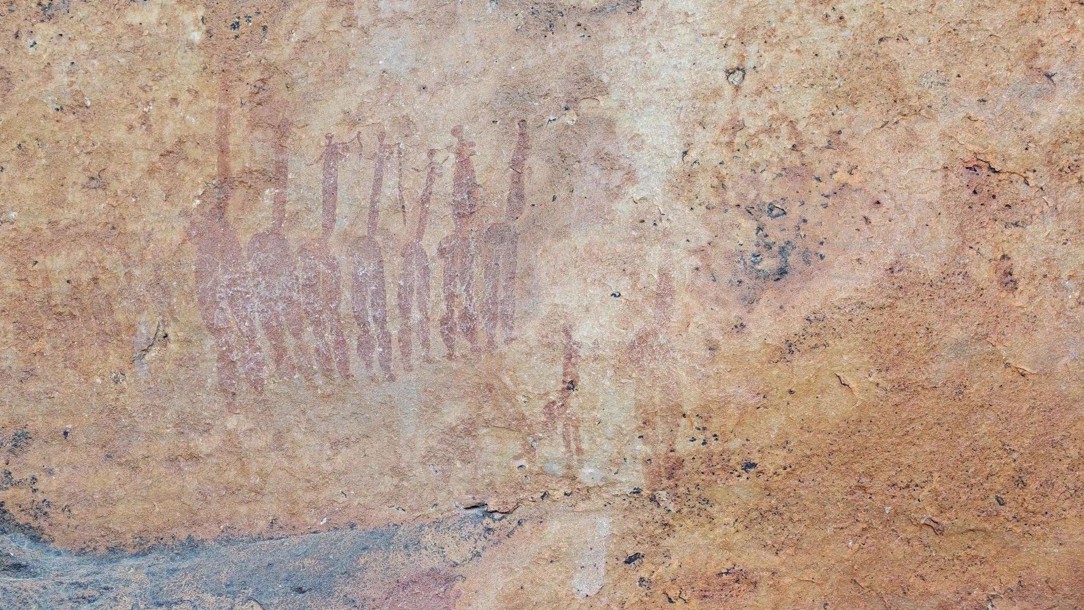
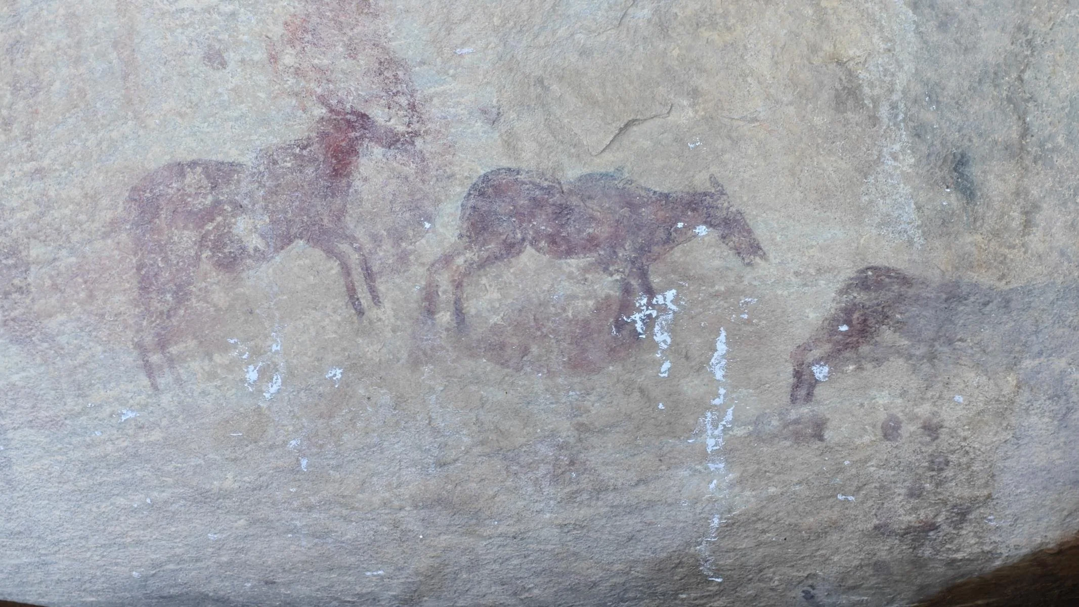
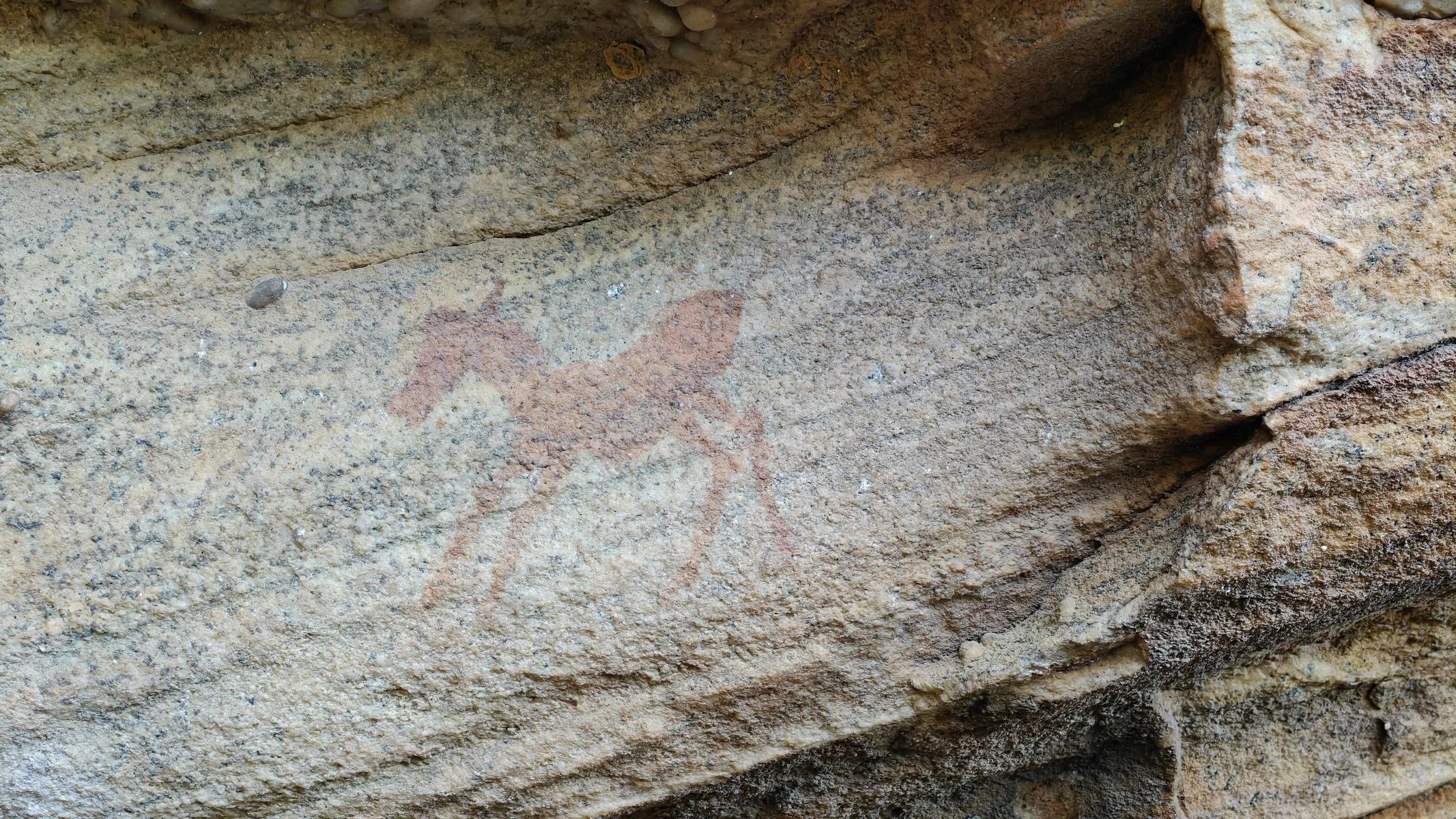
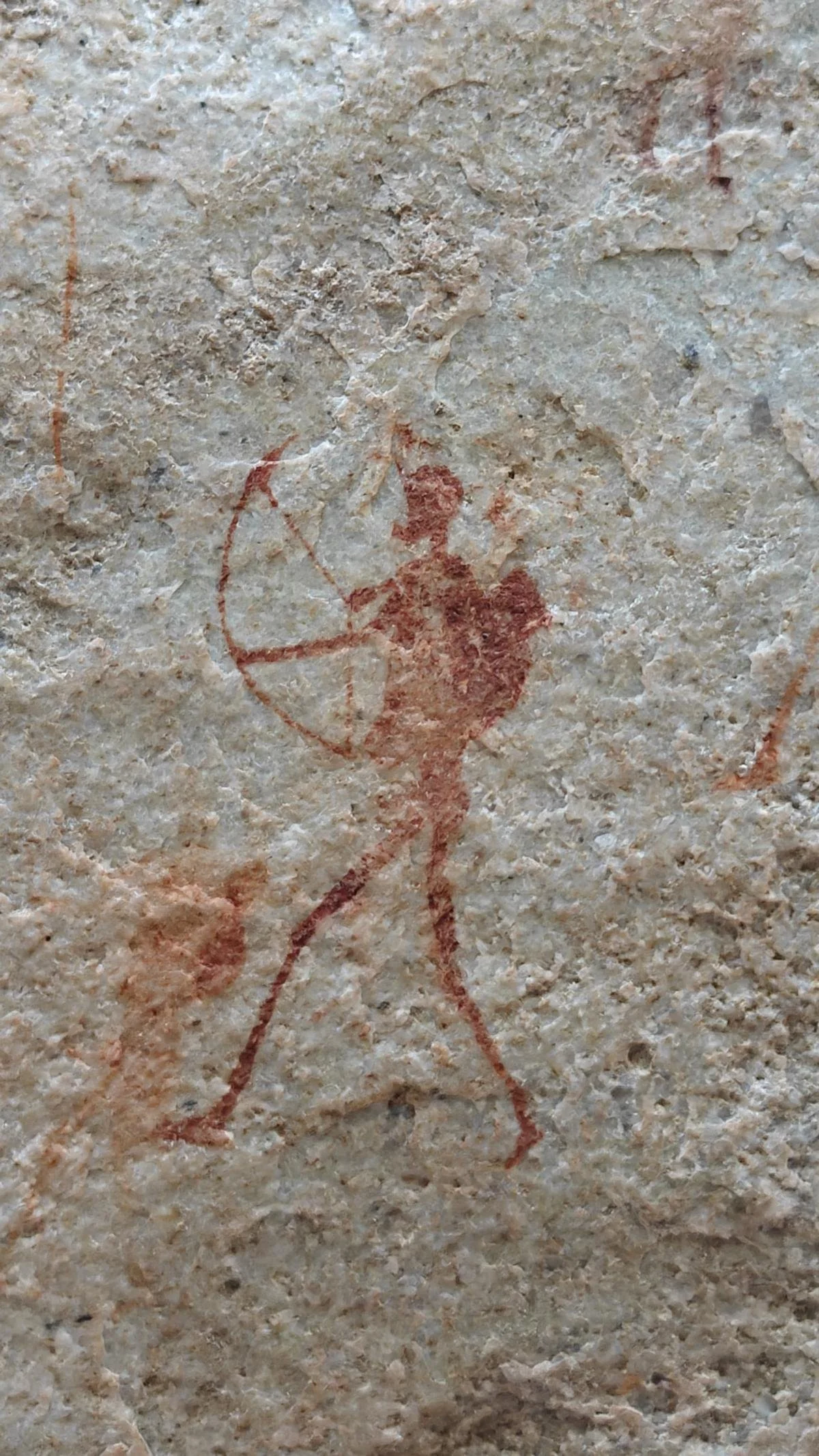
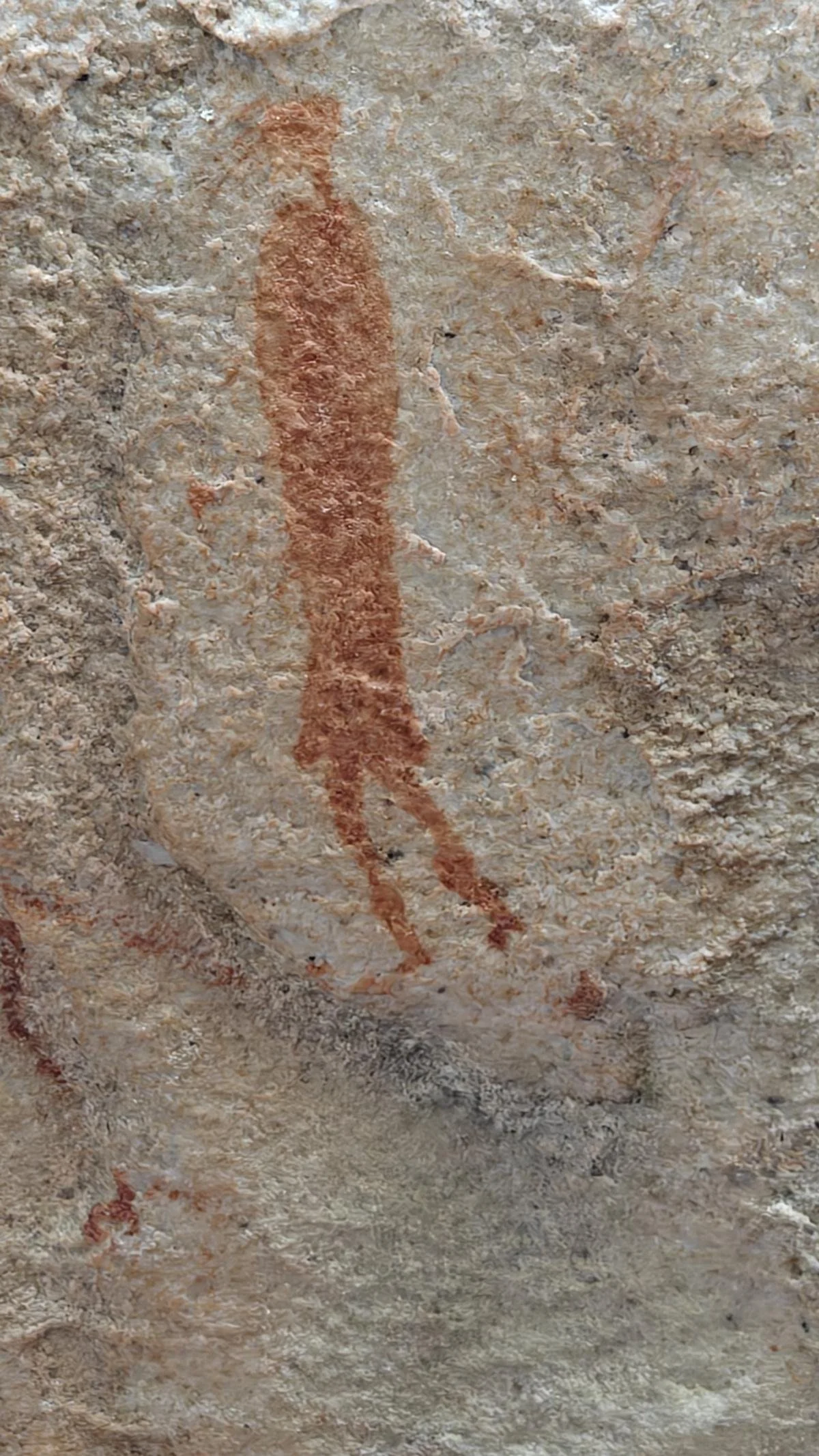
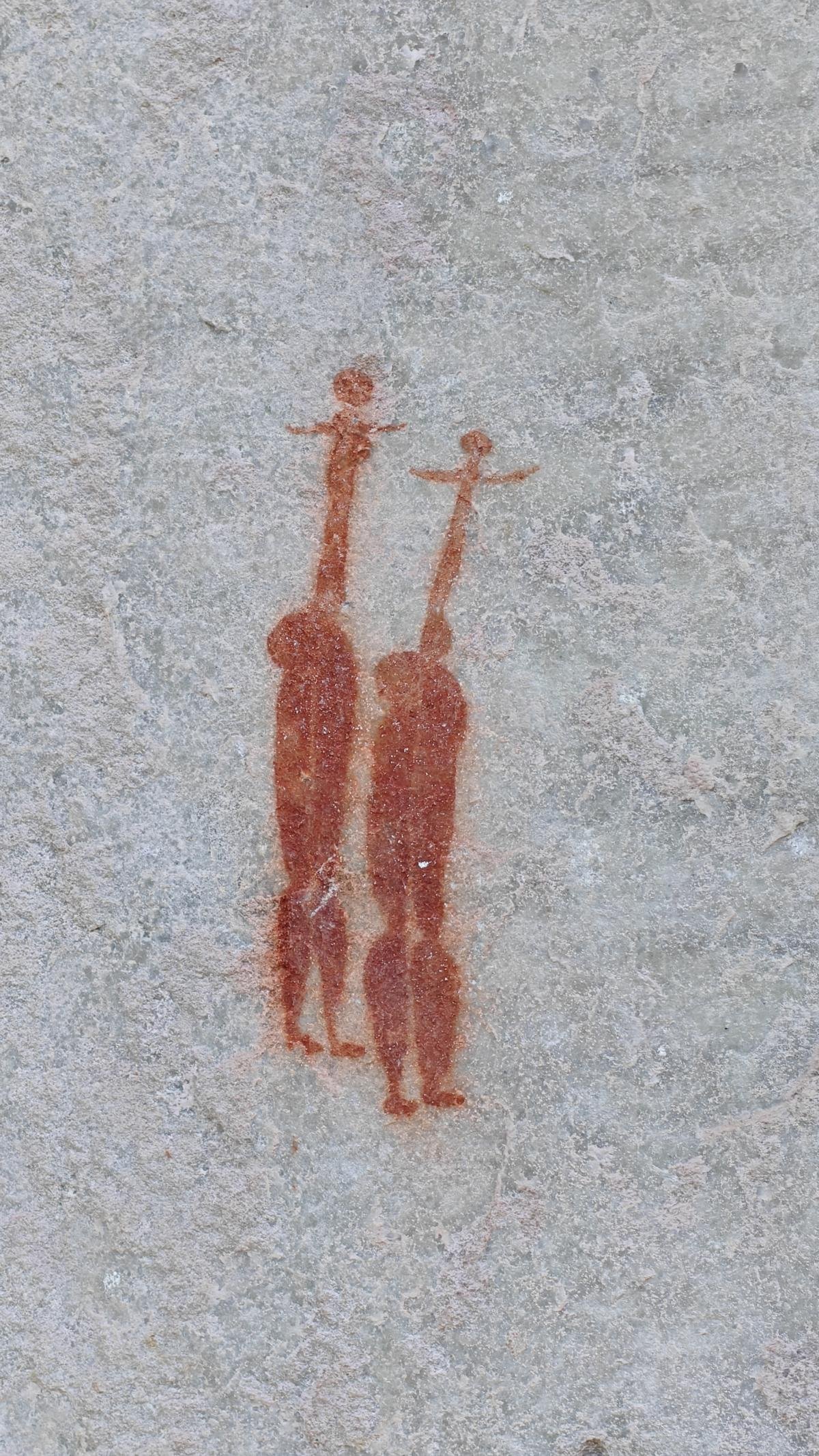
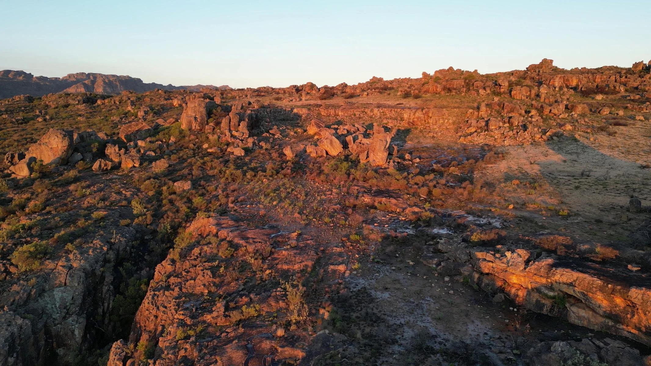
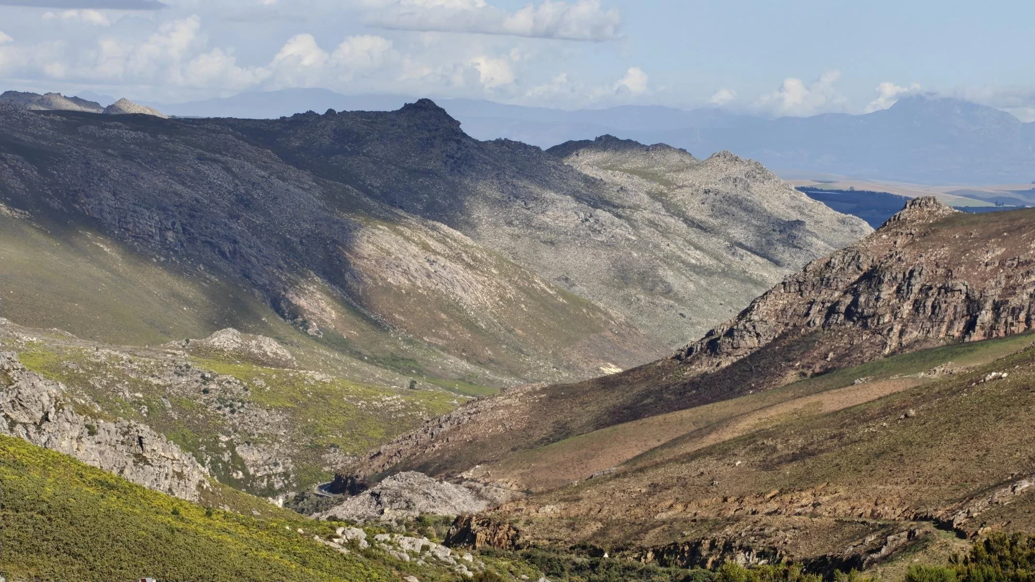
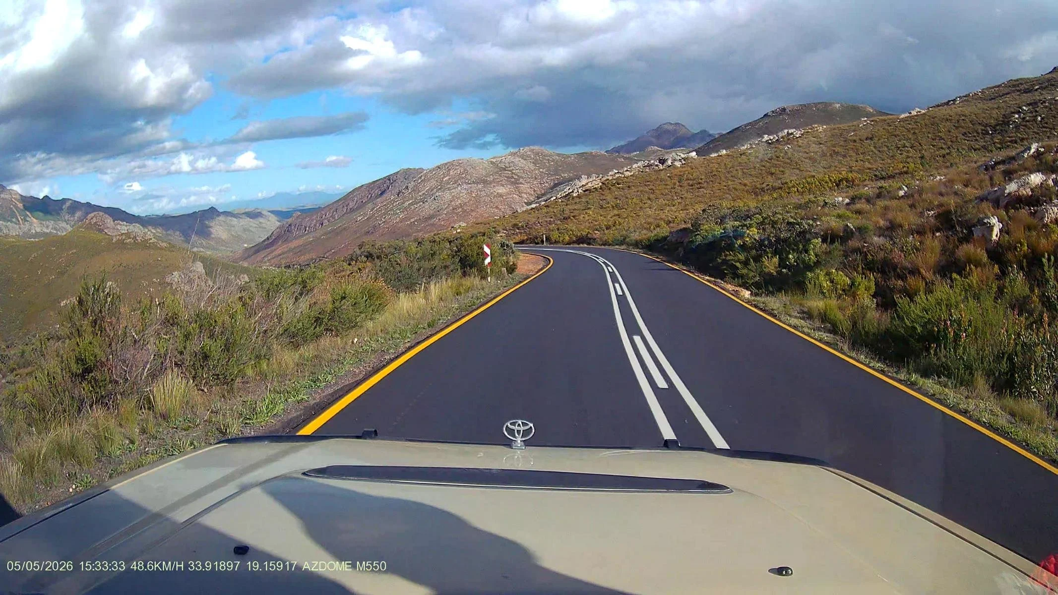
Since the road to Zederberg National Park had been announced impassable for several days, I decided to take day trips to the northern part of the Zederberg Mountains to visit the cave paintings created by the San people several thousand years ago. During the four-hour hike, I kept trying to imagine what skills and knowledge the San Bushmen and -women must have possessed to survive in this barren region. The mountains visible on the photos are up to 1,000 m / 3,300 ft high.
Da die Straße zum Zederberg Nationalpark für längere Zeit unpassierbar war beschloss ich Tagesausflüge im Nordteil der Zederberge zu unternehmen und die von den San vor mehreren tausend Jahren angefertigten Höhlenmalereien zu besichtigen. Bei der vierstündigen Wanderung versuchte ich mir immer wieder vorzustellen, welche Fertigkeiten und Kenntnisse die San-Buschmänner/-frauen gehabt haben mussten, um in dieser kargen Region zu überleben. Die Berge auf den Fotos sind bis 1.000 m hoch.