Island 2021- Teil 3 (Süden)
Iceland 2021 – Part 3 (South)
Im Sommer 2021 fuhren Ursula und ich sieben Wochen und insgesamt etwa 5.000 km durch Island. Der nachstehende Blog ist der dritte Teil unseres Berichts und handelt von unserer Reise durch den Süden des Landes.
In summer 2021 Ursula and I spent seven weeks in Iceland and drove some 5.000 km / 3,000 miles across the island. The following photo blog covers the third part of our journey dealing with southern Iceland.

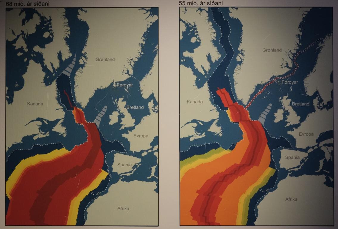
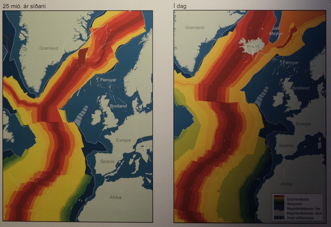
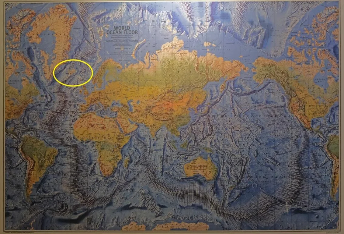
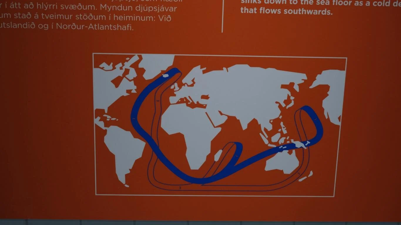
Die geologische Entstehungsgeschichte Islands ist eng mit der Plattentektonik verbunden. Die Nordamerikanische Platte und die Eurasische Platte triften pro Jahr mit einer Geschwindigkeit von etwa 2,5 cm auseinander - siehe die ersten vier Bilder, die die Entwicklung während des Zeitraums der letzten 68 Millionen Jahre darstellen. In den freiwerdenden Raum (Ozeanbodenspreizung) dringt aus dem Erdinneren Magma ein, das den sogenannte Mittelatlantischen Rücken bildet (deutlich zu sehen in der Weltmeeres-Karte). Während der Kamm dieses 20.000 km langen Unterwasser-Gebirgszugs meist 1500 bis 3.000 m unter dem Meeresspiegel liegt ragen die Bergspitzen an einigen Stellen (z.B. die Azoren und Island) aus dem Atlantik. Island, das vor ca. 20 Millionen Jahren aus dem Atlantik stieg ist vulkanischen Ursprungs und war nie mit Europa oder Nordamerika verbunden. Die Bruchlinie geht übrigens auch heute quer durch Island, sodass der nord-westlich Teil geologisch zur Nordamerikanischen Platte gehört und der Süd-Osten Islands zur Eurasischen Platte.
Iceland‘s geological history is closely connected with plate tectonics. The North-American Plate and the Eurasian Plate are drifting apart with a speed of approx. 2.5 cm per year – compare the first four photos, which show the development during the past 65 million years. The growing gap (seafloor spreading) is filled with magma coming from within the earth. This magma forms the mid-Atlantic ridge (clearly visible on the world ocean map). While most peaks of the 20.000 km long underwater mountain ridge lays 1,500 to 3,000 m below the ocean surface some of the summits (e.g., the Azores and Iceland) raise above the sea level. Iceland which since some 20 million years reaches above the ocean surface is of volcanic origin and never has been connected neither with Europe nor with North America. Even today the fault-line between the two continental plates runs right across Iceland. Thus, geologically the north-western part of Iceland belongs to the North-American plate while the south-east is to be considered as being part of the Eurasian plate.
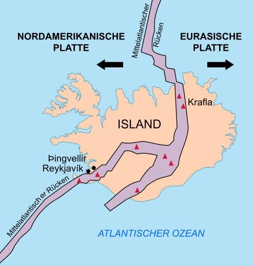
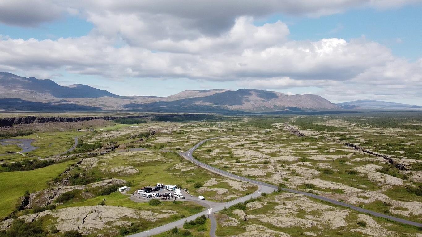
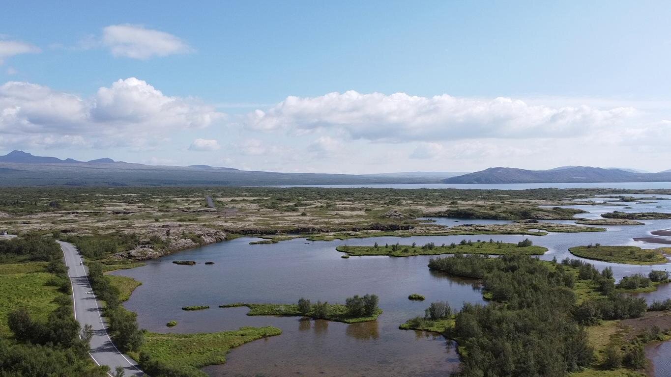
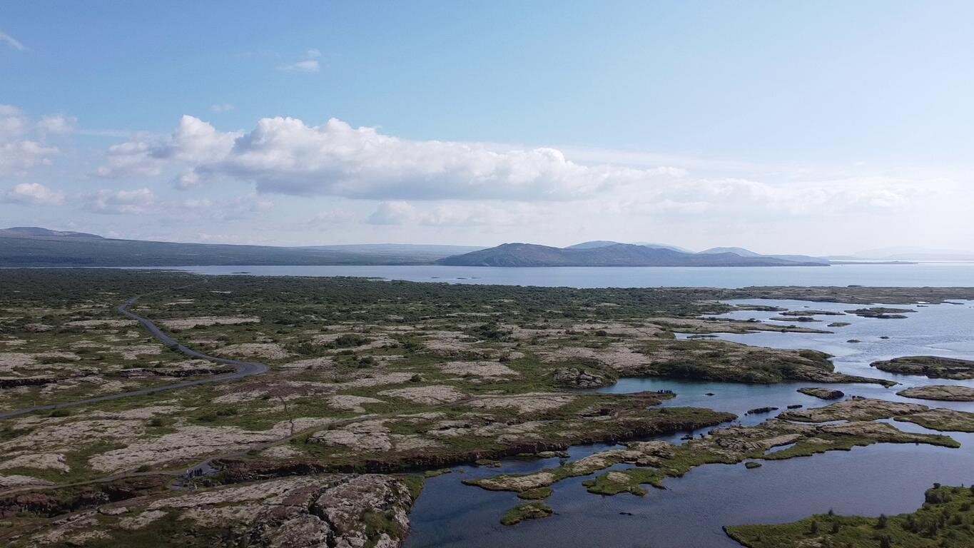
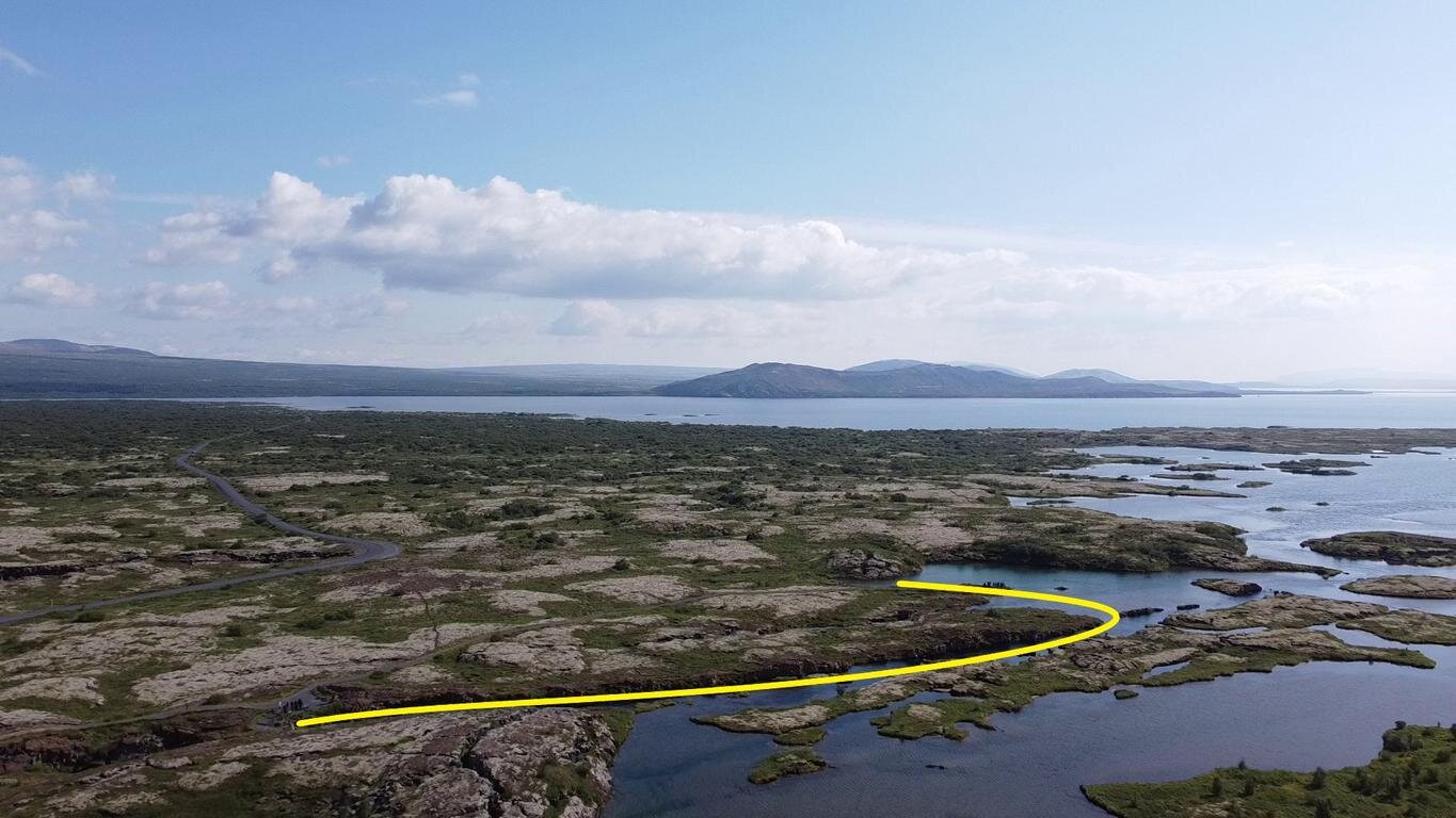
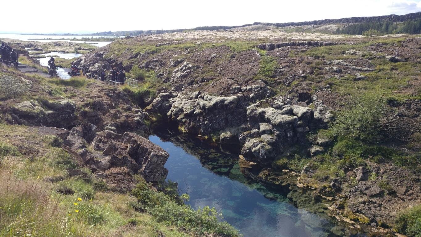
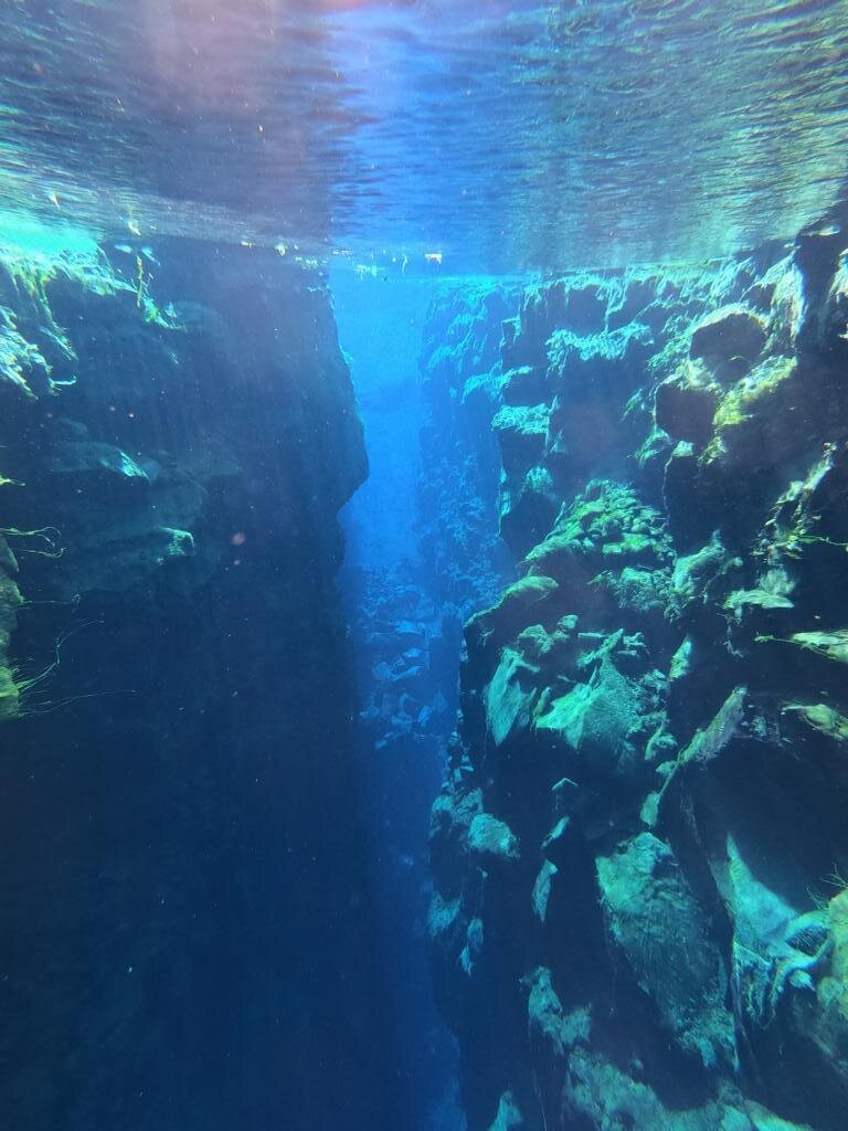
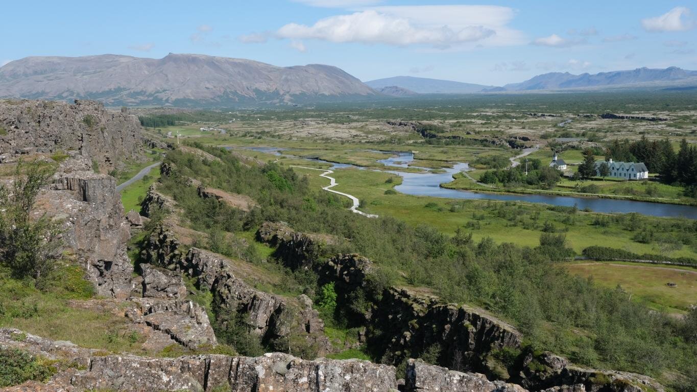
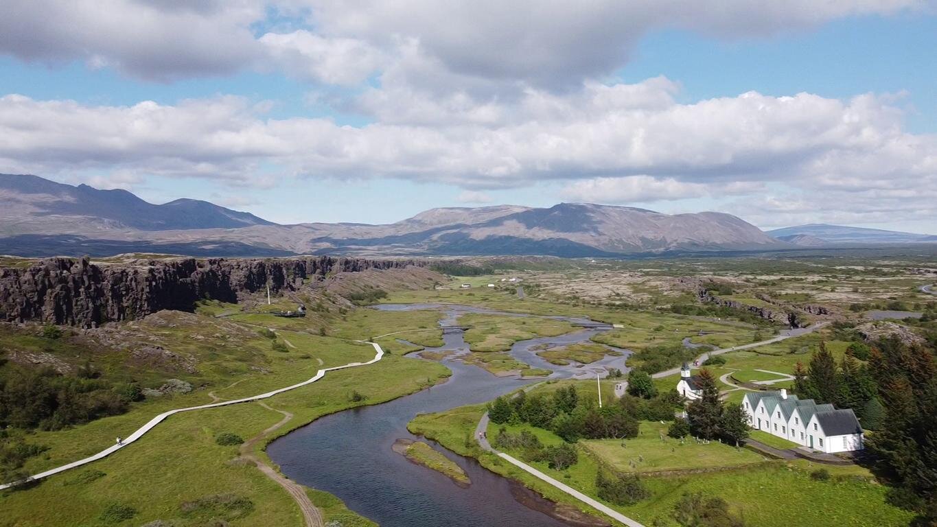
Deutlich sieht man das Auseinanderdriften der beiden Teile Islands im Þingvellir (Thingvellir) Nationalpark, 40 km östlich der isländischen Hauptstadt Reykjavík. Während der letzten 10.000 Jahren ist der Grabenbruch um 70 Meter auseinandergedriftet und der Talboden hat sich um ca. 40 Meter gesenkt. Deutlich sieht man am zweiten Foto die parallelverlaufenden Bruchlinien.
This drifting apart of the two portions of Iceland is clearly visible in the Þingvellir (Thingvellir) national park, 40 km / 25 miles east of the capital Reykjavík. During the past 10,000 years the rift valley has widened by 70 m / 200 ft and the valley floor has lowered by 40 m / 120 ft. The parallel running fault lines can be clearly notices in the second picture.

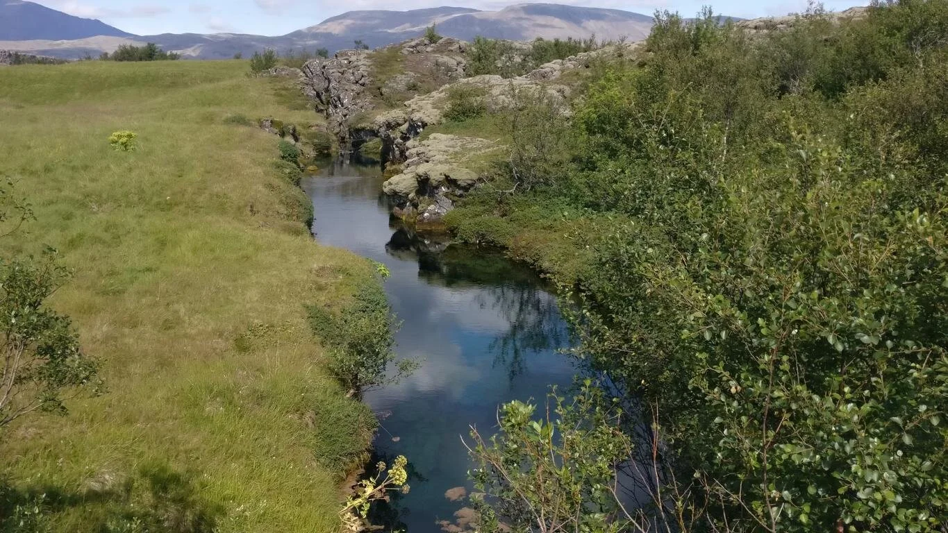
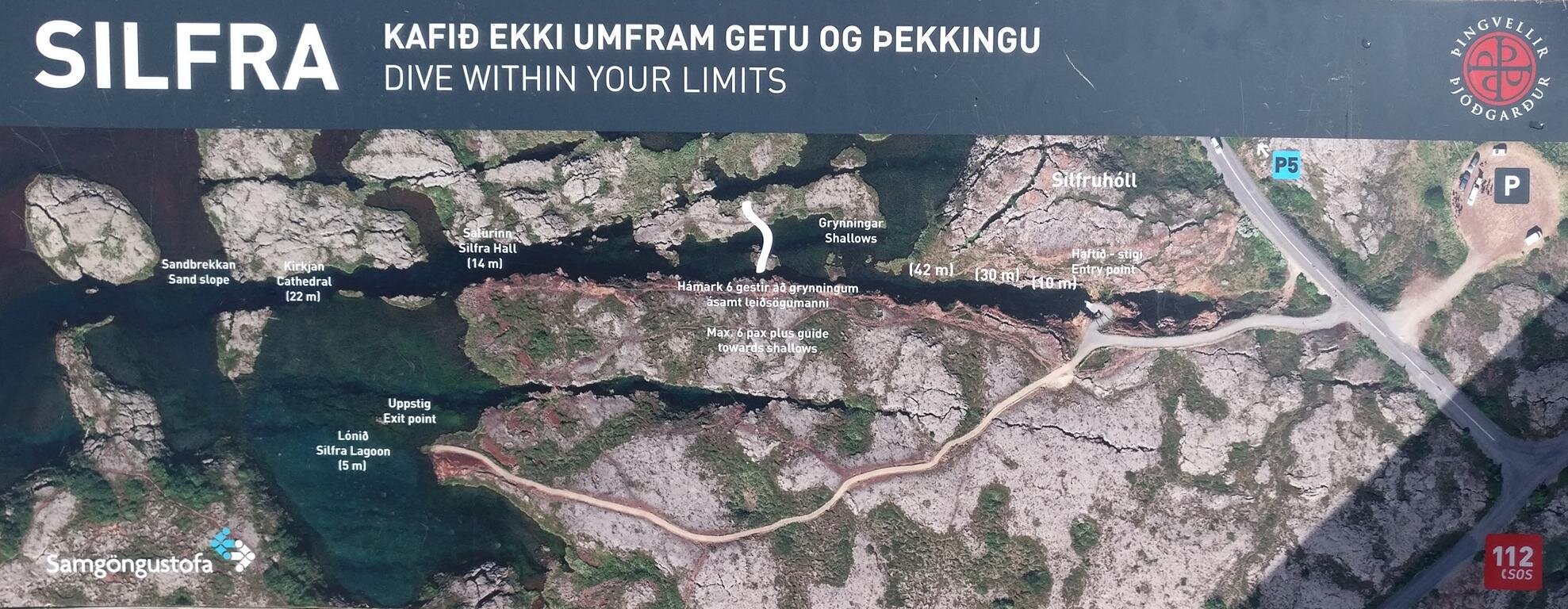
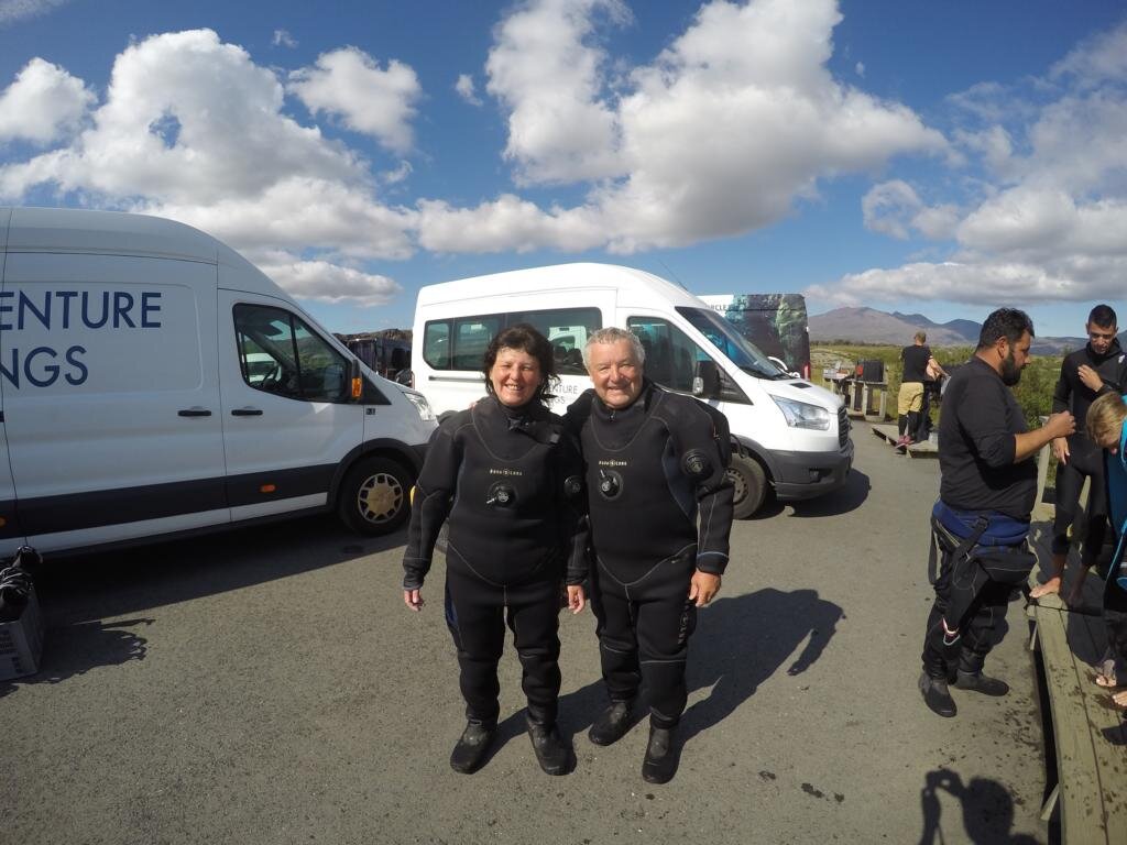
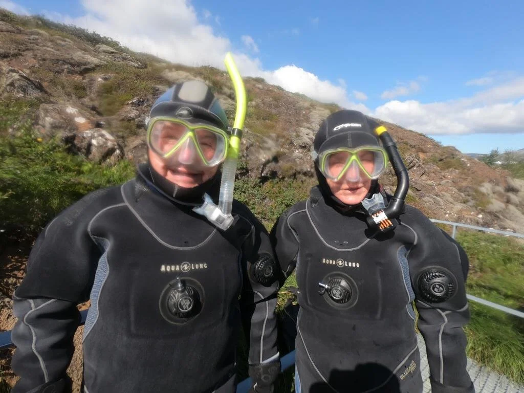
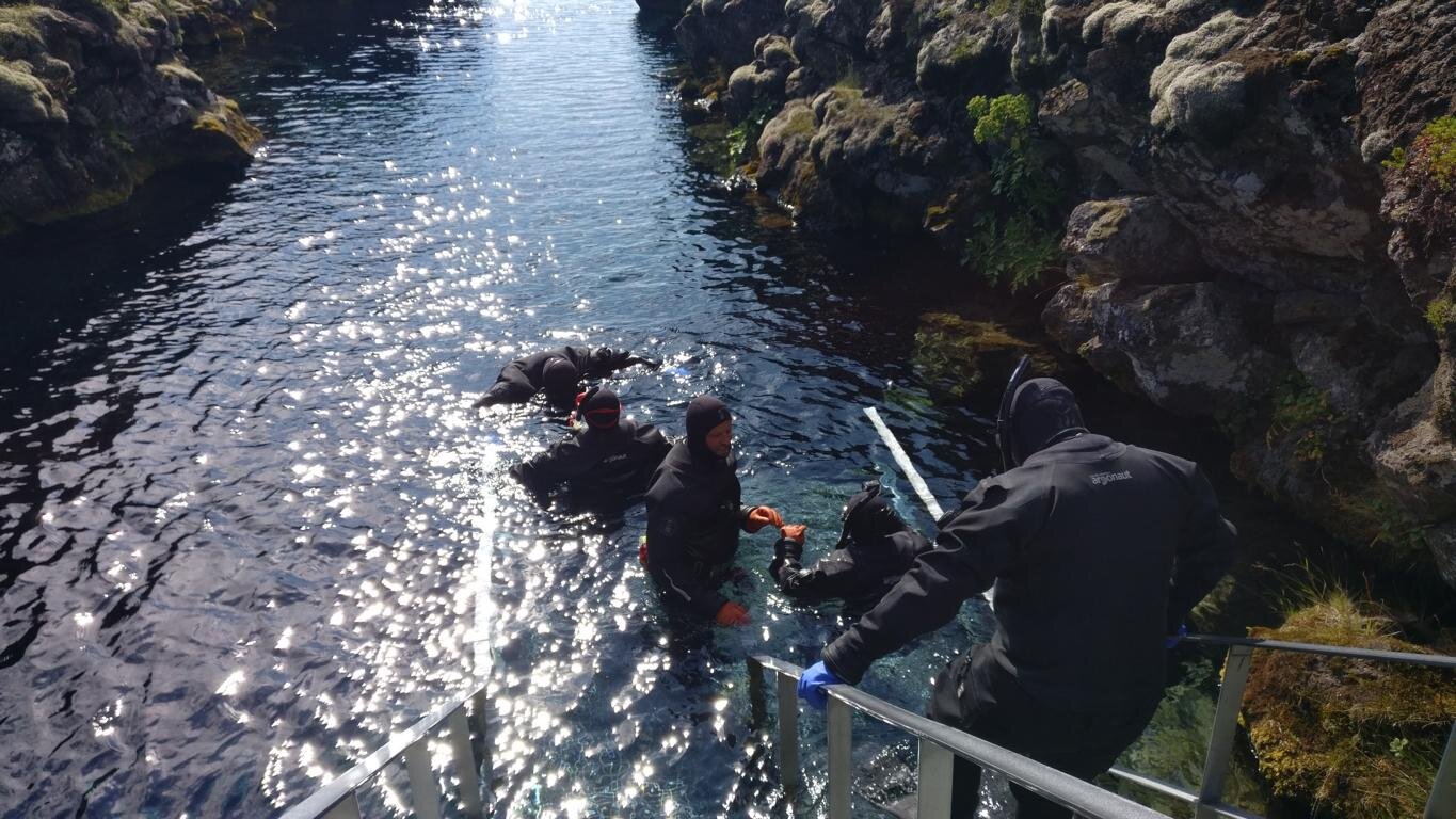
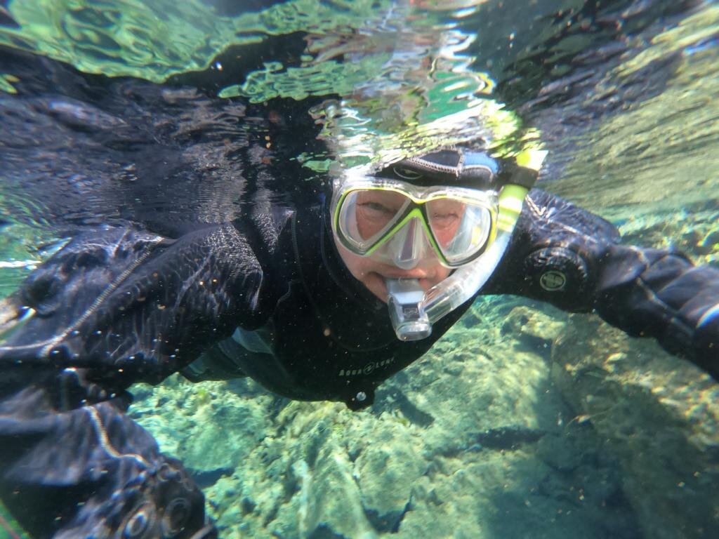
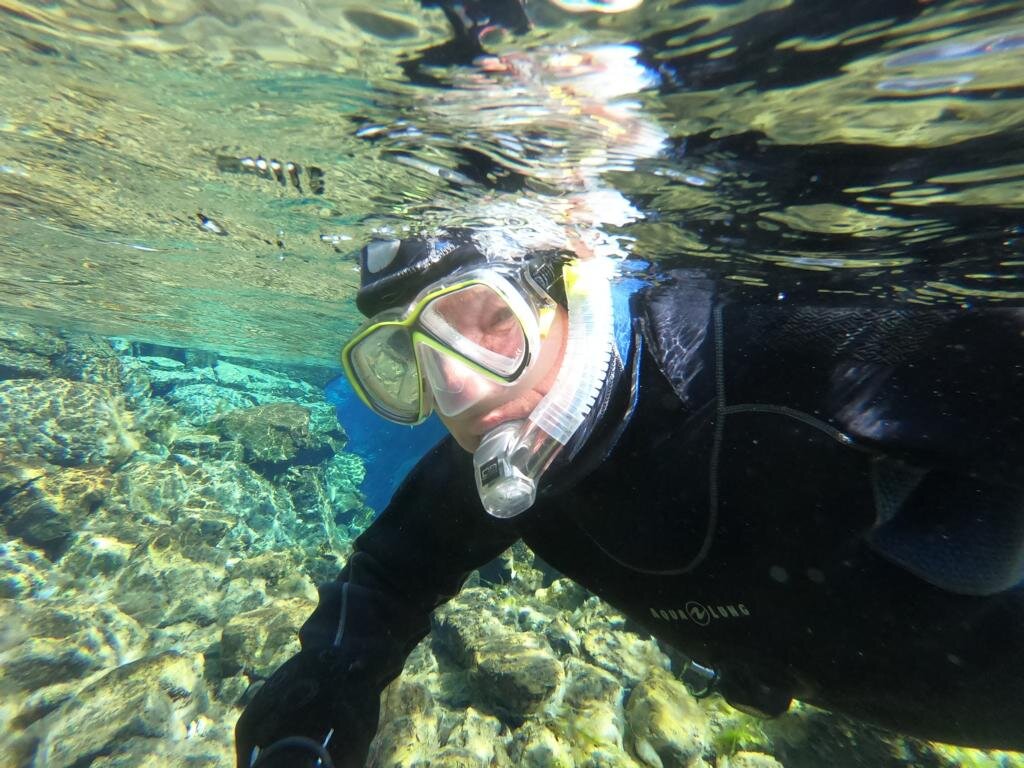
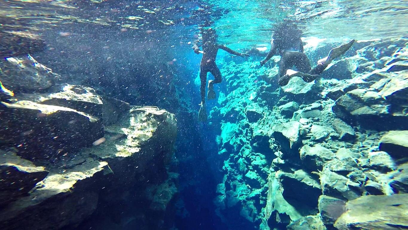
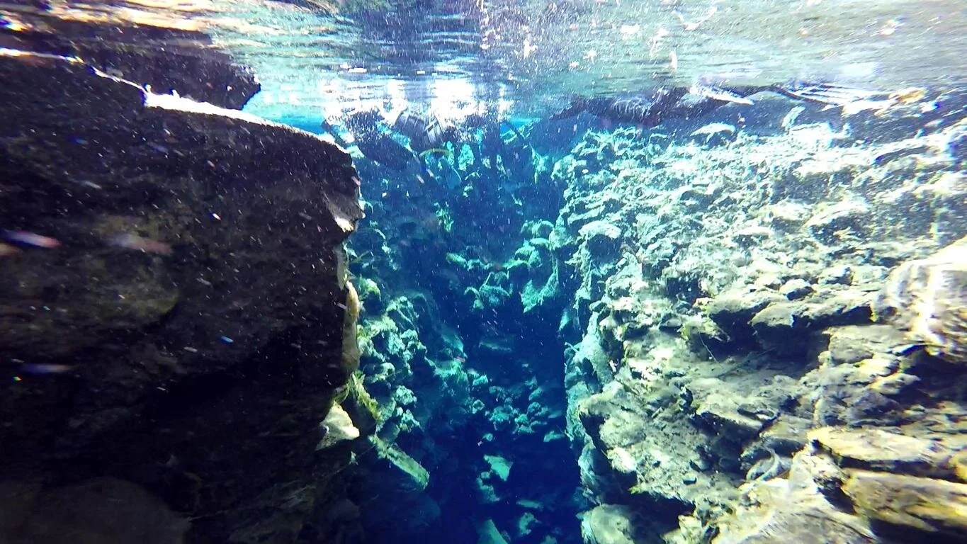
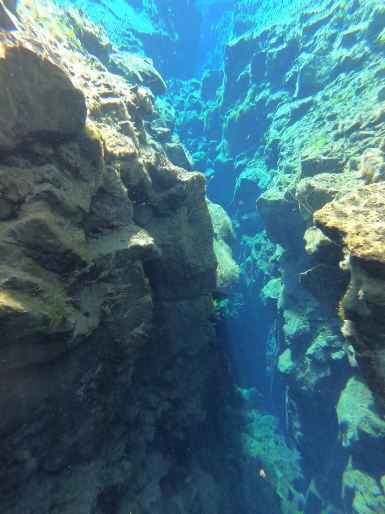
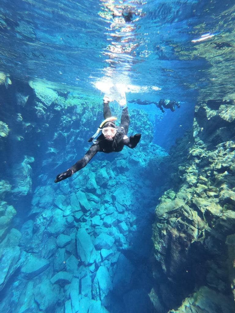
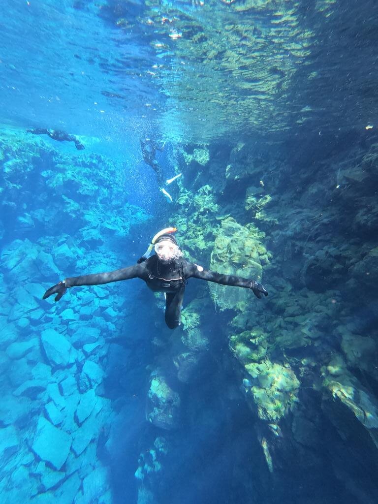
Findige Touristiker haben daraus ein Geschäft gemacht und man kann entlang einer dieser Erdspalten tauchen bzw. schnorcheln. Die Silfra-Spalte existiert seit 1789 und dehnt sich pro Jahr um 7 mm aus. Sie ist mit glasklarem Wasser gefüllt und man kann sozusagen mit dem einen Arm die Eurasische Platte und mit dem anderen die Nordamerikanische Platte berühren. Wegen der Wassertemperatur von 2-4 Grad (Schmelzwasser, das durch das Lavagestein gefiltert wird) entschieden wir uns einen Trockenanzug zu benutzen (man ist ca 40 min im Wasser).
Tourism industry has quickly realized the business opportunity to snorkel or dive along this fissure. The Silfra rift exists since 1989 and widens by 7 mm each year. It is filled with crystal clear water and one literally can reach with one arm to the Eurasian plate and with the other one to the North-American plate. Because of the low water temperature (2-4 degree C, the glacial melting water is filtered through the lava) we decided to wear dry suites as the swim lasts 40 min.

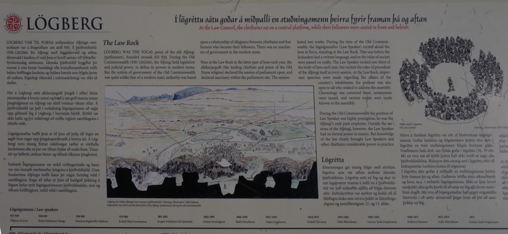
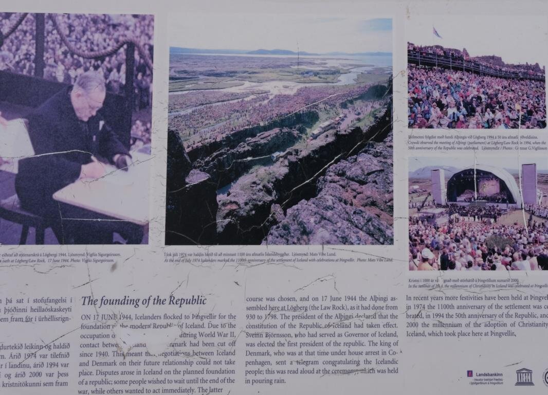
Das Gebiet des Þingvellir (Thingvellir) Nationalparks ist von großer historischer Bedeutung für die Geschichte Islands. An diesem Ort versammelten sich ab dem Jahre 930 jeden Juni die führenden Adeligen Islands zum sogenannten Althing, dem gesetzgeberische und gerichtliche Funktionen zukamen und das eines der ältesten Parlamente der Welt darstellt. Es war daher nicht Zufall, dass dieser Ort im Jahre 1944 ausgewählt wurde, um die Unabhängigkeit Islands von Dänemark zu deklarieren.
The area of the Þingvellir (Thingvellir) national park is of great historic importance for Iceland. It was the location where since 930 the leading nobility gathered every June for the so-called Althing, an assembly with legislative and judicial power. It is among the oldest parliaments in the world. It was not a coincidence that this very location was selected in 1944 to declare Iceland’s independence from Denmark.
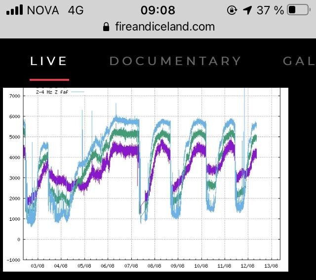
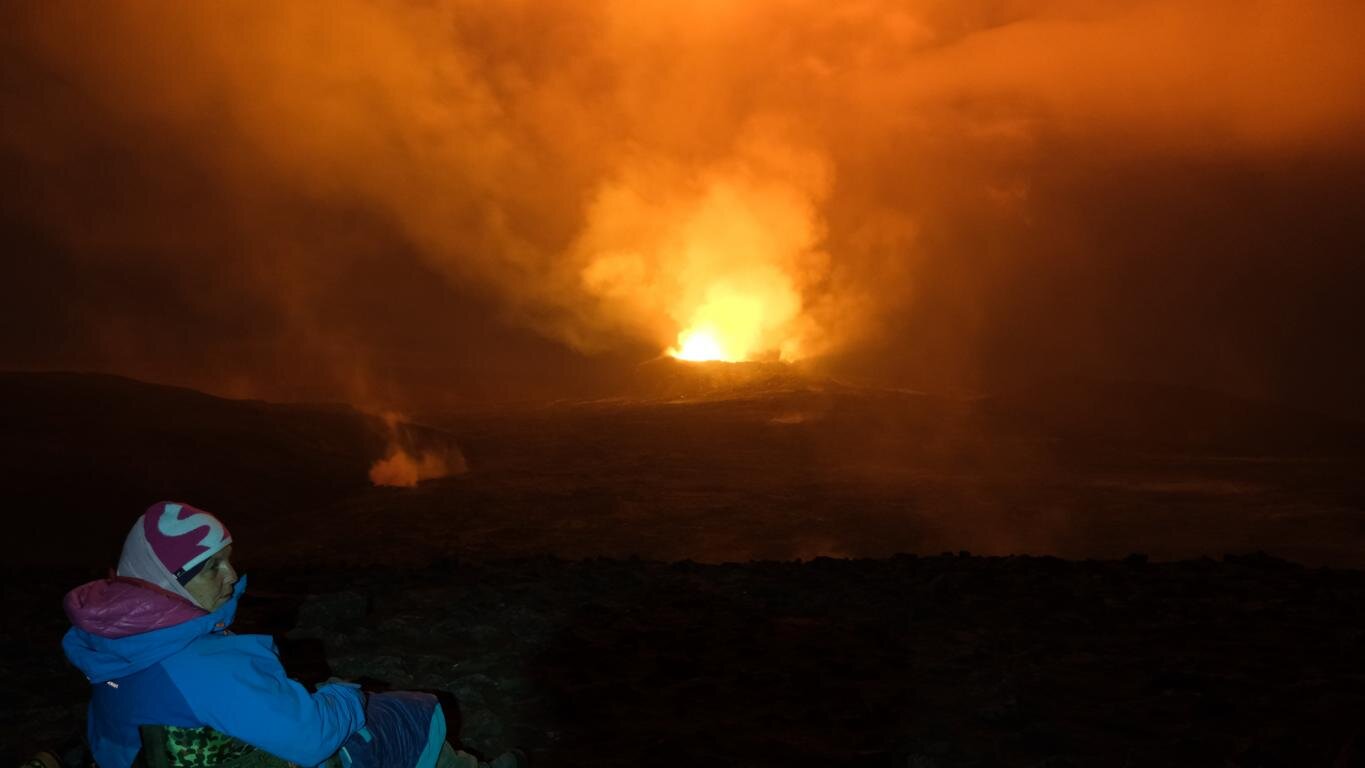
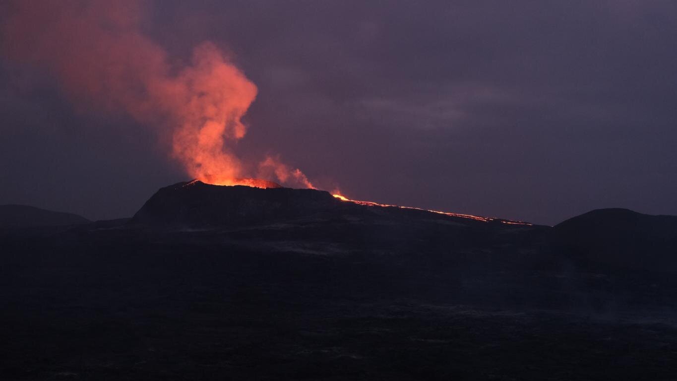
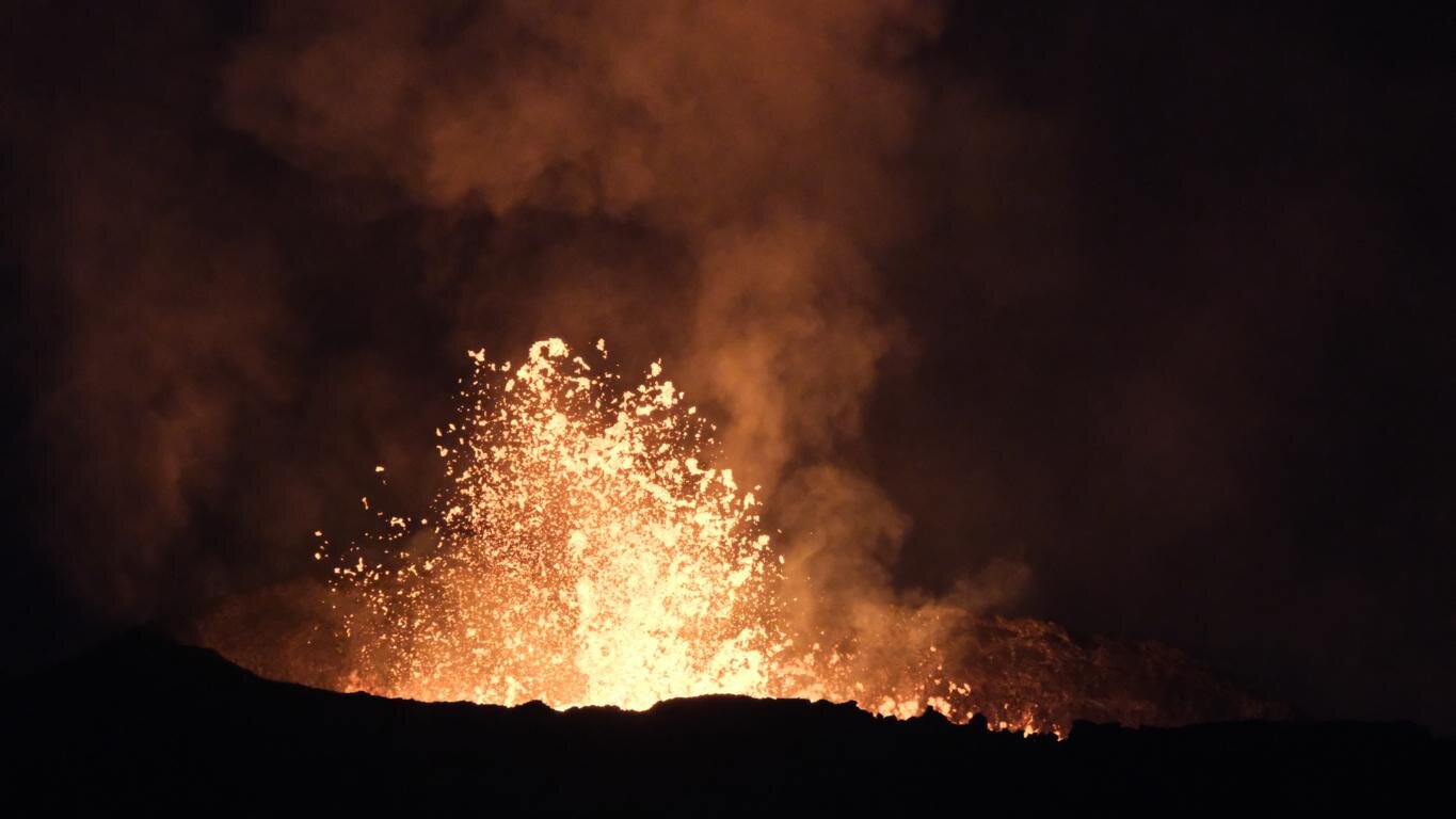
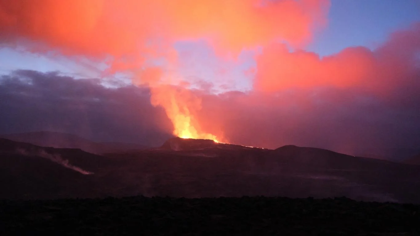
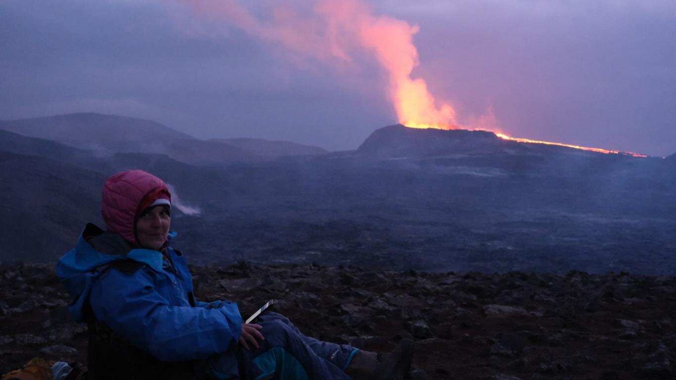
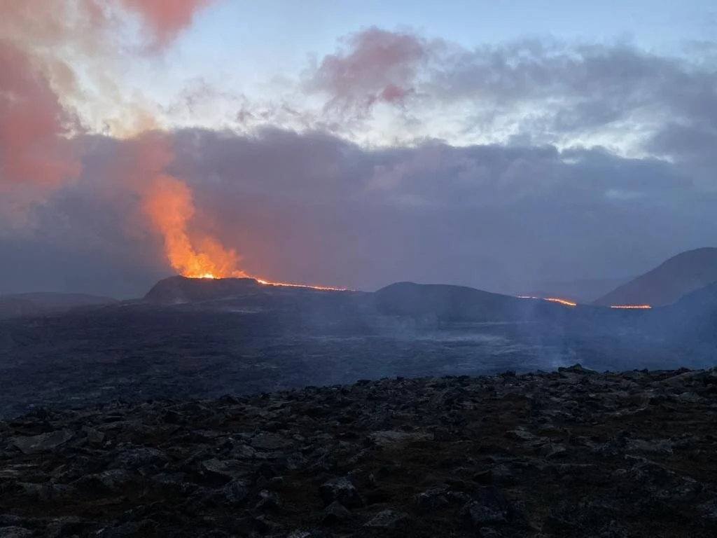
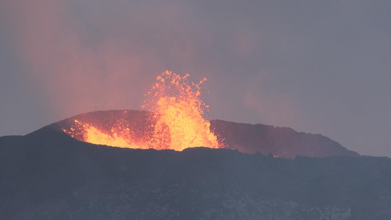
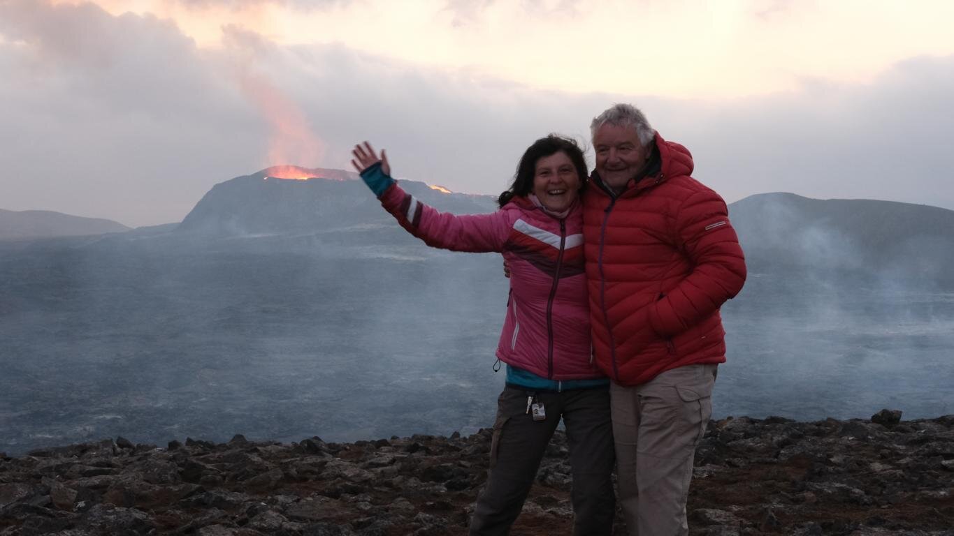
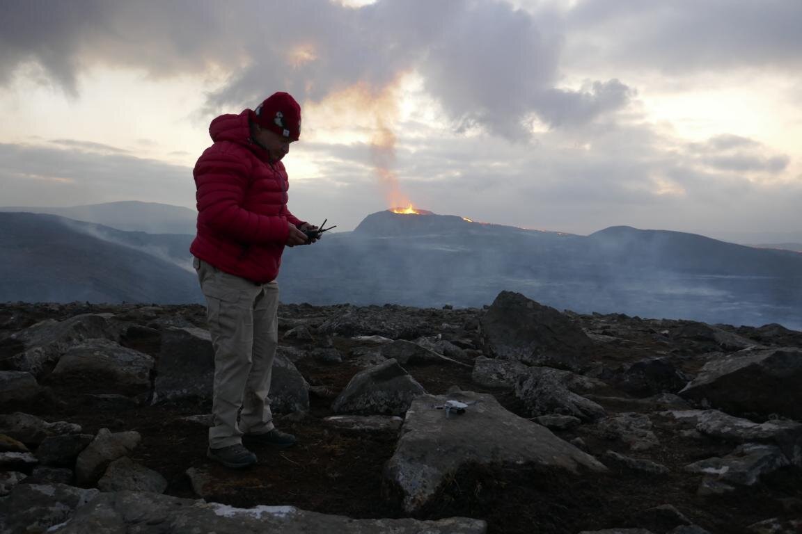
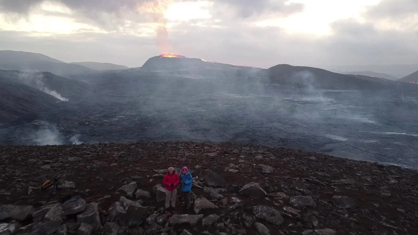
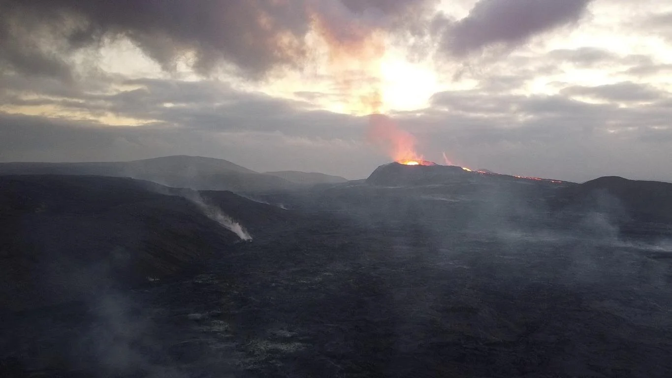
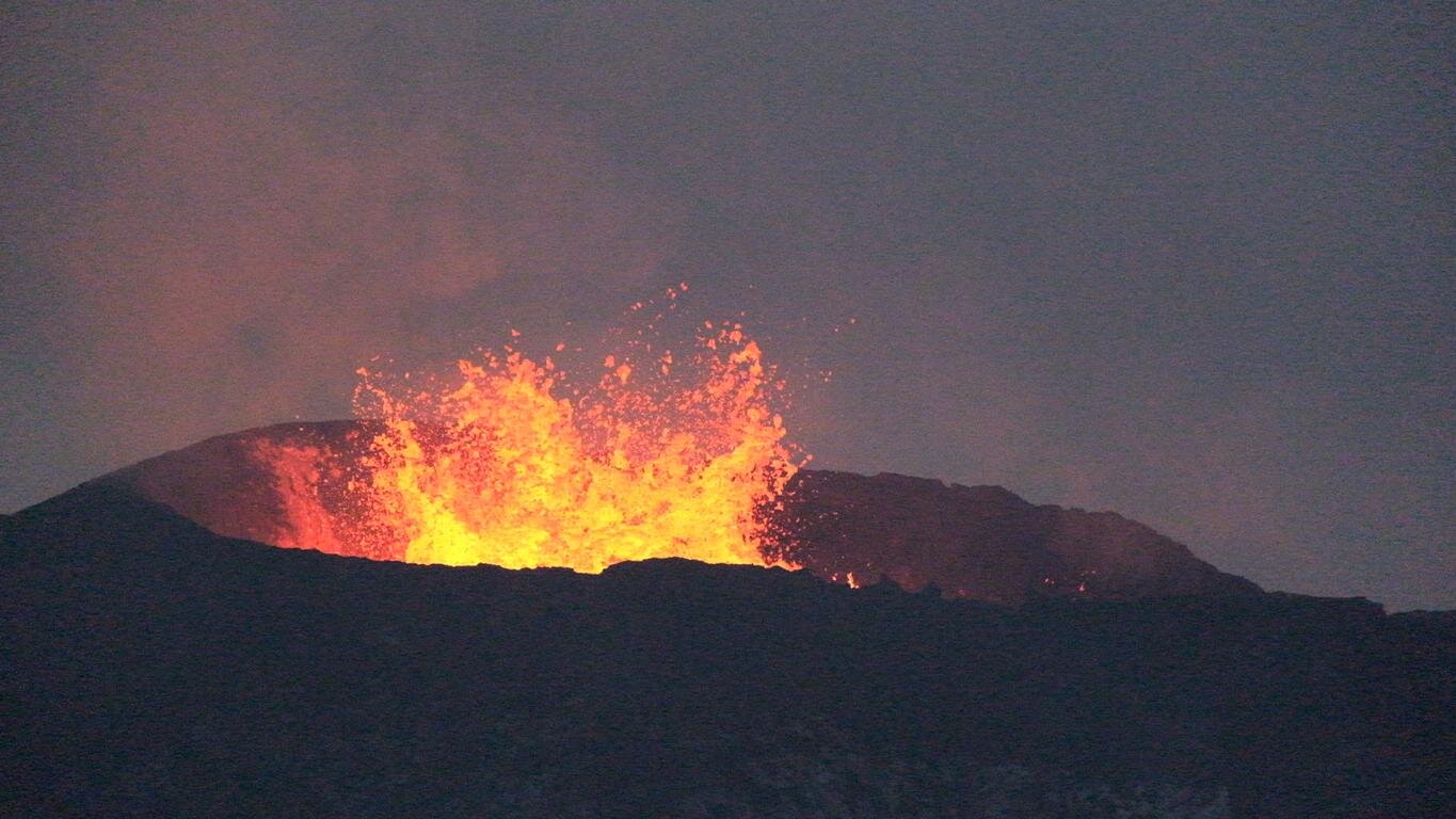
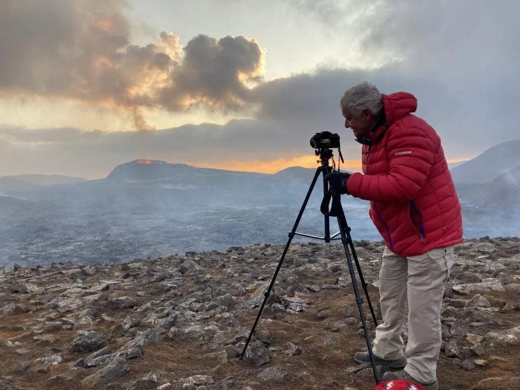
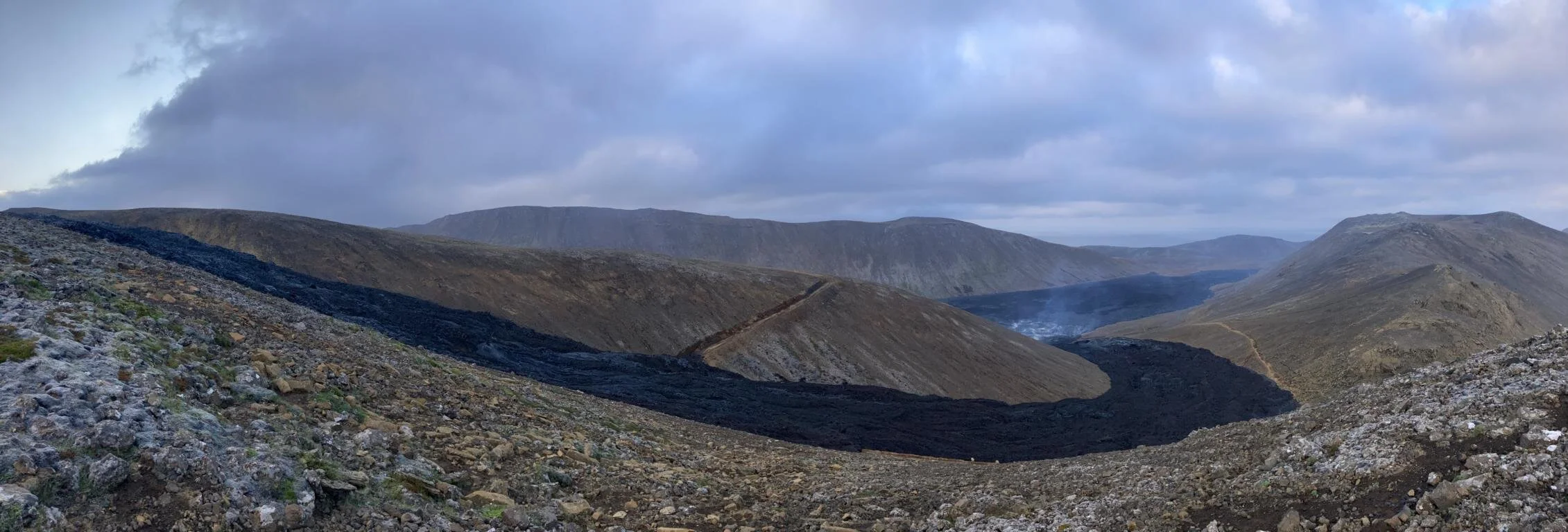
Island bricht deswegen nicht auseinander, weil von unten ständig neues Magma nachgeführt wird. Insgesamt existieren in Island 31 aktive Vulkansysteme. Am 19. März 2021 ist der Geldingadalur Vulkan wieder ausgebrochen und es war für uns möglich - unter Einhaltung eines gewissen Sicherheitsabstands - seine noch immer andauernden Eruptionen direkt zu beobachten. Trotz der Kälte verbrachten wir eine ganze Nacht auf einem gegenüberliegenden Berg, um dieses eindrucksvolle Schauspiel zu verfolgen - eines der intensivsten Erlebnisse auf unserer Reise. Auf der Webseite https://fireandiceland.com/ kann man die Eruptionen live mitverfolgen und den Tremor des Vulkans (drittes Bild) graphisch ablesen.
The reason why Iceland is not breaking apart lays in the fact that the landmass is constantly resupplied with lava from below. All in all, there are 31 active volcano system located in Iceland. On 19th March 2021 the der Geldingadalur volcano erupted and by keeping some distance it was possible for us to watch the still ongoing eruptions. This was one of the most intensiv experiences of our journey. Despite the low temperature we spent a whole night on an adjacent mountain in order to observe the impressive spectacle. The website https://fireandiceland.com/ provides a live view of the eruptions including a graphic display of the tremor (second photo).

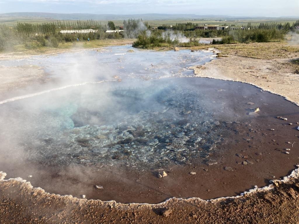
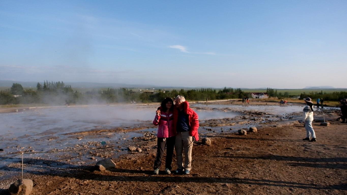
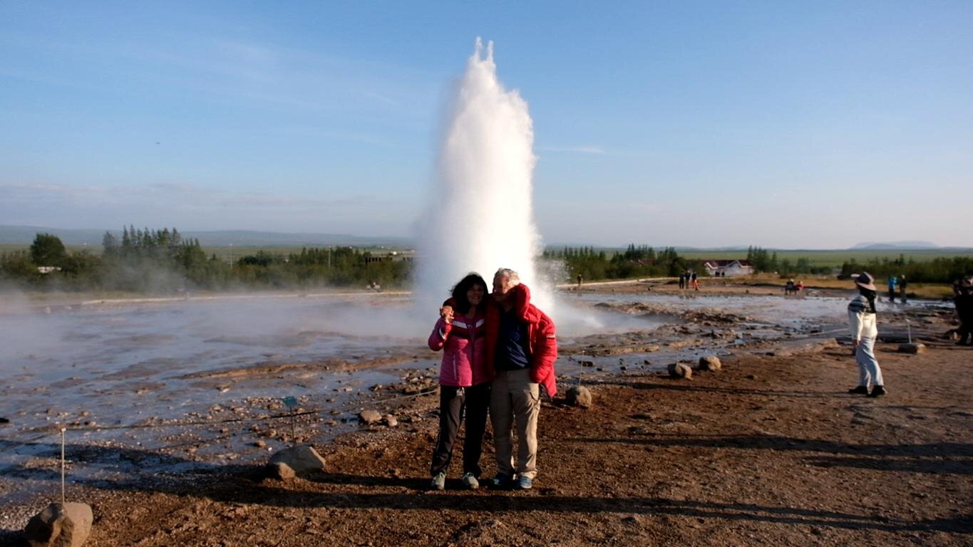
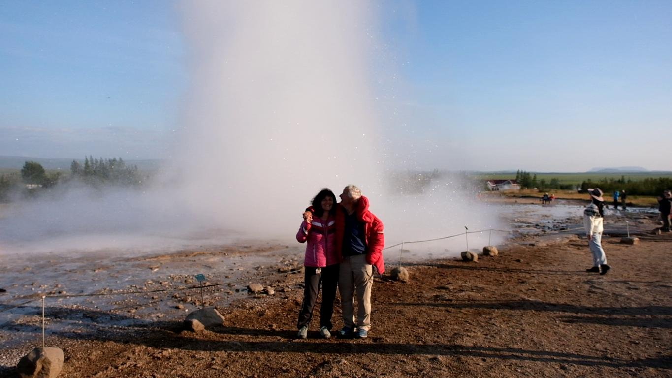
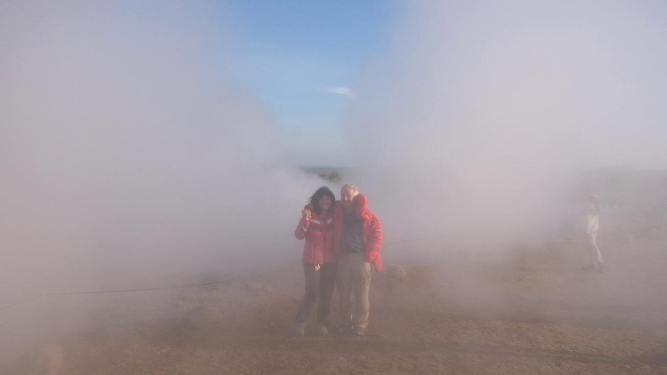
Rund 50 km östlich des Þingvellir (Thingvellir) Nationalparks befindet sich die Stadt Geysir, nach der die gleichnamigen Heißwasser-Fontänen benannt sind. Der Strokkur genannte Geysir schießt etwa alle 10 min eine ca. 25 m hohe Fontäne kochenden Wassers aus dem Erdboden. Man muss sich nur davorstellen, die Filmkamera positionieren und die Nerven bewahren 😊.
Some 50 km east of the Þingvellir (Thingvellir) national park there is a small town called Geysir, which gave name to the hot water phenomena carrying the same name. Every 10 minutes Geyser Strokkur spurts out a 25 m (75 ft) high fountain of boiling water. One just needs to stand in front, position the film camera and keep one’s nerve.
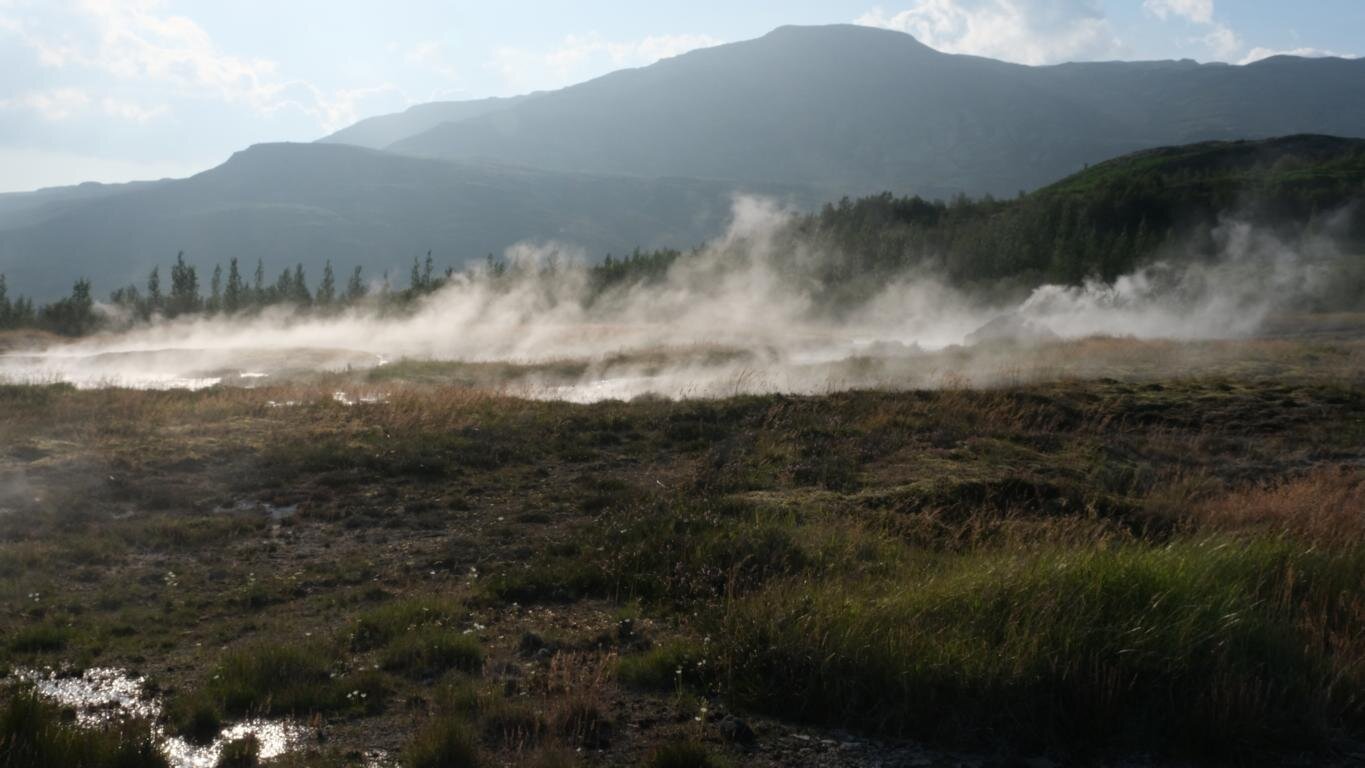
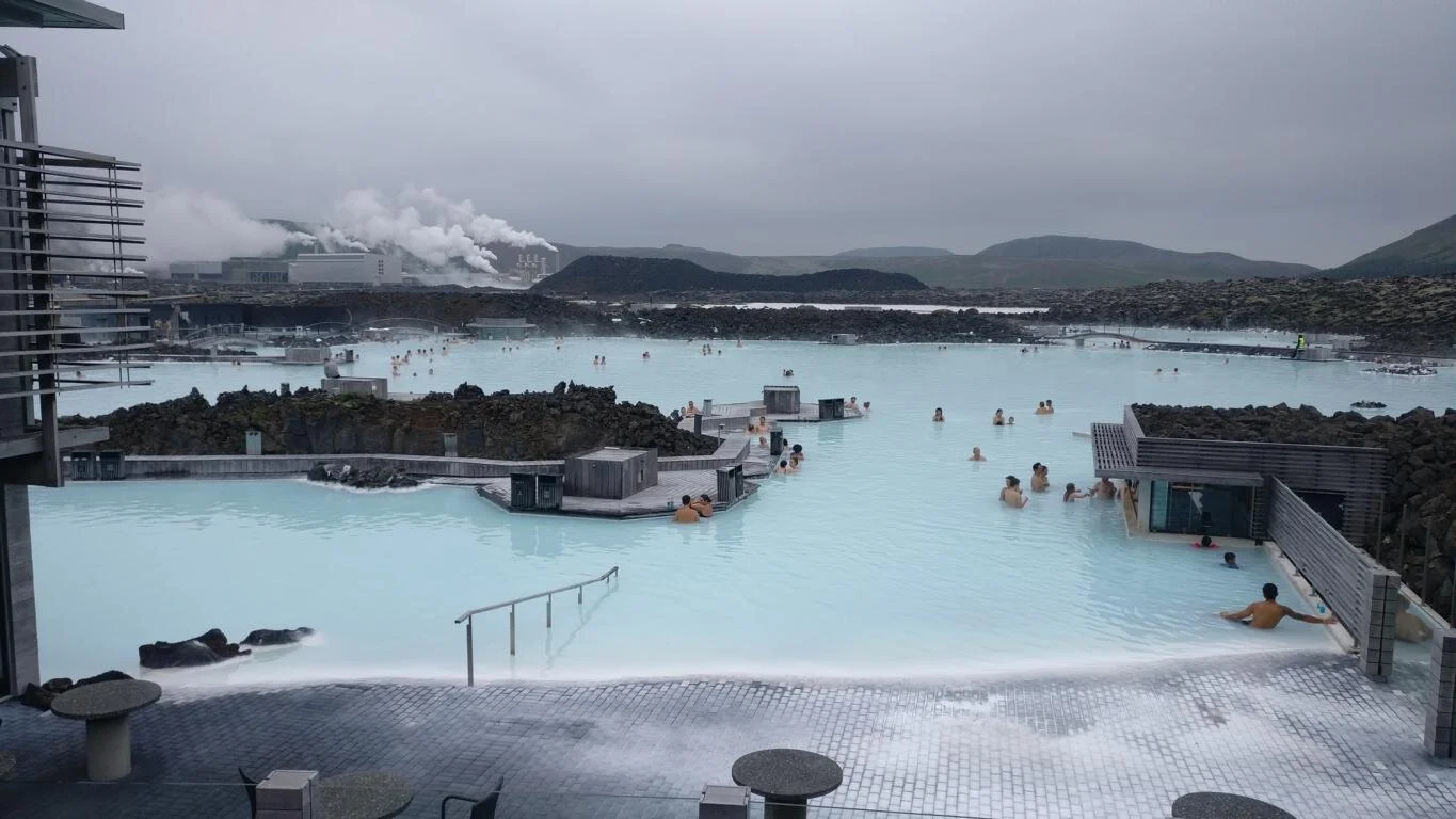
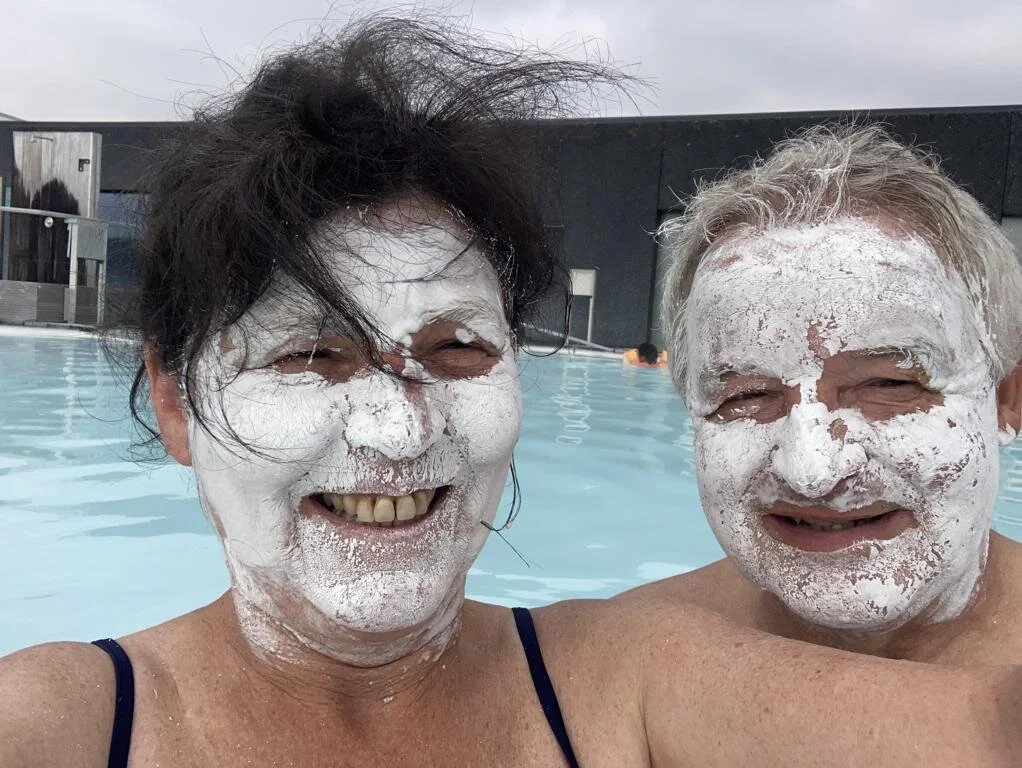
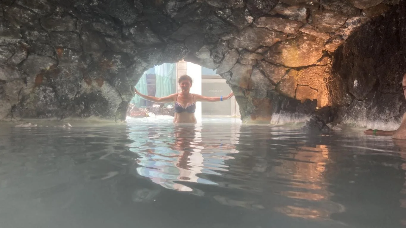
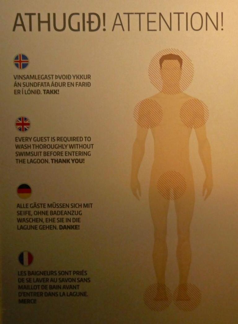
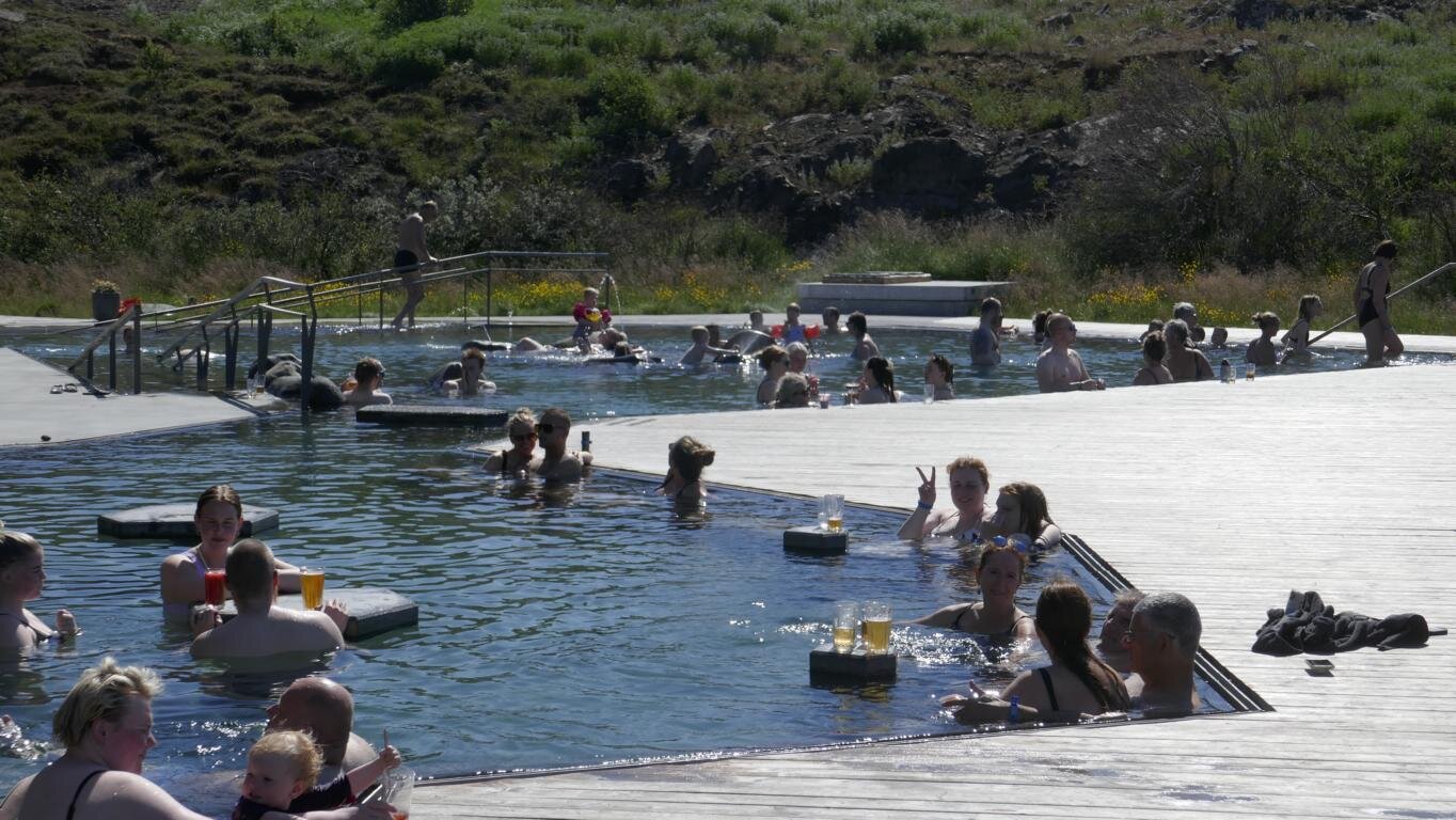
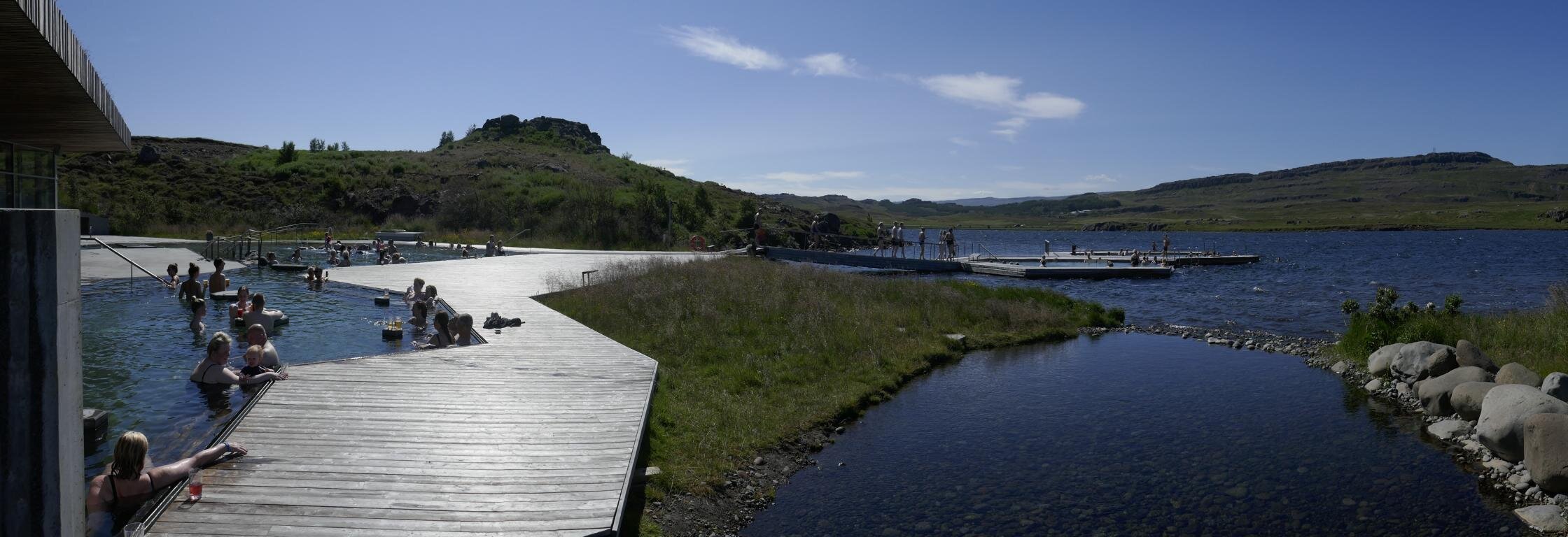
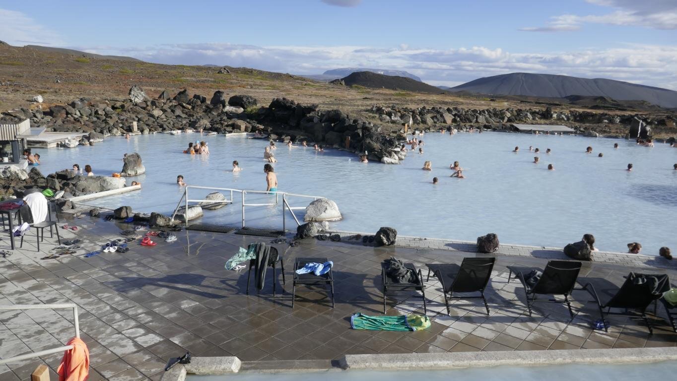
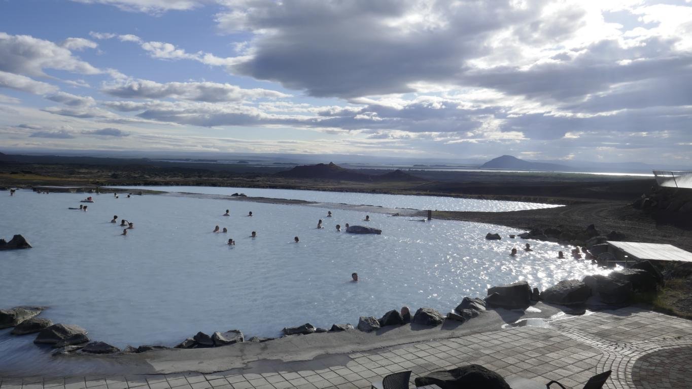
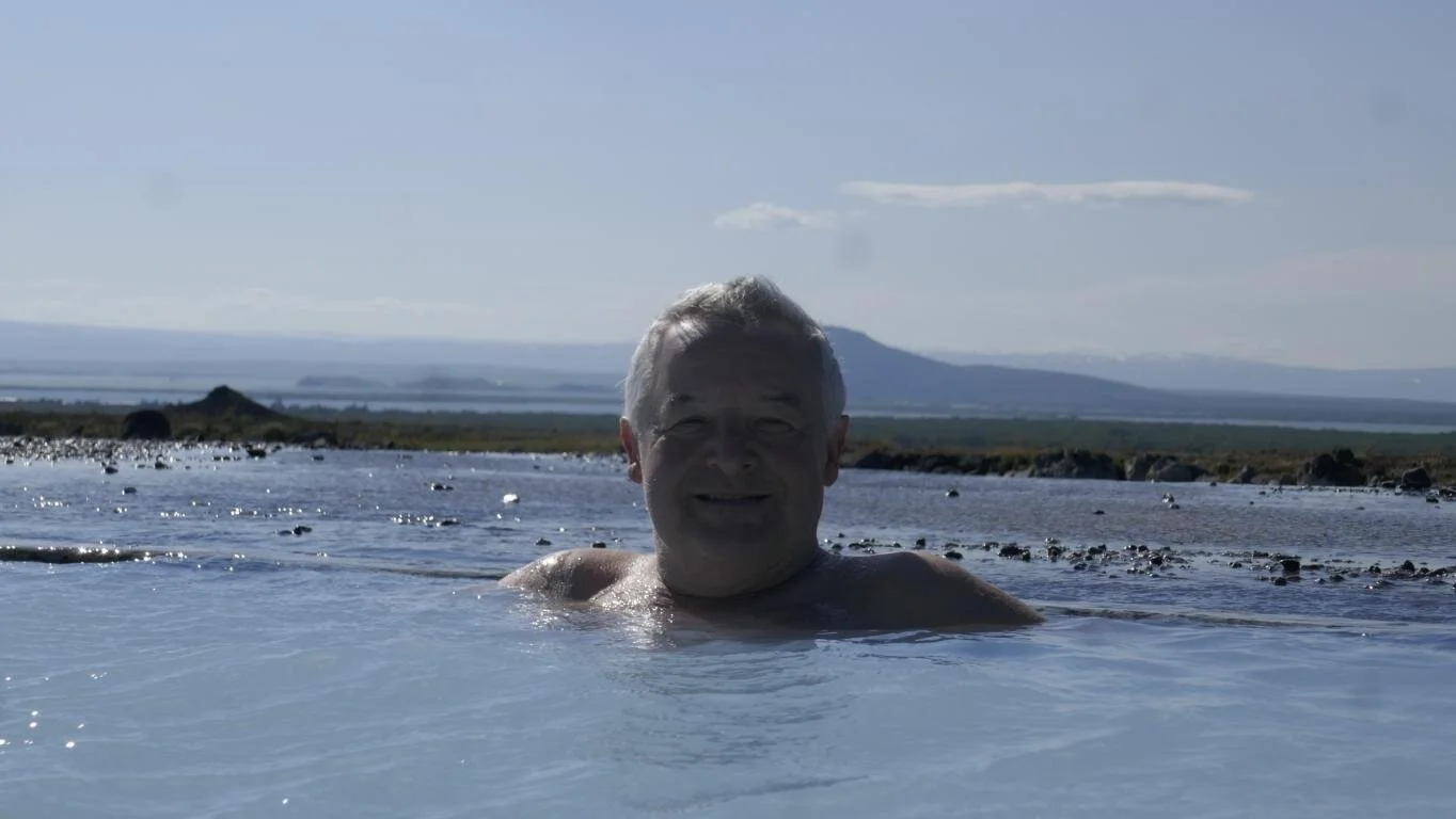
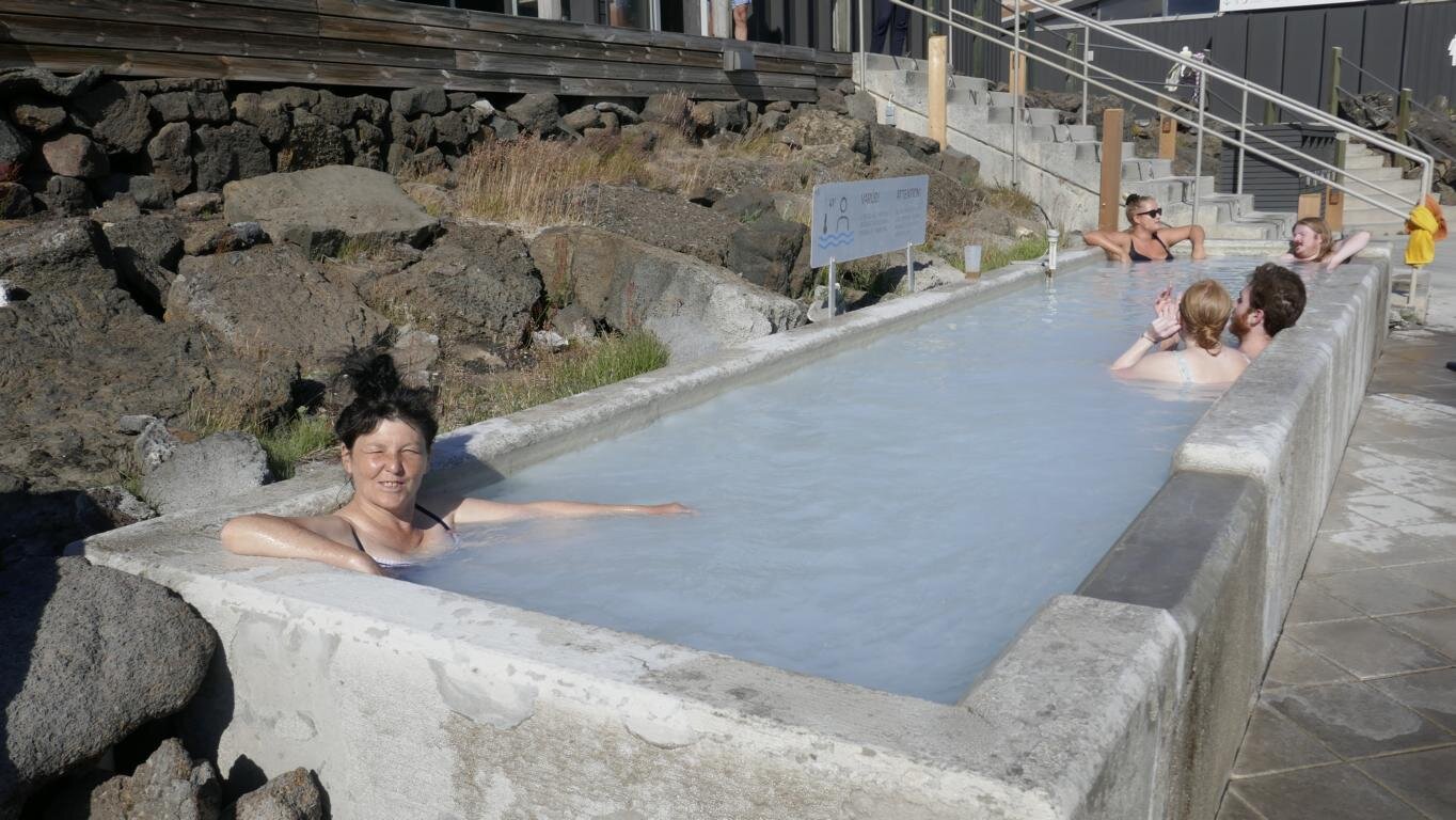
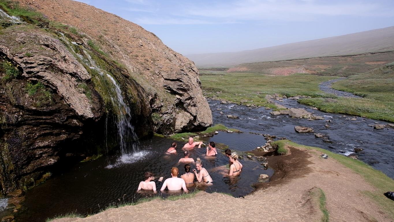
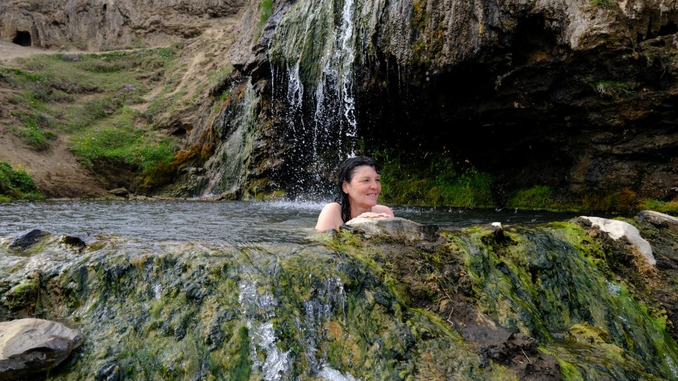
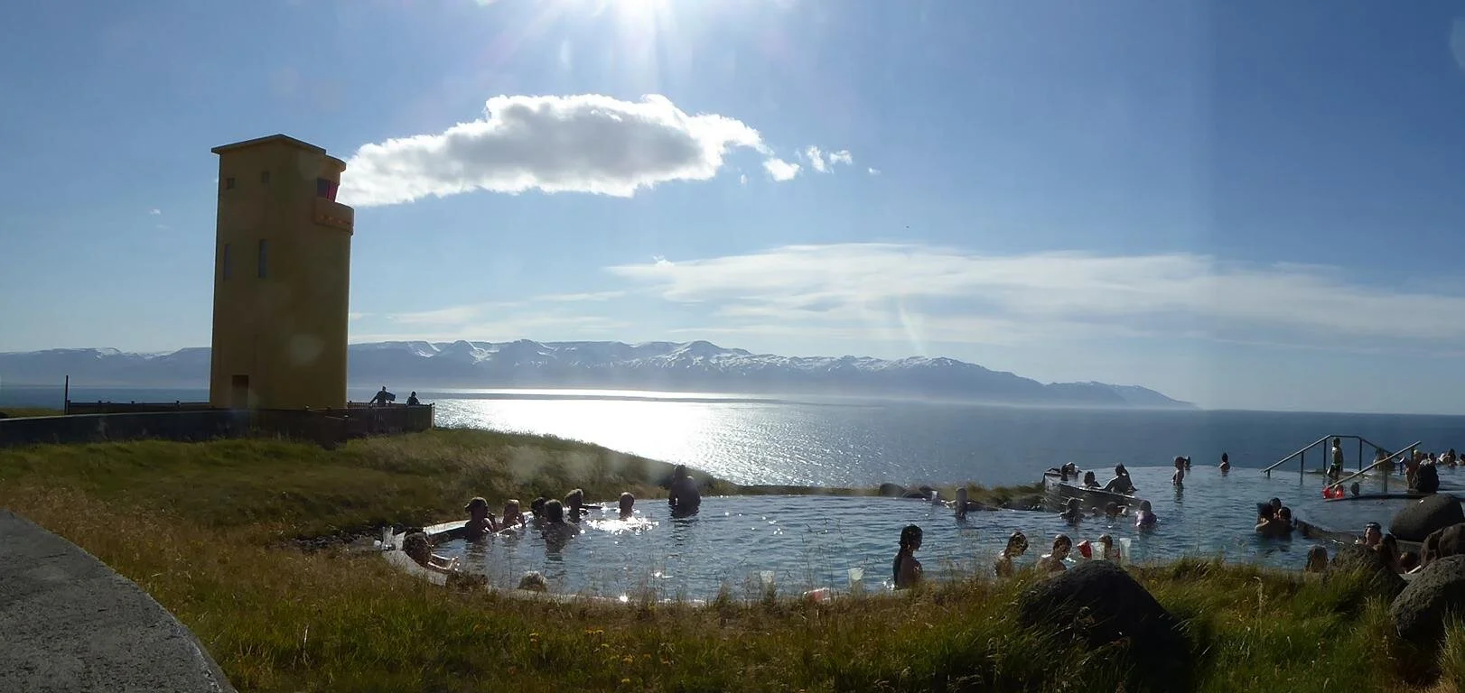
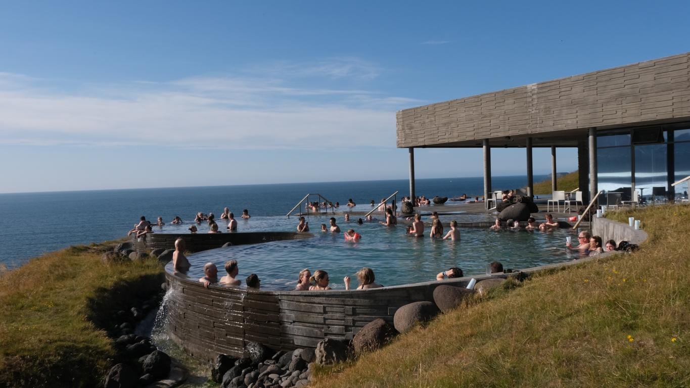
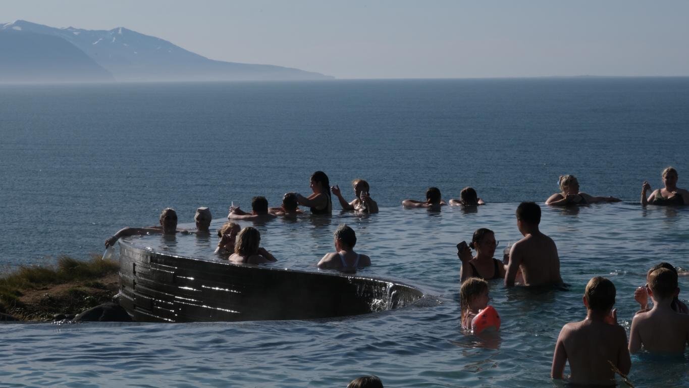
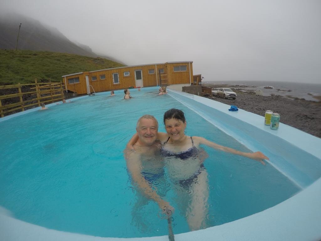
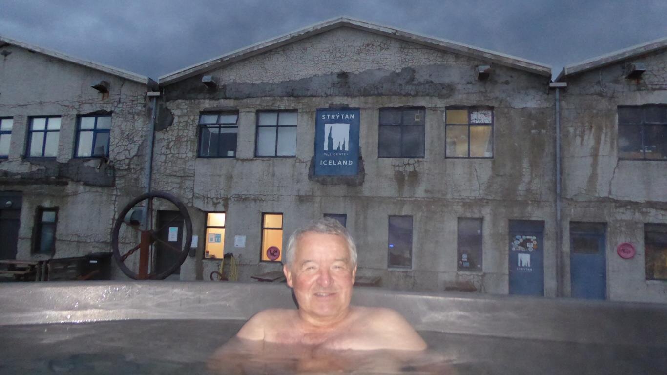
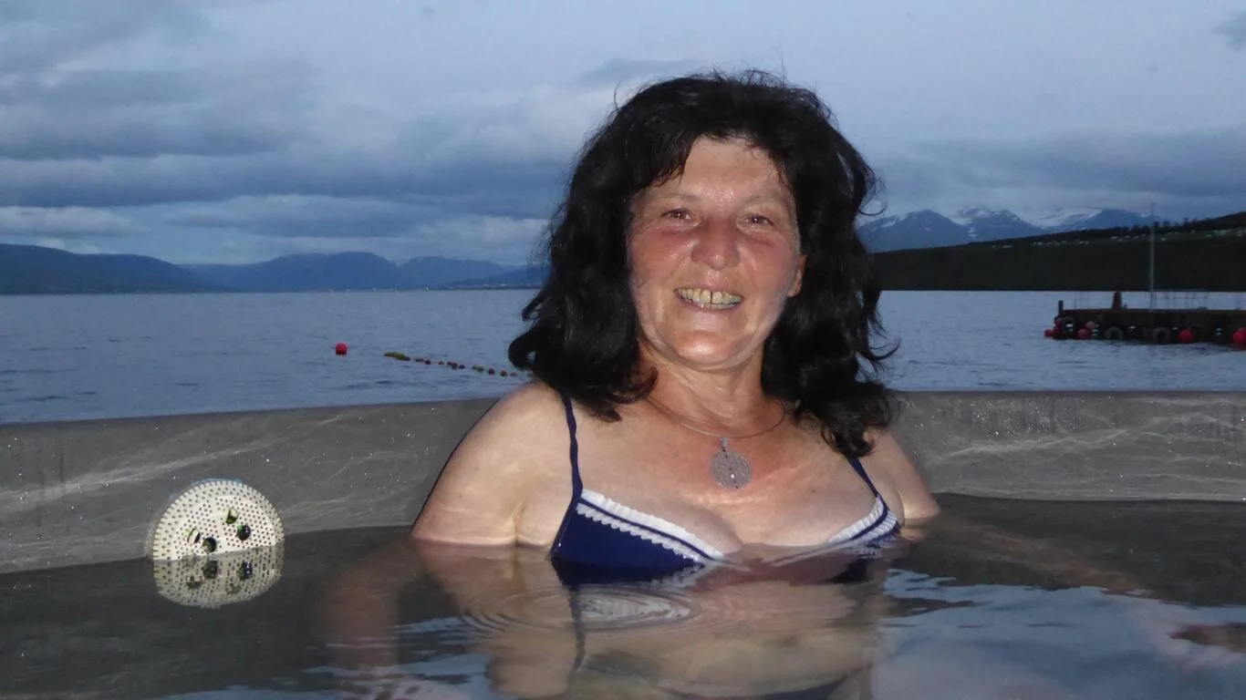
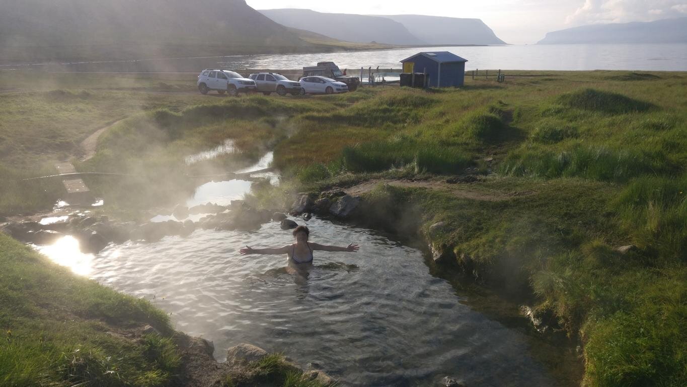
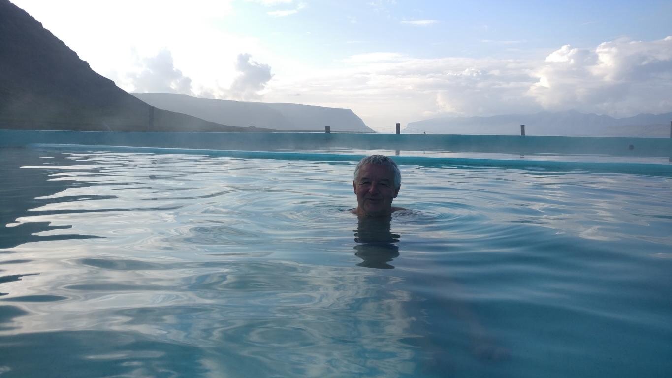
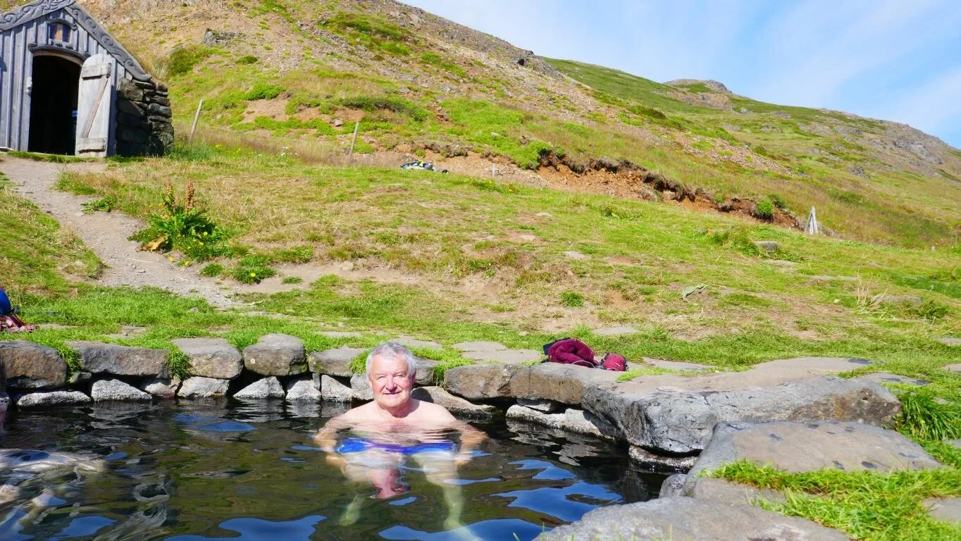
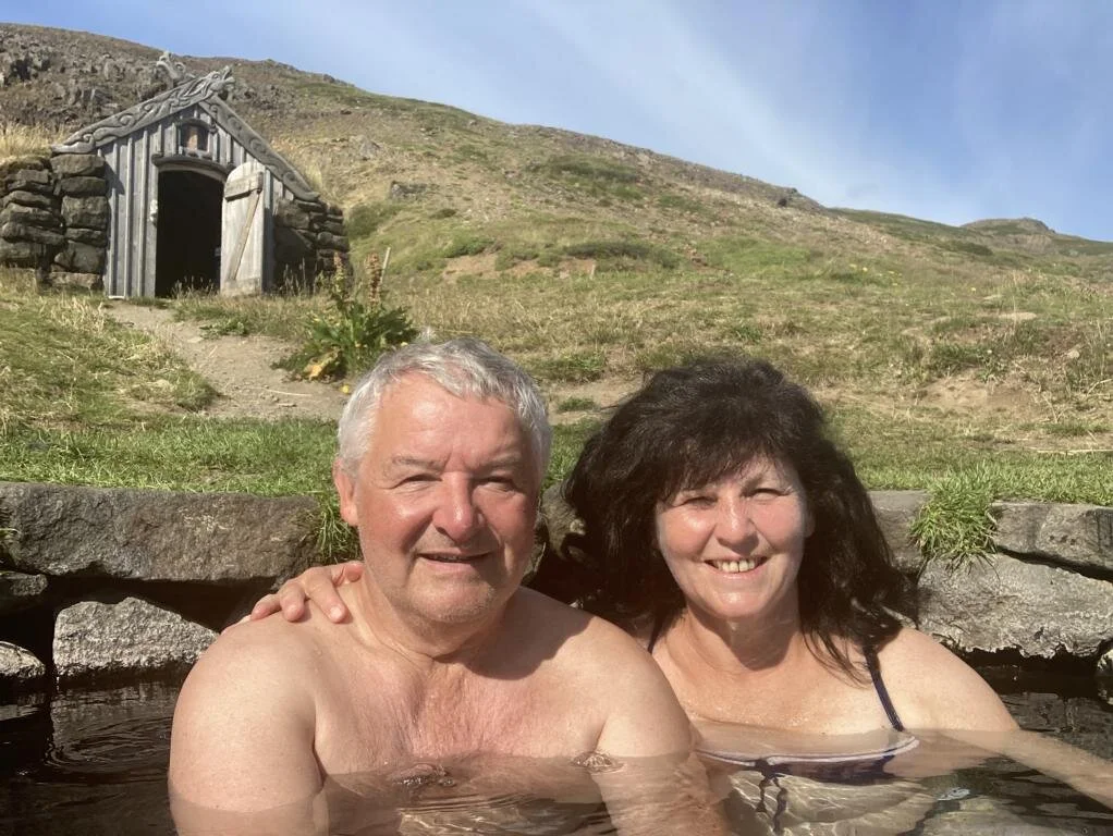
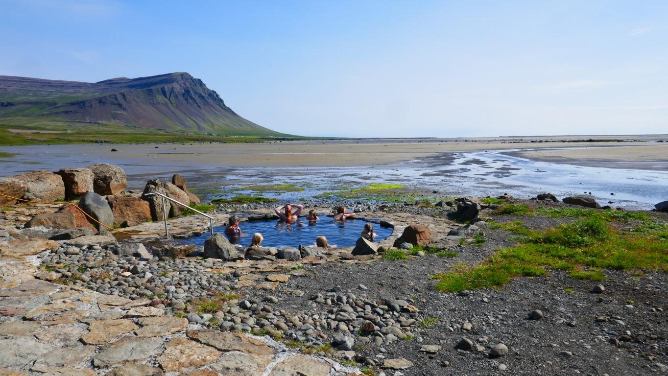
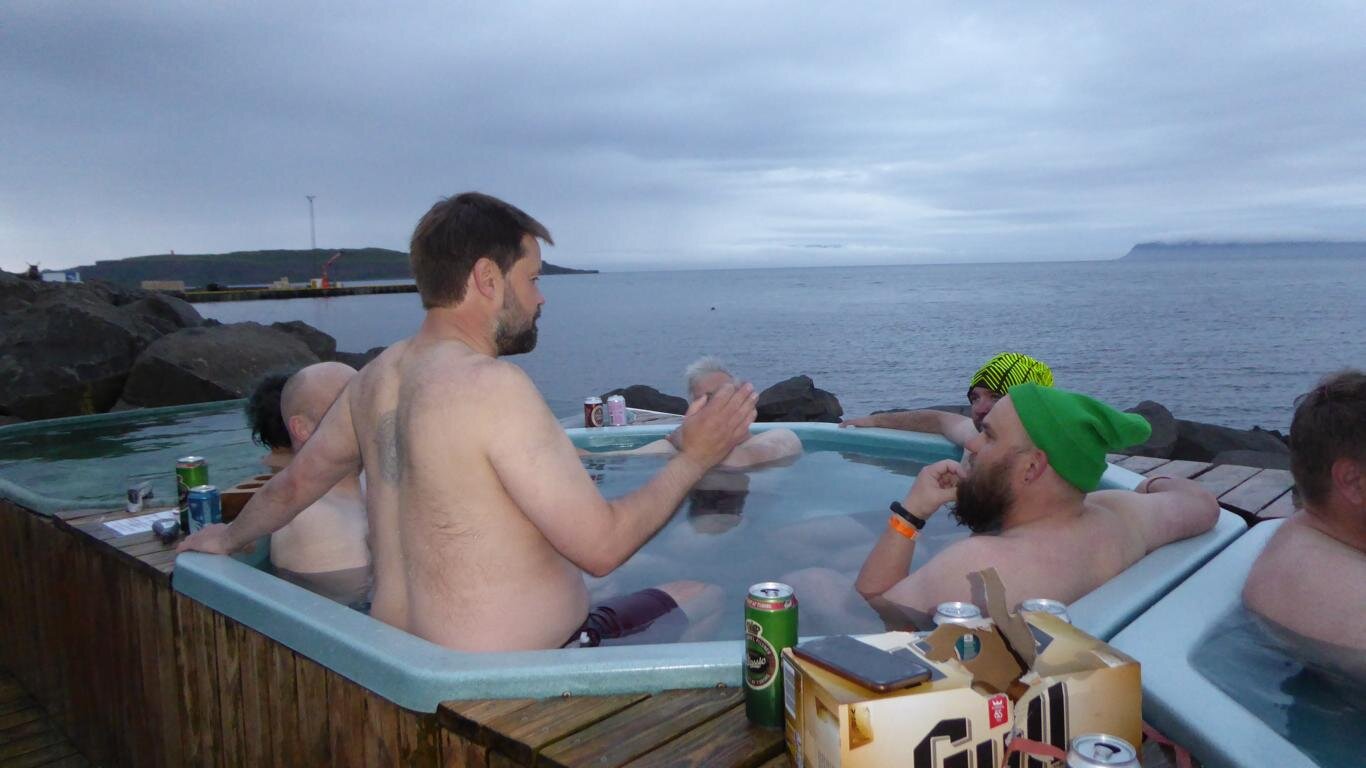
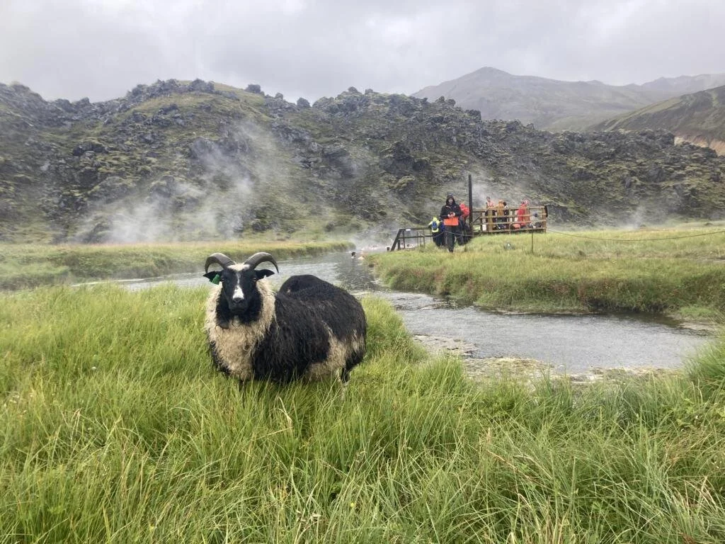
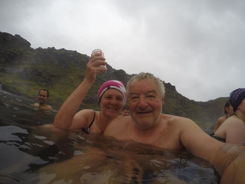
Heiße Bäder, hot tubs und allgemein Schwimmbäder sind ein zentraler Teil der isländischen Lebenskultur und beliebter Treffpunkt. Viele der Bäder werden von heißen Quellen gespeist, andere müssen künstlich beheizt werden. Manche sind luxuriös ausgestattet und teuer (bis zu 65 € pro Person), andere sind kostenlos und befinden sich als natürliche Becken mitten in der Wildnis. Das bekannteste heiße Becken ist die Blaue Lagune nahe dem Flughafen von Reykjavik. Entstanden ist es als „Nebenprodukt“ des im Hintergrund des ersten Bildes sichtbaren Thermalkraftwerks (aus den Schloten kommt nur Wasserdampf). In allen heißen Bädern gibt es eine klare Regel: „Alle Gäste müssen sich mit Seife, ohne Badeanzug waschen, bevor sie in das Schwimmbecken gehen“. Im Laufe unserer Reise besuchten wir eine Reihe von heißen Quellen in Egilsstadir; Myvatn; einen in einer einsamen Gegend gelegener heißer Wasserfall nahe der Straße F 910 (Askya-Region); Husavik; Nordurfjördur; Hjalteyri (nördlich von Akureyri), Drangsnes; einige natürliche Becken entlang der Straßen Nr. 63 und 60.
Hot water basins, hot tubs, and swimming pools are an essential part of Iceland’s life style culture. Many of the pools are filled with warm geothermal water, others need to be heated. Some are luxurious and expensive (up to 65 € / 75 USD per person), others free of charge and consist of natural pools in the middle of nowhere. The most famous pool is the Blue Lagoon near the Reykjavik airport. It started as a by-product of the geothermal powerplant visible in the background of the first picture (what comes out of the chimneys is just steam). In all pools there is a strict rule: “Every guest is required to wash thoroughly without swimsuit before entering the lagoon”. During our tour across Iceland, we visited a number of hot springs in Egilsstadir; Myvatn; a hot waterfall in a remote area near road F 910 (Askya-region); Husavik; Nordurfjördur; Hjalteyri (north of Akureyri), Drangsnes; several natural pools along road # 63 and # 60.


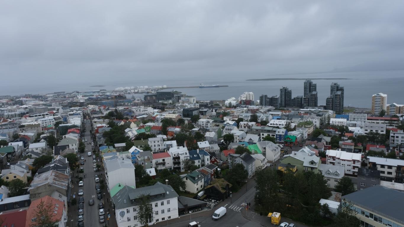
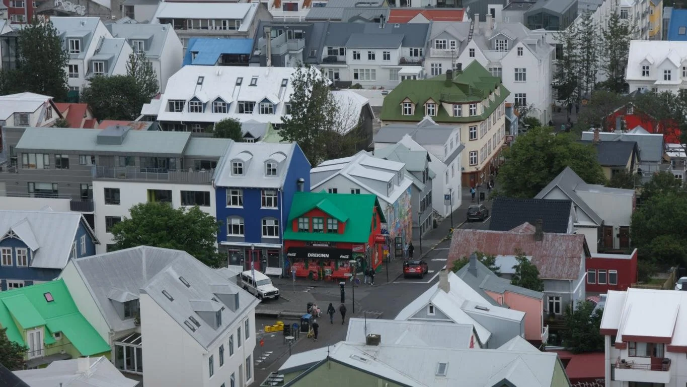
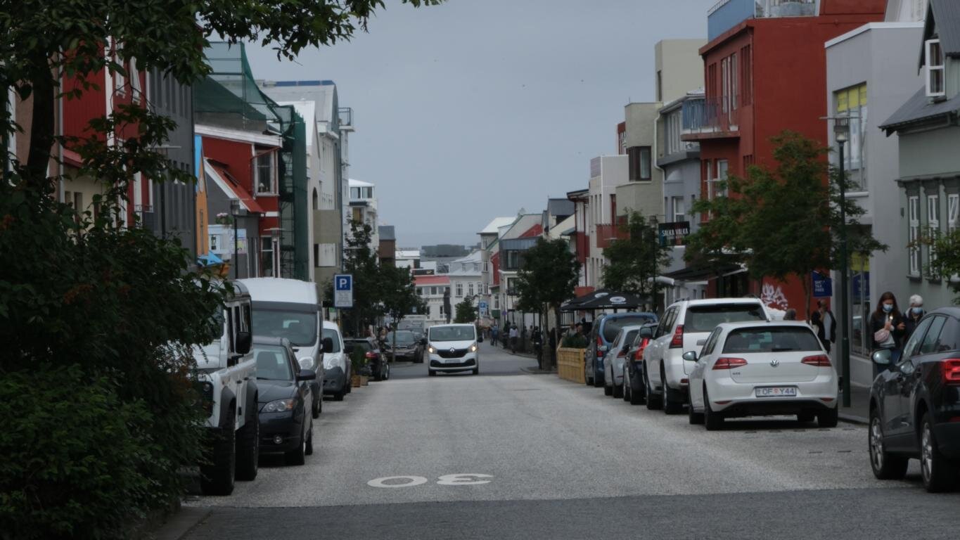
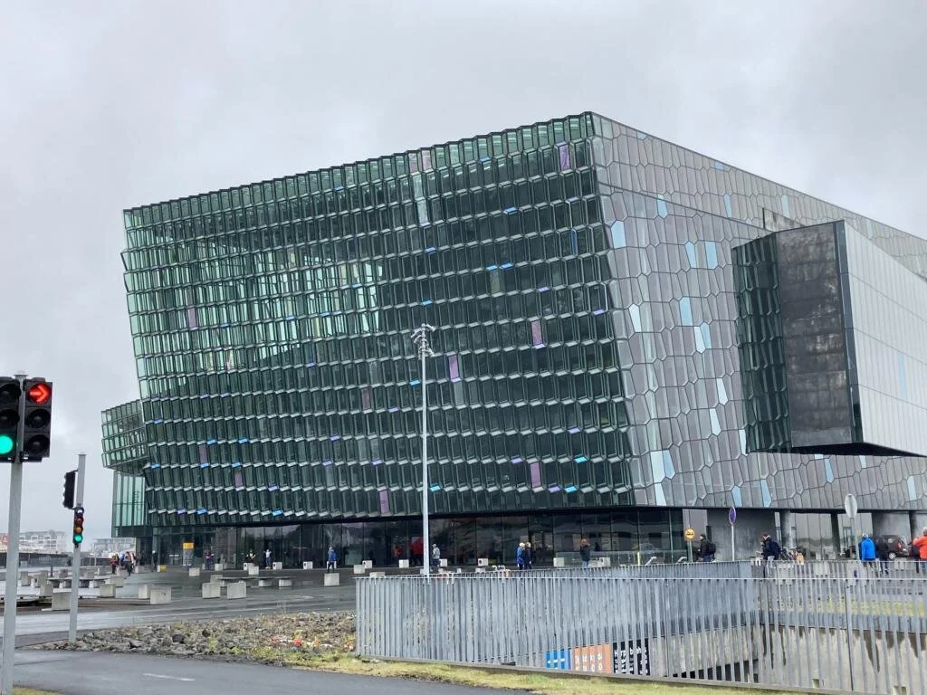
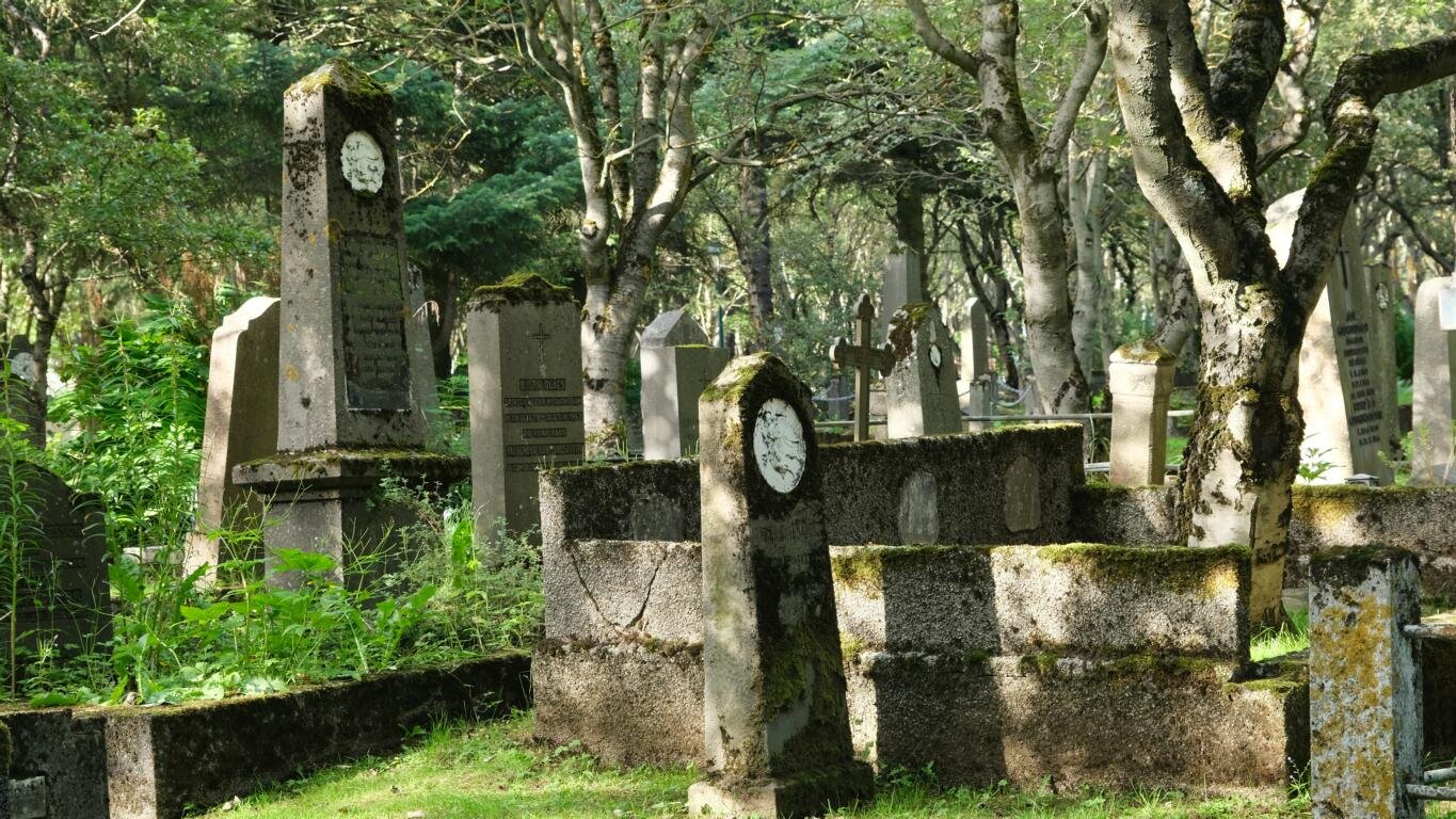
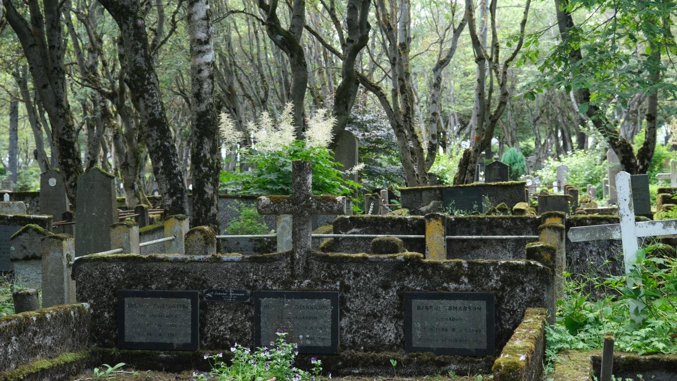
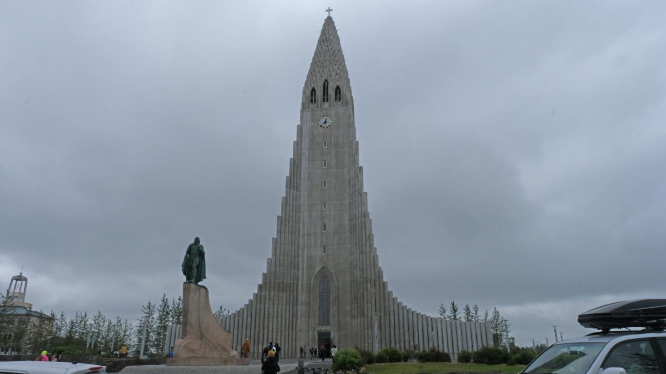
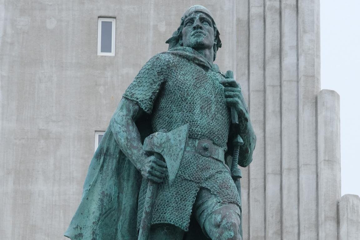
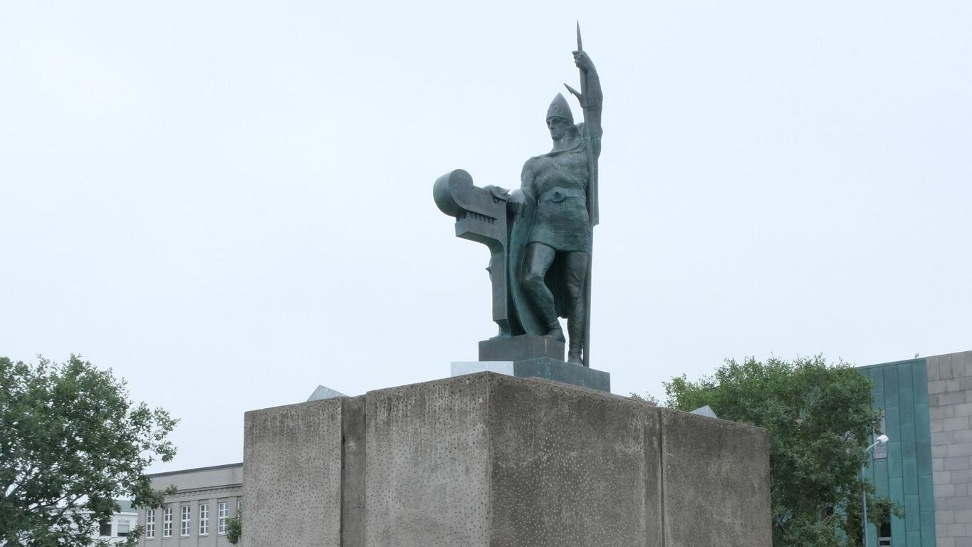
Reykjavik ist die nördlichste Hauptstadt der Welt (249 km südlich des Polarkreises). Mit 129.000 Einwohnern und weiteren 80.000 im Nahbereich leben ca. 60 % der Bevölkerung Islands in oder um Reykjavik. Die Fotos zeigen die Innenstadt, das Konzerthaus Harpa, den Hafen und den sehenswerten Friedhof. Vom Turm der steilaufragenden Hallgrímskirche hat man einen exzellenten Überblick über die Stadt. Vor der Kirche steht ein Denkmal für Leif Eriksson, der um das Jahr 1000 als erster Europäer von Grönland kommend den Fuß auf das nordamerikanische Festland setzte und bis Neufundland (heute Kanada) segelte.
Reykjavik is the northern-most capital on earth (249 km / 190 miles south of the polar circle). With 129,000 inhabitants and 80,000 more living nearby 60 % of Iceland’s population live in or around Reykjavik. The images show the city center, the concert hall Harpa, the harbor and the central graveyard. The tower of the Hallgrim church provides an excellent viewpoint to look over the city center. In front of the church stands a monument for Leif Eriksson, who – departing from Greenland – was the first European to set foot on the North-American mainland and to sail to Newfoundland (Canada).
Einige Informationen zur Geschichte Islands: Die Besiedlung Islands erfolgte im Zuge der Raubzüge und Landnahmen der Wikinger („Nordmänner“). Ingólfur Arnarson besiedelte mit seinen Gefolgsleuten von Norwegen aus um das Jahre 870 Island wobei er unterwegs keltische Sklaven*innen von den Britischen Inseln entführte. Zuvor sollen schon irische Mönche zeitweise auf Island gelebt haben. Bis zum 15. Jh. war das Klima in Island deutlich wärmer als heute. Nach einer Periode interner Auseinandersetzungen zwischen den führenden Adeligen verlor Island im Jahre 1262 seine Unabhängigkeit und wurde Teil des Norwegischen Königreichs. 1397 fiel Island im Rahmen der Kalmarer Union unter die Herrschaft Dänemarks. Unabhängigkeitsbestrebungen, die bis ins beginnende 19. Jh. zurückreichen, kulminierten während des Zweiten Weltkriegs im Jahre 1944 in der Unabhängigkeitserklärung Islands. Zu diesem Zeitpunkt war Dänemark von deutschen Truppen besetzt und Island von den Alliierten.
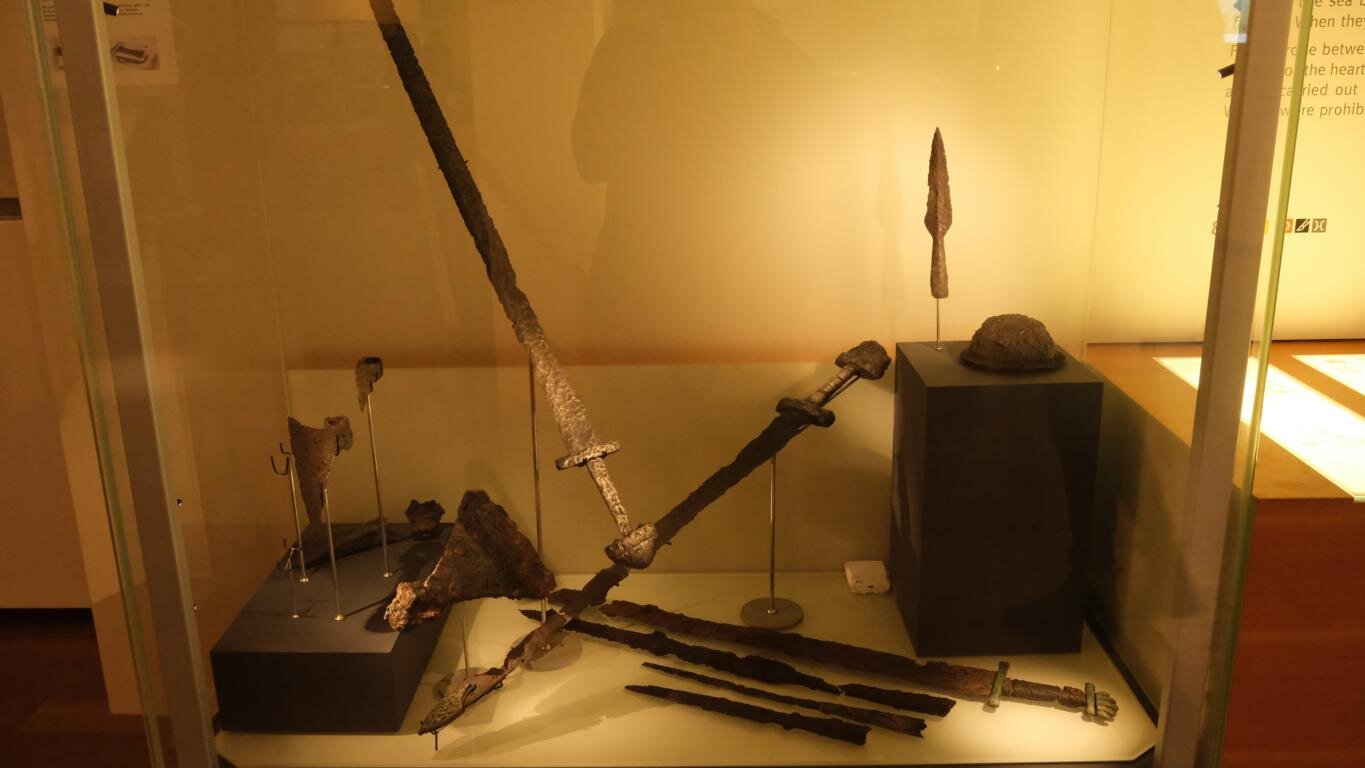
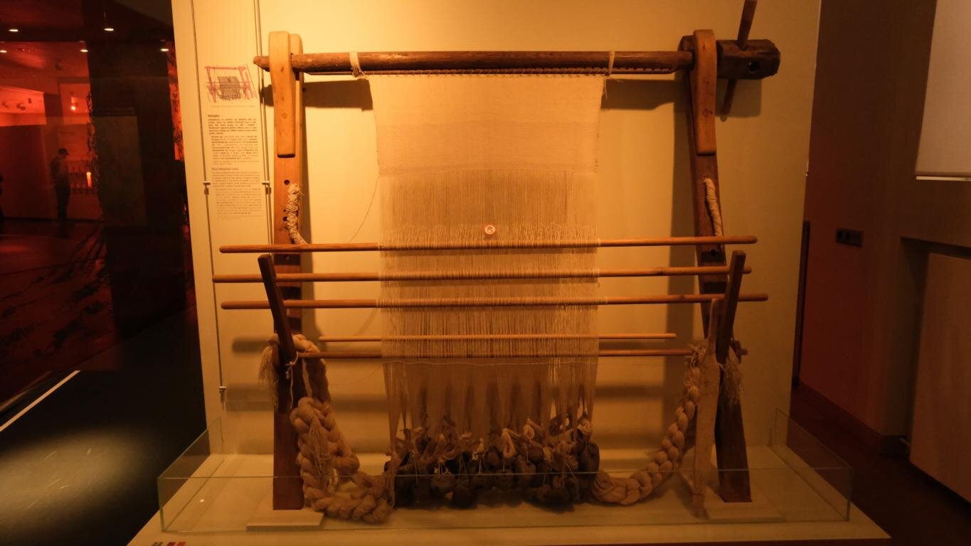
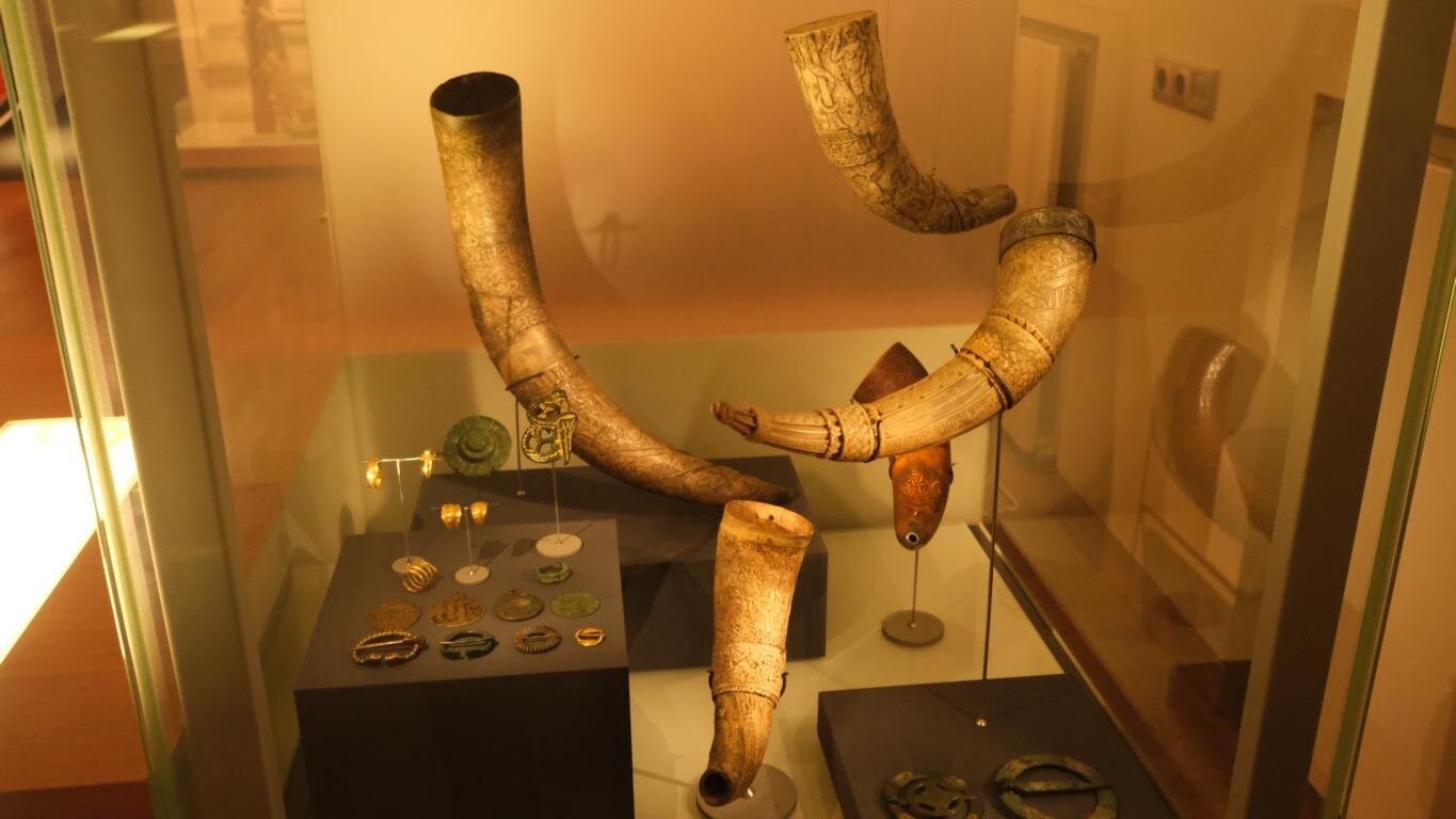
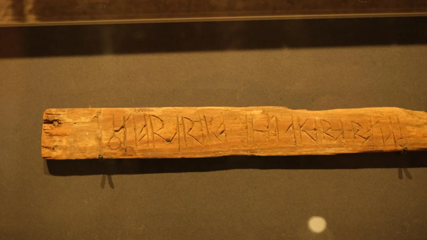
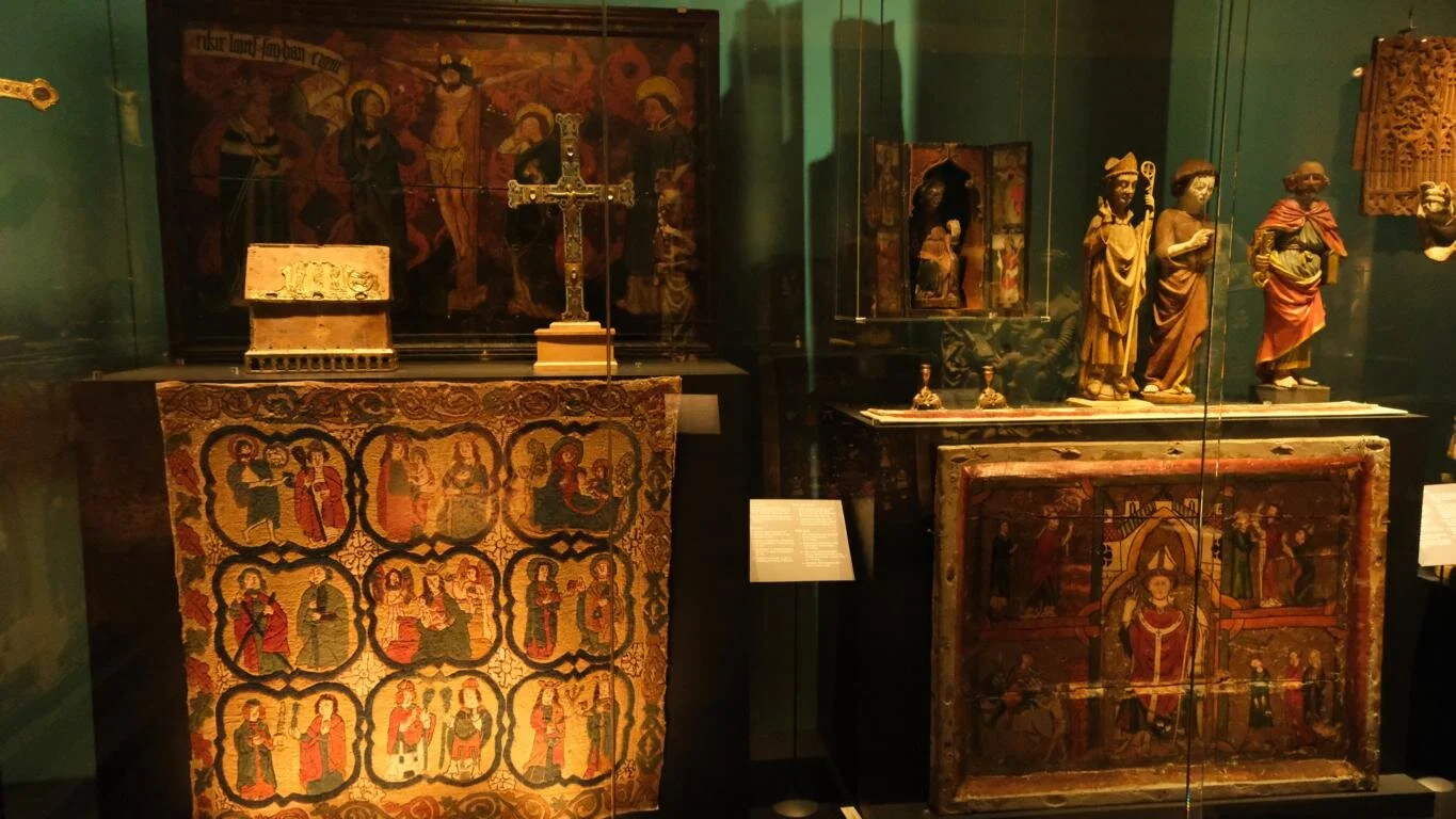
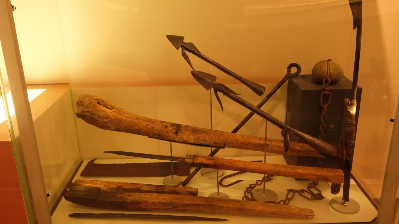
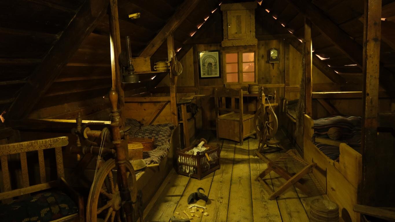
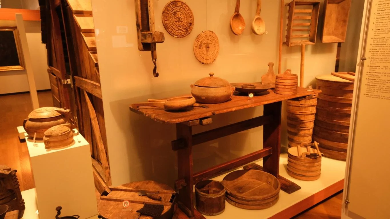
Im Jahr 1000 traten die wichtigsten Stammesfürsten vom germanischen Götterglauben zum Christentum über. Mitte des 16. Jh. setzte sich der Protestantismus nach einem kurzen bewaffneten Konflikt als vorherrschende Religion durch. Im Nationalmuseum in Reykjavik sind Gegenstände aus den ersten Jahrhunderten der Besiedlung ausgestellt.
A brief overview re Iceland’s history: The settlement of Iceland occurred as part of the raids and land seizure by the Vikings (Norsemen). Coming from Norway Ingólfur Arnarson and his followers in the year 870 colonized Iceland. During their journey they first raided the coast of the British Islands and kidnapped Celtic slaves. Before that, Irish monks already temporarily had lived in Iceland. Until the 15th century the climate in Iceland was warmer than today. As a result of ongoing infights within the nobility Iceland in the year 1262 lost its independence and became part of the Norwegian Kingdom. 1397 it came under the rule of Denmark. From the beginning of the 19th century on a movement for independence gained momentum which culminated in the declaration of independence in 1944. At that time Denmark was occupied by German troops and Iceland by the Allied Forces.
In the year 1000 the leading nobles converted from Germanic belief to Christianity. After a brief armed conflict in the middle of the 16th century Protestantism became the dominant religion. The National Museum in Reykjavik displays artifacts form the first centuries of the colonization.
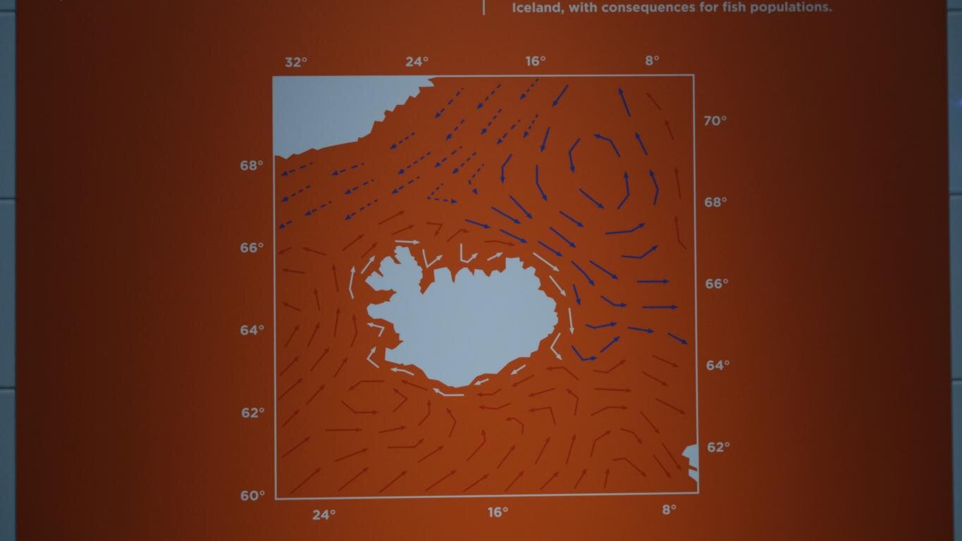
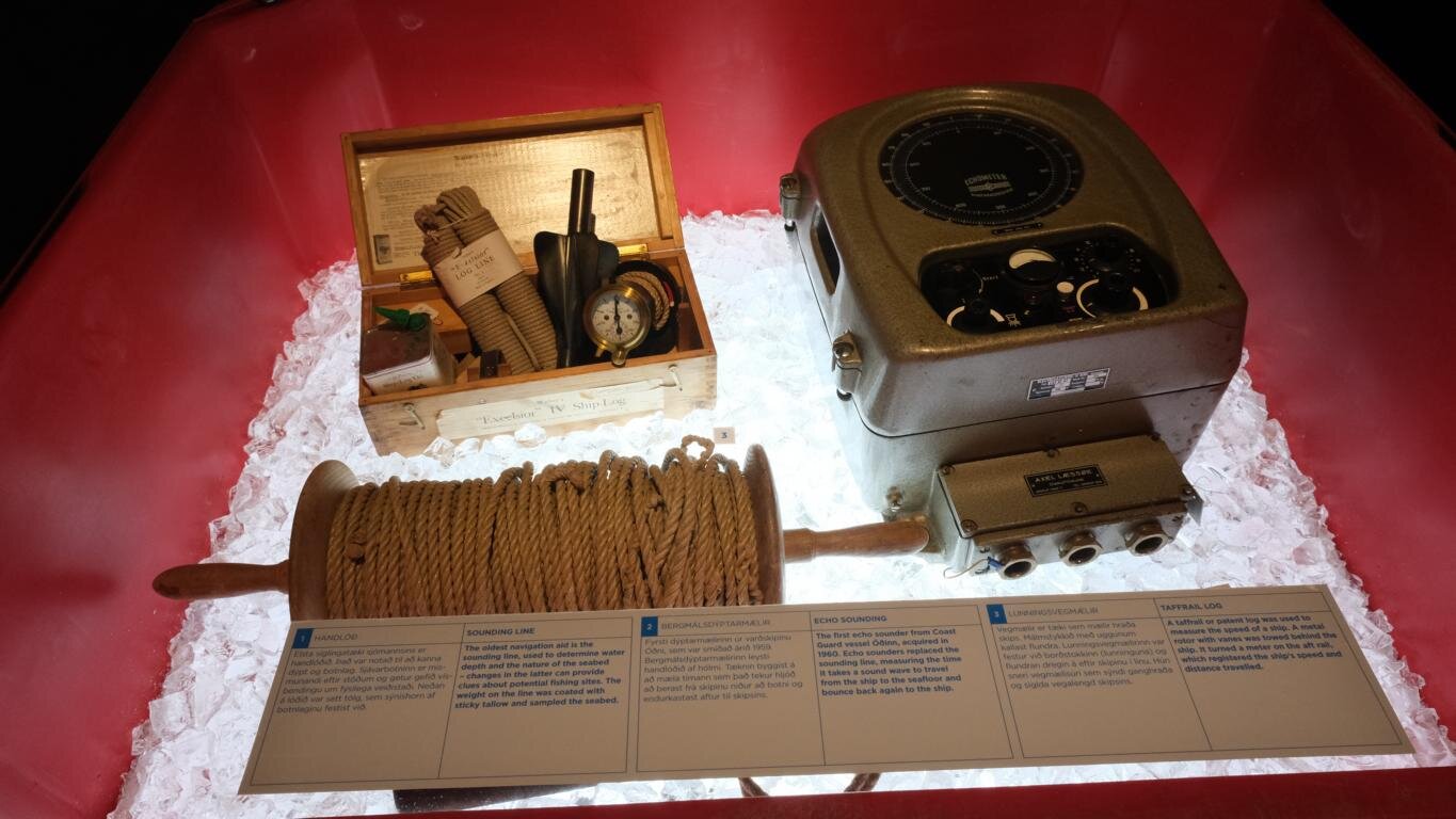
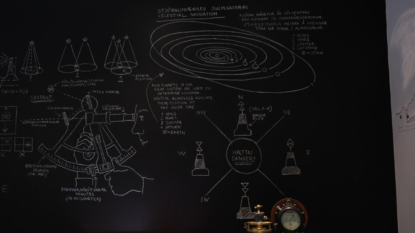
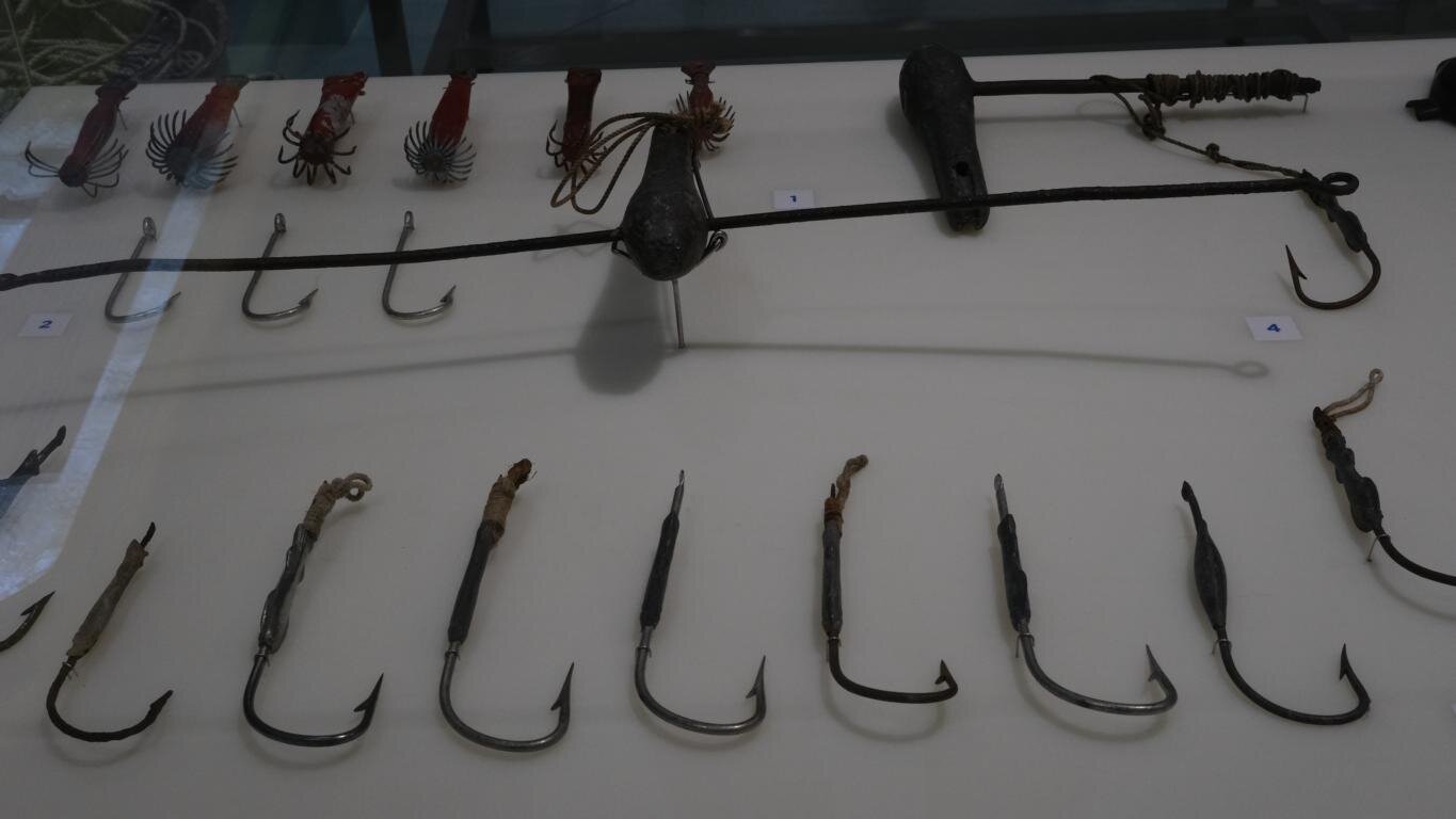
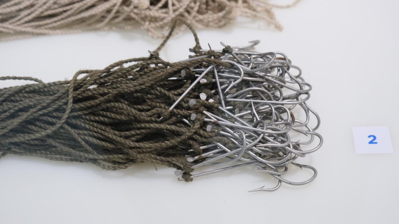
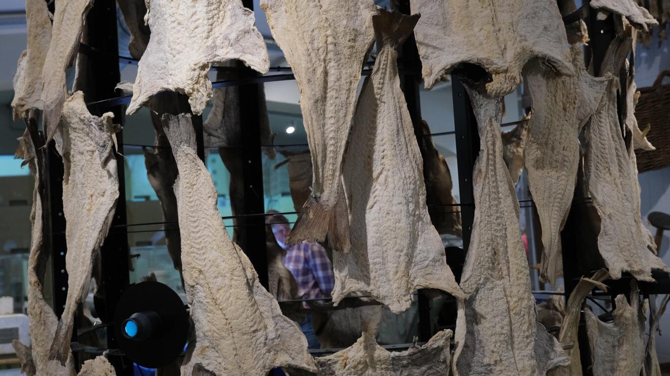
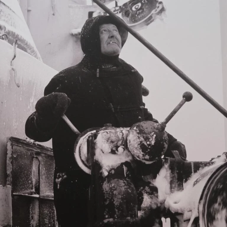
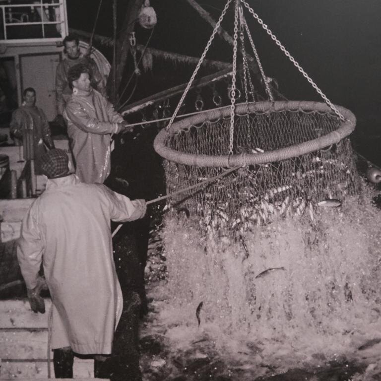
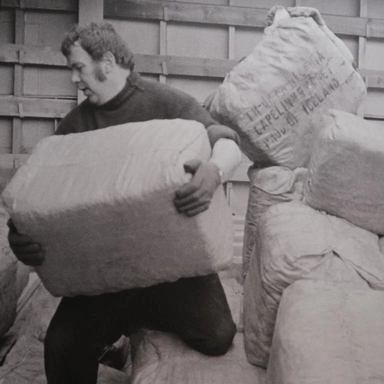
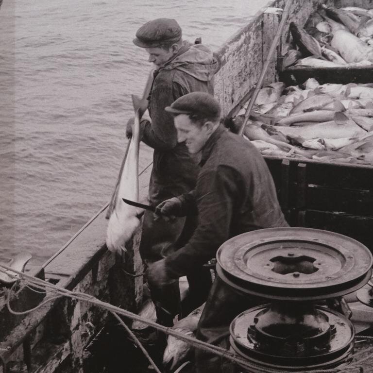
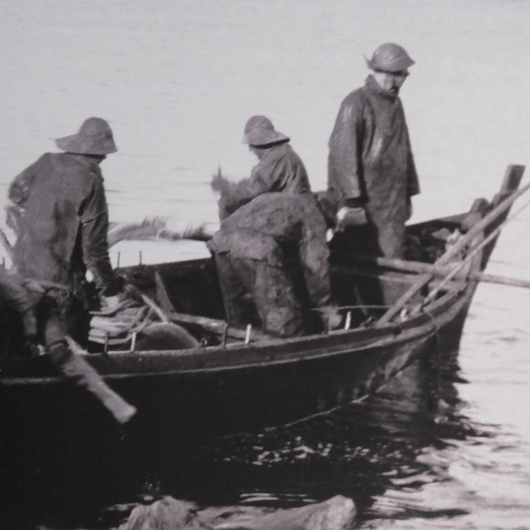
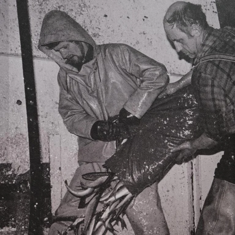
Dem Pro-Kopfeinkommen nach gehört Island heute zu den reichsten Ländern der Erde und die Lebenserwartung ist eine der höchsten der Welt. Wegen eines besonders kinderfreundlichen Umfelds zählt die Geburtenrate in Island zu den höchsten in Europa. Aluminiumindustrie (Island hat selbst kein Bauxit profitiert aber von der kostengünstigen Stromerzeugung durch Wasserkraft und geothermischer Energie), Fischerei und Tourismus sind die wichtigsten Wirtschaftszweige. Das sehenswerte Fischereimuseum in Reykjavik gibt Aufschluss über die beschwerliche Arbeit der Fischer. Das Meer rund um Island ist besonders fischreich, da sich hier kalte und warme Meeresströmungen treffen.
According to the per-capita income Iceland is among the wealthiest countries in the world and life-expectation is one of the highest on earth. Due to a very children-friendly environment birthrate in Iceland is among the highest in Europe. Aluminum industry (Iceland itself has no bauxite but benefits from cheap electricity produced by hydro-electric or geothermal plants), fishery and tourism are Iceland’s most important economic sectors. The fishery museum is worth visiting and informs about the burdensome work of fishermen. The ocean around Iceland is particularly rich in fish as in this region warm water currents mix with cold water.
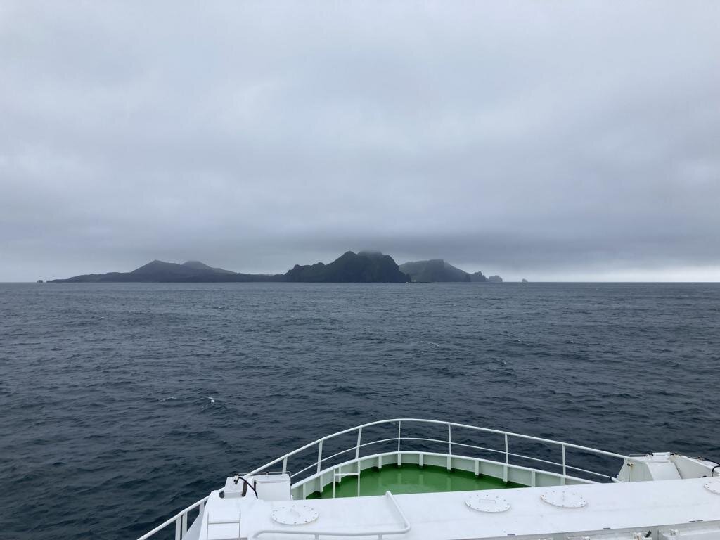
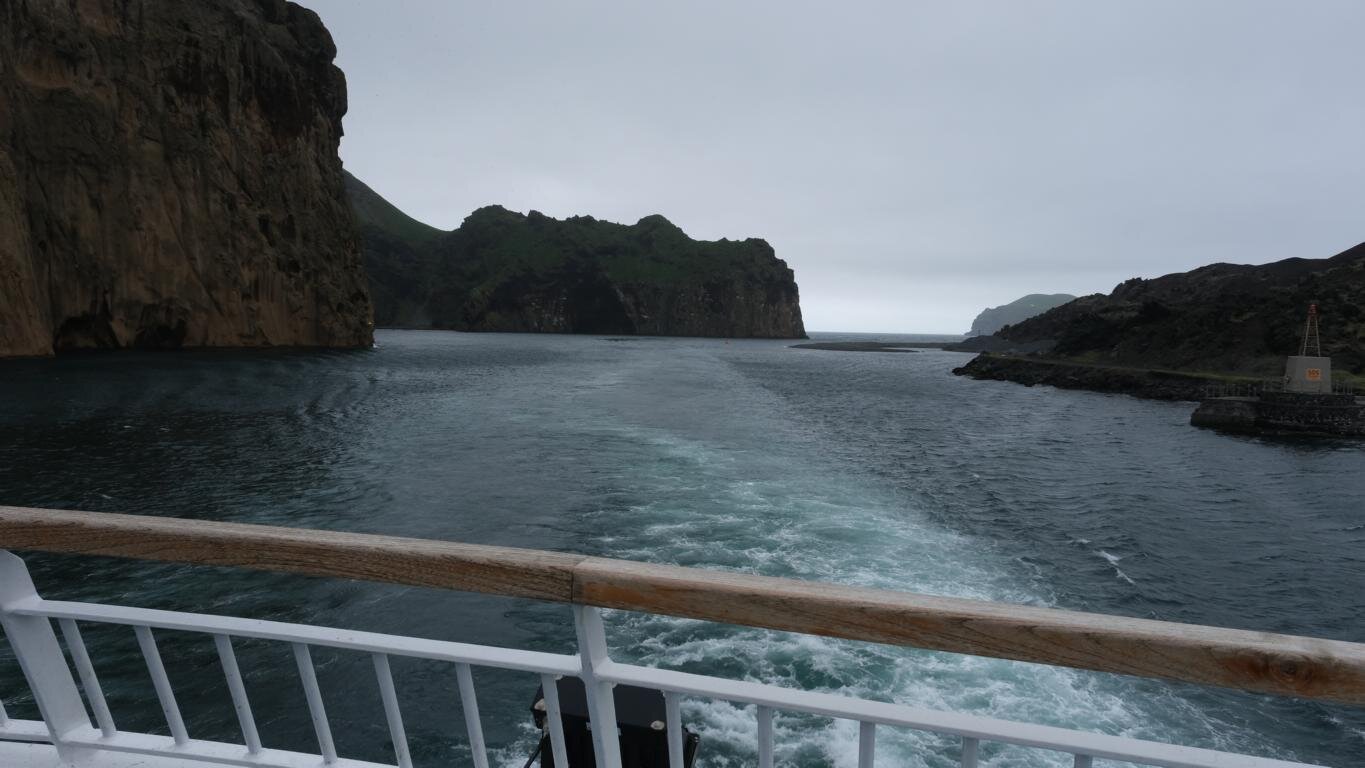
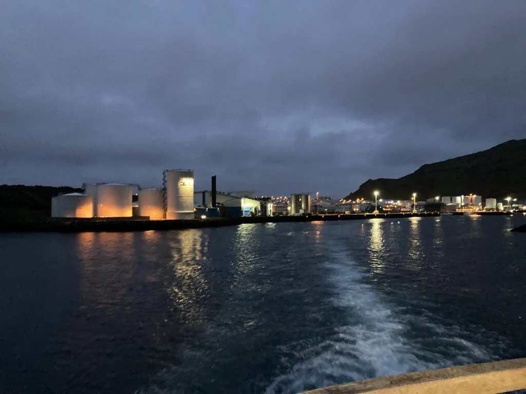
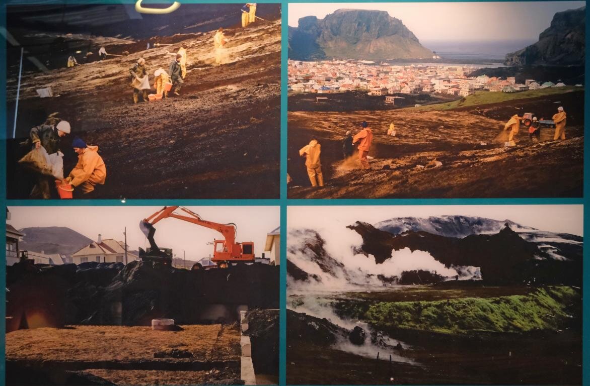
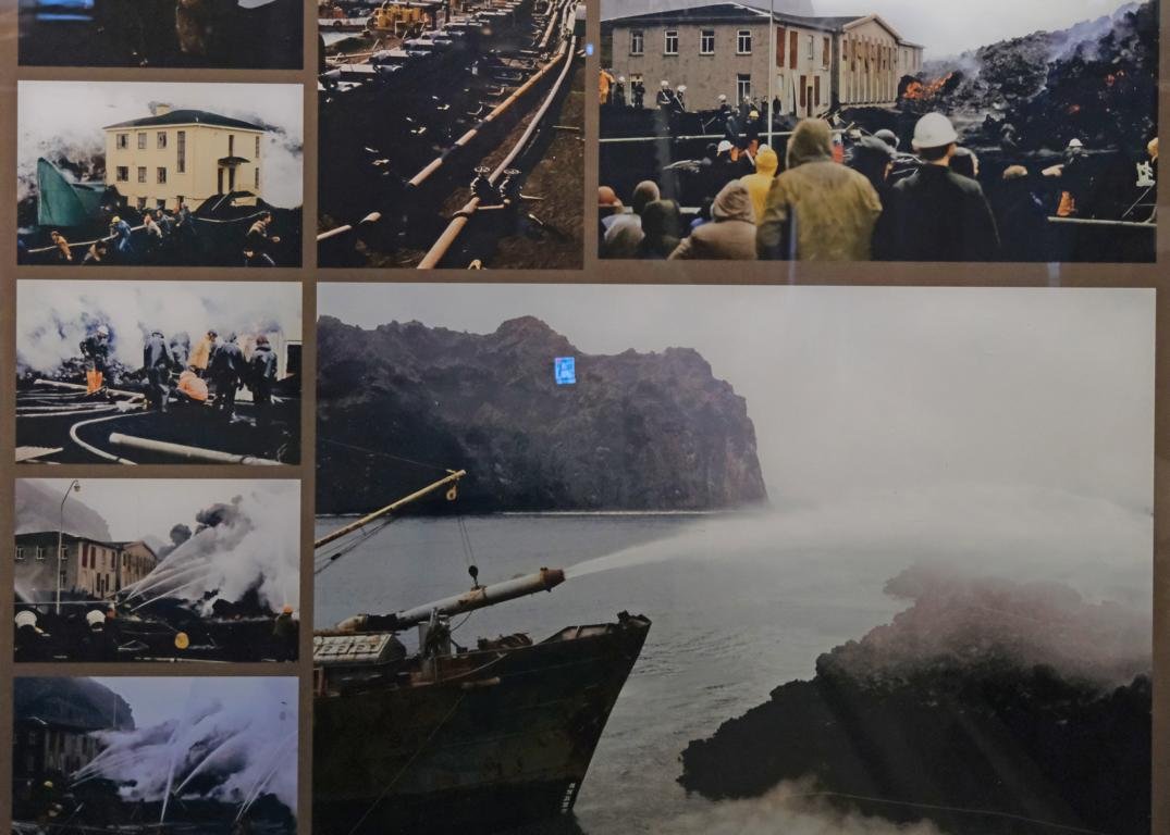
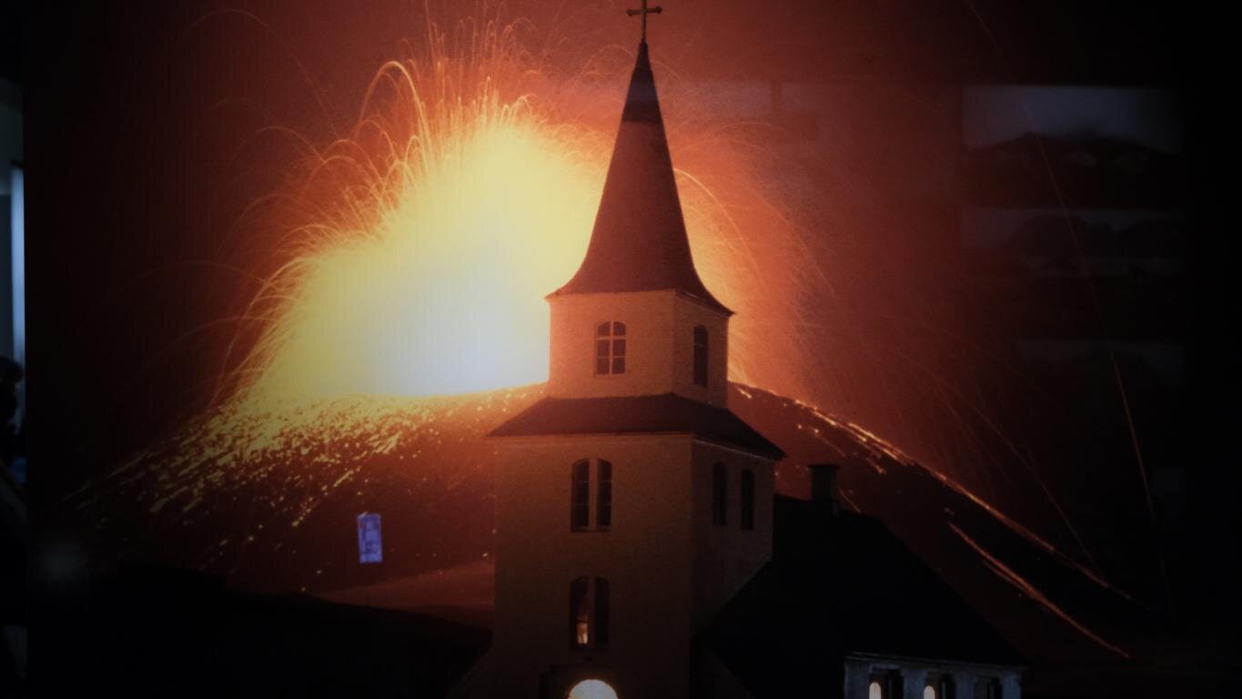
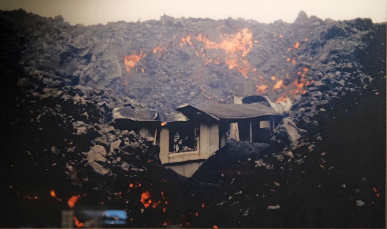
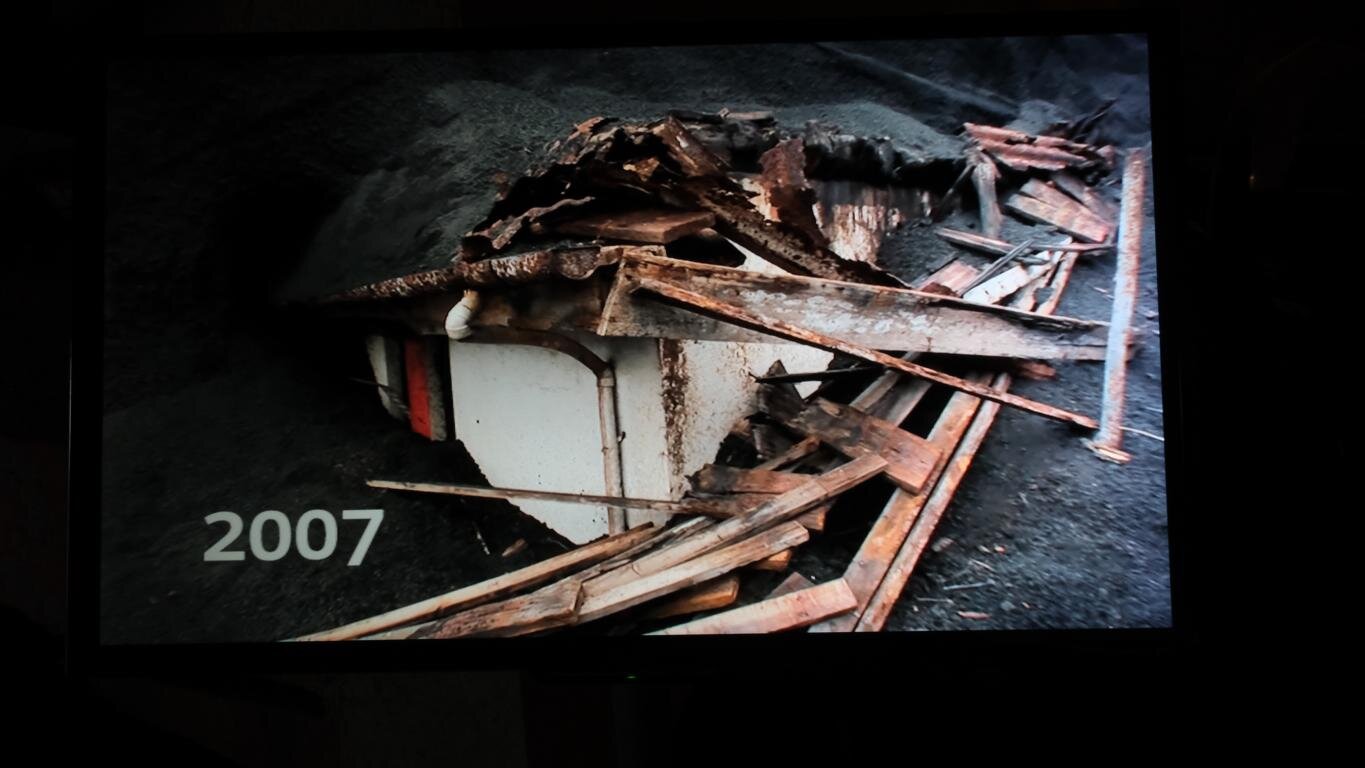
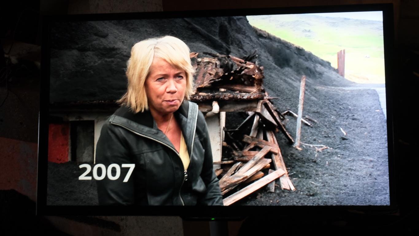
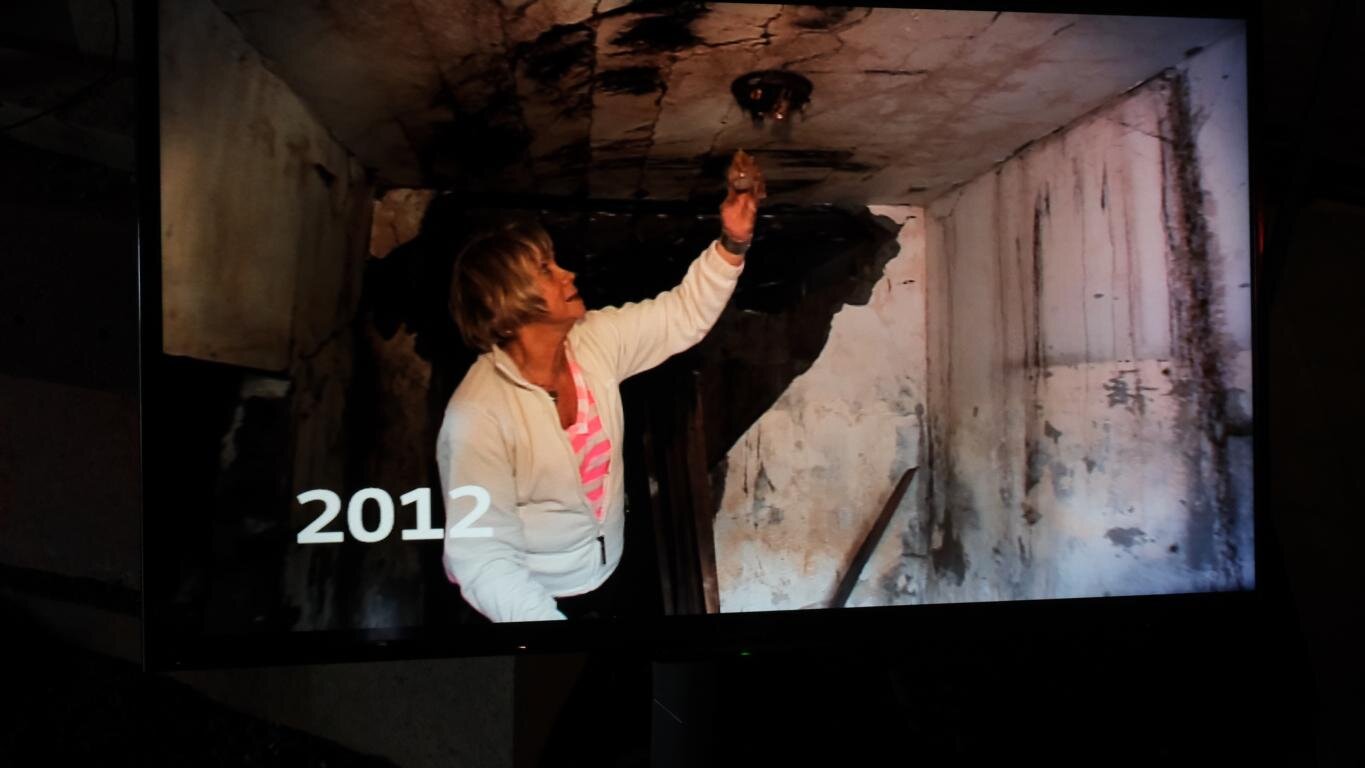
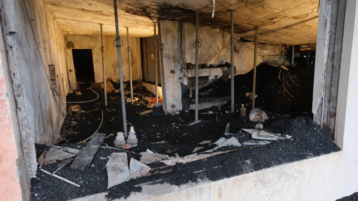
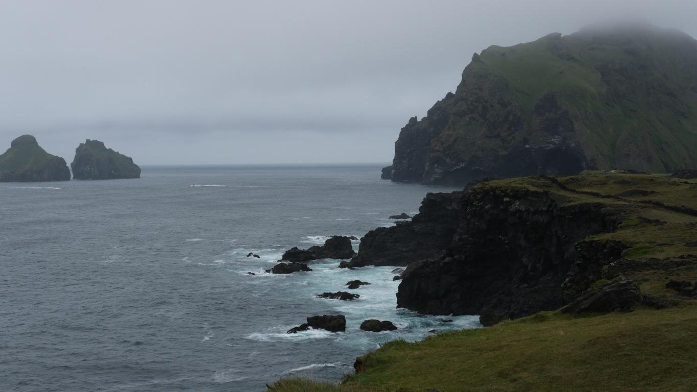
Die Westmänner Inseln (Vestmannaeyjar) im Süden Islands gelegen sind das Produkt submariner Vulkantätigkeit. Im Jahr 1973 brach völlig überraschend der Eldfell Vulkan aus und zerstörte einen Teil der Stadt Heimaey. Alle Bewohner mussten innerhalb einer Nacht evakuiert werden und konnten erst nach Monaten wieder zurückkehren. Ein sehr instruktives Museum vermittelt einen Eindruck von diesen dramatischen Tagen.
The Westman Islands (Vestmannaeyjar) located in the south of Iceland are the result of sub-ocean volcanic activity. In 1973 without warning signs the Eldfell volcano erupted destroying part of the town Heimaey. All inhabitants were evacuated within the first night and it took months until they were able to return. A remarkable museum informs about these dramatic days.
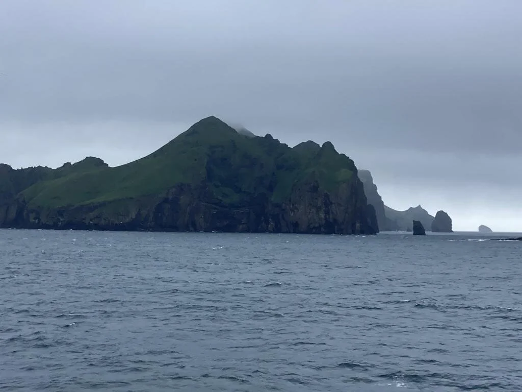
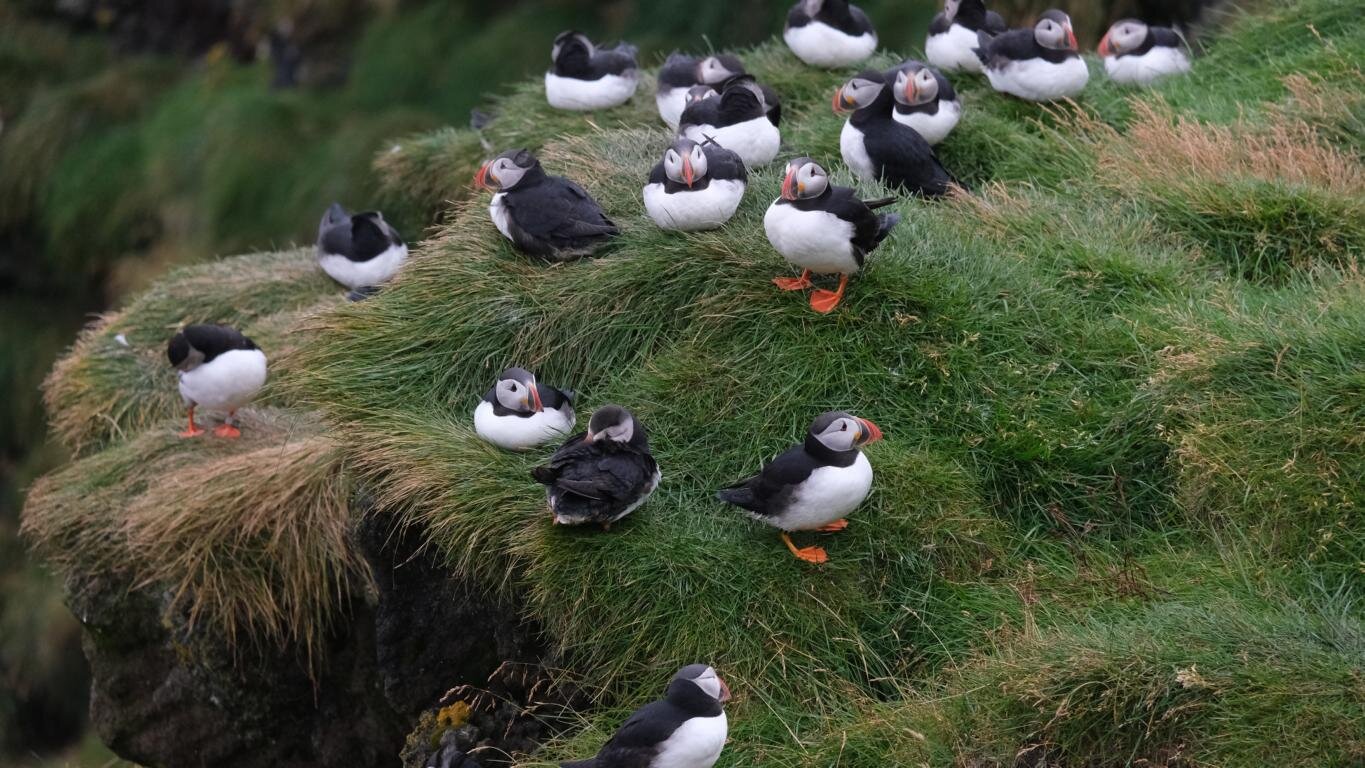
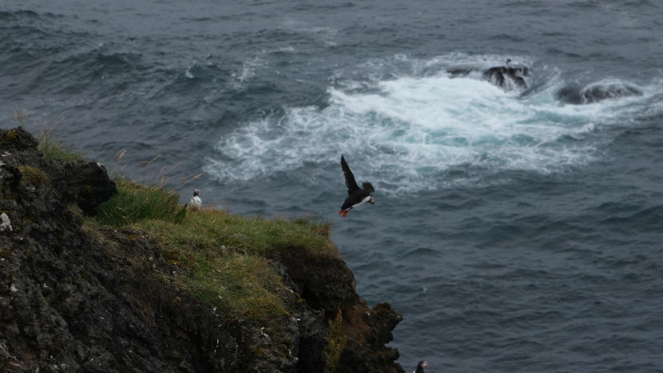
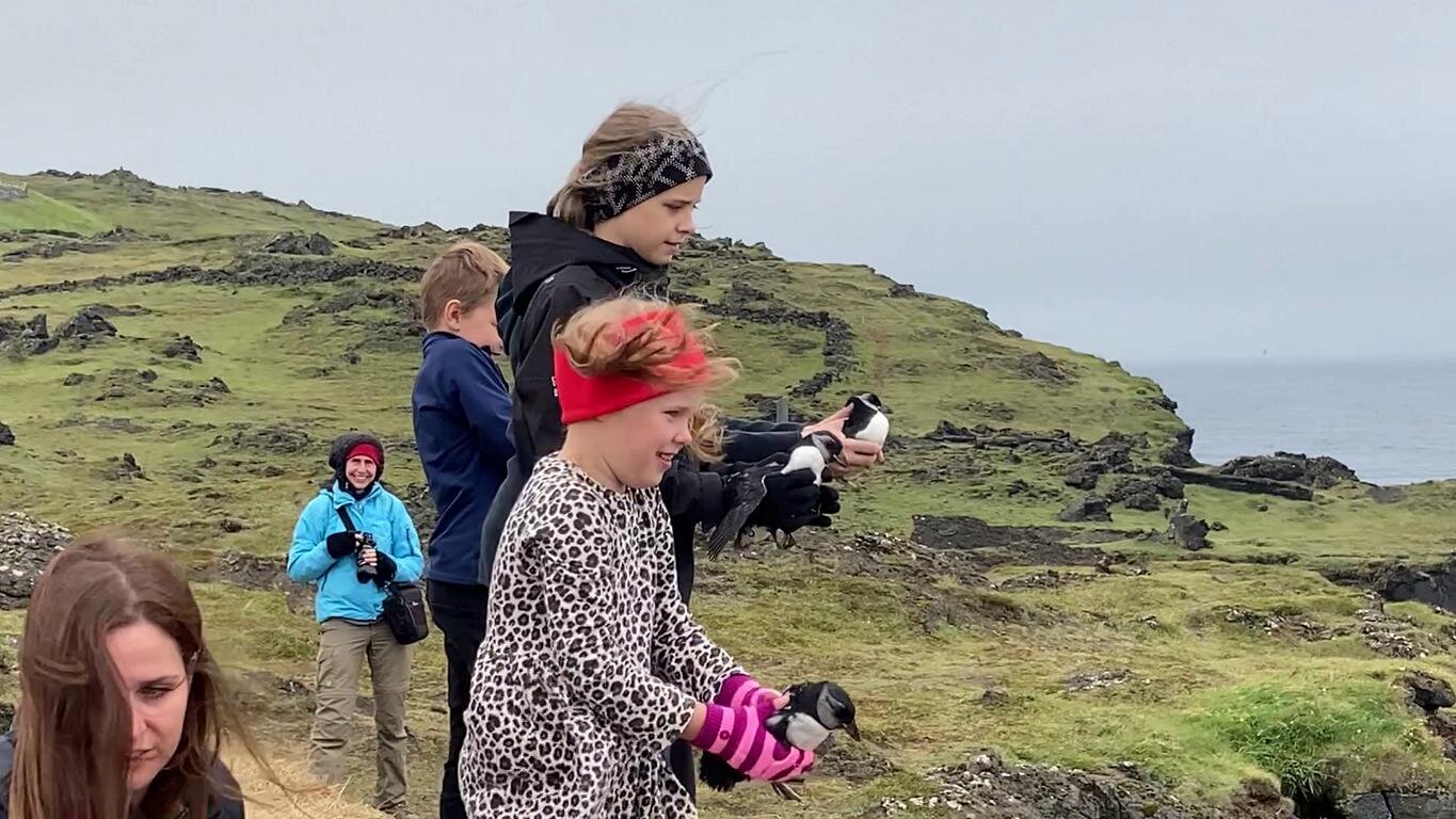
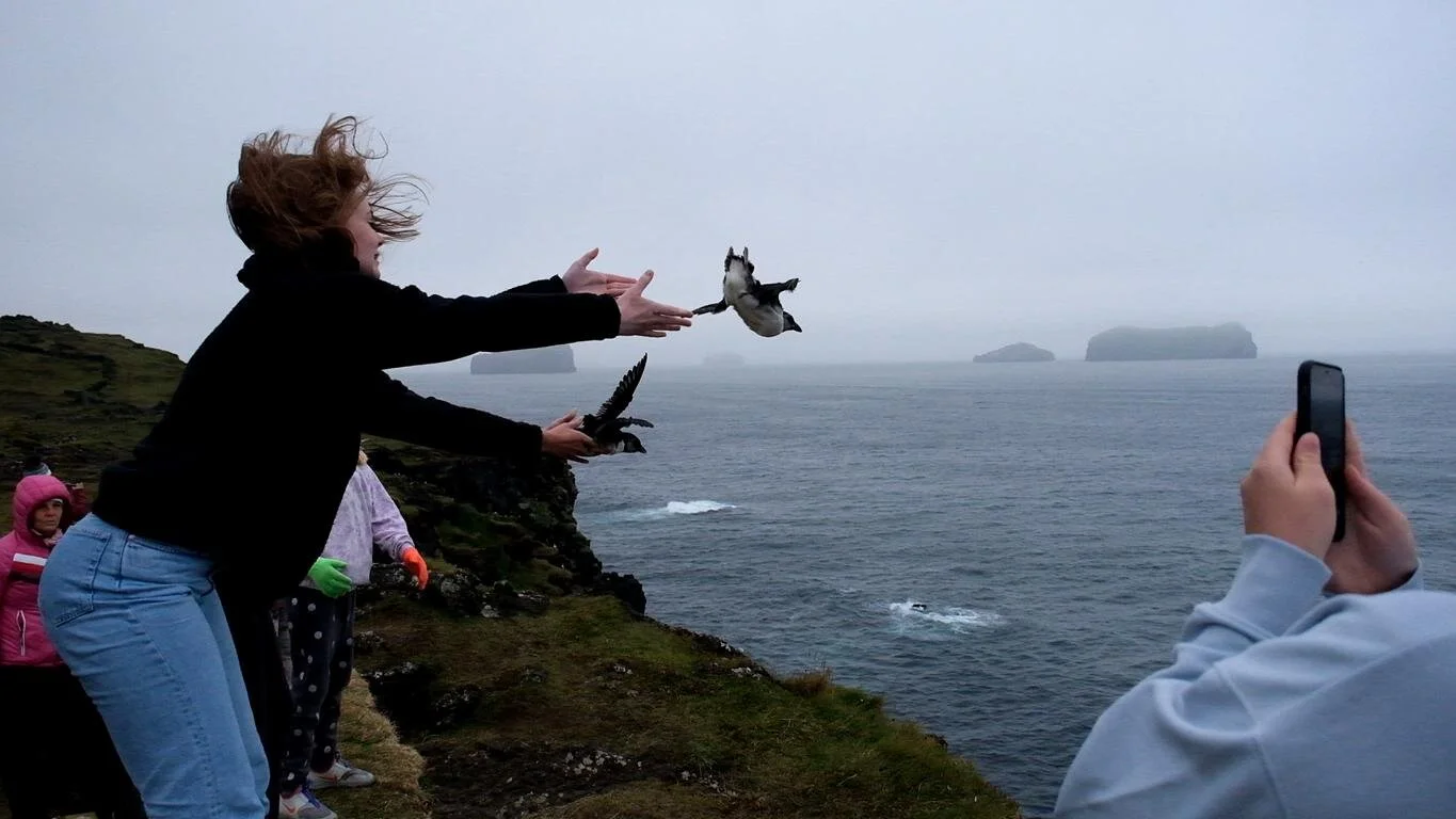
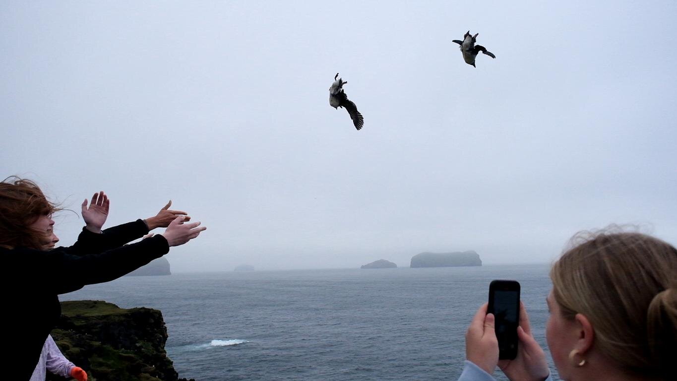
Auf den Klippen der Westmänner Inseln gibt es zahlreiche Papageientaucher Kolonien. Bei ihren Erstflügen verirren sich manche Jungvögel in die Stadt. Sie werden dort aufgelesen und Kinder (unter Aufsicht ihrer Eltern) bringen diese Vögel zurück zur Klippe, um ihnen sprichwörtlich „einen zweiten Start ins Leben“ zu ermöglichen.
On the cliffs of the Westman Islands nest several Puffin colonies. When undergoing their first flight attempts some of the fledglings miss their way and end up in the city center. People collect these birds and children (under the supervision of their parents) bring the young birds back to the cliffs to literally provide them a “second start in life”.
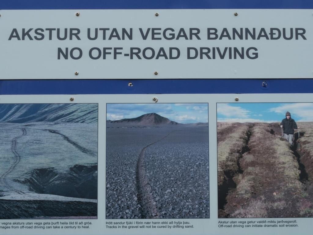
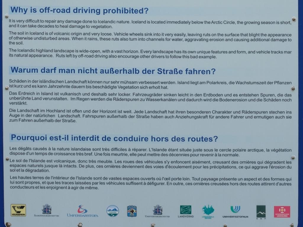
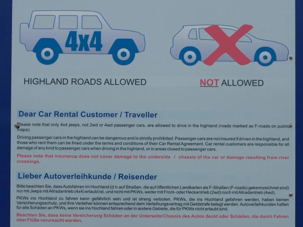
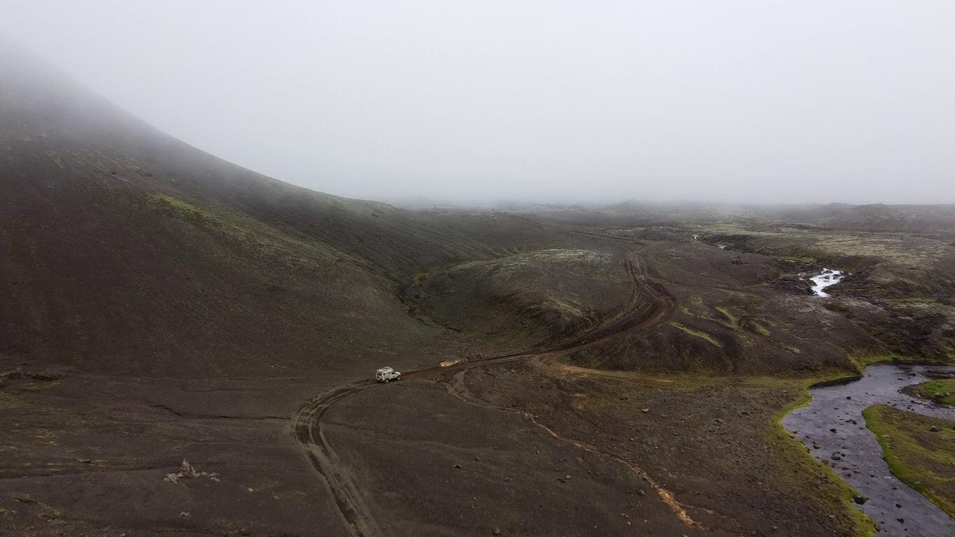
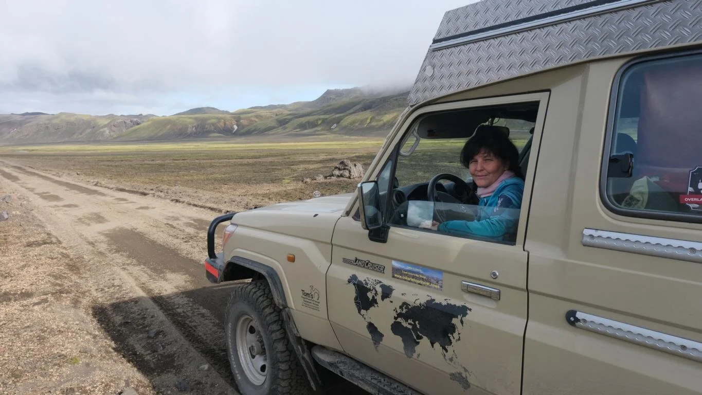
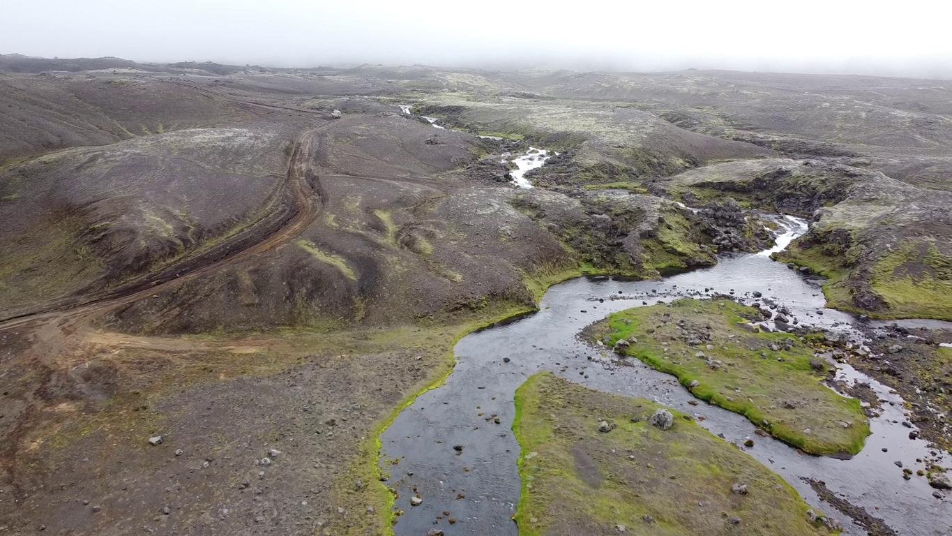
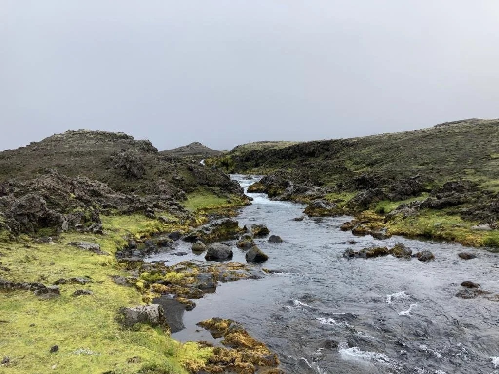
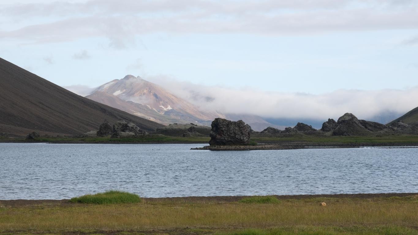
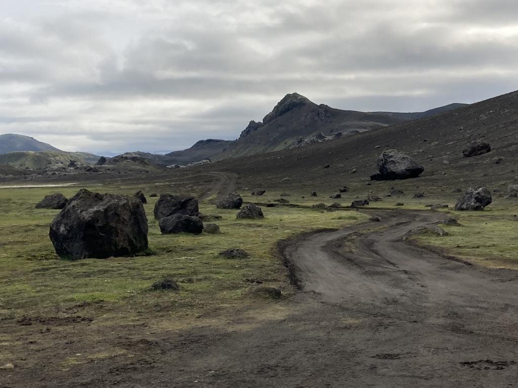
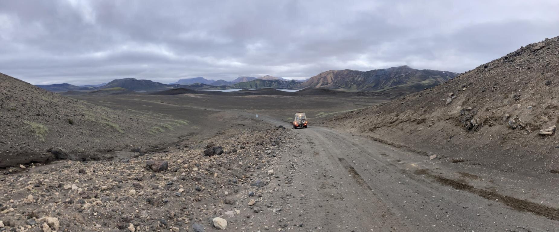
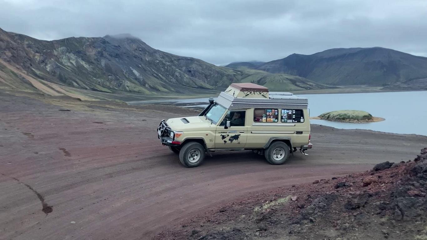
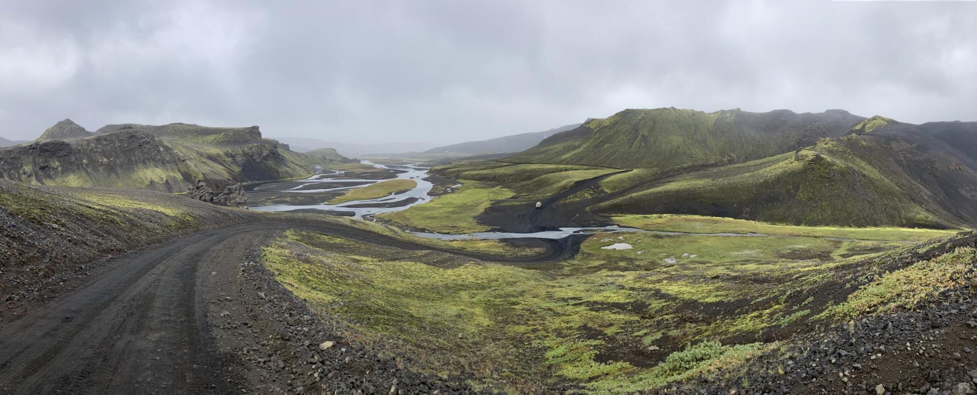
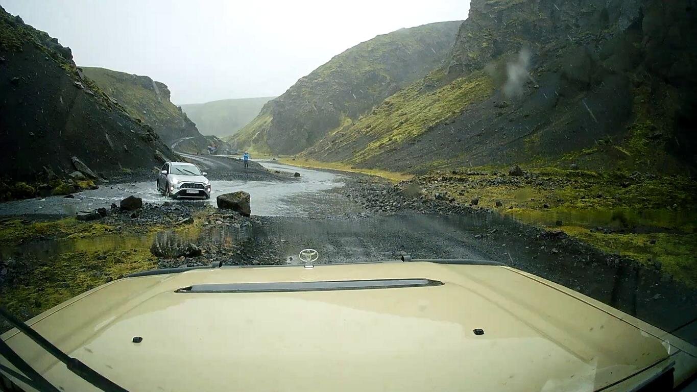
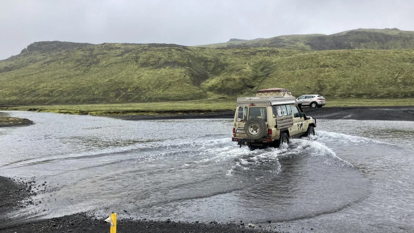
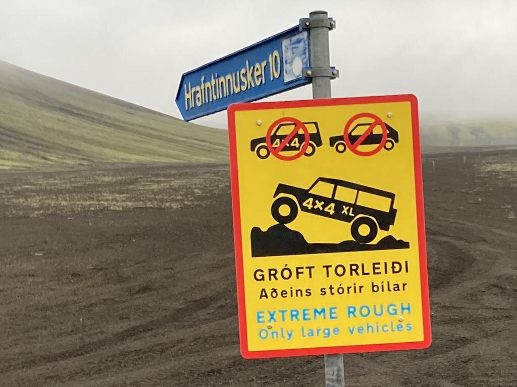
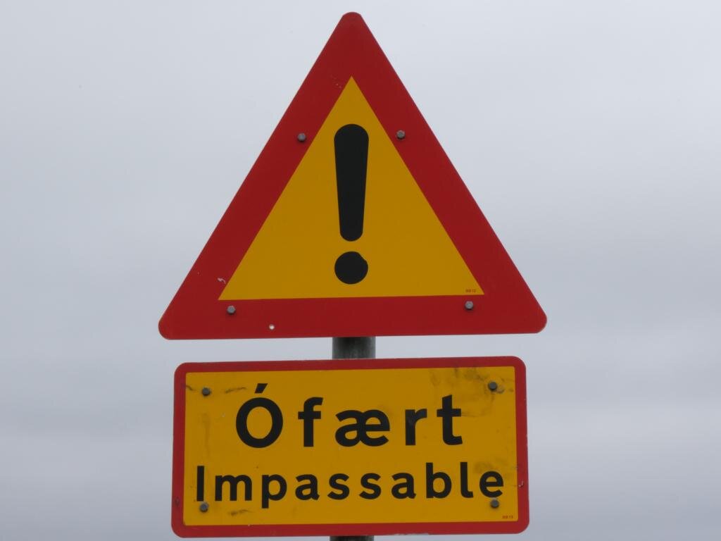
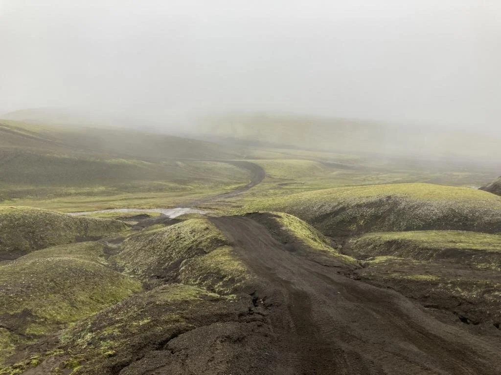
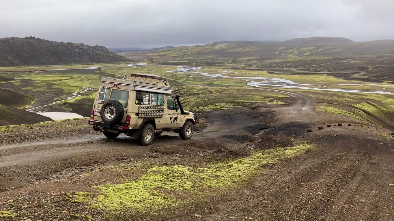
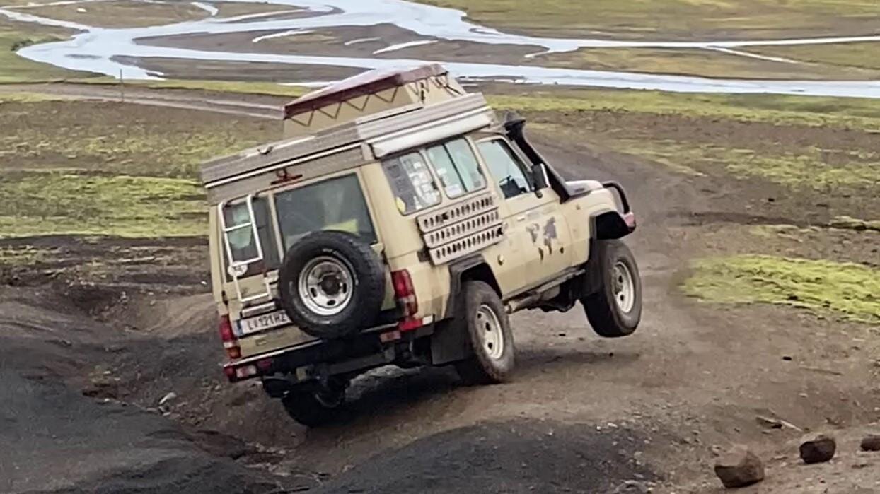
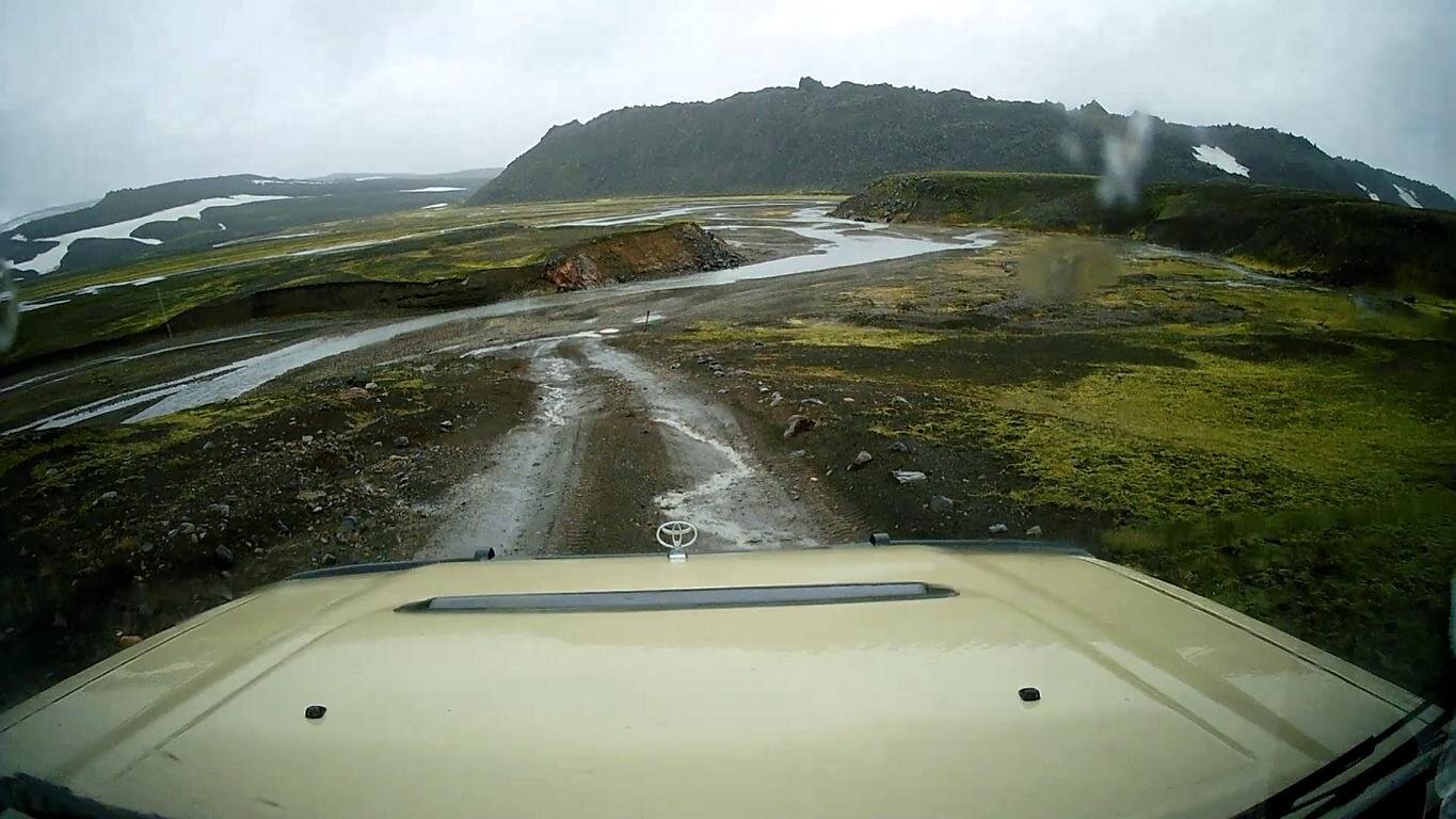
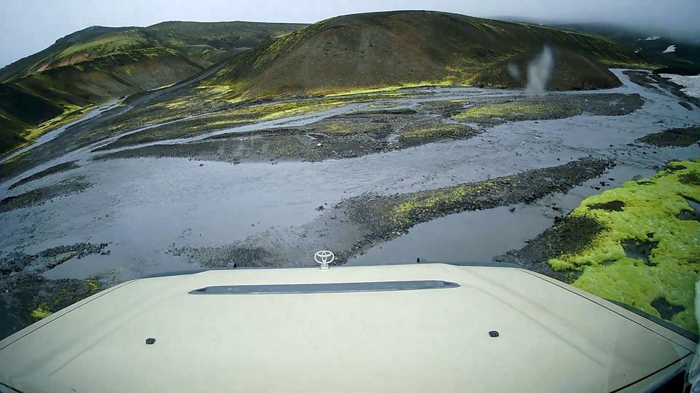
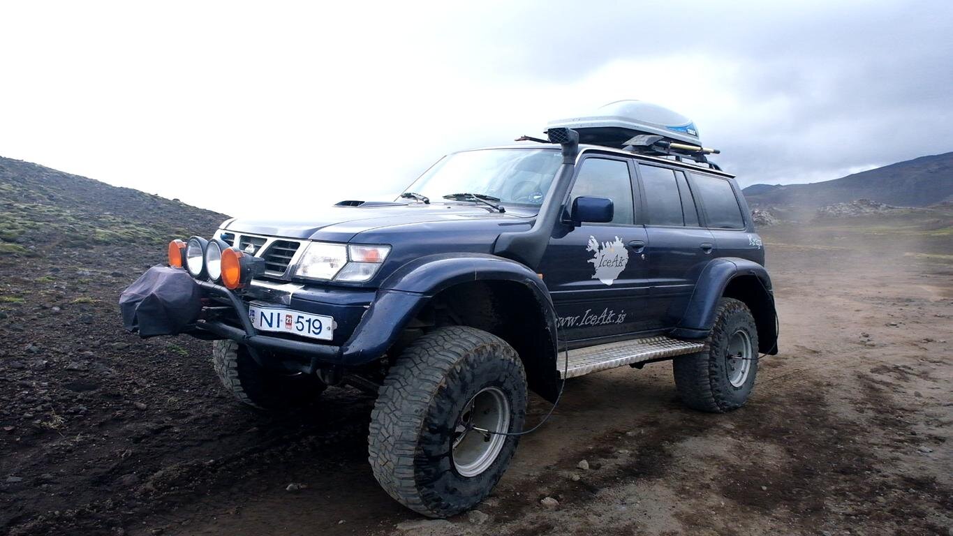
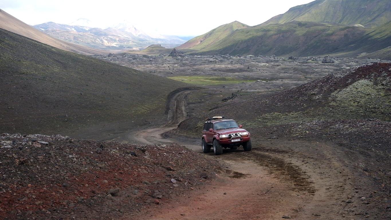
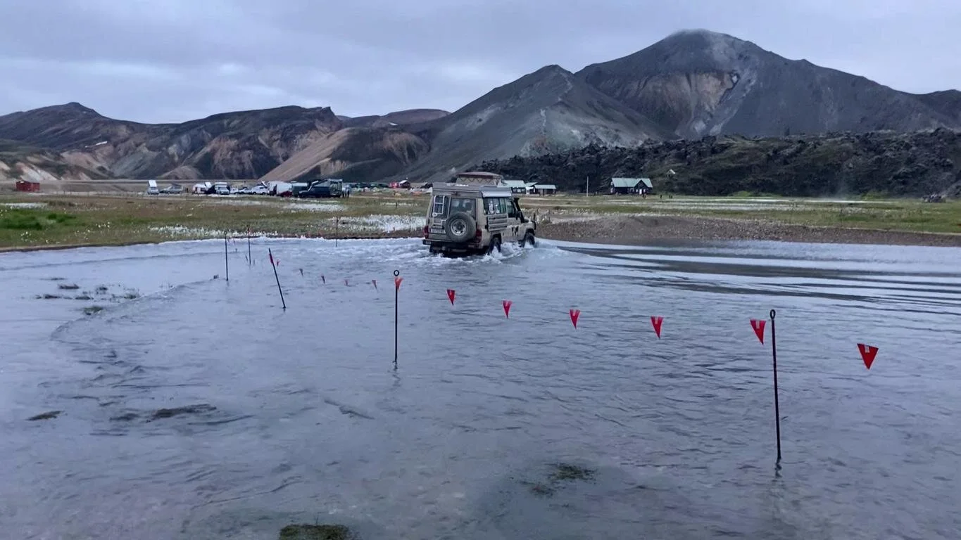
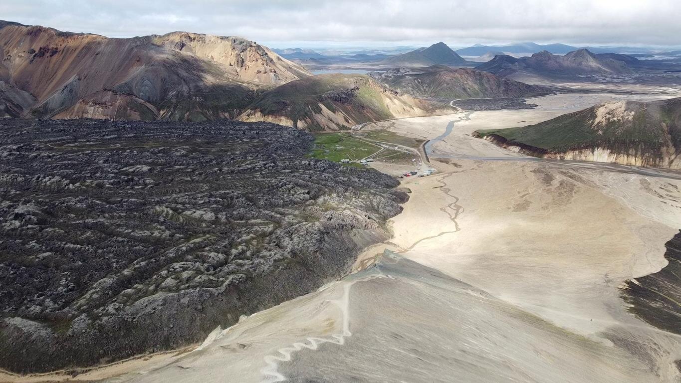
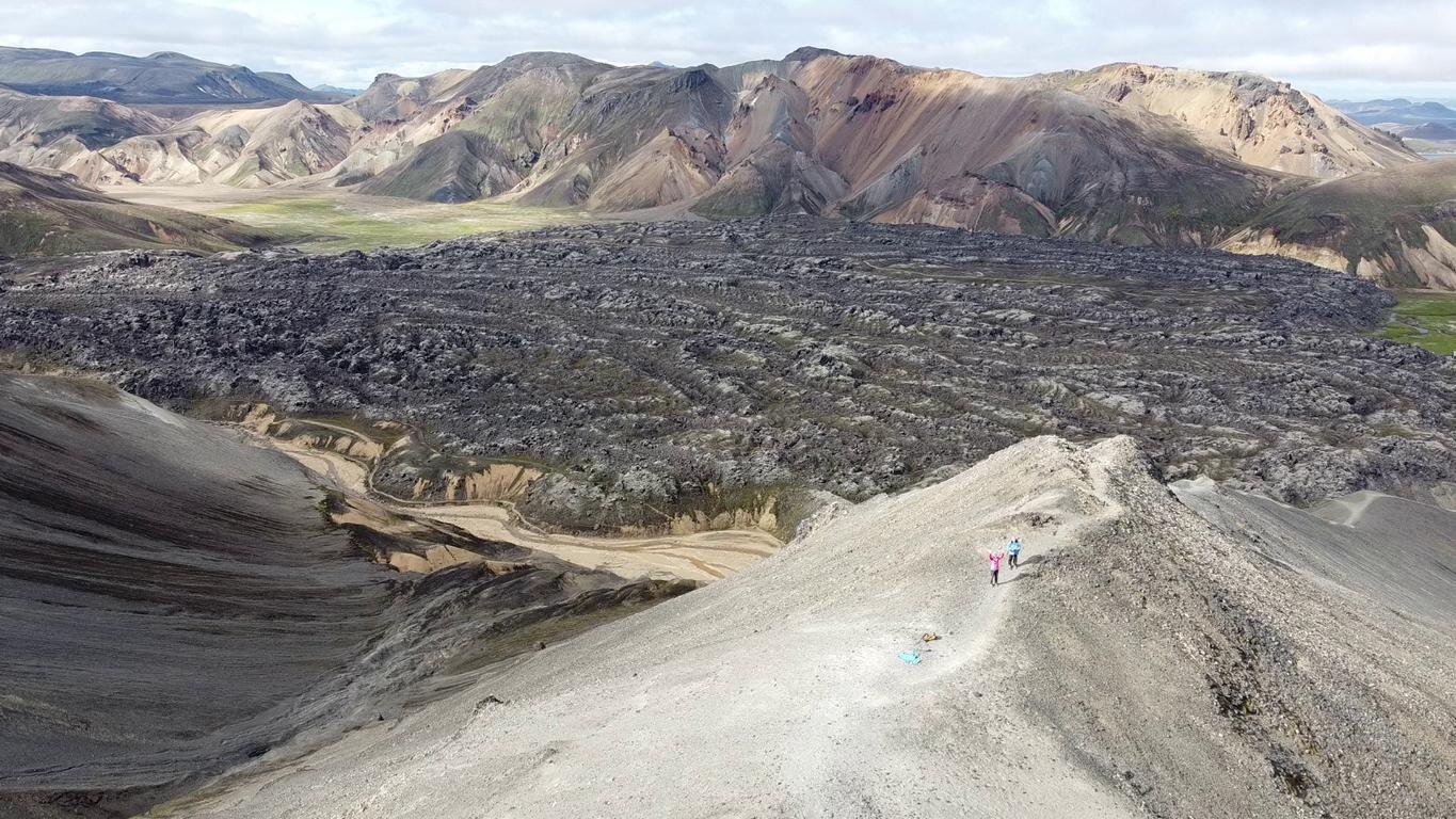
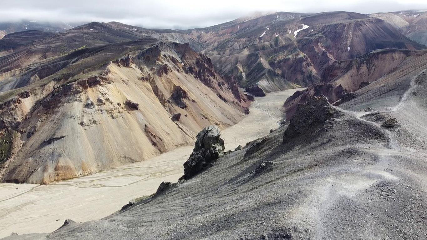
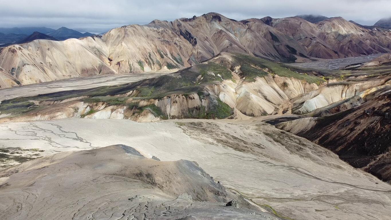
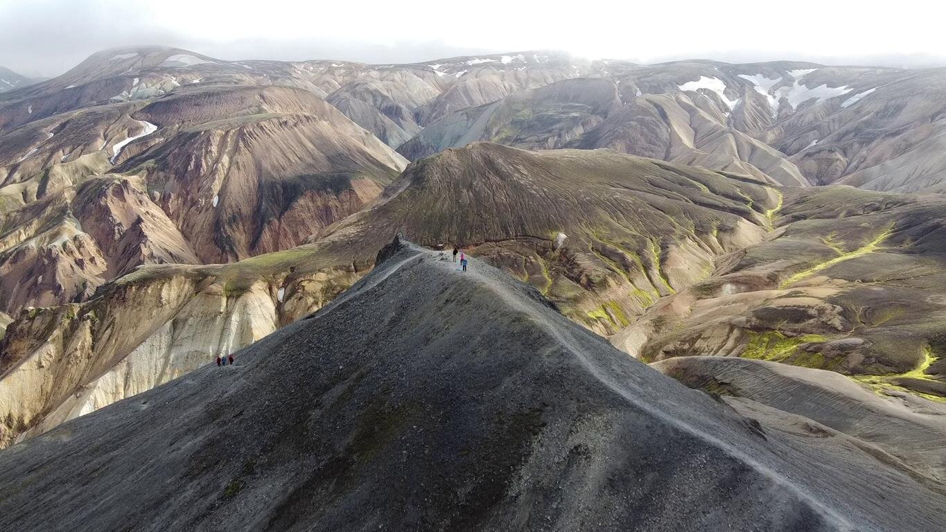
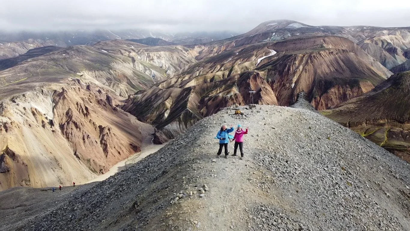
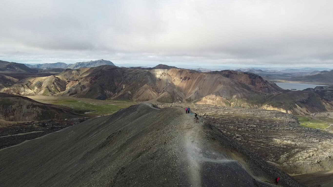
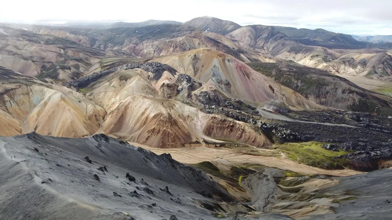
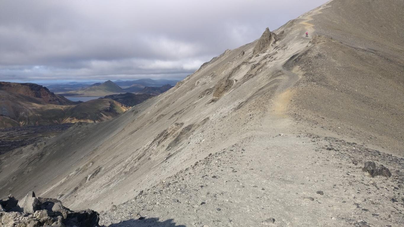
Ein Höhepunkt jeder Islandreise ist der Besuch des Gebiets rund um Landmannerlaugur im Süden von Island. Die vulkanisch geprägte Region besticht mit ihren bizarren Formen und eindrucksvollen Landschaften. Darüber hinaus ist sie ein Eldorado zum 4x4 Fahren. Hinweistafeln weisen darauf hin, dass jedes Fahren abseits der offiziellen Pisten verboten ist.
Highlight of every journey through Iceland is a visit to a place called Landmannerlaugur in the south of the island. The volcanic region stands out with bizarre shapes and impressive landscapes. Beyond that it is wonderland for all 4x4 enthusiasts. Special boards warn drivers to stay on the tracks. Any off-road driving is strictly forbidden.
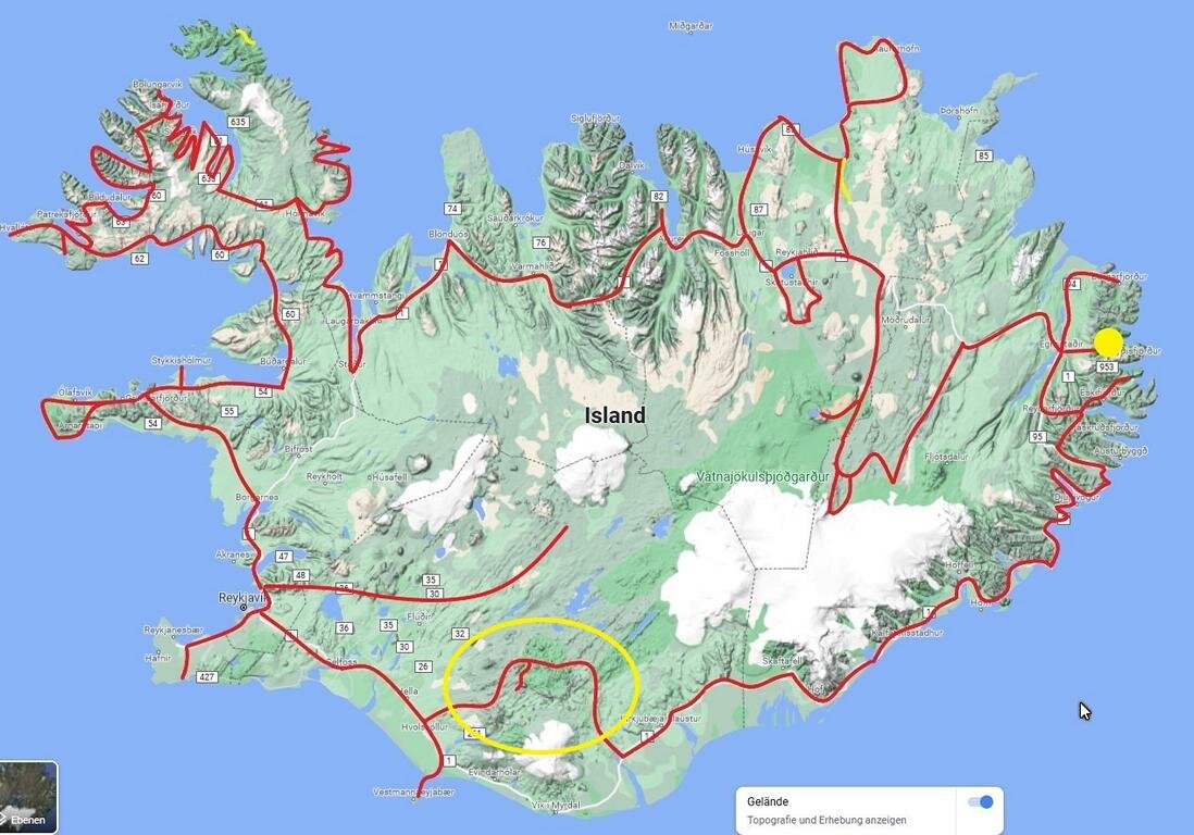
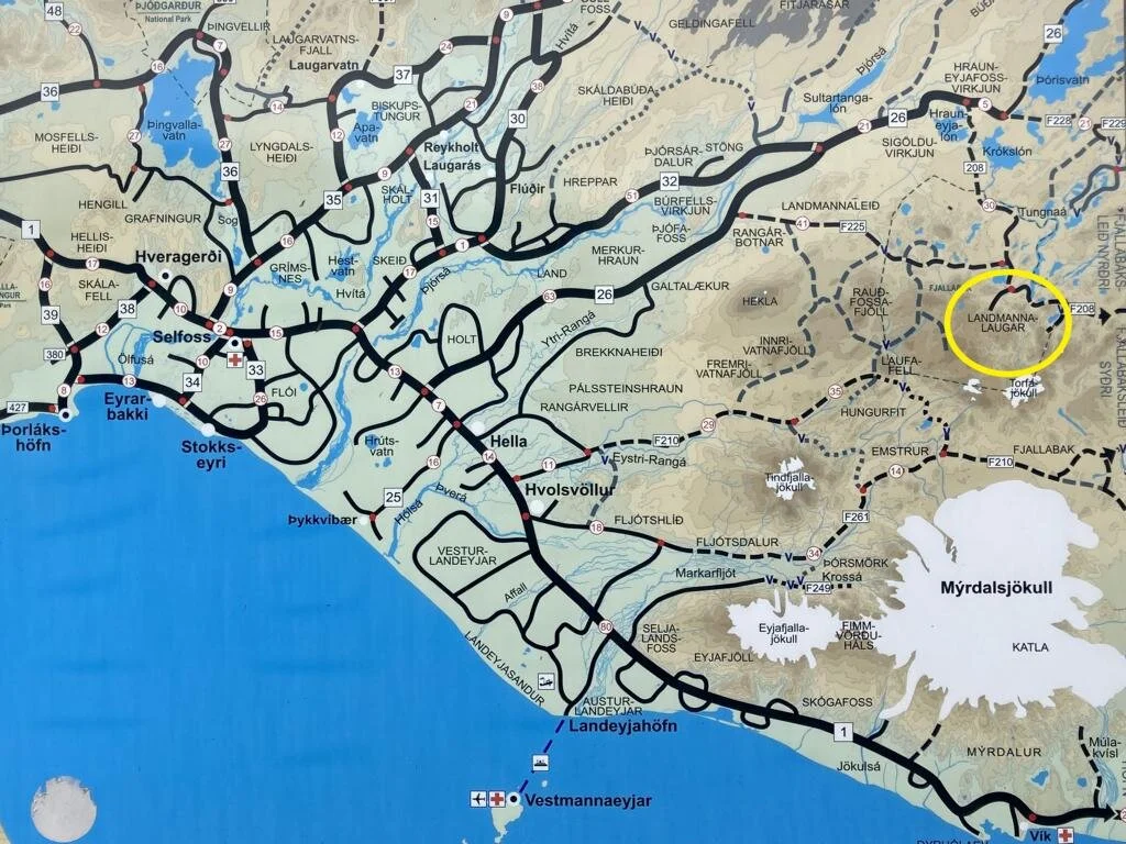
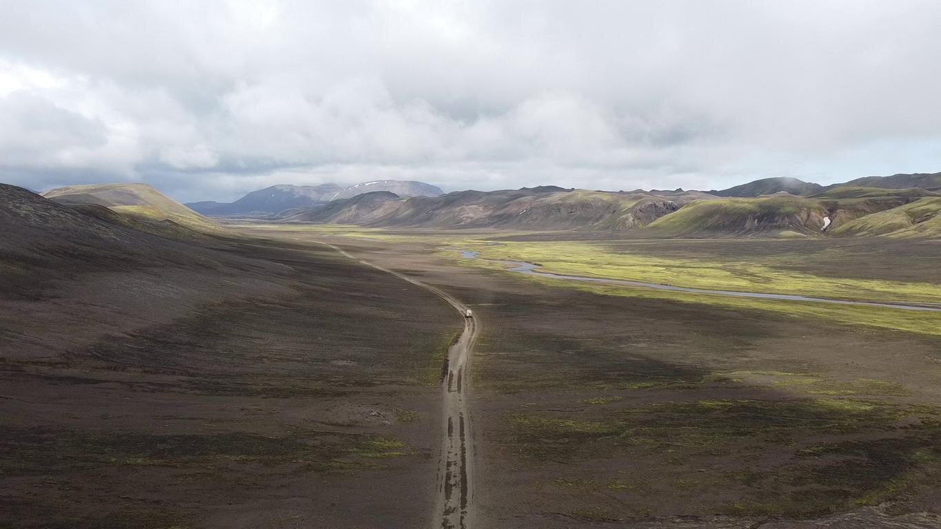
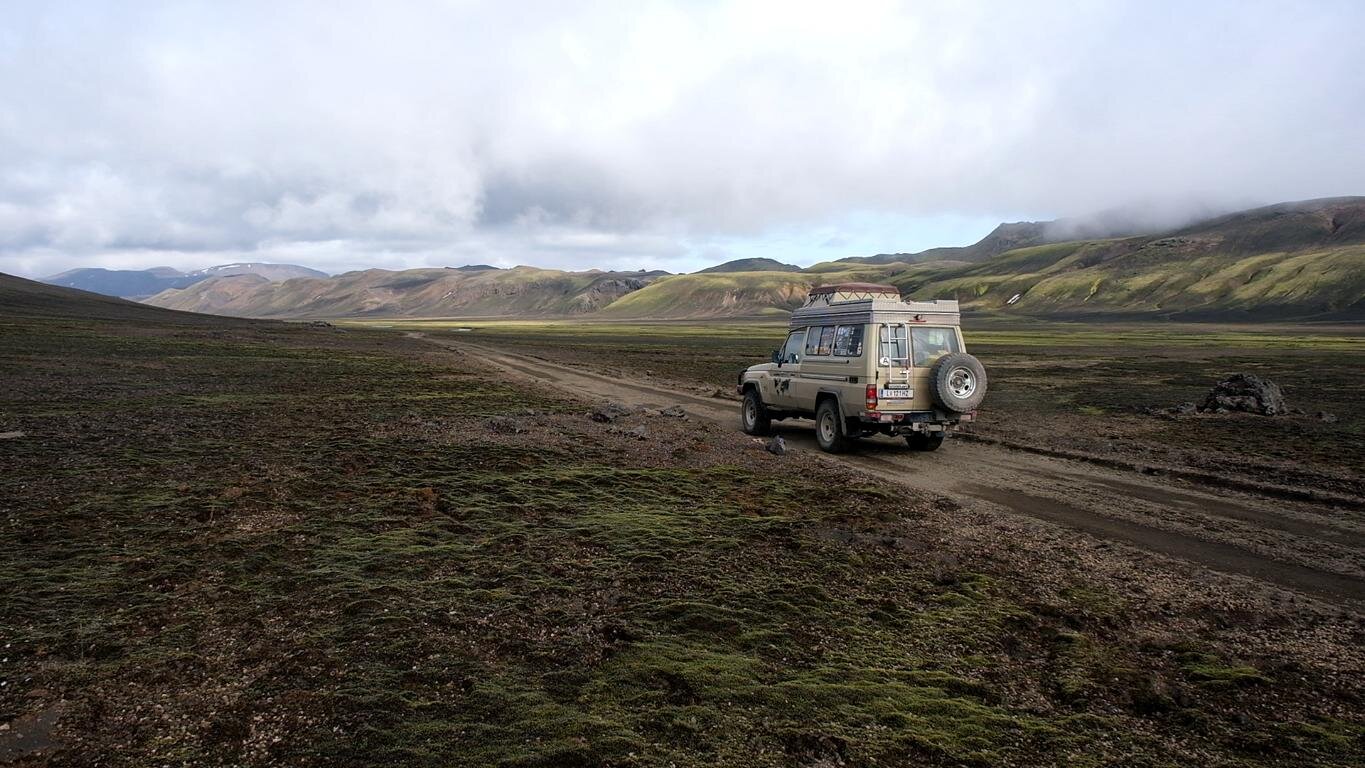
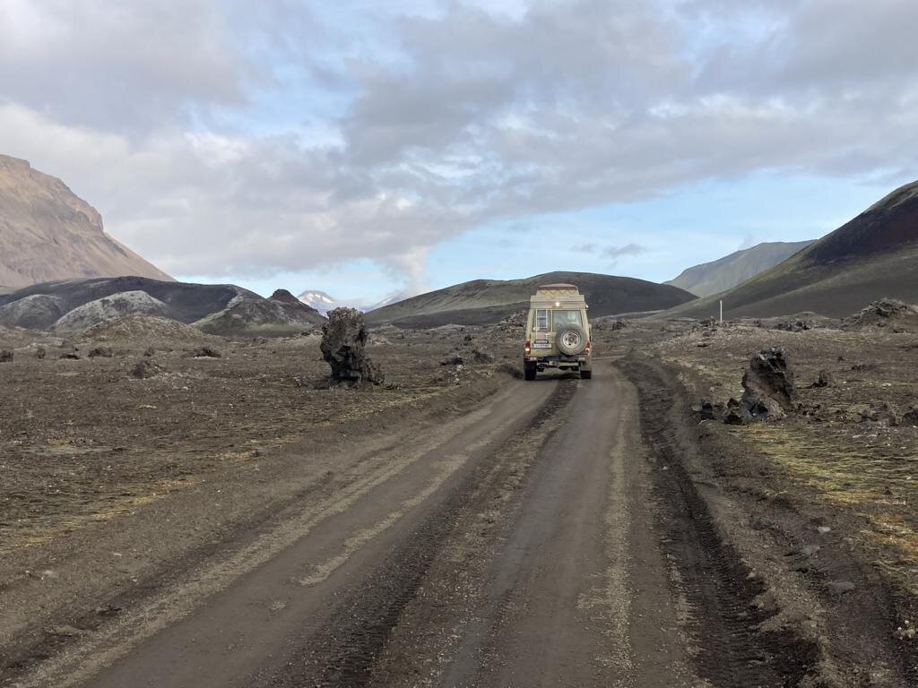
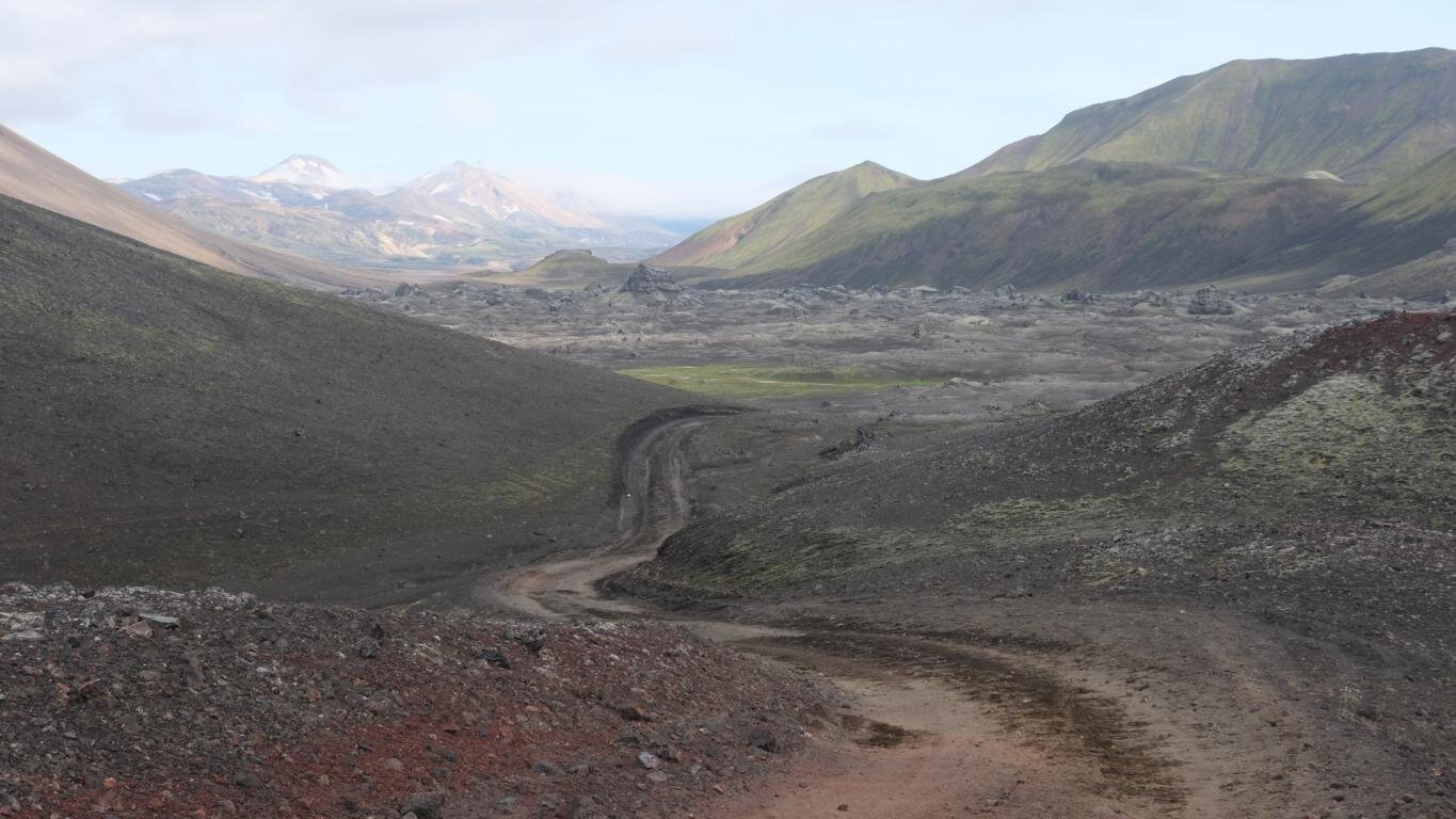
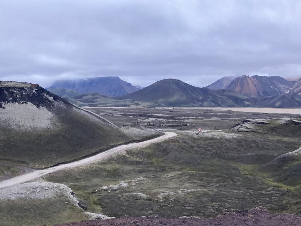
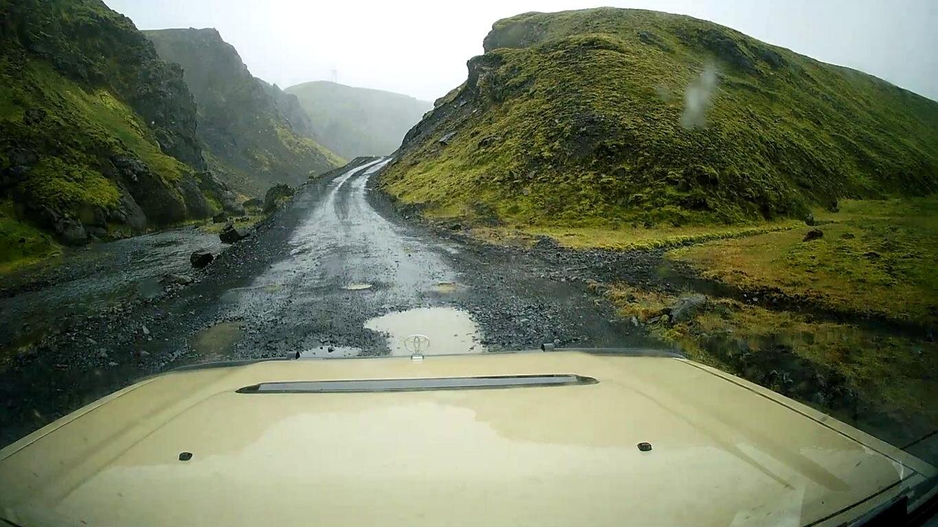
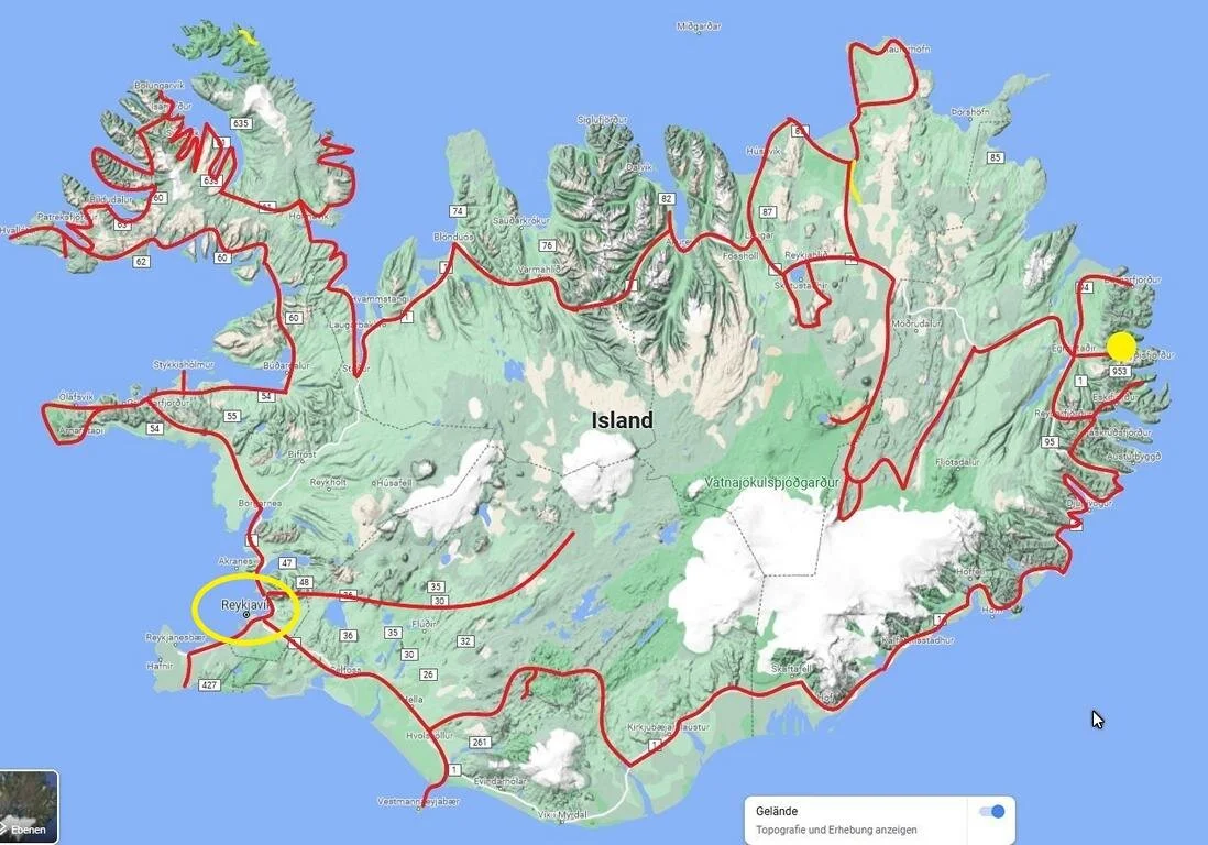
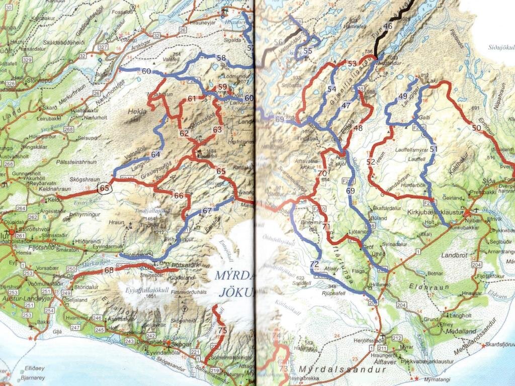
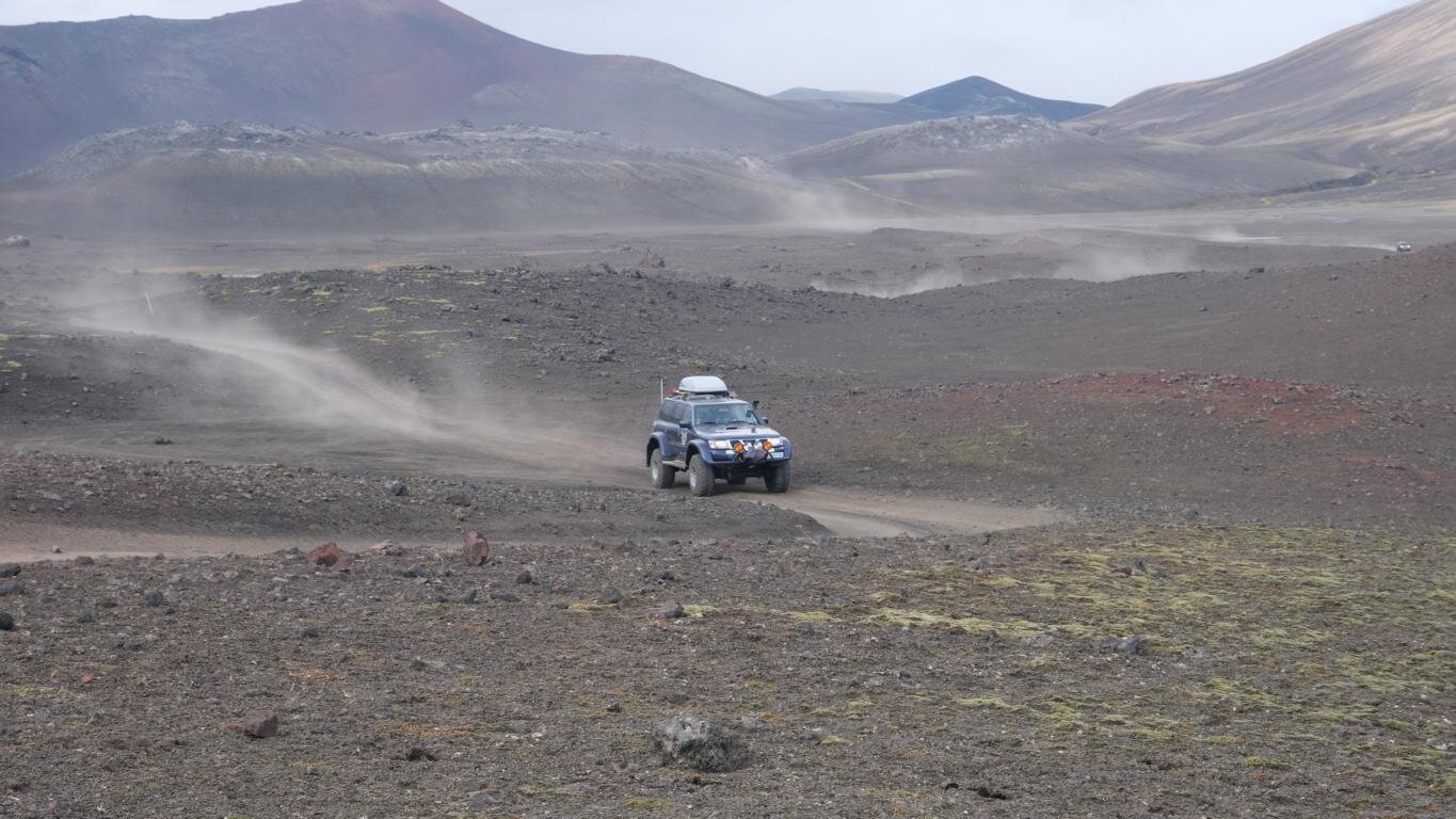
Während mit den Straßen Nr. F 225 und 208 (auf der Karte in blau Nr. 60 und 69) zwei relative einfache Schotterpisten nach Landmannerlaugur führen sind die roten Pisten (Nr. 61 bis 65) deutlich anspruchsvoller und interessanter. Die Landkarte stammt vom Trackbook Island, von Melina Lindenblatt und Matthias Göttenauer.
While there are also two fairly easy gravel roads (# F 225 and 208, in the map marked in blue # 60 and 69) leading to Landmannerlaugur the red tracks (# 61 to 65) are significantly more difficult and interesting. The map is copied from Trackbook Island, written by Melina Lindenblatt and Matthias Göttenauer.
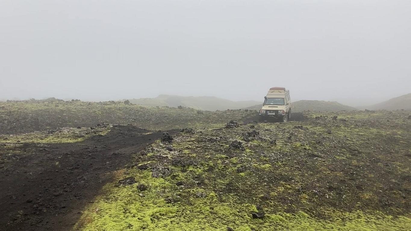
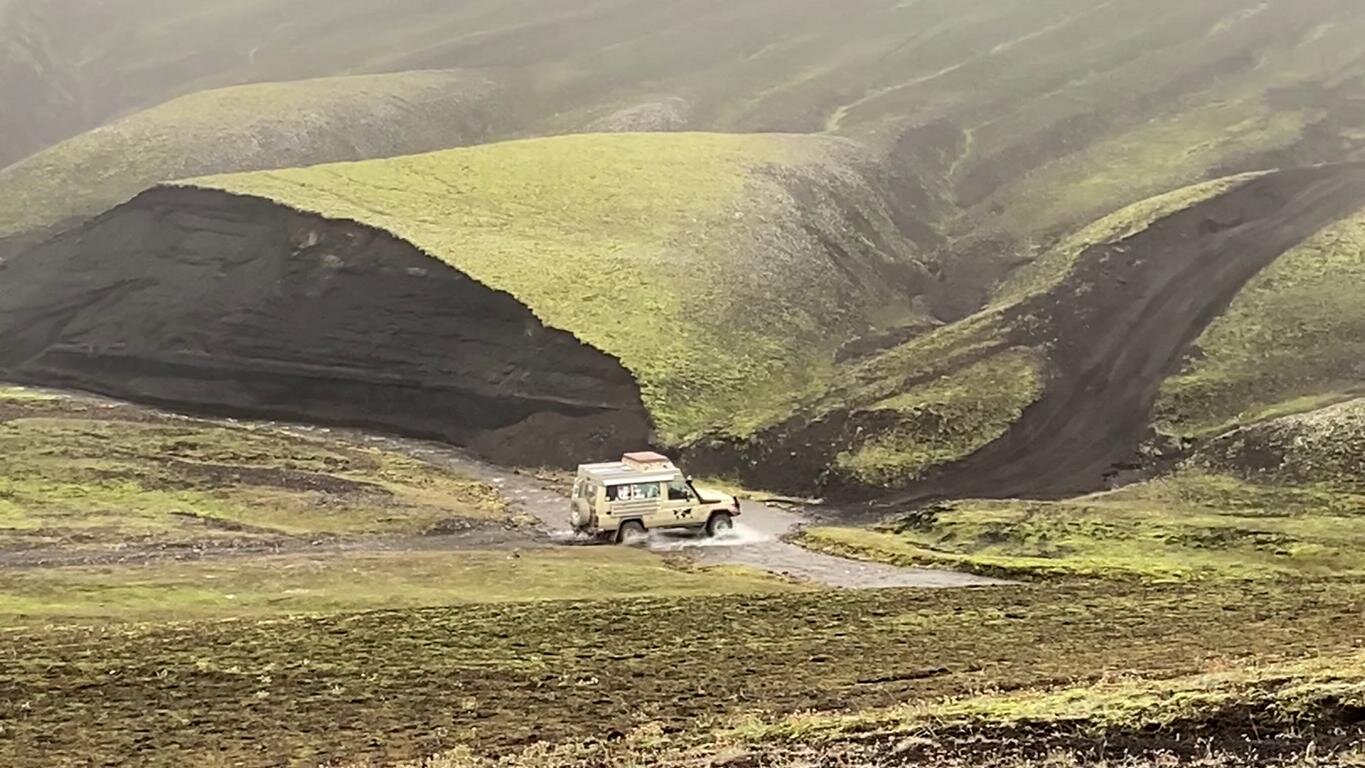
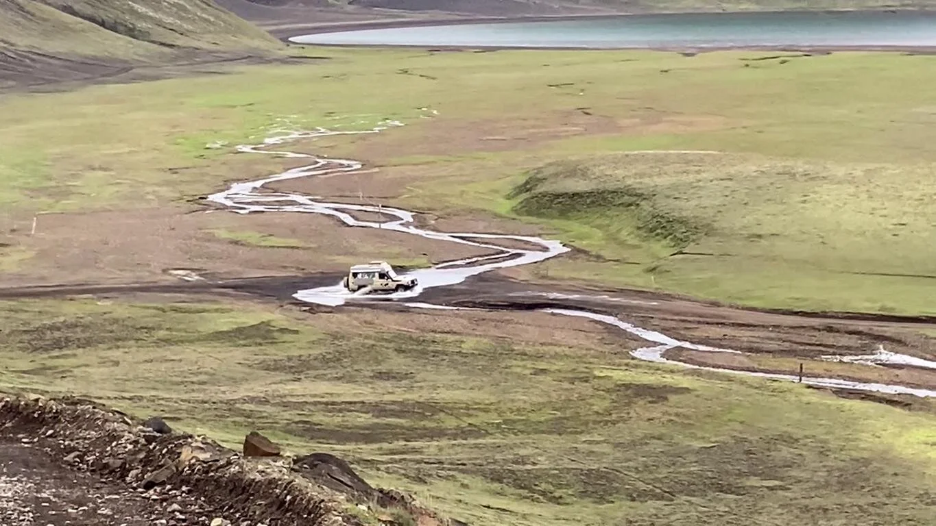
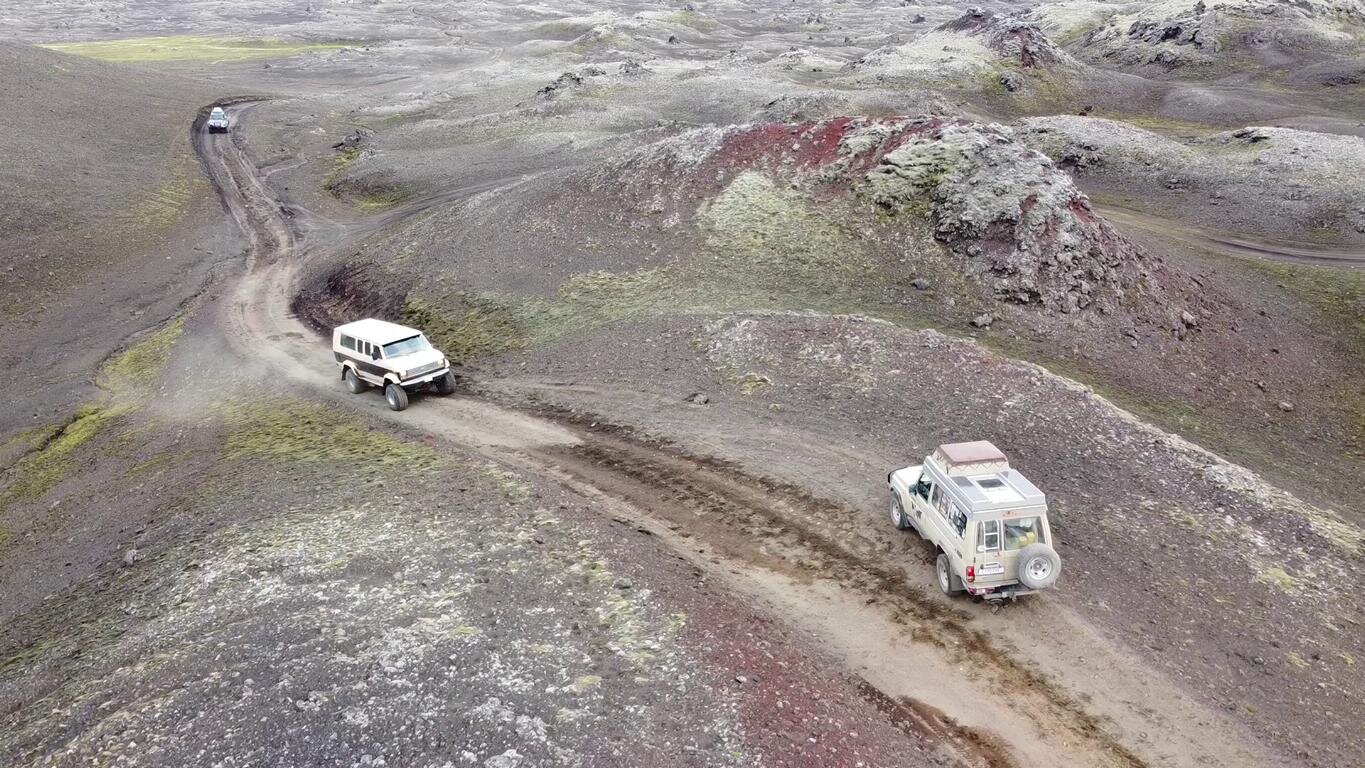
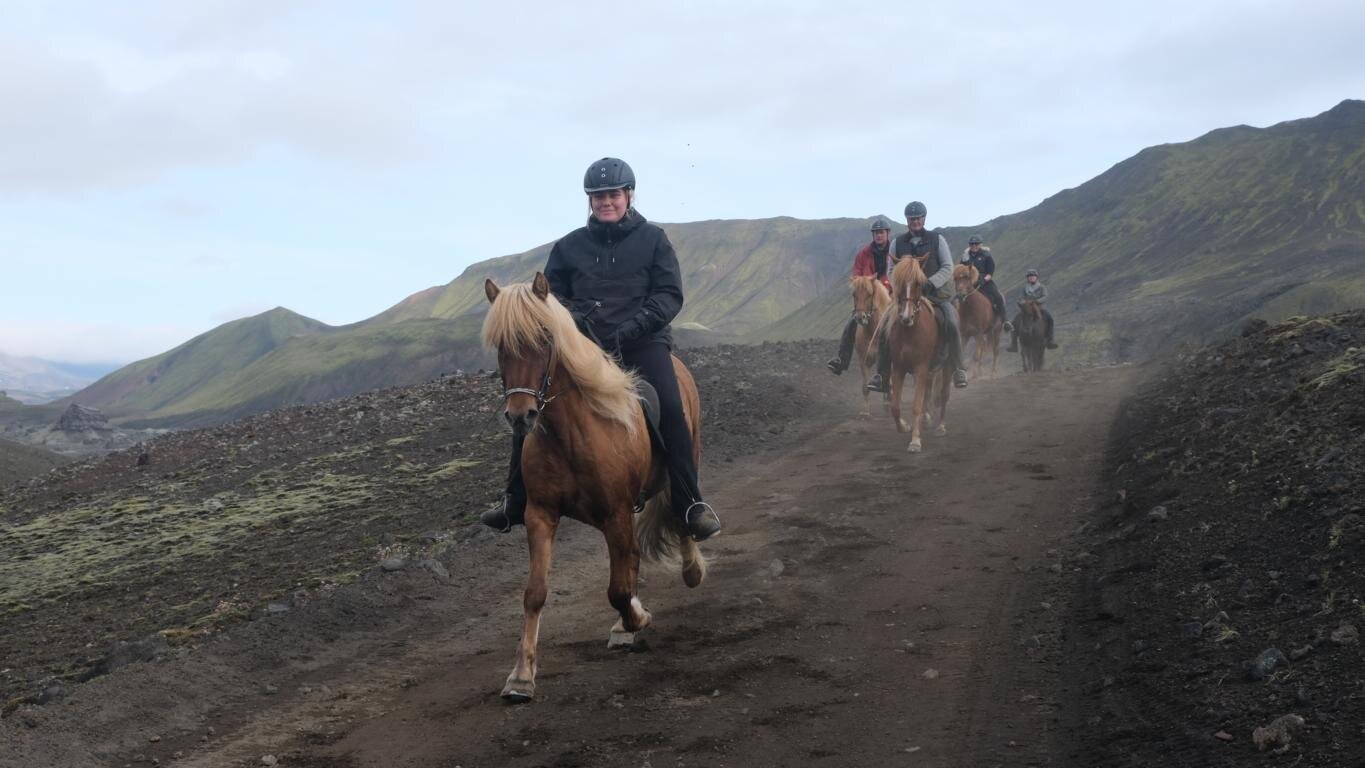
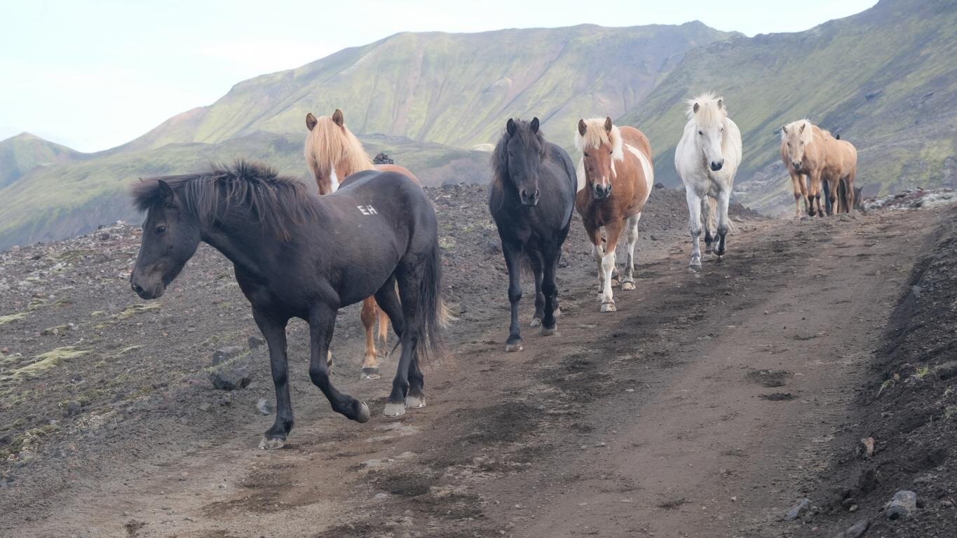
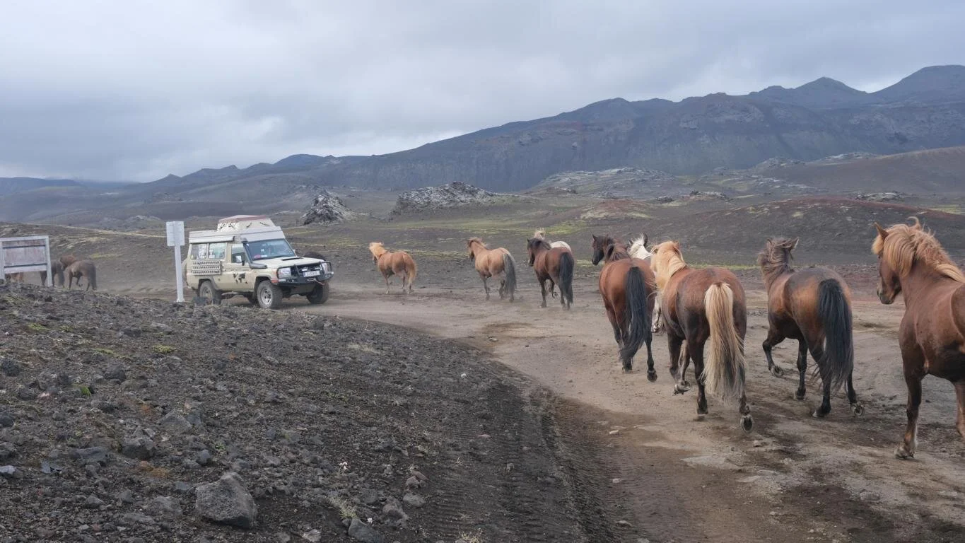
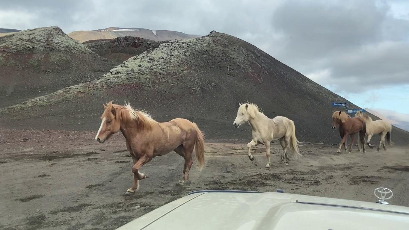
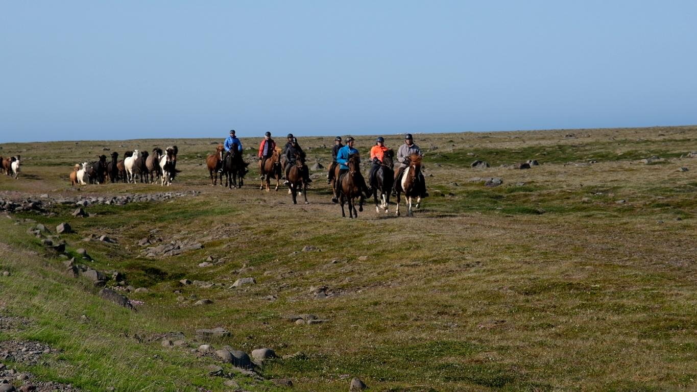
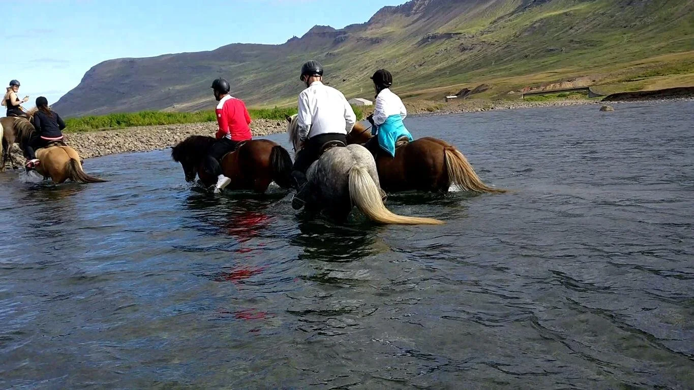
Selbst auf diesen Pisten trifft man mitunter auf Gegenverkehr und gelegentlich kommt einem sogar eine Reitergruppe mit einer Herde Ersatzpferde entgegen.
Even on this remote tracks one meets oncoming traffic and occasionally one even runs into a group of horsemen with a herd of back up horses behind them.
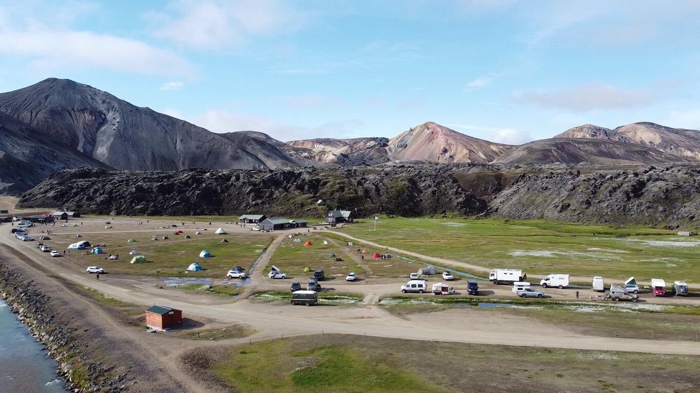
Landmannerlaugur ist eine kleine Oase in der Mitte einer Steinwüste. Direkt neben dem Campingplatz befindet sich eine heiße Quelle, die zum Baden einlädt und besonders bei Schlechtwetter gut besucht ist.
Landmannerlaugur is a small oasis in the middle of a stone desert. Adjacent to the camp ground there is a hot spring ready for taking a bath, particular when it rains.

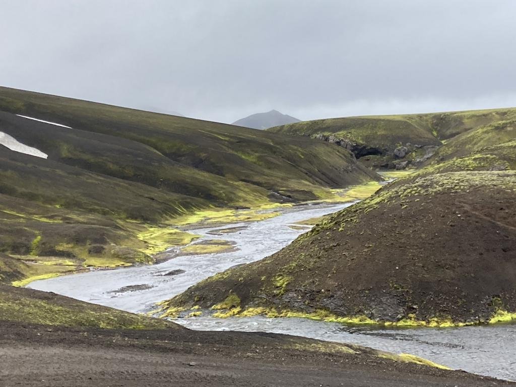
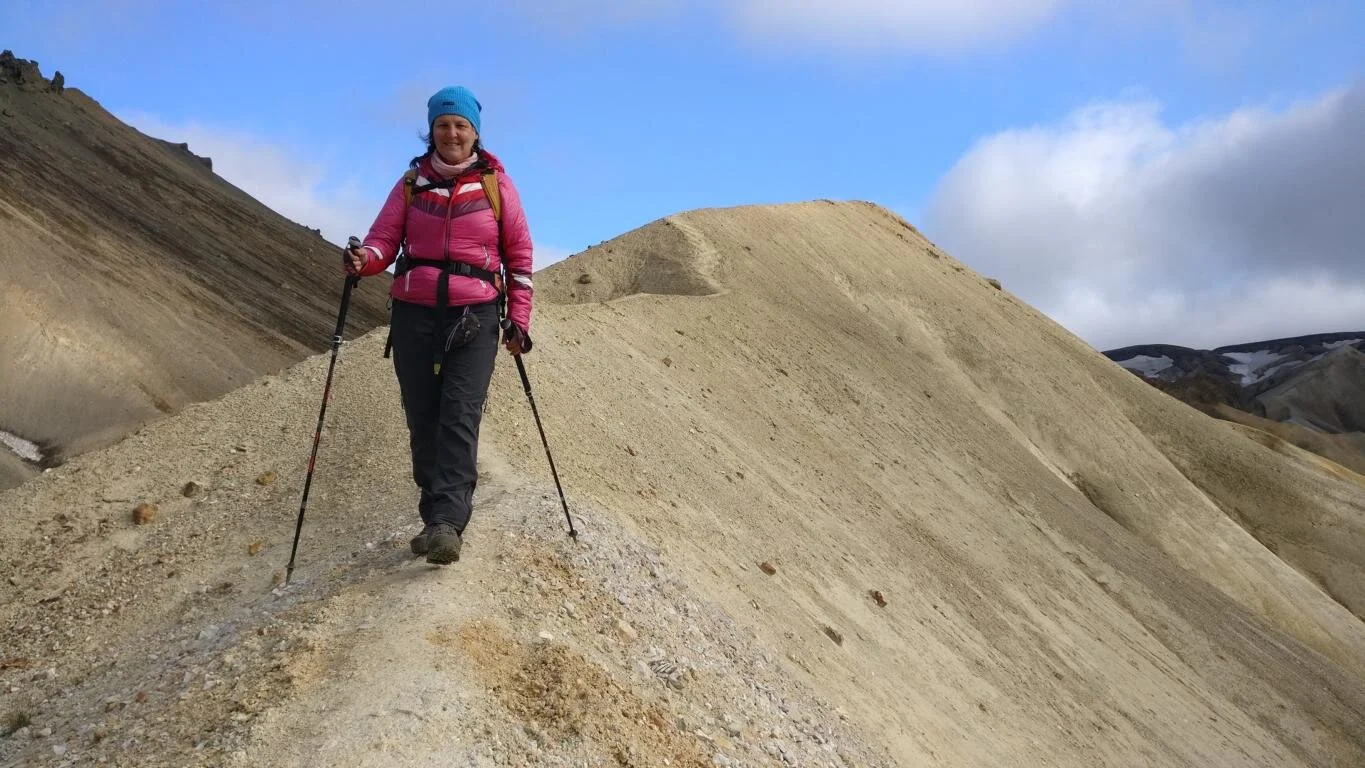
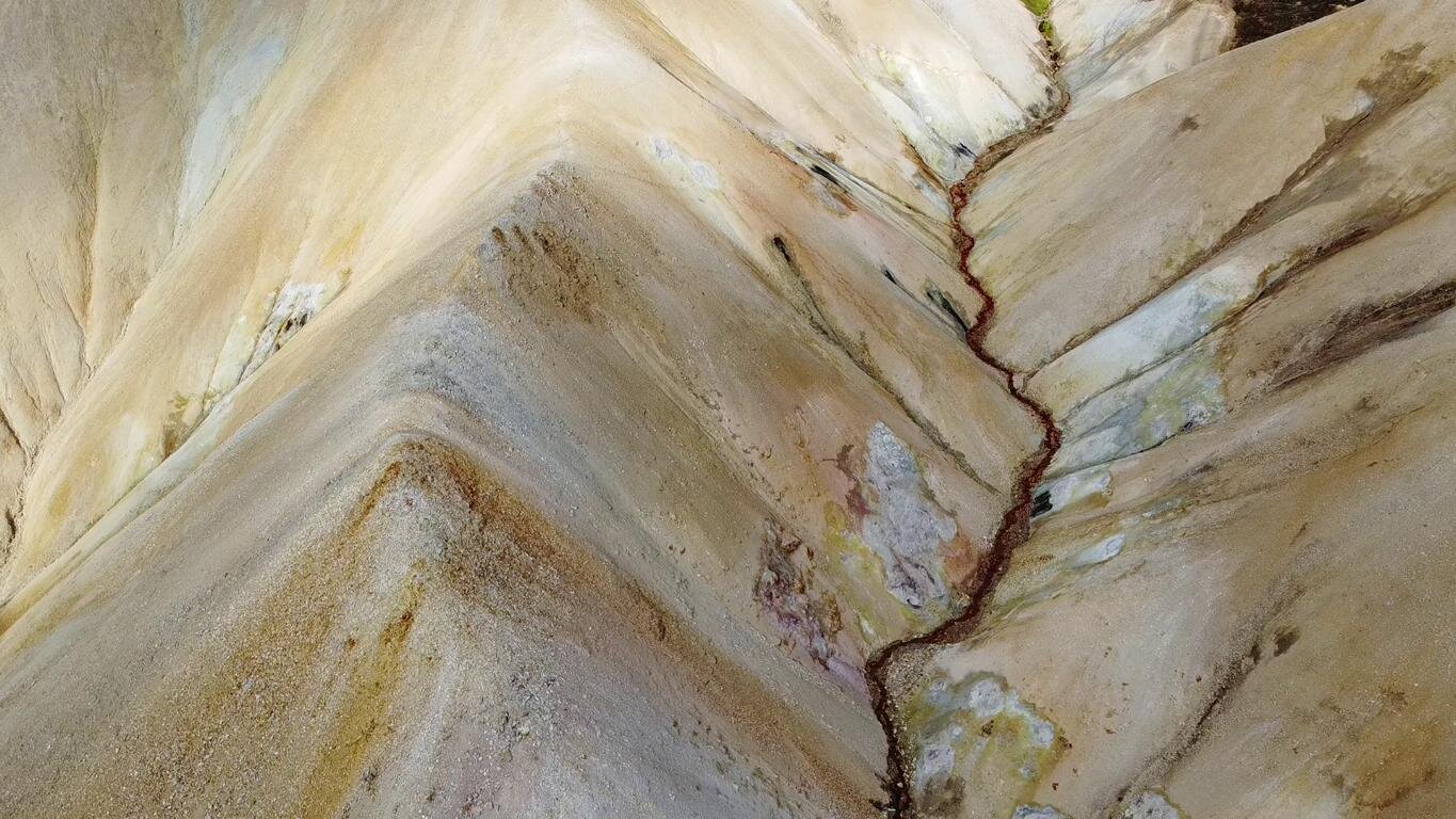
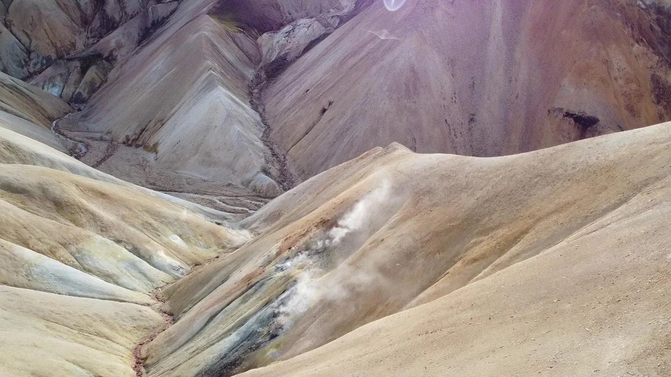
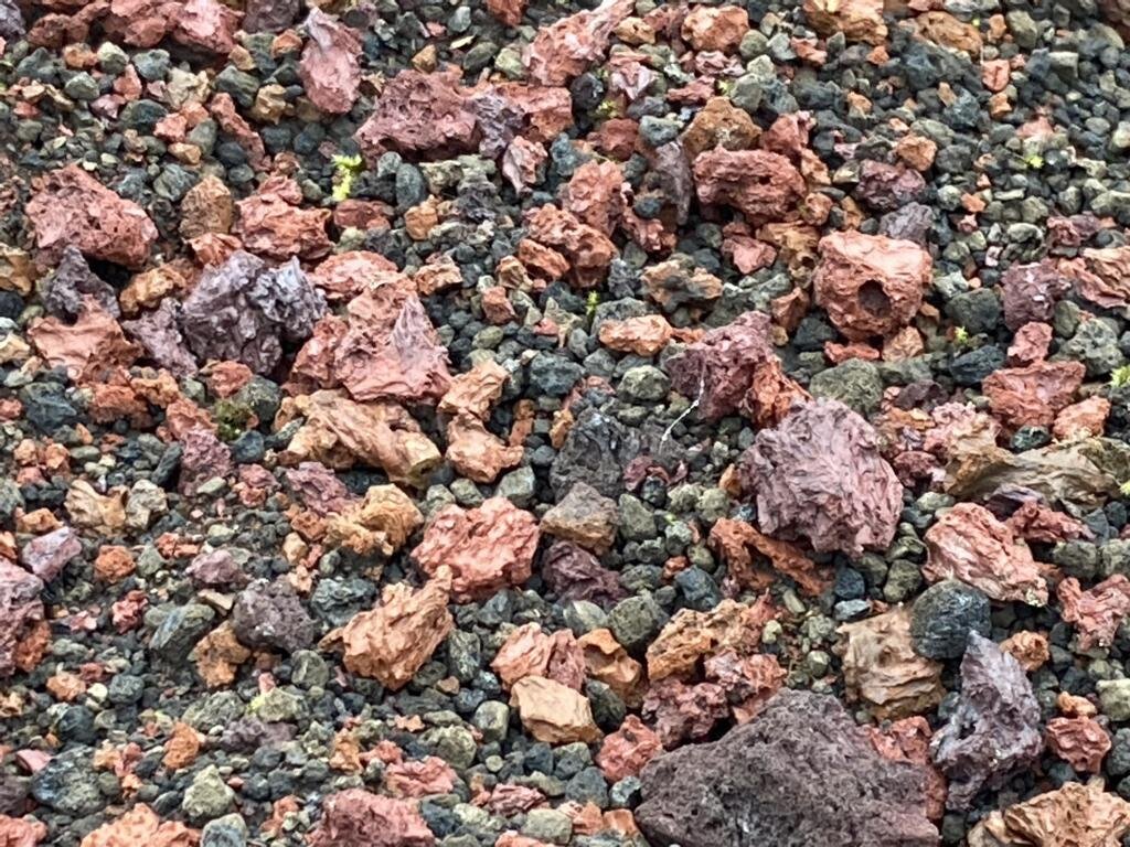
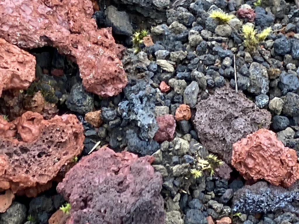
Von Landmannerlaugur aus kann man zahlreiche Ein- oder Mehrtages-Wanderungen unternehmen. Die Rundwanderung auf den 945 m hohen Berg Blahnukur und um das Laugahraun Lava Feld ermöglichen einen großartigen Ausblick auf diese einzigartige Landschaft. Die Vielfalt der Farben des Gesteins stammen von unterschiedlichen Vulkanausbrüchen.
Starting from Landmannerlaugur there are several multi- or one-day hikes. Climbing the 945 m / 3,000 feet high Mount Blahnukur and walking around the Laugahraun lava field provide a stunning view over this unique landscape. The variety of the stones’ colors originates from different volcanic eruptions.
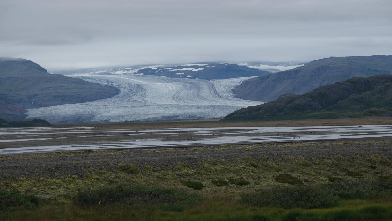
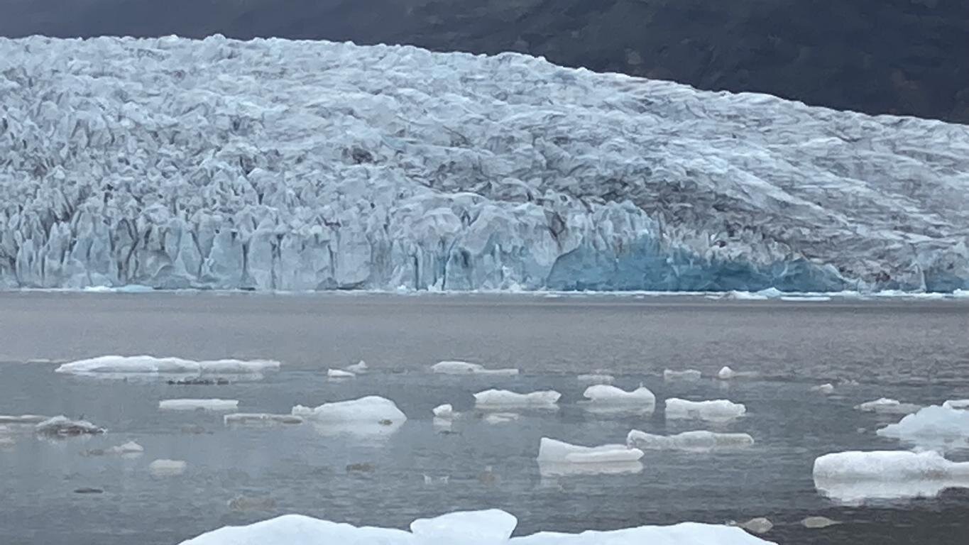
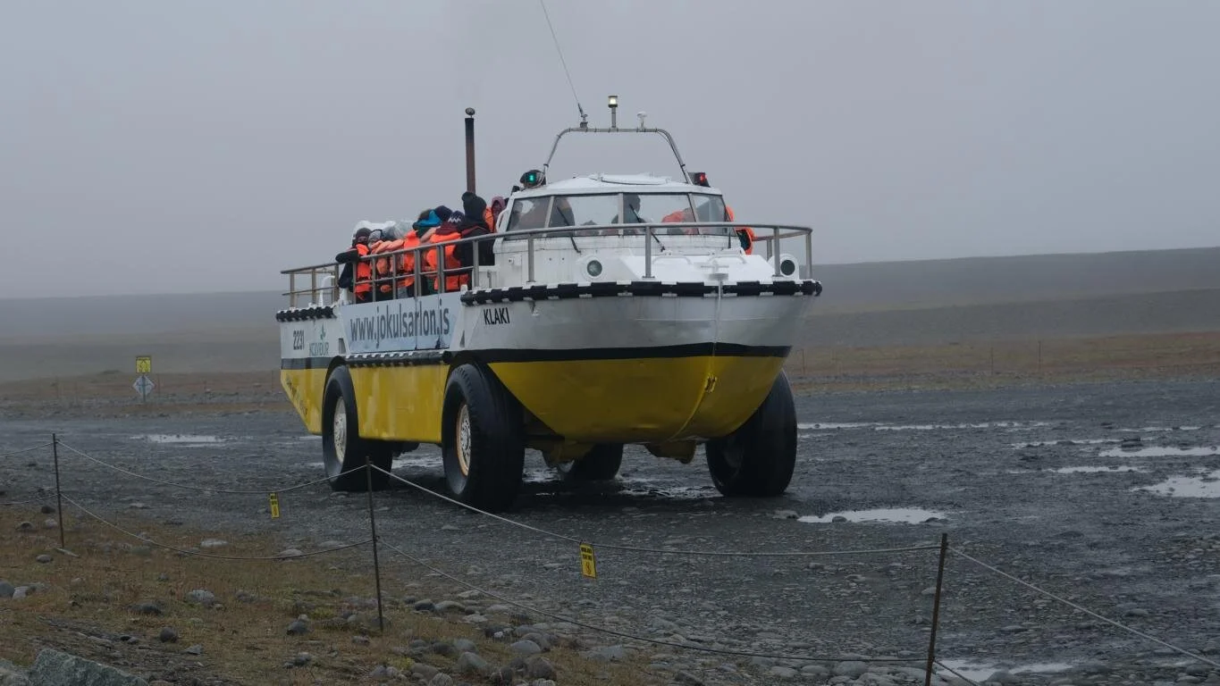
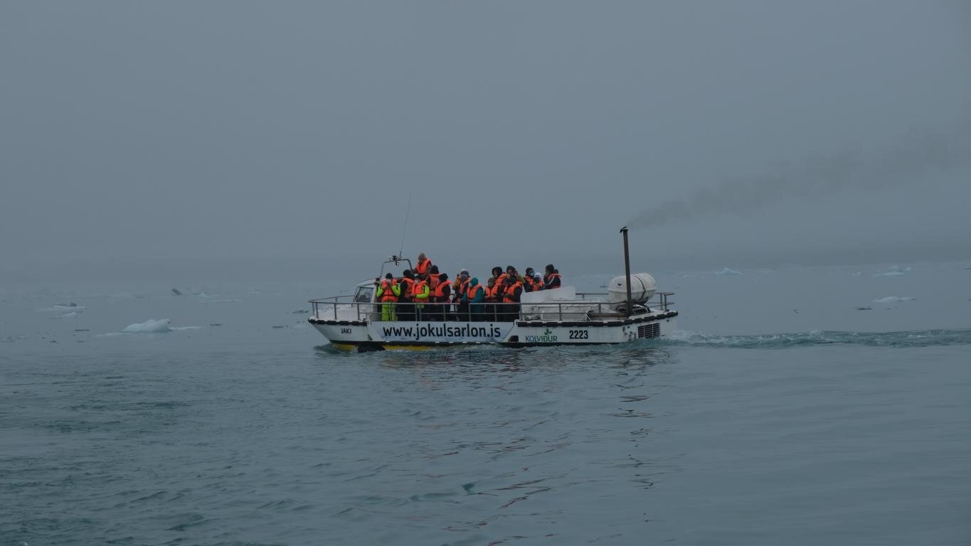
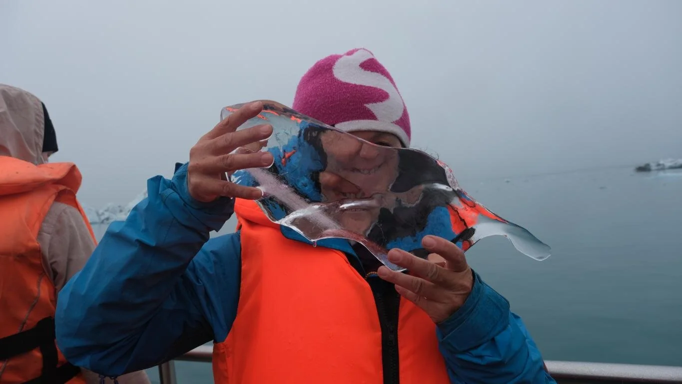
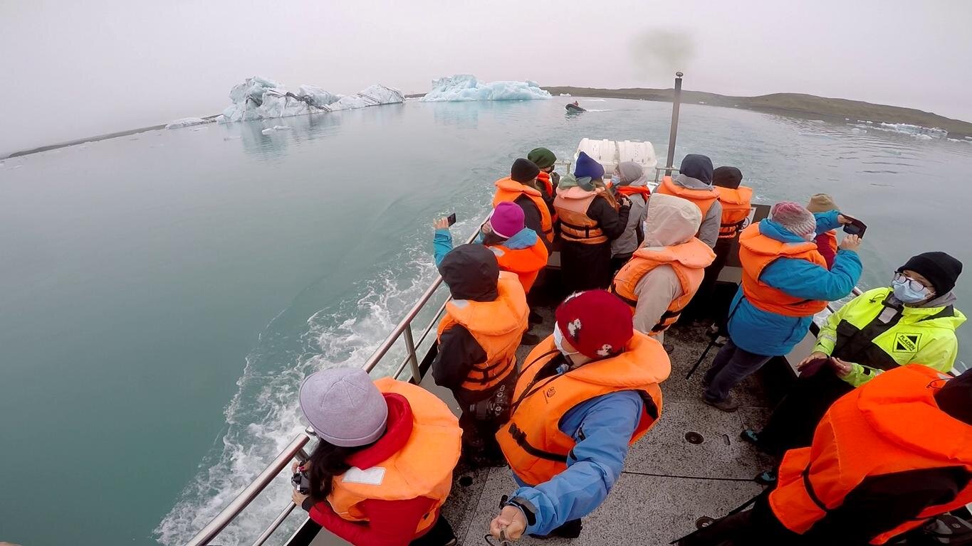
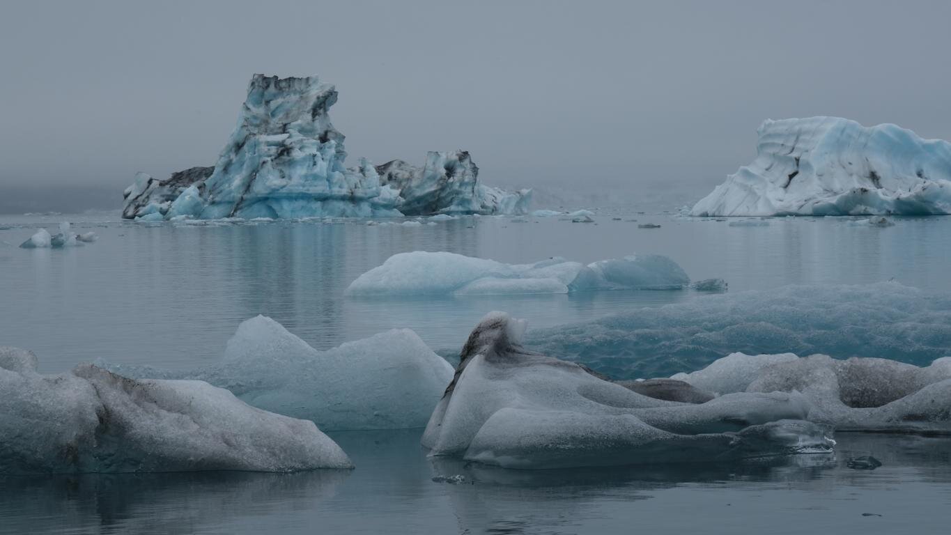
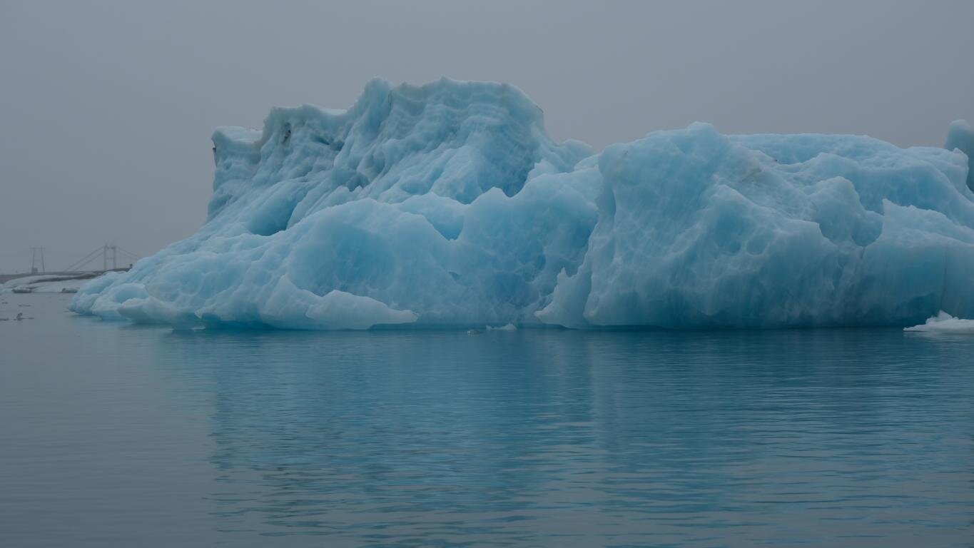
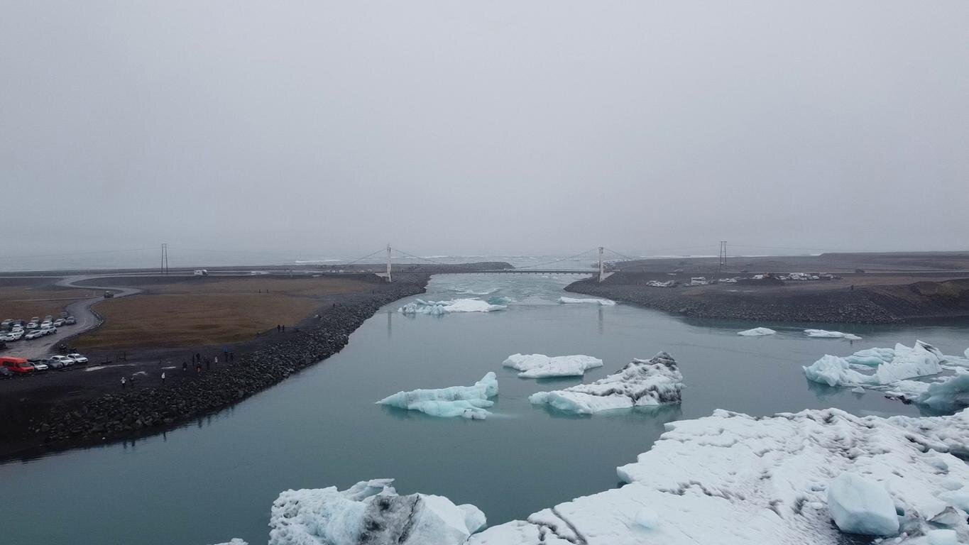
Der Vatnajökull Gletscher ist mit einer Ausdehnung von 8.100 km2 und einer Eisdicke von bis zu 1.000 m der größte Gletscher Europas. Bis vor wenigen Jahrzehnten reichte der Gletscher bis ans Meer. Heute trennt ein langsam breiter werdender Landstreifen den Gletscher vom Atlantik, sodass der Vatnajökull in eine Lagune kalbt, aus der in den nächsten Jahrhunderten ein Fjord entstehen wird. Von einem Amphibienfahrzeug aus kann man aus nächster Nähe beobachten, wie die abgebrochenen Eisberge durch eine schmale Öffnung auf das offene Meer treiben.
With an extent of 8,100 km2 / 3,120 sq miles and 1,000 m / 3,000 feet thickness of ice the Vatnajökull is Europe’s largest glacier. It was only a few decades ago that this glacier extended until the sea. Today a small strip of land separates the glacier from the Atlantic. Currently the Vatnajökull is calving into a small lagoon which in the coming centuries will turn into a fjord. Riding on an amphibian vehicle one can observe from short distance how the icebergs are floating through a small outlet into the ocean.

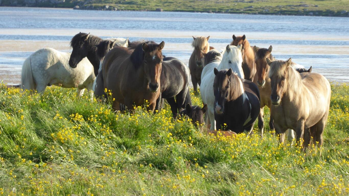
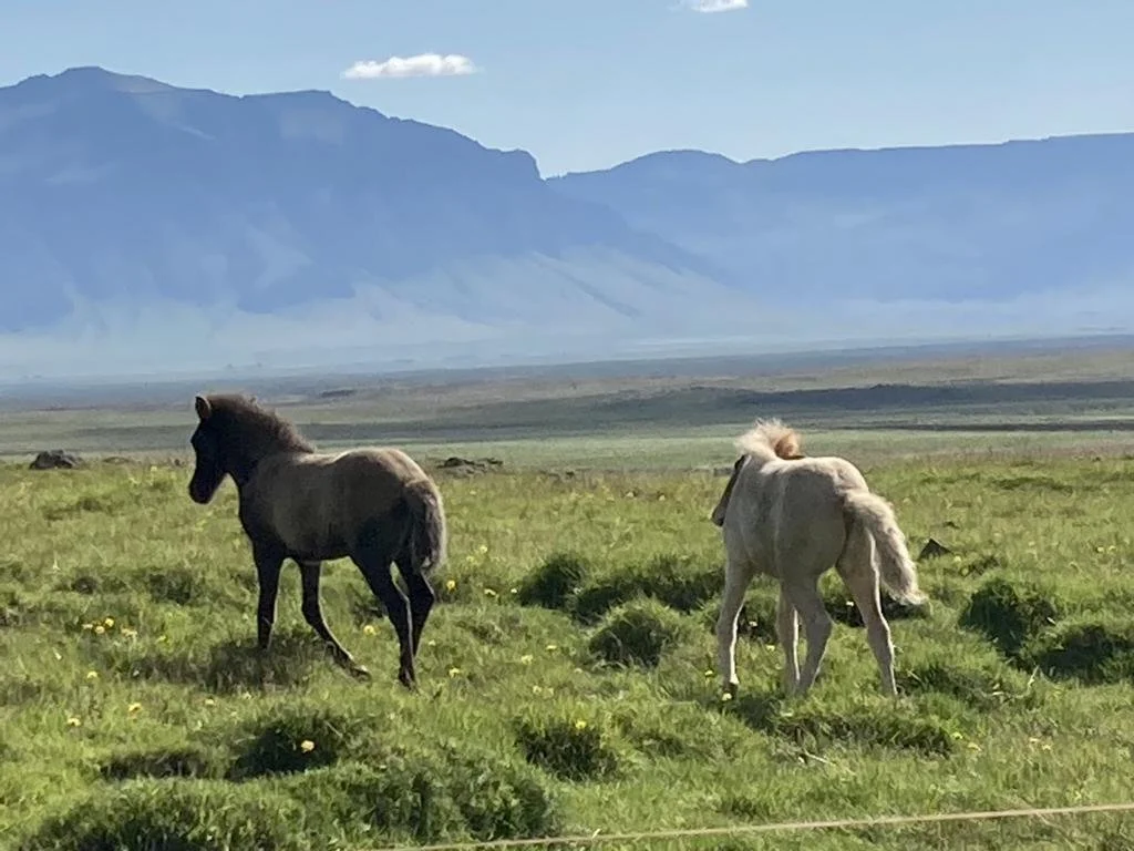
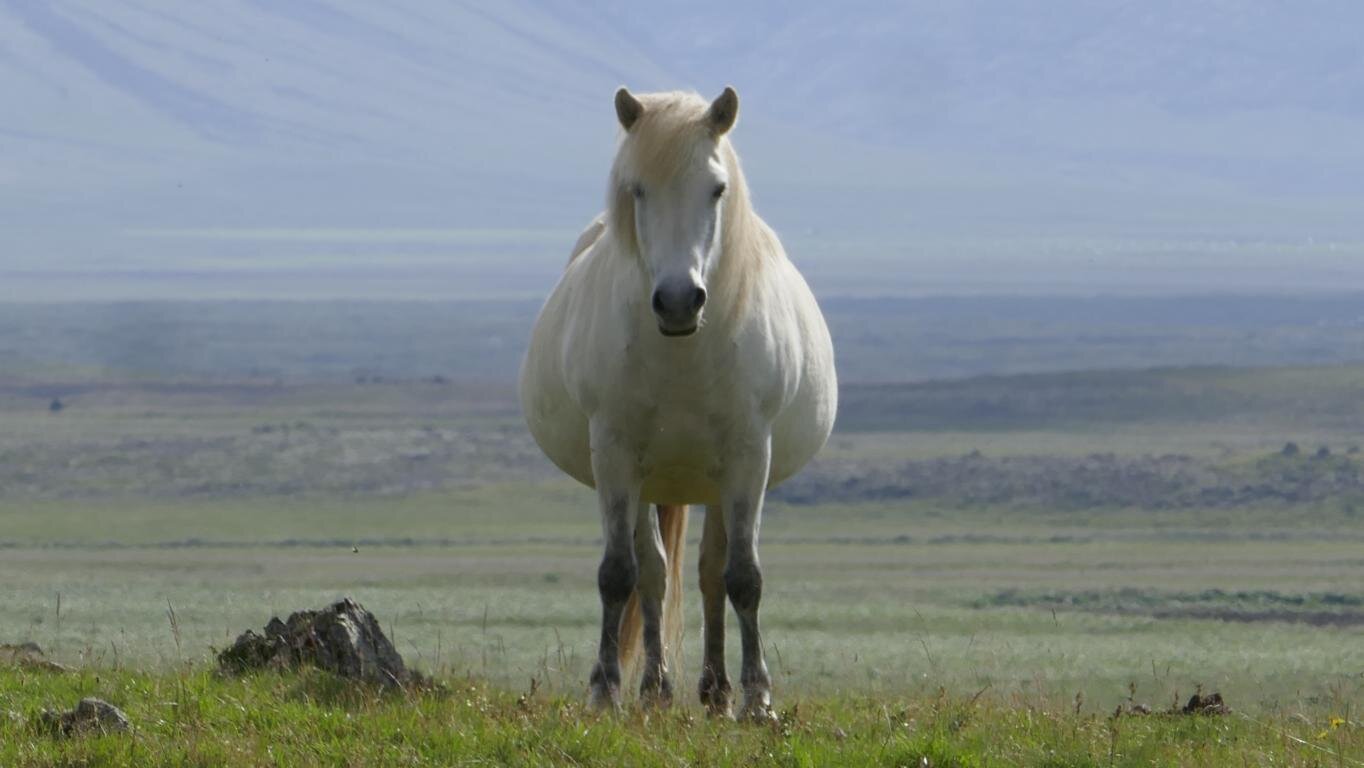
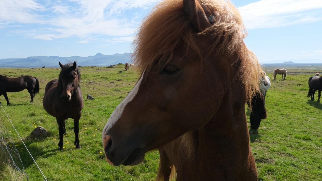
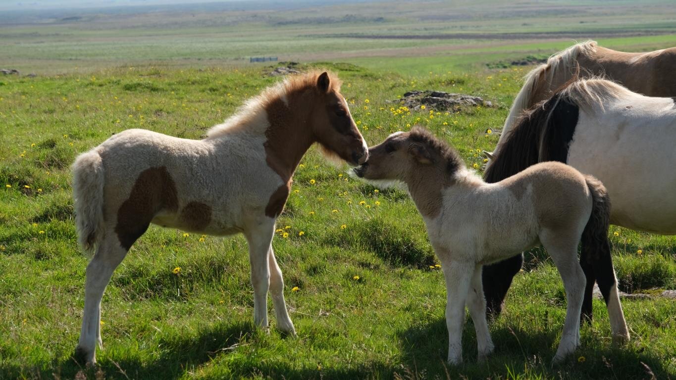
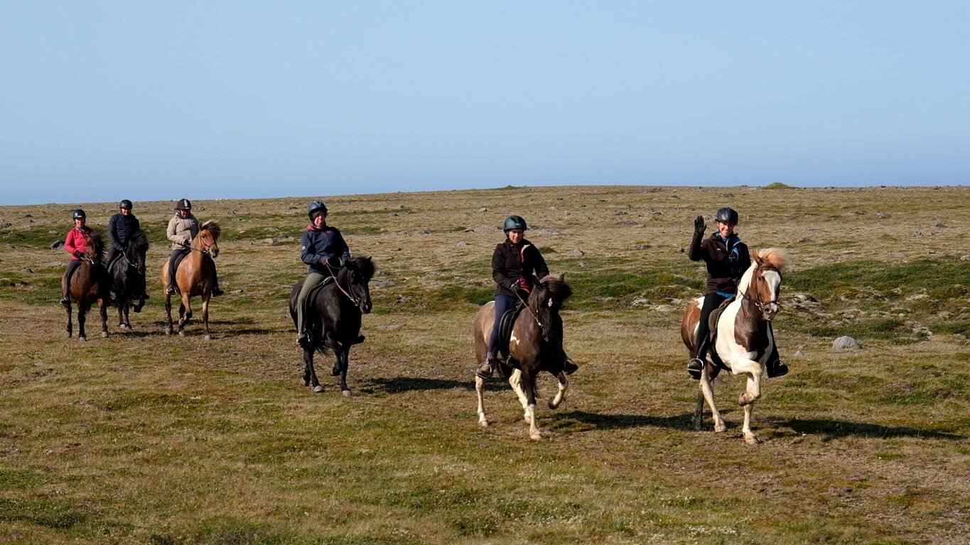
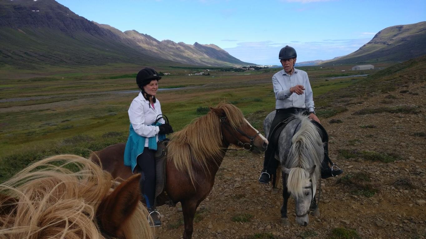
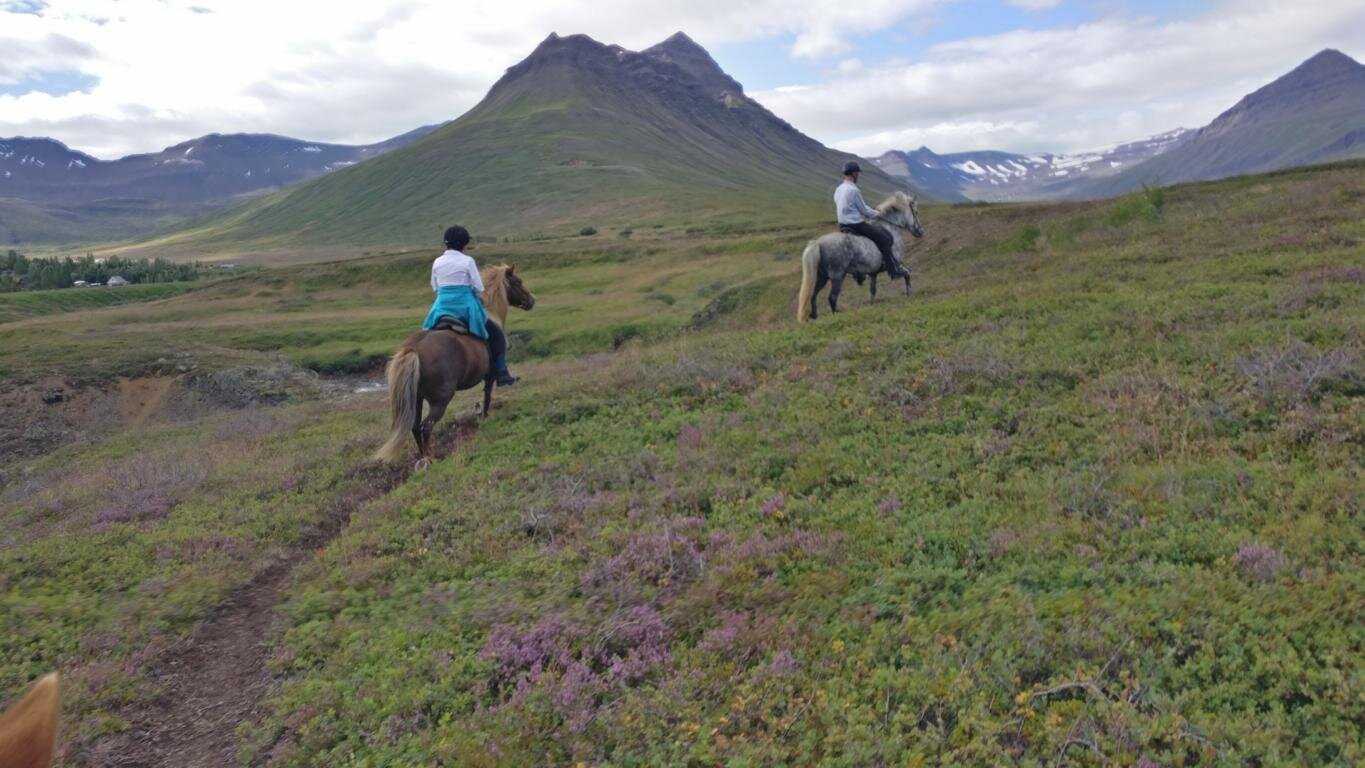
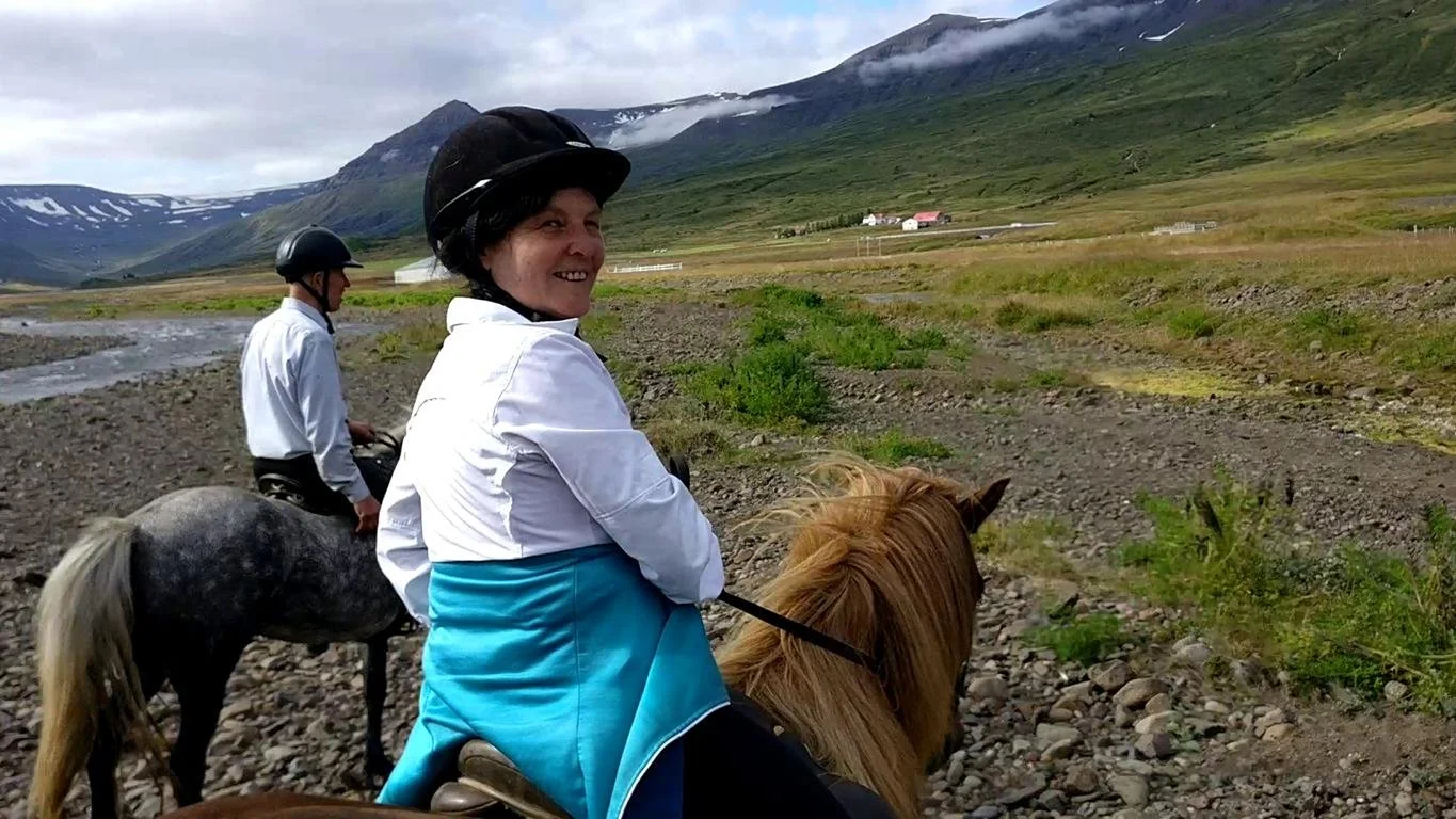
Pferde waren bis ins 20. Jh. das wichtigste Transportmittel (Island verfügt über keine Eisenbahn). In Island gibt es derzeit ca. 80.000 Islandpferde, eine kleine aber besonders robuste und wetterfeste Pferderasse. Aus Angst vor der Einschleppung von Krankheiten ist jeder Import von Pferden nach Island untersagt. Islandpferde, von denen viele den ganzen Sommer über unbeaufsichtigt auf den ausgedehnten Weiden verbringen, werden zu Reitzwecken, aber auch zur Fleischgewinnung gezüchtet. Bekannt sind Islandpferde dafür, dass sie zwei weitere Gangarten beherrschen. Der Tölt und der Pass sind bei Reiter*innen deswegen so beliebt, weil sie fast erschütterungsfreies Reiten ermöglichen.
As Iceland has no railway horses until the 20th century were the main means of transport. Today there are some 80,000 Icelandic horses in Iceland. They are of a robust, stocky and weather-resistant breed. In order to avoid the introduction of diseases any import of horses is forbidden. Many horses stay the whole summer unguarded on the pasture. Farmers are breeding horses for riding as well as for meat production. Islandic horses are famous for having five gaits, the Tölt and Pass being the additional ones. Both are popular as they provide for a smooth ride without shocks.

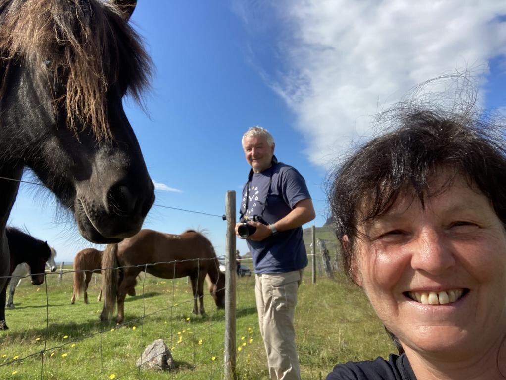
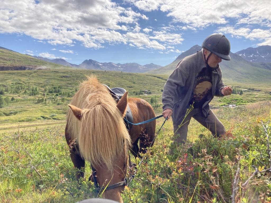
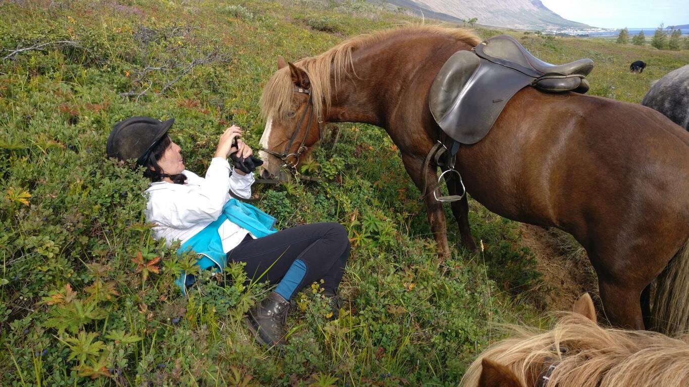
Bei Mehrtagesritten läuft meist eine Herde Ersatzpferde mit, sodass die Reiter bis zu drei Mal am Tag die Pferde wechseln. Wir hatten leider nur Zeit für einen Ein-Tages-Ritt in Nordfjördur (www.skorrahestar.is ) waren aber vom Tölt und Pass begeistert.
For multi-day rides usually a herd of reserve horses is running behind the horsemen enabling each rider to change horses up to three times a day. Unfortunately, we only had time for a one-day ride in in Nordfjördur (www.skorrahestar.is ) but we were delighted by the smooth Tölt und Pass.
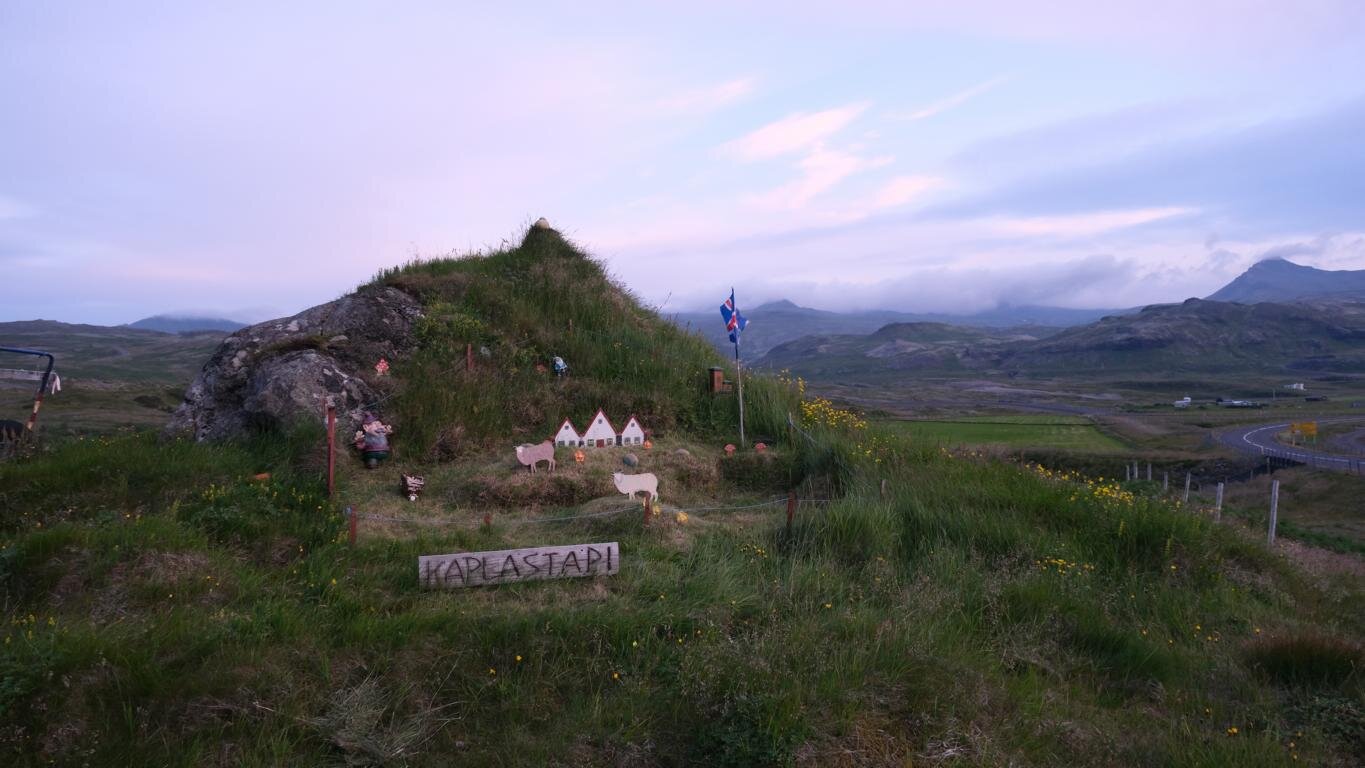
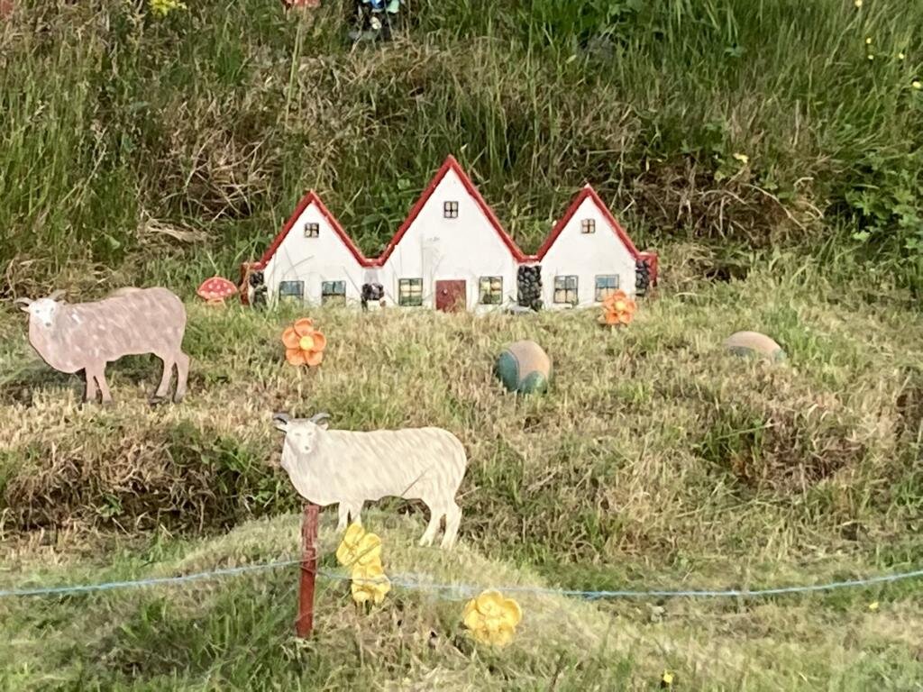
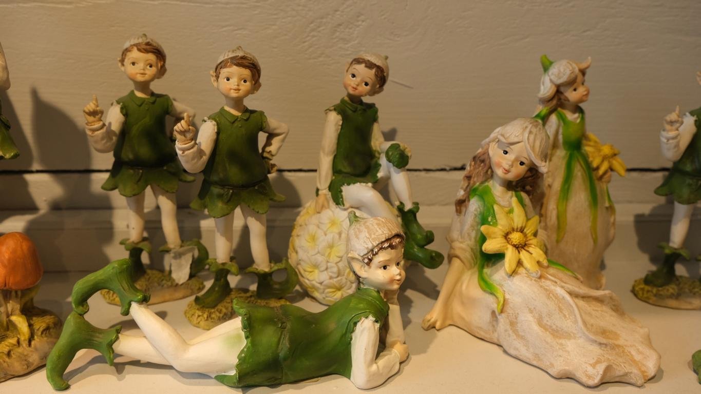
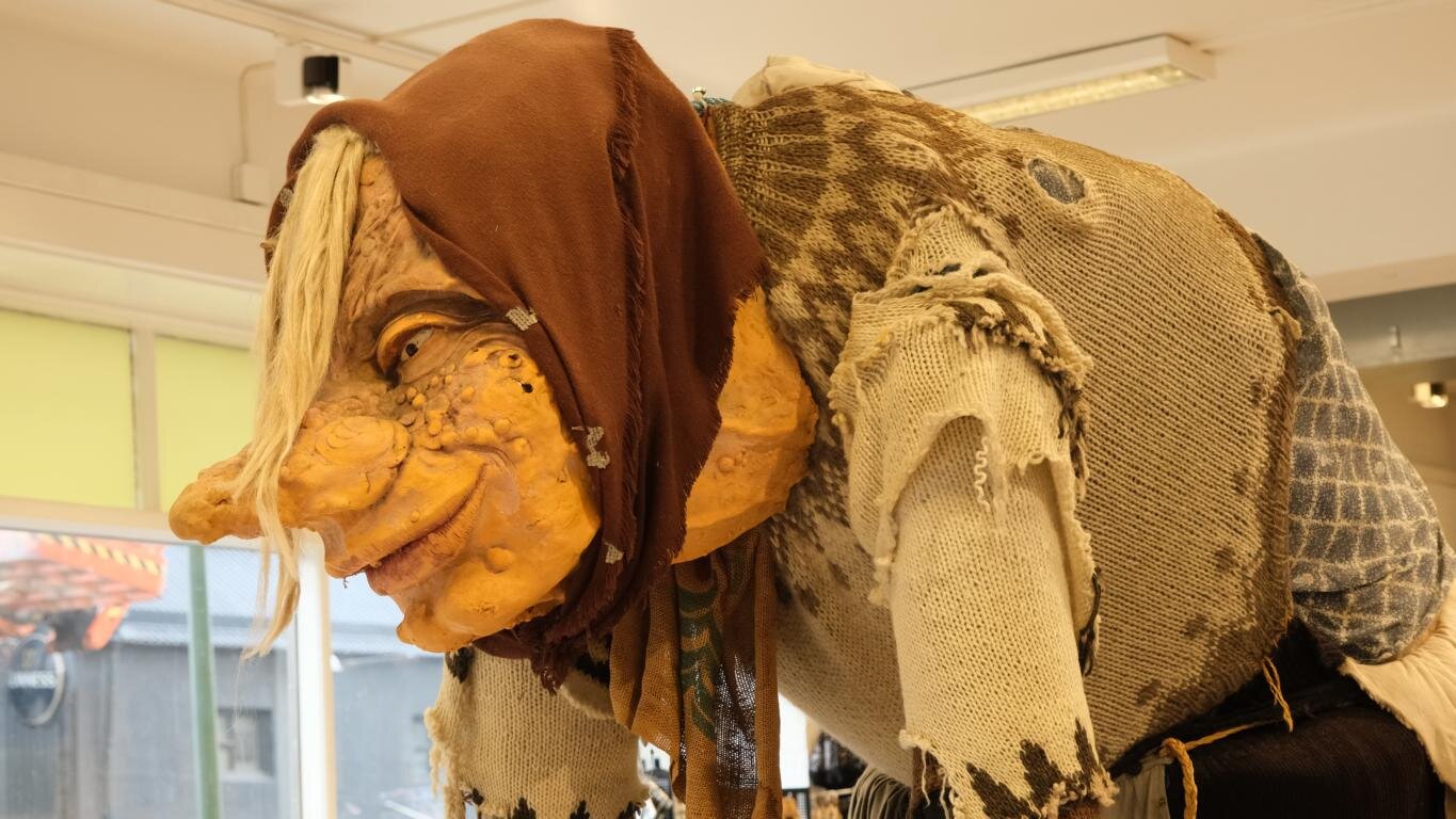
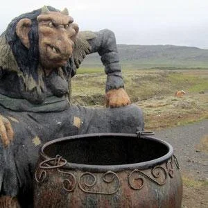
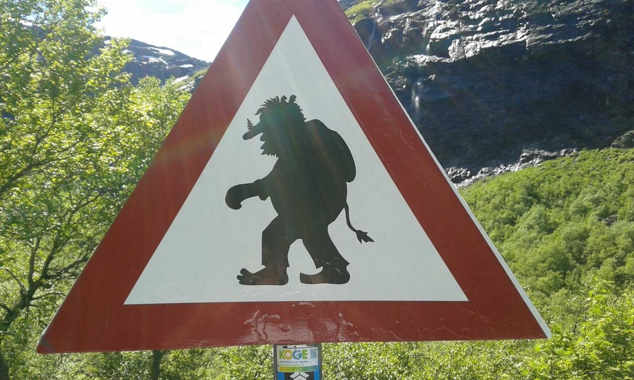
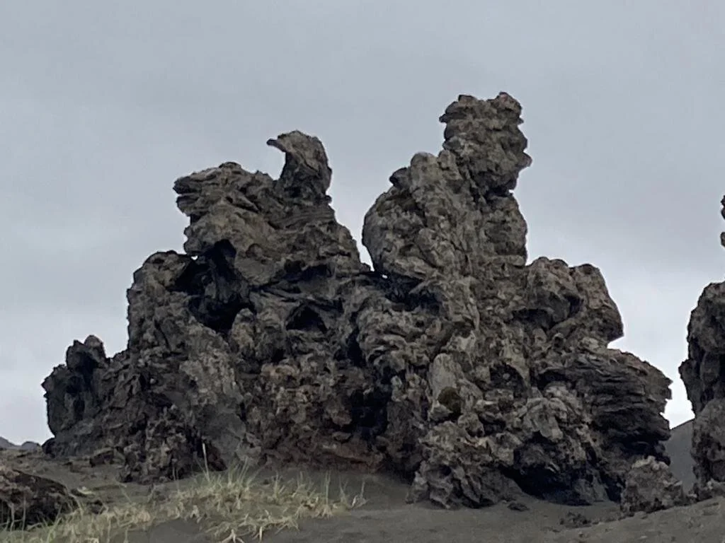
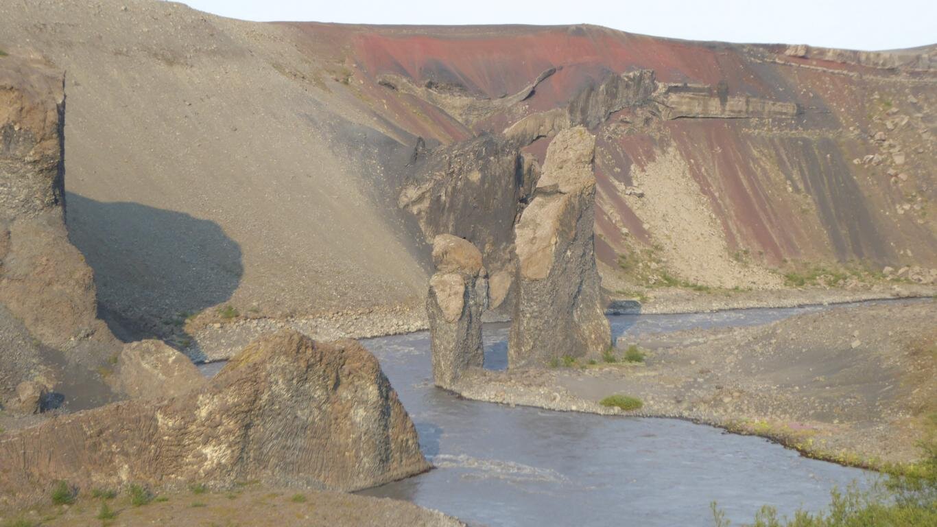
Der Glaube an Naturgeister ist in der isländischen Gesellschaft tief verwurzelt. Manche Isländer erzählen von einem „versteckten Volk“, vom Huldufólk, mit denen Trolle, Elfen und Riesen gemeint sind. Nach der Vorstellung mancher wohnt auf Island parallel zur Bevölkerung ein unsichtbares Volk, das nur von einem mit einer besonderen Gabe ausgestatteten Medium gesehen werden kann. Viele alten Mythen sind noch präsent: Um ausgefallene Felsformationen ranken Geschichten, die meist von Trollen handeln, die versteinert wurden, weil sie es nicht geschafft hatten, vor Sonnenaufgang in ihre Höhle zurückzukehren. Daher ist es nicht verwunderlich, dass es in Island tatsächlich „Elfenbeauftragte“ gibt, die bei der Planung von Bauvorhaben im Bereich von Geländeformationen herangezogen werden, um die sich Sagen und Erzählungen ranken.
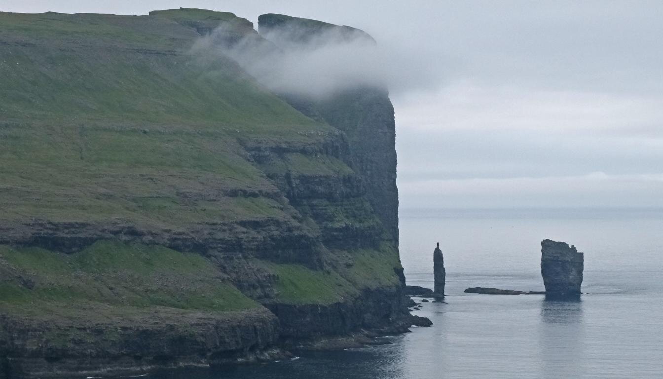
Das letzte Foto stammt von den Färöer-Inseln. Die Sage erzählt, dass zwei im Meer stehende Felsen, die Risin og Kellingin („der Riese und das Weib“) genannte werden, eigentlich zwei versteinerte Trolle seien, die während einer Hungersnot von Island zu den Färöer-Inseln gekommen sind. Sie beabsichtigten, die Färöer-Inseln nach Island zu ziehen, mit dem Ziel, dort den Hunger zu lindern. Allerdings wurden sie damit nicht rechtzeitig fertig und erstarten darum bei Sonnenaufgang zu Stein.
The belief in natural spirits is deeply ingrained in the Islandic society. Some Icelanders speak of an invisible people called Huldufólk consisting of elves, trolls and giants. According to the perception of some Icelanders their country is also populated by invisible creatures that can be seen only by persons who have a special ability to communicate with them. The old myths are still vivid: To each unusual stone formation there is a story, mostly of a troll who has been petrified because s/he did not make it back to his/her cave before sunrise. Therefore, it is not surprising that there are special “elf-commissioners” whose services are applied when a construction project touches a special landscape formation where sagas or historic narratives exist.
The last picture stems from the Faeroe-Islands. The saga goes that the two stones standing in the water called Risin og Kellingin („the giant and his wife“) actually are two trolls who came during a famine from Iceland to the Faeroe-Islands. They intended to pull the Faeroe-Islands to Iceland in order to end the famine. However, they failed to finish their task in time, were caught by the sunrise and subsequently got petrified.